


Hike from Kaltenbronn to Enzklösterle
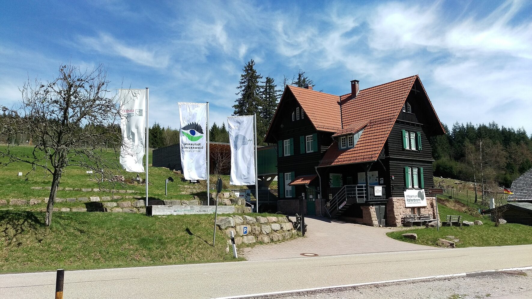
There is much to discover on the hike from Kaltenbronn to Enzklösterle. Starting at the Kaltenbronn Information Center, where interactive exhibits inform about the uniqueness of the nature park designated...
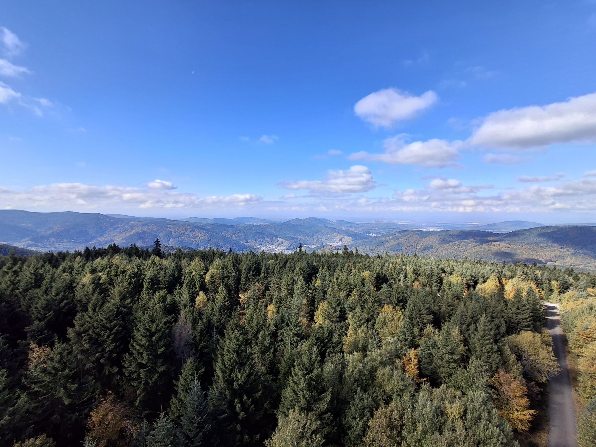
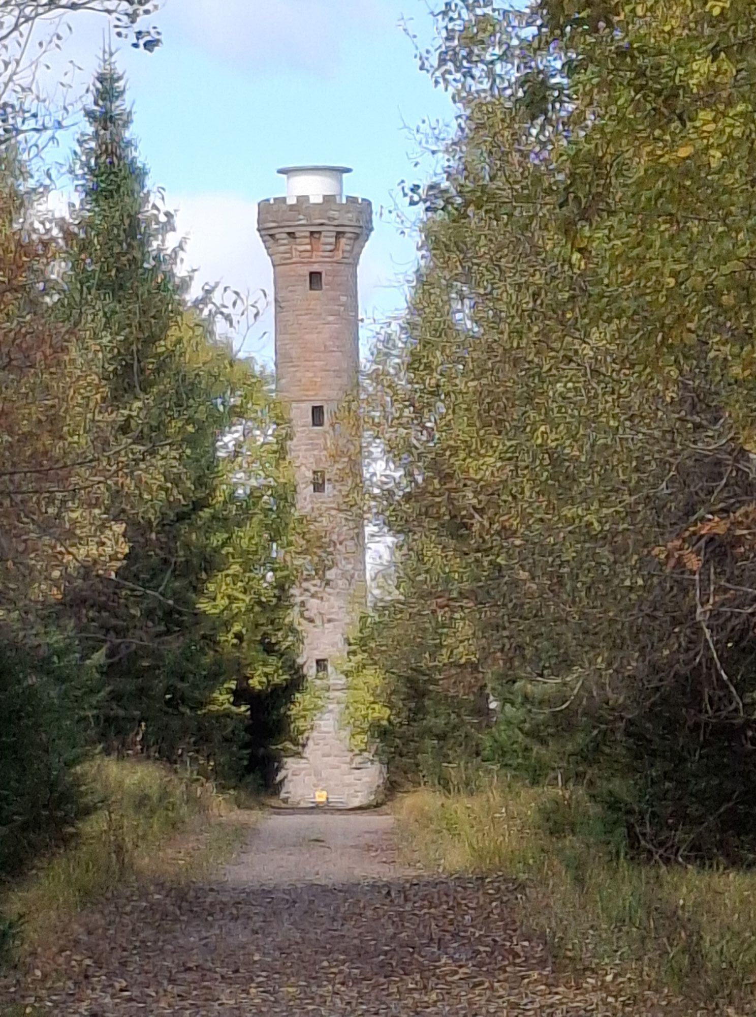
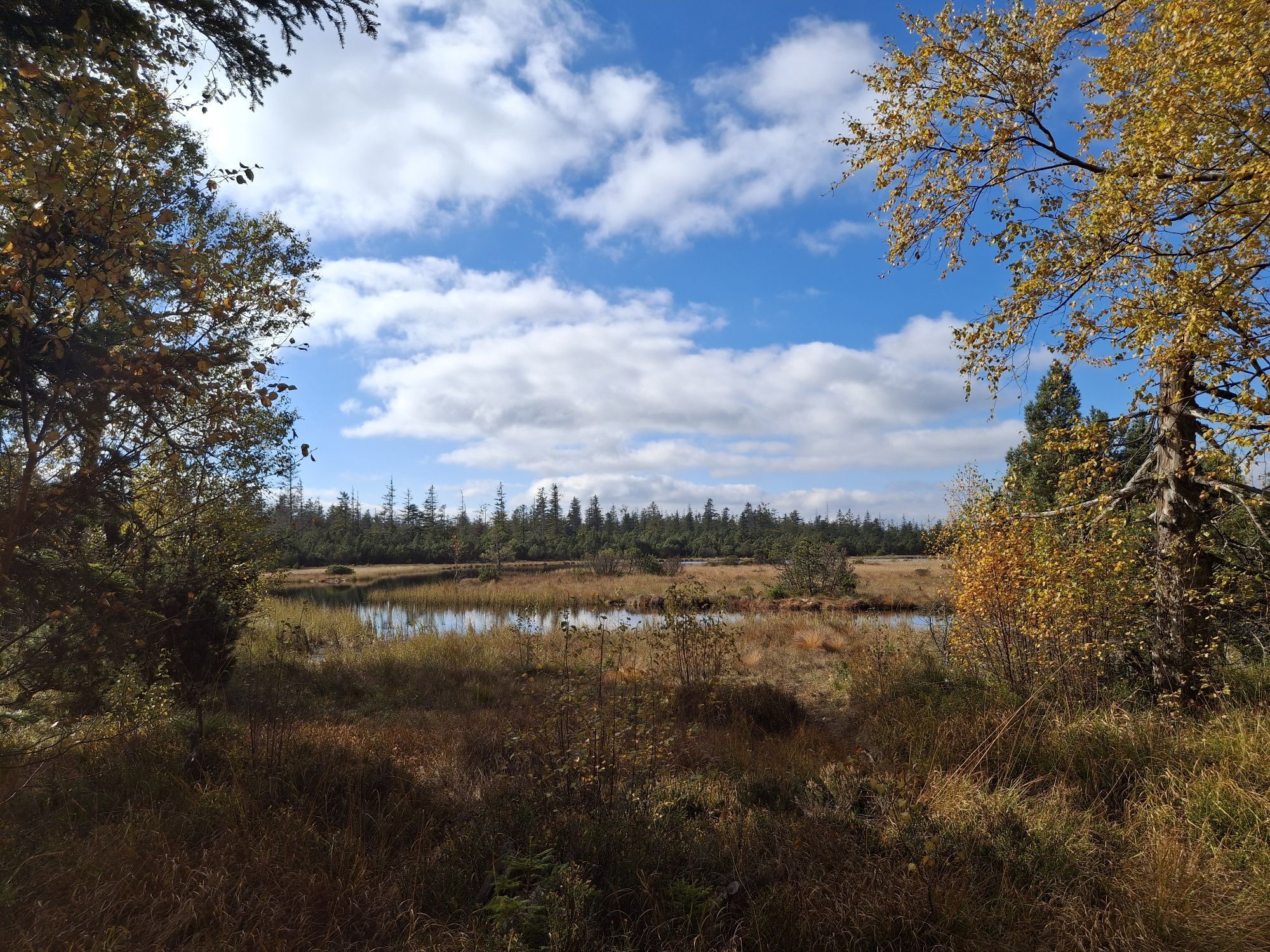
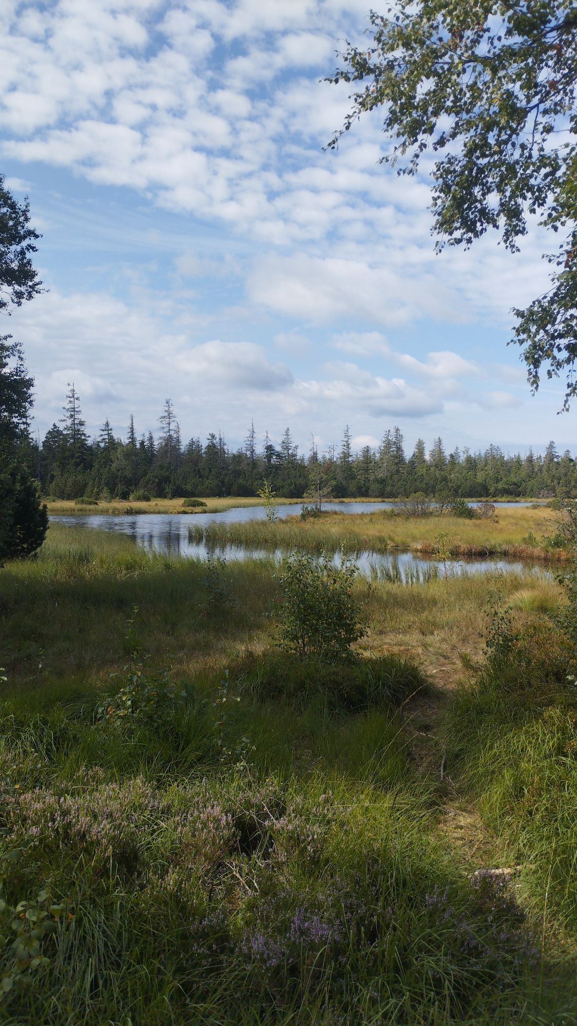
There is much to discover on the hike from Kaltenbronn to Enzklösterle. Starting at the Kaltenbronn Information Center, where interactive exhibits inform about the uniqueness of the nature park designated as a protected area. Continue to the Hohlohturm (from which you have a beautiful panoramic view of the Black Forest, the Murg Valley, and the Rhine Valley), then to the Hohlohsee and the red deer enclosure in the Hirschtal.
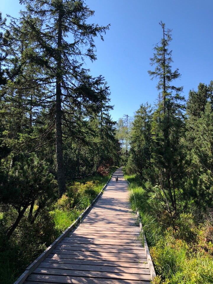
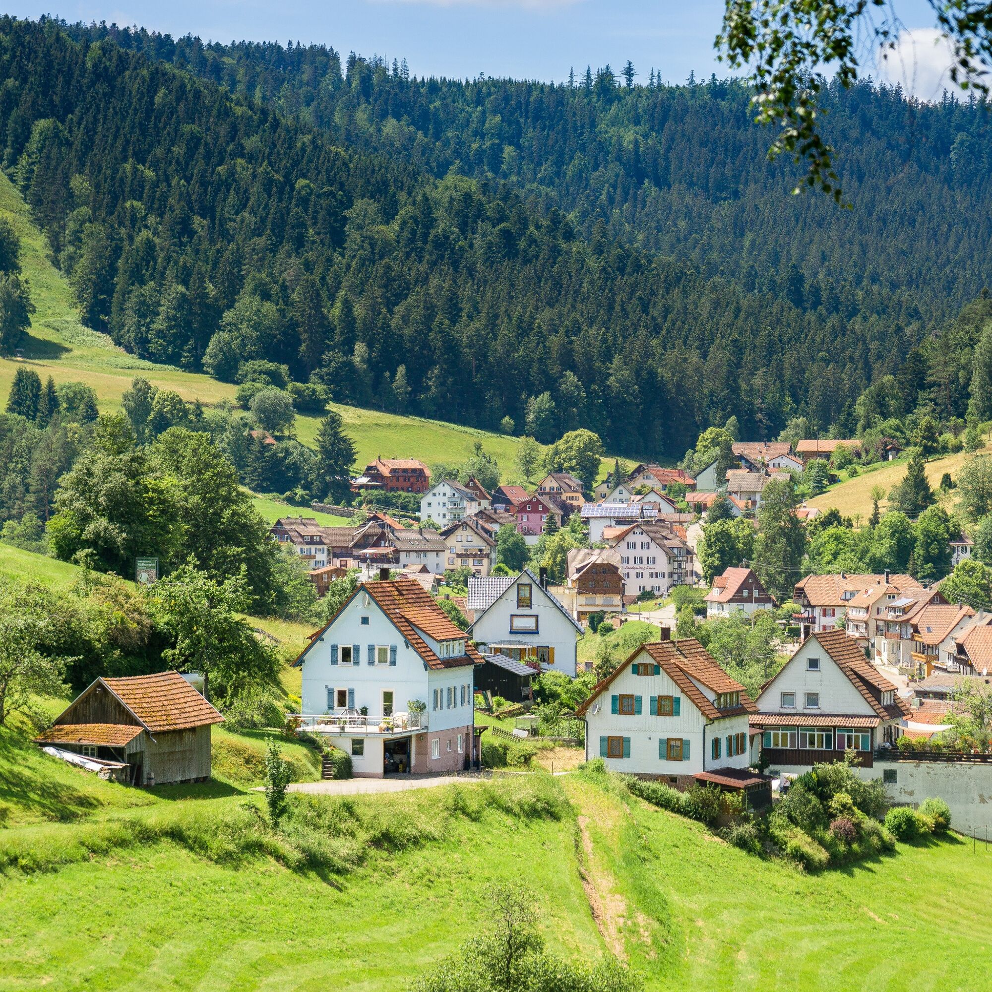
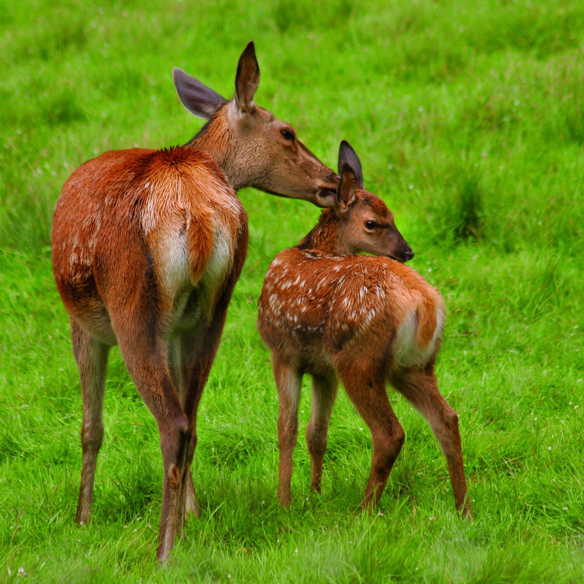
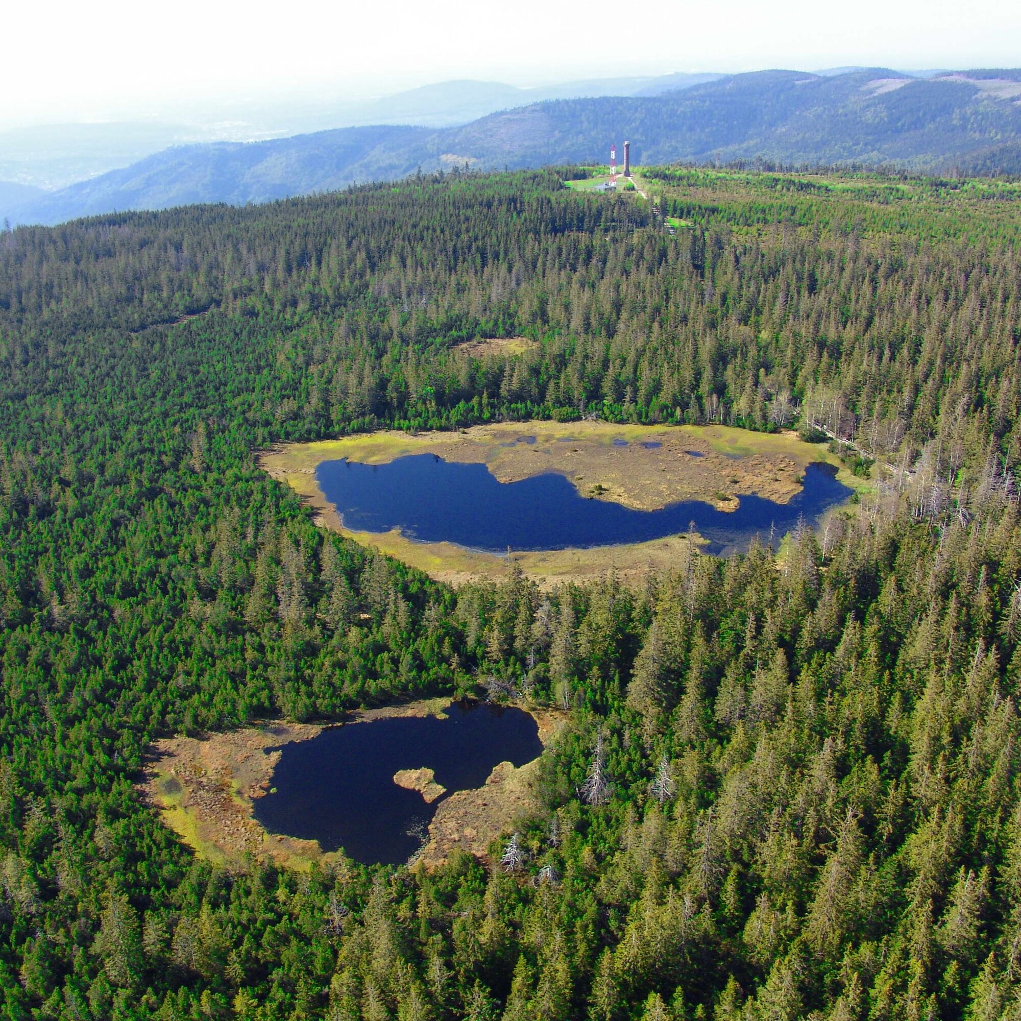
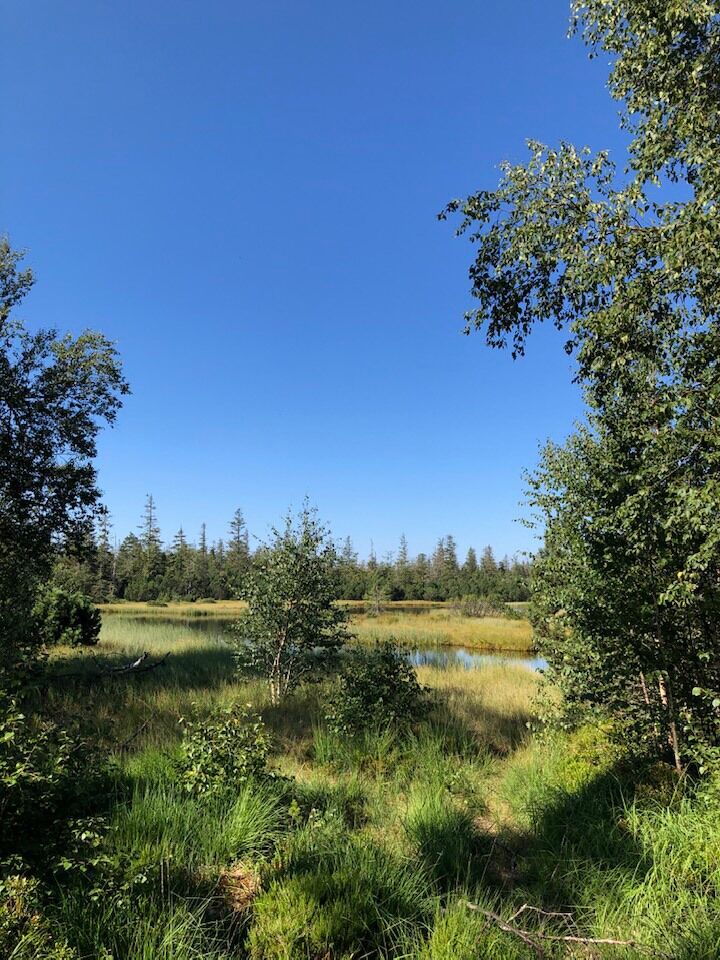
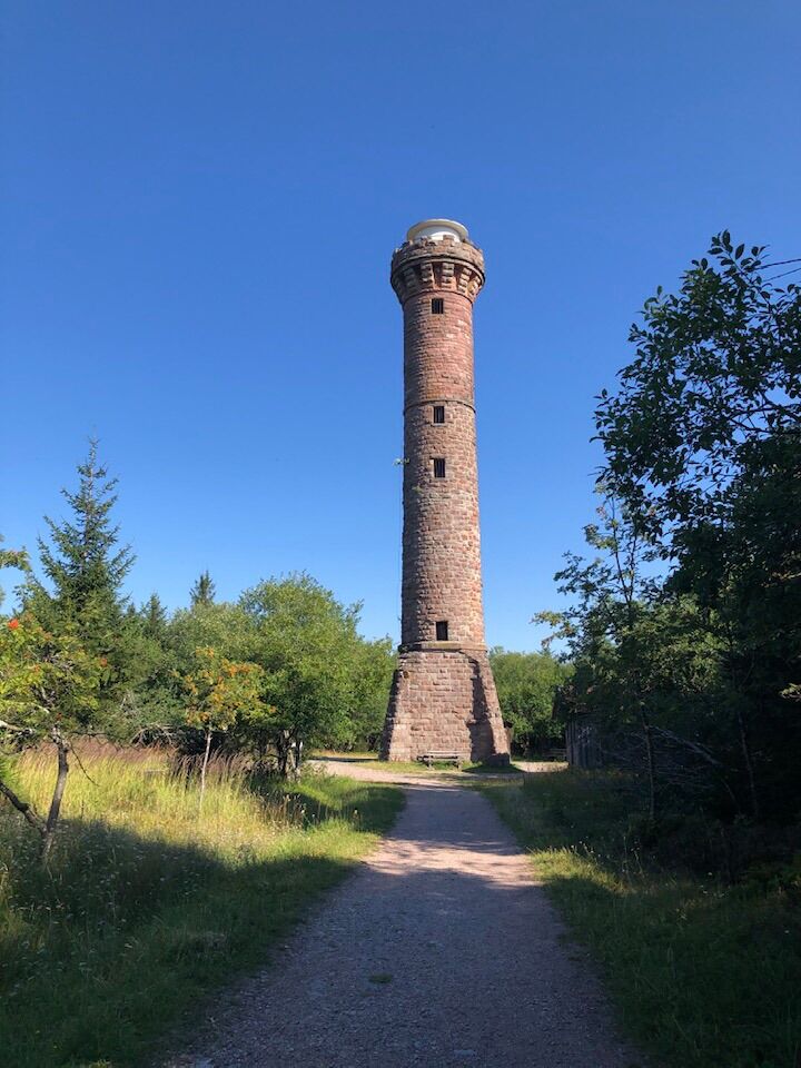
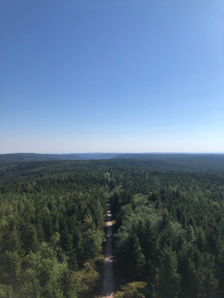
The route starts at the Kaltenbronn Information Center (alternatively, you can start at Sommerberg in Bad Wildbad, first hike over the Wildseemoor to Kaltenbronn, and then join the route). Following hiking trail No. 4, you go to Schwarzmiss, continue to the Hohlohturm (Kaiser Wilhelm Tower), and from there to the Hohlohsee. From Hohlohsee, the route goes via the Upper Hühnerwässerle Trail and then right down the Diebstichweg towards Enzklösterle. Upon arrival in the Hirschtal, you pass the deer enclosure towards the village and the destination, the Tourist Information. Here there are public toilets as well as the spa park with vital and active areas, a water wheel, and a Kneipp basin. The route can also be walked in the opposite direction.
We recommend taking the bus from Enzklösterle to the starting point of the route first. Buses (lines 7780 and 7781) run from the Adventure Golfpark stop towards Bad Wildbad and Kaltenbronn. Walking distance from Tourist Info to Golfpark: 5 minutes through the spa park.
Attention – please check bus departure times beforehand, as a transfer in Sprollenhaus may be necessary!
Hiking boots, sufficient drinks (depending on weather)
B 294 from Pforzheim to Calmbach, then onto K 4367 to Bad Wildbad, through the Meisterntunnel at the roundabout, continuing on district road 4367 to Enzklösterle. B 294 from the Freudenstadt direction via Poppeltal to Enzklösterle.
B296 from Calw to Calmbach, then to Bad Wildbad and from there further via K 4367 to Enzklösterle.
The Call Bus BW3 runs from Bad Wildbad to Kaltenbronn.
The Call Bus BW4 runs from Enzklösterle to Kaltenbronn.
Call buses can be booked by phone at 07051/96 88 55, via app (VGC app or bwegt Bus&Train), or online at www.vgc-online.de/fahrplaene-netz/vgc-plus up to 60 minutes before departure.
The Bus line F20 runs on weekends directly from Altensteig via Enzklösterle to Kaltenbronn.
The Bus line 242 runs from Gernsbach to Kaltenbronn.
Free parking is available in front of the Enzklösterle Tourist Information (starting point), Friedenstraße 16, 75337 Enzklösterle. Additionally, free parking is available at the sports hall (village entrance from Bad Wildbad, immediately left), in the Hirschtal, and at Hetschelhof.
The Kaltenbronn Information Center, where the route begins, offers a great insight into the flora and fauna of the Northern Black Forest. Interesting nature exhibitions provide information about current topics in the Central/Northern Black Forest Nature Park. https://www.infozentrum-kaltenbronn.de/
Please check bus departure times in advance!
Popularne wycieczki w okolicy
- 5,0
Circular route via spring nature trail and Wurstberg
światłoWędrówka 8,08 km - 4,7
Eyach round
średniWędrówka 7,84 km - 4,2
Kaltenbronn Circular Route No. 1 - Wildsee Moor Loop
światłoWędrówka 8,30 km - 4,7
premium hiking trail Enzquellenpfad
średniWędrówka 19,9 km - 3,0
Dobel High-Altitude Route
średniWędrówka 11,8 km - 4,3
Nature experience tour Kaltenbronn
średniWędrówka 14,2 km - 4,0
Eiszeit-Tour
Wędrówka 11,7 km - 4,0
Spaziergang zum Bernsteinfelsen
średniWędrówka 14,5 km - 2,6
Genießerpfad zum Panoramastüble
Wędrówka 10,6 km - 4,8
Weisenbacher Steig (Rechts der Murg)
średniWędrówka 17,6 km
Wędrówki i tropienie


Nie przegap ofert i inspiracji na następne wakacje
Twój adres e-mail została dodana do listy mailingowej.