


2-day hike from the Refuge d'Avérole - Stage 2 - From the Refuge d'Avérole to Vincendière via the mule track
.

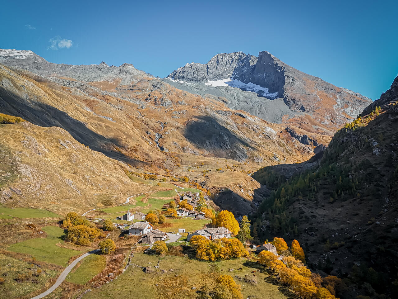
2/ This morning, if you're feeling up to it, why not push a little further to explore this wild valley. It would be a shame not to climb up to the "Pas de la mule", skipping across the streams, before descending into the valley on the left bank of the torrent at the shepherds' hut.
If you're tired, you don't have to make the detour via the "Pas de la mule", but can cross over to the left bank via the bridge below the refuge parking lot and descend gently to your starting point.
The Avérole refuge has been awarded the "Refuge en Famille" label. You must book your overnight stay in the refuge in advance. Stay on the trails and follow the signs, and take your garbage with you.
Popularne wycieczki w okolicy
-
4,7
Rocciamelone partedjo dalla Riposa. Mompantero, Piemont/Italien
średniWędrówka 10,6 km -
BALME Molino Bivouac Loop
średniWędrówka 7,55 km -
Col du Mont Cenis from Lanslebourg
ciężkiDroga rowerowa 9,84 km -
ALA DI STURA AL-BA trail up to Pian della Mussa
średniMountainbike 24,5 km -
5,0
BALME Green Lakes and Lago Paschiet
średniWędrówka 7,51 km -
USSEGLIO Turlo ponds loop from Malciaussia
średniWędrówka 9,49 km -
5-day Méan Martin walking tour - Stage 5 - From Refuge du Carro to Bonneval sur Arc
ciężkiWędrówka 10,7 km -
5-day Méan Martin walking tour - Stage 3 - From the Refuge de Plan du Lac to the Refuge du Fond des Fours
ciężkiWędrówka 18,2 km -
Tour pédestre de Méan Martin en 5 jours - Stage 1 - From Bonneval sur Arc to Refuge de Vallonbrun
ciężkiWędrówka 15,5 km -
Tour de Mean Martin - 5-day hike
ciężkiWędrówka 80,4 km

Wędrówki i tropienie


Nie przegap ofert i inspiracji na następne wakacje
Twój adres e-mail została dodana do listy mailingowej.