The watershed - Beaujolais Vert - Poule-les-Écharmeaux
ciężki
Pobierz tę trasę na swój telefon komórkowy
The watershed - Beaujolais Vert - Poule-les-Écharmeaux
ciężki
Wędrówka
15,16
km
Zeskanuj kod QR i rozpocznij nawigację w aplikacji bergfex.

Wędrówki i tropienie


The watershed - Beaujolais Vert - Poule-les-Écharmeaux
ciężki
Odległość
15,16
km
Czas trwania
05:00
h
Ascent
459
hm
Poziom morza
546 -
871
m
Ścieżka do pobrania
The watershed - Beaujolais Vert - Poule-les-Écharmeaux
ciężki
Wędrówka
15,16
km
You'll love:
• The combination of length and elevation gain, ideal for varied approaches to hiking.
• Adventurers who enjoy physical exertion: climbs, ridge paths, descents on stony terrain... are there...
Opis
You'll love:
• The combination of length and elevation gain, ideal for varied approaches to hiking.
• Adventurers who enjoy physical exertion: climbs, ridge paths, descents on stony terrain... are there to stimulate endorphins and dopamine.
• A one-day trek, far from everything, to walk mindfully in mid-mountain landscapes alternating between panoramas, forests, wild vegetation...
• A glimpse of the Santiago de Compostela trails and the GR®7 on the ridge line between the Rhône and the Loire.
You'll enjoy it better:
• With good shoes, binoculars, a camera, and a good snack.
• By enjoying a snack overlooking the Poule lake on your return from the hike.
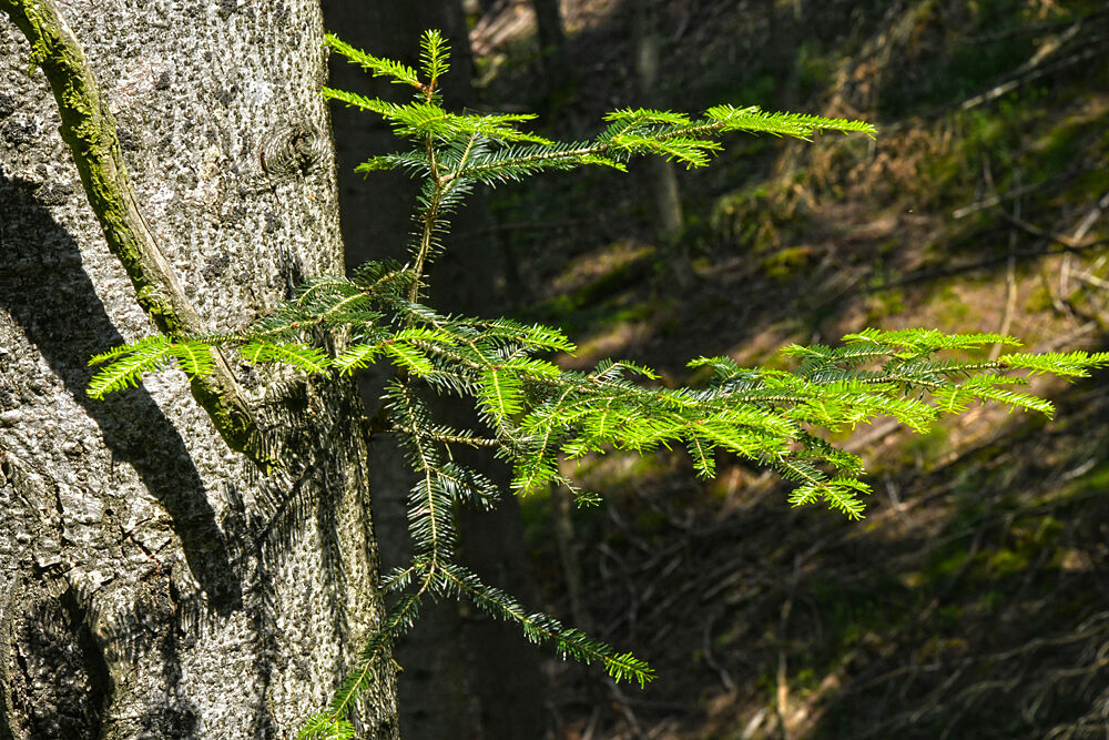
• In spring, to take a forest bath with the scent of wild plants. • At the beginning of winter, for the pleasure of concluding your hike in a cozy atmosphere with a delicious hot chocolate or fragrant tea.
A bit of culture:
A poetic journey along the watershed
The border is invisible, yet here the destiny of an infinite number of raindrops is at stake. When they hit the ground, the precipitation tumbles to either side of the mountain. On the right slope, it reaches the Atlantic Ocean; on the left slope, the Rhône carries it to the Mediterranean. This hydrographic network runs through the Rhône department from north to south.
• The combination of length and elevation gain, ideal for varied approaches to hiking.
• Adventurers who enjoy physical exertion: climbs, ridge paths, descents on stony terrain... are there to stimulate endorphins and dopamine.
• A one-day trek, far from everything, to walk mindfully in mid-mountain landscapes alternating between panoramas, forests, wild vegetation...
• A glimpse of the Santiago de Compostela trails and the GR®7 on the ridge line between the Rhône and the Loire.
You'll enjoy it better:
• With good shoes, binoculars, a camera, and a good snack.
• By enjoying a snack overlooking the Poule lake on your return from the hike.
• In spring, to take a forest bath with the scent of wild plants. • At the beginning of winter, for the pleasure of concluding your hike in a cozy atmosphere with a delicious hot chocolate or fragrant tea.
A bit of culture:
A poetic journey along the watershed
The border is invisible, yet here the destiny of an infinite number of raindrops is at stake. When they hit the ground, the precipitation tumbles to either side of the mountain. On the right slope, it reaches the Atlantic Ocean; on the left slope, the Rhône carries it to the Mediterranean. This hydrographic network runs through the Rhône department from north to south.
Trasa
Église Saint-Martin
(577 m)
Miejsce kultu
0,0 km
Bel-Air
(587 m)
Rozliczenie
1,0 km
La Fortune
(591 m)
Rozliczenie
1,9 km
Le Perron
(696 m)
Rozliczenie
9,9 km
Les Écharmeaux
(708 m)
Rozliczenie
12,0 km
La Tournasserie
(594 m)
Rozliczenie
13,9 km
La Goutte
(570 m)
Rozliczenie
14,6 km
Trasa
The watershed - Beaujolais Vert - Poule-les-Écharmeaux
ciężki
Wędrówka
15,16
km
Poule-les-Écharmeaux
(579 m)
Wioska
0,0 km
Église Saint-Martin
(577 m)
Miejsce kultu
0,0 km
La Fabrique
(536 m)
Rozliczenie
0,3 km
Bel-Air
(587 m)
Rozliczenie
1,0 km
La Goutelle
(583 m)
Rozliczenie
1,4 km
La Fortune
(591 m)
Rozliczenie
1,9 km
Les Javarres
(656 m)
Korytarz/teren
3,1 km
Aux Erves
(735 m)
Korytarz/teren
4,3 km
Le Perron
(696 m)
Rozliczenie
9,9 km
Puits Guillot
(731 m)
Korytarz/teren
10,7 km
Les Écharmeaux
(708 m)
Rozliczenie
12,0 km
Auberge des Tilleuls
(709 m)
Restauracja
12,1 km
La Tournasserie
(594 m)
Rozliczenie
13,9 km
La Goutte
(570 m)
Rozliczenie
14,6 km
Poule-les-Écharmeaux
(579 m)
Wioska
15,0 km
Autor
Dostarczone przez Rhône Tourisme
Wycieczkę The watershed - Beaujolais Vert - Poule-les-Écharmeaux zapewnia outdooractive.com.
Nie ma jeszcze recenzji
Popularne wycieczki w okolicy
-
De l’Aze à l’Ergues - Beaujolais Vert - Claveisolles
światłoWędrówka 13,0 km -
5,0
B3 Mountain Bike Tour from Beaujeu to St Didier/Beaujeu
ciężkiMountainbike 22,6 km -
B9 Mountain Bike Tour Marchampt
ciężkiMountainbike 19,8 km -
Boucle intercommunale
średniWędrówka 75,0 km -
M12 Mountain Bike Tour B2 from Monsols to Ouroux
ciężkiMountainbike 22,5 km -
M2 Mountain Bike Tour from St Bonnet to St Christophe
ciężkiMountainbike 35,6 km -
VTT M9 circuit from propières to Azolette
ciężkiMountainbike 20,4 km -
Trail of Mont Saint-Rigaud - Beaujolais - Deux-Grosnes
ciężkiTrailrunning 15,5 km -
The tour of the Crochet mountain and Tourvéon mount
światłoWędrówka 13,1 km -
B8 Mountain Bike Tour from Quincié-en-Beaujolais to Marchampt
światłoMountainbike 17,1 km
Wędrówki i tropienie

Ponad 550.000 propozycji wycieczek, szczegółowe mapy i intuicyjny planer tras sprawiają, że aplikacja jest niezbędna dla wszystkich entuzjastów przyrody.

Nie przegap ofert i inspiracji na następne wakacje
Zapisz się do newslettera
Błąd
Wystąpił błąd. Spróbuj ponownie.
Dziękujemy za rejestrację
Twój adres e-mail została dodana do listy mailingowej.
Wycieczki po całej Europie
Austria
Szwajcaria
Niemcy
Włochy
Słowenię
Francja
Holandia
Belgia
Polska
Liechtenstein
Czechy
Słowacja
Hiszpania
Chorwacja
Bośnia i Hercegowina
Luksemburg
Andorra
Portugalia
Islandia
Wielka Brytania
Irlandia
Grecja
Albania
Macedonia Północna
Malta
Norwegia
Czarnogóra
Mołdawia
Kosowo
Węgry
San Marino
Rumunia
Estonia
Łotwa
Białoruś
Cypr
Litwa
Serbia
Bułgaria
Monako
Dania
Szwecja
Finlandia