
The Panoramique
światło
Pobierz tę trasę na swój telefon komórkowy
The Panoramique
światło
Wędrówka
7,56
km
Zeskanuj kod QR i rozpocznij nawigację w aplikacji bergfex.


Wędrówki i tropienie





The Panoramique
światło
Odległość
7,56
km
Czas trwania
02:30
h
Ascent
136
hm
Poziom morza
286 -
386
m

Nawiguj po trasie w aplikacji
Zainstaluj aplikację za darmo i śledź trasę dzięki nawigacji GPS i funkcji śledzenia.
Skorzystaj już teraz z funkcji „ bergfex ” w aplikacji
Zeskanuj kod QR za pomocą aparatu
Po zainstalowaniu aplikacji treść otworzy się od razu. Jeśli jeszcze nie masz tej aplikacji, zostaniesz przekierowany do strony, z której możesz ją bezpłatnie pobrać.
Ścieżka do pobrania
The Panoramique
światło
Wędrówka
7,56
km
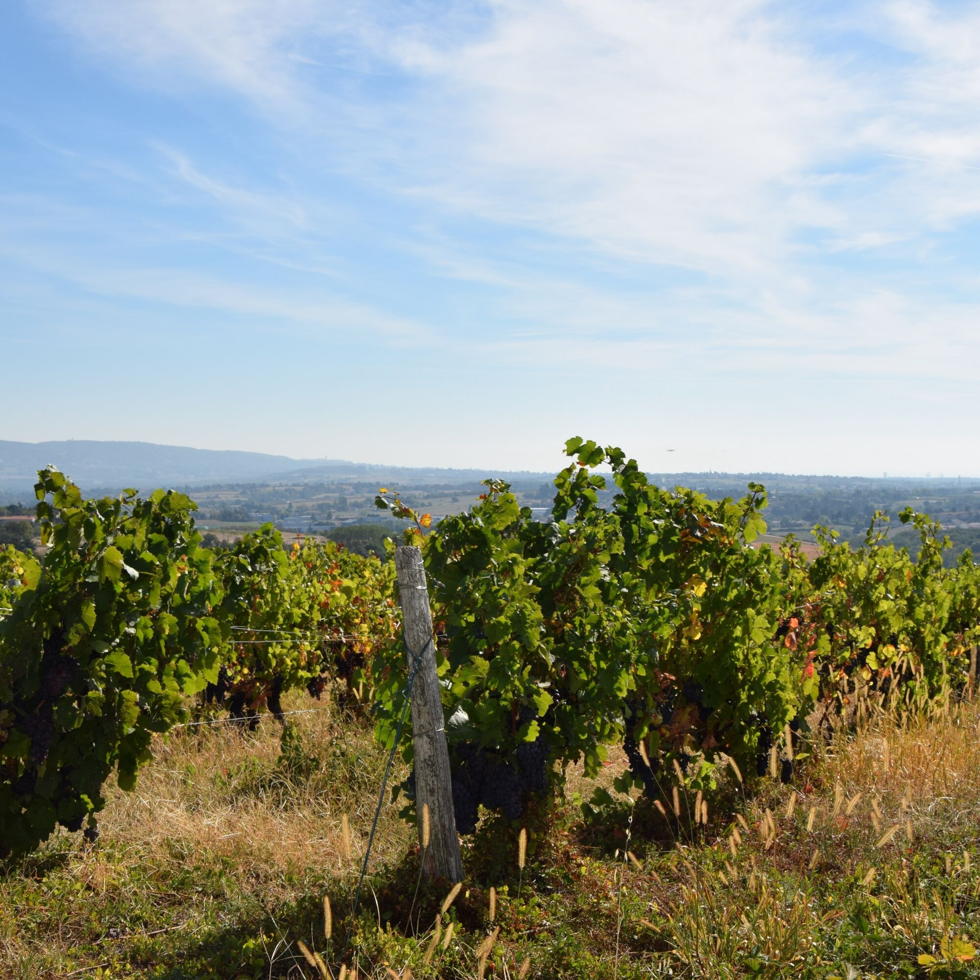
The highlight of this walk: The panorama at the place called Le Poteau in the heart of the Coteaux du Lyonnais vineyard.
In 1814, Napoleon is said to have declared at this spot: "I have seen many countries...
Opis
The highlight of this walk: The panorama at the place called Le Poteau in the heart of the Coteaux du Lyonnais vineyard.
In 1814, Napoleon is said to have declared at this spot: "I have seen many countries but truly, this is the most pleasant panorama one can see...".
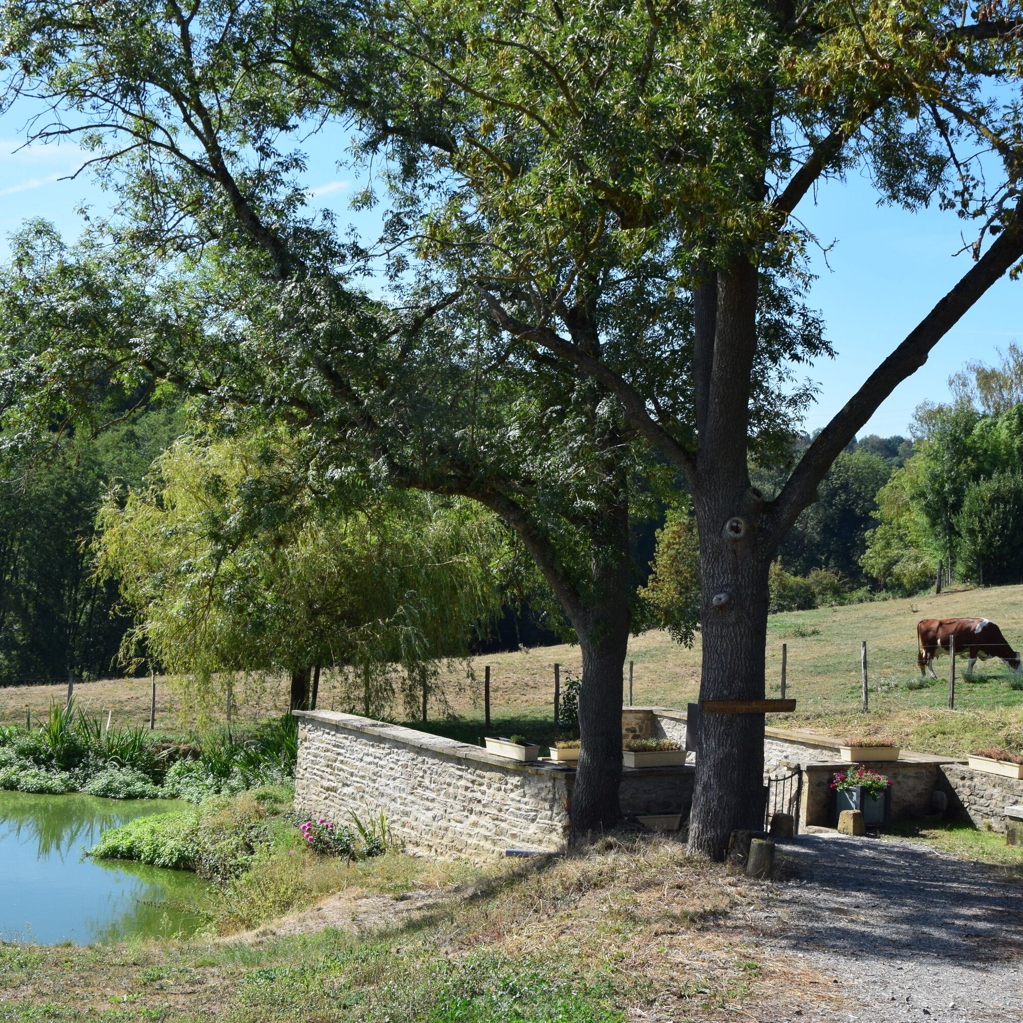
To discover on the route: The Lévy Wash House
Dating from the 18th century, this ruined wash house was restored from 2009 to 2012 by a group of passionate volunteers. It has regained its stairs, gate, and washing stones...
Today it offers a haven of freshness and tranquility to walkers.
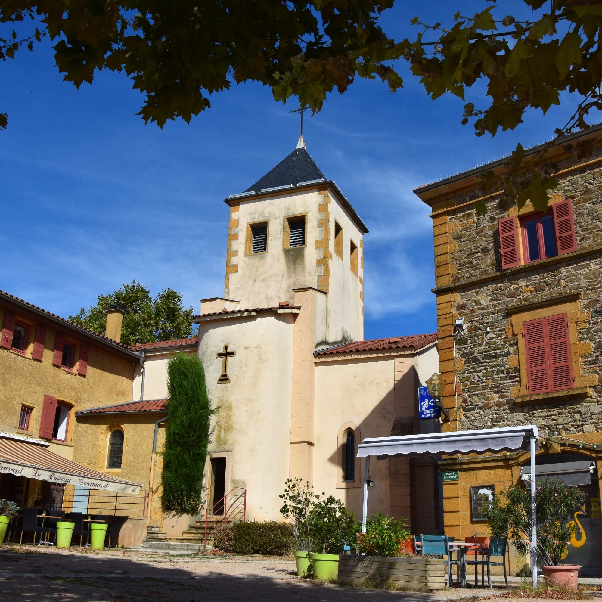
Departure from the François Baraduc space parking (before or after it); address: 133 route de Bel Air. Then head towards the church of Fleurieux-sur-L’Arbresle.
1. Take the road to the right after the church: rue Gabriel Combaudon, then take the first left, rue du Repos which runs alongside the cemetery, continue on the small path along the hillside. Further at the intersection, turn left: la route de la Corniche. (Panoramic view)
2. At the Pilherbe intersection, turn right onto route de la Croix St Vérand which goes down towards Les Pesses, direction Les Brulés. Then take the second left: a small pedestrian path towards "Les Brulés". (Option: to shorten the route, you can take the first left, a small street named Chemin de Pilherbe and catch up with the pedestrian path). Continue straight on chemin du Perreton.
3. At the intersection of chemin Perreton and route Napoléon, turn left towards l’Hèbre. After passing in front of Ferme des Sources (goat milk cheese dairy), at the bend, take the first right on route des Noisetiers then turn left onto the pedestrian path towards le Morillon. (Option: if you want to shorten and partly avoid the portion of route Napoléon, you can take the pedestrian path named la Coursière du Château on your left before Ferme des Sources, then continue straight on Chemin des Châtaigniers and reconnect with rue Jean Lorme).
4. Two options:
At the intersection of Chemin des Tèbres and Chemin du Morillon, you can turn left and continue straight to Le Poteau.
or
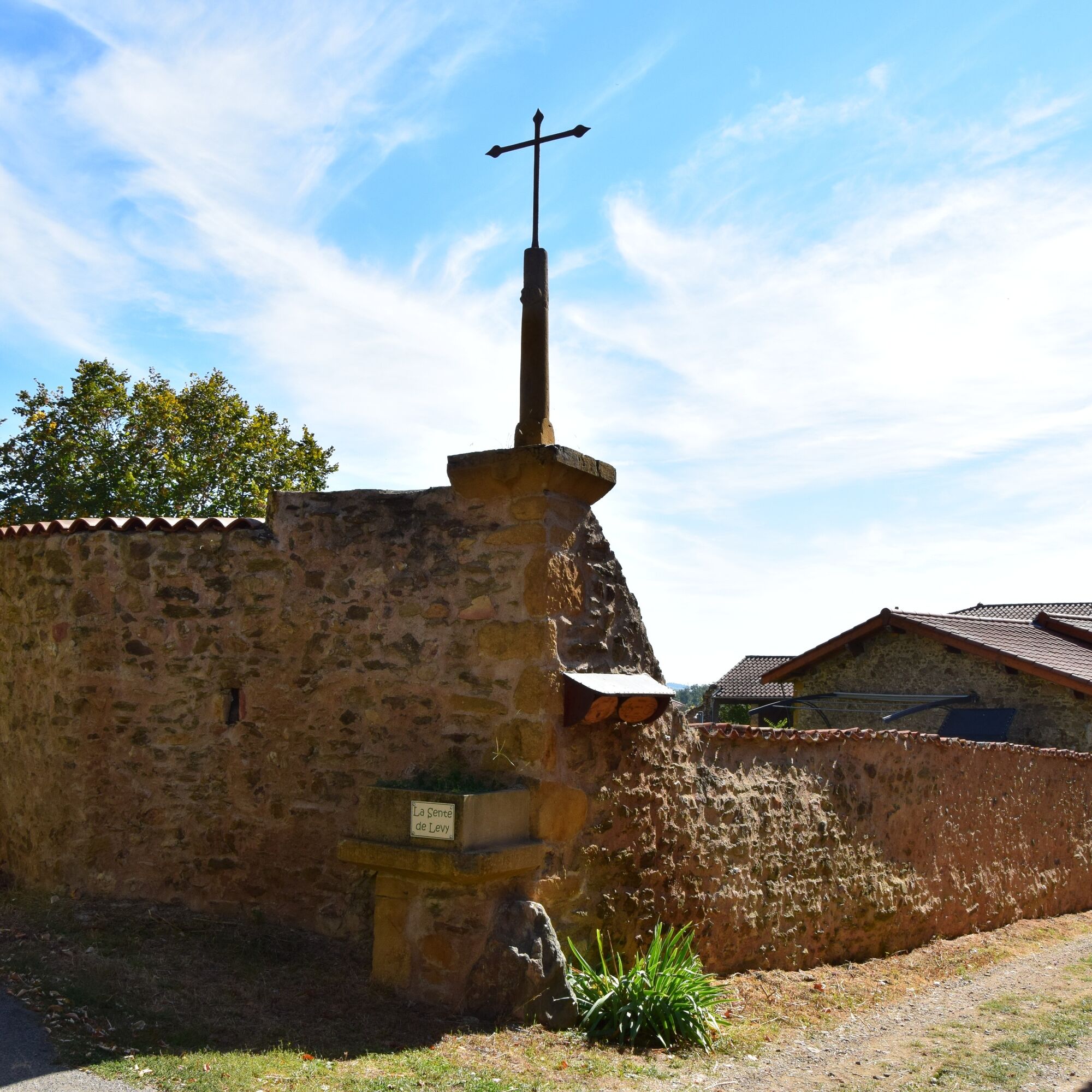
Another option allowing you to see the Morillon Bread Oven and the Lévy Wash House: take the intersection of Chemin des Tèbres and Chemin du Morillon to the right and you reach route Albert Damez, then turn left. You pass in front of Caveau Jomard (winegrower) and arrive at the Bread Oven on your left, renovated in 2018 by the commune of Eveux. You can take the dead-end path to the right "La Sente de Lévy" to go admire the restored Fleurieux wash house.
Then go back up Chemin des Tèbres after the bread oven to reconnect with Chemin du Morillon (point no. 4) and then turn right, heading to Le Poteau, where you will have a 360° view amidst the vineyards of the Coteaux du Lyonnais over Fleurieux and its tree ridge, symbol of the village, and its surroundings: L’Arbresle, Lentilly, and the Alps. Once at the intersection between route Napoléon and rue du Poteau, go straight towards La Croix Vérand.
5. At the stop sign, continue straight on rue du Poteau.
Further on at the bus stop, turn right onto rue Jean Lorme which goes up, then the montée du Chêne where you can admire the Château de Fleurieux turned public school, as well as the two recently renovated pavilions. You arrive at your starting point: the church of Fleurieux, then the François Baraduc space.
In 1814, Napoleon is said to have declared at this spot: "I have seen many countries but truly, this is the most pleasant panorama one can see...".
To discover on the route: The Lévy Wash House
Dating from the 18th century, this ruined wash house was restored from 2009 to 2012 by a group of passionate volunteers. It has regained its stairs, gate, and washing stones...
Today it offers a haven of freshness and tranquility to walkers.
Departure from the François Baraduc space parking (before or after it); address: 133 route de Bel Air. Then head towards the church of Fleurieux-sur-L’Arbresle.
1. Take the road to the right after the church: rue Gabriel Combaudon, then take the first left, rue du Repos which runs alongside the cemetery, continue on the small path along the hillside. Further at the intersection, turn left: la route de la Corniche. (Panoramic view)
2. At the Pilherbe intersection, turn right onto route de la Croix St Vérand which goes down towards Les Pesses, direction Les Brulés. Then take the second left: a small pedestrian path towards "Les Brulés". (Option: to shorten the route, you can take the first left, a small street named Chemin de Pilherbe and catch up with the pedestrian path). Continue straight on chemin du Perreton.
3. At the intersection of chemin Perreton and route Napoléon, turn left towards l’Hèbre. After passing in front of Ferme des Sources (goat milk cheese dairy), at the bend, take the first right on route des Noisetiers then turn left onto the pedestrian path towards le Morillon. (Option: if you want to shorten and partly avoid the portion of route Napoléon, you can take the pedestrian path named la Coursière du Château on your left before Ferme des Sources, then continue straight on Chemin des Châtaigniers and reconnect with rue Jean Lorme).
4. Two options:
At the intersection of Chemin des Tèbres and Chemin du Morillon, you can turn left and continue straight to Le Poteau.
or
Another option allowing you to see the Morillon Bread Oven and the Lévy Wash House: take the intersection of Chemin des Tèbres and Chemin du Morillon to the right and you reach route Albert Damez, then turn left. You pass in front of Caveau Jomard (winegrower) and arrive at the Bread Oven on your left, renovated in 2018 by the commune of Eveux. You can take the dead-end path to the right "La Sente de Lévy" to go admire the restored Fleurieux wash house.
Then go back up Chemin des Tèbres after the bread oven to reconnect with Chemin du Morillon (point no. 4) and then turn right, heading to Le Poteau, where you will have a 360° view amidst the vineyards of the Coteaux du Lyonnais over Fleurieux and its tree ridge, symbol of the village, and its surroundings: L’Arbresle, Lentilly, and the Alps. Once at the intersection between route Napoléon and rue du Poteau, go straight towards La Croix Vérand.
5. At the stop sign, continue straight on rue du Poteau.
Further on at the bus stop, turn right onto rue Jean Lorme which goes up, then the montée du Chêne where you can admire the Château de Fleurieux turned public school, as well as the two recently renovated pavilions. You arrive at your starting point: the church of Fleurieux, then the François Baraduc space.
Trasa
Église Saint-Barthélemy
(350 m)
Miejsce kultu
0,2 km
Pilherbe
(321 m)
Sąsiedztwo
2,3 km
Le Poteau
(367 m)
Rozliczenie
6,2 km
Église Saint-Barthélemy
(350 m)
Miejsce kultu
7,5 km
Trasa
The Panoramique
światło
Wędrówka
7,56
km
Fleurieux-sur-l'Arbresle
(346 m)
Wioska
0,2 km
Au Cambodge Gourmant
(350 m)
Restauracja
0,2 km
Église Saint-Barthélemy
(350 m)
Miejsce kultu
0,2 km
Pilherbe
(321 m)
Sąsiedztwo
2,3 km
Le Morillon
(370 m)
Rozliczenie
4,9 km
Lévy
(360 m)
Rozliczenie
5,3 km
Le Poteau
(367 m)
Rozliczenie
6,2 km
Au Cambodge Gourmant
(350 m)
Restauracja
7,5 km
Église Saint-Barthélemy
(350 m)
Miejsce kultu
7,5 km
Fleurieux-sur-l'Arbresle
(346 m)
Wioska
7,5 km

Informacje o trasie
Trasa
Departure from the François Baraduc space parking (before or after it); address: 133 route de Bel Air. Then head towards the church of Fleurieux-sur-L’Arbresle.
1. Take the road to the right after the church: rue Gabriel Combaudon, then take the first left, rue du Repos which runs alongside the cemetery, continue on the small path along the hillside. Further at the intersection, turn left: la route de la Corniche. (Panoramic view)
2. At the Pilherbe intersection, turn right onto route de la Croix St Vérand which goes down towards Les Pesses, direction Les Brulés. Then take the second left: a small pedestrian path towards "Les Brulés". (Option: to shorten the route, you can take the first left, a small street named Chemin de Pilherbe and catch up with the pedestrian path). Continue straight on chemin du Perreton.
3. At the intersection of chemin Perreton and route Napoléon, turn left towards l’Hèbre. After passing in front of Ferme des Sources (goat milk cheese dairy), at the bend, take the first right on route des Noisetiers then turn left onto the pedestrian path towards le Morillon. (Option: if you want to shorten and partly avoid the portion of route Napoléon, you can take the pedestrian path named la Coursière du Château on your left before Ferme des Sources, then continue straight on Chemin des Châtaigniers and reconnect with rue Jean Lorme).
4. Two options: At the intersection of Chemin des Tèbres and Chemin du Morillon, you can turn left and continue straight to Le Poteau. or Another option allowing you to see the Morillon Bread Oven and the Lévy Wash House: take the intersection of Chemin des Tèbres and Chemin du Morillon to the right and you reach route Albert Damez, then turn left. You pass in front of Caveau Jomard (winegrower) and arrive at the Bread Oven on your left, renovated in 2018 by the commune of Eveux. You can take the dead-end path to the right "La Sente de Lévy" to go admire the restored Fleurieux wash house. Then go back up Chemin des Tèbres after the bread oven to reconnect with Chemin du Morillon (point no. 4) and then turn right, heading to Le Poteau, where you will have a 360° view amidst the vineyards of the Coteaux du Lyonnais over Fleurieux and its tree ridge, symbol of the village, and its surroundings: L’Arbresle, Lentilly, and the Alps. Once at the intersection between route Napoléon and rue du Poteau, go straight towards La Croix Vérand.
5. At the stop sign, continue straight on rue du Poteau.
Further on at the bus stop, turn right onto rue Jean Lorme which goes up, then the montée du Chêne where you can admire the Château de Fleurieux turned public school, as well as the two recently renovated pavilions. You arrive at your starting point: the church of Fleurieux, then the François Baraduc space.
1. Take the road to the right after the church: rue Gabriel Combaudon, then take the first left, rue du Repos which runs alongside the cemetery, continue on the small path along the hillside. Further at the intersection, turn left: la route de la Corniche. (Panoramic view)
2. At the Pilherbe intersection, turn right onto route de la Croix St Vérand which goes down towards Les Pesses, direction Les Brulés. Then take the second left: a small pedestrian path towards "Les Brulés". (Option: to shorten the route, you can take the first left, a small street named Chemin de Pilherbe and catch up with the pedestrian path). Continue straight on chemin du Perreton.
3. At the intersection of chemin Perreton and route Napoléon, turn left towards l’Hèbre. After passing in front of Ferme des Sources (goat milk cheese dairy), at the bend, take the first right on route des Noisetiers then turn left onto the pedestrian path towards le Morillon. (Option: if you want to shorten and partly avoid the portion of route Napoléon, you can take the pedestrian path named la Coursière du Château on your left before Ferme des Sources, then continue straight on Chemin des Châtaigniers and reconnect with rue Jean Lorme).
4. Two options: At the intersection of Chemin des Tèbres and Chemin du Morillon, you can turn left and continue straight to Le Poteau. or Another option allowing you to see the Morillon Bread Oven and the Lévy Wash House: take the intersection of Chemin des Tèbres and Chemin du Morillon to the right and you reach route Albert Damez, then turn left. You pass in front of Caveau Jomard (winegrower) and arrive at the Bread Oven on your left, renovated in 2018 by the commune of Eveux. You can take the dead-end path to the right "La Sente de Lévy" to go admire the restored Fleurieux wash house. Then go back up Chemin des Tèbres after the bread oven to reconnect with Chemin du Morillon (point no. 4) and then turn right, heading to Le Poteau, where you will have a 360° view amidst the vineyards of the Coteaux du Lyonnais over Fleurieux and its tree ridge, symbol of the village, and its surroundings: L’Arbresle, Lentilly, and the Alps. Once at the intersection between route Napoléon and rue du Poteau, go straight towards La Croix Vérand.
5. At the stop sign, continue straight on rue du Poteau.
Further on at the bus stop, turn right onto rue Jean Lorme which goes up, then the montée du Chêne where you can admire the Château de Fleurieux turned public school, as well as the two recently renovated pavilions. You arrive at your starting point: the church of Fleurieux, then the François Baraduc space.
Dodatkowe informacje i wskazówki
Dodatkowe informacje
Please stay on the trails and respect the crops. Remember to take enough water with you, hiking shoes, and clothing suitable for your outing according to the forecasted weather. A small first aid kit is also recommended.
Nie ma jeszcze recenzji
Popularne wycieczki w okolicy
-
The forest of Flachère - Beaujolais - Légny
światłoWędrówka 6,68 km -
Porte des Pierres Dorées - Beaujolais - Jarnioux
światłoWędrówka 14,8 km -
Let's walk in the woods - Monts du Lyonnais - Pollionnay
światłoWędrówka 12,6 km -
Regina, Duroni, Sweetheart - Monts du Lyonnais - Bessenay
światłoWędrówka 13,6 km -
Route around the Tourette
światłoWędrówka 10,6 km -
Mała wycieczka po crêt d'Arjoux - Monts du Lyonnais - Saint-Julien-sur-Bibost
światłoWędrówka 4,93 km -
Z Velair do Saint-Bonnet-le-Froid - Monts du Lyonnais - Courzieu
ciężkiWędrówka 14,7 km -
Courz'y Trail Park - Circuit No. 1: La Découverte
światłoTrailrunning 7,27 km -
5,0
MTB Circuit 23 - The Poirier
światłoMountainbike 15,6 km -
Courz'y Trail Park - Circuit No. 5: La Montée Infernale
ciężkiTrailrunning 2,85 km

Wędrówki i tropienie

Ponad 550.000 propozycji wycieczek, szczegółowe mapy i intuicyjny planer tras sprawiają, że aplikacja jest niezbędna dla wszystkich entuzjastów przyrody.

Nie przegap ofert i inspiracji na następne wakacje
Zapisz się do newslettera
Błąd
Wystąpił błąd. Spróbuj ponownie.
Dziękujemy za rejestrację
Twój adres e-mail została dodana do listy mailingowej.
Wycieczki po całej Europie
Austria
Szwajcaria
Niemcy
Włochy
Słowenię
Francja
Holandia
Belgia
Polska
Liechtenstein
Czechy
Słowacja
Hiszpania
Chorwacja
Bośnia i Hercegowina
Luksemburg
Andorra
Portugalia
Islandia
Wielka Brytania
Irlandia
Grecja
Albania
Macedonia Północna
Malta
Norwegia
Czarnogóra
Mołdawia
Kosowo
Węgry
San Marino
Rumunia
Estonia
Łotwa
Białoruś
Cypr
Litwa
Serbia
Bułgaria
Monako
Dania
Szwecja
Finlandia





