Orgère discovery trail on foot
światło
Nawigacja
Nawigacja
Pobierz tę trasę na swój telefon komórkowy
Orgère discovery trail on foot
światło
Trasa tematyczna
4,75
km
Zeskanuj kod QR i rozpocznij nawigację w aplikacji bergfex.

Wędrówki i tropienie


Orgère discovery trail on foot
światło
Odległość
4,75
km
Czas trwania
02:00
h
Ascent
165
hm
Poziom morza
1 881 -
2 068
m
Ścieżka do pobrania
Orgère discovery trail on foot
światło
Trasa tematyczna
4,75
km
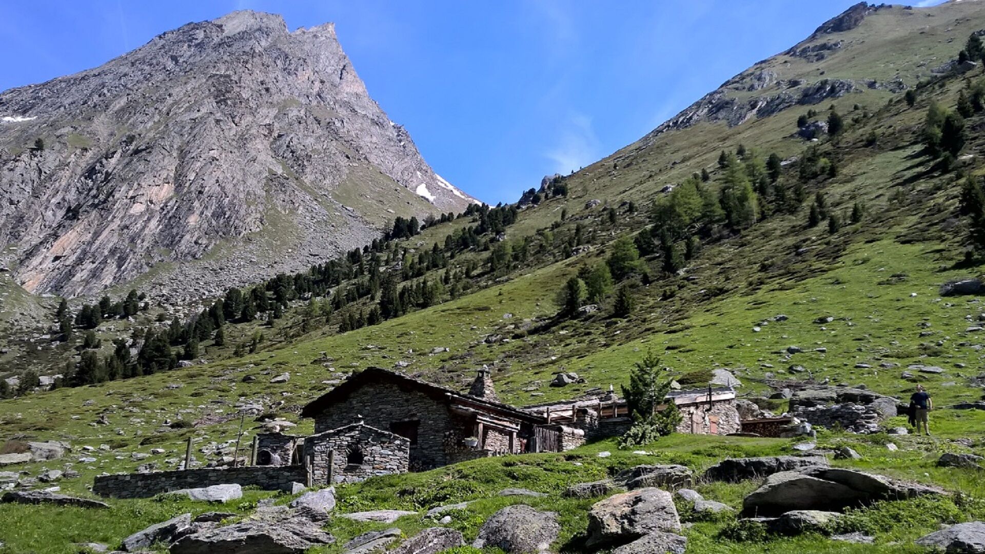
As the whole family ventures onto this easy path, the valley's very own song
welcomes you: this place is home to tits, crickets, and other wild inhabitants.
Some of you may decide to hang out with Benoît...
Opis
As the whole family ventures onto this easy path, the valley's very own song
welcomes you: this place is home to tits, crickets, and other wild inhabitants.
Some of you may decide to hang out with Benoît sheep on the valley floor;
others, to go down on the path that leads to the stream and play around
on the way back to the Orgère refuge. And for those who prefer a terraced
route, just a few loops will take you uphill to enjoy a breathtaking view of
the valley amidst the majestic Arolla pine trees of Haute Maurienne Vanoise.
Handsomely decked out in dark gray scale-like bark, these trees proudly
colonise the slope, sending out resinous fragrances as the sun warms their
backs. Guess the size of the largest trunk you'll come across!
And who knows, you might just be greeted by the spotted nutcracker in this
Arolla orchard, so typical of alpine high-altitude forests... But what's this bird,
who seems so fond of pine cones, in the midst of all these Arolla pines?
Trasa
Le Fournet
(1 949 m)
Korytarz/teren
0,1 km
Refuge de l'Orgère
(1 932 m)
Schronienie
4,6 km
Trasa
Orgère discovery trail on foot
światło
Trasa tematyczna
4,75
km
Le Fournet
(1 949 m)
Korytarz/teren
0,1 km
Refuge de l'Orgère
(1 932 m)
Schronienie
4,6 km
Autor
Dostarczone przez Haute Maurienne Vanoise
Wycieczkę Orgère discovery trail on foot zapewnia outdooractive.com.

Informacje o trasie
Trasa
To guide you in the field, consult the "step-by-step" directional diagram provided in pdf.
Wycieczka w jedną stronę
Tak
Dodatkowe informacje i wskazówki
Dodatkowe informacje
All-terrain stroller and wheelchair access to the end of the valley and back only.
The duration of hiking trails is calculated using reference paces: 300 m/h ascent, 500 m/h descent and 4 km/h on the flat.
As hazards may occur at any time on the routes, the GPX tracks provided are not contractual. They are given for information only. Riders use them at their own risk, depending on their level of technological proficiency and their understanding of the terrain.
Nie ma jeszcze recenzji
Popularne wycieczki w okolicy
-
BARDONECCHIA Rochemolles Dam - Scarfiotti Refuge
średniWędrówka 7,77 km -
Refuge du Fond d'Aussois - a wild valley in the Vanoise - 2-day hike
światłoWędrówka 9,22 km -
5,0
The Builder's Trail on foot
światłoTrasa tematyczna 7,23 km -
Col du Mont Cenis from Modane
ciężkiDroga rowerowa 34,8 km -
5,0
Girarde footpath
światłoWędrówka 8,10 km -
Sentier pédestre des Sculptures - Land Art Montagne
światłoTrasa tematyczna 5,16 km -
Chemin du Petit Bonheur mountain bike trail from Bonneval/Arc to Modane
ciężkiMountainbike 47,2 km -
Ascent to 'Plan du Lac'
ciężkiDroga rowerowa 15,6 km -
Little ascent of Plan d'Aval
ciężkiDroga rowerowa 6,37 km -
Circuit of 'Esseillon'
ciężkiDroga rowerowa 33,0 km
Wędrówki i tropienie

Ponad 550.000 propozycji wycieczek, szczegółowe mapy i intuicyjny planer tras sprawiają, że aplikacja jest niezbędna dla wszystkich entuzjastów przyrody.

Nie przegap ofert i inspiracji na następne wakacje
Zapisz się do newslettera
Błąd
Wystąpił błąd. Spróbuj ponownie.
Dziękujemy za rejestrację
Twój adres e-mail została dodana do listy mailingowej.
Wycieczki po całej Europie
Austria
Szwajcaria
Niemcy
Włochy
Słowenię
Francja
Holandia
Belgia
Polska
Liechtenstein
Czechy
Słowacja
Hiszpania
Chorwacja
Bośnia i Hercegowina
Luksemburg
Andorra
Portugalia
Islandia
Wielka Brytania
Irlandia
Grecja
Albania
Macedonia Północna
Malta
Norwegia
Czarnogóra
Mołdawia
Kosowo
Węgry
San Marino
Rumunia
Estonia
Łotwa
Białoruś
Cypr
Litwa
Serbia
Bułgaria
Monako
Dania
Szwecja
Finlandia