







Pilat Rhodanien - The Rigotte Route - Loop 1.3

Poziom trudności: 3
Sporty side
The panorama of Semons, to be discovered at the start of this loop, gives a good overview of this 23 km route, pleasant and moderately steep on roads winding through vineyards and orchards....
The panorama of Semons, to be discovered at the start of this loop, gives a good overview of this 23 km route, pleasant and moderately steep on roads winding through vineyards and orchards. A nice sporting challenge with the ascent of the Bourrin and Croix Régis passes awaits you: the opportunity for a cycling outing with friends?
Tourism side
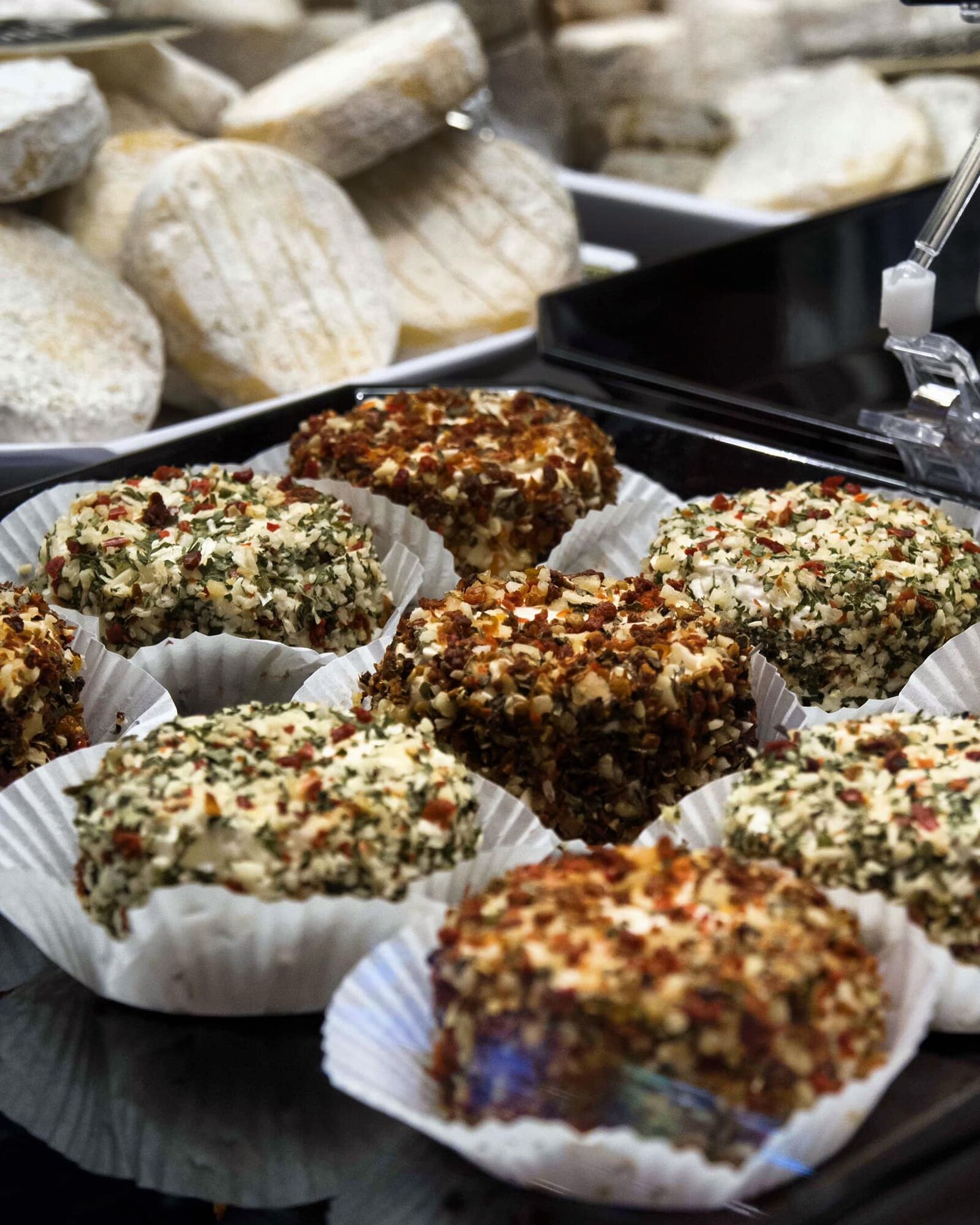
The Rigotte de Condrieu, classified AOP since 2013, is the pride of the goatherds of Pilat. This little unpasteurised goat's cheese in the shape of a cylindrical puck takes its
name from the patois “rigot” or “rigol”. Terms that designated the streams rushing down the slopes of the massif near the farms. A subtle aroma of hazelnuts, a creamy and supple paste are its taste characteristics. After two to three weeks of ripening, it will be even more appreciated if it is associated with a tasting of Condrieu.


Good Practices:
To enjoy your ride safely, here are our tips:
- Check the condition of your bike before departure (brakes, transmission, tightening of screws, ...) and the battery for e-bikes
- Wear a helmet, and keep it on while climbing
- Wear clothing suitable for the activity and weather
- Bring water and food
- Carry a repair kit (tools, inner tube, pump...)
- Do not overestimate your skills
- Study the route before leaving
- Inform someone about the loop you will take
- Have the phone number of a contact person in case of accident
Cycling tourists are subject to the highway code and must respect it (pedestrian crossings, yield signs, traffic lights, ...). The road belongs no more to cyclists than to motorists. The highway code notably prohibits cyclists from riding side by side when a car is overtaking.
40 minutes from Lyon, via A7 motorway.
Saint-Clair-les-Roches station, direction Valence-Ville from Lyon Part-Dieu station, Lyon Perrache.
Parking near the starting point
3
An error on this sheet? Write to the owner quoting this reference:
Sheet name: Le Pilat Rhodanien - La Route de la Rigotte - Loop 1.3 | Sheet ID: 5799176 | URL (link) of this Outdooractive page.
Popularne wycieczki w okolicy
-
5,0
Mont Monnet and Rigotte de Condrieu
światłoWędrówka 9,39 km -
Sentier des Grand(e)s Cru(e)s
światłoWędrówka 3,48 km -
From Arbuel to the hills of Condrieu - Rhône Pilat - Condrieu
światłoWędrówka 5,49 km -
Wine trails at the heart of the vineyards
światłoWędrówka 4,92 km -
Family hike "In the heart of the orchards"
światłoWędrówka 4,04 km -
MTB Route 231 - Les Landes de Montagny
ciężkiMountainbike 19,9 km -
In the heart of the Millery vineyards
światłoWędrówka 9,96 km -
MTB Circuit 241 - The Garon Valley
ciężkiMountainbike 25,4 km -
ViaRhôna : De Loire sur Rhône à Condrieu
średniDroga rowerowa 35,8 km -
Panorama Hike "The landscapes of Montagny"
światłoWędrówka 10,3 km
Wędrówki i tropienie


Nie przegap ofert i inspiracji na następne wakacje
Twój adres e-mail została dodana do listy mailingowej.





