







Enduro ATVs: Motobinouze
Poziom trudności: S3
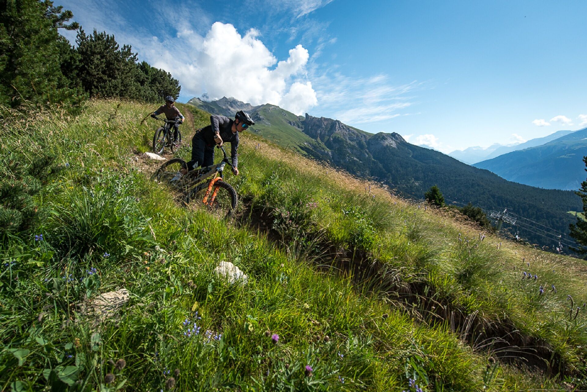
Same departure of the other route Enduro at the top of Grand Jeu chairlift. It is the only thing that is common to the other routes since this route was created from scratch by local monitors. For the...
Same departure of the other route Enduro at the top of Grand Jeu chairlift. It is the only thing that is common to the other routes since this route was created from scratch by local monitors. For the name of this Enduro, see with them! Here is a very different atmosphere between DH and Enduro, while being fun, to do and to do again.

Mountain Biking as you want! but…
Use marked trails for your safety and respect the direction of the routes Do not overestimate your abilities and keep control of your speed Be careful and courteous when overtaking or crossing hikers because pedestrians have priority Check the condition of your MTB and bring refreshments and repair gear If you go alone, leave your itinerary with someone you know Wearing a helmet is highly recommended Respect private properties and cultivated areas Beware of agricultural and forestry machinery Close the gates Avoid picking wild flowers, fruits, and mushrooms Do not disturb the peace of wild animals Take your rubbish with you, be discreet and respectful of the environmentEmergency number: 112
Free outdoor parking at the foot of the Grand Jeu chairlift. Start of the ski lifts. Route des Barrages.
S3
As hazards may occur at any time on the routes, the GPX tracks provided are not contractual. They are provided for information only. Riders use them at their own risk, depending on their level of technological proficiency and their understanding of the terrain.
Uzyskaj wgląd
Zawsze na żywo z ponad 9 500 kamer internetowych. bergfex Jako użytkownik Pro, możesz teraz zobaczyć odpowiednie kamery internetowe dla wielu wycieczek w aplikacji wycieczki od. Pozwala to na bezpośredni podgląd aktualnych warunków.
Popularne wycieczki w okolicy
-
5,0
BARDONECCHIA Colle Sommeiller
średniMountainbike 25,4 km -
little 'Haute-Maurienne Vanoise' circuit
ciężkiDroga rowerowa 32,0 km -
BARDONECCHIA Rochemolles Dam - Scarfiotti Refuge
średniWędrówka 7,77 km -
Refuge du Fond d'Aussois - a wild valley in the Vanoise - 2-day hike
światłoWędrówka 9,22 km -
The White Lake
światłoWędrówka 4,42 km -
5,0
The Builder's Trail on foot
światłoTrasa tematyczna 7,23 km -
BARDONECCHIA Decauville Loop - Scarfiotti Refuge
światłoMountainbike 34,0 km -
Col de l'Iseran from Modane
ciężkiDroga rowerowa 59,5 km -
Col du Mont Cenis from Modane
ciężkiDroga rowerowa 34,8 km -
Col du Mont Cenis from Lanslebourg
ciężkiDroga rowerowa 9,84 km
Wędrówki i tropienie


Nie przegap ofert i inspiracji na następne wakacje
Twój adres e-mail została dodana do listy mailingowej.





