


Alpe Äpnet Trail
Poziom trudności: 2
Fresh air, magnificent views, and interesting discoveries: the winter hiking trail linking Grächen to Alpe Äpnet impresses, surprises, and excites, especially because of the panorama offered to snowshoe...
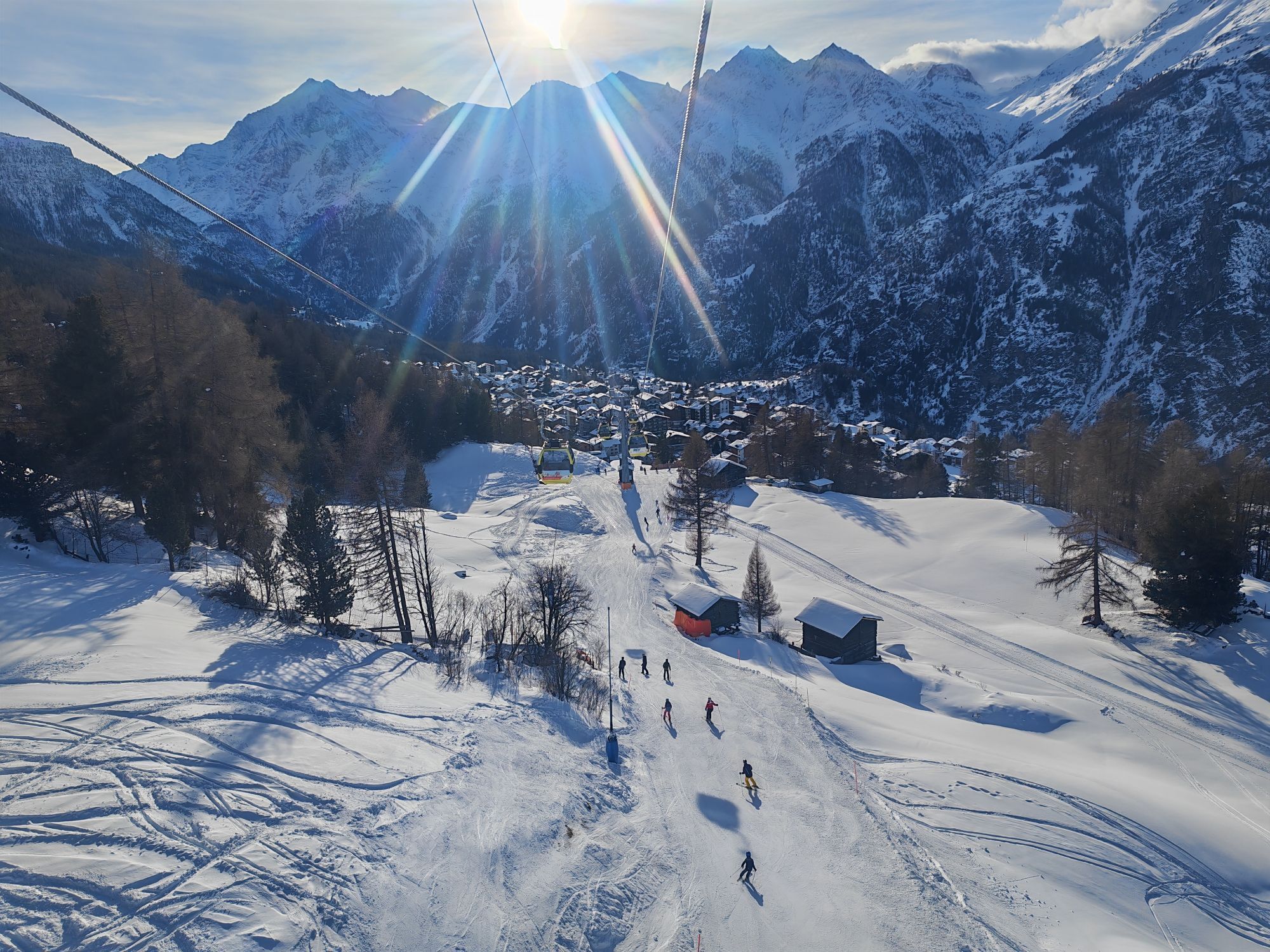
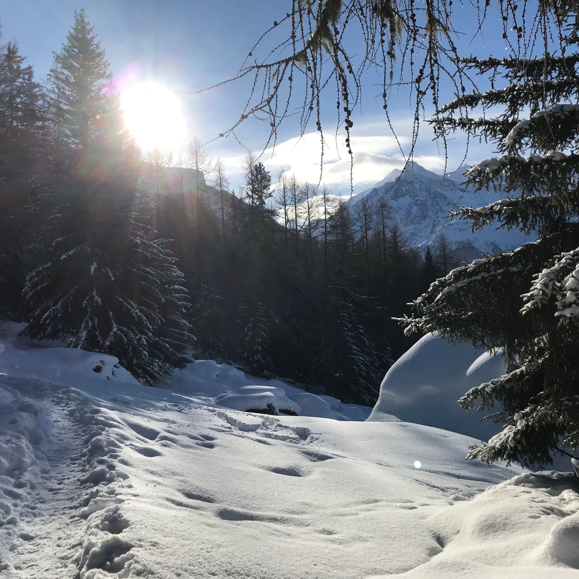
Fresh air, magnificent views, and interesting discoveries: the winter hiking trail linking Grächen to Alpe Äpnet impresses, surprises, and excites, especially because of the panorama offered to snowshoe enthusiasts. The route through the snowy Grächen forest is no less enchanting. The Drieri and Eggeri bisses, which mark the way to Alpe Äpnet, are essential parts of an irrigation system dating back to the 12th century and still in use today. On the way, it is recommended to stop at Restaurant Zum See and enjoy its local specialties. The view of the Weisshorn and the ice-covered lake perfects the experience. Once you reach Alpe Äpnet, cross the valley trail and descend towards Egga. Thanks to the chapel named after this district, you can immerse yourself in Grächen’s history before finally returning to the village.

The starting point of the winter hike to Alpe Äpnet is located on the village square in Grächen. Strolling between the chalets, you pass by the sports center until the edge of the forest. Then take the large left turn, follow the flat path, cross the Grächen forest, and reach the Restaurant Zum See, then Alpe Äpnet. The Drieri and Eggeri bisses accompany you throughout your journey. After crossing the valley trail near the refuge, head towards Ritti, Egga, and finally, return to the village.
Tak
We recommend:
Good shoes Clothing suitable for the weather and cold: always have a waterproof jacket Hat or cap Sunscreen Water bottle, picnic Camera Walking poles (optional) Printed version of the route (click "print" to download)The use of the routes and information on this website is the responsibility of each hiker. On-site conditions may cause route changes. Valais/Wallis Promotion declines any liability for the accuracy and completeness of the website information.
Bring a map. Download the full route description with a large-scale map by clicking the "print" icon at the top right of the page. Only take marked paths and observe all signs — for your safety, for livestock protection, and not to disturb wildlife. Be respectful of other users, plants, and animals. Do not litter in nature. Take special care to protect yourself from the sun at altitude. UV rays can be very strong, even on cloudy days. Plan your hike carefully: consider the physical level of each participant, weather forecasts, and the season. Weather conditions can change quickly and unexpectedly in the mountains. It is essential to have suitable clothing and sufficient food and water reserves. In uncertain weather, turn back in time. Do not venture onto glaciers without a mountain guide. Take note of constant danger warning signs, especially avalanche danger.Inform your relatives about your route and, whenever possible, prefer hiking in groups.
A9 highway direction Visp. Cantonal road direction Saas-Fee / Zermatt to the Grächen junction.
Accessible by train and bus. From the Viège or St. Niklaus station by coach to Grächen.
Grächen is a partially car-free village. Two parking lots are available at the village entrance.
2
Learn more about the destination: Grächen
The view of the village below is unique. And if the snow has freshly fallen, Grächen takes on a magical appearance. On the way, don't miss the opportunity to pause at the Restaurant Zum See.
Kamery internetowe z trasy
Popularne wycieczki w okolicy
-
3,3
Europaweg Grächen - Europahütte - Zermatt
ciężkiWędrówka 39,9 km -
3,6
Höhenweg Kreuzboden - Almagelleralp - Saas-Almagell
Wędrówka 9,74 km -
3,5
Waldweg Saas-Fee - Saas-Almagell
Wędrówka 2,83 km -
3,8
Höhenweg Saas-Fee - Grächen
Wędrówka 12,0 km -
5,0
Moosalp Panoramaweg
światłoWędrówka 6,36 km -
5,0
Via ferrata Jägihorn
ciężkiVia ferrata 6,14 km -
3,5
Saas-Fee - Gemsweg - Hannig - Plattjen
Wędrówka 6,89 km -
Felskinn - Britannia - Plattjen
Wędrówka 12,0 km -
4,5
Saas Fee - Bärenfalle - Melchboden - Hannigalp
średniWędrówka 8,38 km -
Längfluh / Saas-Fee
średniWędrówka 6,46 km
Wędrówki i tropienie


Nie przegap ofert i inspiracji na następne wakacje
Twój adres e-mail została dodana do listy mailingowej.