


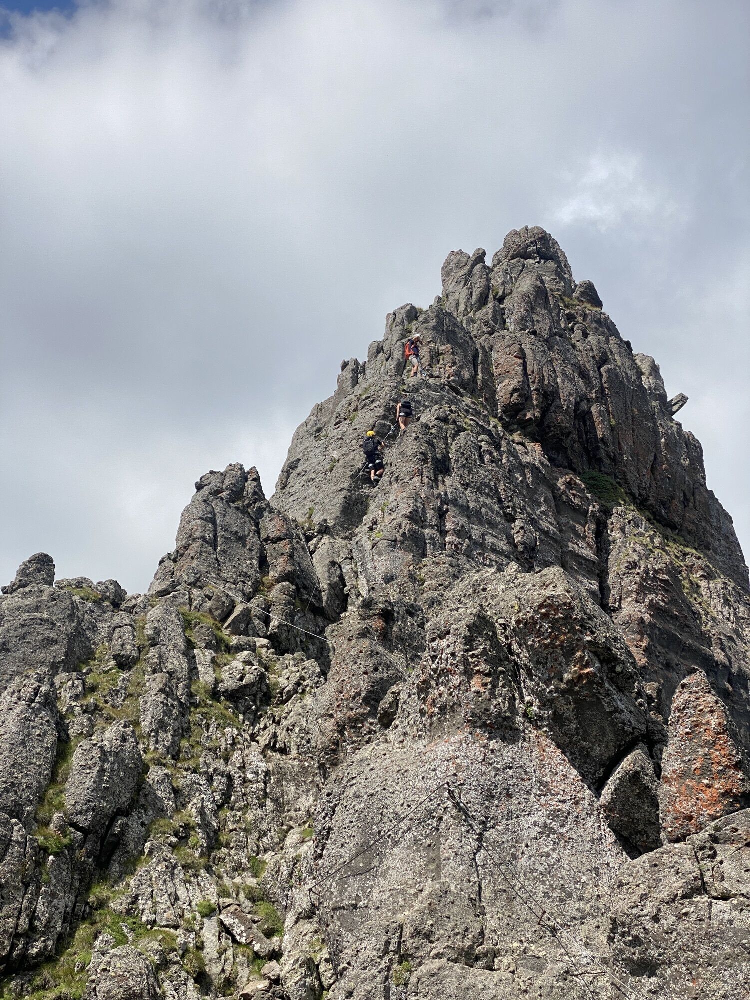
Via ferrata "delle Trincee"
Poziom trudności: C/D
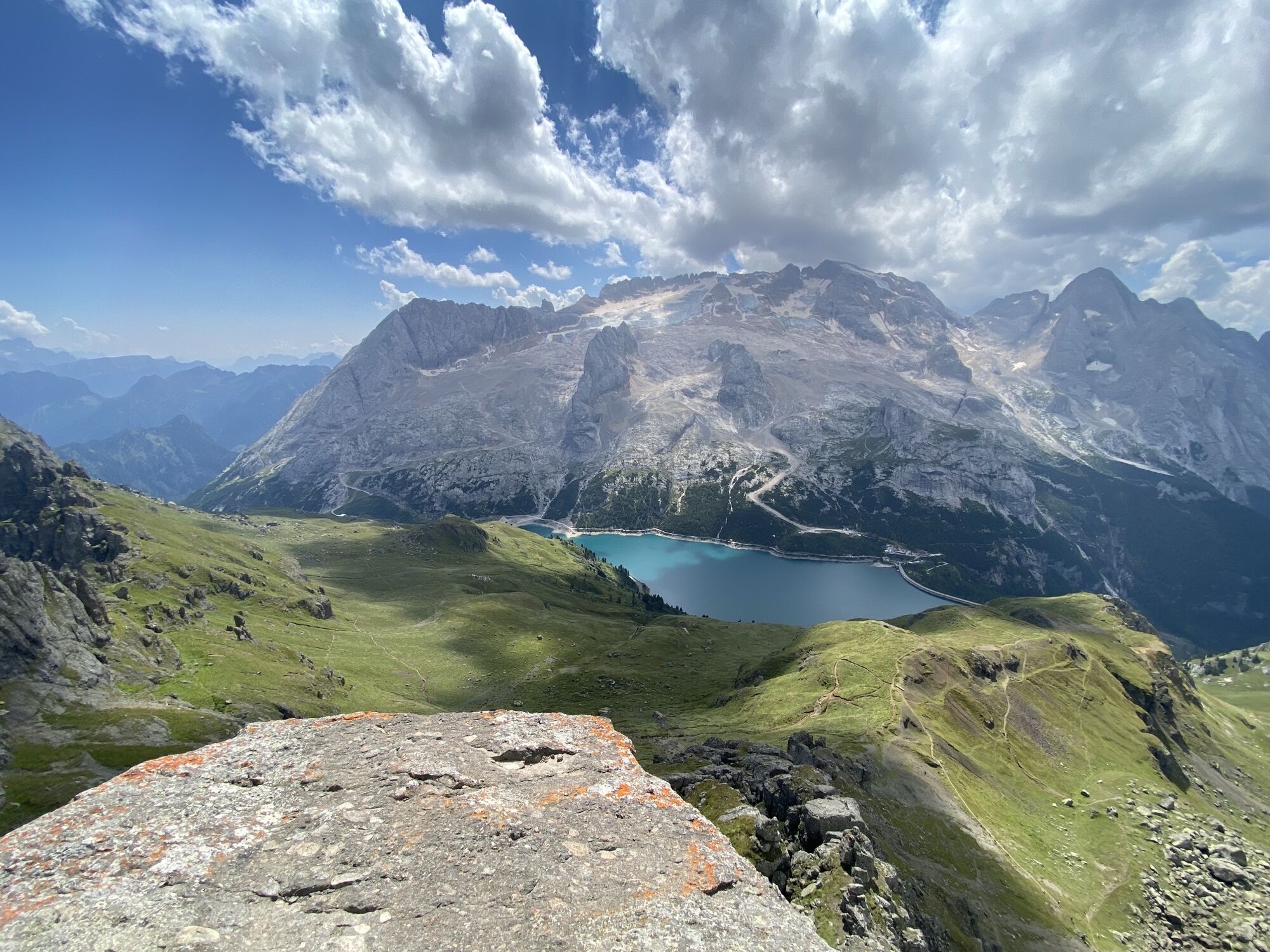
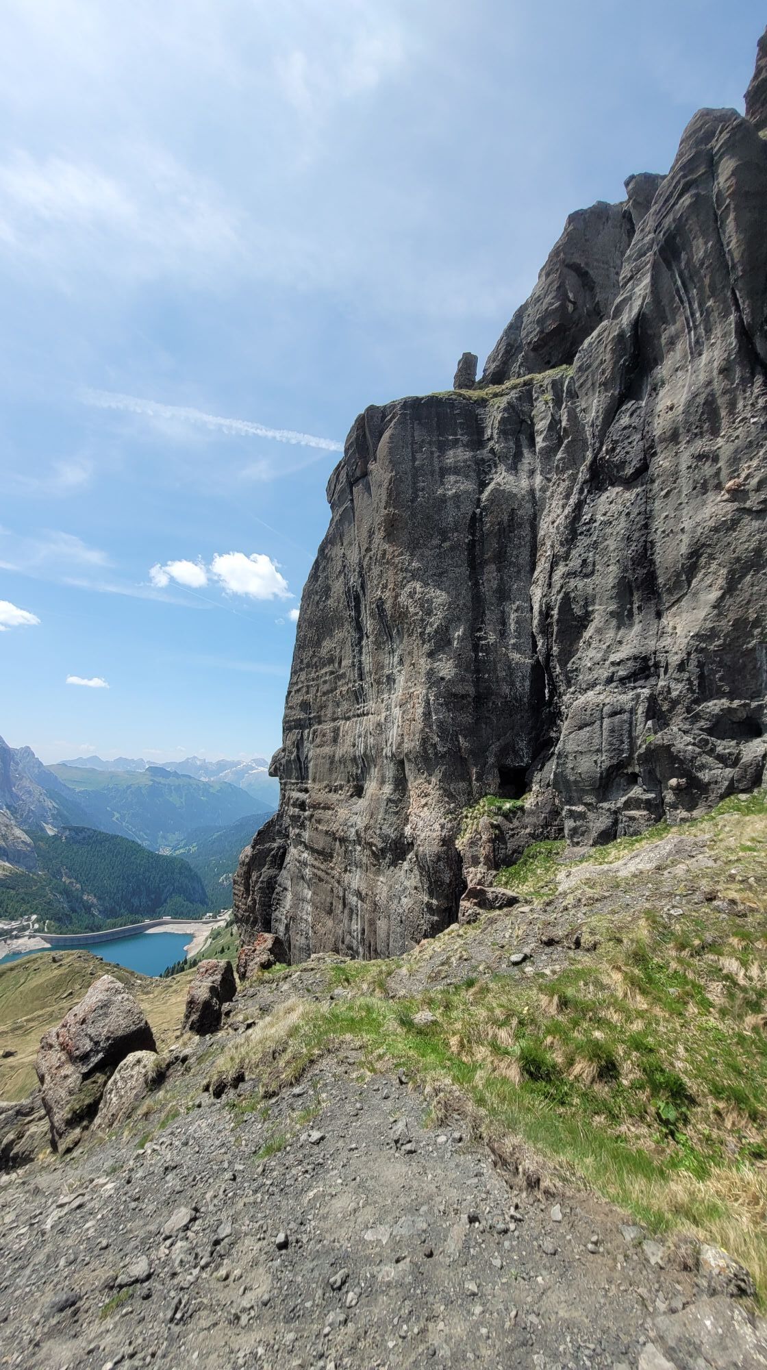
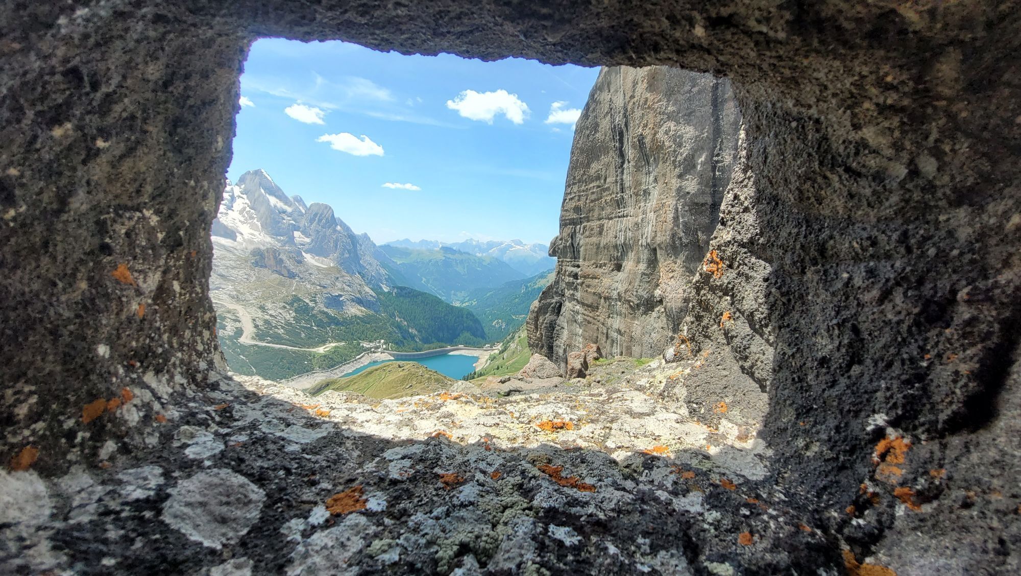
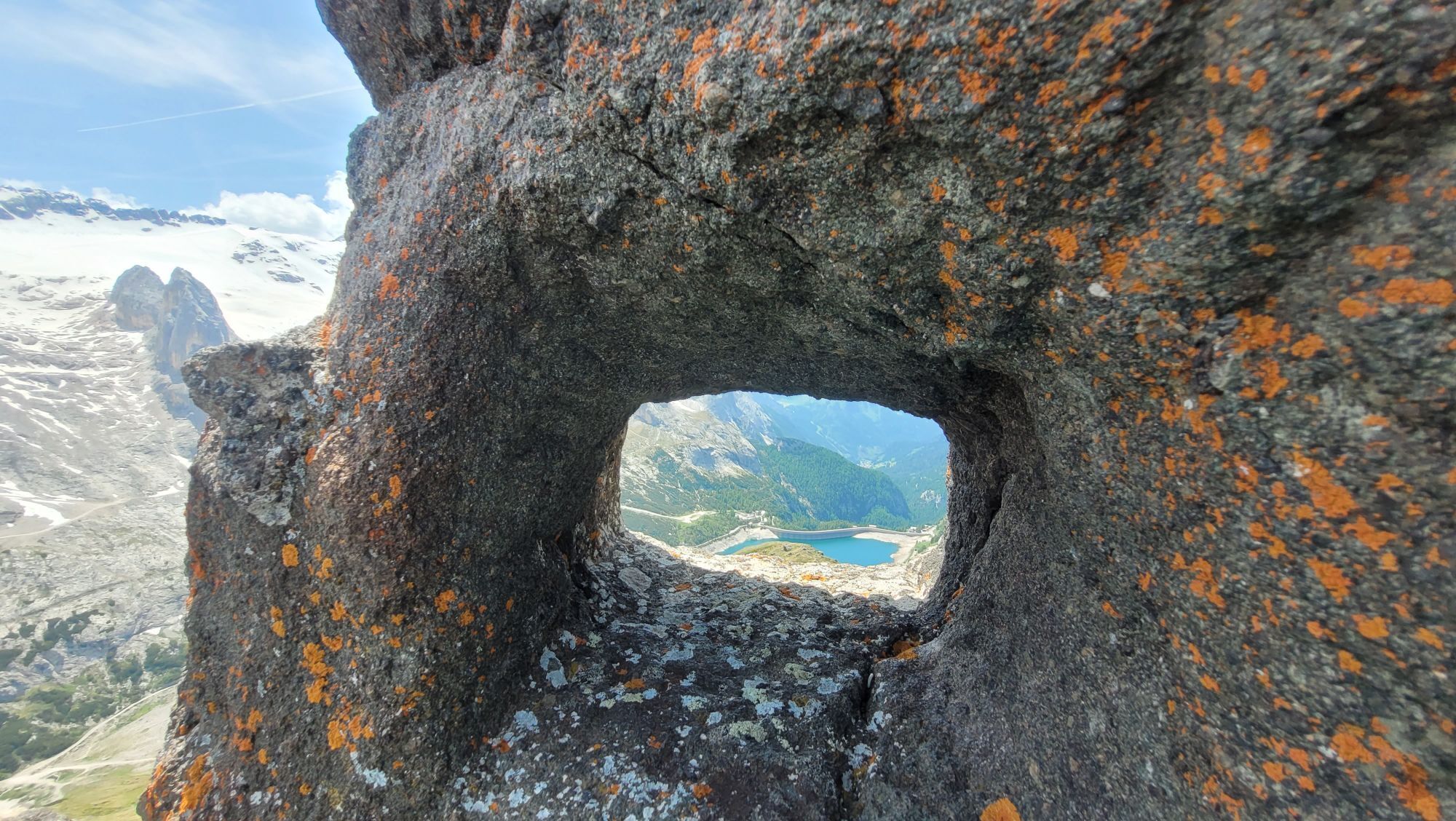
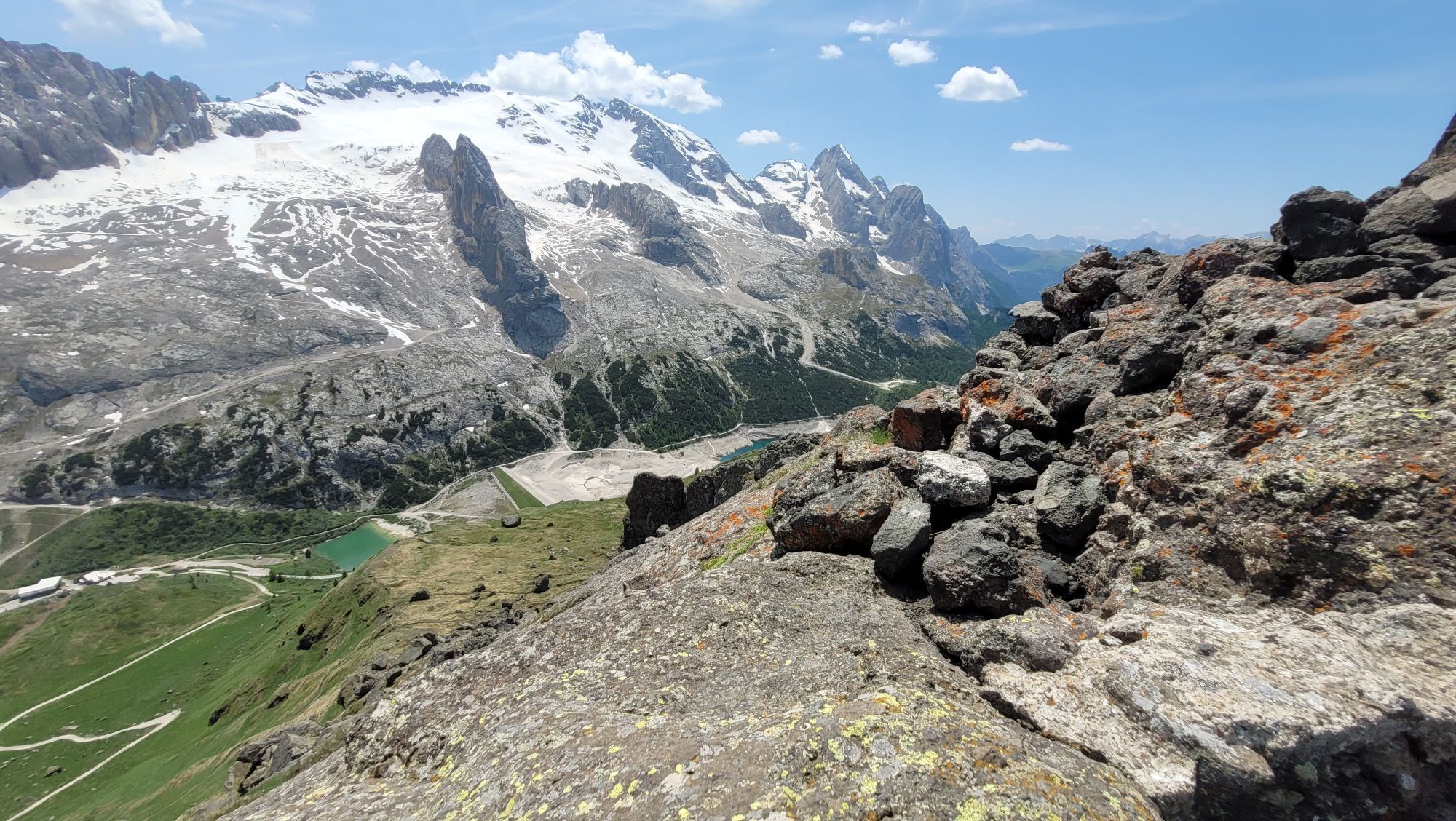
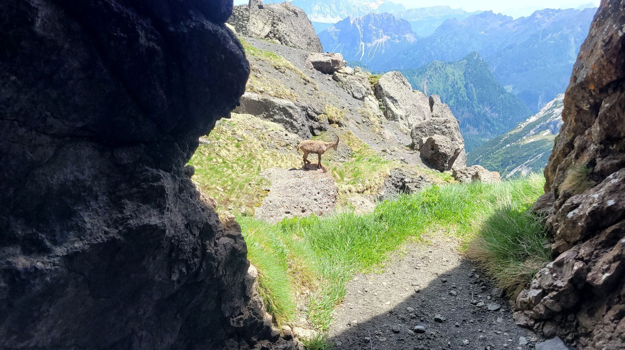
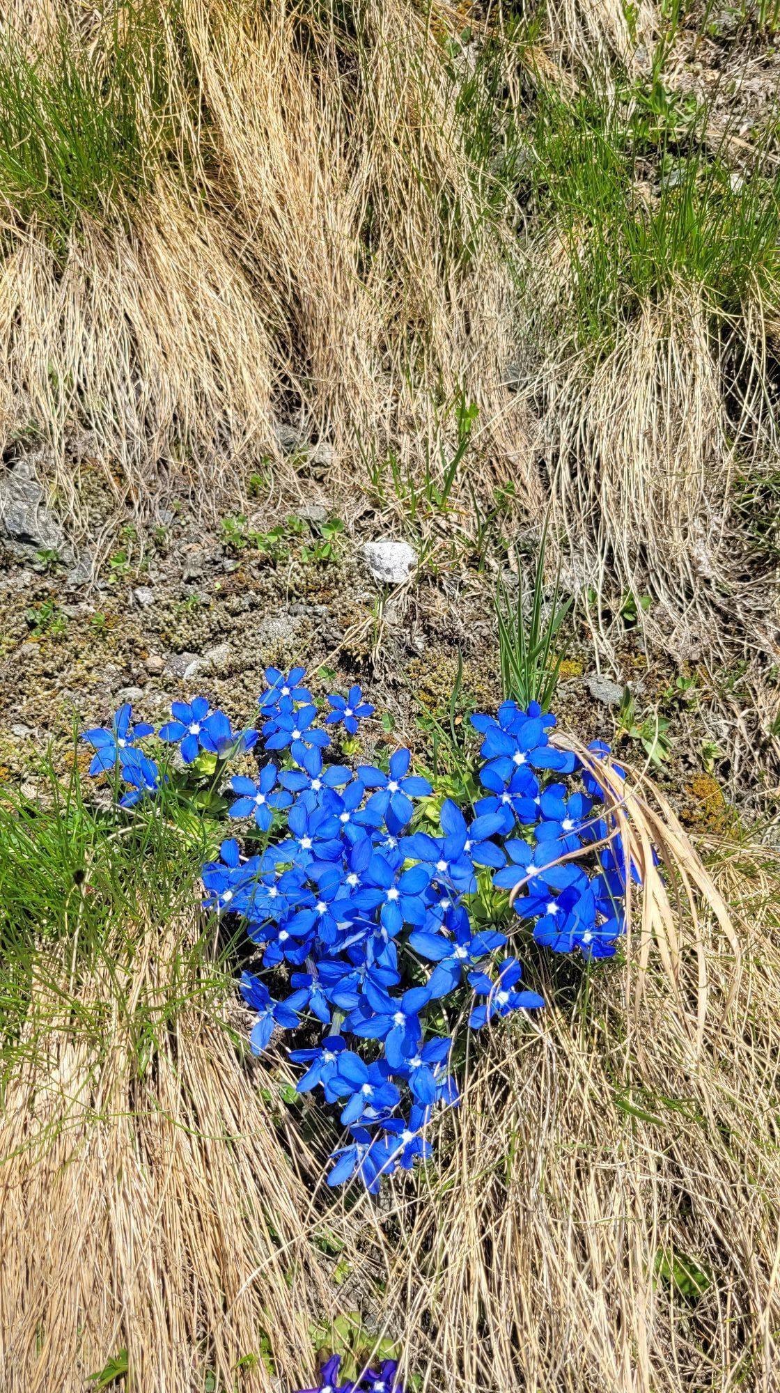
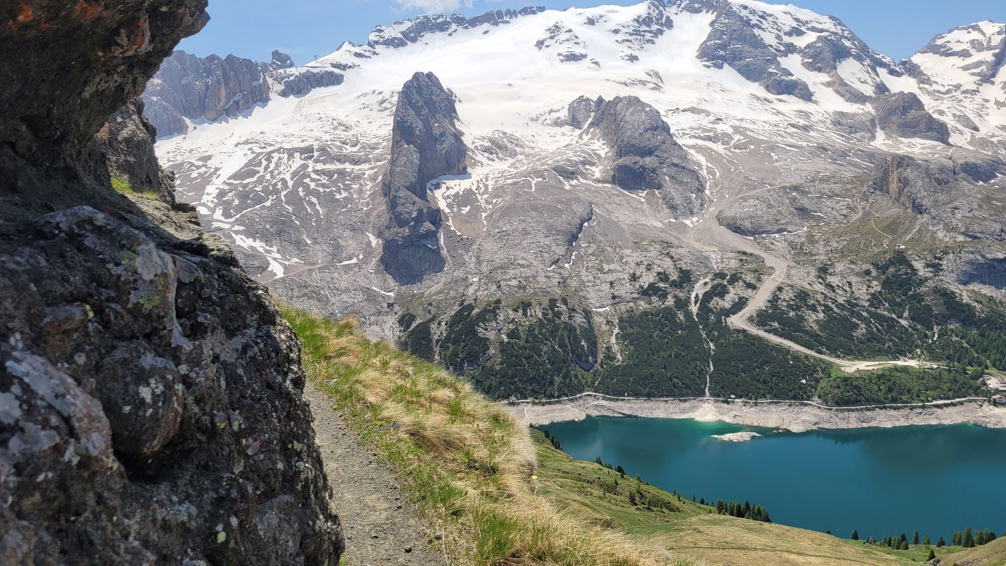
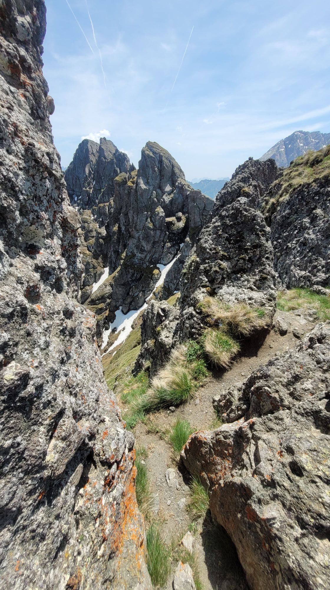
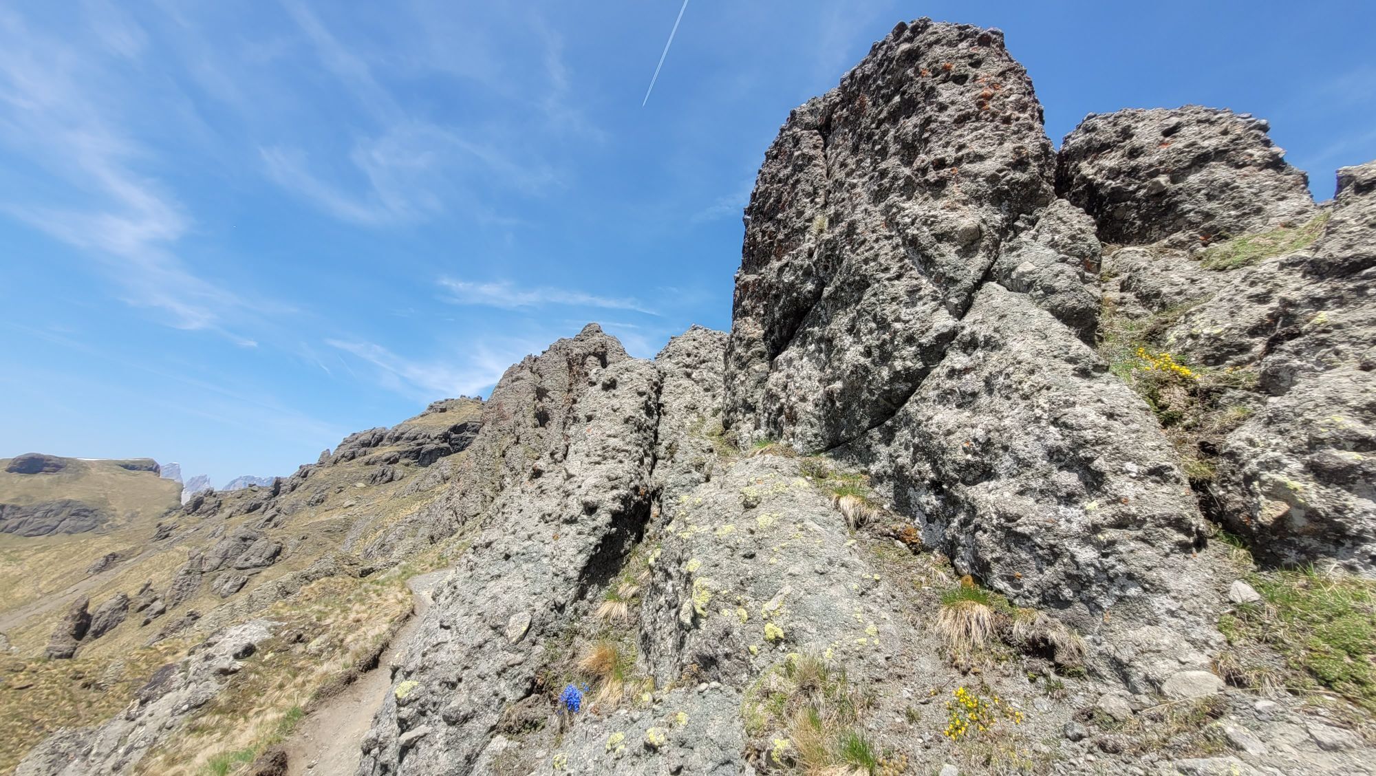
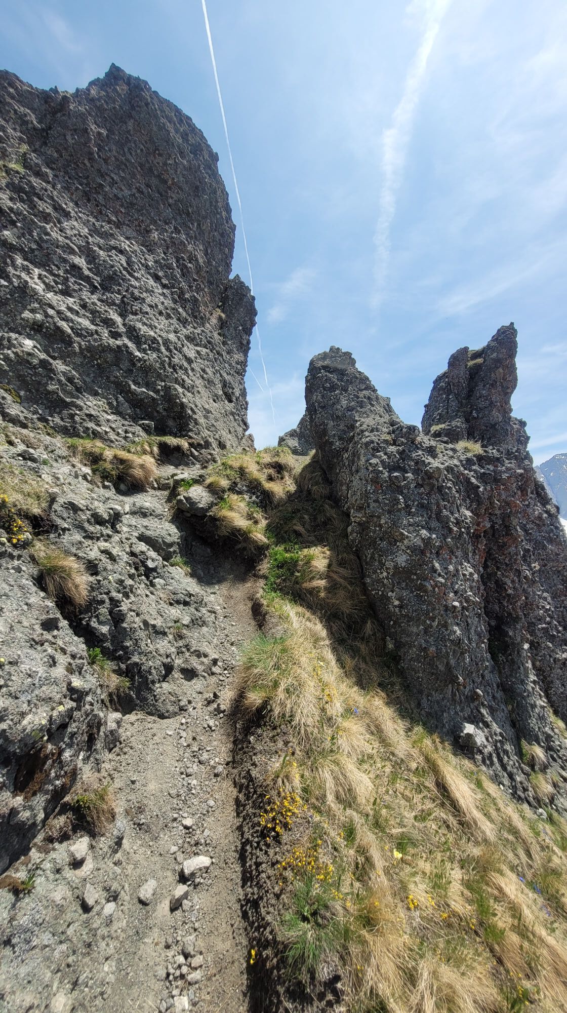

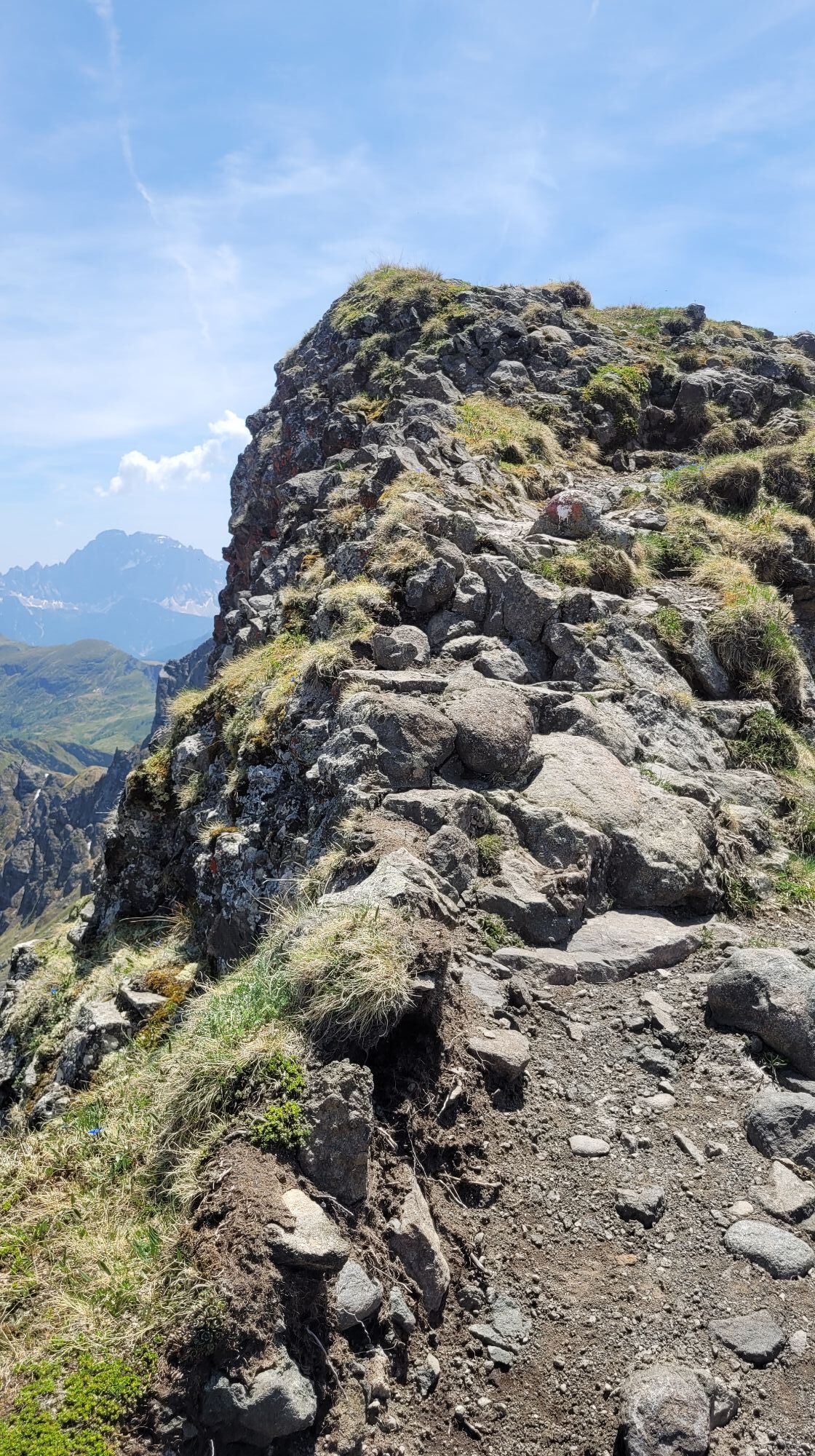
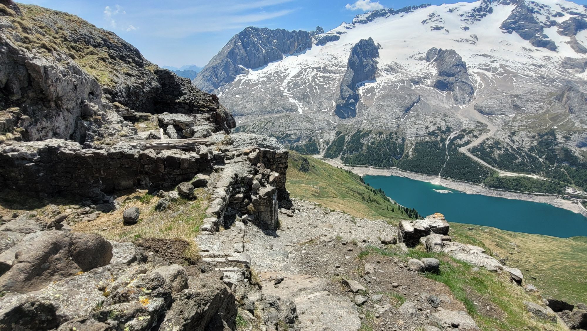
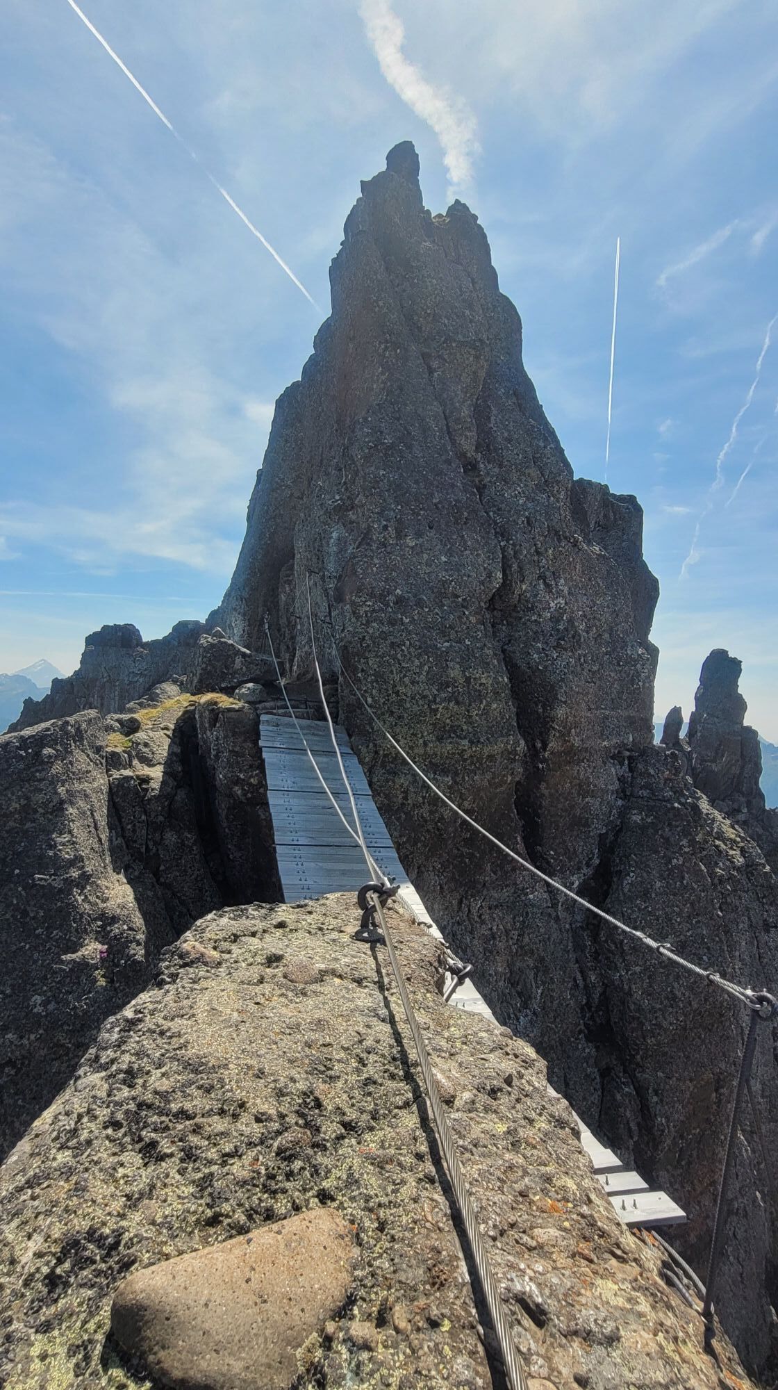
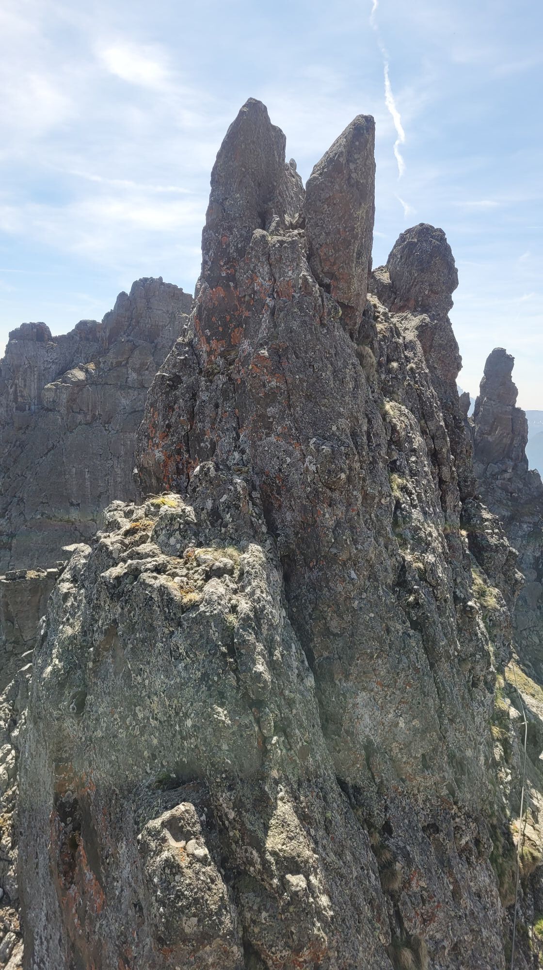
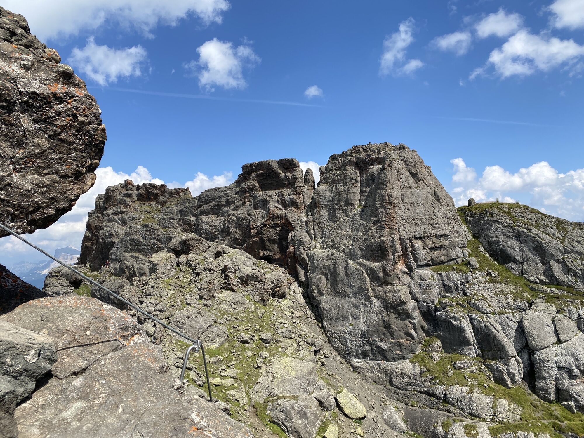
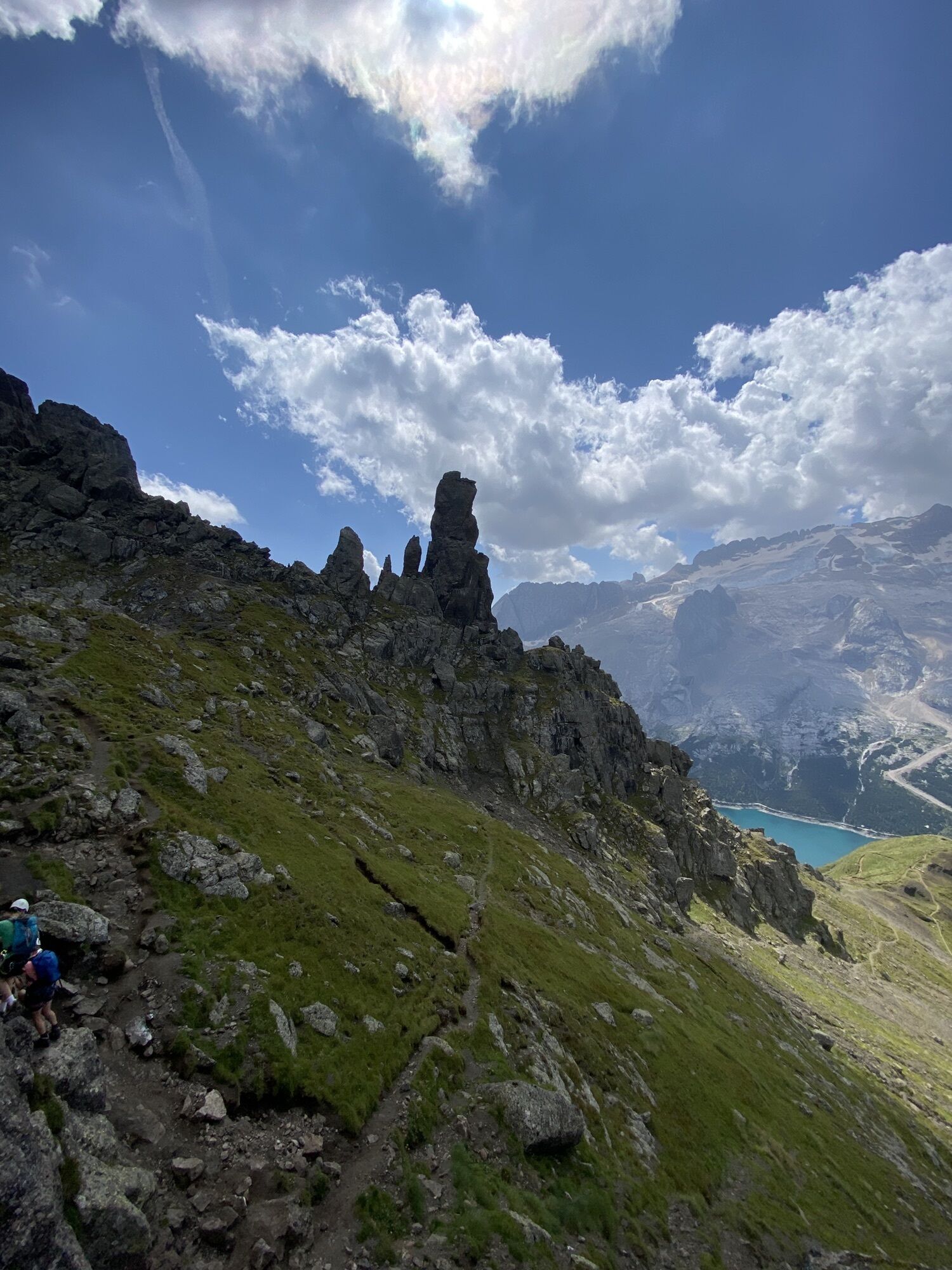
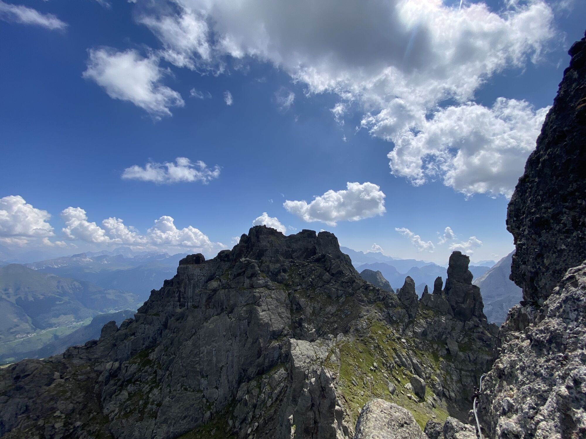
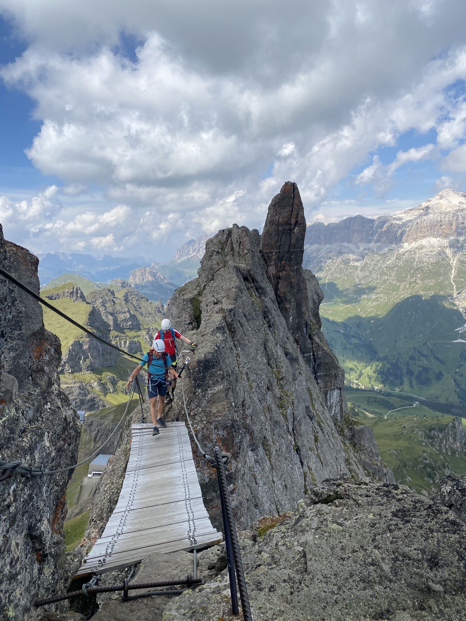
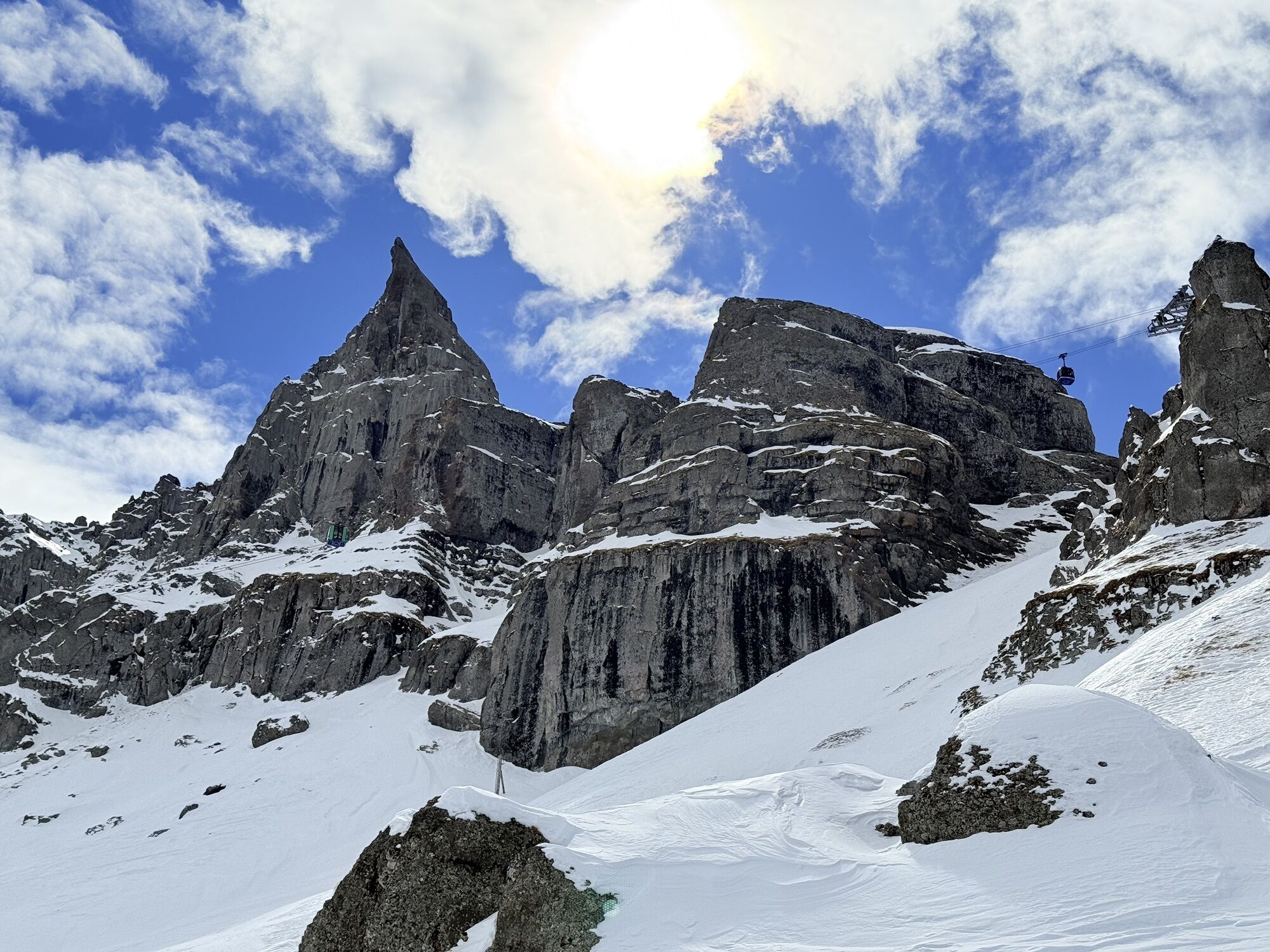
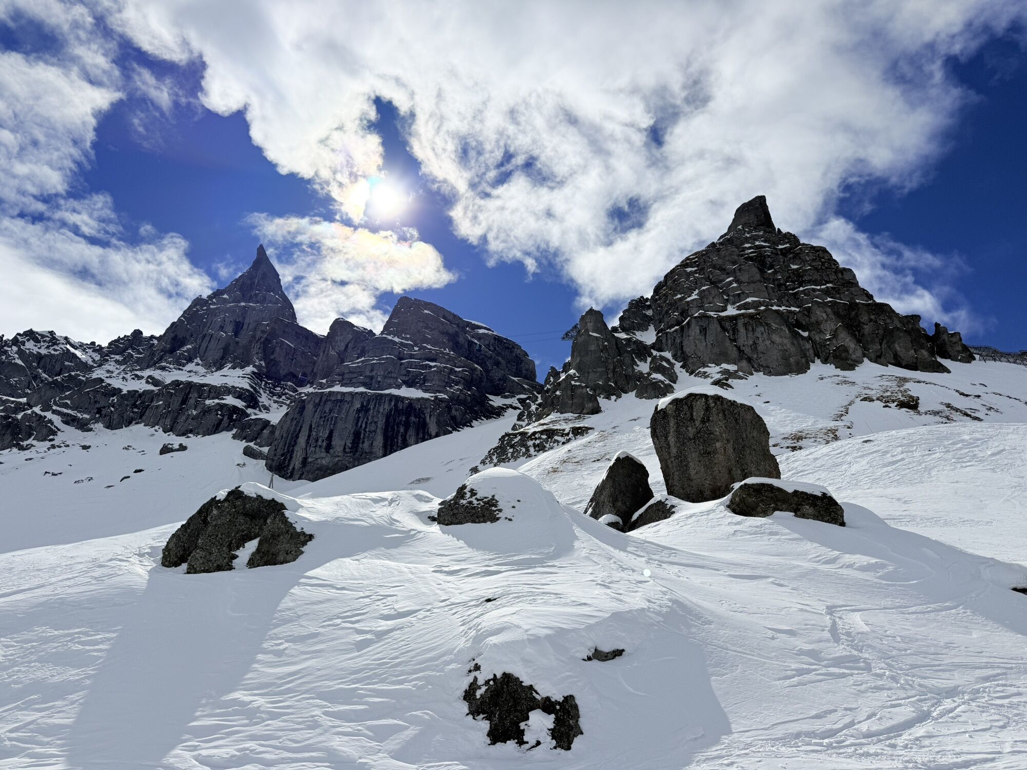
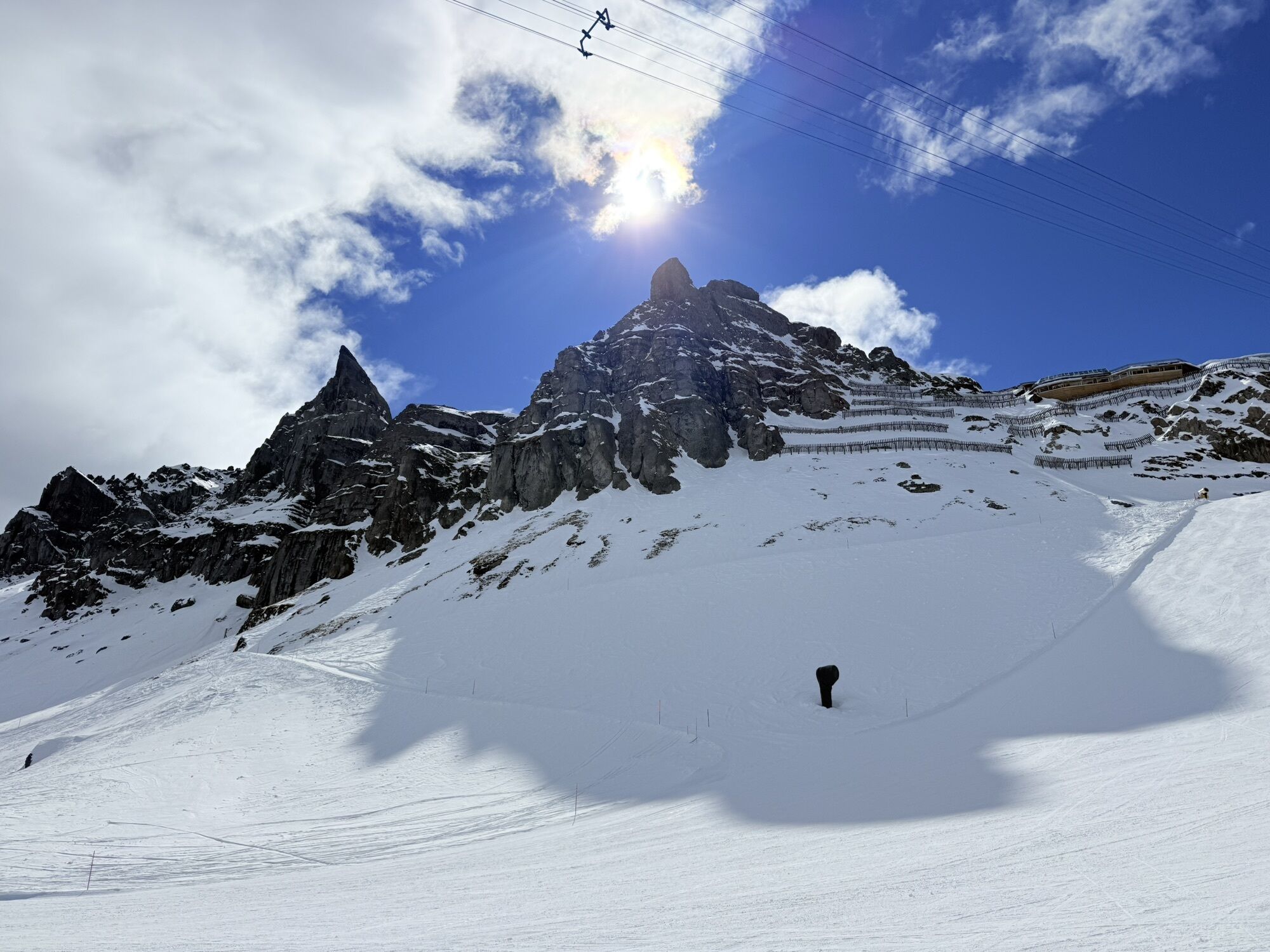
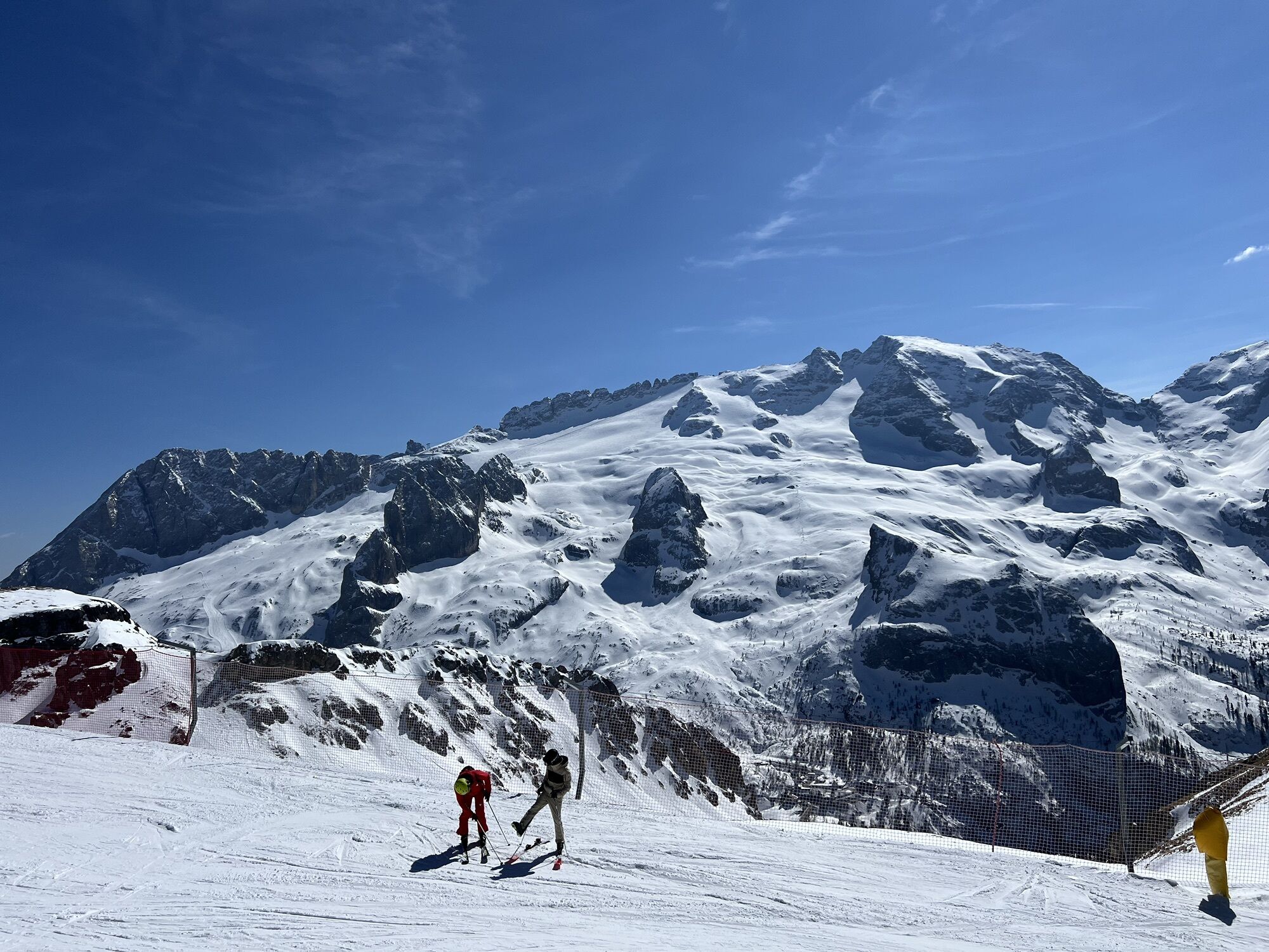
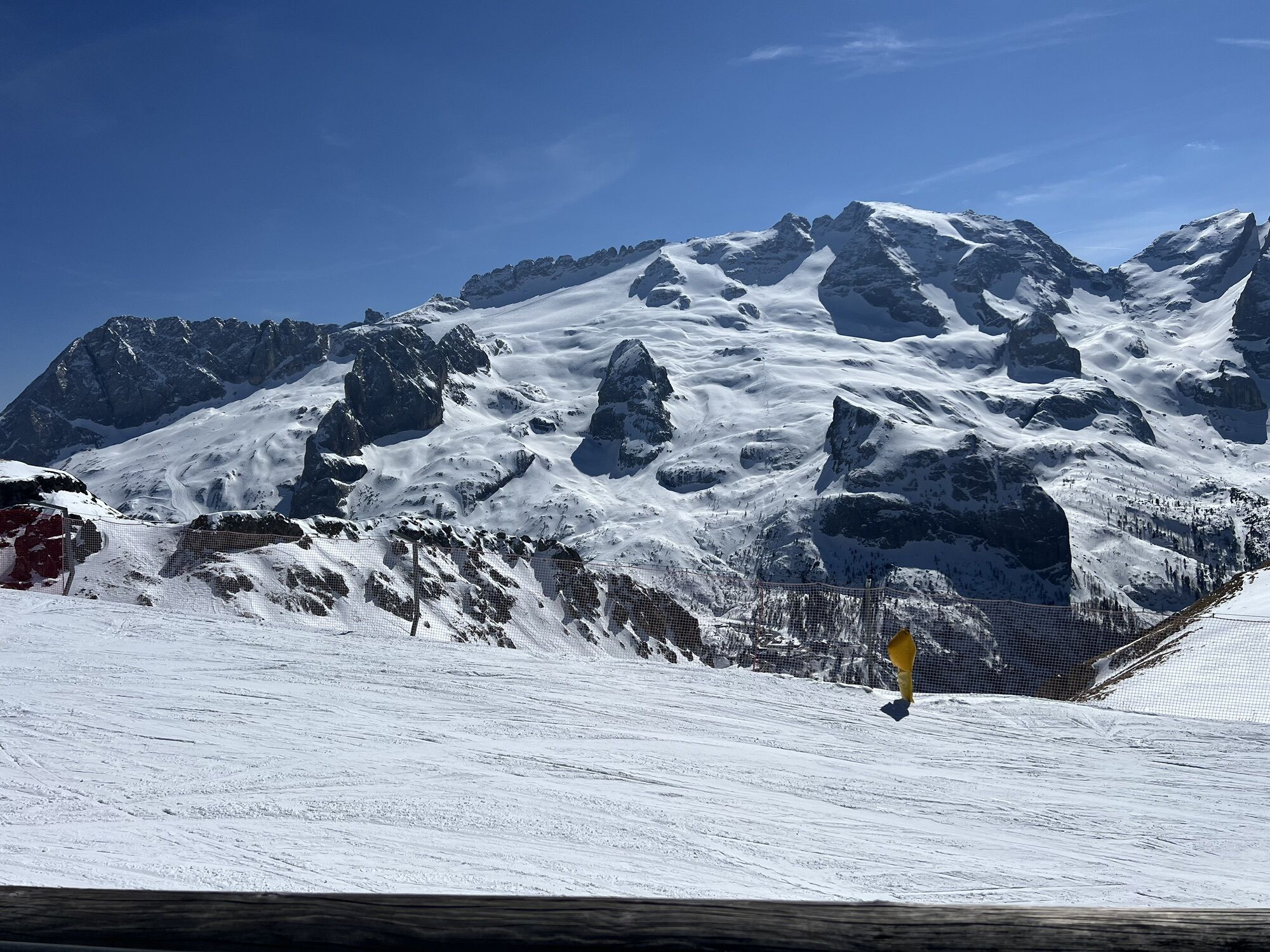
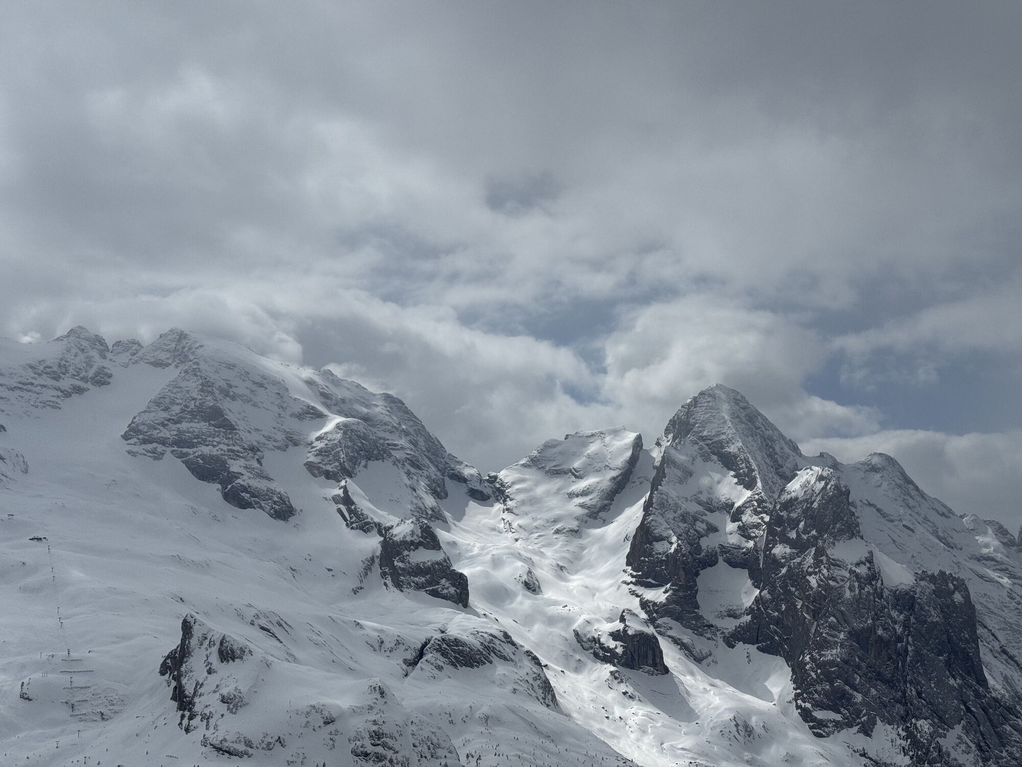
The "Ferrata delle Trincee" unfolds on volcanic rock, rich in breathtaking views between the two sides of the Sella Group and the Marmolada Glacier. Historically important as it is a route from the First...
The "Ferrata delle Trincee" unfolds on volcanic rock, rich in breathtaking views between the two sides of the Sella Group and the Marmolada Glacier. Historically important as it is a route from the First World War.
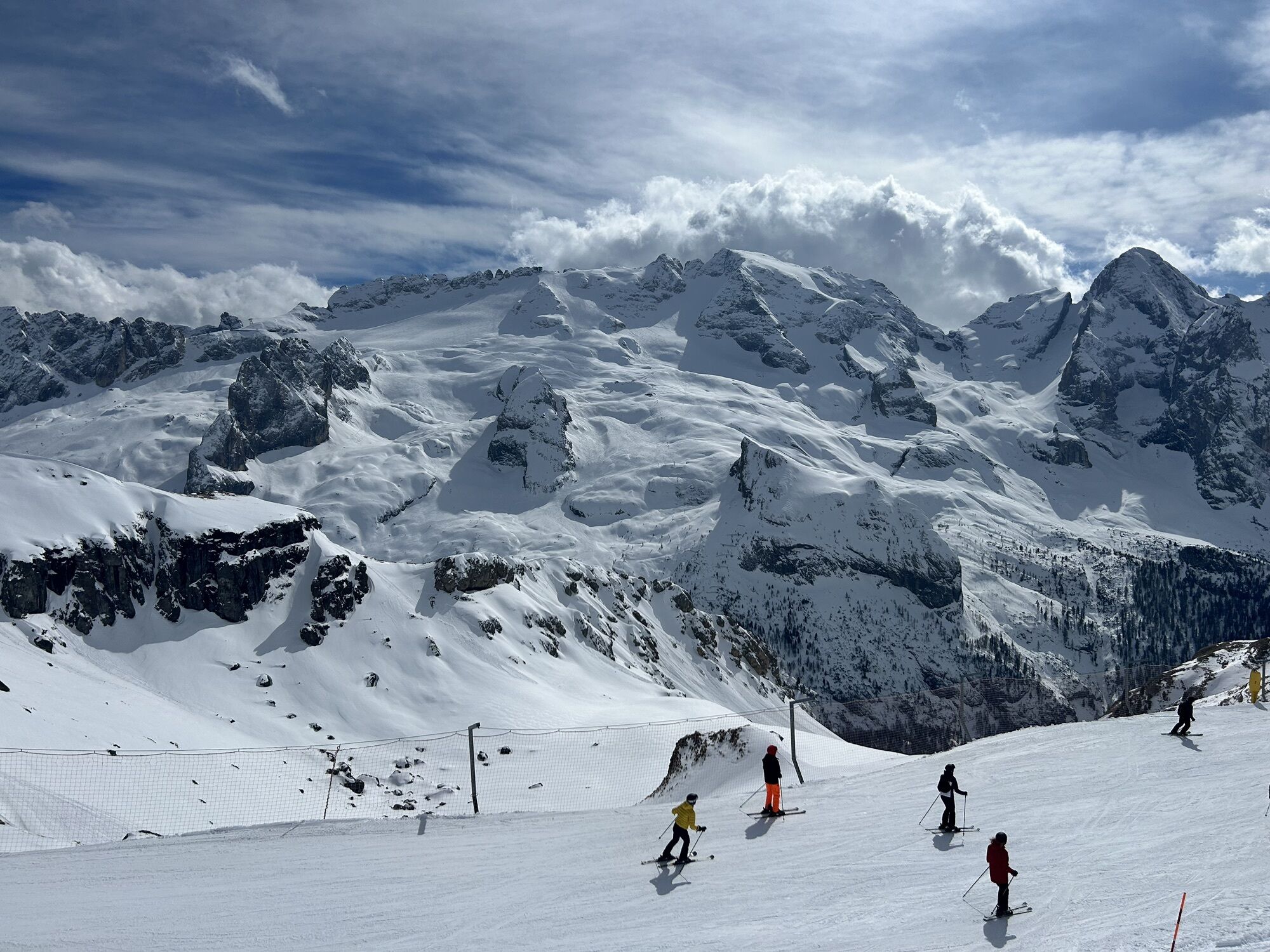
The starting point is Arabba, taking the cable car that reaches the top of "Porta Vescovo" (2478 m), and from here in 15 minutes you reach the via ferrata start.
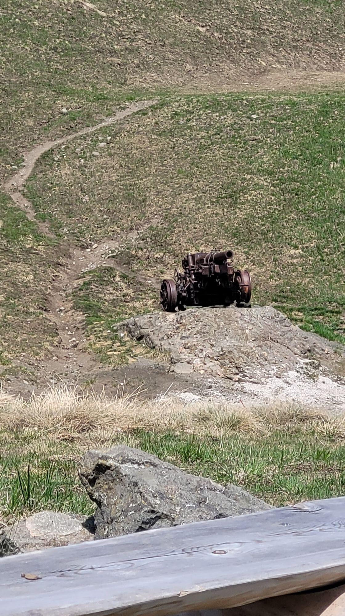
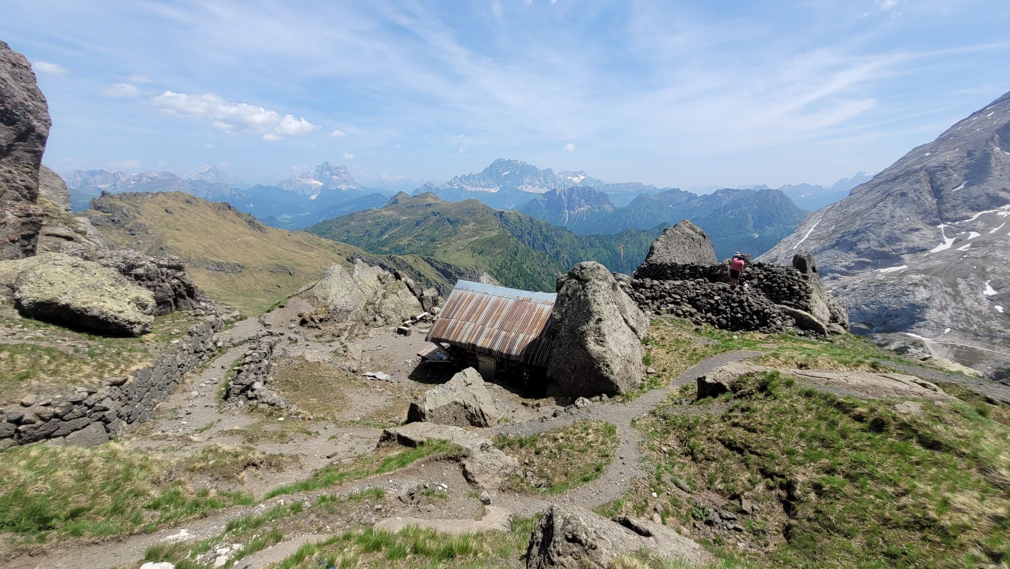
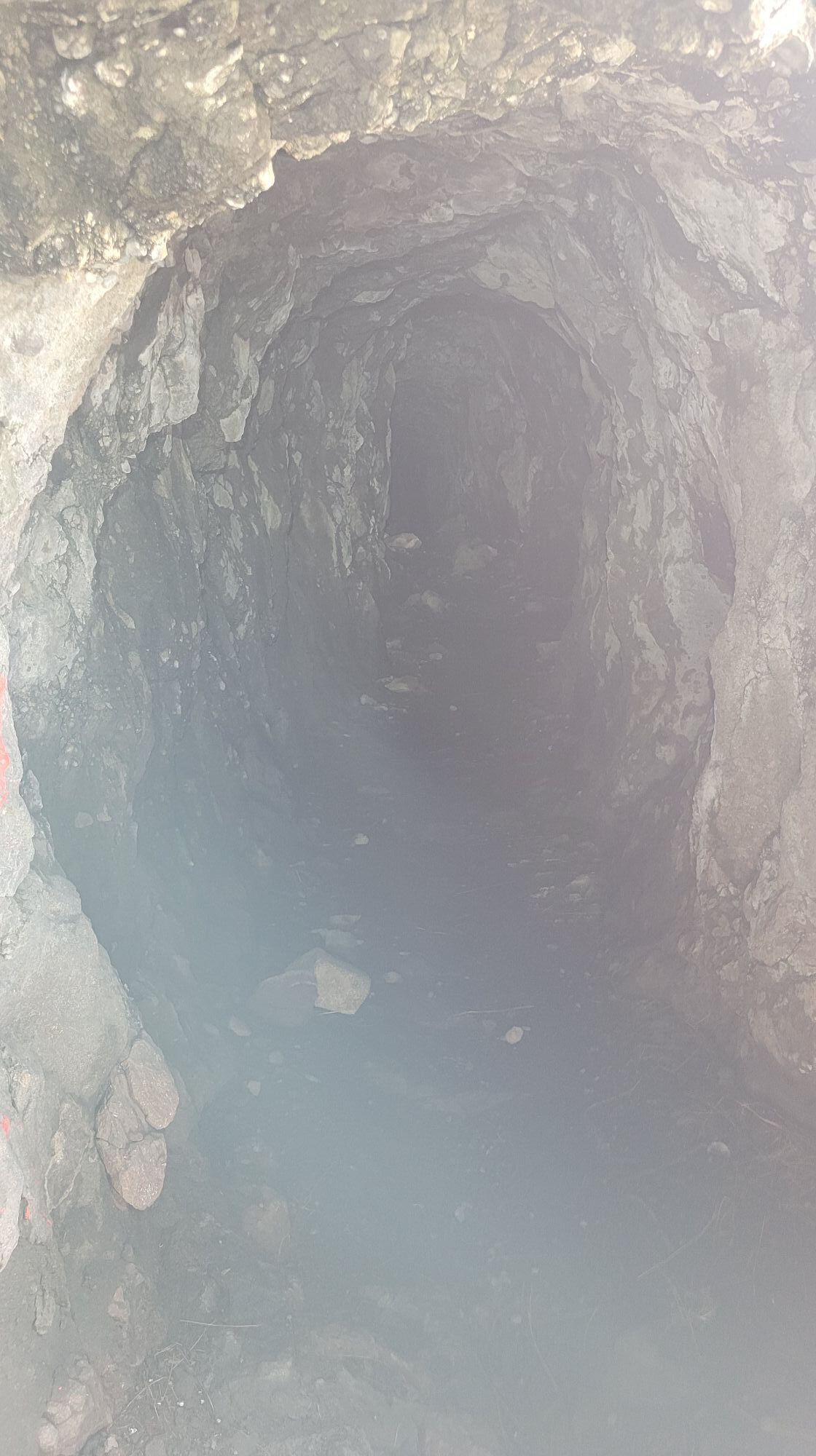
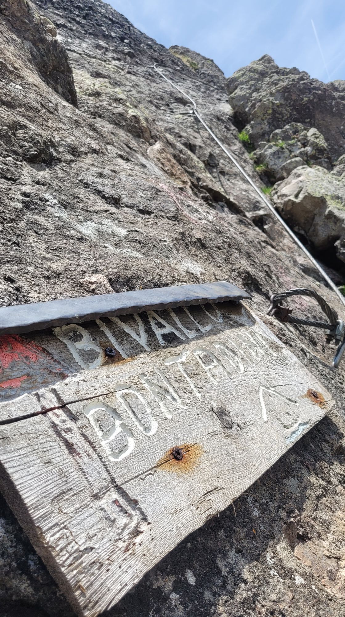
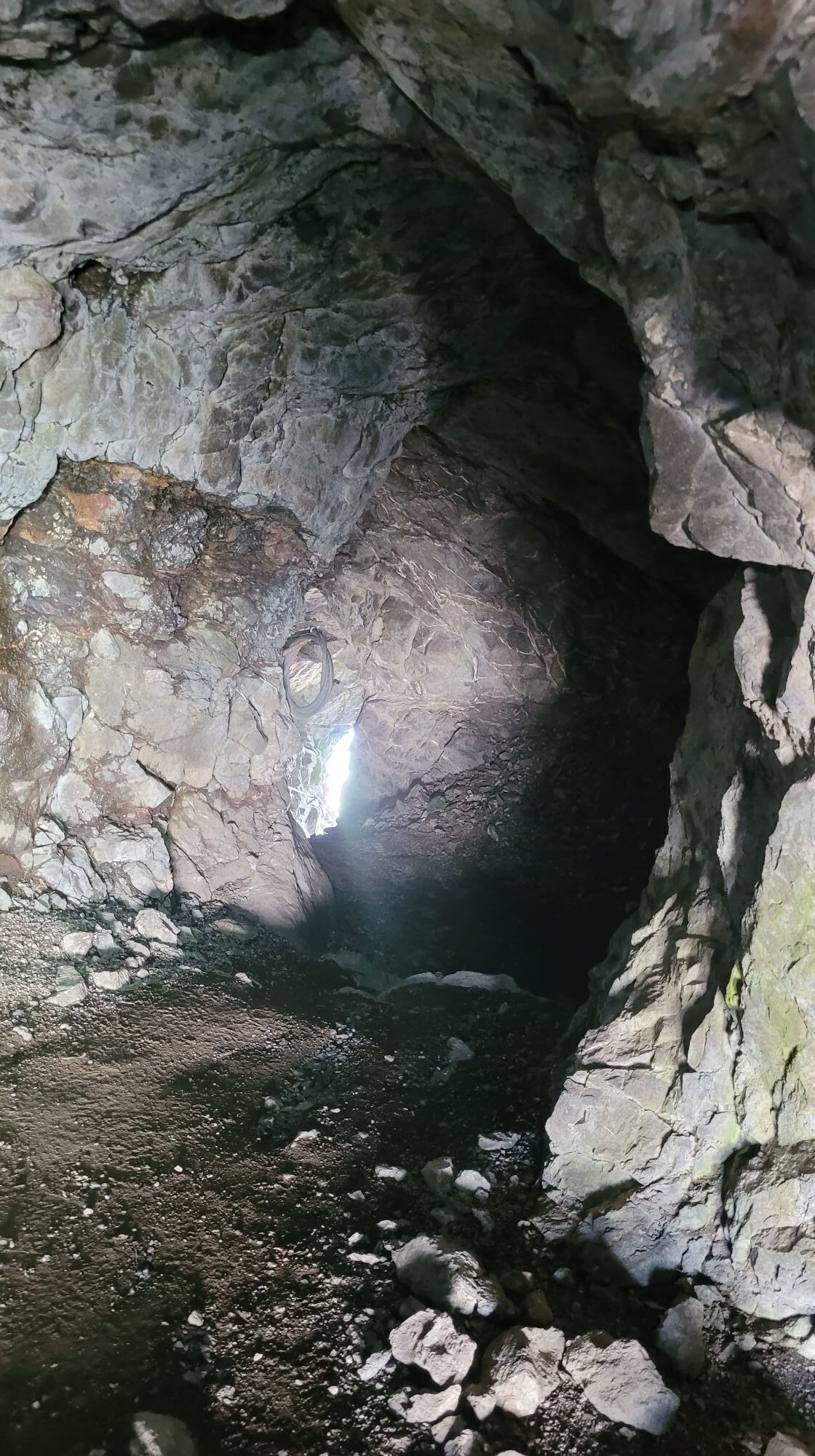
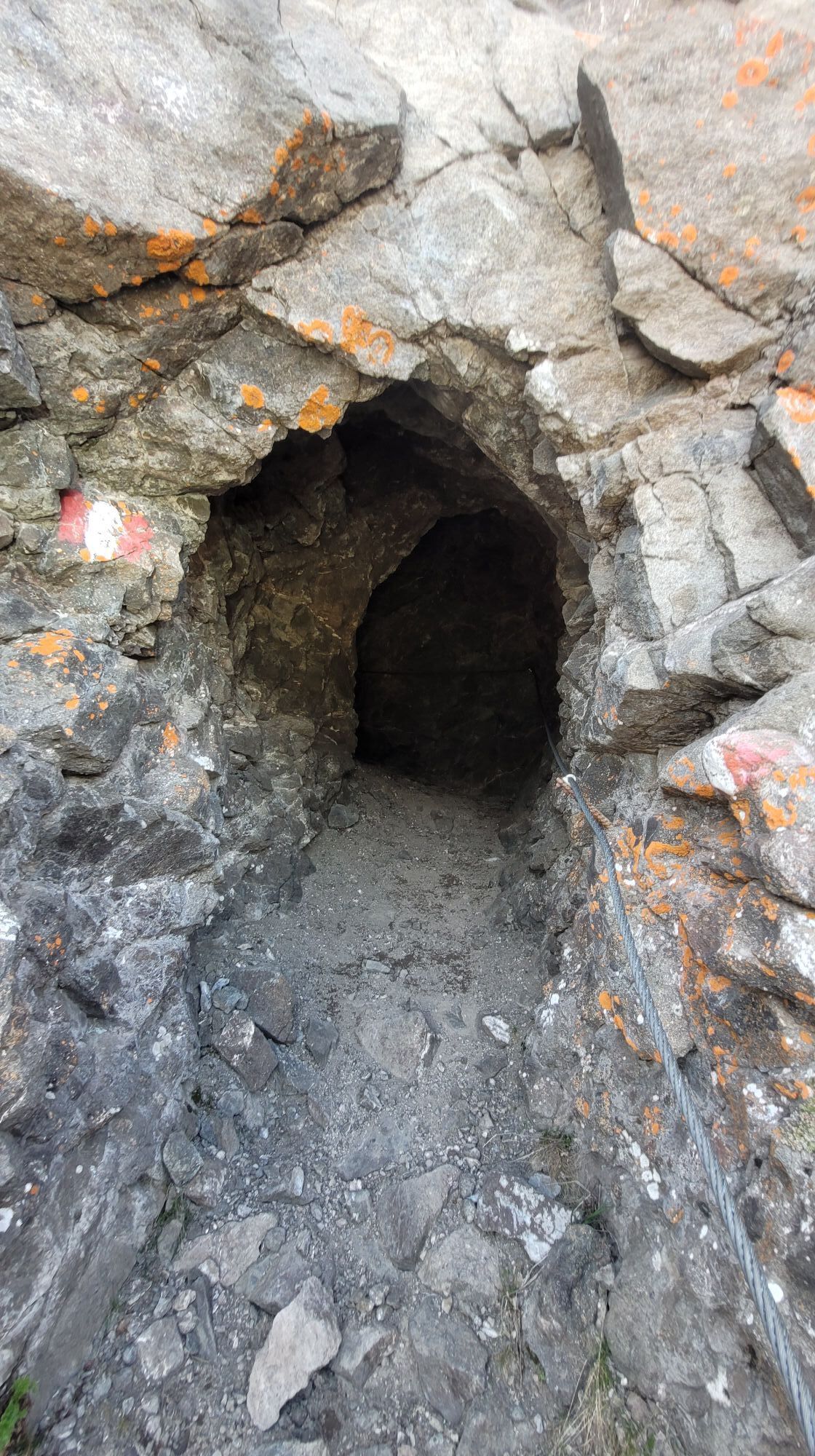
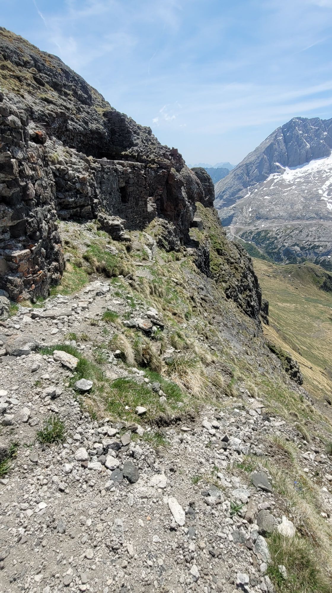
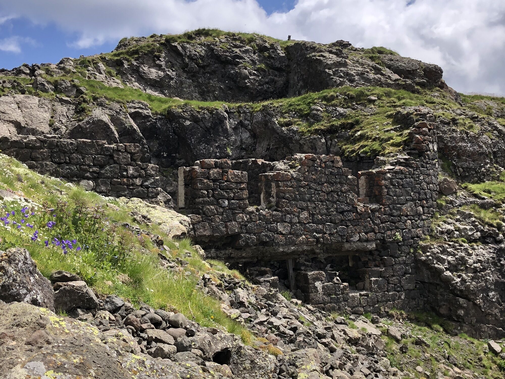
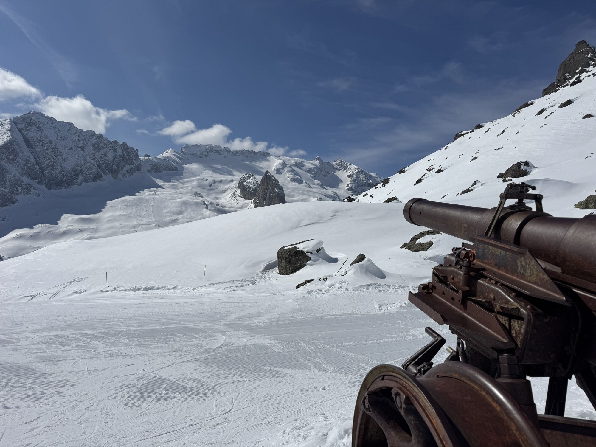
The Ferrata delle Trincee was a battlefield during the First World War, along the route it is therefore possible to still see old Austrian positions, trenches and do not miss the passage through thetunnels, then arriving at the "Bontadini" bivouac, then at "Passo Padon".
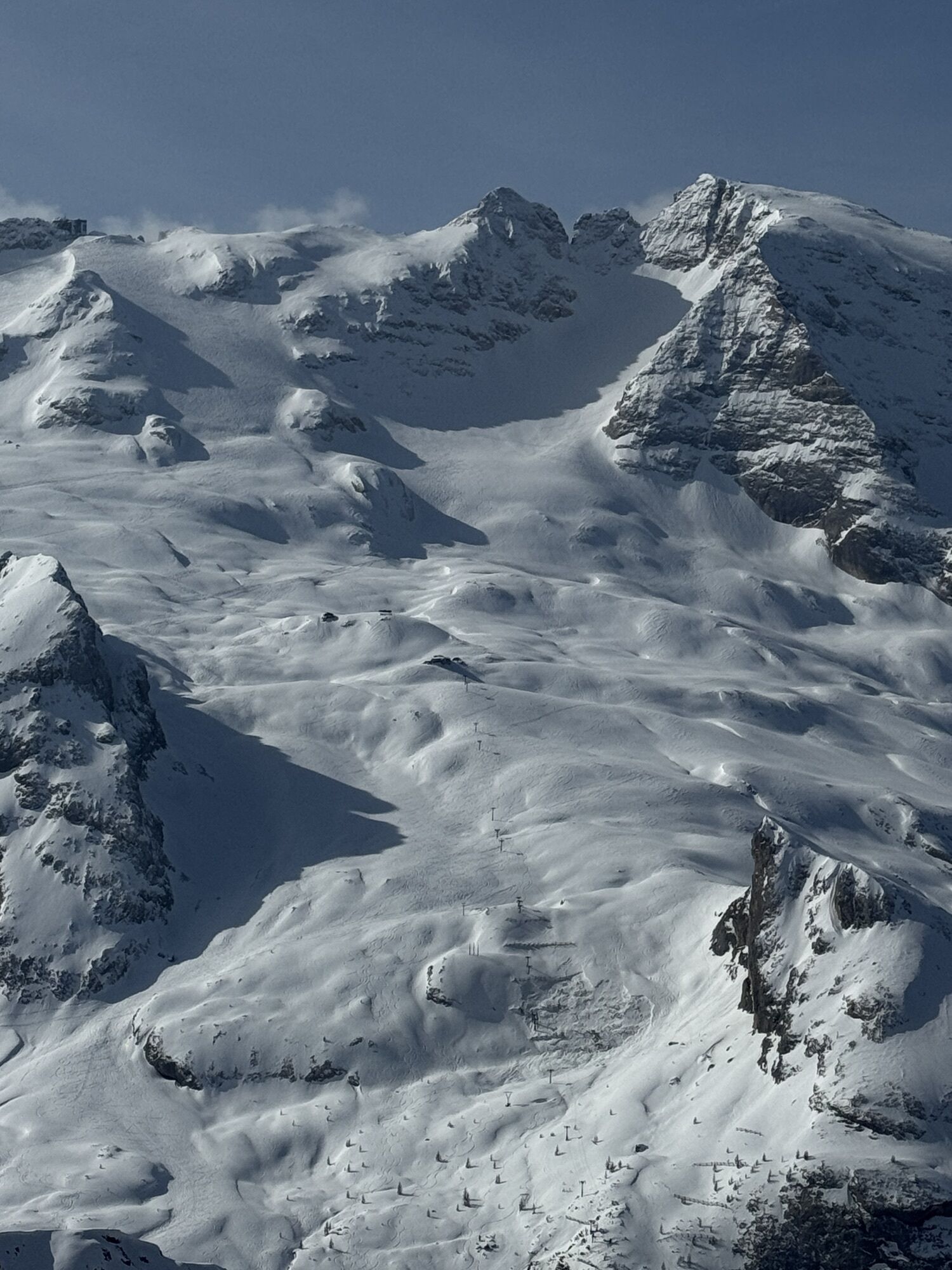
For the return it is possible to continue on foot along the CAI trail no. 699 and no. 698 and descend on foot to Arabba (2 hours) or return to "Porta Vescovo" via a high route to descend again by cable car to Arabba.
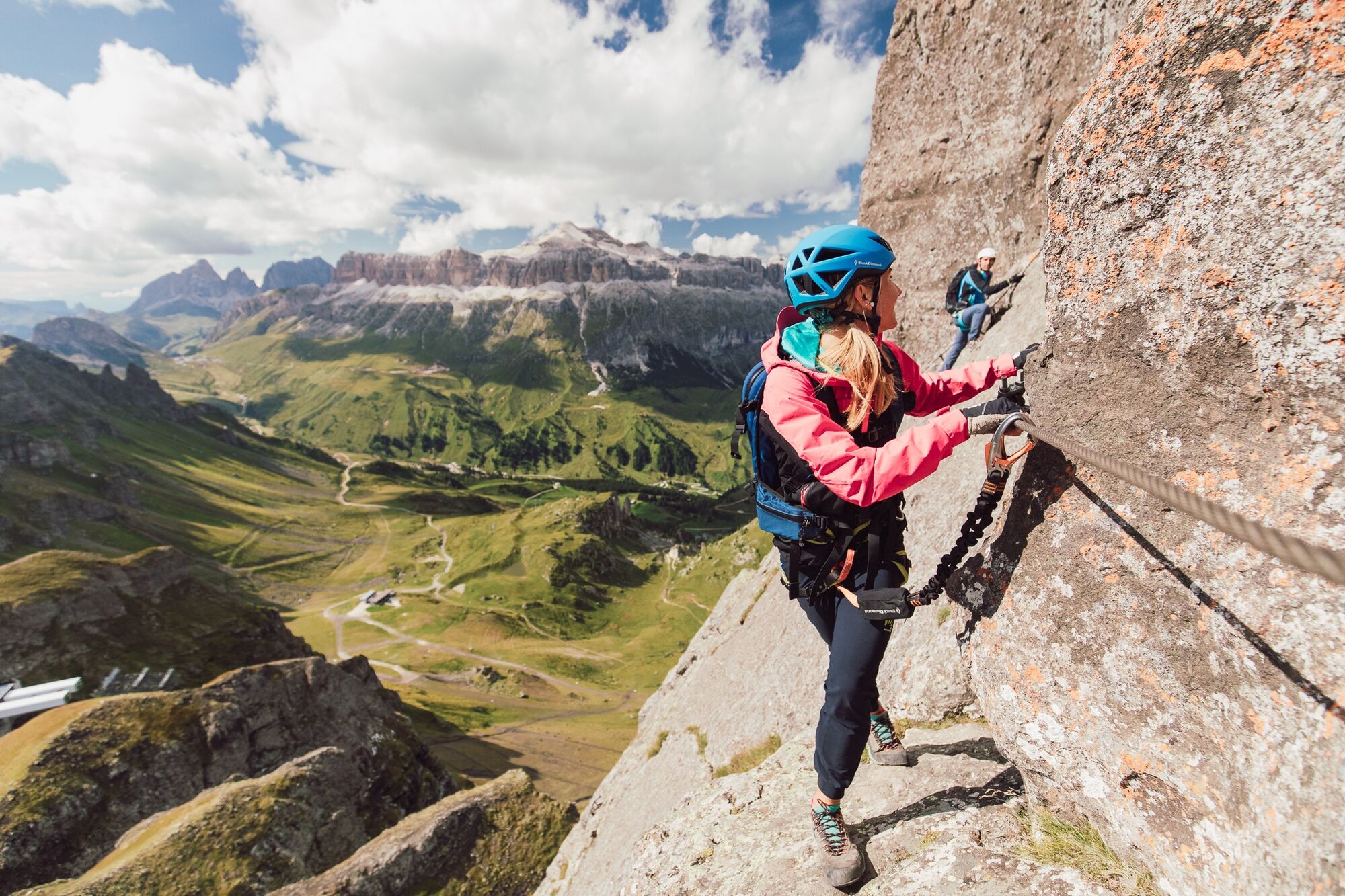
After reaching the top of "Porta Vescovo" by cable car, follow the signs for the "Ferrata delle Trincee" until the start of the route.
Tak
Tak
Tak
The via ferrata kit:
comfortable boot adaptable to the foot shape with grooved rubber sole to prevent slipping long trousers breathable T-shirt spare T-shirt (better if breathable) sweatshirt or fleece wind- and rainproof jacket breathable socks harness via ferrata kit: 2 straps, two carabiners (one with screw lock) and an energy absorber climbing helmet (to be worn already when approaching to avoid falling rocks) via ferrata gloves waterproof backpack or with waterproof cover sunscreen anti-reflective glasses emergency rope (necessary to know how to use it)If you want to approach this activity for the first time, it is advisable to rely on an experienced Alpine Guide.
Always let someone know where you are going and the approximate duration of the hike.
The emergency phone number is 112 or 118 (ambulance).
By car
From Innsbruck: Brenner Motorway A22 to the Bressanone exit, continue towards Val Pusteria, Val Badia, Passo Campolongo, and Arabba. From Verona/Milan: Brenner Motorway A22 to the Egna Ora exit, continue towards Val di Fiemme, Val di Fassa, Passo Pordoi, and Arabba. From Venice: Motorway A27 Belluno exit, follow the Agordina 203 to Agordo, Caprile, and Arabba.By train
Nearest train stations:
Belluno - 70 km Brunico - 48 km Ponte Gardena - 51 kmBy bus
Brunico - 47 km connection via SAD line www.sad.it Belluno – 70 km connection via Dolomitibus line www.dolomitibus.itBy plane
Venice Treviso/Venice Marco Polo – 160/170 km Innsbruck - 140 km Verona – 270 km Milan Bergamo/Milan Malpensa - 310/400 kmA free car park is available near the "Porta Vescovo" cable car and close to the Church of Arabba.
C/D
Alpine Guides:
Francesco Tremolada https://www.proguide.it/ Filippo Beccari https://www.arabba.it/it/arabba/filippo-beccari-guida-alpina/20-72173.htmlMountain conditions and weather can change rapidly and suddenly. Before departure check the weather forecast and the route status.
Use of a headlamp is recommended in the tunnels.
"The sustainable hiker's guide":
choose the route based on your physical and technical abilities research the route you intend to take before departure (distances, elevation gain, time required, springs, fountains, huts, lifts, bivouacs, etc.) check the condition of the chosen trail never undertake a hike alone always carry all waste down to the valley please stay on the marked trails please remain quiet forbidden to collect stones or minerals forbidden to feed animals forbidden to light fires forbidden to pick flowers or plants.Kamery internetowe z trasy
Arabba - Bec de Roces
Arabba - Porta Vescovo
Pordoi - Pass
Canazei - Col dei Rossi
Canazei - Col dei Rossi
Canazei - Col dei Rossi
Canazei - Col dei Rossi
Canazei - Col dei Rossi
Canazei - Col dei Rossi
Canazei - Col dei Rossi
Canazei - Col dei Rossi
Boé
Boé
Boé
Boé
Boé
Pordoi - Pass
Canazei - Col dei Rossi
Canazei - Col dei Rossi
Canazei - Col dei Rossi
Canazei - Col dei Rossi
Canazei - Col dei Rossi
Rifugio Burz
Rifugio Burz
Pista Fodoma
Rifugio Burz
Rifugio Burz
Rifugio Burz
Rifugio Burz
Pista Fodoma
Passo Padon
Boé
Boé
Popularne wycieczki w okolicy
- 4,6
Pordoi Pass - Sass Pordoi - Forcella Pordoi - Piz Boè - Boè Refuge - Forcella Pordoi - Pordoi Pass
ciężkiWędrówka 8,39 km - 4,9
Lang- und Plattkofel Umrundung
średniWędrówka 17,5 km - 5,0
Um den Langkofel
średniWędrówka 9,76 km - 4,8
Langkofel-Umrundung
średniWędrówka 12,9 km - 4,7
Passo Giau roundtrip
średniWędrówka 8,10 km - 4,0
Der Friedrich-August-Weg
średniWędrówka 10,4 km - 5,0
Langkofel Klettersteig/Ferrata Furcela de Saslonch
ciężkiVia ferrata 7,07 km - 4,7
Wycieczka do Pięciu Wież (Rifugi Averau, Nuvolau i Scoiattoli) z przełęczy Giau
średniWędrówka 10,8 km - 4,8
Pisciadùsteig Sella Gruppe
średniVia ferrata 7,15 km - 4,4
Dolomiten Sellagruppe, Alb. Col di Lana, Sas de Pordoi, Piz Boé retour 22.06.2016
średniWędrówka 5 km
Wędrówki i tropienie


Nie przegap ofert i inspiracji na następne wakacje
Twój adres e-mail została dodana do listy mailingowej.