


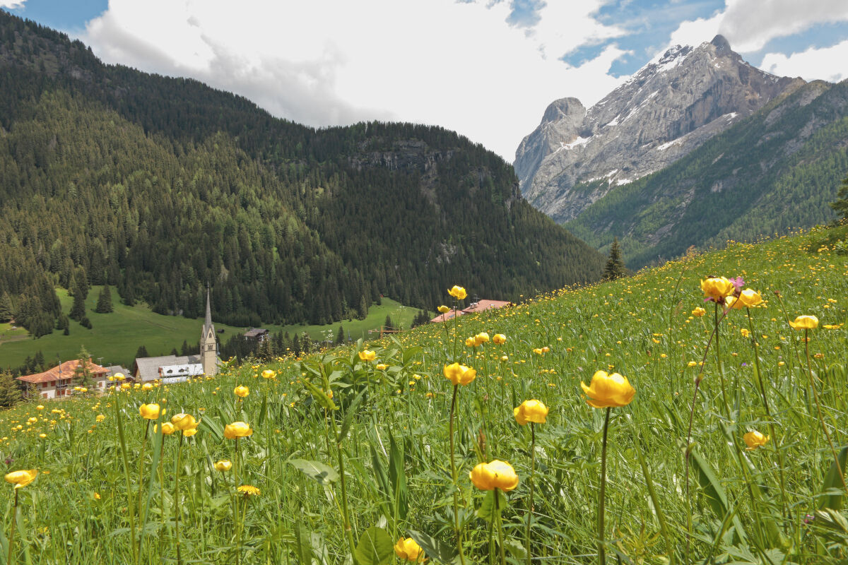
Canazei - Pènt de la Roa - Molin - Alba Penìa - Canazei
Starting from the Canazei playground, take the dirt road behind the Ski School building along the "Avisio" river, until you come out of the village near the bridge "Pènt de la Roa". Cross the national...
Starting from the Canazei playground, take the dirt road behind the Ski School building along the "Avisio" river, until you come out of the village near the bridge "Pènt de la Roa". Cross the national road and turn left onto the asphalt road (called "Strèda dò Veisc") running close along the "Avisio" river. The track, which is mostly even, alternates shady little woods and open areas. The walk is well equipped with tables and benches. Approximately half-way you reach a playground for children. Continue until the end of the road and get onto the national road at the beginning of "Penìa", near the bridge over the "Avisio". Go back to Canazei going over this bridge to the right and go down the left bank of the torrent. Pass by the ice stadium, cross the bridge on the right and walk back to the starting point along the same route.

Starting from the Canazei playground, take the dirt road behind the Ski School building along the "Avisio" river, until you come out of the village near the bridge "Pènt de la Roa".
Go back to Canazei crossing the bridge over the "Avisio" to the right and go down the left bank of the torrent. Pass by the ice stadium, cross the bridge on the right and walk back to the starting point along the same route. There are fountains, picnic areas and playgrounds for children along the whole walk.
Tak
Tak
Carry in your backpack the necessary to face possible emergency situations, and a first aid kit.
2.Walk slowly, enjoy the landscape and the silence.
3. Inform somebody about your itinerary, return time and possible changes.
4. Rely on professionals (mountain and hiking guides).
5. Help those in need. Call 112 only in case of real necessity.
6. Make sure you have suitable clothes and equipment + some water and snacks.
7. Respect the environment around you and its inhabitants. Bring back your rubbish.
8. Follow the marked trails avoiding those in the bikepark.
9. To protect the wonders of nature, leave everything in its place.
10. Bring your pet along, but keep it on a leash.
Other access points to Val di Fassa:
from A27 motorway (Venezia), exit Belluno/Ponte nelle Alpi, S.S. 203 to Agordo and S.P. 346 to San Pellegrino Pass - Moena (Val di Fassa). At the roundabout in Moena, proceed towards Canazei from A27 motorway (Venezia), exit Belluno/Ponte nelle Alpi, S.S. 203 to Agordo/Alleghe/Rocca Pietore. S.P. 641 to Fedaia Pass - Canazei coming from Arabba, S.S. 48 to Pordoi Pass - Canazei from Val Gardena, S.S. 242 to Sella Pass - CanazeiPublic transport lines SAD - Val di Fassa:
line no. 180 Vigo di Fassa - Carezza Pass - Bolzano- Nearest bus stop (Trentino Trasporti): Canazei > Piaz G. Marconi (square)
Parking at the Dòlaondes Aquatic Centre.
Strèda Roma, 36
38032 Canazei (TN)
Phone +39 0462 609500
info@fassa.com
www.fassa.com
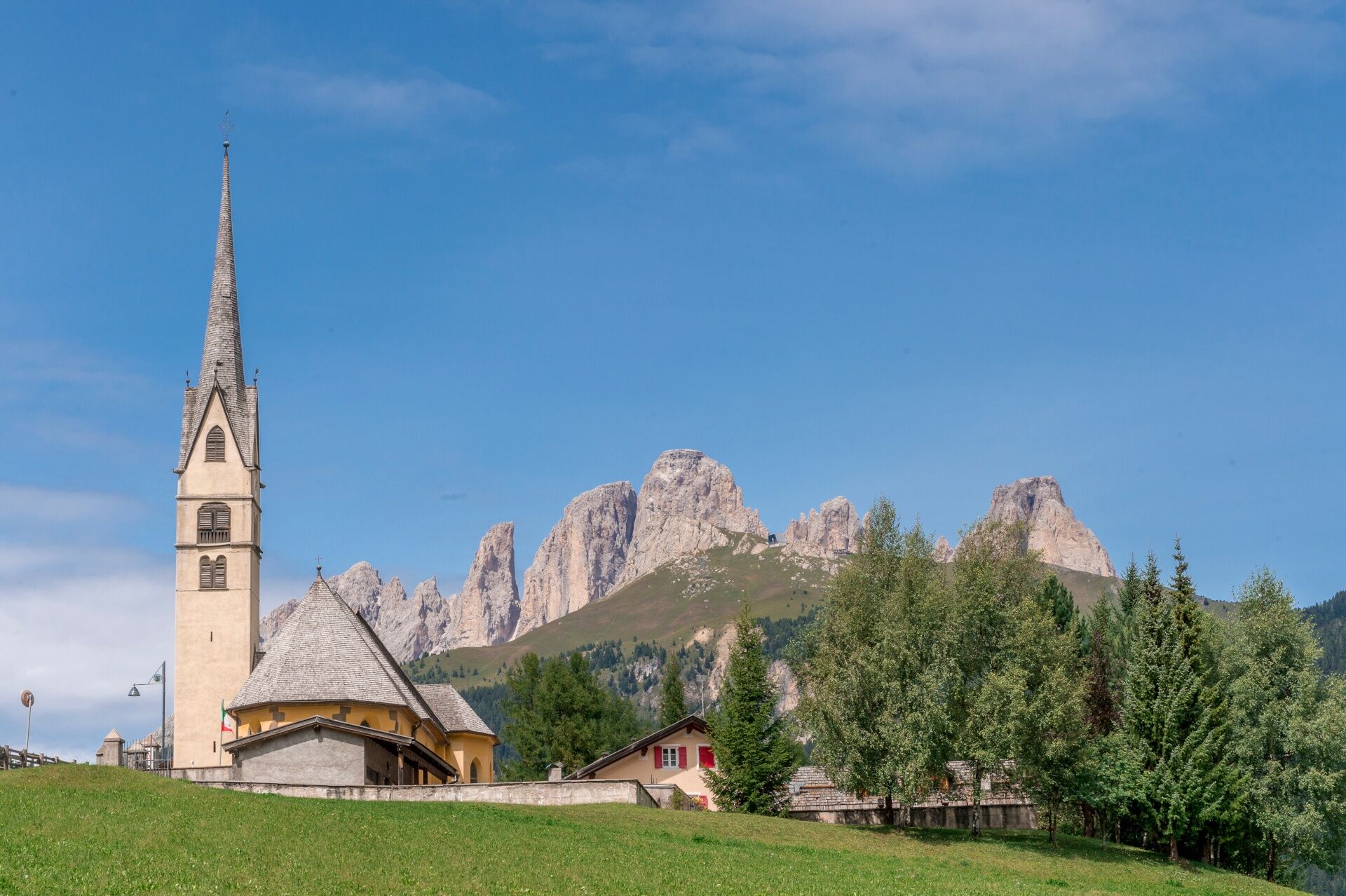
Easy loop walk that runs along the orographic right and left of "Avisio" river, connecting Canazei to the hamlets of Alba and Penìa. It’s suitable for families with children and is accessible with a baby carrier.
Kamery internetowe z trasy
Col dei Rossi
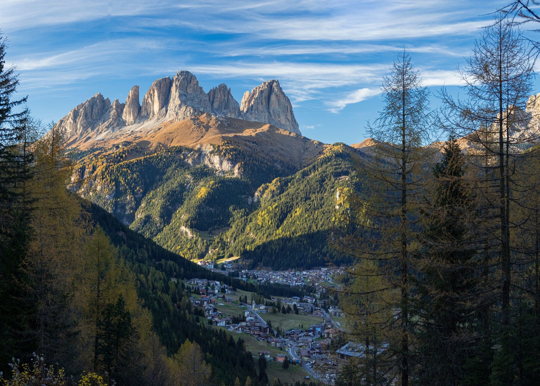
Val Gardena - Citta dei Sassi
Canazei - Col dei Rossi
Canazei - Col dei Rossi
Canazei - Col dei Rossi
Canazei - Col Rodella
Canazei - Col dei Rossi
Canazei - Col dei Rossi
Canazei - Col dei Rossi
Canazei - Col dei Rossi
Canazei - Col dei Rossi
Canazei - Col dei Rossi
Canazei - Col dei Rossi
Canazei - Col dei Rossi
Canazei - Col dei Rossi
Canazei - Col dei Rossi
Popularne wycieczki w okolicy
- 4,6
Pordoi Pass - Sass Pordoi - Forcella Pordoi - Piz Boè - Boè Refuge - Forcella Pordoi - Pordoi Pass
ciężkiWędrówka 8,39 km - 4,9
Lang- und Plattkofel Umrundung
średniWędrówka 17,5 km - 5,0
Um den Langkofel
średniWędrówka 9,76 km - 4,8
Santnerpass Klettersteig
średniVia ferrata 8,29 km - 4,8
Langkofel-Umrundung
średniWędrówka 12,9 km - 4,0
Der Friedrich-August-Weg
średniWędrówka 10,4 km - 5,0
Langkofel Klettersteig/Ferrata Furcela de Saslonch
ciężkiVia ferrata 7,07 km - 4,8
Schlern Bersteigung
średniWędrówka 19,1 km - 4,8
Pisciadùsteig Sella Gruppe
średniVia ferrata 7,15 km - 4,7
Vom Col Raiser über die Seceda und Pieralongia zur Regensburger Hütte
średniWędrówka 10,4 km
Wędrówki i tropienie


Nie przegap ofert i inspiracji na następne wakacje
Twój adres e-mail została dodana do listy mailingowej.