


Marmot Trail
Poziom trudności: T1
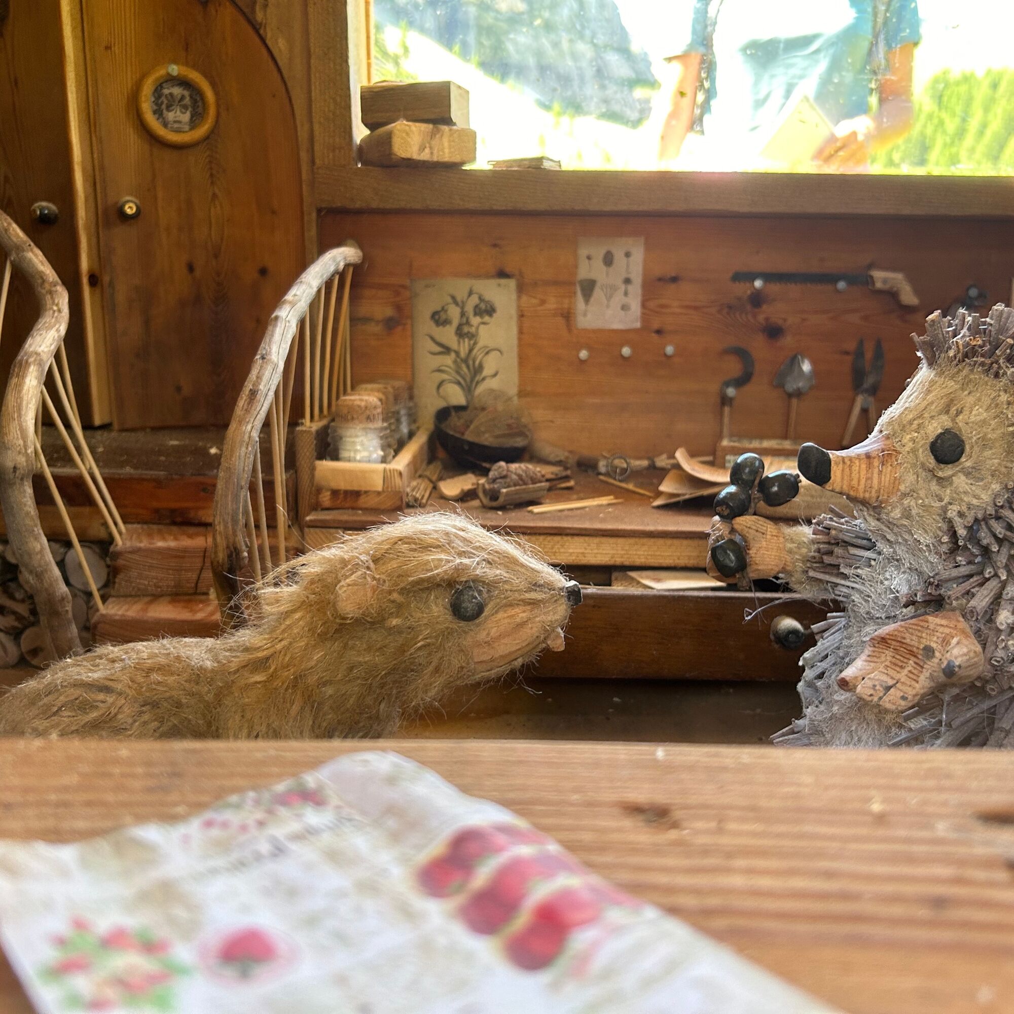
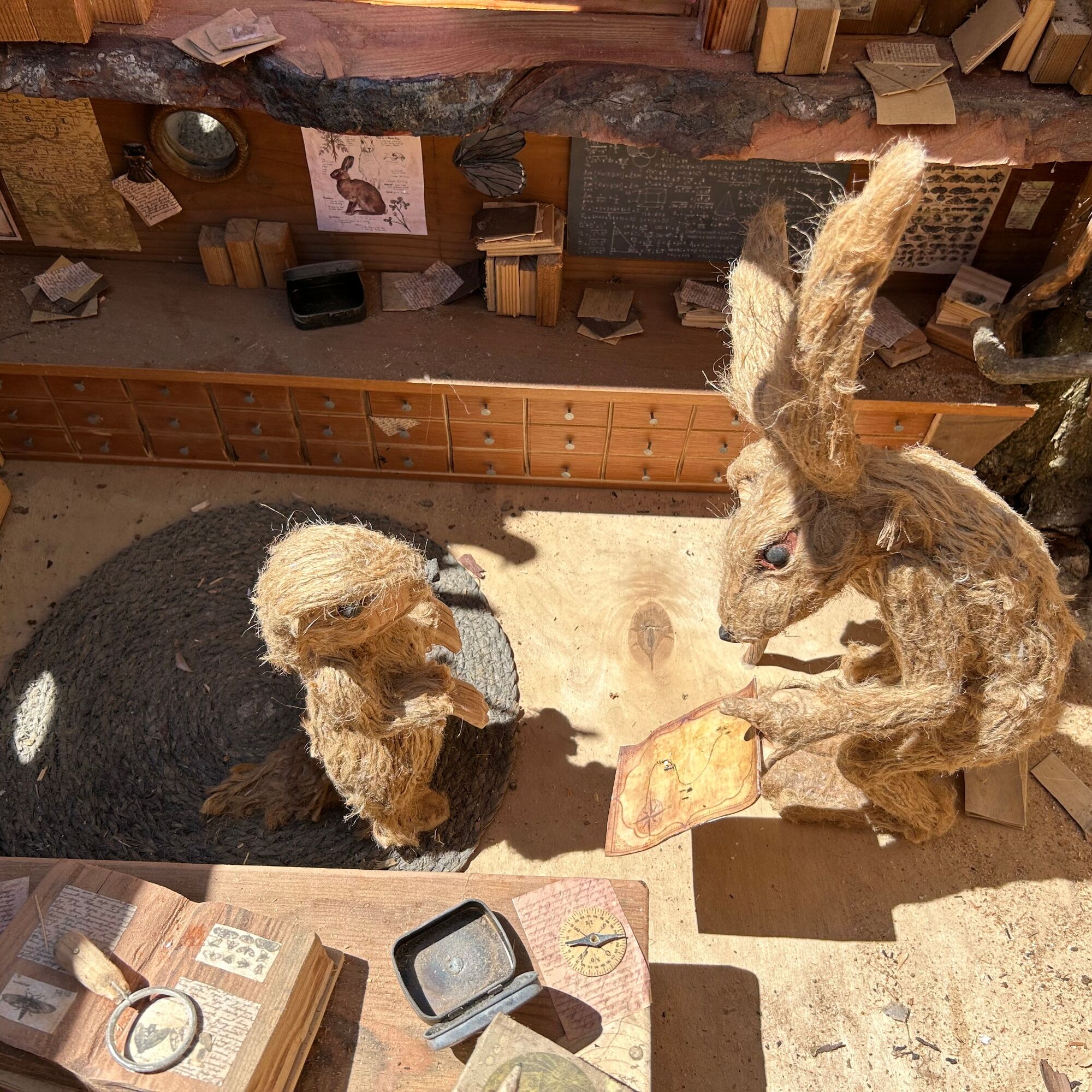
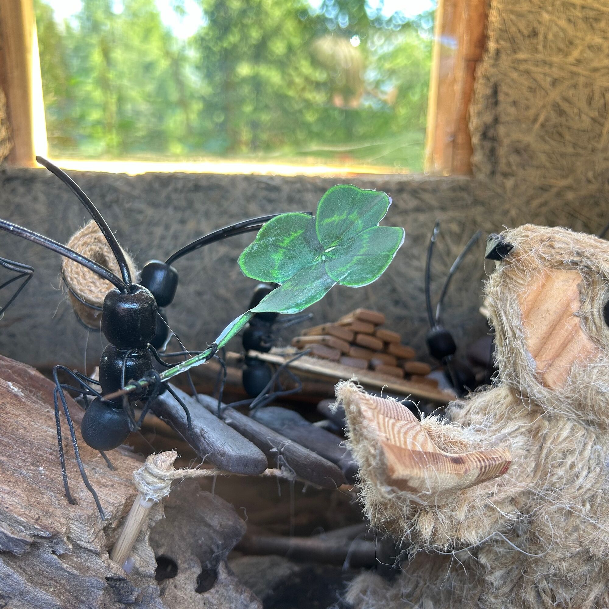
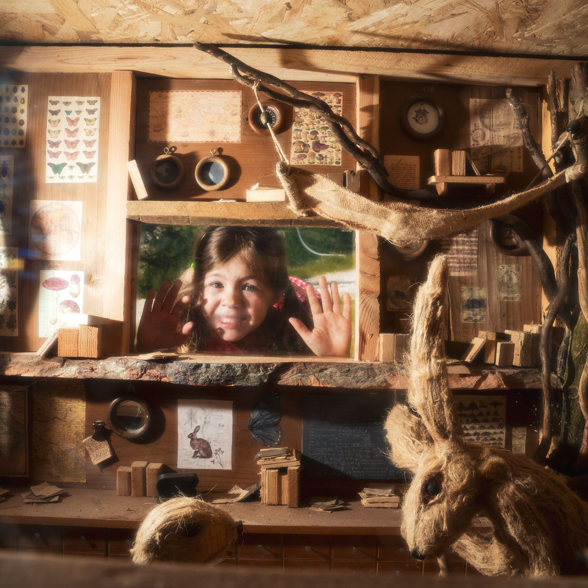
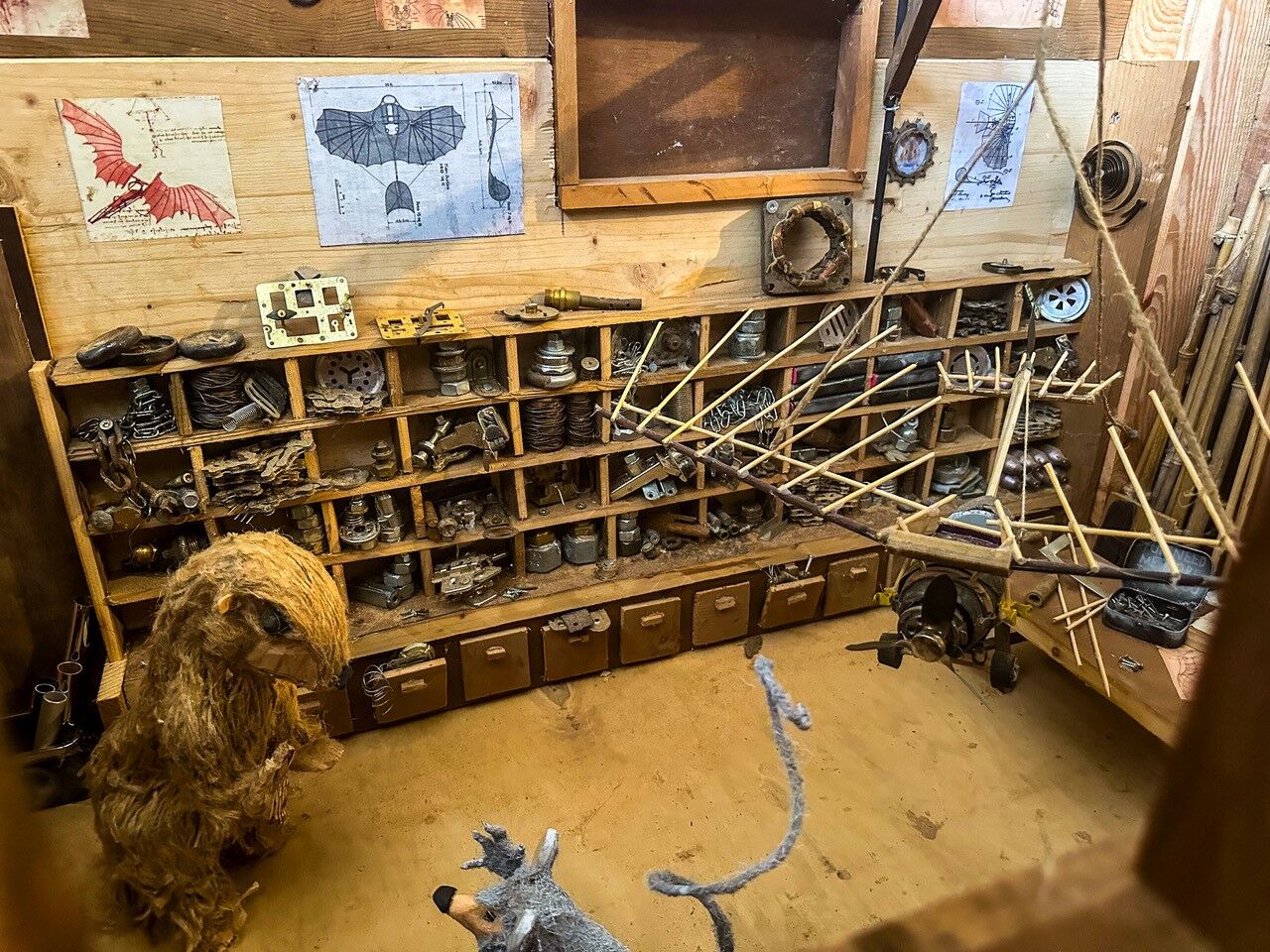
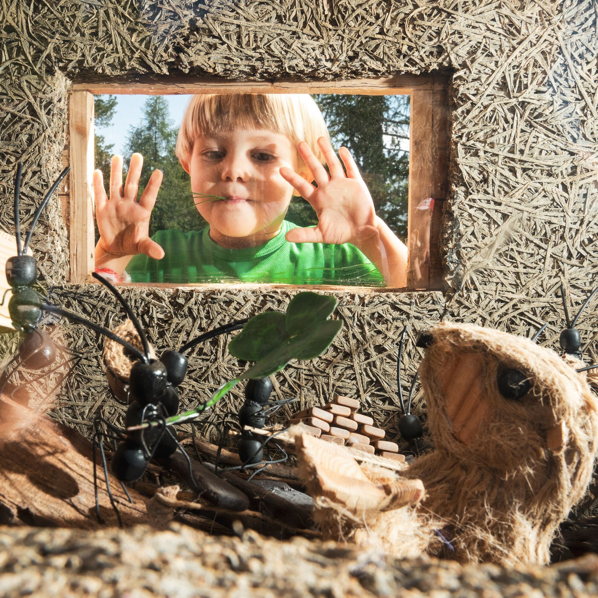
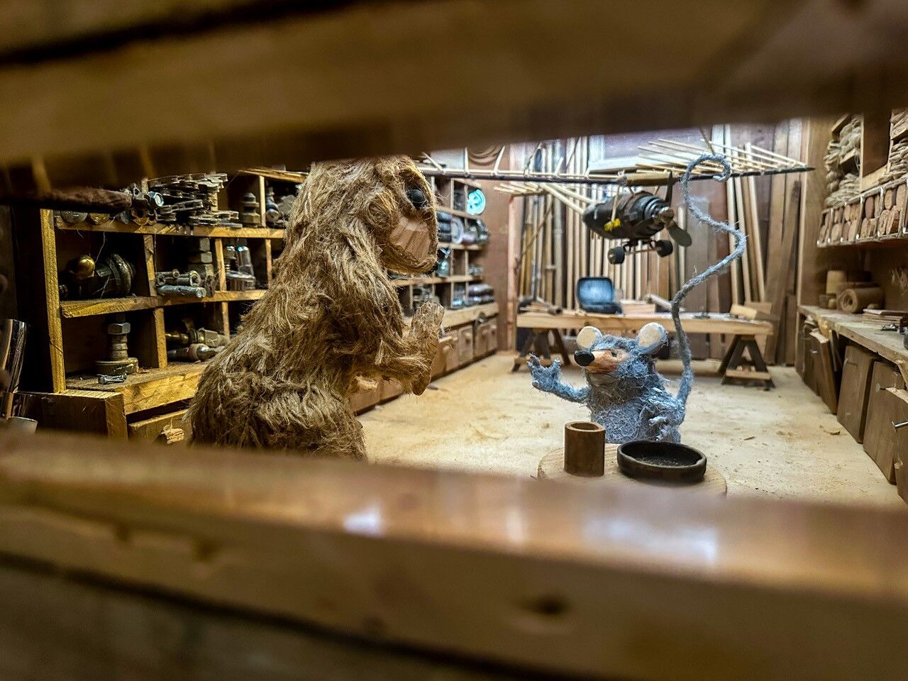
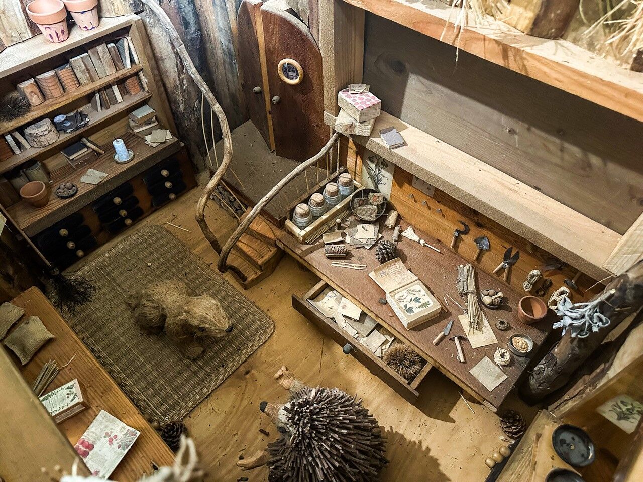
Along the route, eight wooden boxes created by the artist Francesco Avancini hold miniature scenes of marmot life, telling the thrilling story of Margot and her journey in the heart of the Dolomites to...
Along the route, eight wooden boxes created by the artist Francesco Avancini hold miniature scenes of marmot life, telling the thrilling story of Margot and her journey in the heart of the Dolomites to find her way home. Peeking through the little windows, children can discover the habits of these charming Ciampac inhabitants and collect the clues needed to complete the illustrated booklet. Stage after stage, thanks to the informative cards, they will learn not only about the world of marmots but also about other forest animals who help Margot on her adventure.
An interactive experience combining play, exploration, and love for nature, engaging the little ones with collectible stickers and a mission to complete. An adventure for the whole family, where imagination and discovery intertwine in a spectacular setting!

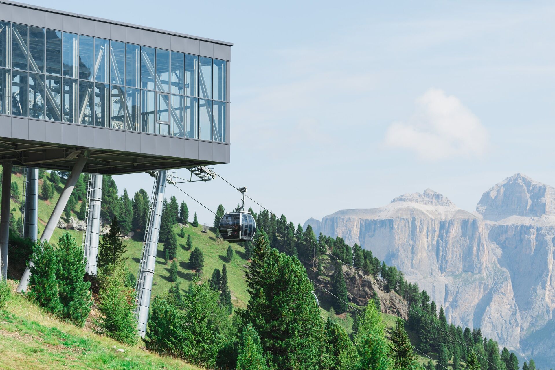


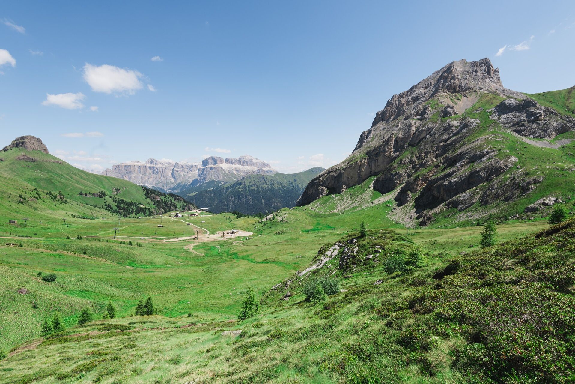
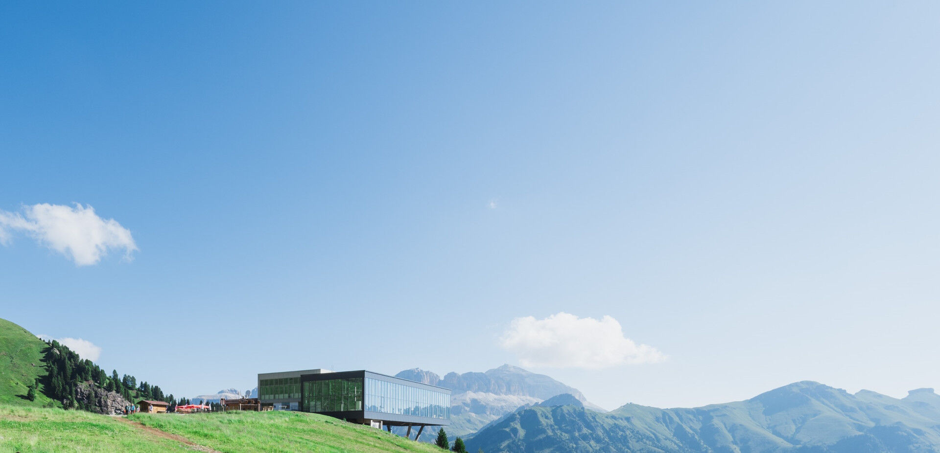
Walk for children at Ciampac
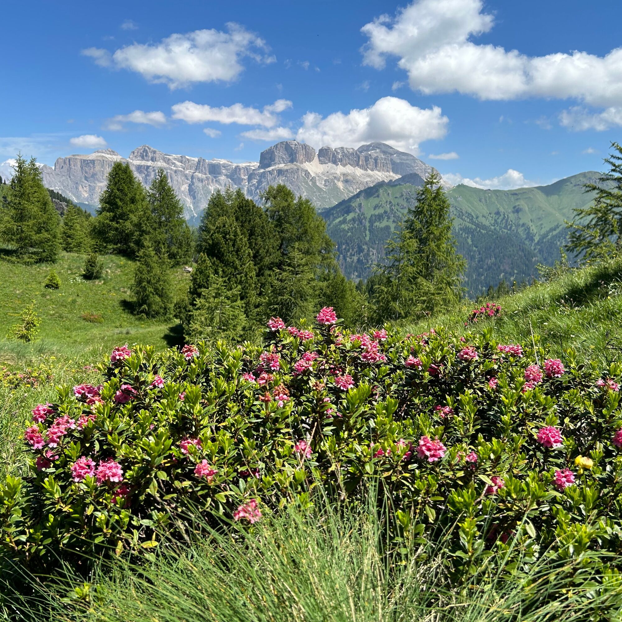
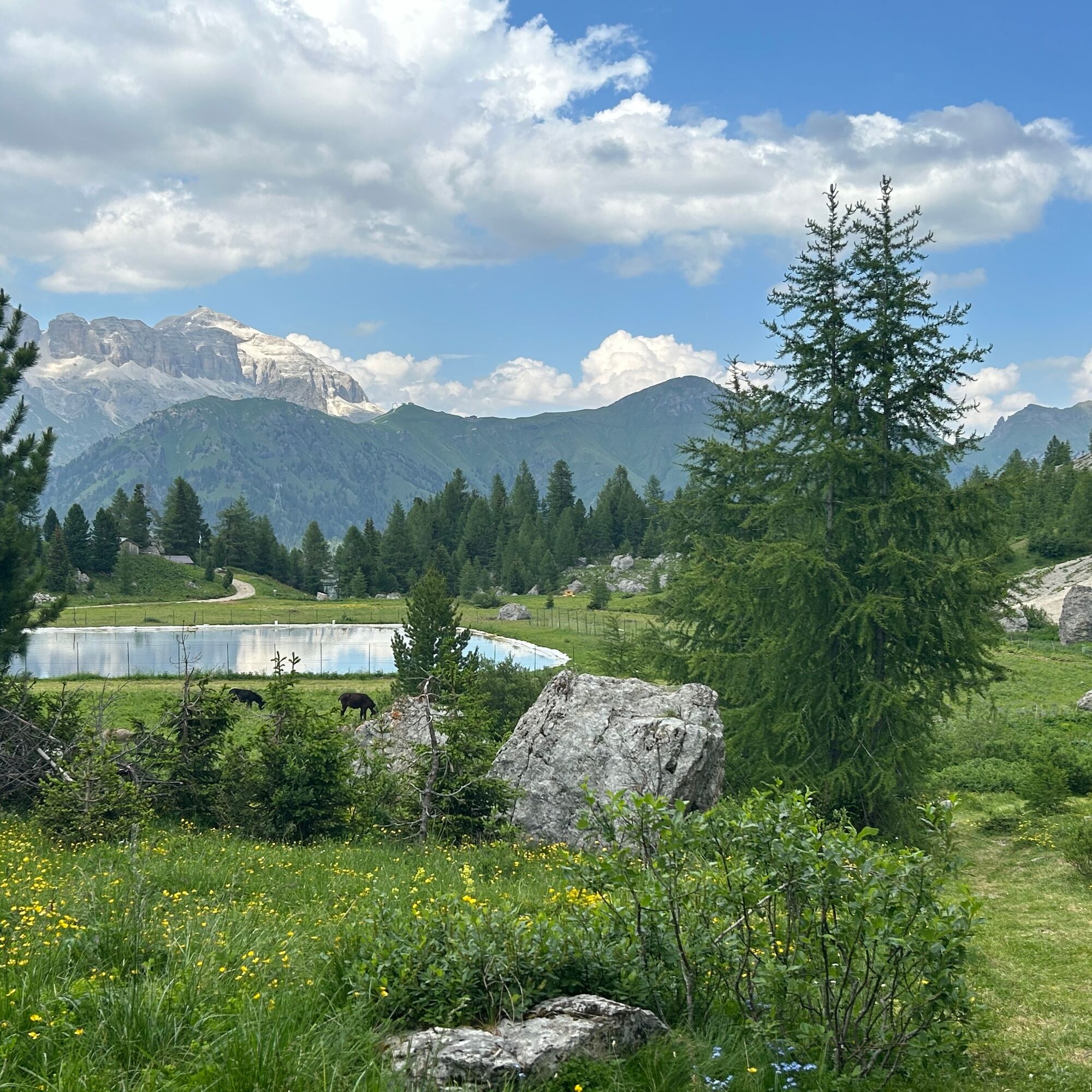
From Alba di Canazei, take the cable car up to Ciampac, where a nature-immersed route awaits you. At the exit of the station, turn right and reach the playground, where you will find the info point hut. Here you can collect the guide booklet, your adventure companion along the way. Then cross the basin in the opposite direction, passing in front of Rifugio Ciampac, and start descending along the ski slope for about 400 meters. Before the big curve, take the path on the right that bypasses some mountain huts. The trail, mostly flat, runs alongside the gravelly slopes of Colac on one side and the artificial pond on the other. After a short uphill stretch, you will reach the highest point of the route, in the heart of the marmot territory. Stop for a moment: the mountain sentinels are already alert, ready to launch their warning whistle before disappearing swiftly into the burrows. From here, the path gently winds through green rolling pastures, quickly leading you back to the starting point, with the Dolomites panorama keeping you company.
And to perfectly conclude the experience, four welcoming mountain huts await you for a tasty Ladin lunch or a delicious snack, perfect for recharging your energy after the walk!
Tak
Tak
Tak
Carry in your backpack the necessary items for possible emergency situations, along with a minimal first aid kit.
1. Plan the hike according to your abilities and the weather.
2. Go slow, enjoy the view and the silence.
3. Inform someone you trust about the itinerary and the expected return time.
4. Rely on mountain professionals.
5. Help those in difficulty. In case of real need and emergencies call 112.
6. Make sure to have suitable clothing and equipment with you, enough water and some snacks.
7. Respect the environment around you and its inhabitants by taking your waste down the mountain.
8. Follow marked trails avoiding those of the bike park.
9. To protect the wonders of nature, leave every element in its place.
10. Bring your animal friend along, but only on a leash.
Main access points to the valley coming from the A22, Modena-Brenner motorway:
Ora/Egna exit, S.S. 48 delle Dolomiti - Passo San Lugano - Val di Fiemme - Val di Fassa (distance 45 km). From the Moena ring road (craft area) towards Canazei Bolzano Nord exit, S.S. 241 Grande Strada delle Dolomiti - Passo Carezza - Vigo di Fassa (distance 40 km). From Vigo north towards Canazei, south towards Soraga di Fassa and MoenaOther accesses to Val di Fassa:
from the A27 motorway (Venice), Belluno/Ponte nelle Alpi exit, S.S. 203 for Agordo and S.P. 346 del Passo San Pellegrino - Moena (Val di Fassa). From the Moena ring road towards Canazei from the A27 motorway (Venice), Belluno/Ponte nelle Alpi exit, S.S. 203 for Agordo/Alleghe/Rocca Pietore. S.P. 641 del Passo Fedaia - Canazei coming from Arabba, S.S. 48 del Passo Pordoi - Canazei coming from Val Gardena, S.S. 242 Passo Sella - CanazeiPublic transport lines Trentino Trasporti - Val di Fassa:
line no. 101 Canazei - Cavalese - Trento line no. 104 Cavalese - Ora - Trento line no. 123 Moena - Passo San Pellegrino - FalcadePublic transport lines SAD - Val di Fassa:
line no. 180 Vigo di Fassa - Passo Carezza - Bolzano- Nearest bus stop (Trentino Trasporti): Alba di Canazei (Strèda de Costa)
Parking at the Ciampac cable car valley station (paid).
T1
Val di Fassa Tourism Board
Strèda Roma, 36
38032 Canazei (TN)
Tel. 0462 609500
info@fassa.com
www.fassa.com
The route can be done independently. It is passable with a child carrier backpack. It is suitable for children of at least 5 years old.
Cable car transport from Alba to Ciampac (Panorama Pass is valid or you can buy a round trip ticket at the station ticket office).
Guide booklet available for €5 to collect at the info point.
Popularne wycieczki w okolicy
- 4,6
Pordoi Pass - Sass Pordoi - Forcella Pordoi - Piz Boè - Boè Refuge - Forcella Pordoi - Pordoi Pass
ciężkiWędrówka 8,39 km - 4,8
Langkofel-Umrundung
średniWędrówka 12,9 km - 4,4
Dolomiten Sellagruppe, Alb. Col di Lana, Sas de Pordoi, Piz Boé retour 22.06.2016
średniWędrówka 5 km - 4,9
Lang- und Plattkofel Umrundung
średniWędrówka 17,5 km - 3,8
Der Friedrich-August-Weg
średniWędrówka 10,4 km - 4,2
Rundwanderung Compatsch-Schlernhaus-Tierser Alpl
średniWędrówka 21,2 km - 4,5
Steviahütte - Nadelscharte, Regensburger Hütte
średniWędrówka 10 km - 4,8
Santnerpass Klettersteig
średniVia ferrata 8,29 km - 5,0
Ciampedie - Gardeccia - Refuges Vajolet and Preuss - Refuge Re Alberto I - Gardeccia - Ciampedie
ciężkiWędrówka 11,8 km - 4,5
Kölner Hütte - Hirzelsteig - Rotwandhütte - Baita Tre - Karerpass
średniWędrówka 9,56 km
Wędrówki i tropienie


Nie przegap ofert i inspiracji na następne wakacje
Twój adres e-mail została dodana do listy mailingowej.