


Via Ferrata delle Laste e Gallerie di Cima Rocca
Poziom trudności: A/B
Zdjęcia naszych użytkowników
 © Martin LexaUtworzono dnia 25.04.2026
 © Martin LexaUtworzono dnia 25.04.2026
 © Martin LexaUtworzono dnia 25.04.2026
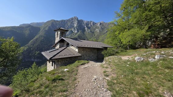 © Martin LexaUtworzono dnia 25.04.2026
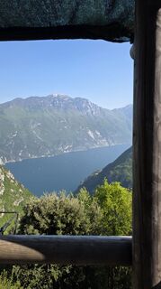 © Martin LexaUtworzono dnia 25.04.2026
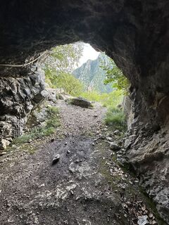
 © Mum AlesUtworzono dnia 03.08.2025
 © Mum AlesUtworzono dnia 03.08.2025
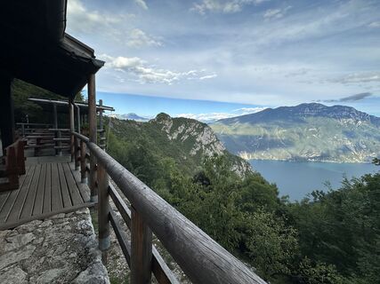 © Mum AlesUtworzono dnia 03.08.2025
 © Marina IUtworzono dnia 17.09.2024
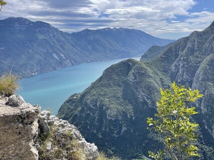 © Marina IUtworzono dnia 15.09.2024
 © Nicola BiancardiUtworzono dnia 31.10.2020
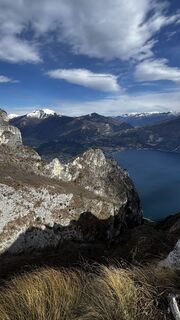
 © ROBERTO BONIOTTIUtworzono dnia 27.03.2026
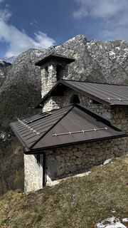 © ROBERTO BONIOTTIUtworzono dnia 27.03.2026
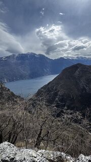 © ROBERTO BONIOTTIUtworzono dnia 27.03.2026
 © ROBERTO BONIOTTIUtworzono dnia 27.03.2026
 © ROBERTO BONIOTTIUtworzono dnia 27.03.2026
 © ROBERTO BONIOTTIUtworzono dnia 29.12.2025
 © ROBERTO BONIOTTIUtworzono dnia 29.12.2025
 © Michl FUtworzono dnia 03.05.2023


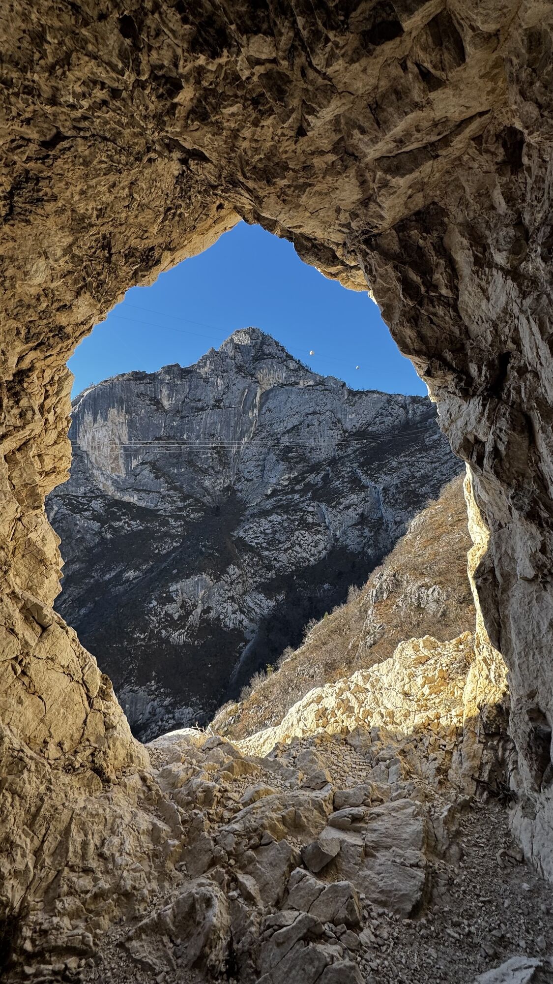
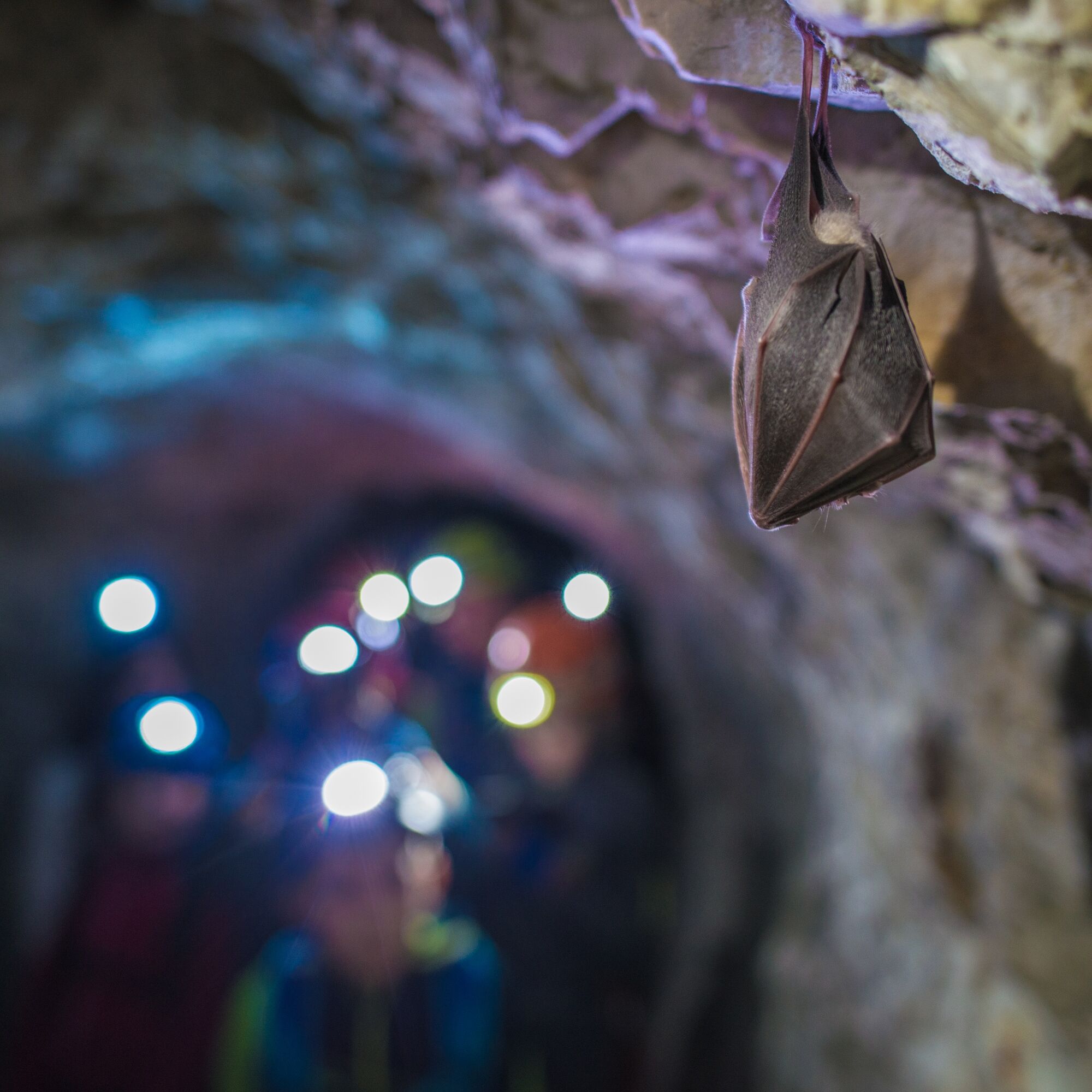
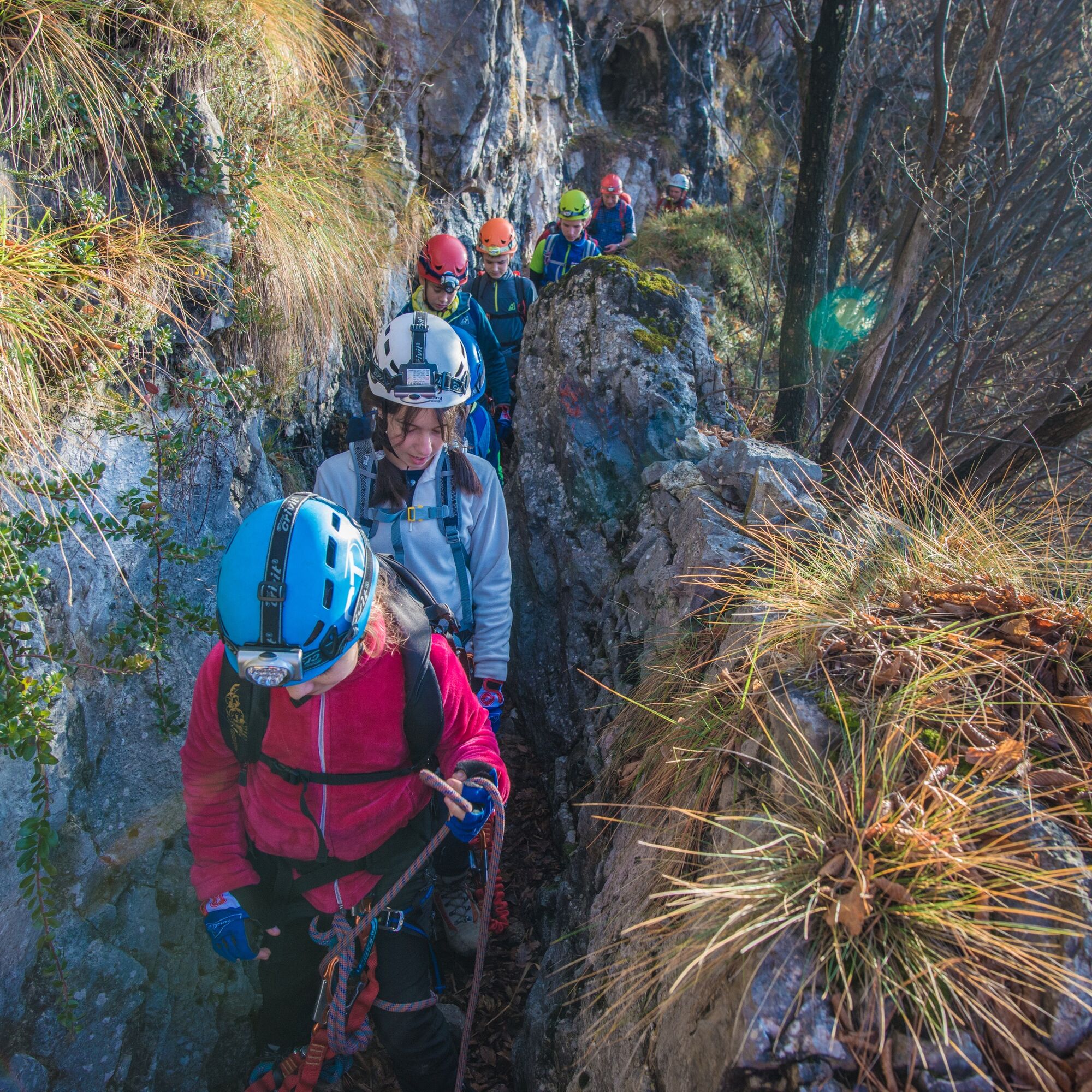
Easy protected routes which follow the higher part of the system of tunnels and trenches which were part of the Austrian defence lines during the First World War. Headlamps needed for the tunnels
The simple...
Easy protected routes which follow the higher part of the system of tunnels and trenches which were part of the Austrian defence lines during the First World War. Headlamps needed for the tunnels
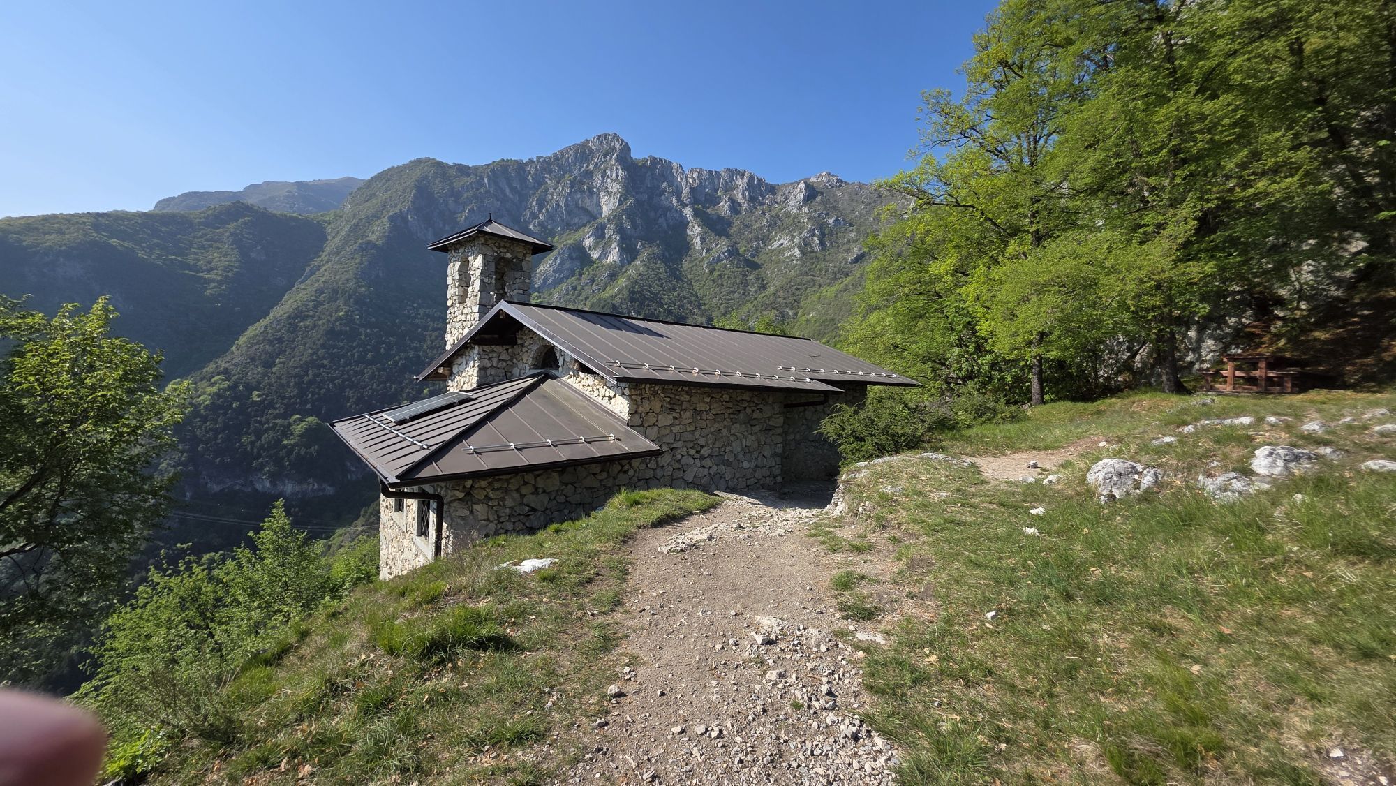
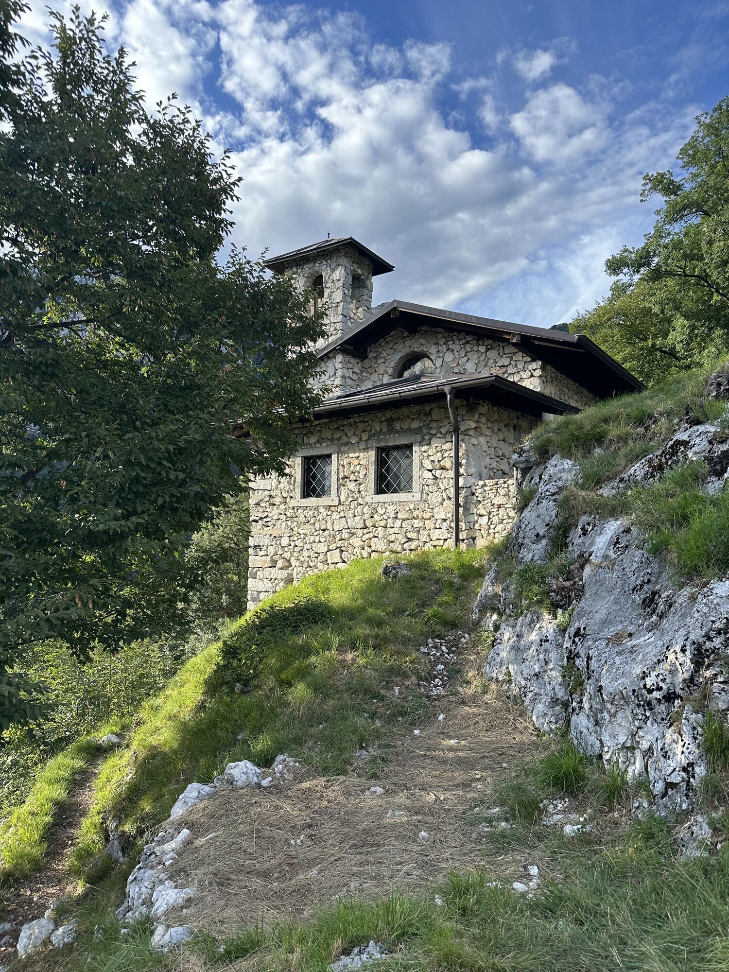
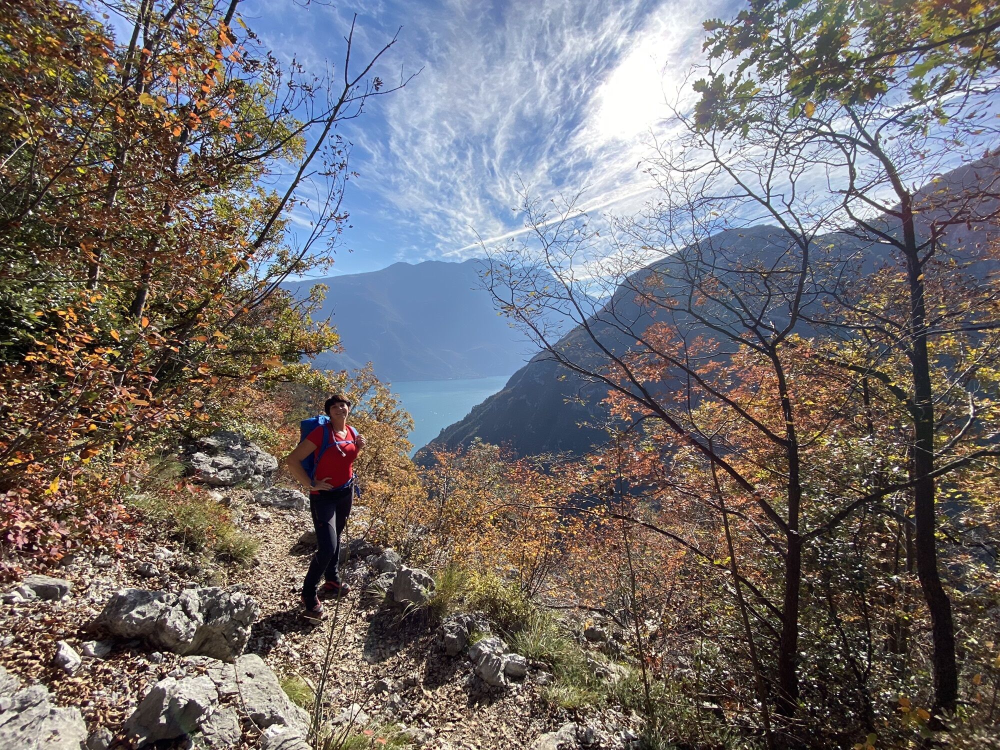
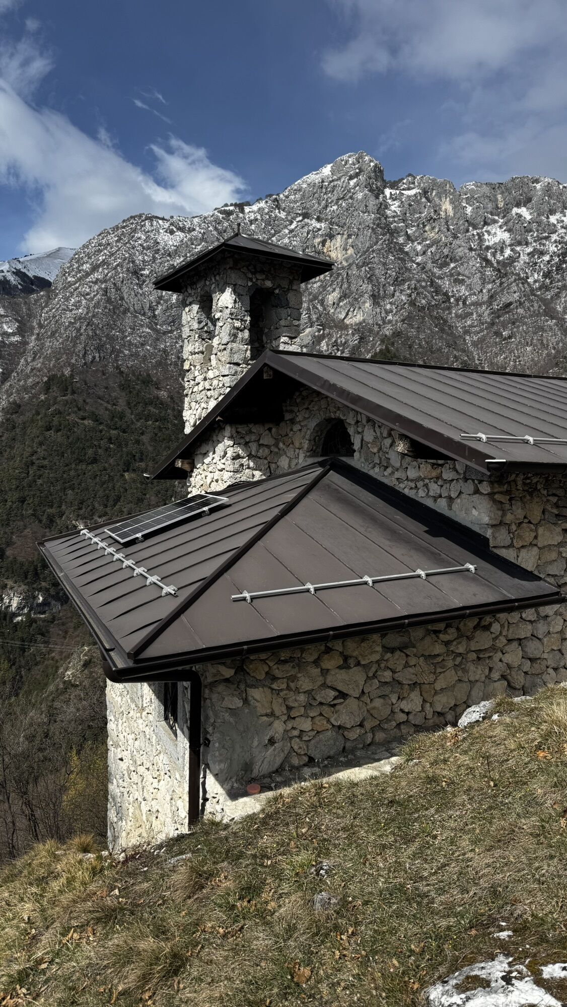
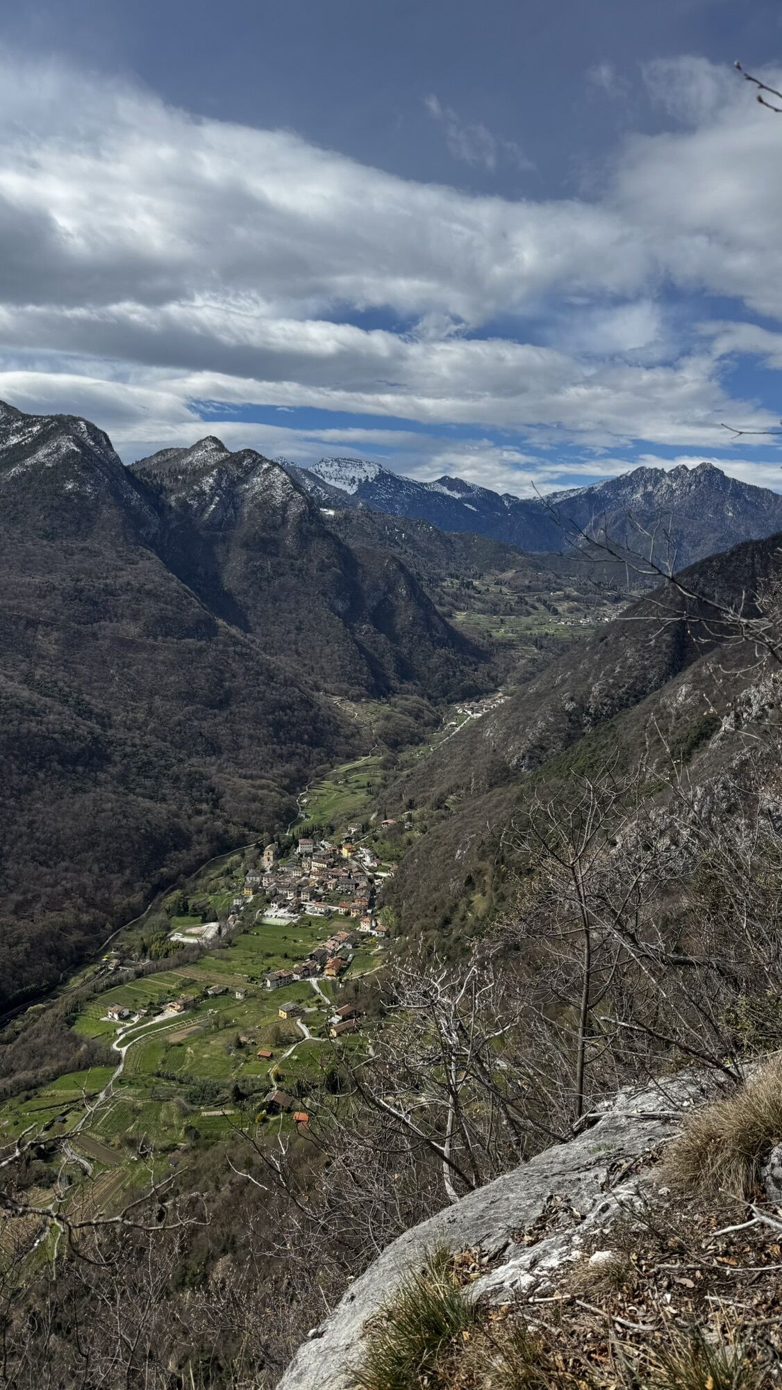
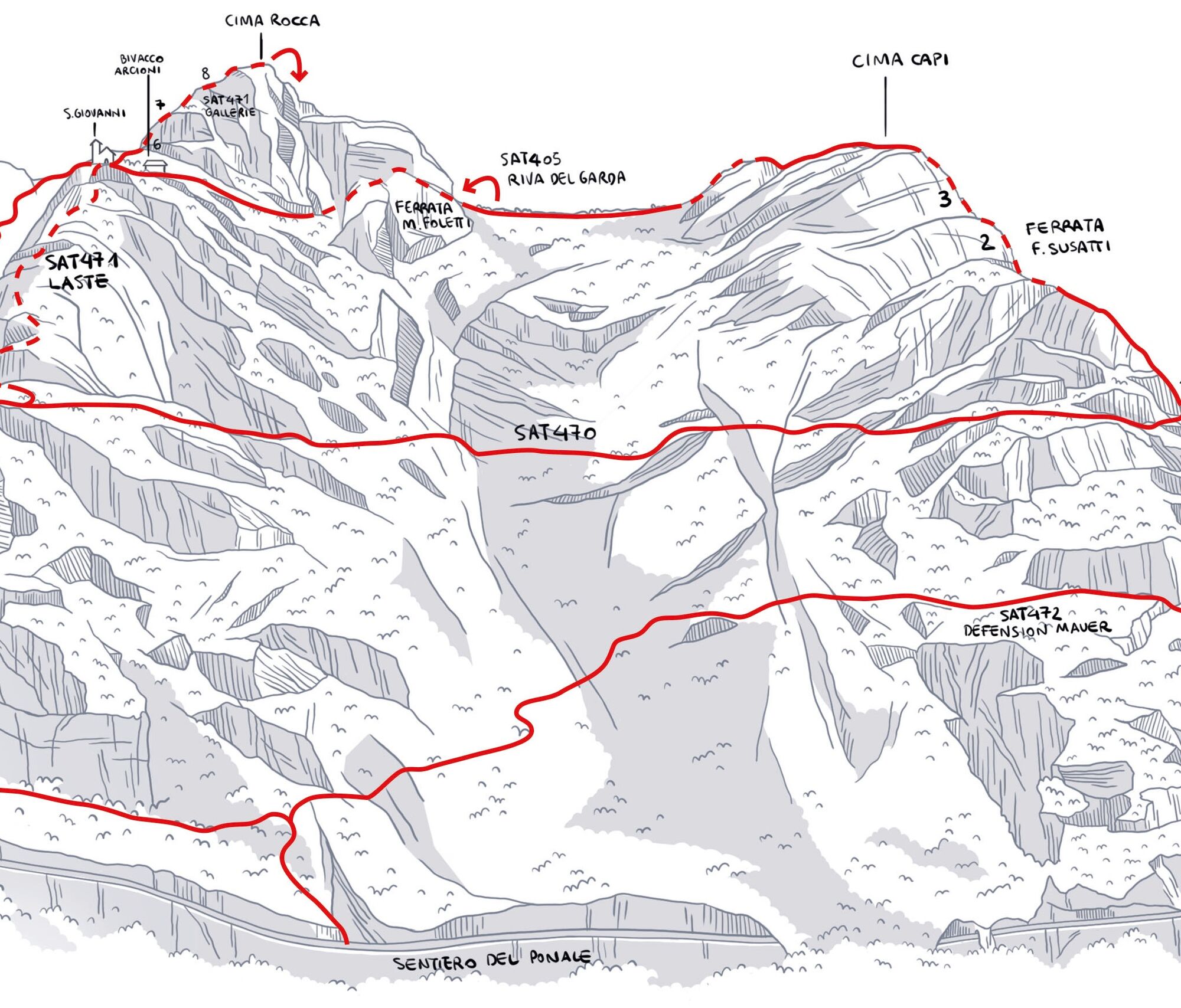
The simple Via Ferrata delle Laste leads to the Chapel of San Giovanni al Monte – popular with the inhabitants of Biacesa – the starting point of the labyrinth of tunnels and trenches excavated into the hart of the mountain which lead to Cima Ro cca, or rather cross it from side to side. There are tunnels and trenches to explore with a torch which are also suitable for families with children who have a love of the mountains and a taste for adventure.
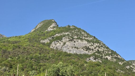
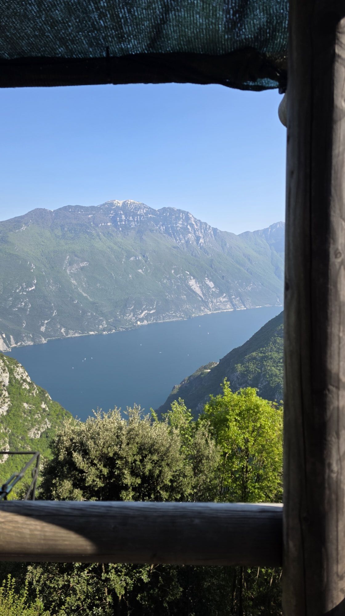
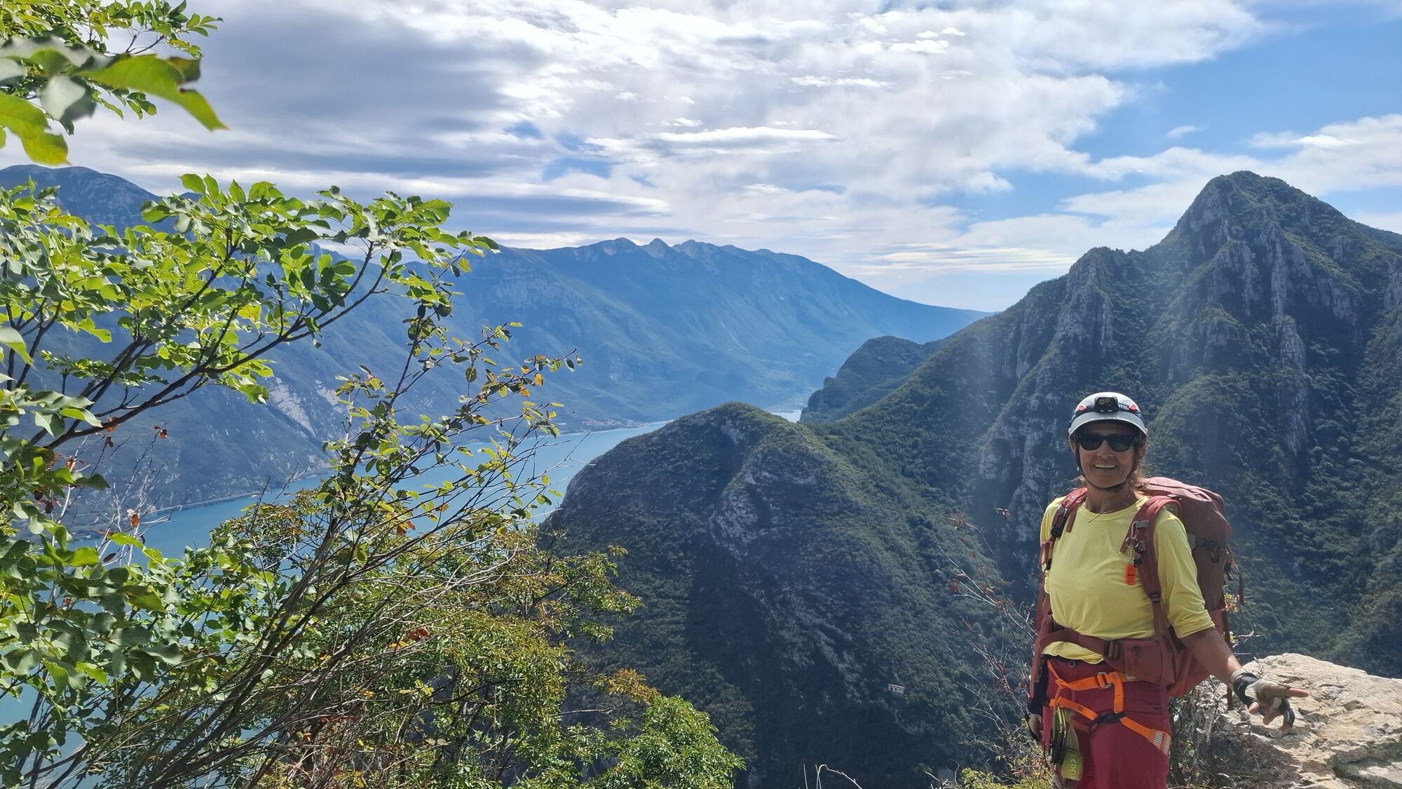
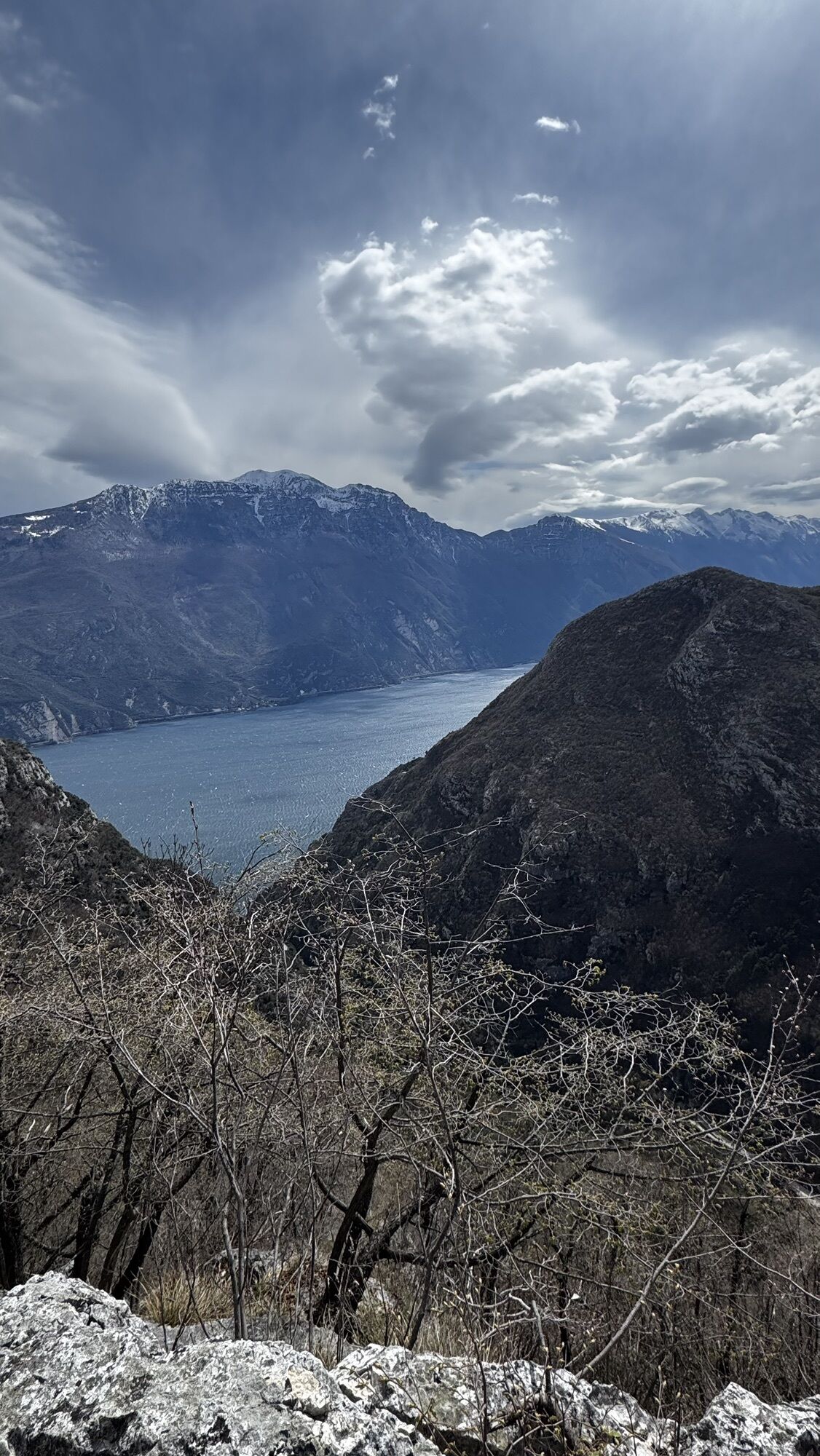
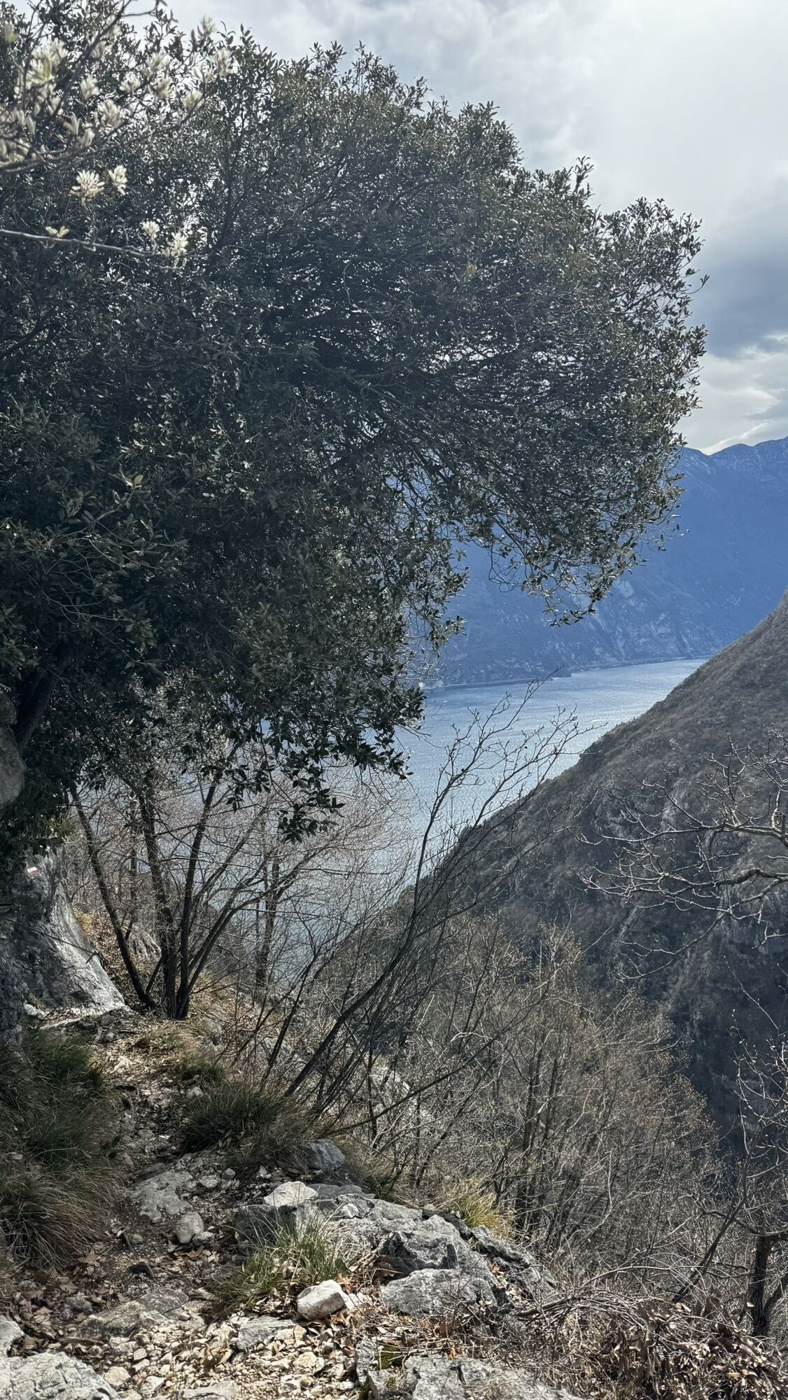
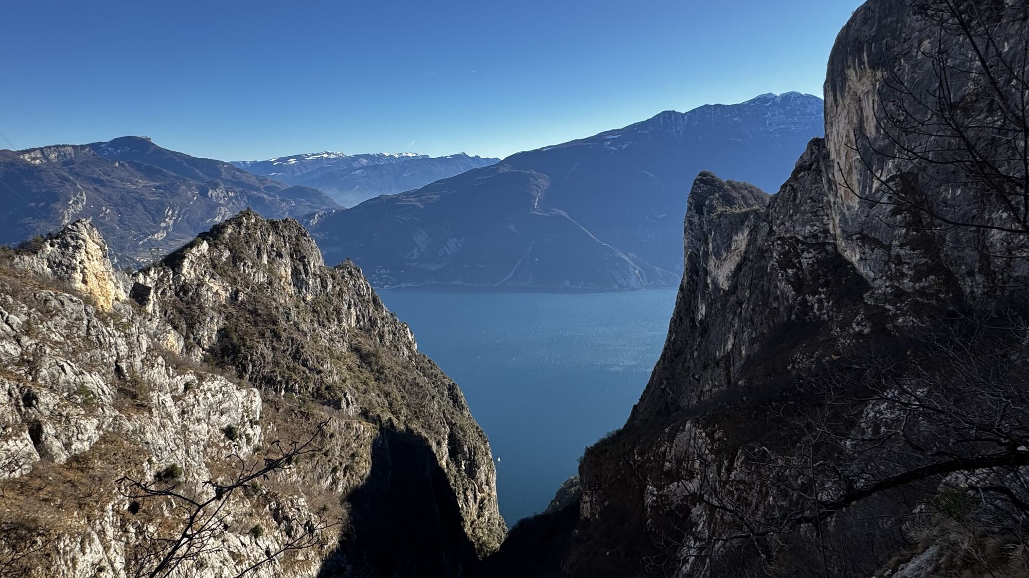
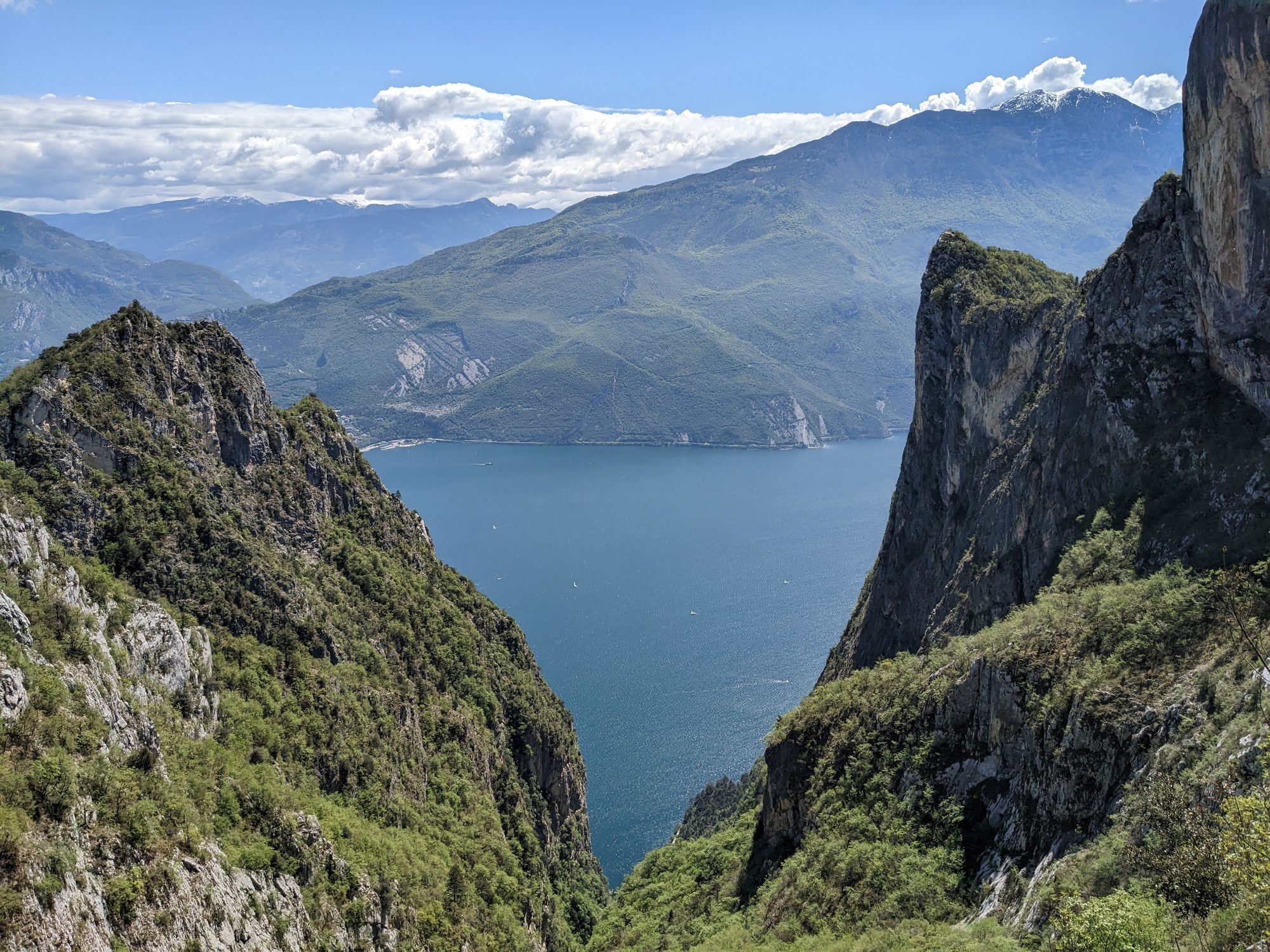
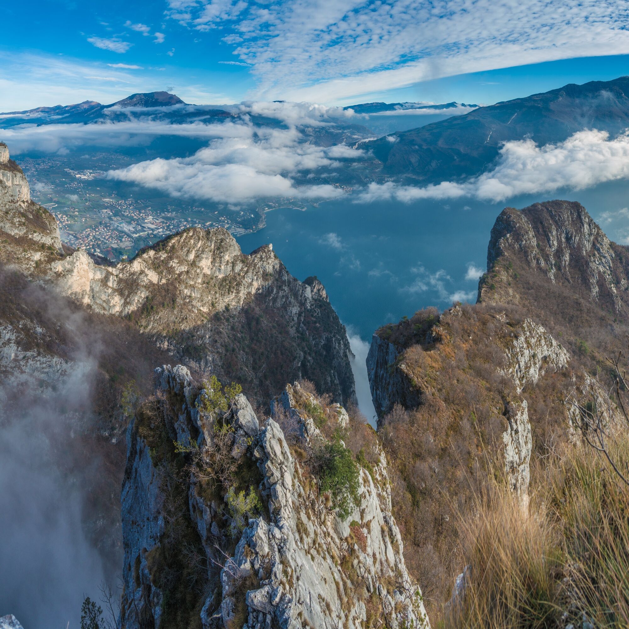
The view from Cima Rocca extends from Lake Garda to the eastern peaks of the Ledro Valley.

Access
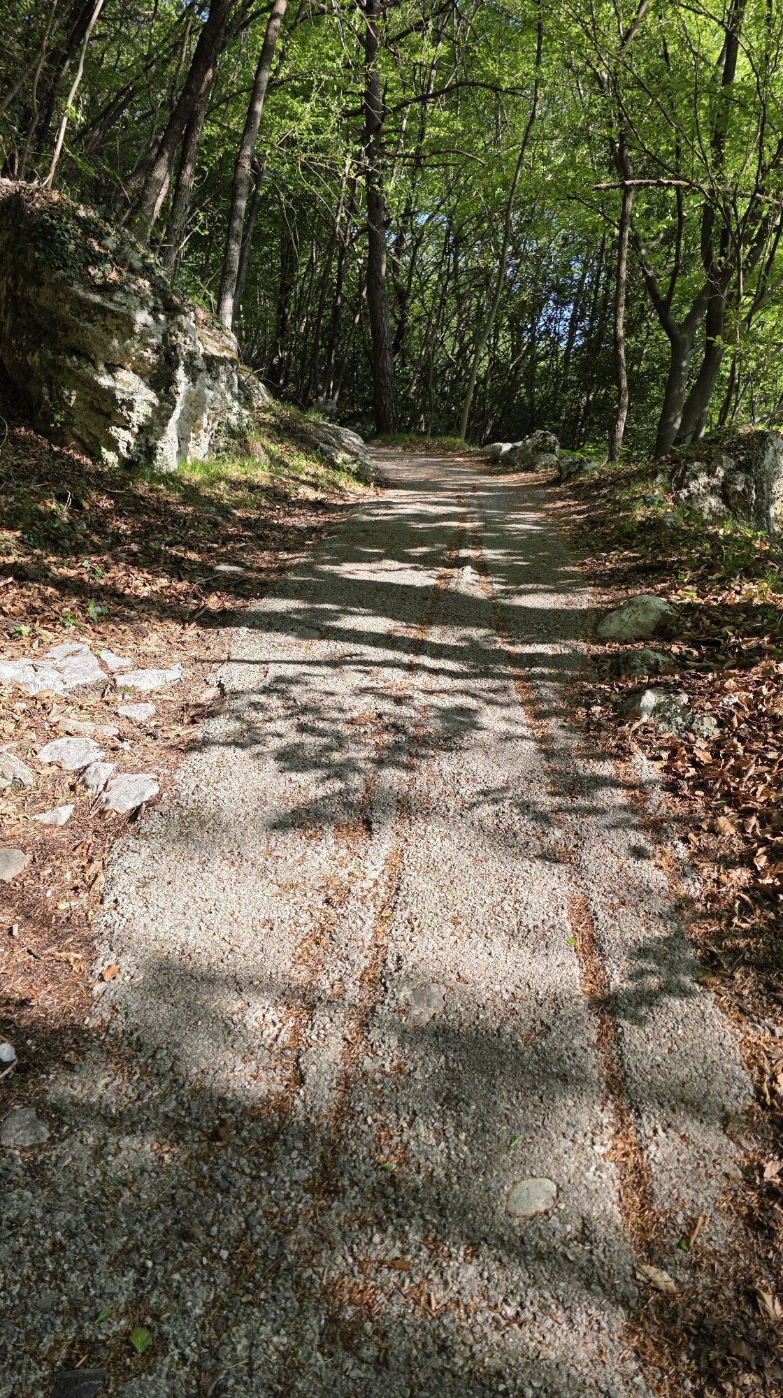
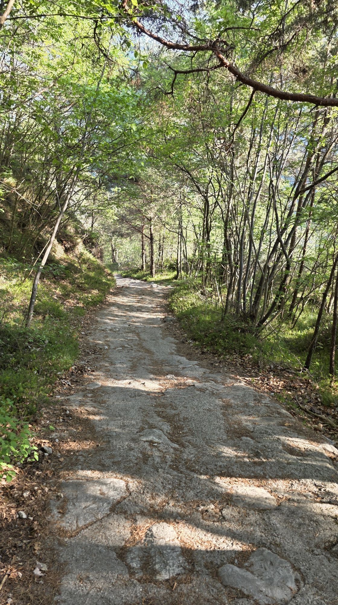
From the car park in Biacesa take the path SAT470 dei Bech and then the bolted trail SAT471 delle Laste.
Route
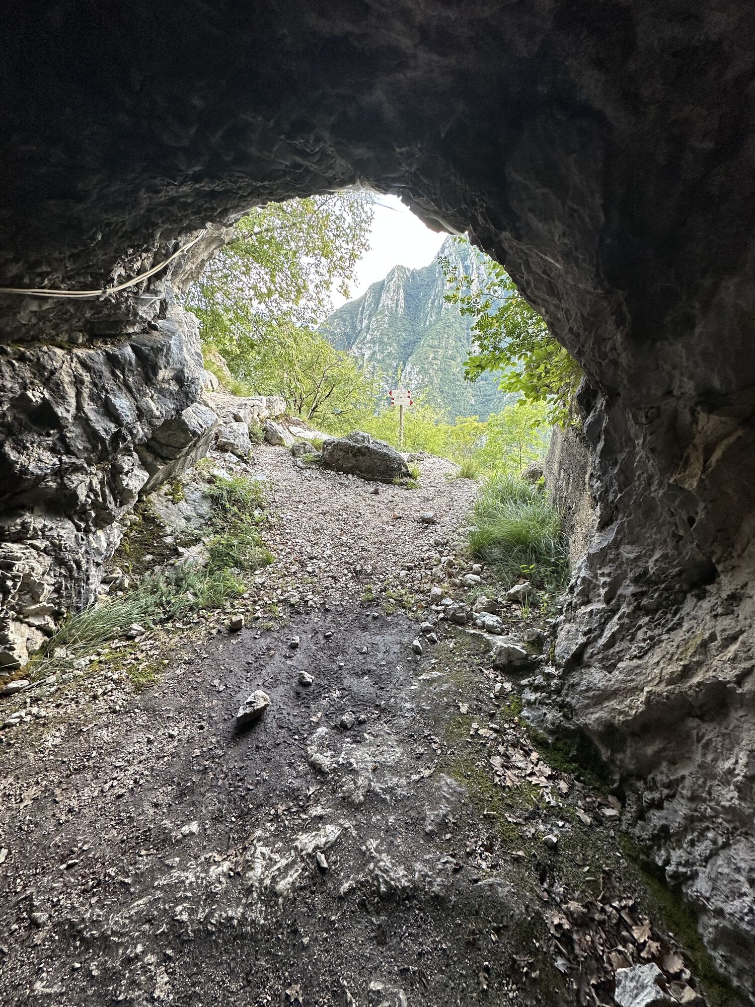
After a few bends you find yourself at the start of the bolted section,which heads up easy slabs as far as a small cave (5). You get over the finalrocky outcrops and come to the shelter Bivacco Arcioni and the chapelof San Giovanni.Keep going and you come to three tunnels (make sure to have a headlamp)with a ladder (6-7-8) excavated in the rock from one side to the other.You reach the summit along the trail that leads up on your right.
Return
From Cima Rocca head down the north side along a steep boltedsection which leads you to the mouth of the main tunnel. Once youreach Bocca Pasumer you go down to Biacesa on the SAT460.
You need to wear the right clothing and take the proper gear when you go hiking in the mountains. Even on relatively short easy outings make sure to take all you need so you don't run into trouble if things take an unexpected turn, for example a storm blows up or you have a sudden drop in energy levels.
What should you absolutely have with you on a via ferrata tour?
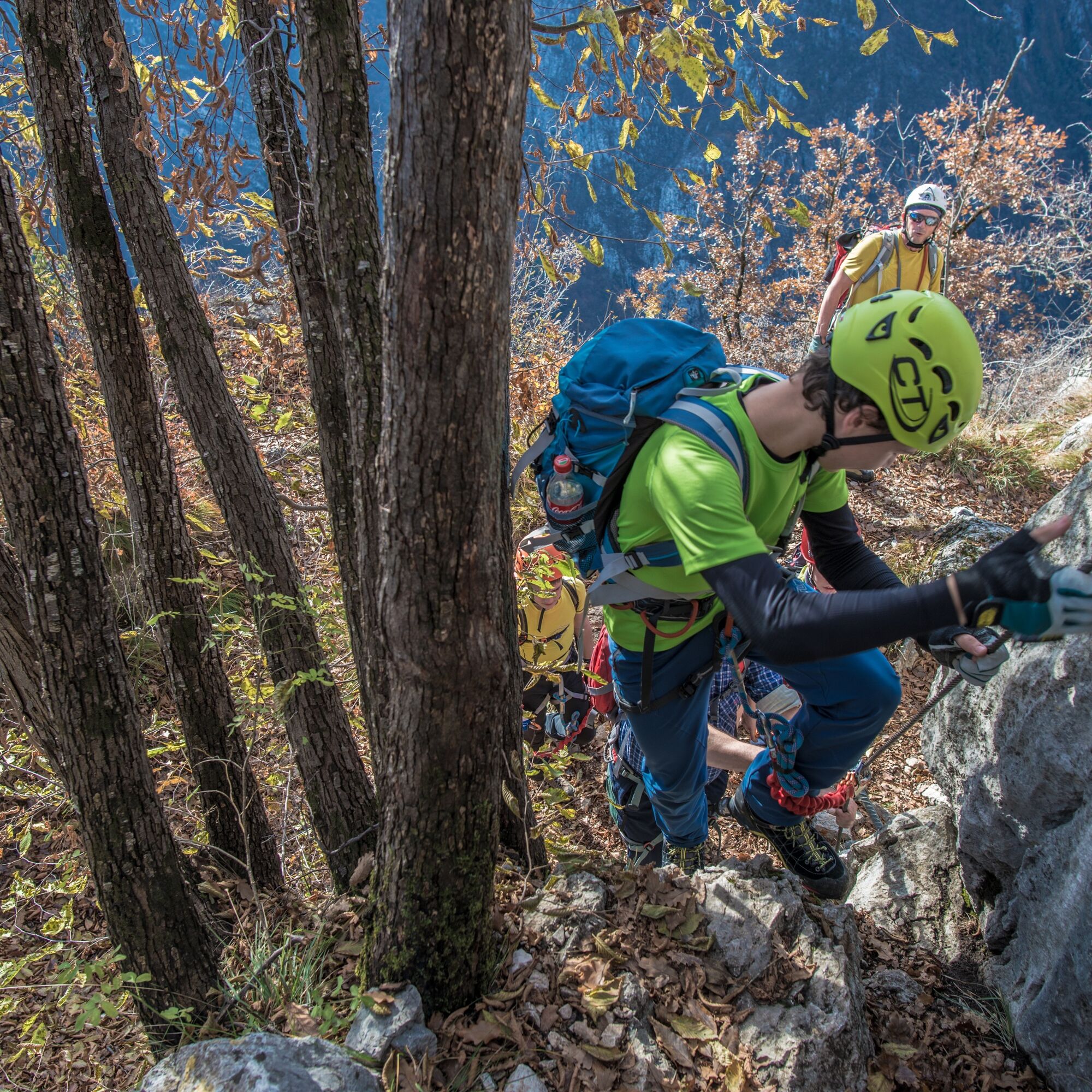
rucksack (25/30L capacity) for a day trip technical mountain clothing hiking boots with Vibram or similar sole via ferrata gear harness helmet gloves pickaxe and crampons (when necessary) a length of rope (recommended)Safety Tips
Choose the route based on your actual psycho-physical preparation, technical ability, and experience. Always assess the conditions of crowding, weather, the state of the fixed equipment, and the route. The final decision and responsibility for the passability of the route lie entirely with the person who decides to undertake it. If you are unsure, seek information or rely on qualified professionals.
Only do the via ferrata if you are reasonably fit and in excellent health. Use proper safety gear (helmet, harness, ferrata kit with double selflocking carabiners and energy absorbing systems). Put on your helmet once you get near to the wall in case of rock falls. Check the weather report and do not undertake the via ferrata ascent in adverse weather conditions, especially in the event of a thunderstorm threat. The risk of rock falls increases if there are others on the via ferrata or with wind or rain. During progression always keep both carabiners clipped onto the safety cable and when you pass the anchor points make sure at least one carabiner is clipped on to the metal cable. Only one person may be on any length of cable between two anchor points. Always check route conditions; in winter you may find snow and ice, making progress very dangerous. Do not do the via ferrata alone: if you have an accident nobody will be able to call for help.Emergency telephone number 112.
The information on this chart is subject to inevitable variations, so this means that none of the indications are absolute. It is not entirely possible to avoid giving inexact or imprecise information, given how quickly environmental and weather conditions can change. For this reason, we decline any responsibility for changes which the user may encounter. In any case, the hiker is advised to check the conditions of the places, environment and weather before setting out.
From the Garda Trentino area follow the directions to Valle di Ledro. Biacesa is the first village after the long tunnel.
Find out how to reach Garda Trentino.
Valle di Ledro is connected to Riva del Garda by the intercity bus line 214 (Riva-Valle di Ledro-Storo).
Car park by the helipad just outside the village of Biacesa.
A/B
There is a complex and articulated system of tunnels in Cima Rocca. Do not forget a lamp!


Popularne wycieczki w okolicy
- 5,0
Bastione and Santa Barbara, the lords of Riva del Garda
średniWędrówka 2,94 km - 4,8
Via Ferrata Rio Sallagoni
średniVia ferrata 2,75 km - 4,8
Bocca Fortini - Tour
ciężkiMountainbike 35,4 km - 4,8
Via Ferrata Fausto Susatti - Cima Capi (from Ledro)
średniVia ferrata 7,11 km - 4,7
Sentiero Busatte Tempesta
światłoWędrówka 7,90 km - 4,5
Walking around Lake Ledro
światłoWędrówka 9,40 km - 4,9
Via Ferrata dell’Amicizia - Cima SAT
średniVia ferrata 4,41 km - 5,0
Via Ferrata Signora delle Acque - Rio Ruzza
ciężkiVia ferrata 5,32 km - 4,3
Tremalzo Big - Tour
ciężkiMountainbike 45,6 km - 4,6
Colodri Klettersteig (A/B)
Via ferrata 7,50 km

Wędrówki i tropienie


Nie przegap ofert i inspiracji na następne wakacje
Twój adres e-mail została dodana do listy mailingowej.