


Marienstein in Saaldorf - circular hiking route - Bad Lobenstein
From the hiking car park in Saaldorf, follow the signs towards Altsaaldorf, past the Waidmannsheil hunting lodge, up the village road. Keep right at the hill, behind the stone gate turn left until the...
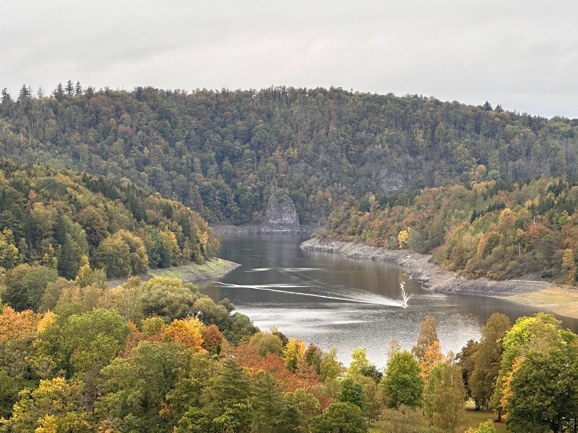
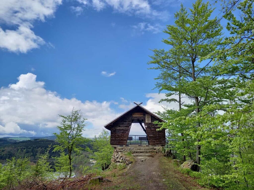
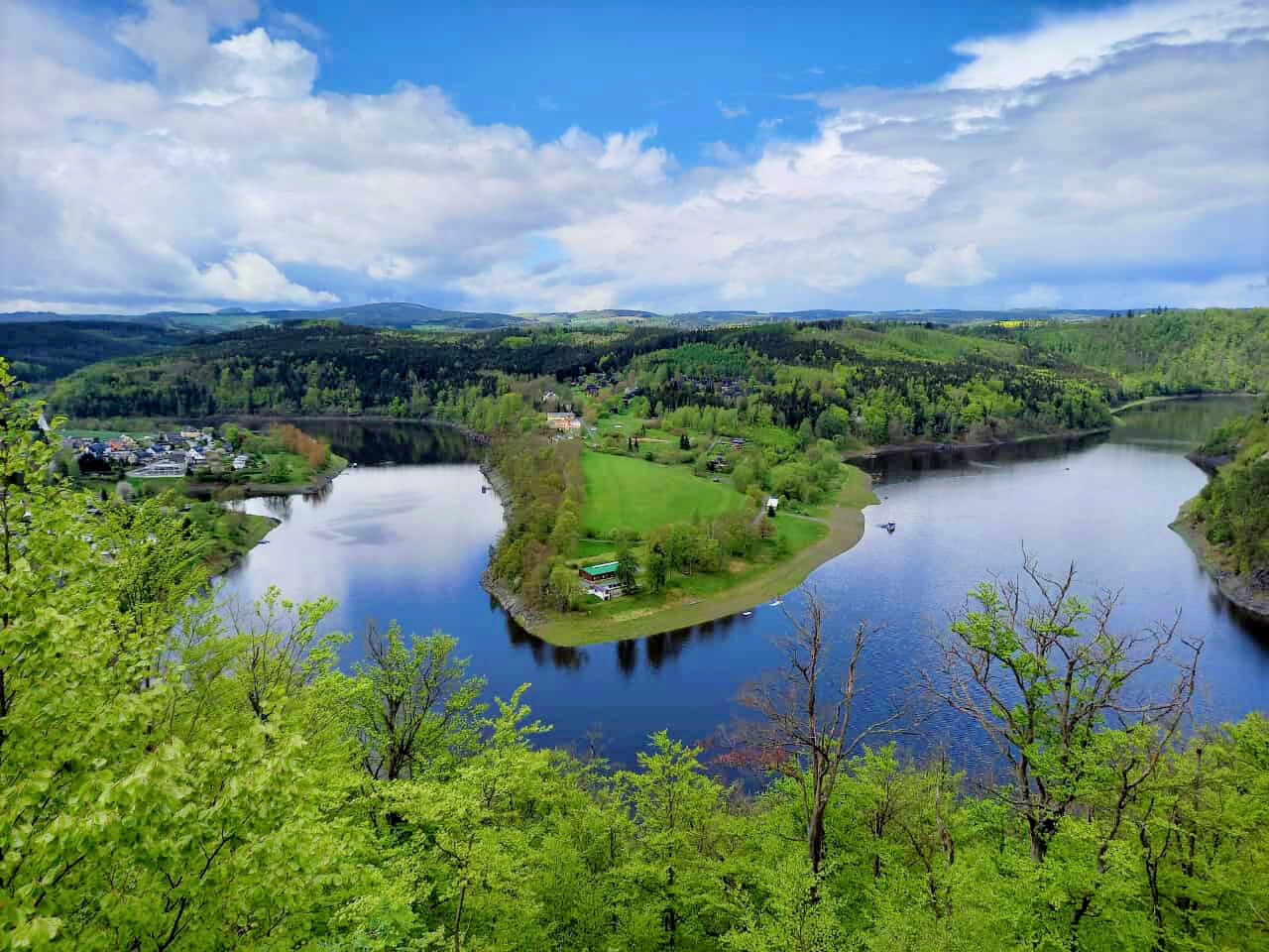
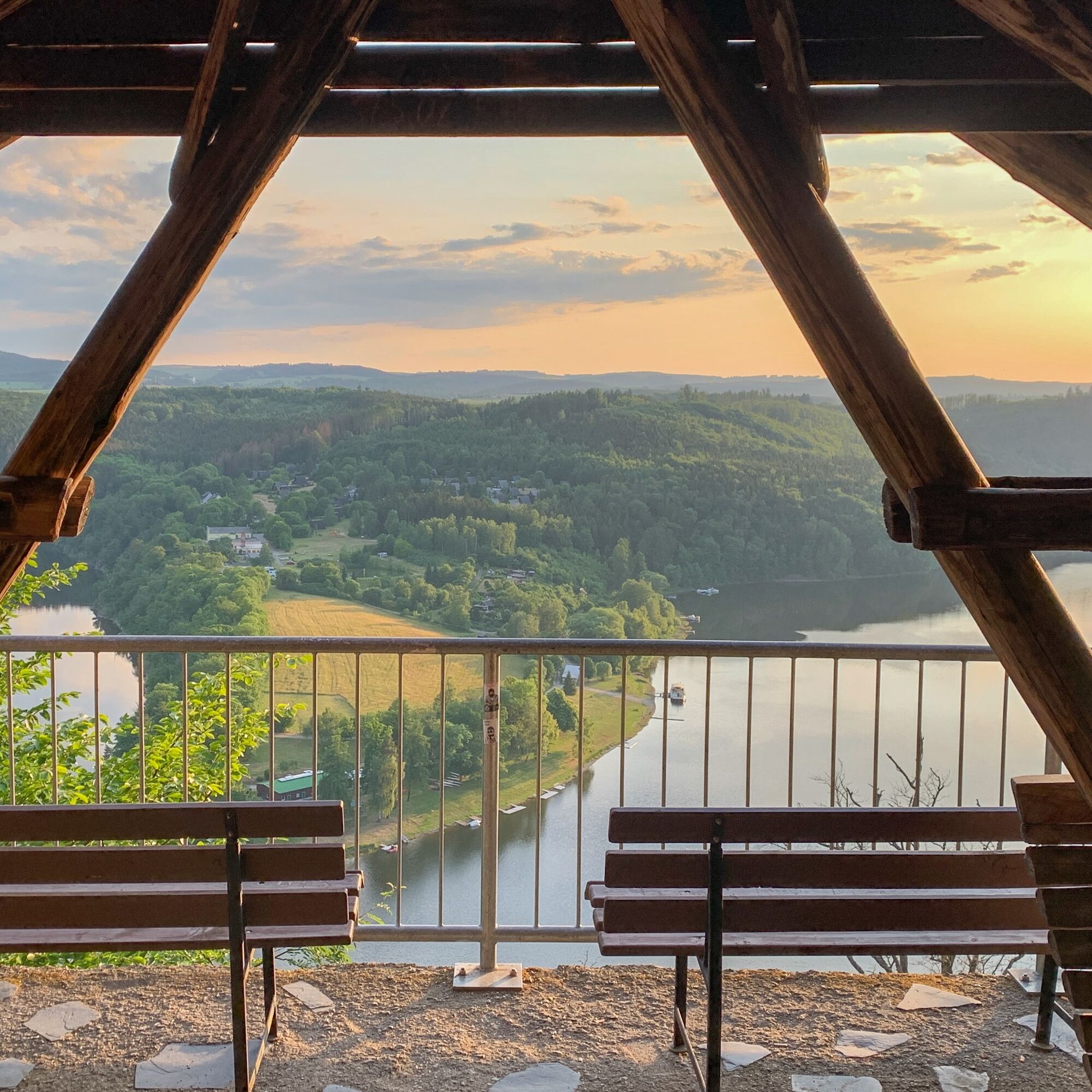
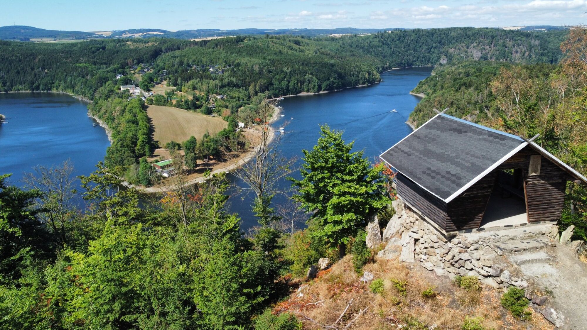
From the hiking car park in Saaldorf, follow the signs towards Altsaaldorf, past the Waidmannsheil hunting lodge, up the village road. Keep right at the hill, behind the stone gate turn left until the viewpoint. Here you enjoy a unique view of the Thuringian Sea in every season. A shelter invites you to linger. For the further path, follow the signs to the left towards Stahlleite. Now you hike along this panoramic route, always with the reservoir in view, back to Saaldorf to the hiking rest area. Very close by there is also a landing stage for reservoir shipping. From April to October, there is the possibility twice daily (except Tuesdays) to take a cruise ship trip on the Thuringian Sea from here.

Marking: yellow dot
Saaldorf hiking rest area - Neu Saaldorf - Alt Saaldorf - Stone gate - Marienstein - Stahlleite panoramic route - panoramic route - Alt Saaldorf - Neu Saaldorf – hiking rest area
Tak
Sturdy footwear
First aid kit
Drink reserve, small snack
GPS navigation device or smartphone
Tourist information
Graben 18
07356 Bad Lobenstein
Tel.: 036651 2543
touristinformation@bad-lobenstein.de
Popularne wycieczki w okolicy
-
4,0
Höllental über Hirschsprung und unten wieder zurück
średniWędrówka 9,61 km -
4,5
Hirschberg Primeval Forest Trail - Thuringian Primeval Forest Trails
światłoWędrówka 2,84 km -
Rund um Schloss Burgk
światłoWędrówka 7,04 km -
5,0
Saalepfad - Circular hike at the Green Belt
ciężkiWędrówka 34,8 km -
5,0
Circular route - Schönblickweg - Harra
średniWędrówka 7,80 km -
Hike - Rennsteig - Stage 8 - From Brennersgrün to Blankenstein
średniWędrówka 20,8 km -
4,0
Rund um die BleilochTalsperre - Saalburg Beach und zurück
średniE-MTB 20,1 km -
Circular hiking trail - Mushroom experience trail Gräfenwarth - Thuringia
średniTrasa tematyczna 5,48 km -
Roßkunst Geopath - Harra
średniWędrówka 6,23 km -
Venzka - Hirschberg - Saalesteg - Venzka
średniWędrówka 8,24 km
Wędrówki i tropienie


Nie przegap ofert i inspiracji na następne wakacje
Twój adres e-mail została dodana do listy mailingowej.