


Thuringian Cycle Paths - "Schleuse Valley Cycle Path" - Thuringian Forest
Poziom trudności: 2
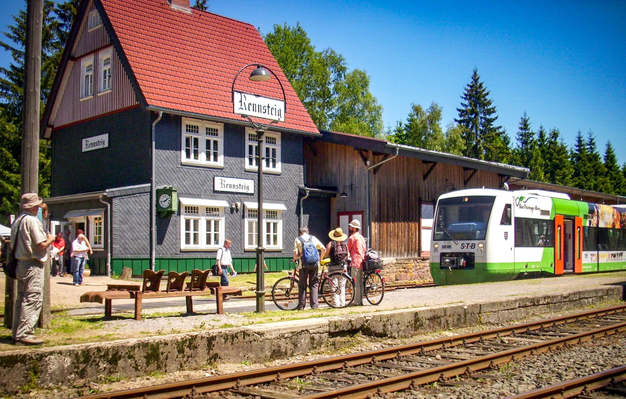
The starting point of the bike route is the Rennsteig Train Station. The cycle path initially runs to Allzunah past the bunker museum on the Rennsteig cycle path. In Allzunah, the Ilmtal cycle path branches...
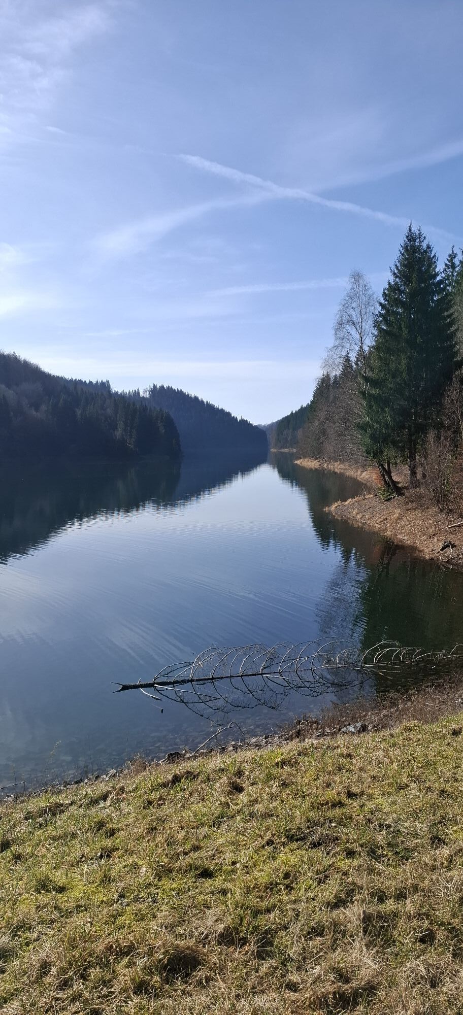
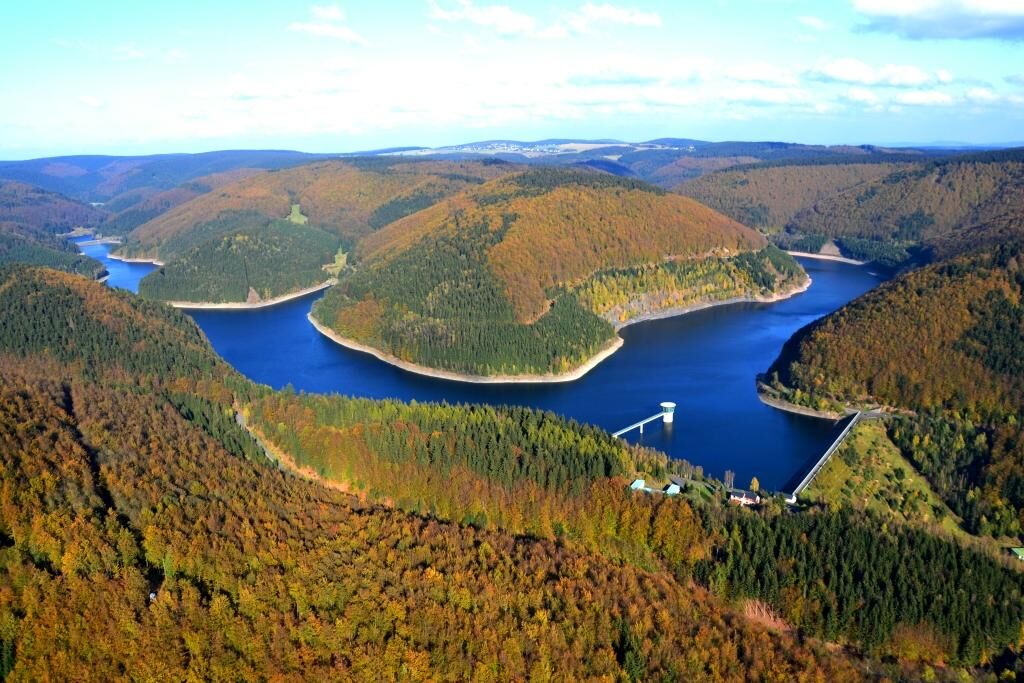
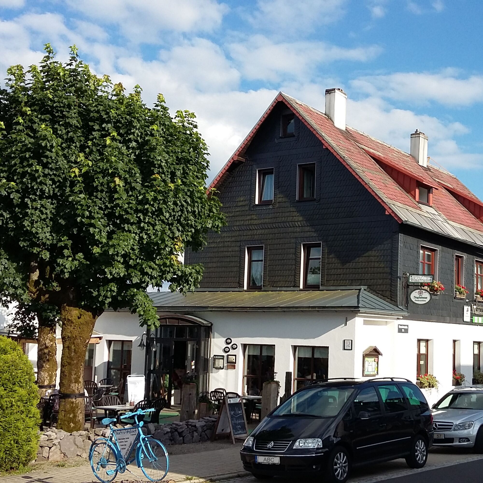
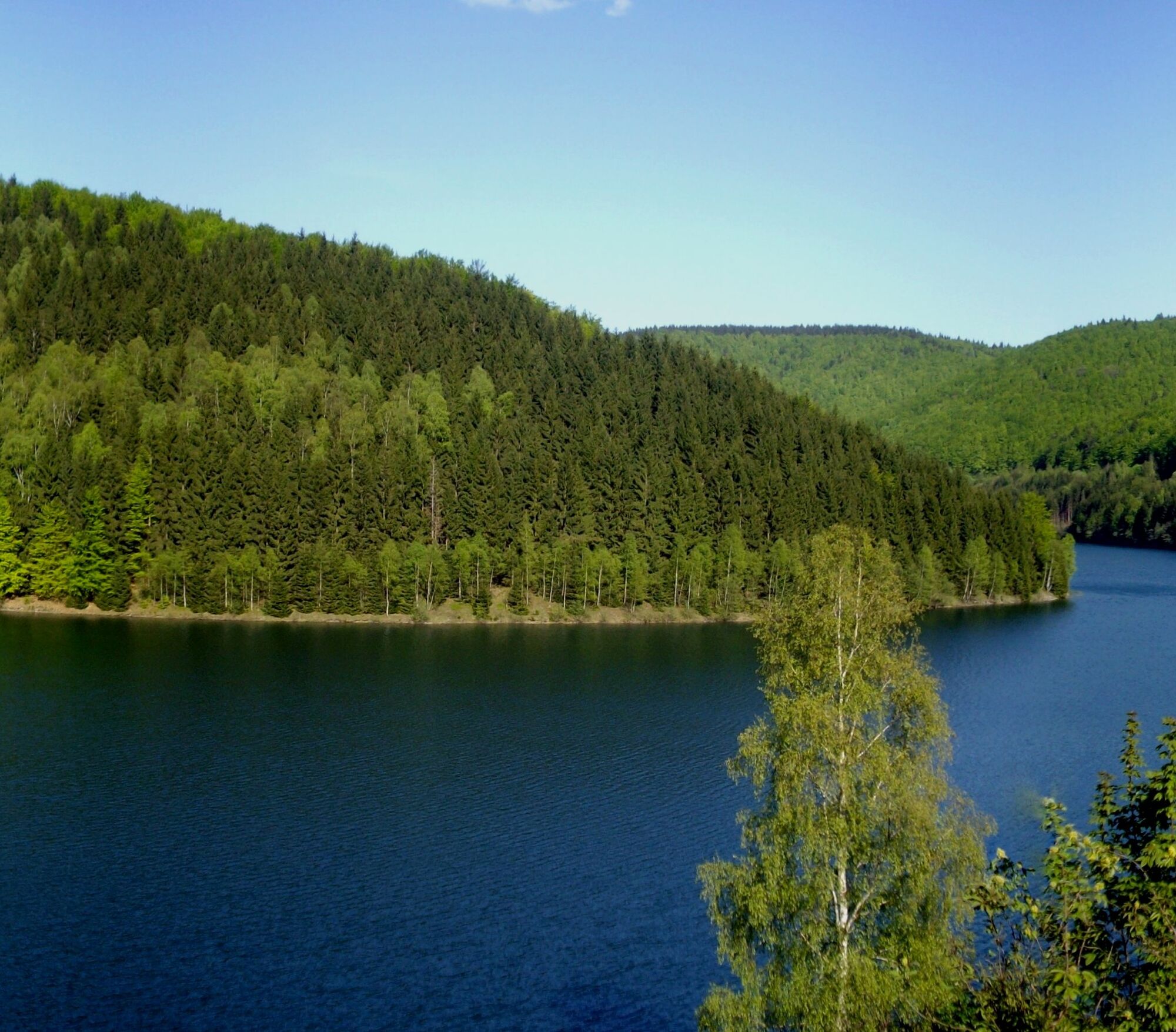
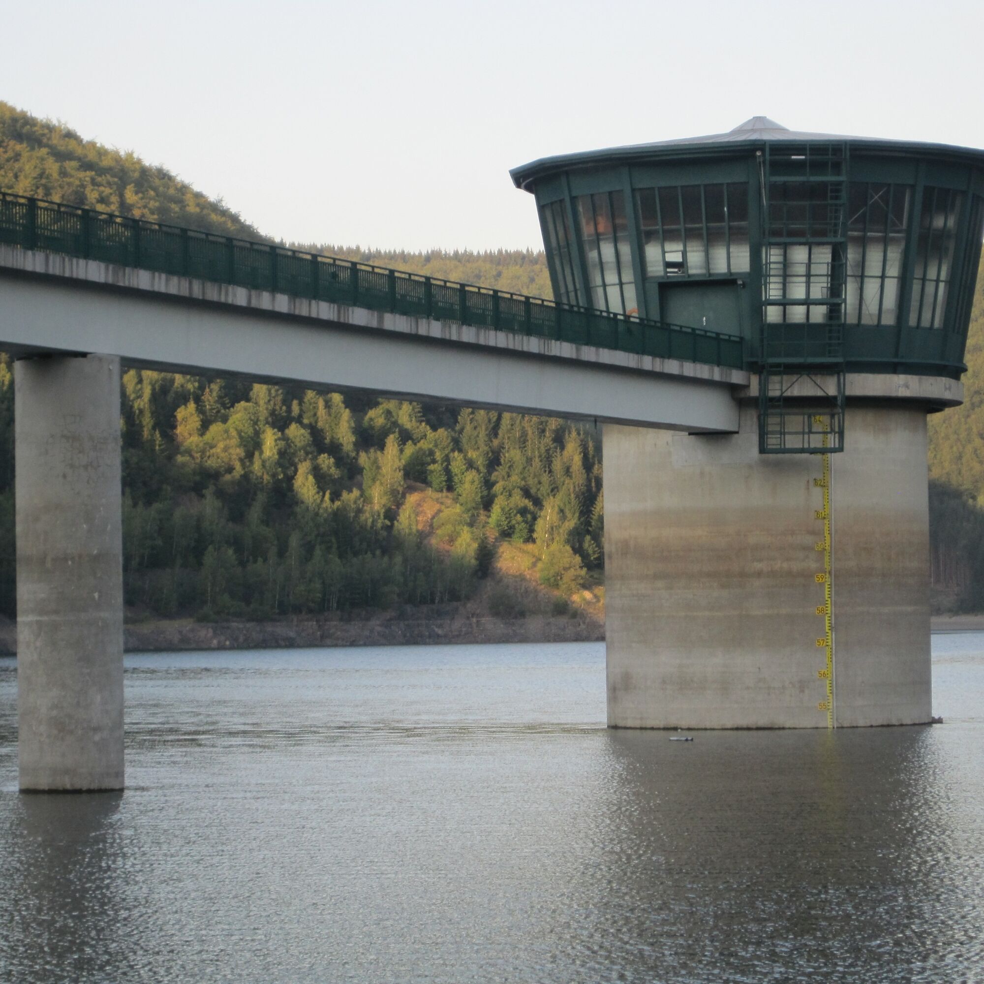
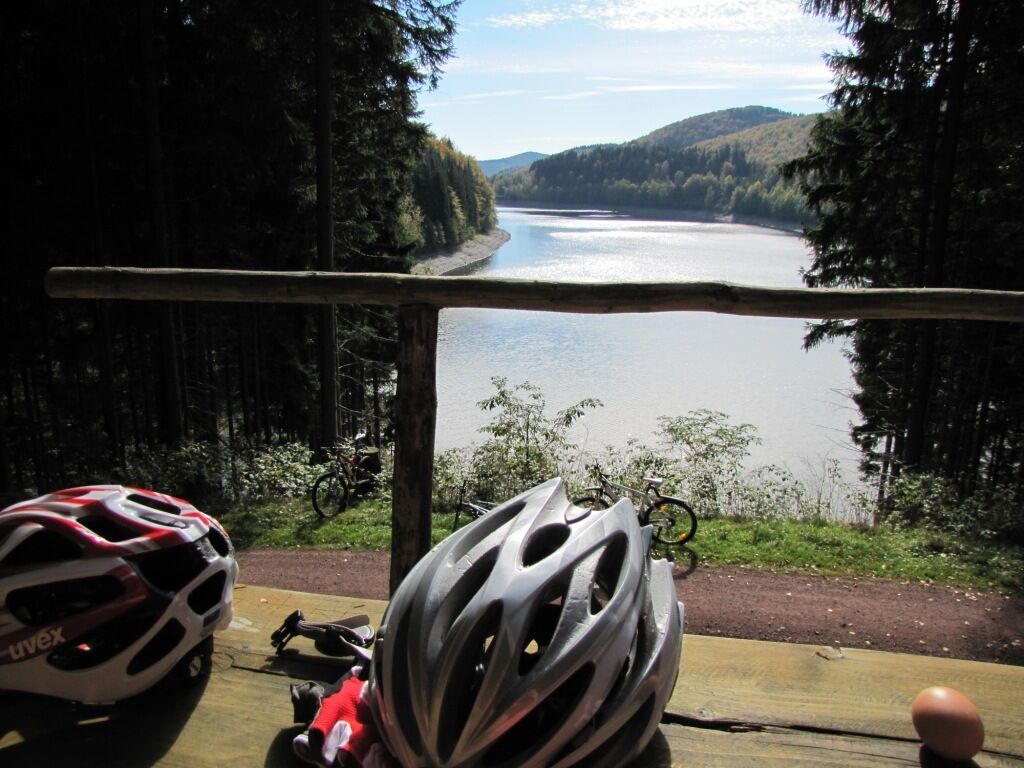
The starting point of the bike route is the Rennsteig Train Station. The cycle path initially runs to Allzunah past the bunker museum on the Rennsteig cycle path. In Allzunah, the Ilmtal cycle path branches off. From here, the Schleuse Valley cycle path goes downhill along the Tränkbach, one of many tributaries of the Schönbrunn drinking water reservoir. Past the pre-dam, it goes gently uphill with beautiful views of the reservoir to the viewpoint dam. Be careful on the descent to Schönbrunn because there is busy traffic of pedestrians and cars. In the center of Schönbrunn, turn right and follow the former Gründerlas railway line past the Adlernest to Lichtenau. Here, follow the developed cycle path through the industrial area to Waldau across the meadows past Oberrod onwards to the Ratscher Mountain Lake. A rest at Cafe Helene (Heckengereuth) with delicious cakes is worthwhile. Refreshed, continue to Ratscher past Schleusingen to Rappelsdorf, where the cycle path currently ends.
Note:
An extension of the cycle path to Veßra Monastery is planned. Those who want to connect to Veßra Monastery and the Werra Valley cycle path must currently travel via the heavily trafficked country road "L1625" to Zollbrück and Veßra Monastery.
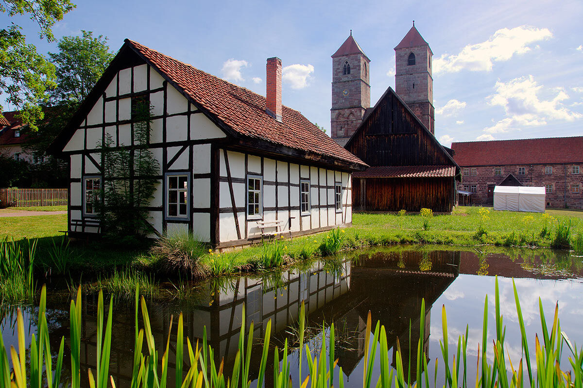
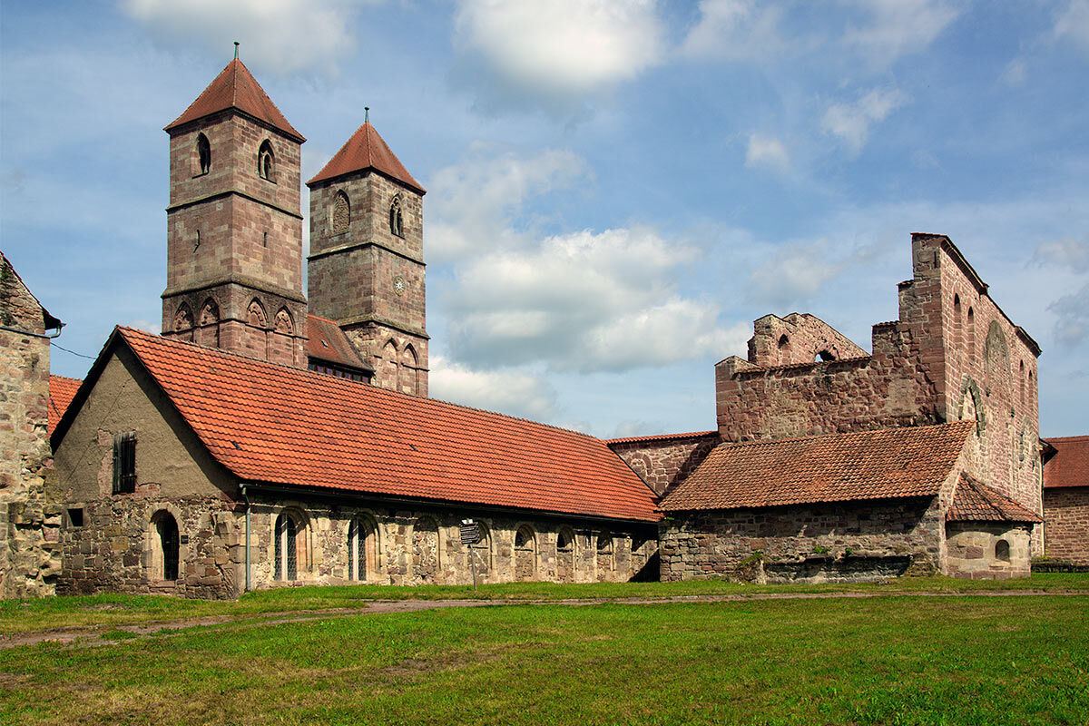
Rennsteig Train Station - Allzunah - Cafe Stube Spindler Allzunah - Pre-dam Schönbrunn Drinking Water Reservoir - Dam Schönbrunn Drinking Water Reservoir - Schönbrunn Inn Fröhlicher Jäger - Spice Museum Schönbrunn - Schönbrunn Terrace Pool - Lichtenau - Waldau - Oberrod - Heckengereuth - Cafe Helene Heckengereuth - Ratscher Mountain Lake - Ratscher - Schleusingen - Natural History Museum Bertholdsburg Castle Schleusingen - Rappelsdorf - Zollbrück - Veßra Monastery - Henneberg Museum Veßra Monastery - Connection to the Werra Valley Cycle Path - Themar - Connection to the Rennsteig Railway
Tak
Road bike or mountain bike.
Always pay attention to the safety of your bike. The cycle path runs partly on public roads. Watch out for other road users and ride cautiously!
Always carry something to drink, especially in the hot summer months, to prevent dehydration. A sunscreen with a high SPF is also recommended.
From here, the cycle path runs on the L1625 country road via Zollbrück to Veßra Monastery; please watch out for traffic here! At Veßra Monastery, you have a connection to the Werra Valley Cycle Path.
Coming from the A71 exit 19 (Suhl / Zella-Mehlis). Then continue towards Suhl city center. Immediately after entering the city area, turn left towards Schmiedefeld. Follow the road over the Ringberg to Schmiedefeld. After passing through Schmiedefeld, follow Ilmenauer Street north towards Ilmenau and turn right at the Rennsteig junction to the station.
On weekends, you can conveniently reach the Rennsteig Train Station by train. The Ilmenau - Stützerbach - Rennsteig Train Station route is served by the RennsteigShuttle operated by the South Thuringia Railway. All information on tickets, timetables, and connections to Erfurt and Saalfeld can be found HERE >>
During the week, you can reach Rennsteig Train Station from Schmiedefeld and Ilmenau by bus. Use line 300
2
Rennsteig Train Station
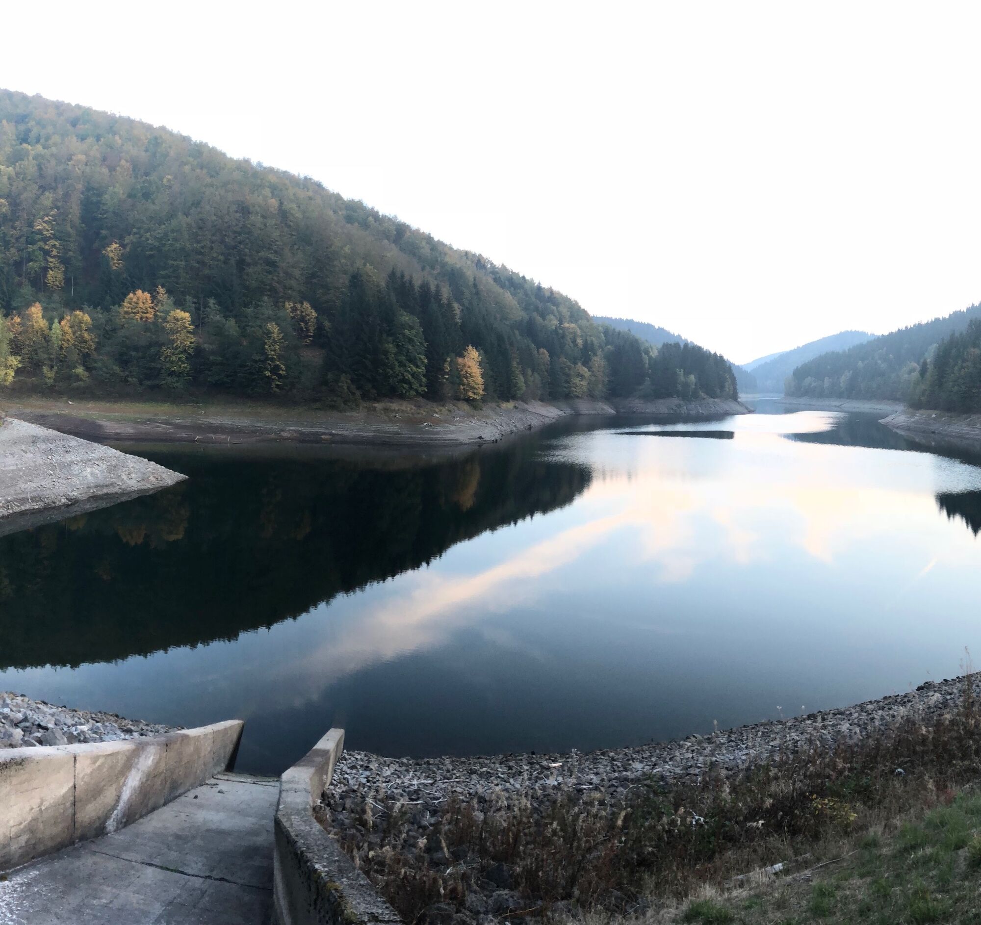
Schönbrunn Drinking Water Reservoir
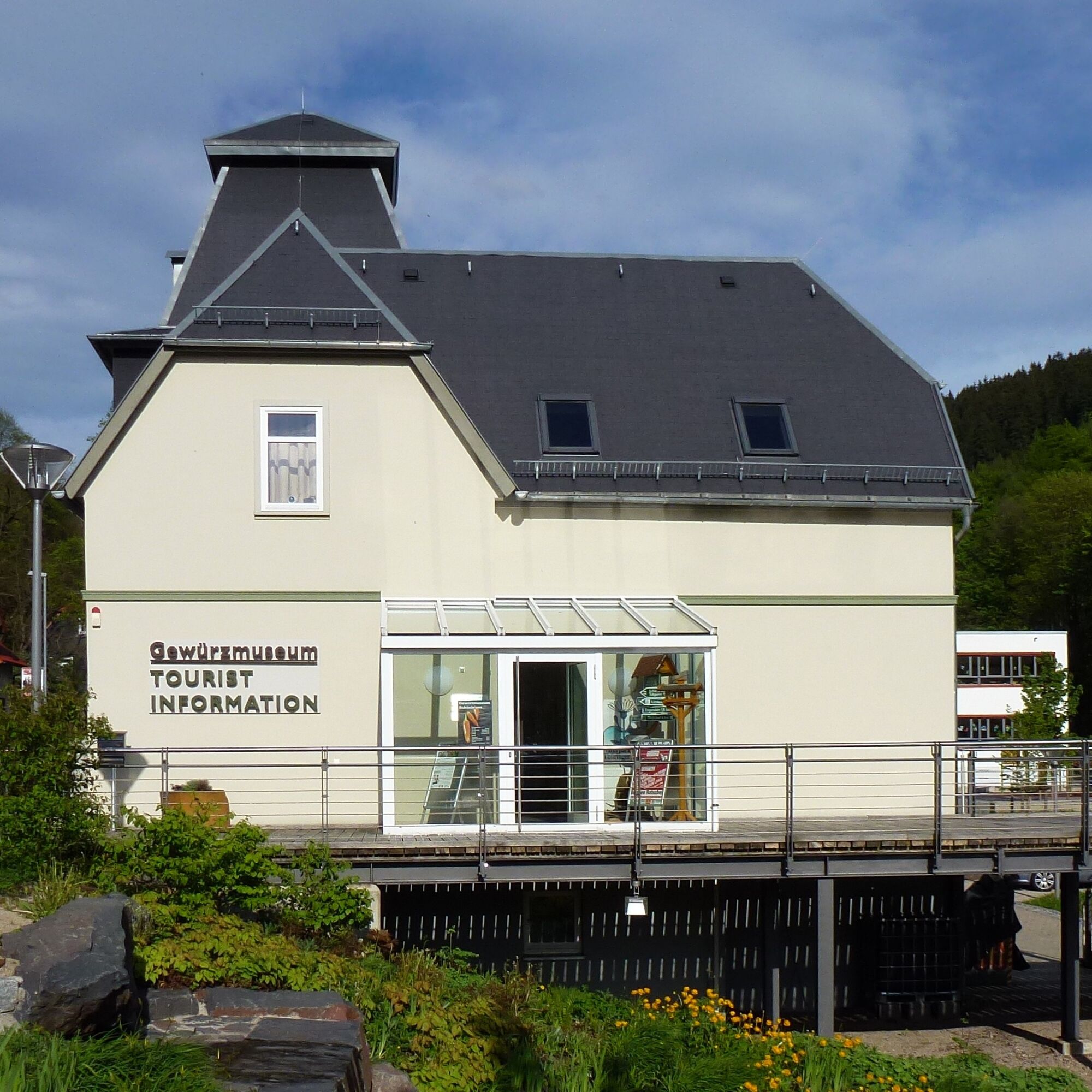
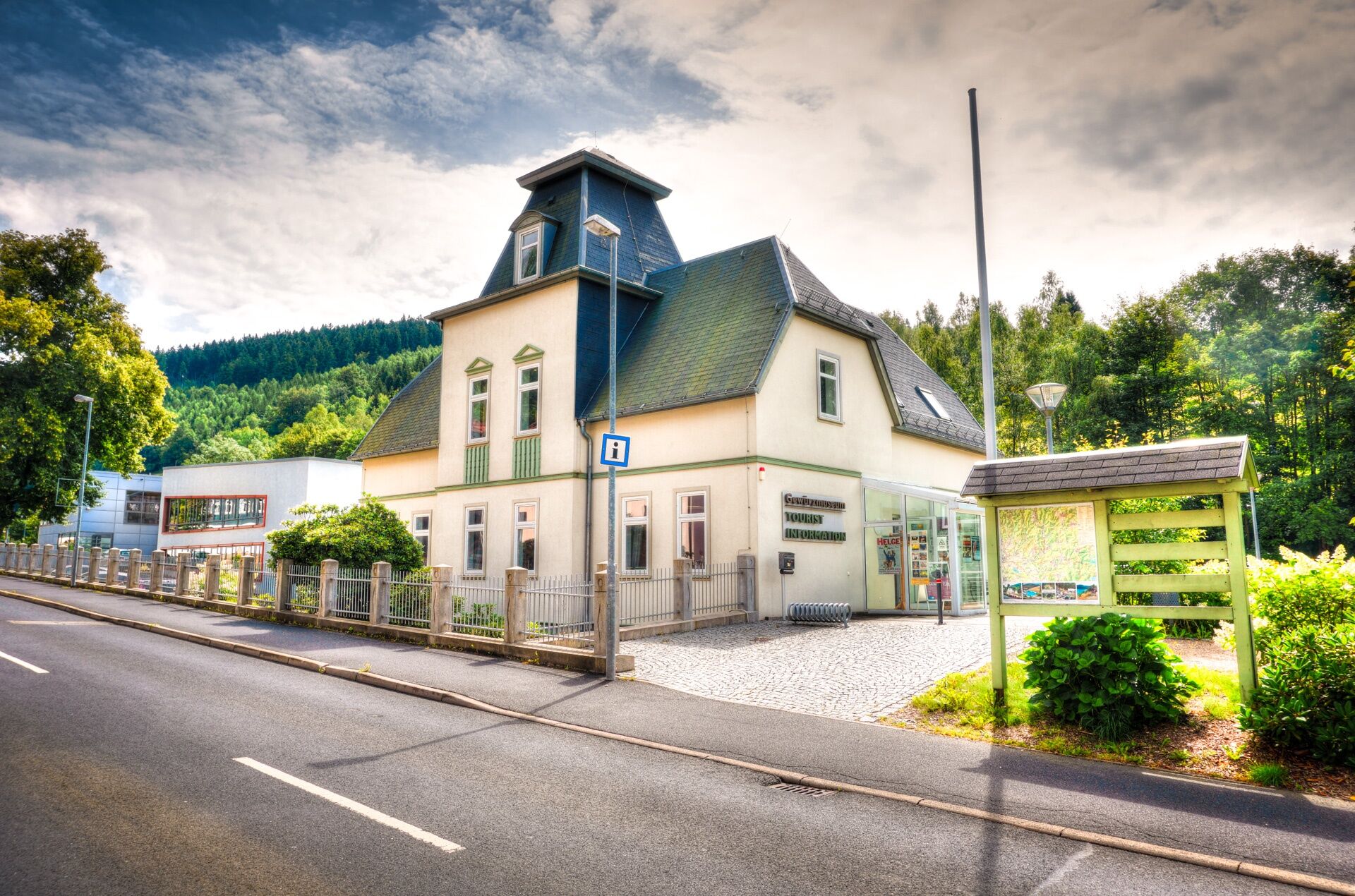
Tourist Information & Spice Museum Schönbrunn
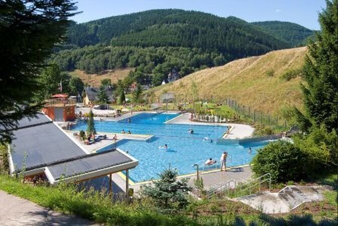
Schönbrunn Terrace Pool
Ratscher Mountain Lake
Bertholdsburg Castle in Schleusingen
Henneberg Museum Veßra Monastery
Kamery internetowe z trasy
Popularne wycieczki w okolicy
-
5,0
Naturlehrpfad Gießübler Schweiz
średniWędrówka 7,99 km -
3,0
Circular hike - "4 ponds hike" Neustadt am Rennsteig - Thuringian Forest
ciężkiWędrówka 12,6 km -
3,8
Rundweg Talsperre
średniJazda na rowerze 14,5 km -
The Rennsteig - long-distance hiking trail from Hörschel to Blankenstein - Thuringian Forest
ciężkidługodystansowy szlak pieszy 169,0 km -
5,0
Circular hiking route - TOP 1 - Werra Source - Masserberg - Thuringian Forest
średniWędrówka 5,94 km -
4,0
Circular hiking trail - TOP 4 - Masserberg - Fehrenbach Switzerland - Thuringian Forest
średniWędrówka 11,5 km -
5,0
Rundtour Staudamm
światłoWędrówka 3,91 km -
5,0
Circular hike - To the Schönbrunn Dam - Frauenwald
średniWędrówka 15,1 km -
3,0
Circular route - Panorama route Stützerbach - Terrain course TK 4
średniWędrówka 10,4 km -
5,0
Circular hiking trail - Dwarf trail Frauenwald - Thuringian Forest
światłoWędrówka 4,02 km
Wędrówki i tropienie


Nie przegap ofert i inspiracji na następne wakacje
Twój adres e-mail została dodana do listy mailingowej.