Flößergraben nature and history trail - Zwickau tourist region (Grenzenlos. Wildromantische Naturerlebnisse)
światło
Pobierz tę trasę na swój telefon komórkowy
Flößergraben nature and history trail - Zwickau tourist region (Grenzenlos. Wildromantische Naturerlebnisse)
światło
Wędrówka
4,97
km
Zeskanuj kod QR i rozpocznij nawigację w aplikacji bergfex.

Wędrówki i tropienie


Flößergraben nature and history trail - Zwickau tourist region (Grenzenlos. Wildromantische Naturerlebnisse)
światło
Odległość
4,97
km
Czas trwania
01:30
h
Ascent
85
hm
Poziom morza
318 -
401
m
Ścieżka do pobrania
Flößergraben nature and history trail - Zwickau tourist region (Grenzenlos. Wildromantische Naturerlebnisse)
światło
Wędrówka
4,97
km
Trasa
Hubertuskapelle
(411 m)
Miejsce kultu
4,6 km
Weidmannsruh (Bildhaus)
(411 m)
Restauracja
4,6 km
Trasa
Flößergraben nature and history trail - Zwickau tourist region (Grenzenlos. Wildromantische Naturerlebnisse)
światło
Wędrówka
4,97
km
Hubertuskapelle
(411 m)
Miejsce kultu
4,6 km
Weidmannsruh (Bildhaus)
(411 m)
Restauracja
4,6 km
Autor
Dostarczone przez Erlebnisheimat Erzgebirge

Informacje o trasie
Trasa
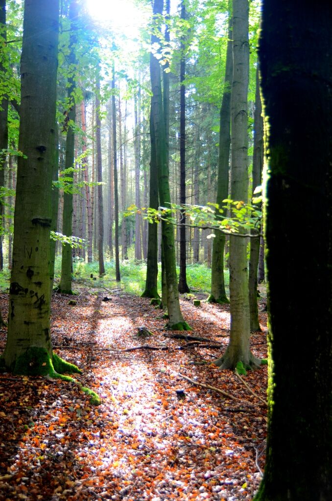
The hike starts at the parking lot in the Werdauer district of Leubnitz-Forst. Follow the edge of the forest to the Rohrteich pond to the "Alter Flößergraben". Continue along the bridle path to the Leubnitz wing, past the "Three Larches" and the "Turned Beech", along Benjes hedge to the Weidmannsruh restaurant. A detour to the Elferteich pond is also recommended. This pond was created as a water dam for the rafting
. After just under 1.5 hours, you will reach the Weidmannsruh restaurant. You can now walk back the same way or take the Bauernsteig trail to the water lily pond. From there, following Trünzinger Straße, you will return to the starting point of the hike in the Leubnitz-Forst district.
. After just under 1.5 hours, you will reach the Weidmannsruh restaurant. You can now walk back the same way or take the Bauernsteig trail to the water lily pond. From there, following Trünzinger Straße, you will return to the starting point of the hike in the Leubnitz-Forst district.
Informacje o przyjeździe
Transport publiczny
Bus
Parking
Parking lot Werdauer district Leubnitz-Forst
Dodatkowe informacje i wskazówki
Dodatkowe informacje
Tourismusregion Zwickau e. V.
Peniger Straße 10
08396 Waldenburg
Tel. 037608 27243
Fax 037608 27245
info@tourismus-zwickau.de
www.tourismus-zwickau.de
Peniger Straße 10
08396 Waldenburg
Tel. 037608 27243
Fax 037608 27245
info@tourismus-zwickau.de
www.tourismus-zwickau.de
Wskazówki
Sights
- "Rohrteich und Umgebung" natural monument
- Leubnitz outdoor pool
- guided tours with raftsman Ole possible
- "Rohrteich und Umgebung" natural monument
- Leubnitz outdoor pool
- guided tours with raftsman Ole possible
Refreshment stops
- Restaurant "Weidmannsruh"
- Restaurant "Zur Perlquelle"
- "Erdbeerschänke"
Wyceny
Popularne wycieczki w okolicy
Spaziergang durch den Sahnpark
światłoPrzechadzka 3,10 kmKunsthistorischer Stadtrundgang
światłoPrzechadzka 3,50 km- 3,0
Neukirchner Waldrunde
światłoMountainbike 35,9 km Leubnitz - Werdauer Wald - Stauweiher - Leubnitz
światłoWędrówka 6,86 km- 4,0
Wanderweg "Zur Göltzschtalbrücke"
średniWędrówka 13,4 km Elster Pearls Trail – Stage 6
średniWędrówka 10,0 km- 5,0
Durch das Waldhaus-Revier Greiz
światłoWędrówka 6,65 km Elster Pearls Trail – Stage 5
średniWędrówka 9,92 kmHirschfeld circular hike - Tourism Region Zwickau (For treasure hunters and princesses. Hikes with children)
światłoWędrówka 17,6 km- 5,0
Rundwanderung "Zur Clodramühle" - Elstersteigen
Wędrówka 11,5 km

Wędrówki i tropienie

Ponad 550.000 propozycji wycieczek, szczegółowe mapy i intuicyjny planer tras sprawiają, że aplikacja jest niezbędna dla wszystkich entuzjastów przyrody.

Nie przegap ofert i inspiracji na następne wakacje
Zapisz się do newslettera
Błąd
Wystąpił błąd. Spróbuj ponownie.Dziękujemy za rejestrację
Twój adres e-mail została dodana do listy mailingowej.
Wycieczki po całej Europie
Austria Szwajcaria Niemcy Włochy Słowenię Francja Holandia Belgia Polska Liechtenstein Czechy Słowacja Hiszpania Chorwacja Bośnia i Hercegowina Luksemburg Andorra Portugalia Islandia Wielka Brytania Irlandia Grecja Albania Macedonia Północna Malta Norwegia Czarnogóra Mołdawia Kosowo Węgry San Marino Rumunia Estonia Łotwa Białoruś Cypr Litwa Serbia Bułgaria Monako Dania Szwecja Finlandia