


Circular hike Coßmannsdorf-Tharandt


Start of the hike at Coßmannsdorf stop, Gasthaus zum Rabenauer Grund.
(If you hike from Coßmannsdorf station to Somsdorf about 500 m, first along the footpath on Hainsberger Straße and then 200 m on Somsdorfer Straße, you reach at the foot of the mountain leading up to Somsdorf the Gasthaus zum Rabenauer Grund.)
And here begins the hiking trail that leads into the Rabenauer Grund directly along the Rote Weißeritz.
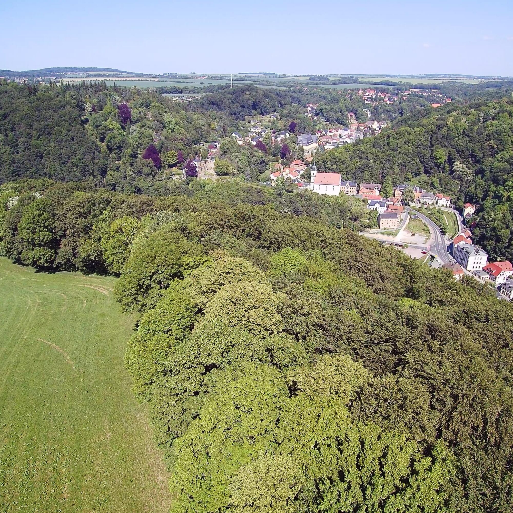
At first, follow the green line marking along the Rote Weißeritz 500 m against the current up to the hiking trail leading up to Somsdorf. You can follow this trail or continue 800 m further to the entrance of the romantic Somsdorfer Gorge, marked with a yellow line, for the steep ascent to the Teufelskanzel, and on both routes you reach at the end of the ascent the locality on Somsdorfer Höhe.
Through the village, the hiking marking yellow line continues over to Tharandt to the Sonnentempel. Then the descent leads down to the town of Tharandt with castle ruins, animal enclosure, botanical garden, and S-Bahn station towards Dresden via Freital Coßmannsdorf, or you can take the lower Leitenweg (green dot) back to Coßmannsdorf.
Tak
Weißeritztalbahn
S3 Dresden Tharandt
Weißeritztpark parking lot
Popularne wycieczki w okolicy
- 5,0
Winter experience Rabenauer Grund and Rabenauer Höhe
średniWędrówka zimą 7,79 km - 4,0
Rabenauer Grund family tour and adventure trail
światłoWędrówka 4,92 km - 4,5
Stadtrundgang Dresden
światłoWędrówka 7,78 km Legend trail and adventure trail "Legendary Mühlberg"
światłoWędrówka 4,84 km- 5,0
Circular hike Malter and Dippoldiswalder Heide
światłoWędrówka 6,77 km Niederwartha, Cossebaude
światłoWędrówka 8,01 kmPanorama trail Talsperre Malter
Wędrówka 5,08 km- 3,0
Blick auf Dresden
światłoWędrówka 13,3 km - 5,0
Rundweg über Backofenfelsen und Opitzhöhe nach Tharandt
średniWędrówka 11,9 km Water, silver, noble crown ... the Ritter Theler Tour!
średniWędrówka 22,6 km
Wędrówki i tropienie


Nie przegap ofert i inspiracji na następne wakacje
Twój adres e-mail została dodana do listy mailingowej.