Holiday Route Silver Road
Motorrad
Nawigacja
Nawigacja
Pobierz tę trasę na swój telefon komórkowy
Mapa
Holiday Route Silver Road
Motorrad
147,63 km
Zeskanuj kod QR i rozpocznij nawigację w aplikacji bergfex.
QR Code
Wędrówki i tropienie
Pobierz dla iOS
Pobierz dla systemu Android

Holiday Route Silver Road

Odległość
147,63 km
Czas trwania
02:15 h
Ascent
2.048 hm
Poziom morza
113 - 672 m
Ścieżka do pobrania
Mapa
Holiday Route Silver Road
Motorrad
147,63 km

Over about 275 kilometers, between Zwickau and Dresden and also crossing the border into the Czech Republic, the holiday route impressively connects the witnesses of history. These outstanding cultural...


Opis

Over about 275 kilometers, between Zwickau and Dresden and also crossing the border into the Czech Republic, the holiday route impressively connects the witnesses of history. These outstanding cultural treasures and high-quality events are the basis of today’s richness of the Ore Mountains.

So simply follow the silver ribbon on your personal discovery journey to the treasures of the experiential homeland Ore Mountains.

Saxon-Bohemian Silver Road

Experience 800 years of mining culture comfortably by car

Discover the Ore Mountains along the Silver Road, which connects cities and sites of centuries-old silver mining over a length of 275 km, fascinating in their diversity like nowhere else in Germany!

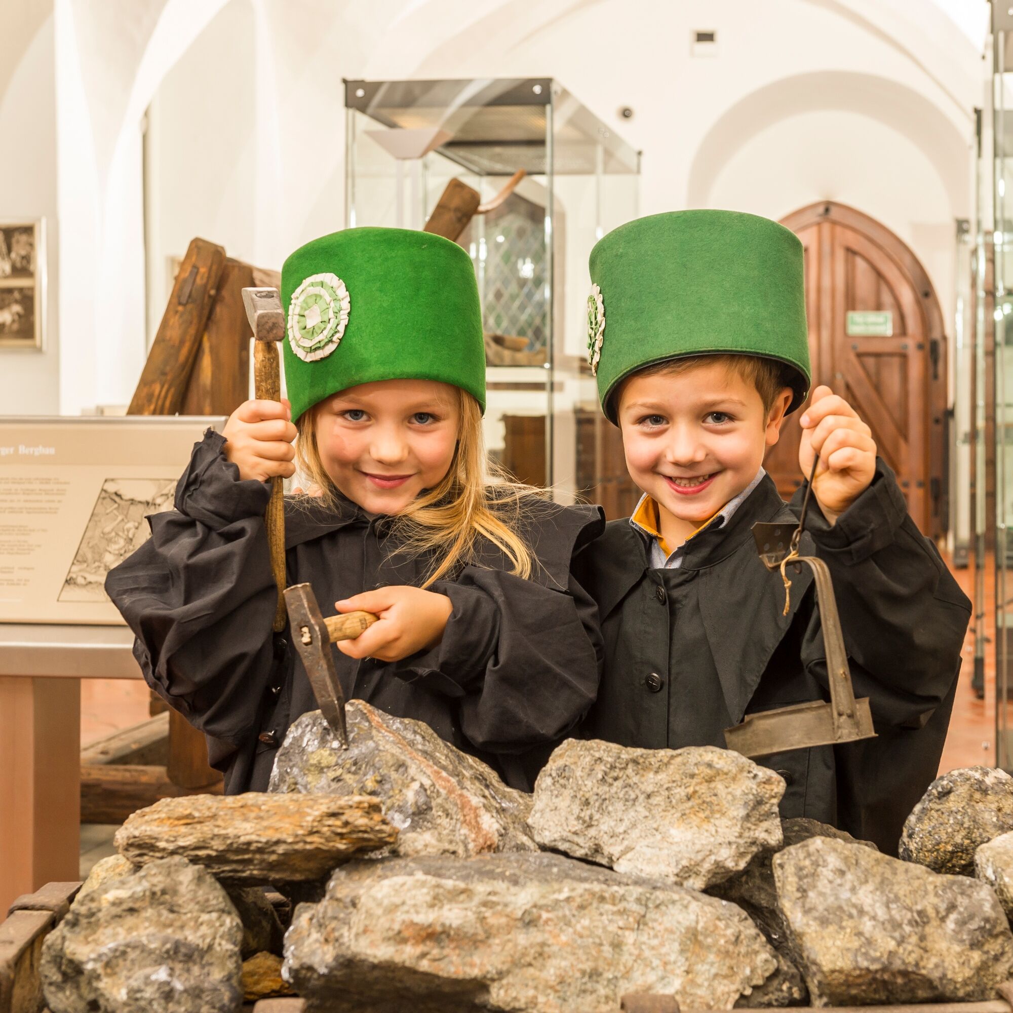
Anyone traveling in the Ore Mountains still encounters the miners’ traditions everywhere today. The heartfelt "Glück auf" greeting you hear here is the best proof of this. Where it has its roots can best be explored by entering one of the many show mines.

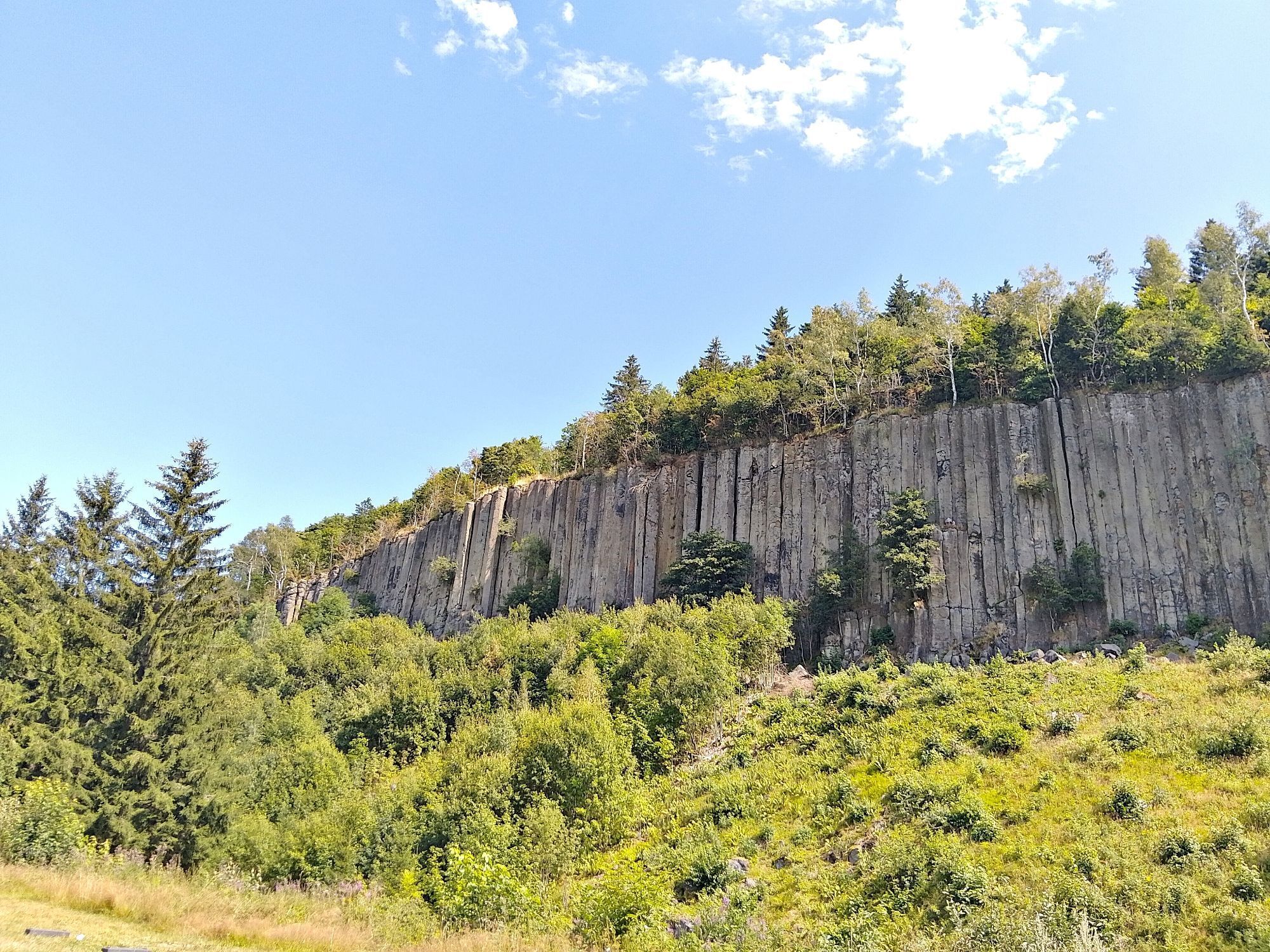
Nowhere in Germany today are there so many historical witnesses from mining of the Middle Ages and the early modern period, so many buildings and artworks related to mining as in the Ore Mountains. They form a unique cultural landscape in Europe, for which the region is striving for UNESCO World Heritage status.

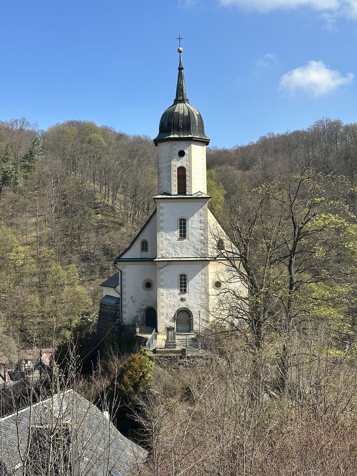
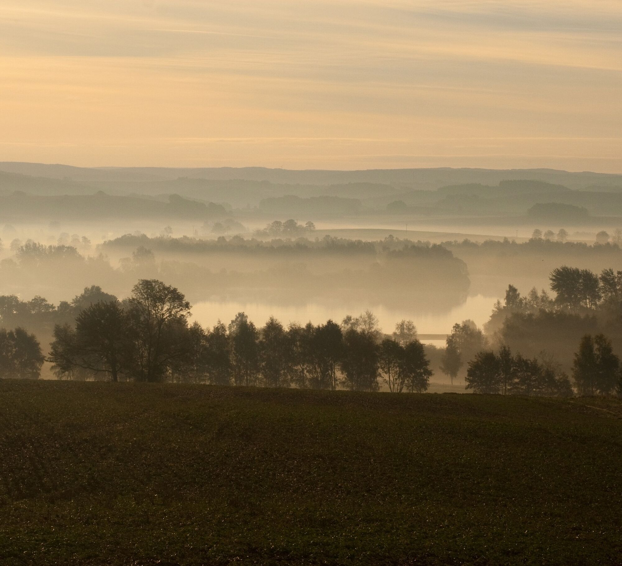
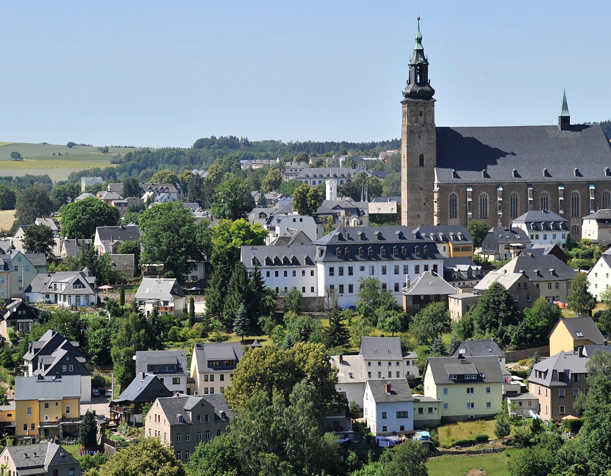
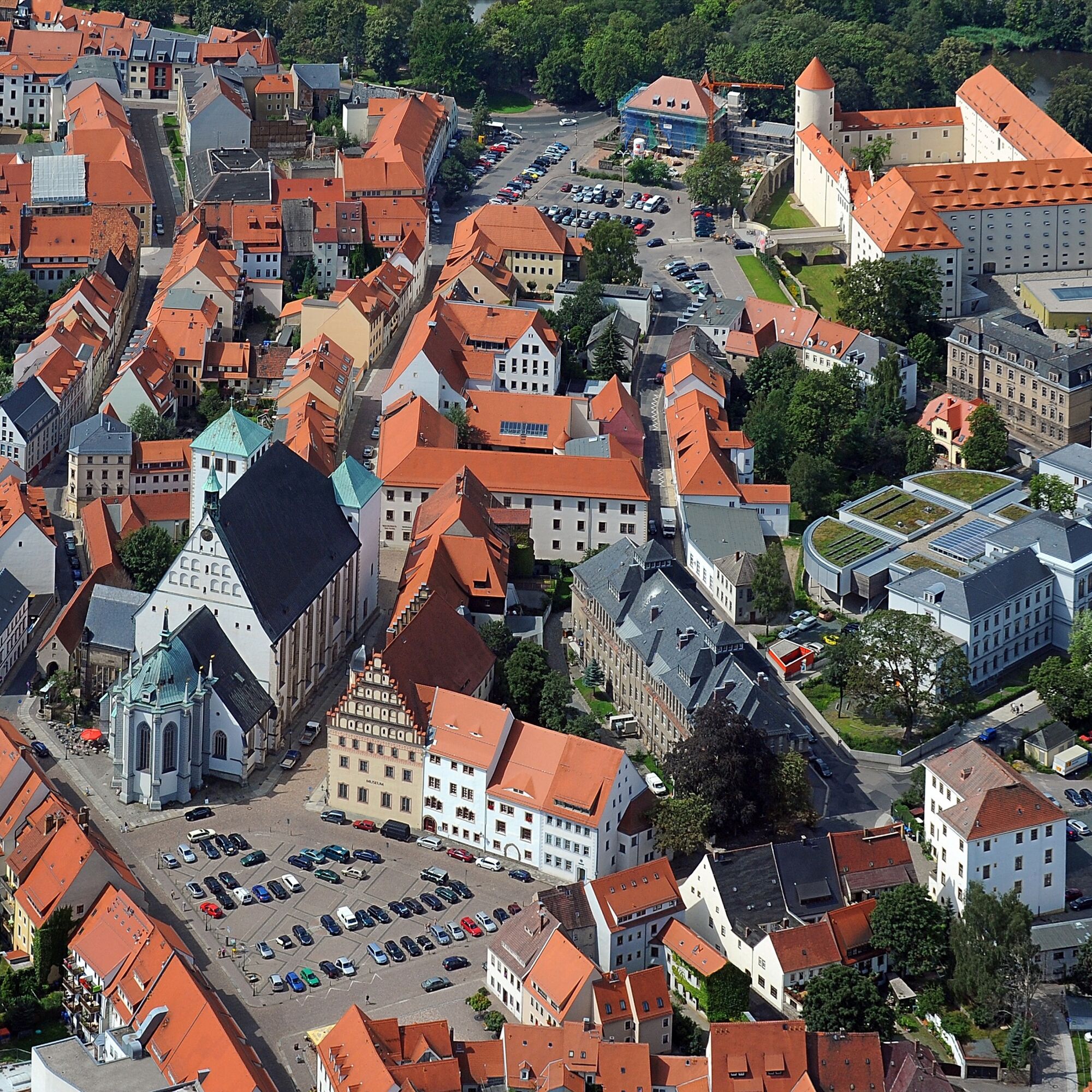
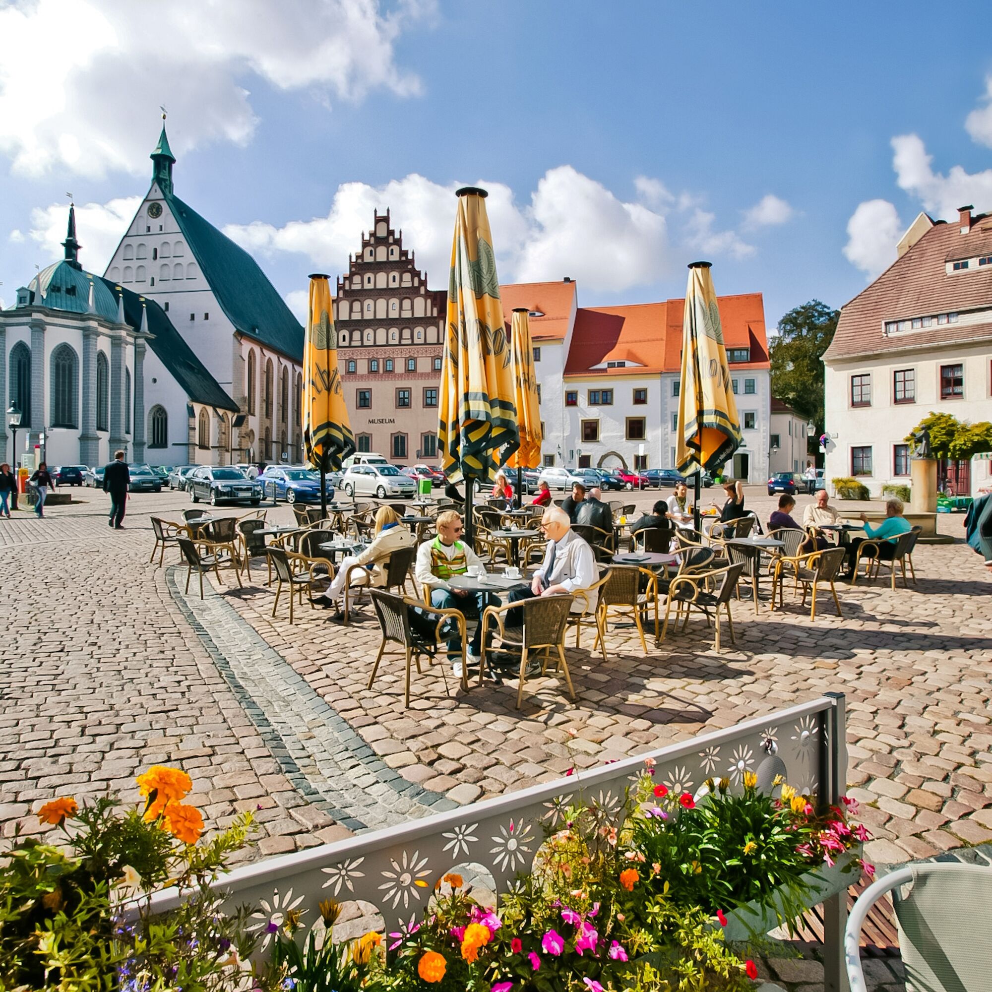
More than 800 years ago, the people of the Ore Mountains discovered that their land is rich in ores, and they set about extracting the valuable treasure. Countless tunnels and shafts, hammer mills, and smelting works were created. Gradually, a modern industrial region developed whose reputation drew thousands of people. With the new wealth, magnificent towns were built, for example Marienberg – a place completely designed on the drawing board – or the mining town of Freiberg, the silver town par excellence. Magnificent sacred buildings such as Freiberg Cathedral, St. Anne’s Church in Annaberg-Buchholz, and St. Wolfgang’s Church in Schneeberg were also constructed, which still rank among Germany’s most important cultural monuments today.

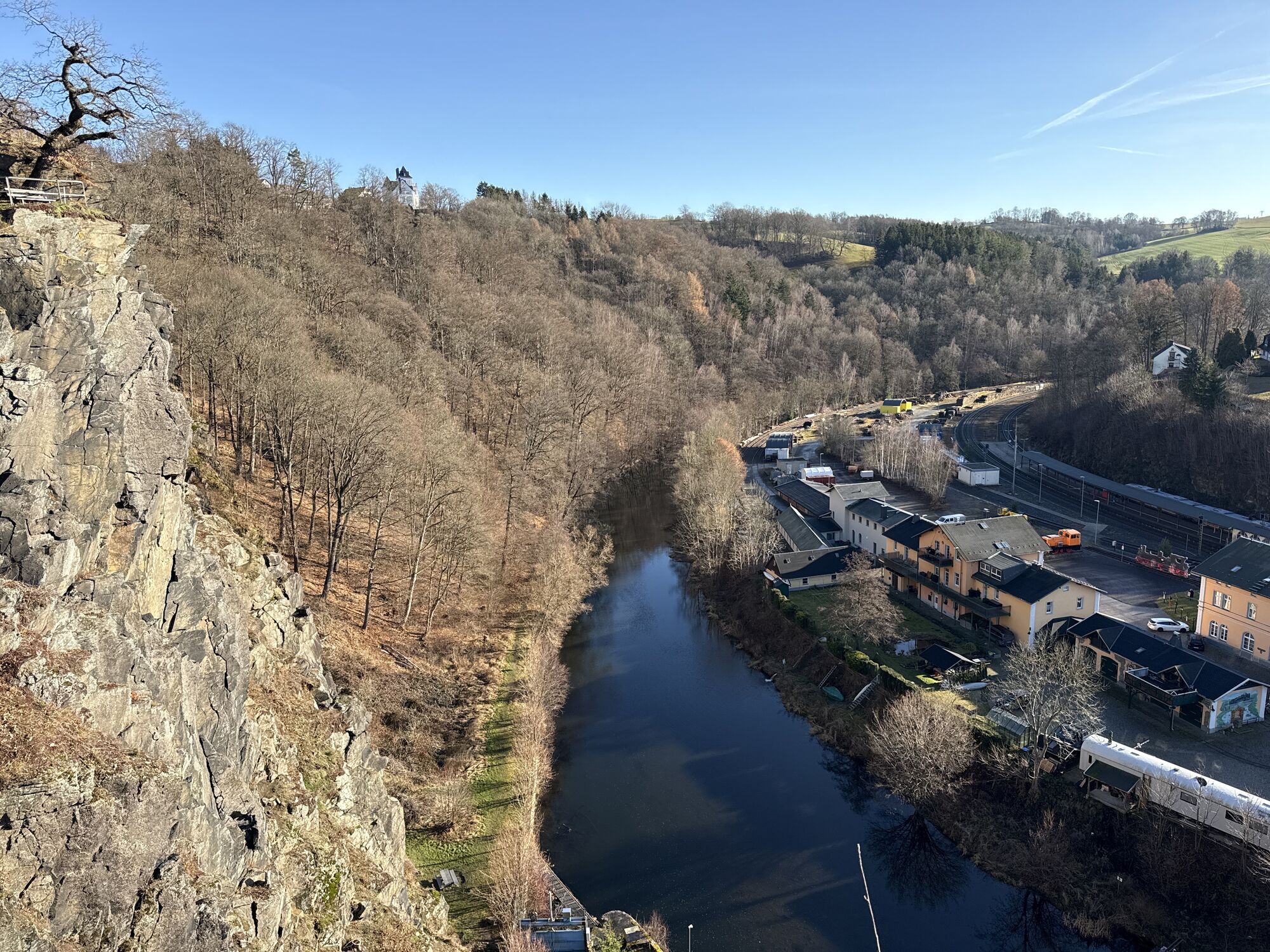
The witnesses of the various mining epochs line up – like pearls on a string – along the Saxon-Bohemian Silver Road. Over about 275 kilometers from Zwickau to Dresden and across the border into the Czech Republic, the old trade route impressively shows what everyday life must have looked like back then. It tells the story of the shining metal that shaped this region. Mills, copper hammers, the first arithmetic school of Adam Ries, and Silbermann organs are just a small part of the attractions awaiting curious visitors in the Ore Mountains.

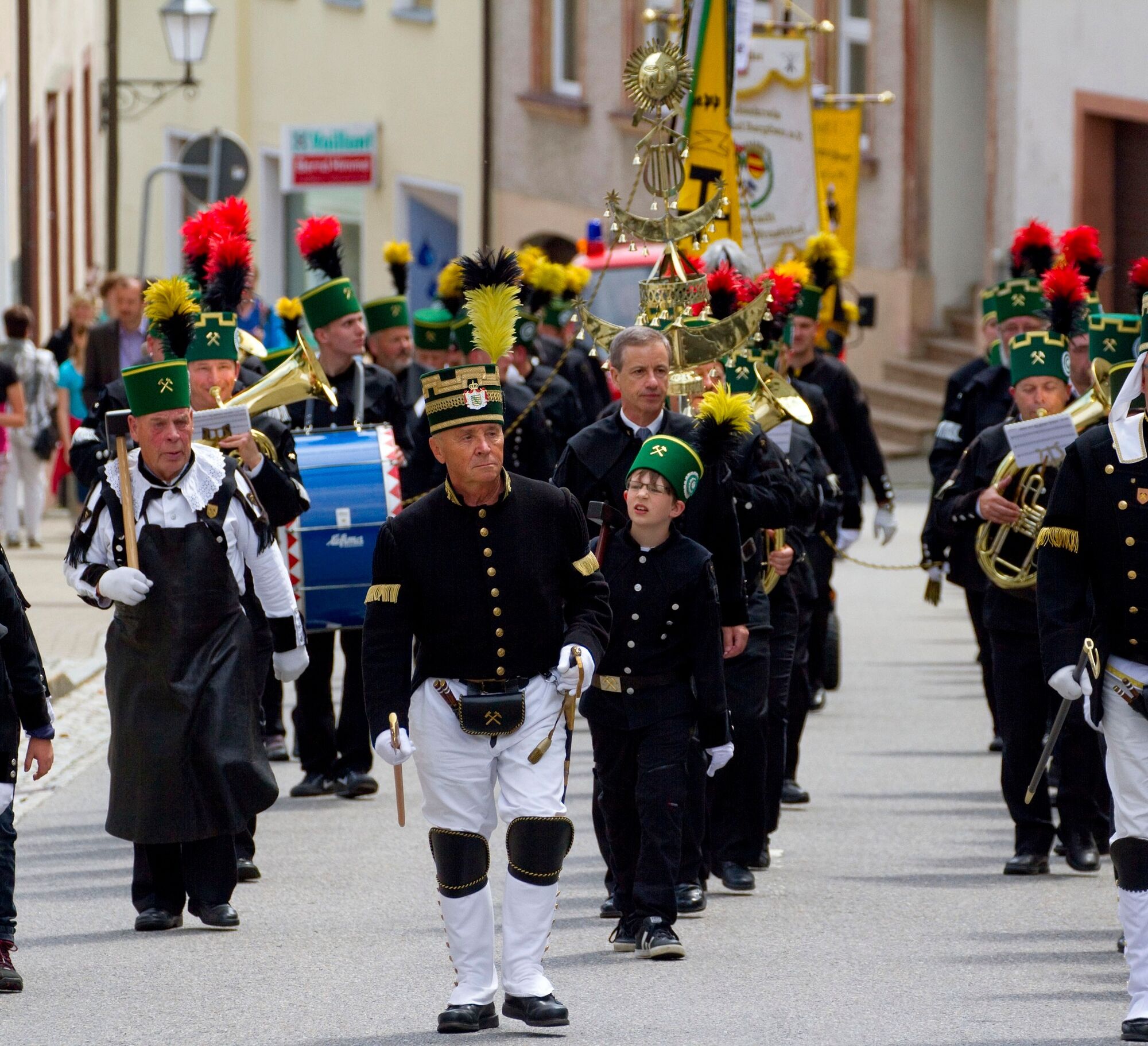
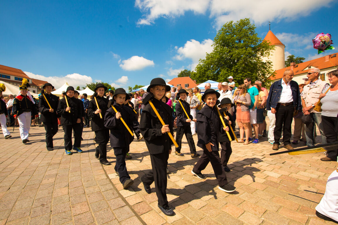
For a very long time, mining set the pace. From it developed the Christmas tradition and the craftsmanship of the Ore Mountains, as well as customs and traditions that are still alive today and can be experienced most intensively during Advent. On these days, festive fanfare sounds accompany the miners as they march in their magnificent costumes.

Trasa
Friedenskapelle
(433 m)
Miejsce kultu
19,4 km
Nicolaikirche
(364 m)
Miejsce kultu
25,0 km
St. Ulrich
(577 m)
Miejsce kultu
49,0 km
Friedhofskapelle Hilmersdorf
(578 m)
Miejsce kultu
74,0 km
Helbigshöhe
(570 m)
Szczyt
91,0 km
Brand-Erbisdorf
(480 m)
Miasto
105,8 km
Tharandt
(230 m)
Miasto
133,1 km
Trasa
Mapa
Holiday Route Silver Road
Motorrad
147,63 km
Zwickau
(267 m)
Miasto
0,0 km
Schedewitz
(268 m)
Sąsiedztwo
1,9 km
Ev.-Luth. Matthäuskirche
(269 m)
Miejsce kultu
2,0 km
Bockwa
(266 m)
Sąsiedztwo
2,1 km
Sandberg
(298 m)
Sąsiedztwo
3,9 km
Wilkau-Haßlau
(285 m)
Miasto
4,9 km
Niederhaßlau
(283 m)
Sąsiedztwo
5,4 km
Oberhaßlau
(296 m)
Sąsiedztwo
7,0 km
Silberstraße
(292 m)
Wioska
8,1 km
Landcafé
(295 m)
Restauracja
8,3 km
Wiesenburg
(349 m)
Wioska
10,5 km
Gasthaus Goldene Höhe
(537 m)
Restauracja
17,1 km
Schneeberg
(469 m)
Miasto
18,8 km
Friedenskapelle
(433 m)
Miejsce kultu
19,4 km
Mater Dolorosa
(389 m)
Miejsce kultu
24,1 km
Aue
(354 m)
Miasto
24,9 km
Nicolaikirche
(364 m)
Miejsce kultu
25,0 km
Lauter
(464 m)
Miasto
28,5 km
Dino Döner - Pizzeria
(470 m)
Restauracja
28,8 km
Neuwelt
(444 m)
Sąsiedztwo
31,4 km
Sachsenfeld
(415 m)
Sąsiedztwo
33,1 km
Valentin
(415 m)
Restauracja
33,1 km
Neustädter Hof
(415 m)
Restauracja
33,2 km
Schwarzenberg/Erzgebirge
(468 m)
Miasto
34,3 km
Landeskirchliche Gemeinschaft Schwarzenberg
(425 m)
Miejsce kultu
34,6 km
Wildenau
(425 m)
Sąsiedztwo
34,7 km
Brückenberg
(464 m)
Sąsiedztwo
34,9 km
Am Stölzelplatz
(452 m)
Restauracja
36,3 km
Grünstädtel
(454 m)
Wioska
36,7 km
Raschau
(453 m)
Wioska
37,9 km
Markersbach
(497 m)
Wioska
41,9 km
Ev.-meth. Kapelle
(520 m)
Miejsce kultu
42,1 km
Erzgebirgsstübl
(563 m)
Restauracja
42,9 km
Oberscheibe
(613 m)
Wioska
44,2 km
Sächsischer Hof
(679 m)
Restauracja
45,4 km
Scheibenberg
(688 m)
Miasto
45,5 km
Imbiss
(674 m)
Restauracja
45,9 km
Das Kochdippl
(630 m)
Restauracja
48,1 km
Schlettau
(576 m)
Miasto
48,9 km
St. Ulrich
(577 m)
Miejsce kultu
49,0 km
Neu Amerika
(657 m)
Rozliczenie
51,5 km
Landhotel Forsthaus
(630 m)
Restauracja
51,8 km
Buchholz
(556 m)
Sąsiedztwo
53,8 km
Annaberg
(607 m)
Sąsiedztwo
56,1 km
Annaberg-Buchholz
(655 m)
Miasto
56,7 km
Rosenaue
(439 m)
Restauracja
62,9 km
Thermalbad Wiesenbad
(424 m)
Wioska
63,6 km
Restaurant & Pension Wettin
(429 m)
Restauracja
63,7 km
Schönbrunn
(426 m)
Wioska
68,3 km
Wolkenstein
(478 m)
Miasto
70,0 km
Gemeinschaftshaus Geringswalde
(485 m)
Miejsce kultu
71,7 km
Gehringswalde
(493 m)
Wioska
72,0 km
Friedhofskapelle Hilmersdorf
(578 m)
Miejsce kultu
74,0 km
Gasthof Hilmersdorf
(585 m)
Restauracja
74,2 km
Hilmersdorf
(587 m)
Wioska
74,3 km
Heinzebank
(606 m)
Rozliczenie
75,1 km
Gasthof zur Heinzebank
(607 m)
Restauracja
75,1 km
Am Kalkwerk
(612 m)
Restauracja
80,2 km
Kalkwerk
(609 m)
Sąsiedztwo
80,3 km
Pockau
(411 m)
Wioska
84,0 km
Görsdorf
(422 m)
Wioska
85,1 km
Blaue Taube
(519 m)
Rozliczenie
86,6 km
Forchheim
(453 m)
Wioska
88,6 km
Helbigshöhe
(570 m)
Szczyt
91,0 km
Mittelsaida
(513 m)
Wioska
94,2 km
Lichte
(571 m)
Korytarz/teren
95,6 km
Erbgericht
(510 m)
Restauracja
98,1 km
Großhartmannsdorf
(505 m)
Wioska
98,3 km
Gasthof an der B101
(499 m)
Restauracja
99,3 km
Sporthotel Glück Auf Mönchenfrei
(546 m)
Restauracja
101,6 km
Brand-Erbisdorf
(480 m)
Miasto
105,8 km
Trattoria Due Fratelli
(475 m)
Restauracja
105,9 km
Bombay Palace
(476 m)
Restauracja
106,4 km
Hammer's Gasthaus
(474 m)
Restauracja
108,4 km
Seilerberg
(447 m)
Sąsiedztwo
109,7 km
Freiberg
(400 m)
Miasto
111,5 km
Jakobikirche
(408 m)
Miejsce kultu
112,5 km
Halsbach
(362 m)
Wioska
114,7 km
Geheege
(362 m)
Rozliczenie
117,4 km
Naundorf
(341 m)
Wioska
118,0 km
Zum Rosental
(340 m)
Restauracja
118,6 km
Grillenburg
(377 m)
Wioska
124,8 km
Gasthaus Waldblick
(367 m)
Restauracja
129,4 km
Tharandt
(230 m)
Miasto
133,1 km
Bella Italia (ehemals La Bella)
(222 m)
Restauracja
133,4 km
Schillereck
(224 m)
Restauracja
133,5 km
Hainsberg
(185 m)
Sąsiedztwo
137,1 km
Wirtshaus Alte Schmiede
(180 m)
Restauracja
138,4 km
Tresor-Café
(176 m)
Restauracja
138,7 km
Deuben
(174 m)
Sąsiedztwo
138,9 km
Wirtschaft
(171 m)
Restauracja
139,4 km
Potschappel
(165 m)
Sąsiedztwo
141,0 km
Freital
(171 m)
Miasto
141,1 km
Niederdölzschen
(149 m)
Sąsiedztwo
143,8 km
Dresden
(112 m)
Miasto
146,7 km
Informacje o wycieczce

More than 30 visitor mines, sites of living traditions, magnificent hall churches, and historic mining towns line up like pearls on a string. Over about 275 kilometers, between Zwickau and Dresden and also across the border into the Czech Republic, the holiday route impressively connects the witnesses of history.

Dostępny przez cały rok
Sty
Lut
Mar
Kwi
Maj
Cze
Lip
Sie
Wrz
Paź
Lis
Gru
Autor
Dostarczone przez Erlebnisheimat Erzgebirge
Logo
Udostępnij trasę
Mapa
Holiday Route Silver Road
Motorrad
147,63 km
Błąd
Wystąpił błąd. Spróbuj ponownie.
Informacje o trasie
Najważniejsze informacje geologiczne

Tak

Odpowiedni dla rodzin

Tak

Informacje o przyjeździe
Przybycie
Arrival by car via: A4 from Frankfurt am Main direction A9 from Nuremberg direction A13 from Berlin direction A14 from Magdeburg direction A17 from Prague direction A72 from Hof direction

Arrival by planeDresden: www.dresden-airport.de Leipzig: www.leipzig-halle-airport.de Karlovy Vary: www.airport-k-vary.cz

Transport publiczny
Arrival by train

The Ore Mountains are easily accessible by train from all over Germany via Leipzig, Riesa, Dresden, and Zwickau/Hof.

Information

Deutsche Bahn: 0800 1507090 0800 1507090 FREE * or 0800 11861 0800 11861 FREE **

www.bahn.de

* automated timetable information from landline, free of charge;
** personal information, 3 ct/sec., from connection to travel service, 39 ct/min.
from landline DT AG

Central Saxony Transport Association/VMS

Timetable and fare information: 01801 4000888*

www.vms.de

* 3.9 ct from landline, mobile possibly different, Mon to Fri 7am–6pm

Upper Elbe Transport Association GmbH
Timetable and fare information: 0180 22662266 0180 22662266

www.vvo-online.de

Dodatkowe informacje i wskazówki
Dodatkowe informacje

Ore Mountains Tourism Association e.V.
Adam Ries-Straße 16
09456 Annaberg-Buchholz

Tel.: 03733 18800-0 03733 18800-0
Fax: 03733 18800-20
Email: info@erzgebirge-tourismus.de

http://www.silberstrasse.de/

Wskazówki

For all who like to sleep well!

Cozy guesthouses and country inns invite their guests to experience the Ore Mountains with a family connection. Fine hotels and wellness facilities pamper their guests. Holiday apartments and holiday homes offer every comfort. In the middle of greenery, young and old relax and return home with unforgettable impressions.

Get information in the Ore Mountains accommodation directory about many options and plan your next vacation!

Would you like personal advice?

Then simply contact us! Call us during our business hours (Mon-Thu 8am-5pm, Fri 8am-4pm) or send us an email:

Service hotline:
03733-188 00 88 03733-188 00 88

Email inquiry:

Nie ma jeszcze recenzji
Napisz recenzję

Recenzje pomagają innym użytkownikom wybrać kolejną przygodę. Oceniaj tylko trasę, a nie pogodę lub przekąskę.

Wybierz jedną z gwiazdek, aby ocenić wycieczkę
Zła trasa
Słaba trasa
Przeciętna wycieczka
Dobra wycieczka
Doskonała wycieczka
bergfex logoUzyskaj wgląd Zawsze na żywo z ponad 9 500 kamer internetowych. bergfex Jako użytkownik Pro, możesz teraz zobaczyć odpowiednie kamery internetowe dla wielu wycieczek w aplikacji wycieczki od. Pozwala to na bezpośredni podgląd aktualnych warunków.
Wędrówki i tropienie

Wędrówki i tropienie

Pobierz dla iOSPobierz dla systemu Android
Wędrówki i tropienie
Ponad 550.000 propozycji wycieczek, szczegółowe mapy i intuicyjny planer tras sprawiają, że aplikacja jest niezbędna dla wszystkich entuzjastów przyrody.
Wędrówki i tropienie
bergfex bergfex