


Circular route "Brietzer Teiche - SpeciesRich on the Green Belt"
Poziom trudności: T1
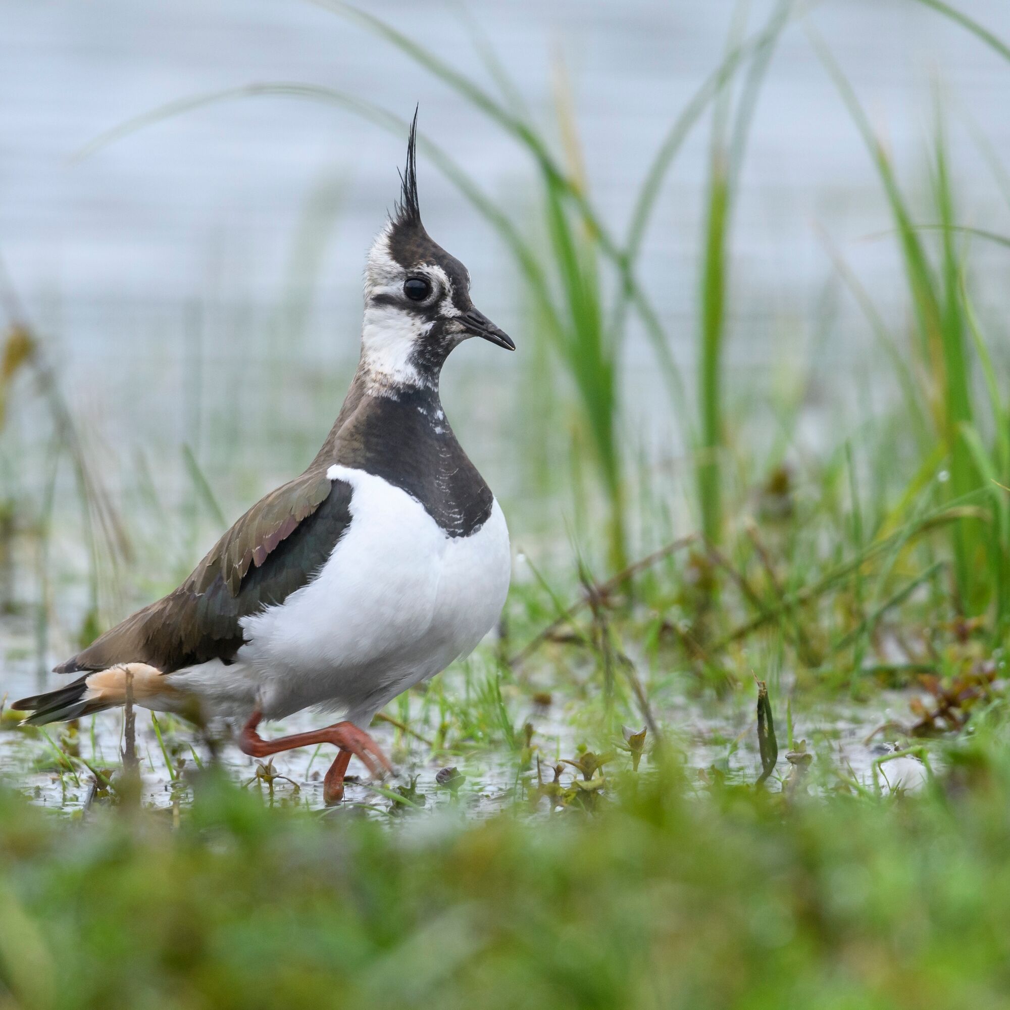
This hike takes you to natural waters and colorful flowering wet meadows. At the Brietzer Teiche, you can best enjoy the eldorado for wading and water birds, dragonflies, and amphibians from the observation...
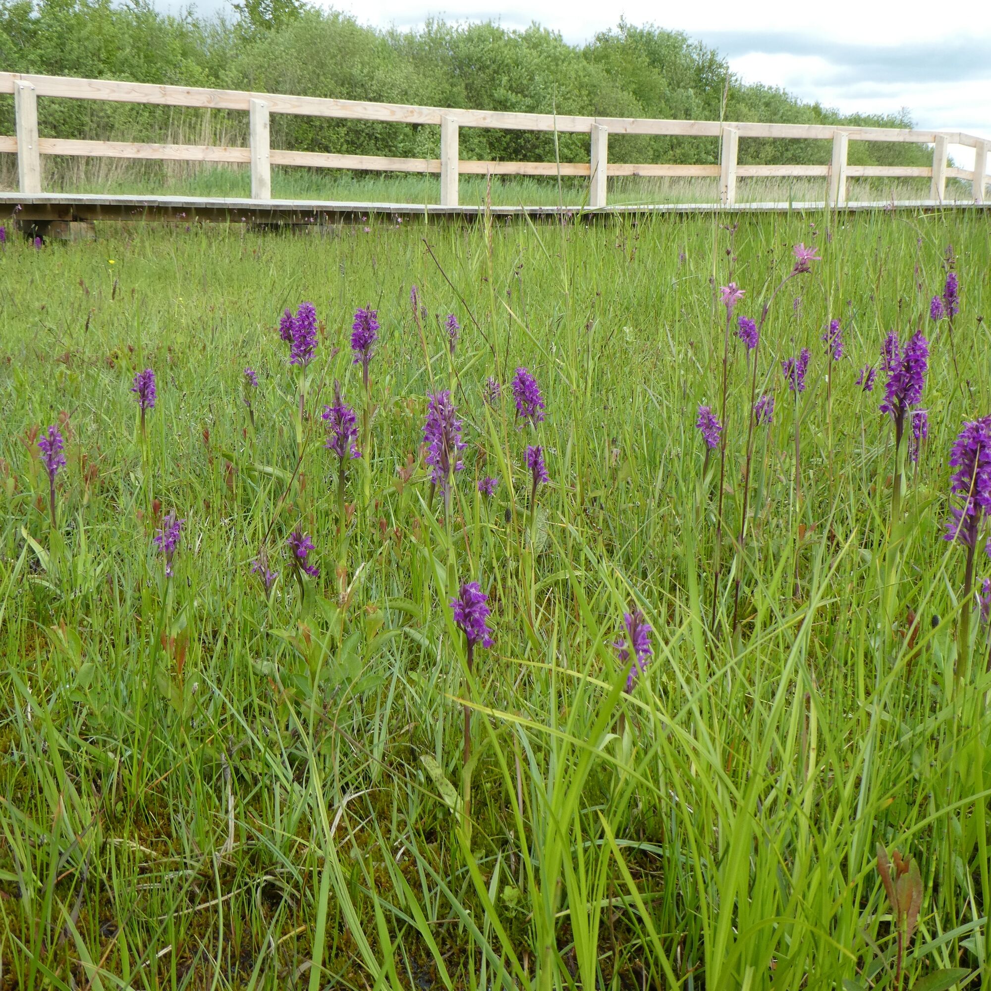
This hike takes you to natural waters and colorful flowering wet meadows. At the Brietzer Teiche, you can best enjoy the eldorado for wading and water birds, dragonflies, and amphibians from the observation hides. Since the late 1990s, the former "brick ponds" have been naturally restored, creating a valuable wet biotope for migratory and breeding birds. We especially recommend visiting the boardwalk in May and June. Then the area shows itself colorfully with the blossoms of the rare orchids of the broad-leaved marsh orchid.

Tak
Turn north from the B71 into Mühlenweg.
Please park if possible at the sports field in Brietz, Mühlenweg 4.
T1
Popularne wycieczki w okolicy
-
Europa-Radweg Eiserner Vorhang Iron Curtain Trail - Am Grünen Band entlang von Gummern bis Oebisfelde
Kolarstwo długodystansowe 164,9 km -
Altmark route: From the Hanseatic city of Salzwedel to Arendsee
średniJazda na rowerze 27,2 km -
Borderland Route
światłoJazda na rowerze 28,9 km -
Großer Rundlingsweg
średniWędrówka 17,4 km -
Dummewiesen-Weg
światłoWędrówka 13,9 km -
Kiefen - Grünen Mühle
średniJazda konna 15,6 km -
Wendland-Tour
średniJazda na rowerze 49,2 km -
Rundlings-Tour
światłoJazda na rowerze 22,6 km -
Clenzer-Schweiz-Weg
średniWędrówka 19,4 km -
Hanse-Wendland-Radweg
światłoJazda na rowerze 162,0 km

Wędrówki i tropienie


Nie przegap ofert i inspiracji na następne wakacje
Twój adres e-mail została dodana do listy mailingowej.