


Hike around the Frankenteich
The start and end of this easy but beautiful hike are at the parking lot of Naturresort Schindelbruch at the foot of the Auerberg. At the beginning, you pass the nature trail and then reach the parking...
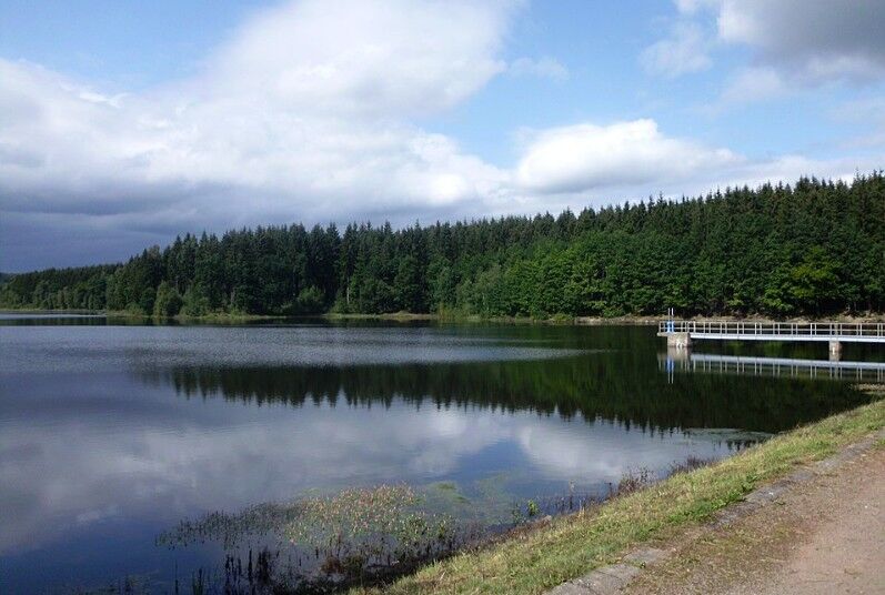
The start and end of this easy but beautiful hike are at the parking lot of Naturresort Schindelbruch at the foot of the Auerberg. At the beginning, you pass the nature trail and then reach the parking lot at the Auerberg. At the end of the parking lot, a narrow path runs parallel to the road. This is crossed, and after a short section through the forest, you turn right to reach a meadow. You then arrive at the Frankenteich; it is best to circle it counterclockwise. At the pond itself, there are beautiful views, ideal for a rest.
The start and end of this easy but beautiful hike are at the parking lot of the Naturresort Schindelbruch at the foot of the Auerberg. At the beginning, you pass the nature trail and then reach the parking lot at the Auerberg. At the end of the parking lot, a narrow path runs parallel to the road. This is crossed, and after a short stretch through the forest, you turn right to reach a meadow. You then arrive at the Frankenteich; it is best to circle it counterclockwise. At the pond itself, there are beautiful views, ideal for a rest.
Tak
Tak
Make a brief stop at the Josephskreuz, the largest iron cross. There are also dining options at the Bergstüb'l Josephshöhe on the Auerberg. The restaurant is a partner of the Karst Landscape South Harz Biosphere Reserve.
Popularne wycieczki w okolicy
-
4,8
Thale - Bodetal - Treseburg - Hexentanzplatz Runde, Deutschland
ciężkiWędrówka 19,2 km -
4,3
Selketal-Stieg
światłoWędrówka 9,62 km -
4,0
Stadt Stolberg (Harz) - Marienkapelle - Josephshöhe - St. Martini
średniWędrówka 8,81 km -
3,0
Harzer Wandernadel HWN 98, 99
światłoWędrówka 6,97 km -
Grasburg - ruins as witnesses of bygone times
światłoWędrówka 3,91 km -
Circular hike from the Bauerngraben car park to Dittichenrode, to the Bauerngraben and back (HWN 213)
światłoWędrówka 6,38 km -
5,0
Harzgerode, Mägdesprung, Alexisbad HWN 177,195,179
światłoWędrówka 15,4 km -
Treseburg - Hohe Sonne
średniWędrówka 13,0 km -
Güntersberge - Talsperre Neustadt - Stolberg - Josephskreuz
E-MTB 53,1 km -
HWN-Tour 81 - HWN57
średniWędrówka 9,88 km

Wędrówki i tropienie


Nie przegap ofert i inspiracji na następne wakacje
Twój adres e-mail została dodana do listy mailingowej.