







Historic city walk through the old town of Osterburg
Osterburg is the center of a unified municipality formed in 2009 from the city and ten other formerly independent municipalities, including over 30 villages in total. A historic city walk introduces you...
Osterburg is the center of a unified municipality formed in 2009 from the city and ten other formerly independent municipalities, including over 30 villages in total. A historic city walk introduces you to the development of our city and will initially take you through the old town. Unique is the possibility to nearly circle the entire city center on a promenade following the former inner rampart.

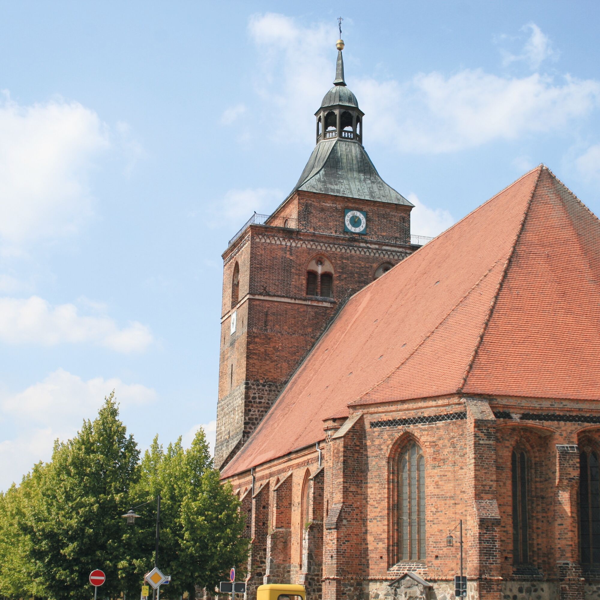
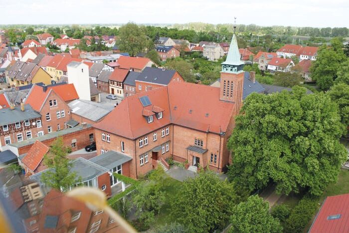

Our tour through and around the old town of Osterburg begins at the Nicolaikirche, which together with the adjacent Wasser- and Kirchstraße and the Kleine Markt forms an ensemble. The Romanesque basilica, built at the end of the 12th century, was converted into a three-aisled Gothic hall church in the 15th century. Its baroque cupola was added after the city fire of 1761. In addition to the organ from the Berlin workshop of the Buchholz family (1824; prospect 1765), the bronze baptismal font (1442) is particularly worth seeing. On the north side of the church is the Neptune Fountain, originally belonging to the Schloss Rönnebeck, an Italian work from the early 20th century.
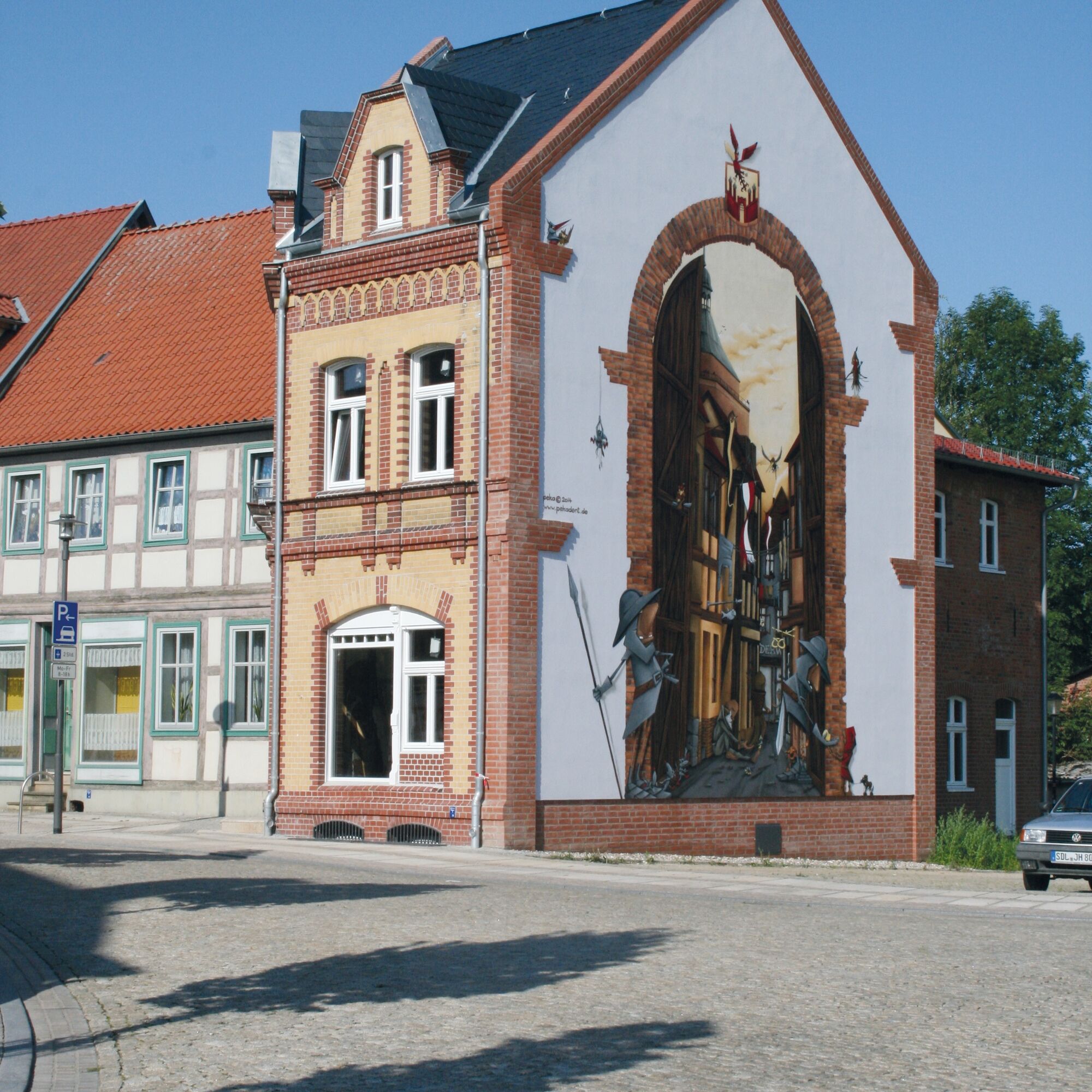
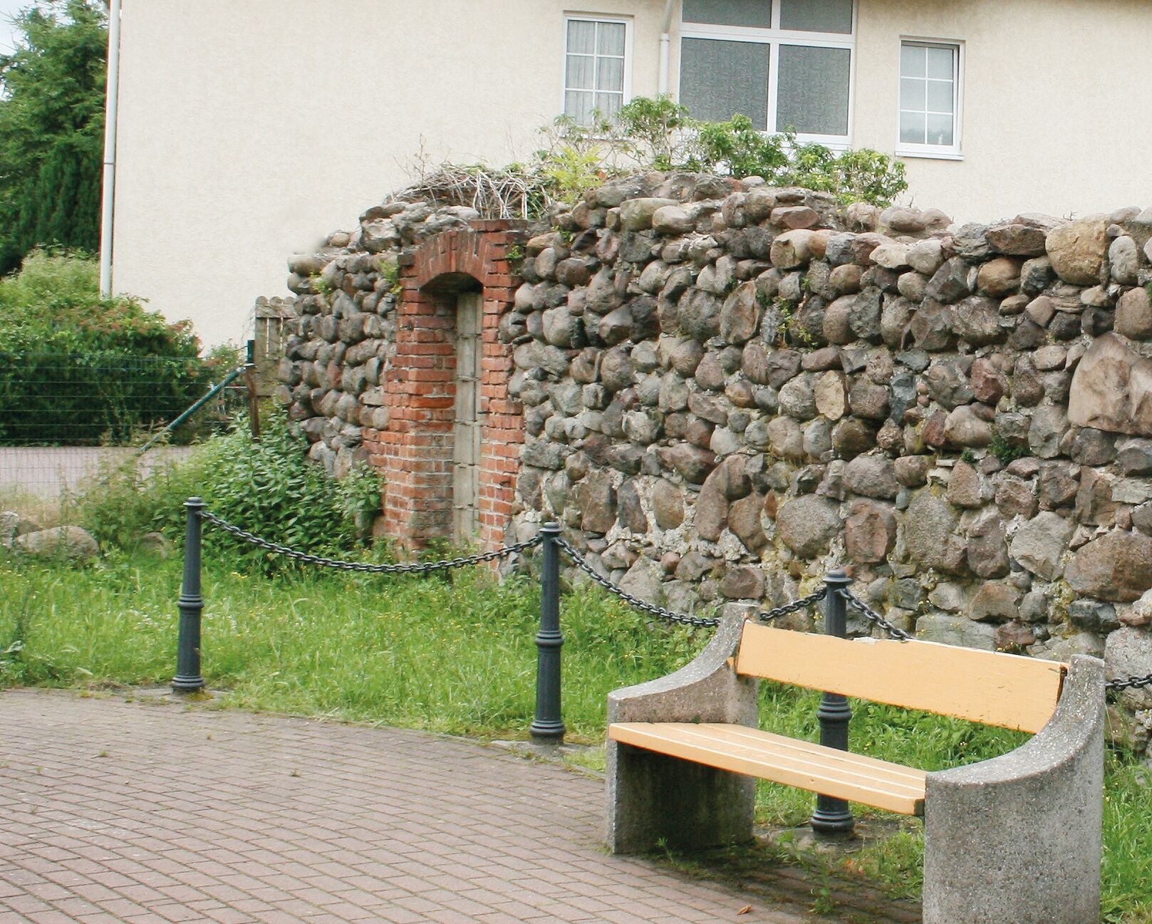
Across Kirchstraße, with two half-timbered houses from the reconstruction period after the great city fire of 1761, we reach the northern Breite Straße, where the district museum is located in a traditional commercial building dating from 1762. Diagonally opposite is a gabled house, the only remaining witness to the pre-fire typology of this street. The name Jüdenstraße recalls that in the Middle Ages Jewish residents were assigned separate residential quarters. Along a brick wall built at the end of the 19th century on the foundations of the old city wall, we follow the North Promenade to the area of the former Seehäuser Gate, now marked by a large mural on the gable of the former Lies House. From there, our tour leads to Burgstraße. It owes its name to a castle complex that existed here from the second half of the 10th century until the end of the 11th century. The former municipal girls' school, built in 1888/89 to expand the elementary school, now belongs to the grammar school.
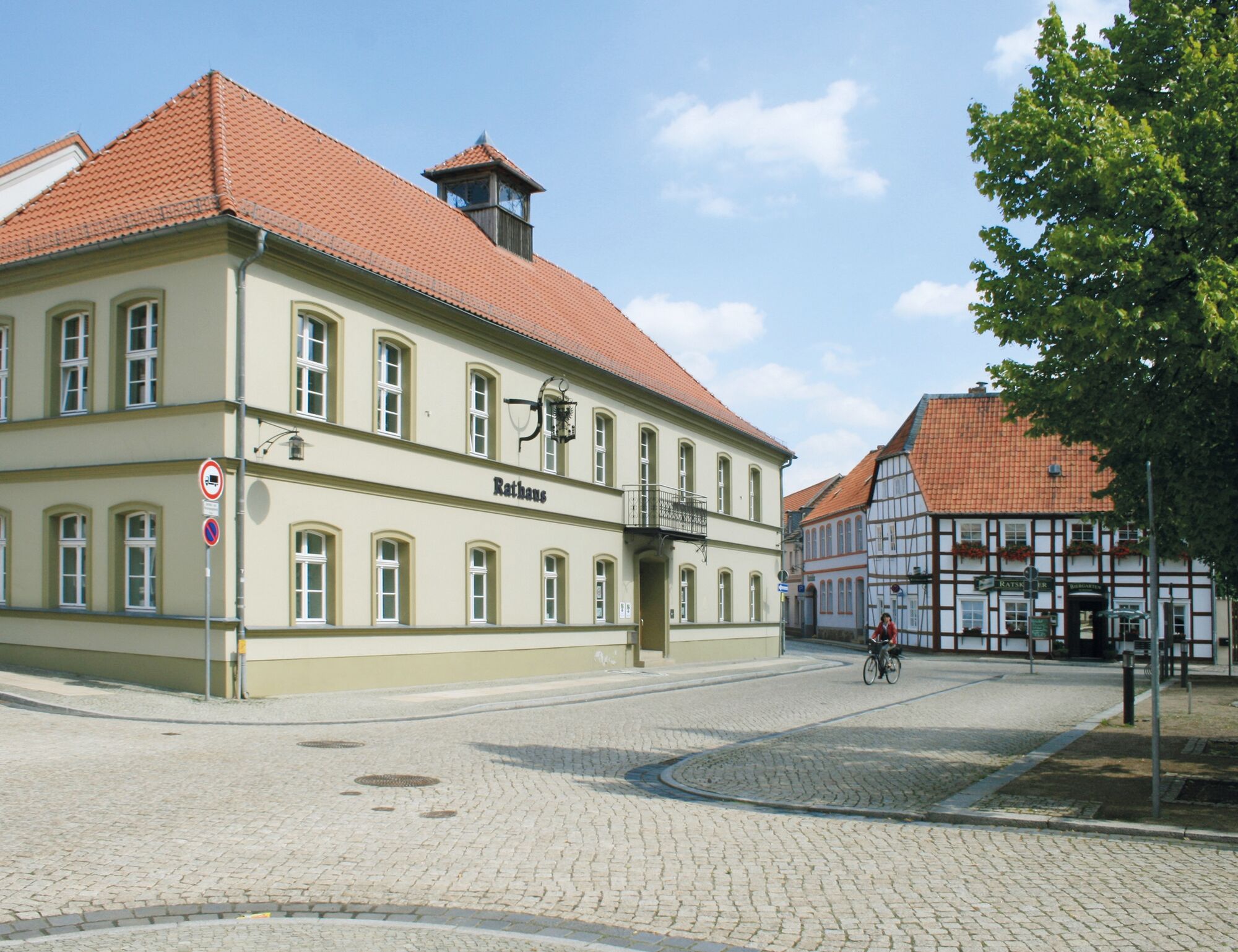
From Burgstraße you step onto the Kleine Markt with the town hall, whose current appearance is largely defined by renovations and expansions from 1879 and 1905. Originally there was a Gothic council cellar here, which, like the town hall on the church square, was destroyed during the Thirty Years' War and again in the devastating city fire of 1761, leading to the decision in 1771 to build a new town hall with a council cellar at the current location.
Over the Großer Markt, we reach the city and district library. The impressive residential building erected at the end of the 18th century initially served as an elementary school after being purchased by the Osterburg magistrate in 1834. Entering Werbener Straße, you find yourself in the area of the former “Alte-Stadt-Tor” (Old City Gate). Here, in 1859, after relocating from Gardelegen to Osterburg, the first building of the Royal Teacher Seminary was constructed. The complex, now part of the Markgraf-Albrecht-Gymnasium, was expanded with a generous annex in 1888 and by the addition of a dedicated seminar practice school on the Wallpromenade in 1909. On the schoolyard is a remnant of the Osterburg city wall largely demolished in the 19th century.
A few steps further, we enter the eastern Wallpromenade. After leveling the ramparts and establishing the promenade around 1800, houses began to be built here from the mid-19th century. Next to the former seminar practice school is the former residence of August Huchel, pioneer of German asparagus cultivation and founder of the German Asparagus Breeding Society (1929), worthy of a pause. On the southern Wallpromenade stands the Catholic Church St. Josef since 1928, featuring remarkable artistic furnishings from the 1960s.
The name Hilliges-Platz commemorates August Hilliges, who as mayor of Osterburg (1888–1920) earned lasting merits, especially for the commercial development of the city. In the area of the former Stendaler Gate, we enter Blumenstraße, whose course also follows the former city fortifications. Entering Poststraße, laid out only from 1913 onwards, concludes the circuit around the former old town.
Those who wish can continue the extended city walk, which initially leads northwest to the Biesebad. The bath, existing since the late 19th century, is one of the last still operated river baths in Germany. The adjacent Werderwiesen have served as a skating area for young and old for more than a hundred years in winter. Over the Schwiegermutterbrücke you reach Krumker and from there Seehäuser Straße. Both street sections were created during the 19th-century city expansion, which here never reached the same extent as in the southern and western city parts. Over the Biesebrücken and the Biese Island with the warehouse of the former water mill, we re-enter the area of the medieval northern city gate. Through Bergstraße and Werbener Straße past the Markgraf-Albrecht-Gymnasium, our extended tour leads to the chapel St. Martin. Its predecessor was probably the first church of the earliest urban settlement of Osterburg, likely protected by the nearby castle rampart (circa 11th century). Over the cemetery with its old trees and through Gartenstraße, you reach Schillerplatz, where in 1908 the Schiller monument, financed by a donation from former seminary director Heinrich Eckholt and created by Gottlieb Elster, was unveiled. After World War I, a monument for the fallen seminarians was also erected here. At the corner of Puschkinallee-Bahnhofsallee is the building of the preparatory institute, founded already in 1860 to improve the education of prospective seminarians, built in 1899.
Past the main station building (1901/02) and the former Hotel Berliner Hof (1895), you enter Bahnhofstraße. In this area between the station, Lindenstraße and Stendaler Chaussee, systematic city expansion began in the 1860s, resulting from commercial upswing triggered by the construction of the Magdeburg-Wittenberge-Hamburg railway line and the Stendal-Wittenberger Chaussee in the 1840s. At the intersection with Hainstraße, you reach the complex of the Lorenz’schen Pädogogium, another formerly private teaching institute (1893/94), serving as a public school since 1918. Through the extended Hainstraße and over the Wilhelmshain, laid out in 1875/76, you reach the former provincial institution for the deaf and mute. Founded in 1864, the institute moved into this new building in 1890/91. In today’s Thälmannstraße, the former Woltersdorff teaching institutes point to another chapter of Osterburg school history. The private school with a pro-gymnasium character was founded in 1863 by establishing a boys' school and received its first own building, the red brick building, in 1868. Between 1871 and 1874, it was expanded by a higher daughters' school on Bahnhofstraße, with two more buildings added later in Thälmannstraße.
From there, it is just a few steps to the former Hospital St. Georg, built here already in 1681. Its present form is largely due to an extensive structural renewal in 1863/64. At the corner of Lindenstraße is the district parliament building, erected in 1892/93, which was the seat of the district administration until the district of Osterburg was dissolved in 1994. From there, the tour leads back towards the old town. At the intersection of Bismarker Straße, the former post office building from 1889 and the opposite commercial building from the late 19th century form a distinctive corner location. With Breite Straße, we enter the old town again. Its character is still largely determined by residential and commercial buildings from the late 19th and early 20th centuries, including former restaurants and hotels.
Tak
No special equipment necessary. Good footwear is recommended.
Via federal highway B189 to Osterburg, exit Osterburg Zentrum, Wasserstraße 12
Coordinates for navigation systems 52°47'24.3"N 11°45'13.0"E
The Hanseatic city of Osterburg is accessible by bus and train. Distance from station to Nicolaikirche approximately 650m
Possible in the immediate vicinity of Nicolaikirche
Flyer "Historic City Walk"
Further information on the websites of the Hanseatic city of Osterburg at
City information Osterburg
Großer Markt 10
39606 Hanseatic city Osterburg (Altmark)
Tel. 03937 89 50 12
Enjoy stations on the extended tour in the former outer area of the city, including ensembles of urban development from the 19th and 20th centuries
Popularne wycieczki w okolicy
-
Seehäuser Försterweg through Barsberge
ciężkiWędrówka 7,78 km -
Altmark circular route: From the Hanseatic city of Seehausen to the Hanseatic city of Havelberg
średniJazda na rowerze 70,4 km -
Von Roland zu Roland: Steinerne Wächter & lebendige Städte
ciężkiJazda na rowerze 80,2 km -
Archäologisch-Historischer Ortsrundgang Bretsch
Trasa tematyczna 2,62 km -
Tour 6: Barock-Kirchen-Tour mit kunstvollen Glasmalereien in der Altmark
ciężkiJazda na rowerze 134,9 km -
Tour 2: Kulturgenuss entlang der Elbe: Kirchenspezialitäten entdecken
średniJazda na rowerze 69,4 km -
Mehrin - Leichenhalle - Kirche - Bretsch
średniJazda konna 22,9 km -
Seehausen - St. Nicolai - Dorfkirche Dobbrun - St. Peter und Paul
średniDroga rowerowa 46,3 km -
Osterburg - Dorfkirche Dobbrun - Galgenberg - St. Nicolai
średniMountainbike 32,4 km -
Dequede - Hubertusquelle - Polkern - Krevese
światłoMountainbike 17,3 km

Wędrówki i tropienie


Nie przegap ofert i inspiracji na następne wakacje
Twój adres e-mail została dodana do listy mailingowej.





