







Wine hike: Herxheim am Berg - Himmelreichweg

Easy walk through the vineyards and the village of Herxheim am Berg with a rest option in the castle garden, the "balcony" of the Wine Route.

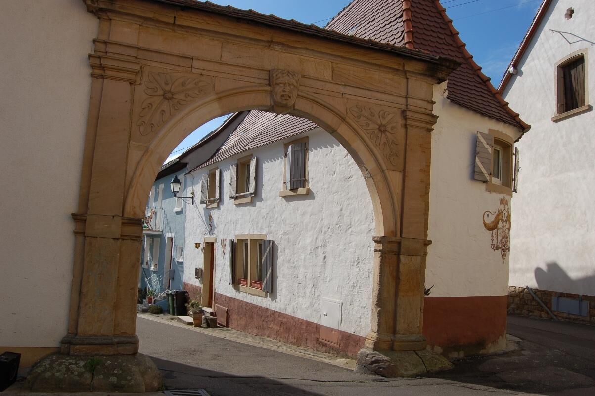
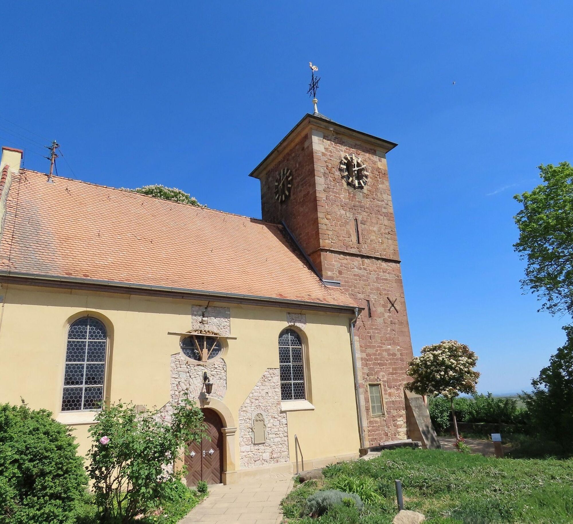

From the town center at "Kerweplatz" along Weisenheimer Straße to the traffic light intersection at B 271. Cross it, walk 50 meters left along Weinstraße, then turn right into Friedhofstraße. The Pfaffenhoftor is on the left. You go through the gate and through the "Pfaffenhof", then turn left to St. Jakob Church. Next to it, take your time in the castle garden and enjoy the wonderful view from one of the benches under old trees. At the other end of the castle garden, go through the gate onto Friedhofstraße and turn right. After about 200 meters, turn right again and then immediately left. You cross the road between Freinsheim and Herxheim and continue along the path below the old fortification wall about 400 meters downhill to the south towards Kallstadt. Now turn right and again after 200 meters. Here, continue for a further 200 meters again directly towards Herxheim. All the time, you have a good view of the remains of the formerly stately fortifications of the village. Near the road, turn left and carefully cross Weinstraße below the village entrance (no crossing aid). You go up the access road of the parking lot of the wine cooperative, turn left, and 50 meters after the parking lot turn right again. At the first junction, turn right onto Raiffeisenstraße. Here right and immediately left into "Am Felsenberg." Through "Im Eulengeschrei," you reach Weisenheimer Straße again and the starting point of the route.
Tak
Non-slip footwear and weather-appropriate clothing.
The path often runs on so-called agricultural roads. These serve agricultural use and are used all year round by tractors and harvesting machines. Please note that using the paths is at your own risk, and we ask cyclists, hikers, and vintners to show mutual consideration for the sake of everyone. The agricultural roads may be dirty due to agricultural traffic. After rainy days and especially in winter, the paths can be wet and slippery.
From the north: via the A61 motorway at the Frankenthal interchange onto A6 towards Kaiserslautern. Exit Grünstadt/Deutsche Weinstraße. Continue on B271 (German Wine Route) towards Bad Dürkheim, exit Herxheim am Berg.
From the south: via the A61 motorway at the Ludwigshafen interchange onto A650 towards Bad Dürkheim. At the end of the motorway, continue on B37. Pass the Bruch industrial area, next traffic light turn right to Ungstein. At the roundabout take the 3rd exit into the village. After about 50 m turn right onto B271 (German Wine Route) towards Grünstadt.
Herxheim am Berg train station, regular connections via Freinsheim from the Rhine-Neckar Triangle, from Neustadt/Weinstraße and Bad Dürkheim as well as from Grünstadt. Timetable information: http://www.vrn.de
About 400m walk from the train stop, slightly uphill to the town center; go straight at the intersection. The village/"Kerweplatz" is immediately on the right side of the street.
Village/"Kerweplatz," Weisenheimer Straße in the town center or parking lot at the cemetery in Friedhofstraße
Freinsheim holiday region, i-point Kallstadt, Tel: 06322/667838, www.urlaubsregion-freinsheim.de
After the walk, the Herxheim gastronomy is open for refreshments.
Popularne wycieczki w okolicy
-
4,0
Ganerbenweg - Premium circular hiking route in the Freinsheim holiday region
średniWędrówka 10,5 km -
4,5
From Deidesheim over the Heidenlöcher to Eckkopf
średniWędrówka 14,6 km -
Wachenheim - Eckkopf - Heidenlöcher - Wachenheim
średniWędrówka 12,8 km -
4,5
Wachenheimer Valleys Route to Oppauer Haus
średniWędrówka 11,7 km -
4,8
Zum Saupferch - Jägerthal - Drachenfels - Lambertskreuz
średniWędrówka 10,1 km -
5,0
Circular route through forest and vineyard: Weisenheim am Berg - "Wine, Forest, Ungeheuer"
średniWędrówka 12,5 km -
3,5
Thomas‘ Waldweinstube über die Wachtenburg
światłoWędrówka 4,81 km -
5,0
Leininger Castle Trail - Premium hiking trail with audio and video stations
ciężkiWędrówka 22,3 km -
3,5
Leininger Monastery Trail - Premium hiking trail with audio and video stations
średniWędrówka 15,3 km -
Palatinate Wine Steig Stage 03 Bad Dürkheim - Deidesheim
średnidługodystansowy szlak pieszy 15,2 km
Wędrówki i tropienie


Nie przegap ofert i inspiracji na następne wakacje
Twój adres e-mail została dodana do listy mailingowej.





