


Tour D of the PWV Rodalben
Poziom trudności: T2
Zdjęcia naszych użytkowników
-

 © Katja SenkelUtworzono dnia 07.03.2026
 -
 © Katja SenkelUtworzono dnia 07.03.2026
 -
 © Katja SenkelUtworzono dnia 07.03.2026
 -
 © Katja SenkelUtworzono dnia 07.03.2026
 -
 © Katja SenkelUtworzono dnia 07.03.2026
 -
 © Katja SenkelUtworzono dnia 07.03.2026
 -
 © Katja SenkelUtworzono dnia 07.03.2026
 -
 © Katja SenkelUtworzono dnia 07.03.2026
 -
 © Katja SenkelUtworzono dnia 07.03.2026
 -
 © Katja SenkelUtworzono dnia 07.03.2026
 -
 © Katja SenkelUtworzono dnia 07.03.2026
 -
 © Katja SenkelUtworzono dnia 07.03.2026
 -
 © Katja SenkelUtworzono dnia 07.03.2026
 -
 © Katja SenkelUtworzono dnia 19.09.2025
 -
 © Katja SenkelUtworzono dnia 19.09.2025
 -
 © Katja SenkelUtworzono dnia 19.09.2025
 -
 © Katja SenkelUtworzono dnia 19.09.2025
 -
 © Katja SenkelUtworzono dnia 19.09.2025
 -
 © Katja SenkelUtworzono dnia 19.09.2025
 -
 © Katja SenkelUtworzono dnia 19.09.2025
 -
 © Katja SenkelUtworzono dnia 19.09.2025
 -
 © Steph119Utworzono dnia 18.05.2025
 -
 © Steph119Utworzono dnia 18.05.2025
 -
 © Steph119Utworzono dnia 18.05.2025


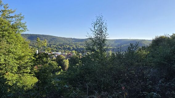
This extremely varied circular route offers on nearly 10 kilometers everything that a hiker’s heart desires: magnificent nature park mixed forests, wildly romantic valleys and streams, impressive landscape...
UFFBASSE! - Campaign for considerate coexistence in nature
Fire & Smoking - Making fires, smoking and grilling are strictly forbidden in the forest and must be absolutely avoided! Fires and thus great damage to nature and wildlife can only be prevented this way.
Being considerate while out - Always behave in a forward-looking, friendly and considerate way towards everyone you meet along the way.
Nature conservation - Stay on designated paths and avoid unnecessary noise when you are out in nature. Leave the forest at dusk at the latest so as not to disturb the rhythm of nocturnal animals.
Picnic & Waste - Bring a garbage bag for the way and take waste back home. Use only furnished rest areas for breaks and picnics.
Leash dogs - Please always keep your dog on a leash. Other visitors and animals will thank you.
More information at: www.pfalz.de/uffbasse
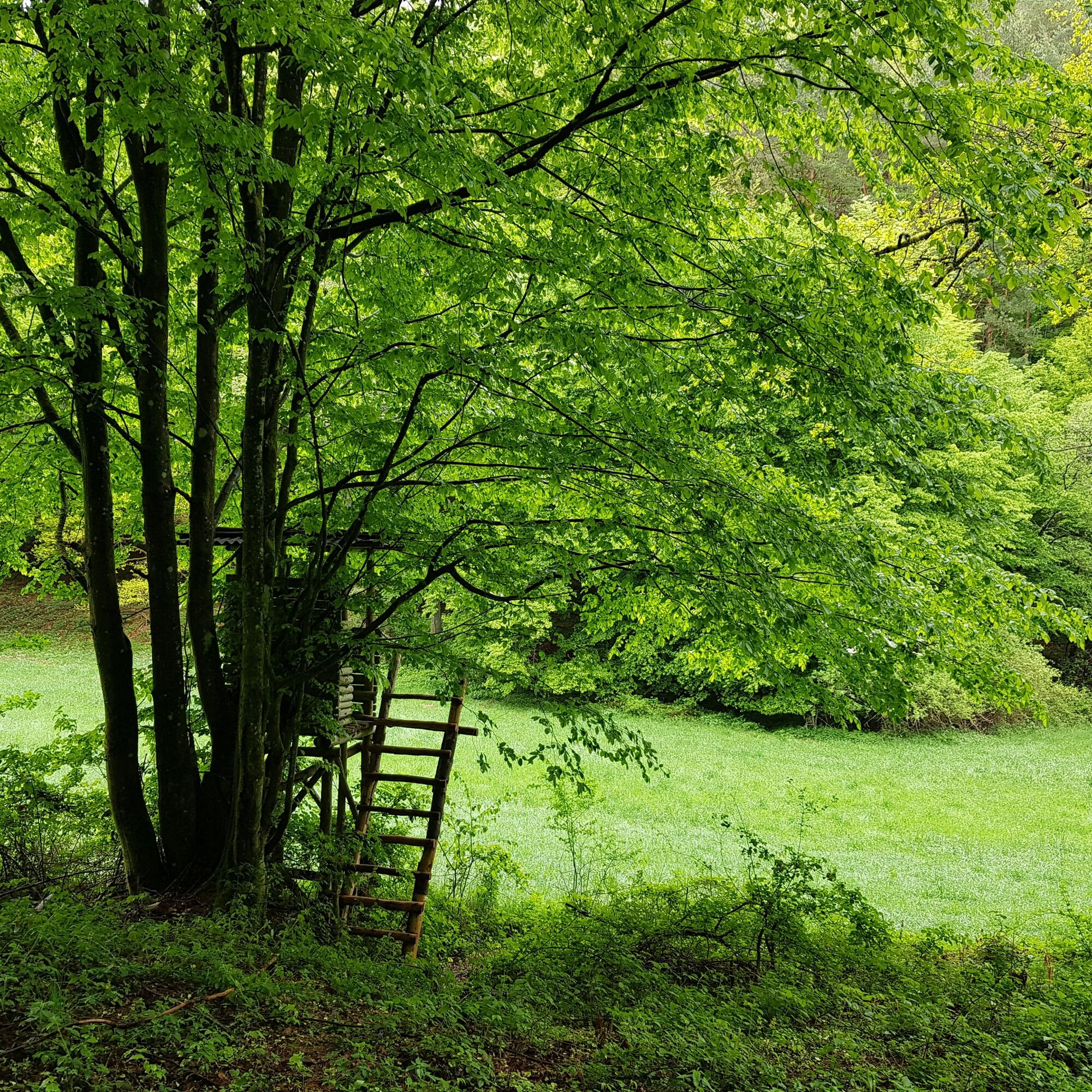
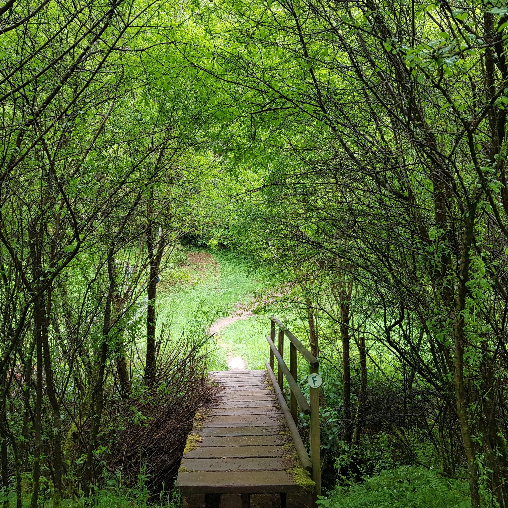
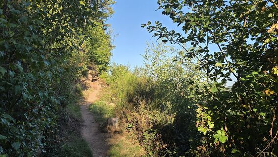
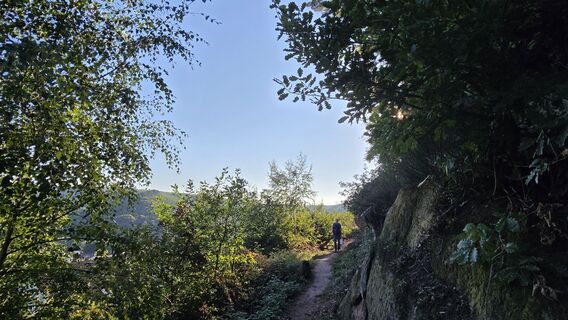
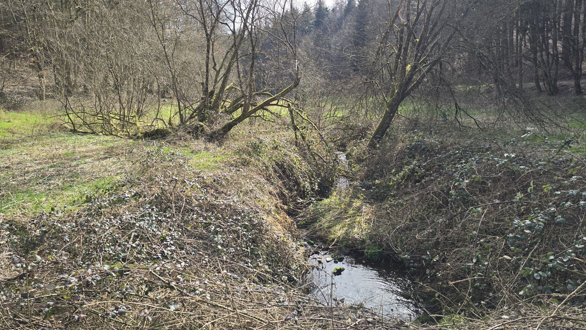
At the forest parking lot, turn right heading northeast. After about 400 meters, you cross the well-known Rodalber rock hiking trail and after another 300 meters descend into the romantic Clauser Valley. You cross this to climb gently on the opposite side. After about 200 meters, keep left at the fork and shortly afterwards cross - among other things over a small bridge - the meadow valley with its fallow deer enclosure. If you are lucky, you can observe the shy wild animals in their natural environment here.
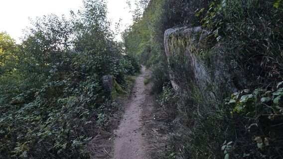
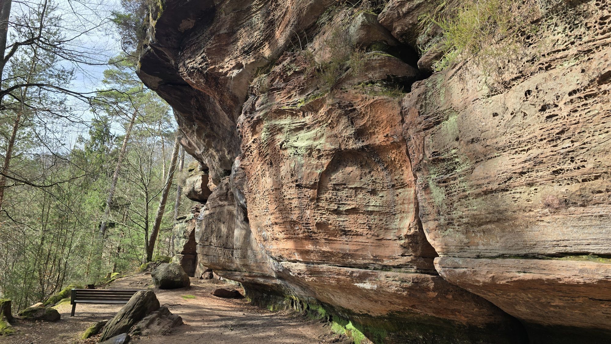
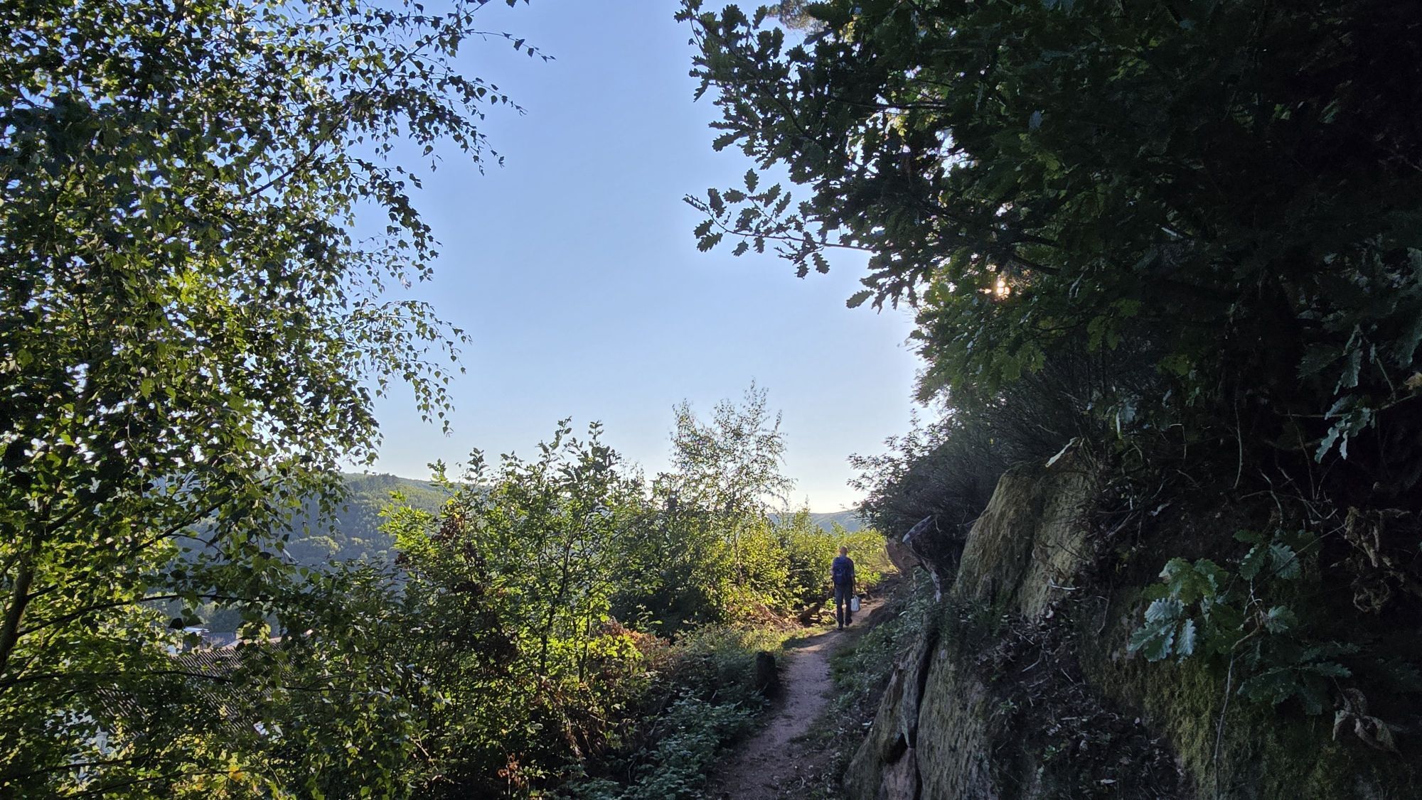
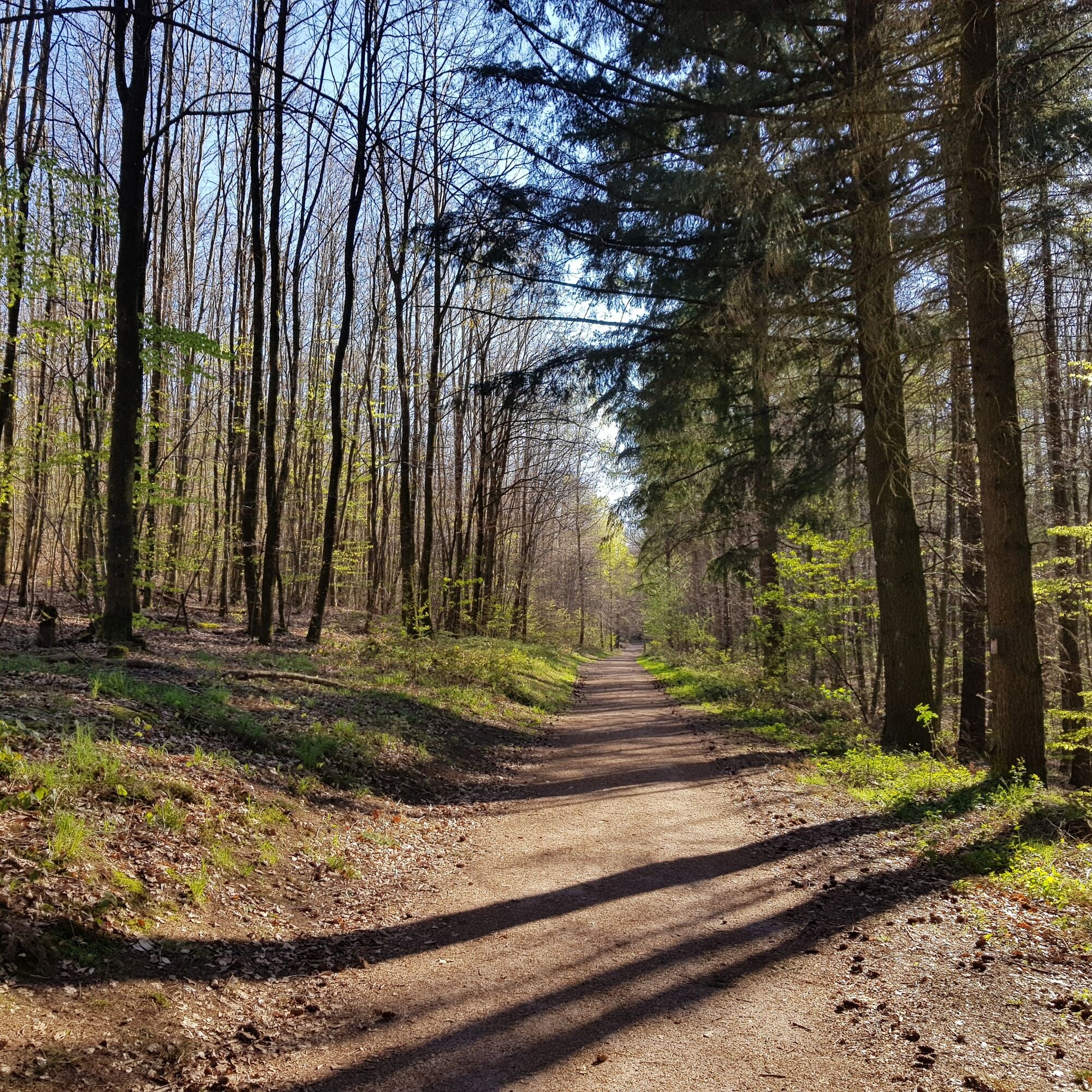
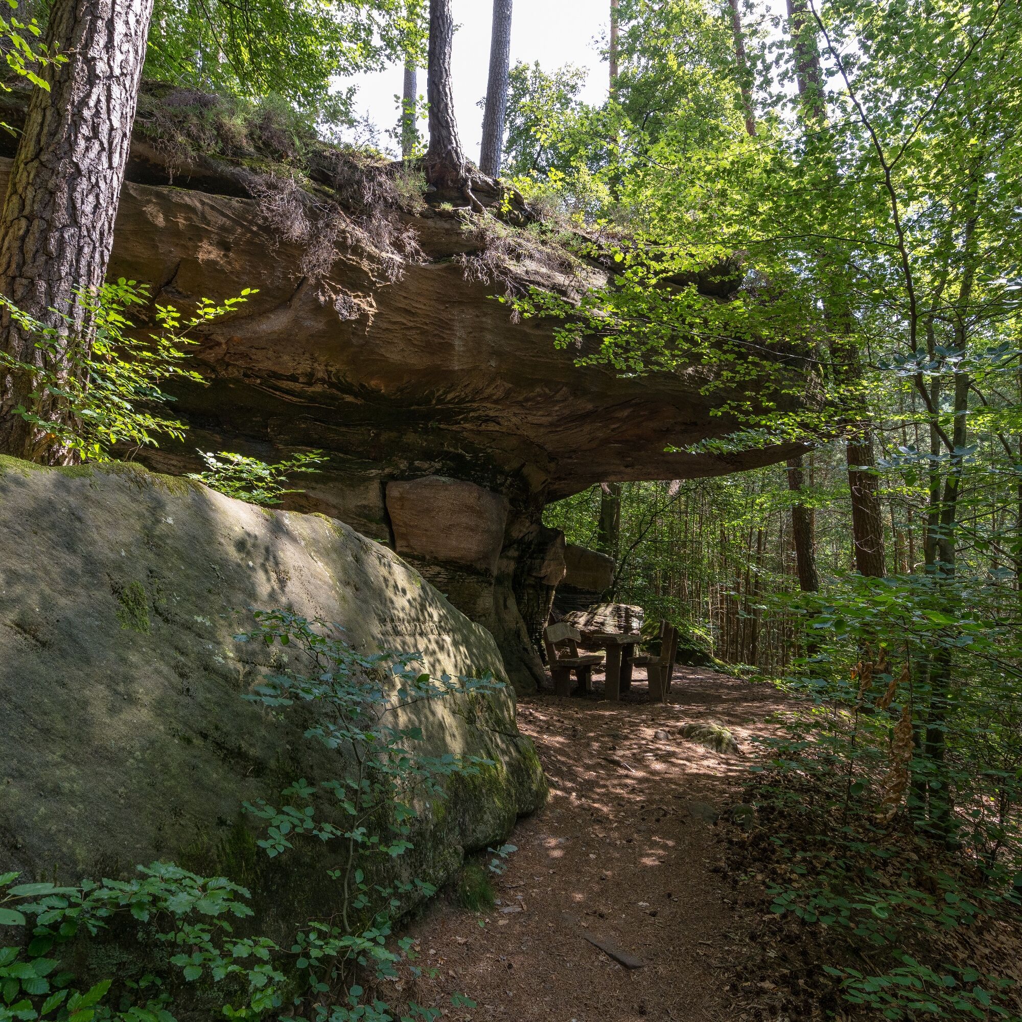
On a beautiful section of the Rodalber rock hiking trail, which, by the way, took an excellent second place in 2022 in the category of multi-day routes in the Wandermagazin's vote for Germany's most beautiful hiking trail, you continue - past the Eisenbärchen rocks - for about 800 meters to the Kuhfelsen, where you can rest and relax at one of the cozy seating areas just like herders used to do in former times.
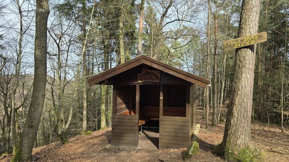
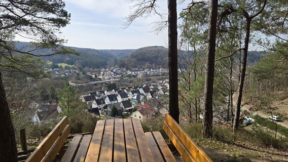
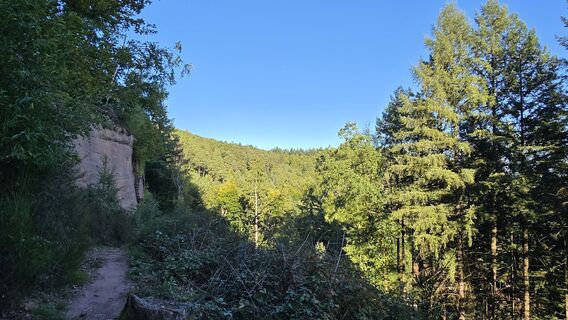
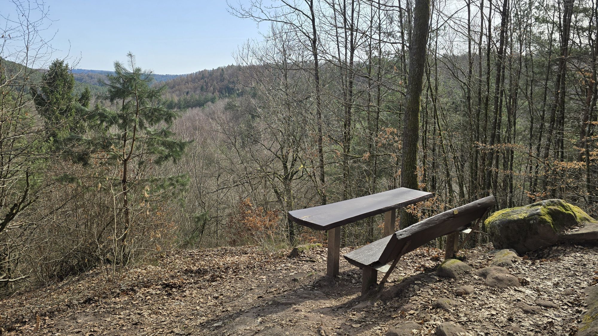
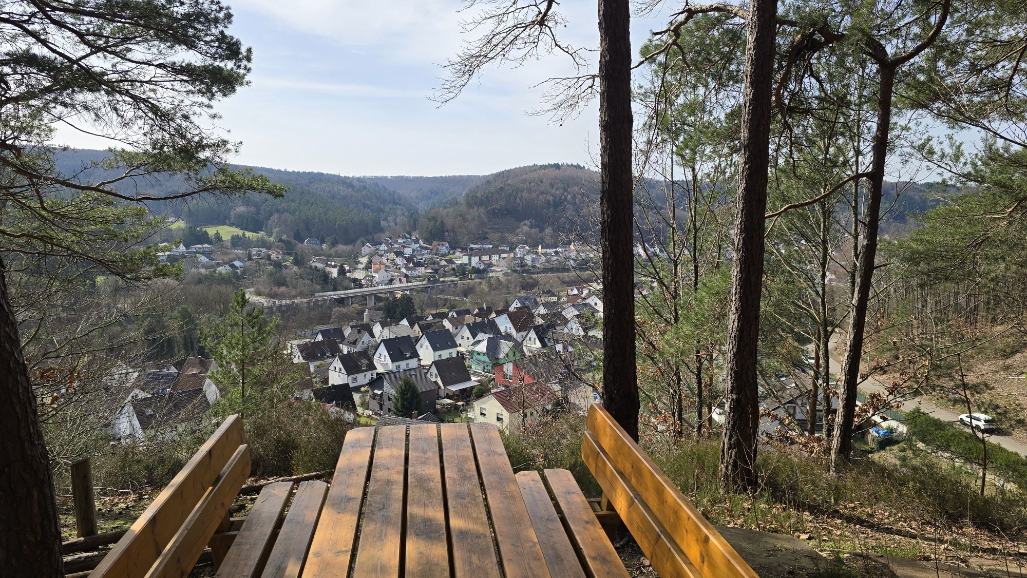
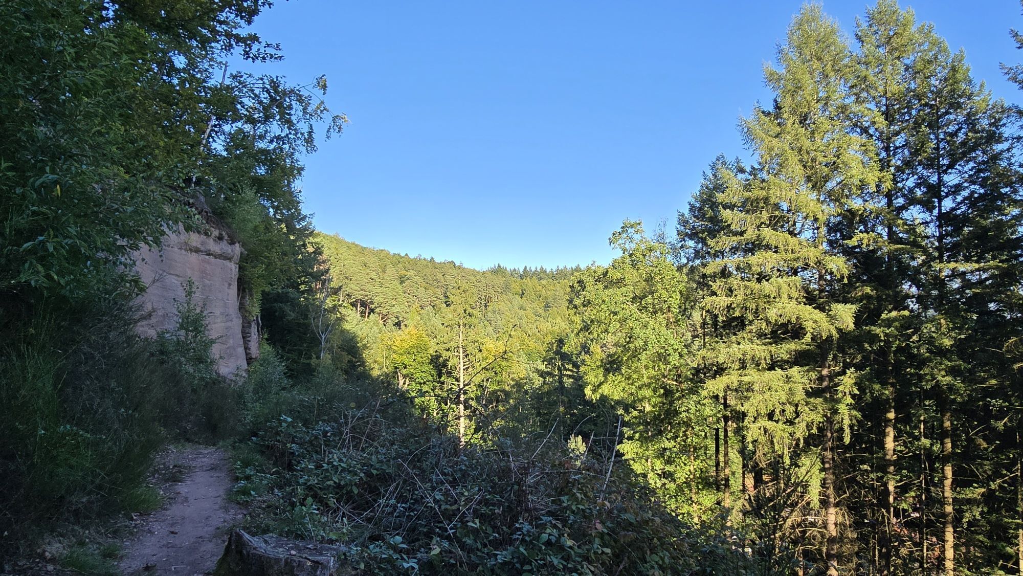
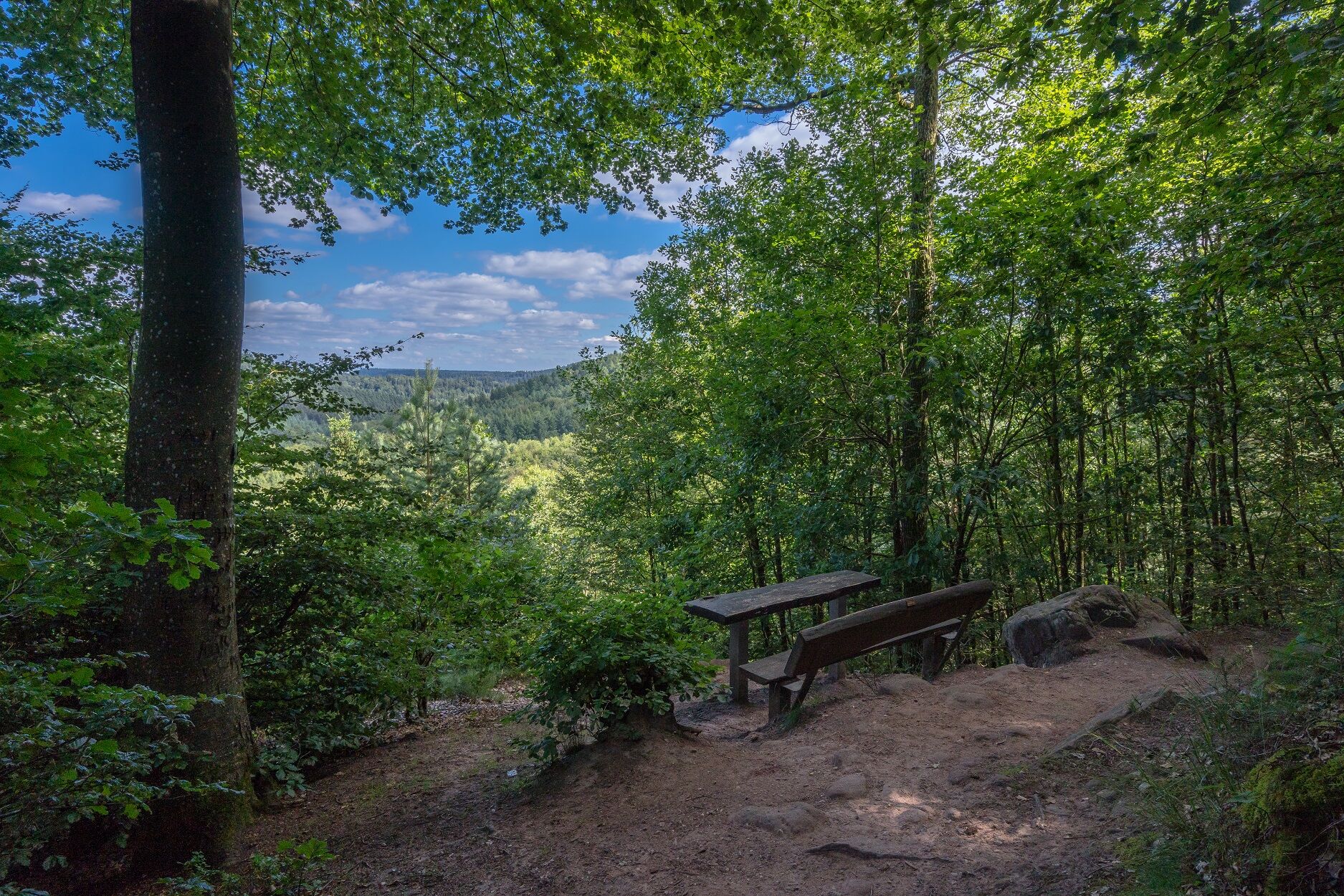
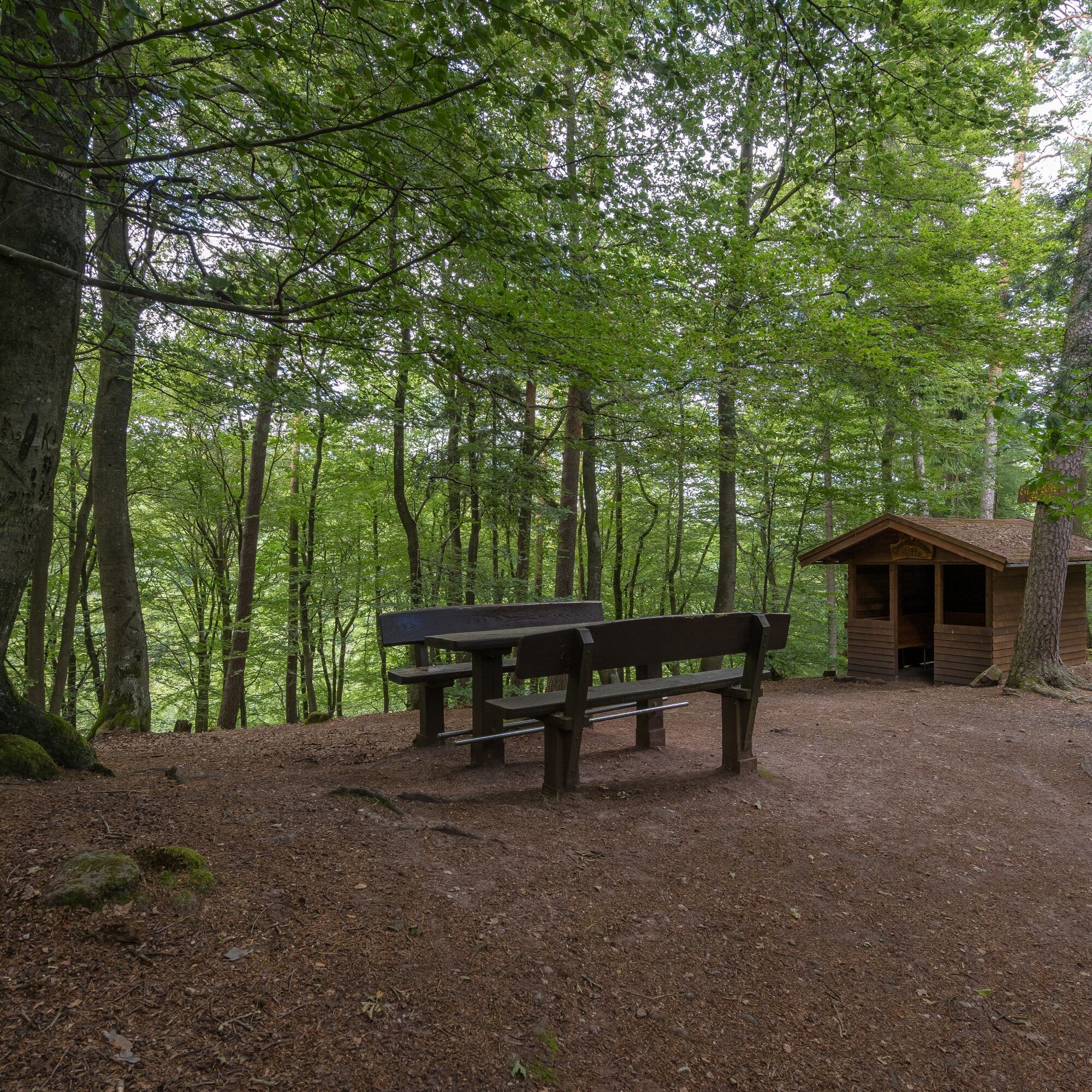
Continuing on the rock hiking trail, you first climb steadily, then proceed relatively flat past various rocks and springs. Here - away from all roads and traffic routes - enjoy absolute peace. After about 2,600 meters, you finally reach the Gipfelstürmer hut with its various seating options and shortly afterwards the Gipfelstürmer seating area with a beautiful view of the Clauser Valley. Both are wonderful places to rest, linger, and relax.
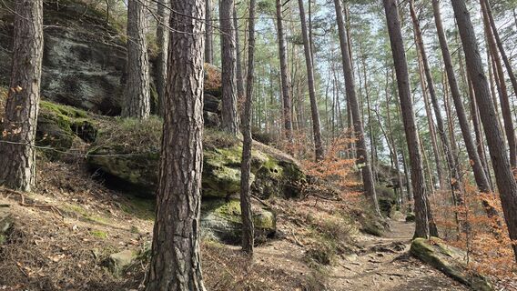
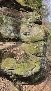
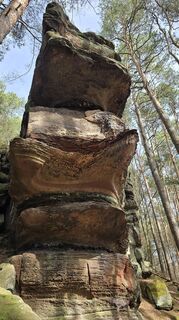
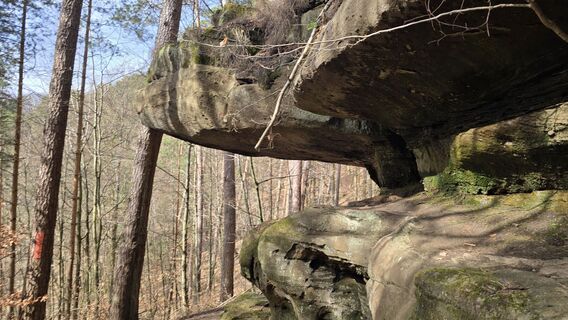
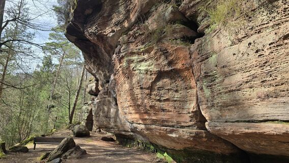
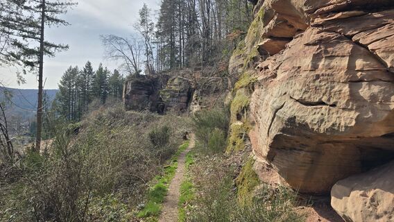
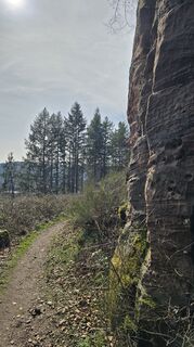
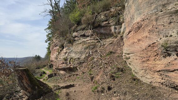
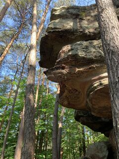
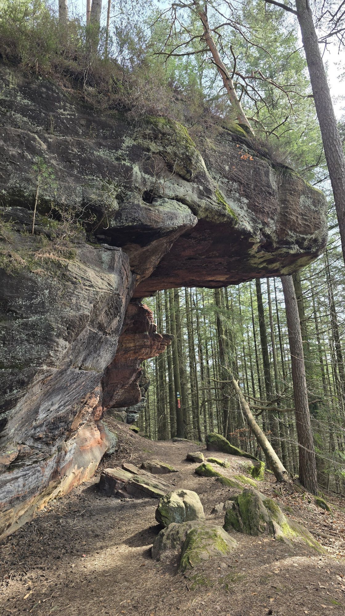
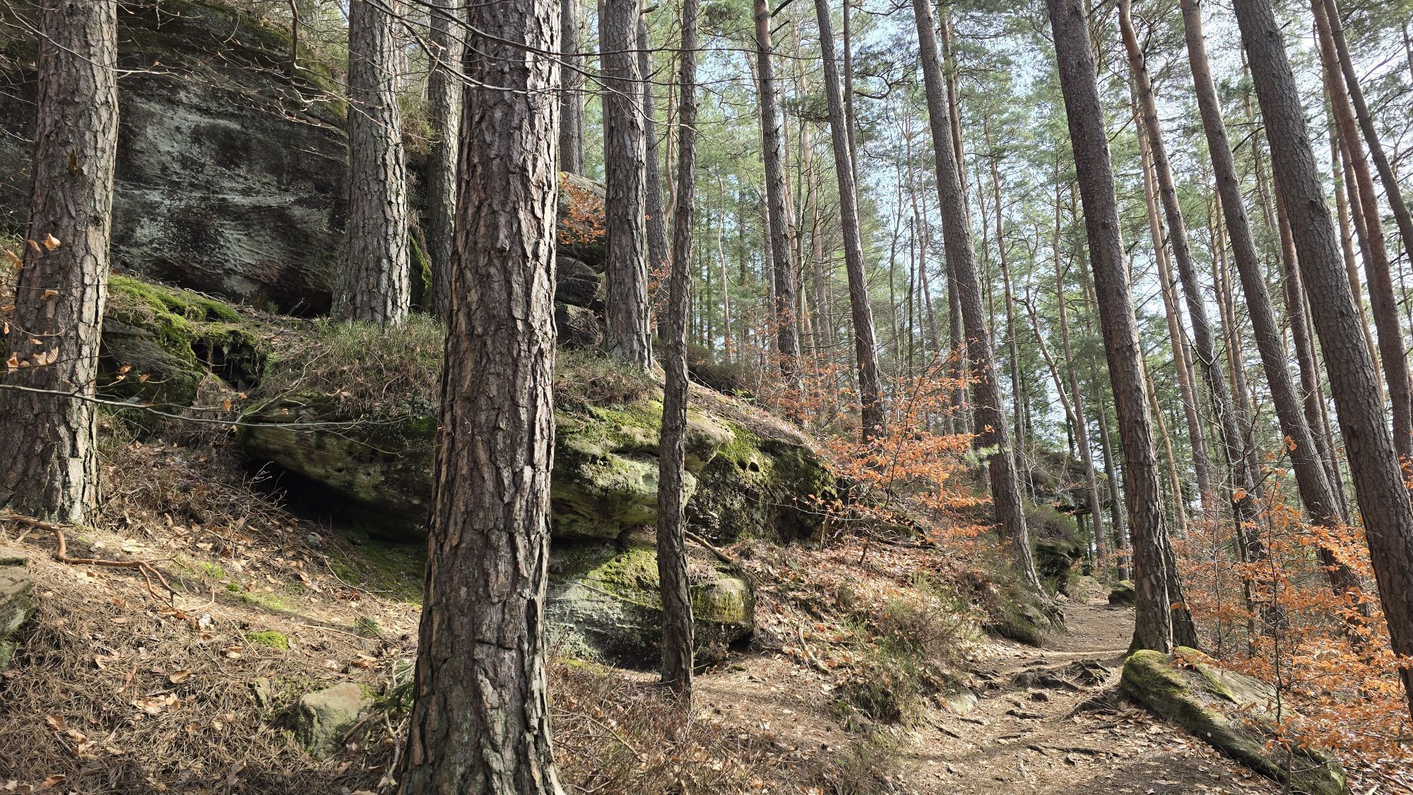
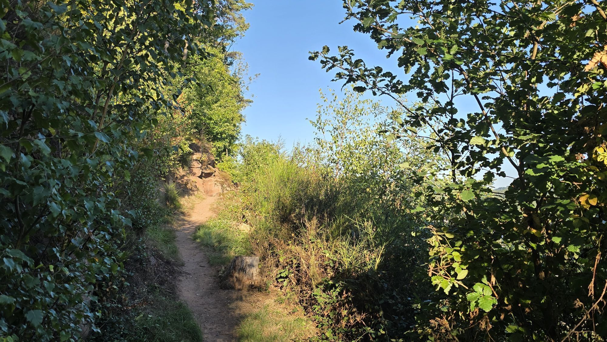
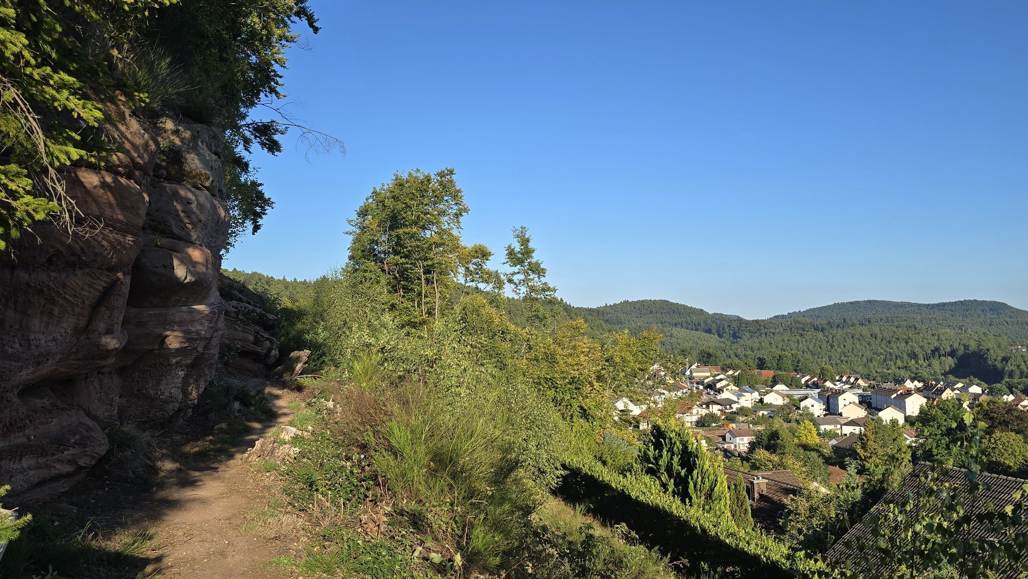
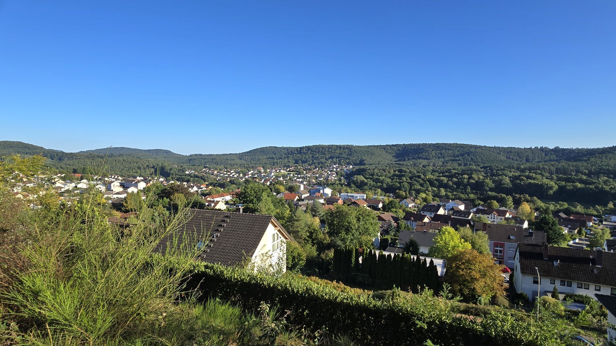
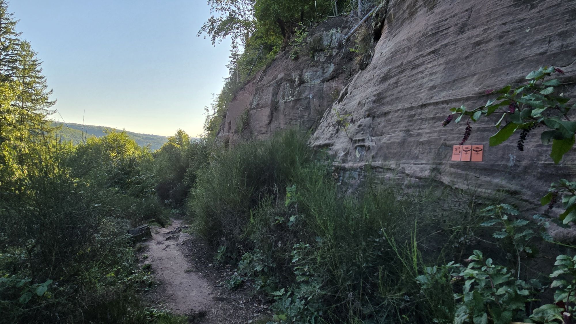
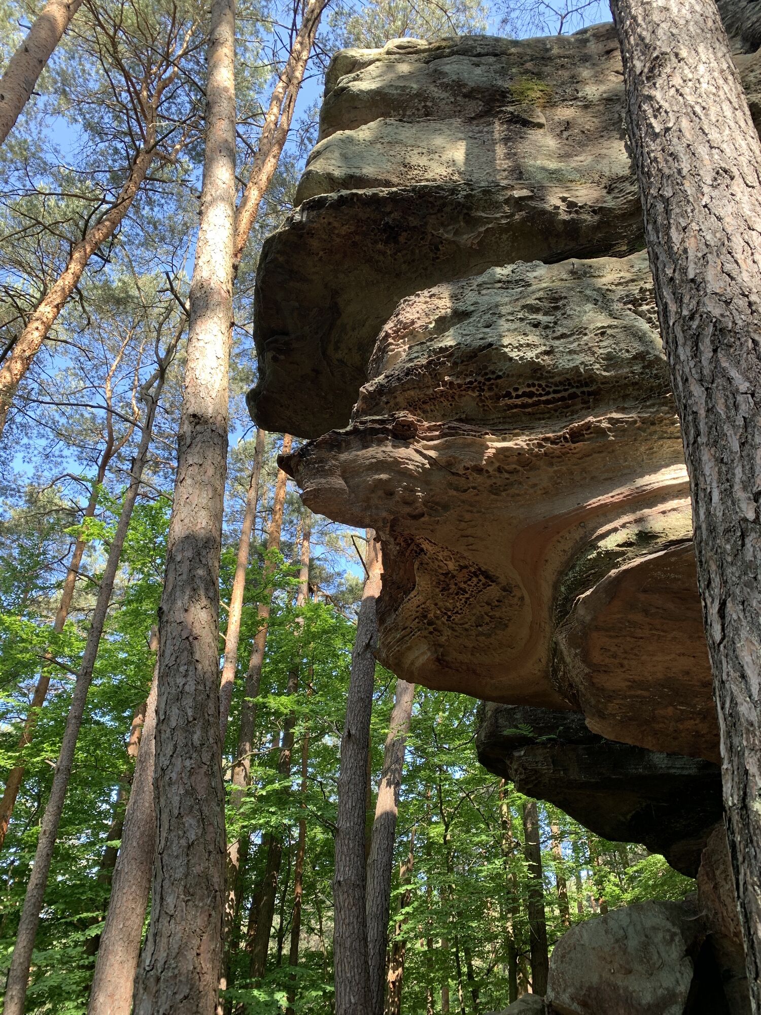
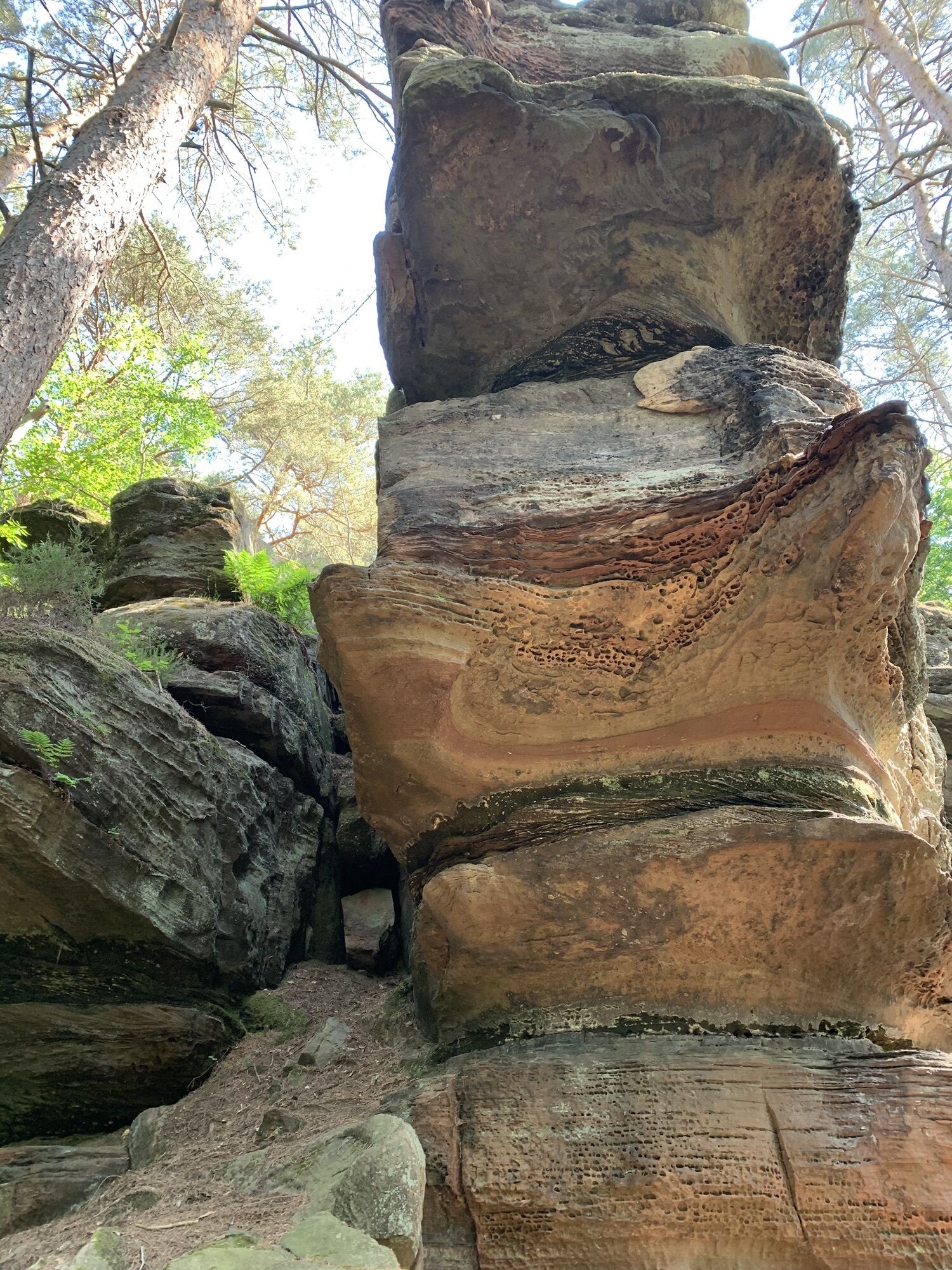
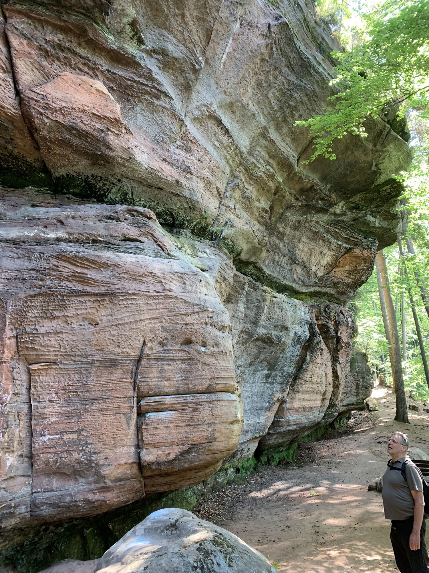
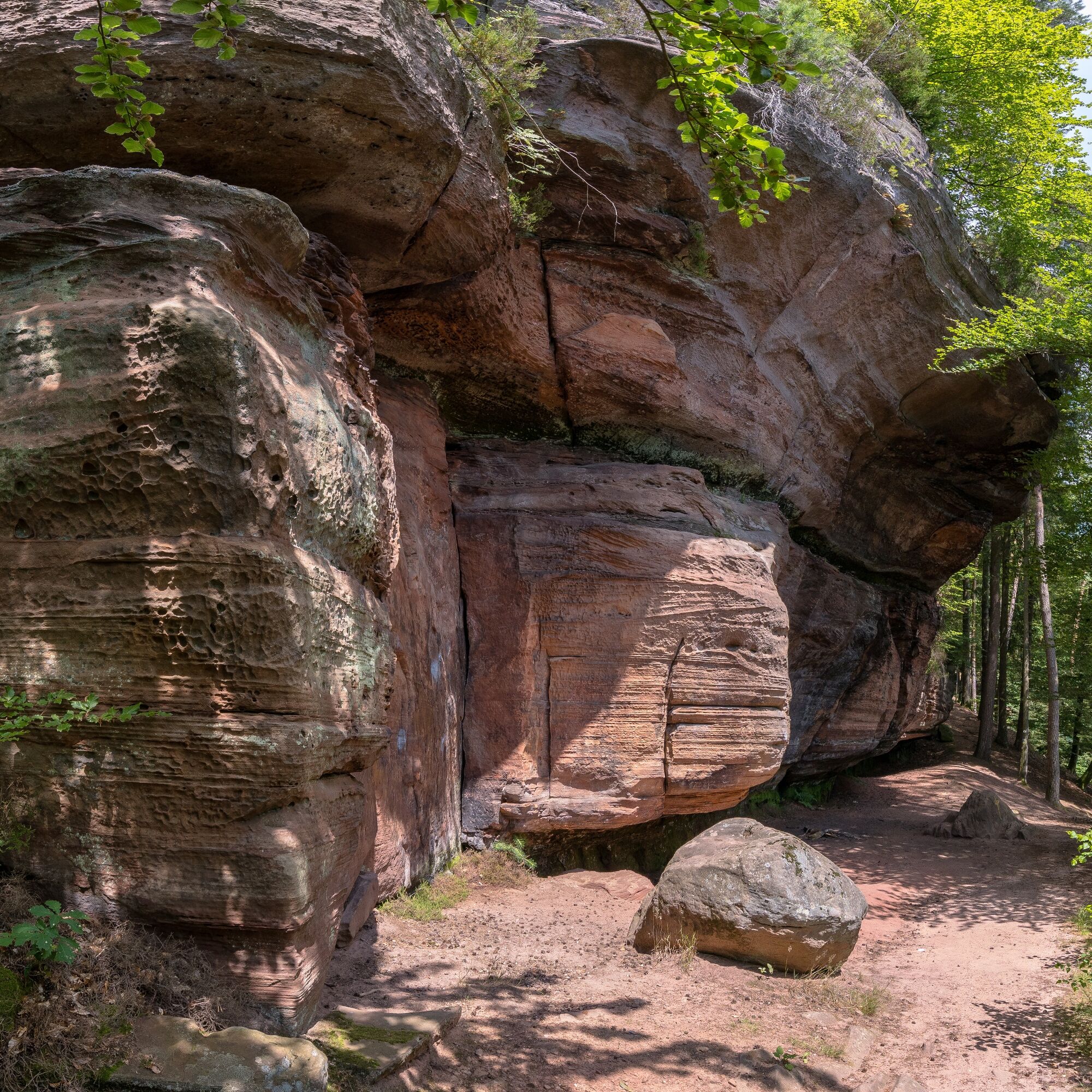
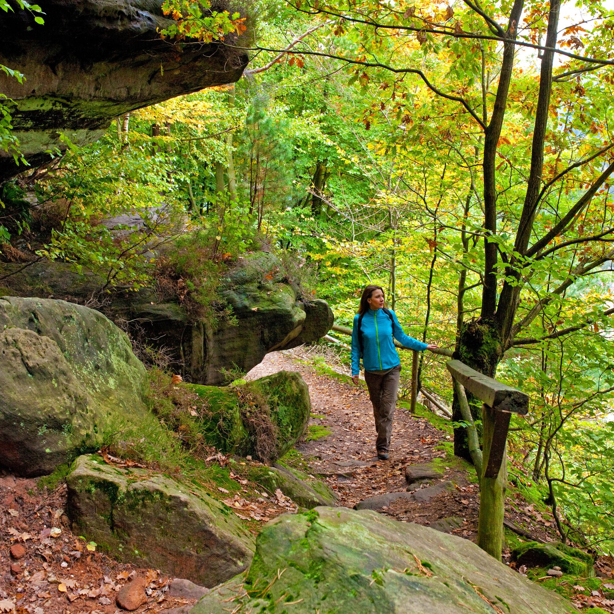
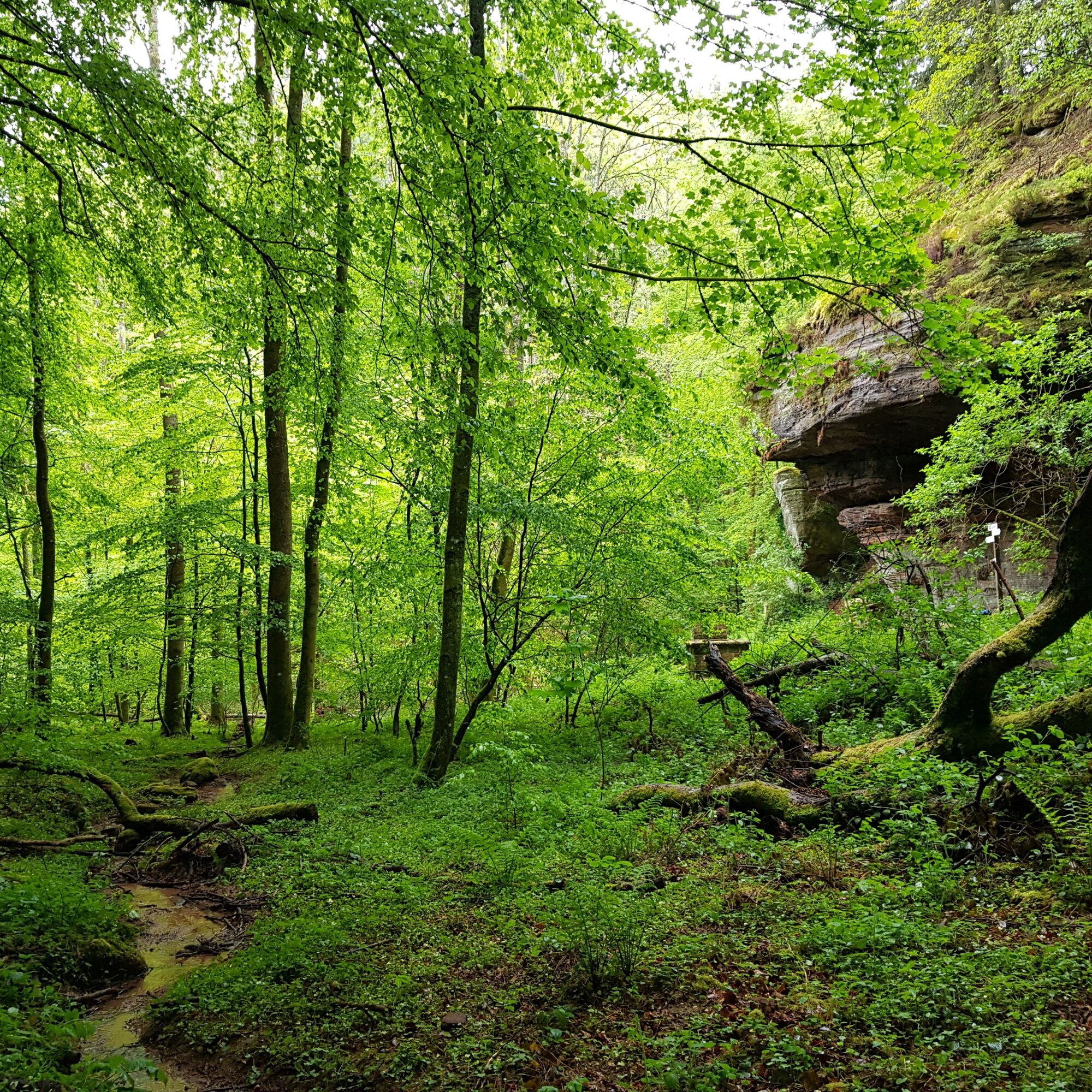
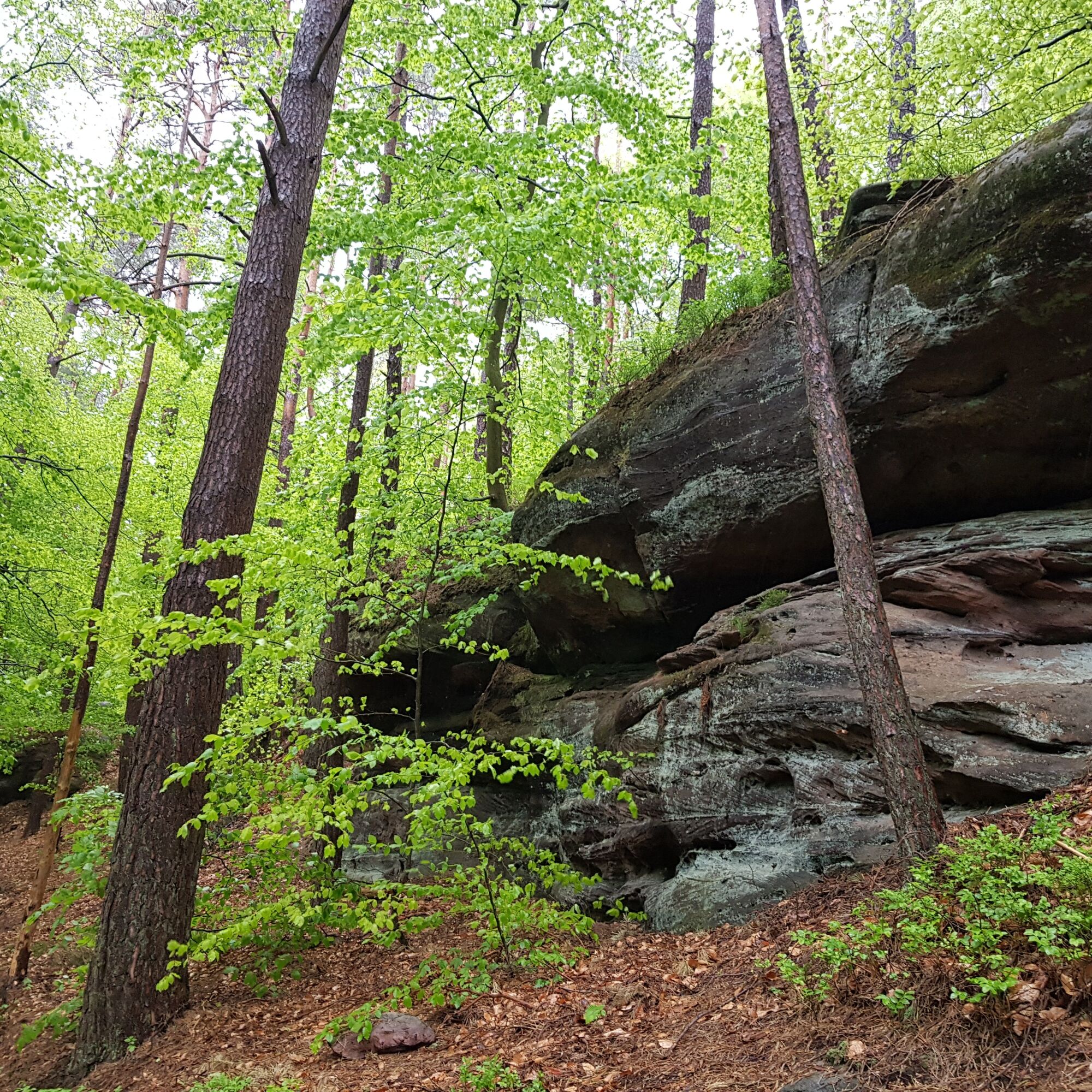
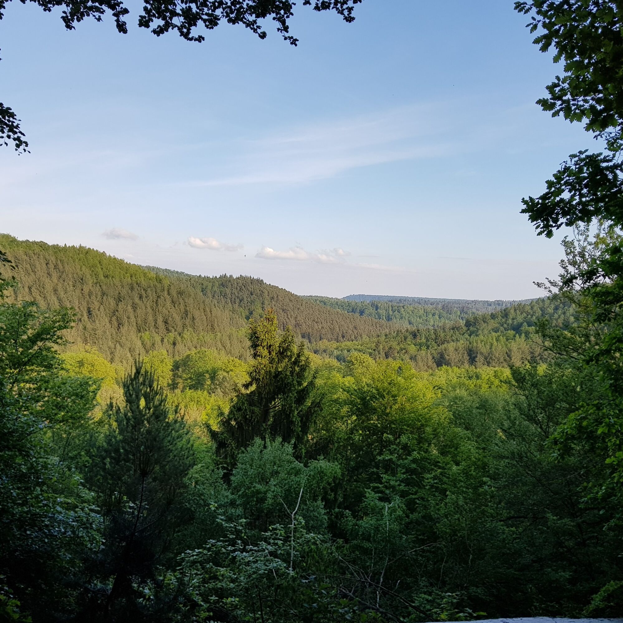
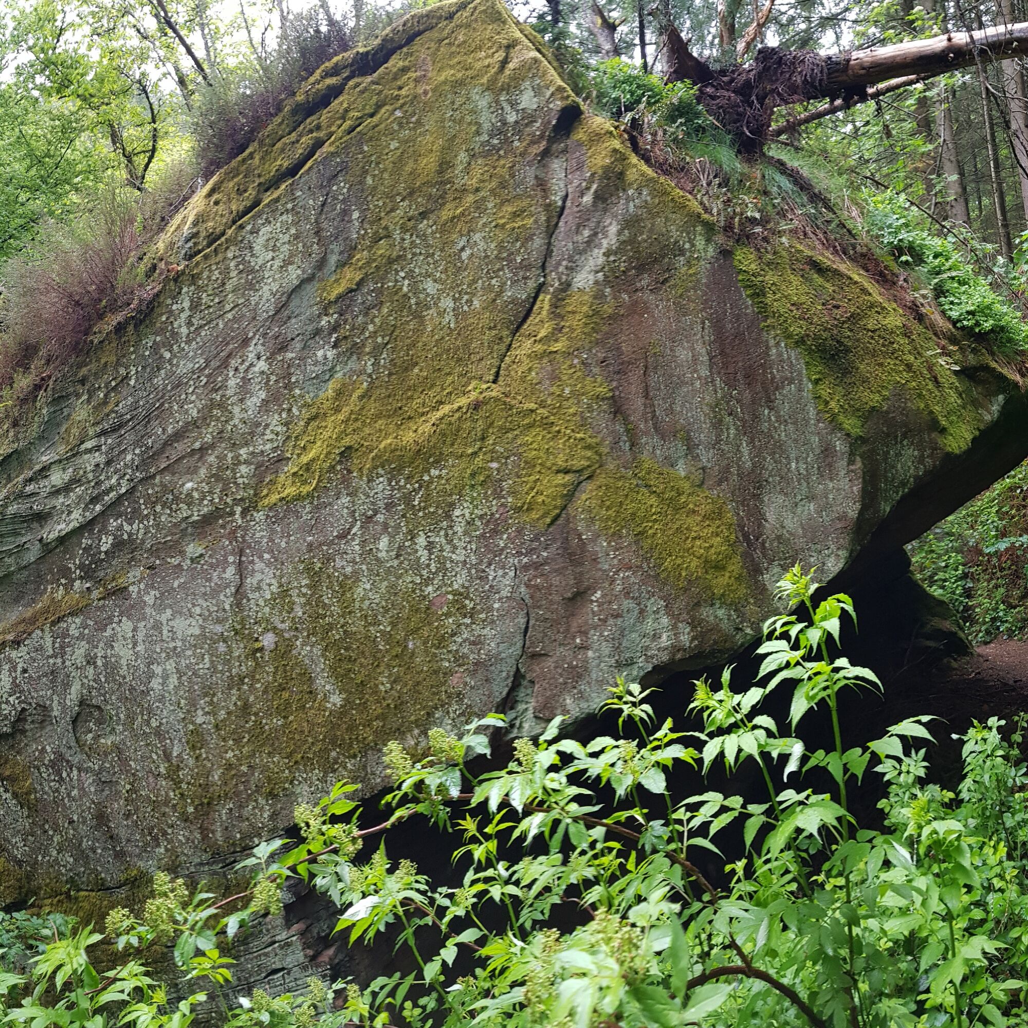
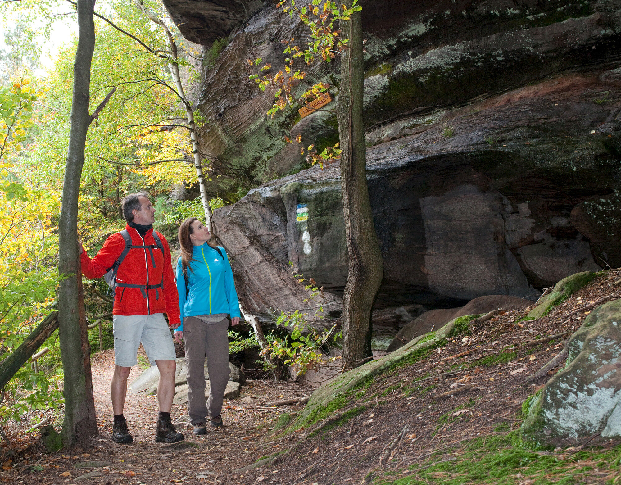
From now on, you will pass impressive Buntsandstein rock formations almost every minute. First, you see the rear and front Rappenkopf, whose names probably derive from their impressive form. At the Rappenteich rock, under whose rock overhang there is another cozy seating area, you can pause again and take a break. The next highlight is the mighty rock walls of the Saufelsen, before you can catch almost continuous beautiful views of the charming town of Rodalben on the lengthy Hilschberg rocks. Finally, shortly before returning to the starting point, you also pass the Krappen rock.
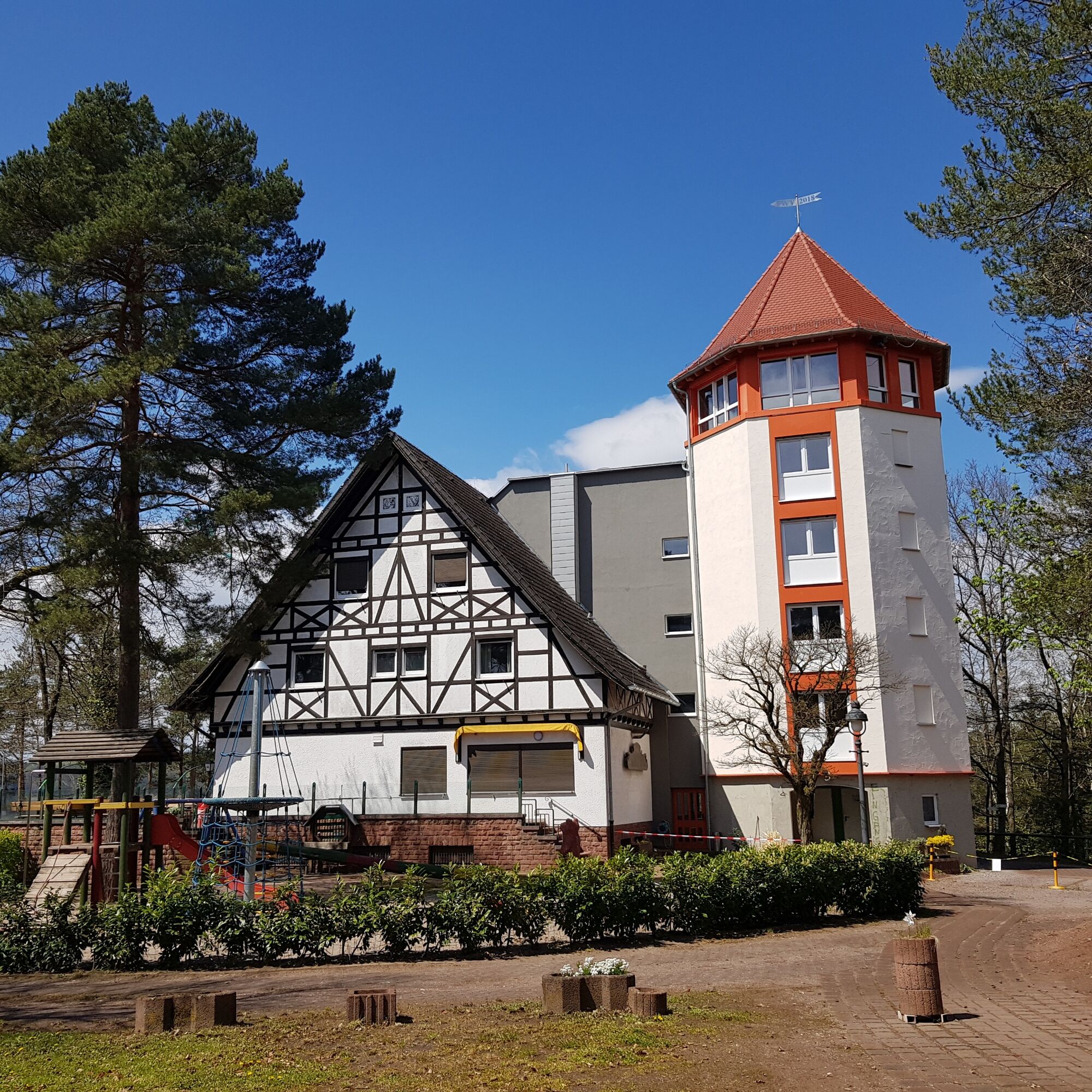
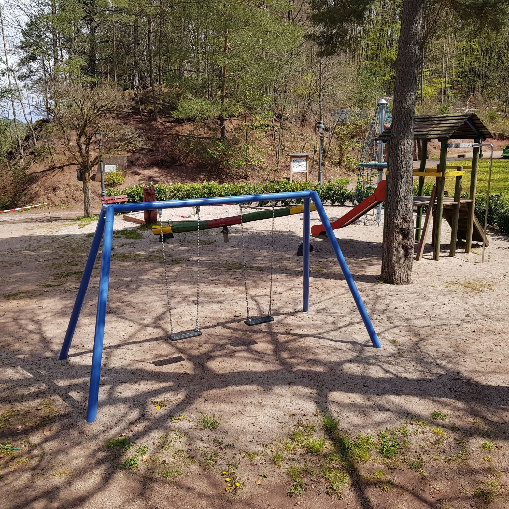
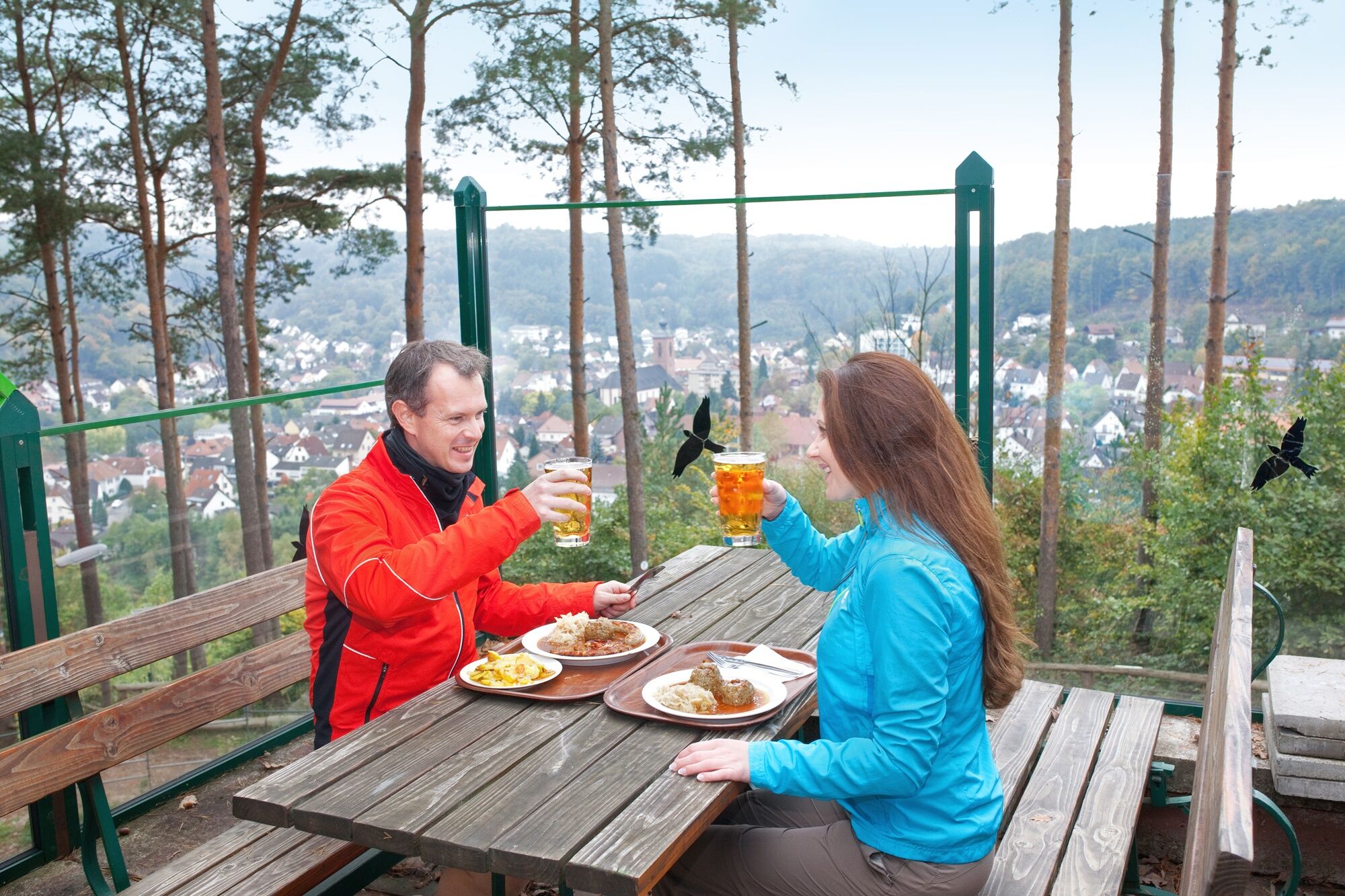
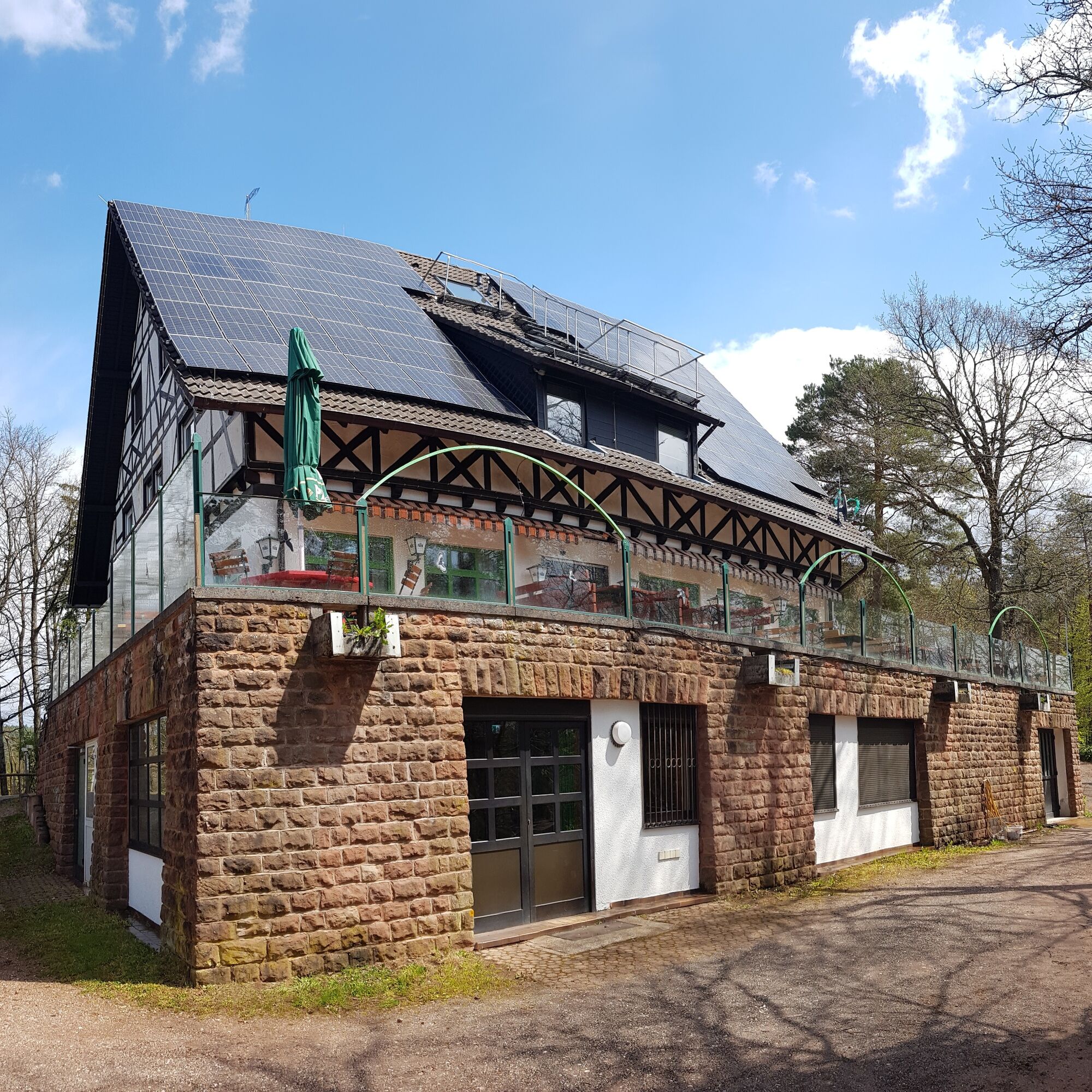
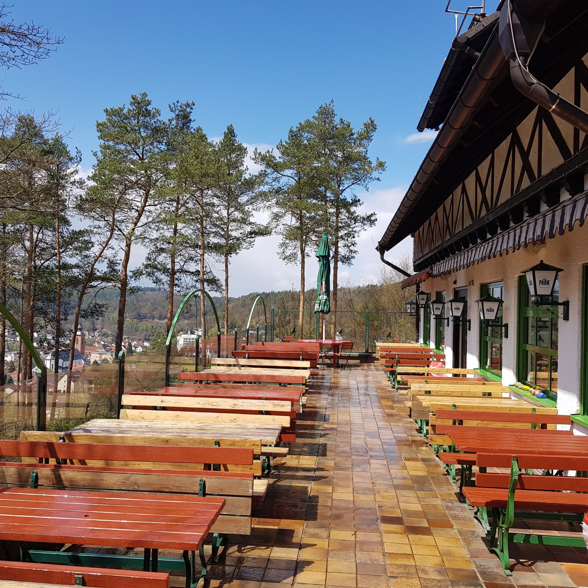
Back at the Hilschberghaus, you can conclude an all-around successful hike with Palatinate delicacies and wonderful views on the sunny terrace of the PWV-Hilschberghaus, while the children enjoy themselves in its playground.
Tak
Tak
Tak
Especially in autumn, note that fallen leaves can cover unevenness, roots, stones, or holes in the path. After thunderstorms or rainstorms, trees can still fall or branches can fall afterwards. Especially in adverse weather conditions, natural trails may become muddy and slippery. Such path impairments must always be expected during hikes. If you think certain sections are not passable, it is better to circumvent them.
Also, not all rocks or slopes are secured with ropes or railings. Sure-footedness is partly required. Rocks should especially not be climbed on by children, as the brittle sandstone poses a risk of falling for non-experts. Railings and fall protection must never be climbed over (danger to life).
Note - We try to announce all closures caused by forest work or hunting societies on this platform. However, there are situations where hiking trails are closed and we might not have been informed. If you unexpectedly encounter such a closure or detour, please strictly observe the notices for your own safety.
B270, in the area Donsieders-Biebermühle change to L497 towards Rodalben, drive on this road until the exit Rodalben city center/Pirmasens, turn right onto L482 (Pirmasenser Straße) and follow it towards Clausen. The L482 later becomes Lindersbachstraße after turning left. Near the TSR sports hall finally turn right into Fichtenstraße, shortly before the end of the steep ascent turn left onto the path towards the forest and follow the signs up to PWV-Hilschberghaus.
L482 from Clausen/Donsieders, immediately after entering Rodalben turn left into Fichtenstraße near the TSR hall, shortly before the end of the steep ascent turn left onto the path towards the forest and from here follow the signs up to PWV-Hilschberghaus.
From here, it’s about a 20-minute walk via Bahnhofstraße, Pirmasenser Straße, and Lindersbachstraße - passing the Arme-Sünder-Brunnen installation - and Fichtenstraße to reach the PWV-Hilschberghaus, which is the start and end point of the route.
Please always park only in the designated parking spaces and keep access routes clear for emergency vehicles as well as forest work paths. For overnight stays in camper vans & caravans, use only explicitly designated motorhome parking spaces such as those in the center of Rodalben or at the Spielmannszug in Hettersbach.
T2
Restaurant PWV-Hilschberghaus
Fichtenstraße 1b, 66976 Rodalben
Tel. 06331/18020
Fax: 06331/216310
Email: info@hilschberghaus.de
www.pwvhilschberghaus.de
Room rental PWV-Hilschberghaus:
Tel.: 0178-2657734
Email: zimmer@hilschberghaus.de
Tourist Information Gräfensteiner Land
Am Rathaus 9, 66976 Rodalben
Tel. 06331/234180
Email: tourist@graefensteiner-land.de
www.graefensteiner-land.de
Facebook
Municipal Association Rodalben
Gipfelstürmer hut and seating area
Arme-Sünder-Brunnen installation
Hiking menu Palatinate - the most beautiful hiking trails
Hiking arena Palatinate Forest-North Vosges
Enjoy a picnic with a magnificent view at the Gipfelstürmer seating area or sheltered by the Rappenteich or Kuhfelsen, enjoy peace and nature!
Popularne wycieczki w okolicy
-
4,8
Dahner Felsenpfad
średniWędrówka 13,2 km -
5,0
Karlstal Gorge Circular Hiking Route
średniWędrówka 10,1 km -
Women Go Their Way - Theme hiking trail about strong women in the Southwest Palatinate
światłoTrasa tematyczna 3,21 km -
5,0
Bear Cave Tour Rodalben
średniWędrówka 8,61 km -
Münchweiler High-Altitude Hiking Trail - Part 2
średniWędrówka 9,33 km -
Clausensee tour
średniWędrówka 12,5 km -
Clauser Haweweg
średniWędrówka 11,3 km -
Old Post Road Merzalben - Leimen/Pfalz
średniWędrówka 13,8 km -
Merzalber Luitpoldturmweg
średniWędrówka 3,14 km -
Circular hiking trail Leimen/Pfalz
średniWędrówka 11,5 km

Wędrówki i tropienie


Nie przegap ofert i inspiracji na następne wakacje
Twój adres e-mail została dodana do listy mailingowej.