


Rabenlay dream loop
The dream loop surprises you right after the start with the vantage point "Eifelblick".
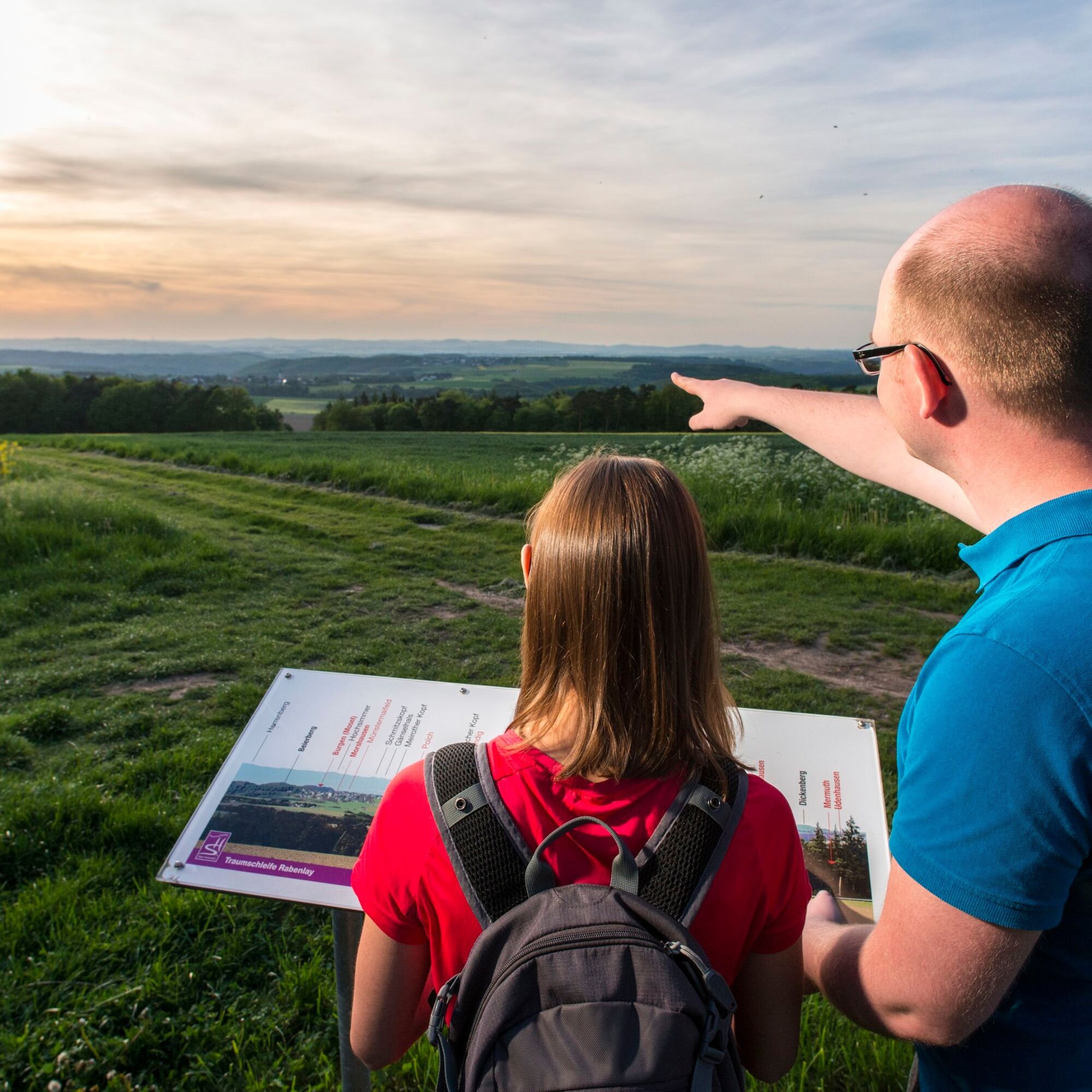
A display board explains almost every depression, but above all the Eifel heights: Over the Baybach and Moselle valleys...
A display board explains almost every depression, but above all the Eifel heights: Over the Baybach and Moselle valleys we look far into the Eifel, recognise the Hohe Acht, the Nürburg, the Laacher Kopf and also the Siebengebirge. Here you will also find the first of eight information boards on the four elements that accompany the hiker along the entire route.
Past the Sonnenhof, the descent into the valley begins, which is called the "Canyon of Hunsrück". The path spirals downwards. In the narrow valley, the path follows a narrow path along the water. Some rock massifs tower upwards. Up to the former Weins-Antone mill, the path remains in the narrow valley. From the remains of the walls, you can see that the mill was once an extensive estate. At the old mill wall, you leave the valley upwards. The last section to Rabenlay is steep. But you are rewarded with special views over the forest area above the Baybach Valley.
The final loop leads across the high plateau around Gondershausen, past the dreamy Waldsee lake with its resting place and the romantic Schönstatt chapel.
The hiking trail was rated 73 points by the German Hiking Institute.

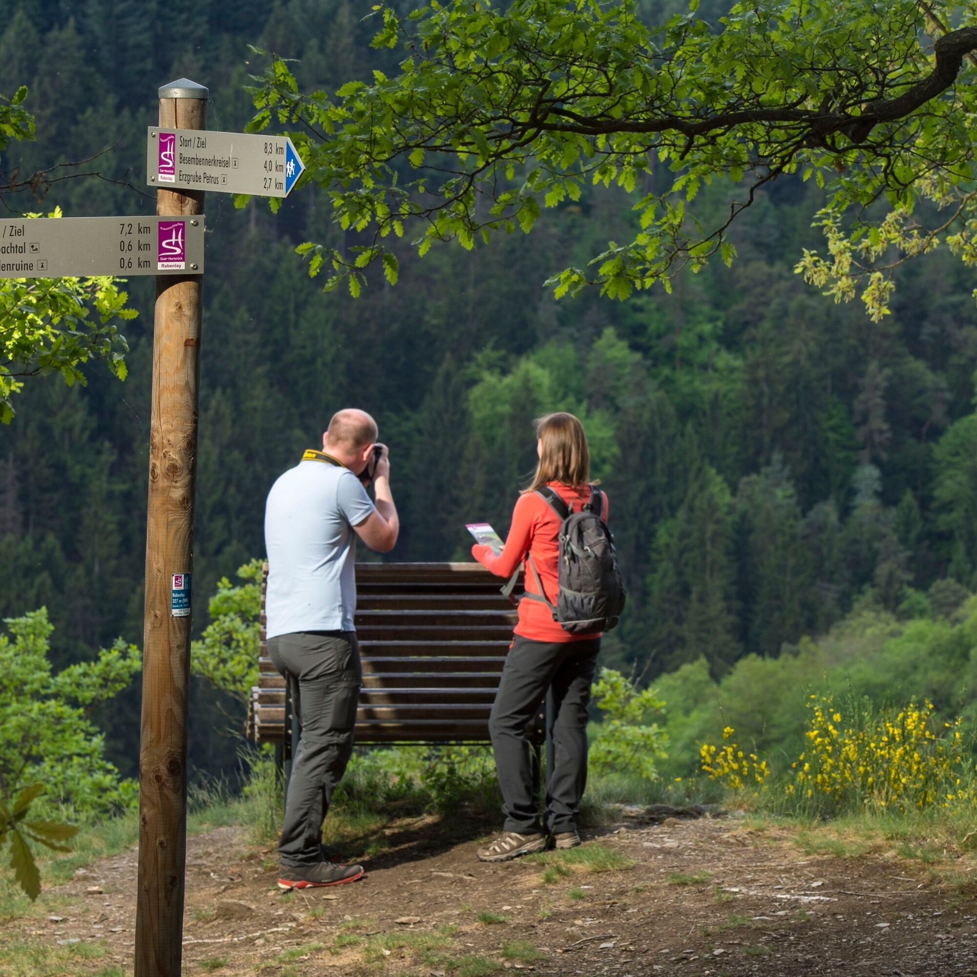
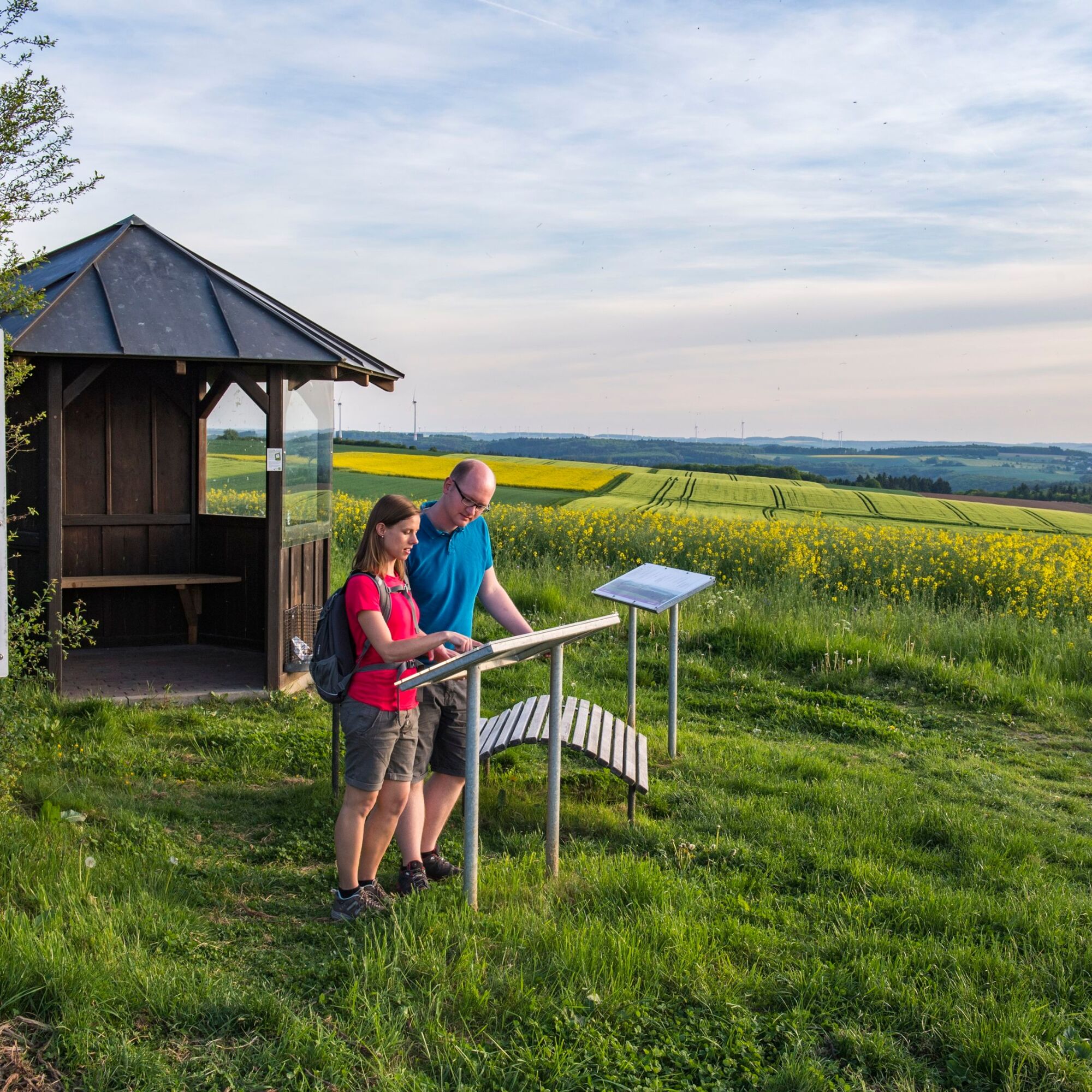
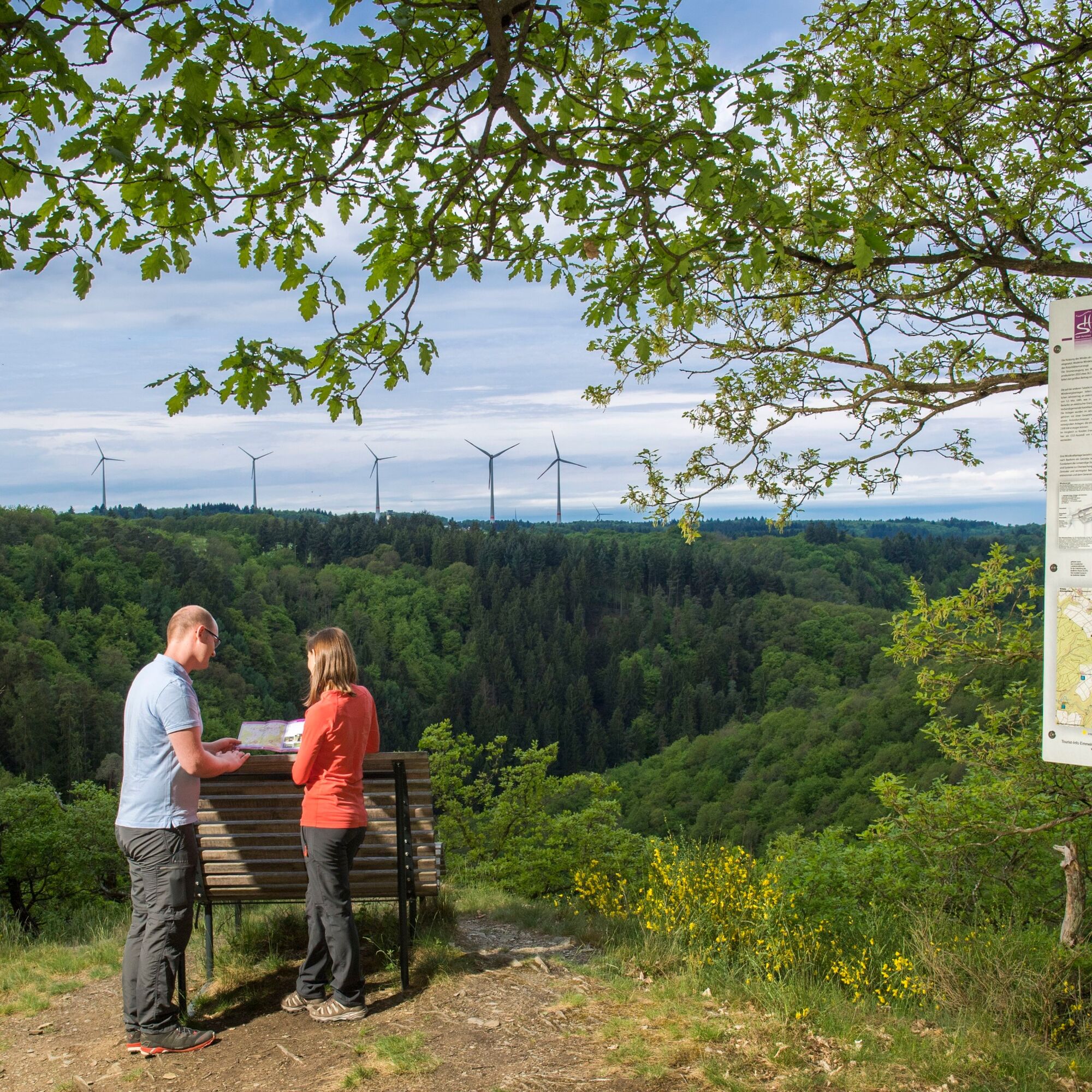
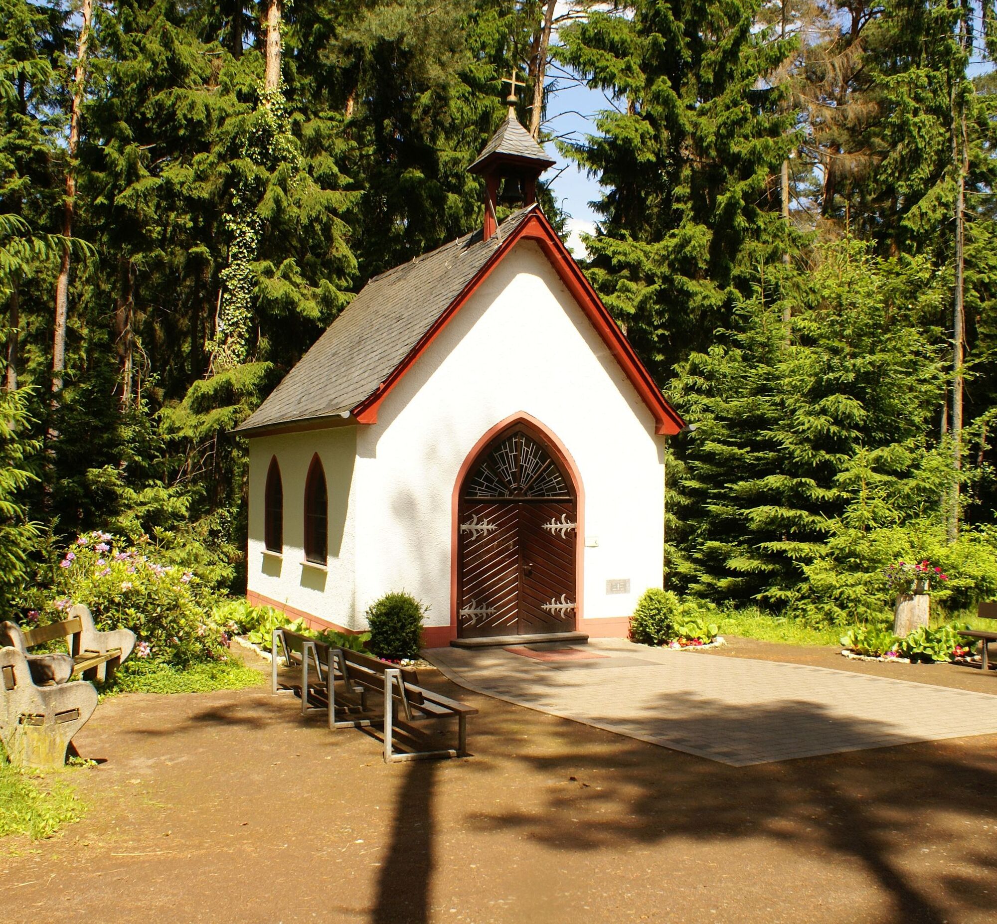
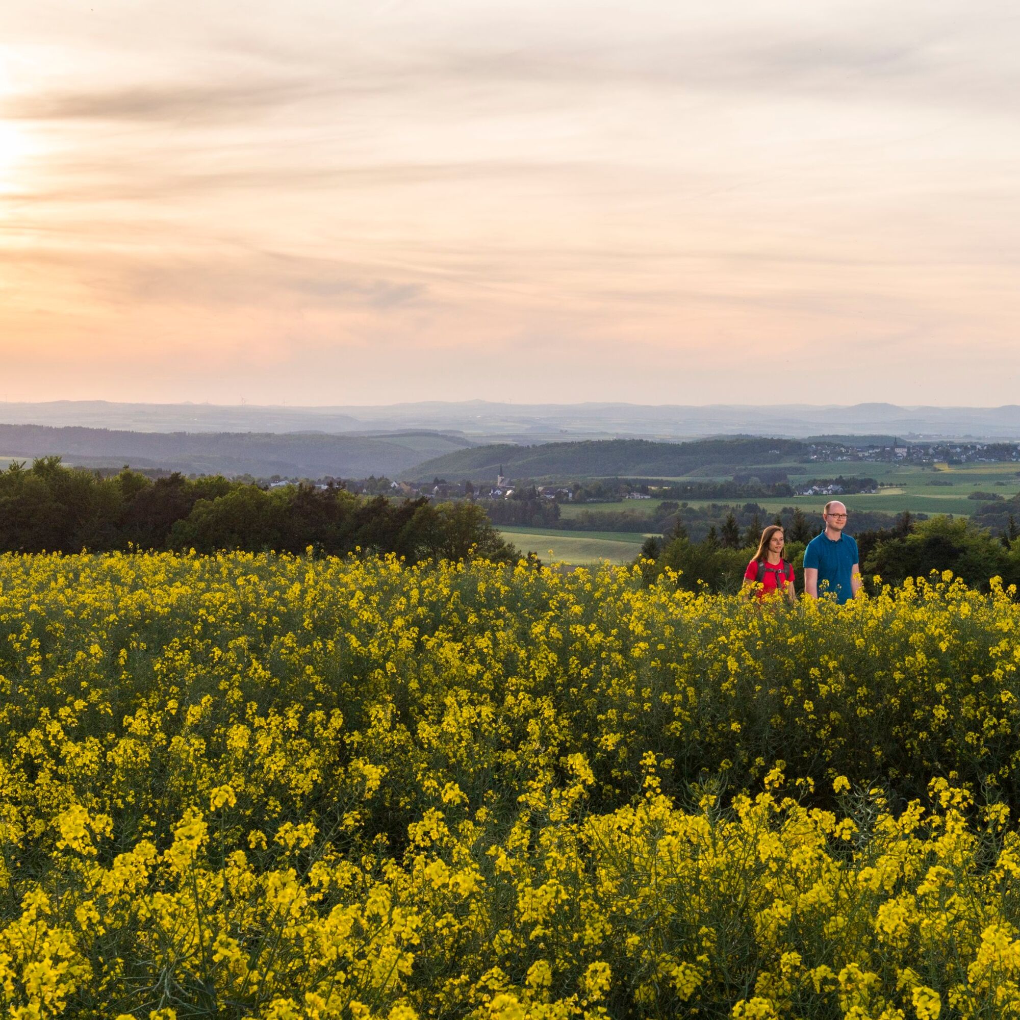
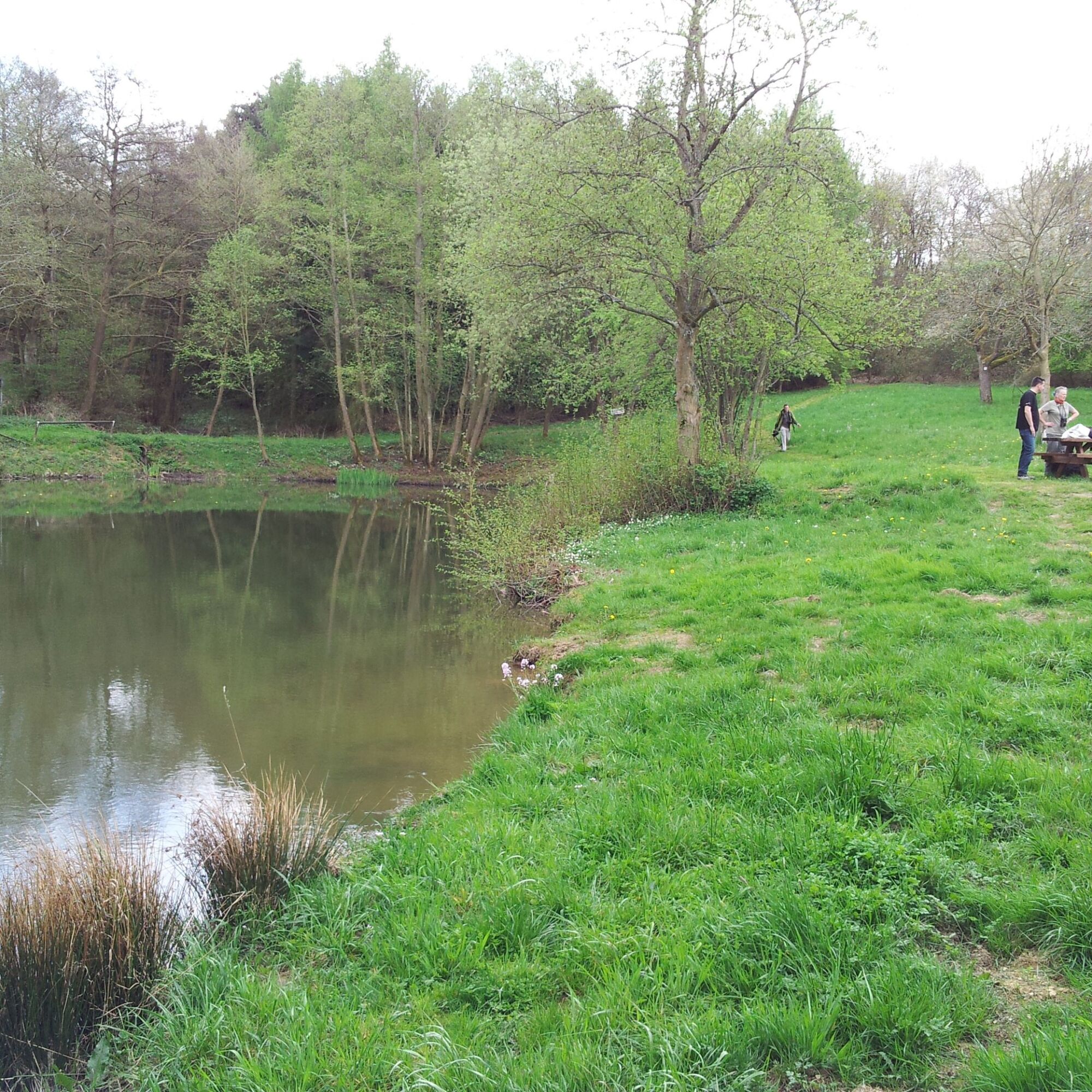
From the car park at the Gunthershalle, a short path leads to the entrance portal of the Rabenlay dream loop north of Gondershausen. There we will learn about the topic "The 4 Elements". On the way, we will learn about this topic on further information boards.A narrow path leads through the forest before we can enjoy the first wide views over the Hunsrück heights. At the Eifelblick rest stop, we can clearly see the Hohe Acht and Nürburg castles in the Eifel and also get an explanation of the individual elevations and extinct volcanoes on a display board.With these views, we continue along meadow orchards and forests until we reach the biotope at Sonnenhof. At the sensory bench at Windradblick, the locations of the wind turbines in Hunsrück are explained to us. Of course, we do not guarantee completeness.There we can also enjoy the first views over the Baybach valley, which is now our destination. Soon we reach the forest and descend into the "Canyon of the Hunsrück". Rocks as high as church steeples now line our path. Over millions of years, the water has carved its way along the Rabenlay. We recommend a short rest at the ruins of the Weins-Antone Mill, because we are about to climb up the rock that gave the Traumschleife its name.We may be a little out of breath when we reach the top, but the great views from the rock massif compensate for the effort. We take a short break and enjoy the silence on a sensory bench.We leave this wonderful place and walk first through the forest, then along field and meadow paths until we reach the next resting place at a small wood. This island of trees looks quite inconspicuous, but when we take a look inside, we realise that some earthmoving took place here. Iron ore was mined here until the end of the First World War.Passing paddocks, we head down the valley before climbing up the Ginsterberg. At the new development area, we choose an interesting alternative route over the noise barrier, which gives us great views over the village to the valleys of Baybach and Ehrbach.Directly behind it, we pass the Besembenner roundabout, which symbolises the Gondershausen tradition of binding whisk brooms.The trail continues to the Steinkaul viewpoint, where we enjoy the Rhine-Moselle triangle view. There we can see, for example, the second and third highest buildings in Rhineland-Palatinate. Which ones are they? We can find out on the information board on site.From the Steinkaul, it is only 600 metres to the Waldsee, a wonderful biotope that invites you to take a break.Freshly refreshed, we set off for the last stage of the hike. Shortly before reaching our destination, we find a place of reflection in the forest, the very well-maintained Schoenstatt Chapel. Here we can review the hike once again before returning to the starting point via a narrow forest path.
Tak
Sturdy footwear (hiking boots) is strongly recommended.
The dream loops sometimes have steep, difficult and, in rainy or winter weather, slippery passages. Therefore Therefore, surefootedness and good physical condition are essential prerequisites for hiking these premium circular trails.
L206 to 56283 GondershausenNavigation: Buchenweg 3, 56283 Gondershausen
Timetable information on bus connections via VRM-Info
Car park at the Gunthershalle (Gondershausen)
Tak
Hunsrück-Touristik GmbH, Gebäude 663, 55483 Hahn-FlughafenTel. 06543 - 507700, www.hunsruecktouristik.de
Worth seeing is the wooden figure of the "Gondersche Besembenner" at the Besembenner roundabout in Gondershausen. "Besembenne" is the Hunsrück dialect word for "broom tying". At the roundabout, the old Gondershausen tradition is explained. On an information board we learn everything about this traditional craft, which was still practised into the 21st century.
Popularne wycieczki w okolicy
-
4,6
Traumschleife Ehrbachklamm
ciężkiWędrówka 11,0 km -
4,7
Langhalsweg Osterspai
średniWędrówka 7,50 km -
4,4
Marienkapellchen - Wierschem - Petersköpfchen - Unterschänke
ciężkiWędrówka 12,7 km -
4,4
Mosel - Burg Eltz - Mosel
średniWędrówka 12,8 km -
4,8
Dommershausen - Steffenshof - Schmausemühle - Beltheim
ciężkiWędrówka 10,4 km -
4,2
Moselsteig Stage 20: Treis-Karden – Moselkern
średnidługodystansowy szlak pieszy 13,6 km -
4,3
Dream loop Werlauer Pilz
światłoWędrówka 5,60 km -
Pfalzfeld - Geierlay suspension bridge
średniJazda na rowerze 28,1 km -
4,5
Boppard - Restaurant Cafe Vierseenblick - GedeonsEck
ciężkiWędrówka 4,99 km -
4,7
Schessels Beersche
średniWędrówka 5,44 km
Wędrówki i tropienie


Nie przegap ofert i inspiracji na następne wakacje
Twój adres e-mail została dodana do listy mailingowej.