Göllheim: On the Way of St. James to Eiswoog
średni
Pobierz tę trasę na swój telefon komórkowy
Göllheim: On the Way of St. James to Eiswoog
średni
Trasa pielgrzymki
14,15
km
Zeskanuj kod QR i rozpocznij nawigację w aplikacji bergfex.

Wędrówki i tropienie


Göllheim: On the Way of St. James to Eiswoog
średni
Odległość
14,15
km
Czas trwania
03:32
h
Ascent
171
hm
Poziom morza
210 -
349
m
Ścieżka do pobrania
Göllheim: On the Way of St. James to Eiswoog
średni
Trasa pielgrzymki
14,15
km
Trasa
Protestantische Kirche Göllheim
(247 m)
Miejsce kultu
0,0 km
Kühberg
(366 m)
Szczyt
7,4 km
Schloßberg
(327 m)
Szczyt
8,0 km
Pfarrkirche Mariä Himmelfahrt
(233 m)
Miejsce kultu
10,3 km
Hotel Landgasthaus zum Hirsch
(219 m)
Restauracja
10,4 km
Eiswoog Stumpfwaldbahn
(254 m)
Stacja kolejowa
13,8 km
seehaus forelle
(255 m)
Restauracja
14,1 km
Trasa
Göllheim: On the Way of St. James to Eiswoog
średni
Trasa pielgrzymki
14,15
km
Protestantische Kirche Göllheim
(247 m)
Miejsce kultu
0,0 km
Göllheim
(247 m)
Wioska
0,0 km
Kriegsberg-Hütte
(334 m)
Restauracja
3,2 km
Kühberg
(366 m)
Szczyt
7,4 km
Stauf
(319 m)
Sąsiedztwo
7,7 km
Schloßberg
(327 m)
Szczyt
8,0 km
Pfarrkirche Mariä Himmelfahrt
(233 m)
Miejsce kultu
10,3 km
Ramsen
(214 m)
Wioska
10,4 km
Hotel Landgasthaus zum Hirsch
(219 m)
Restauracja
10,4 km
Eiswoog Stumpfwaldbahn
(254 m)
Stacja kolejowa
13,8 km
seehaus forelle
(255 m)
Restauracja
14,1 km
Autor
Dostarczone przez Zum Wohl die Pfalz
Wycieczkę Göllheim: On the Way of St. James to Eiswoog zapewnia outdooractive.com.


Informacje o trasie
Trasa
From the center of Göllheim via Kerzweiler and Rosenthalerhof, to Stauf, then continuing via Ramsen to Eiswoog.
Sprzęt
Suitable hiking map, sturdy footwear, weather-appropriate clothing, sun and rain protection,
and sufficient supply of food and drinks, as there are not always dining or shopping options
available or open.
and sufficient supply of food and drinks, as there are not always dining or shopping options
available or open.
Instrukcje bezpieczeństwa
Especially in autumn, it should be noted that fallen leaves can cover unevenness, roots, stones or holes in the path. You should expect such path impairments when going on a hike. If you believe certain sections of the path are impassable for you, you should avoid them. Particularly in adverse weather conditions, natural trails can have muddy and slippery sections.
Informacje o przyjeździe
Przybycie
Via the A 63: Coming from Mainz or Kaiserslautern, take the Göllheim exit. Follow the signs to Göllheim, town center.
Transport publiczny
Timetable information at www.vrn.de
Parking
in Göllheim, town center
Dodatkowe informacje i wskazówki
Dodatkowe informacje
Donnersberg Tourism Association (Tel. 06352 / 1712)
www.jakobusgesellschaft.eu
http://www.jakobsweg-pfalz.de/
www.jakobusgesellschaft.eu
http://www.jakobsweg-pfalz.de/
Wskazówki
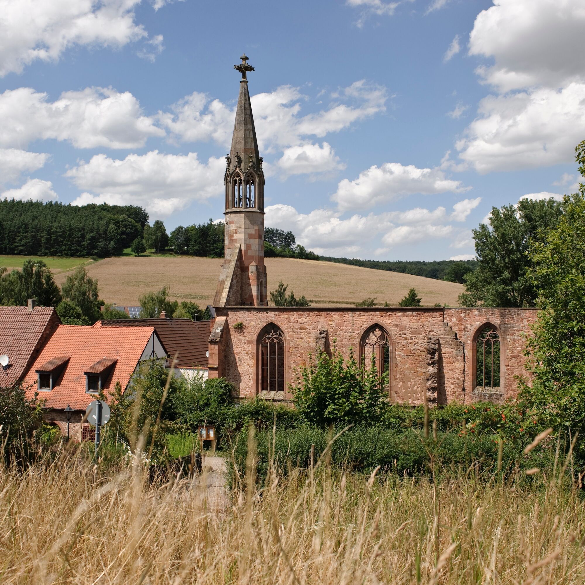
Rosenthal Monastery Ruins
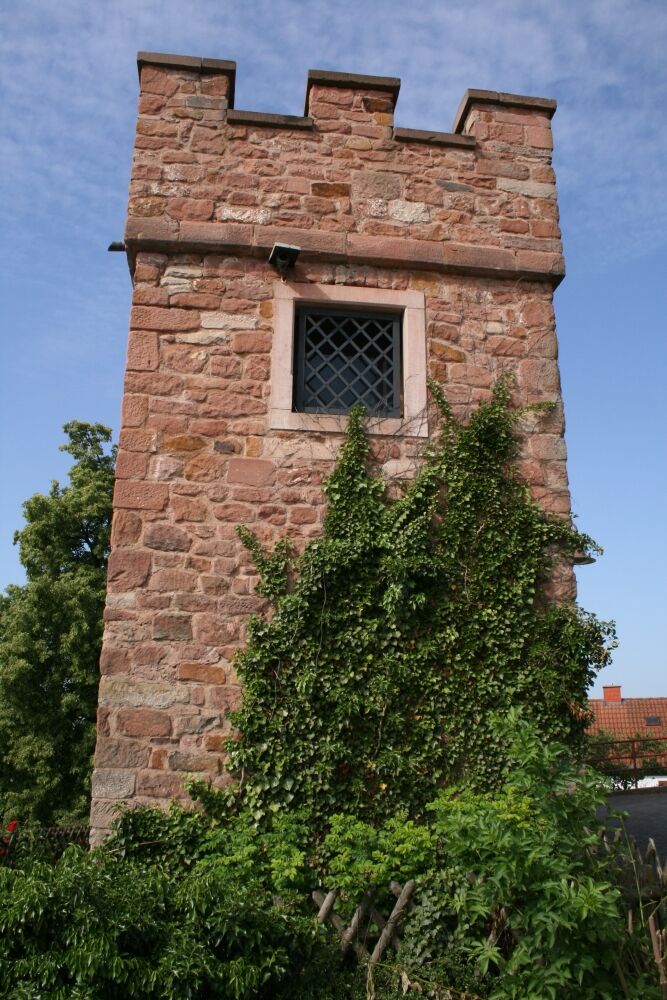
Stauf Castle
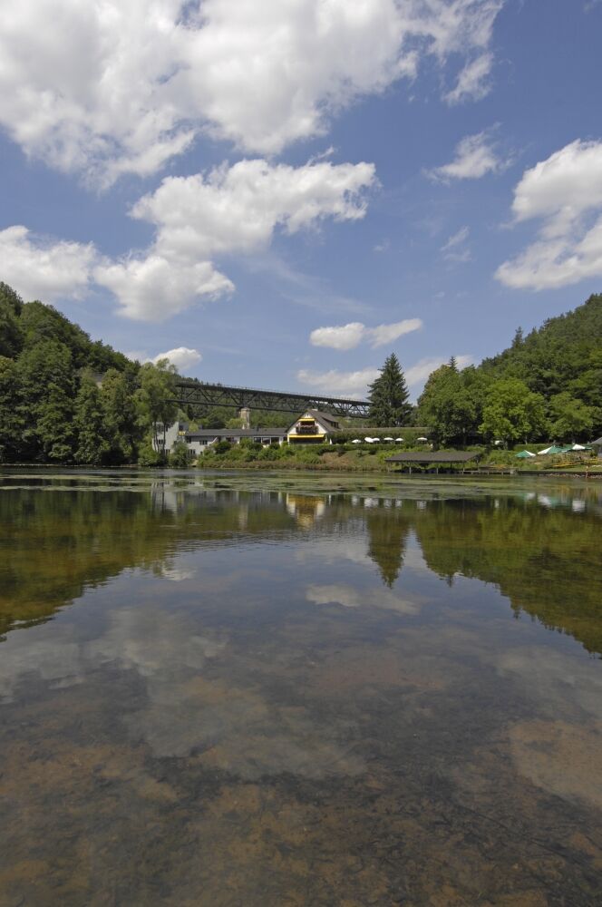
Eiswoog
Stauf Castle
Eiswoog
Nie ma jeszcze recenzji
Popularne wycieczki w okolicy
-
4,0
Ganerbenweg - Premium circular hiking route in the Freinsheim holiday region
średniWędrówka 10,5 km -
5,0
Circular route through forest and vineyard: Weisenheim am Berg - "Wine, Forest, Ungeheuer"
średniWędrówka 12,5 km -
5,0
Leininger Castle Trail - Premium hiking trail with audio and video stations
ciężkiWędrówka 22,3 km -
3,5
Leininger Monastery Trail - Premium hiking trail with audio and video stations
średniWędrówka 15,3 km -
4,3
Zwei-Burgen Tour Battenberg
średniWędrówka 5,43 km -
5,0
Palatinate Wine Trail Stage 01 Bockenheim - Neuleiningen
średnidługodystansowy szlak pieszy 16,9 km -
5,0
Palatinate Wine Trail Stage 02 Neuleiningen - Bad Dürkheim
średnidługodystansowy szlak pieszy 17,6 km -
Wine hike: Kallstadt - Rieslingweg
światłoWędrówka 6,57 km -
4,0
Wine hike: Weisenheim am Berg - Herxheim am Berg - Dackenheim
światłoWędrówka 7,95 km -
5,0
Circular route through vineyards and forest: Weisenheim am Berg - Bobenheim am Berg - Leiningerland - Dackenheim
ciężkiWędrówka 17,0 km

Wędrówki i tropienie

Ponad 550.000 propozycji wycieczek, szczegółowe mapy i intuicyjny planer tras sprawiają, że aplikacja jest niezbędna dla wszystkich entuzjastów przyrody.

Nie przegap ofert i inspiracji na następne wakacje
Zapisz się do newslettera
Błąd
Wystąpił błąd. Spróbuj ponownie.
Dziękujemy za rejestrację
Twój adres e-mail została dodana do listy mailingowej.
Wycieczki po całej Europie
Austria
Szwajcaria
Niemcy
Włochy
Słowenię
Francja
Holandia
Belgia
Polska
Liechtenstein
Czechy
Słowacja
Hiszpania
Chorwacja
Bośnia i Hercegowina
Luksemburg
Andorra
Portugalia
Islandia
Wielka Brytania
Irlandia
Grecja
Albania
Macedonia Północna
Malta
Norwegia
Czarnogóra
Mołdawia
Kosowo
Węgry
San Marino
Rumunia
Estonia
Łotwa
Białoruś
Cypr
Litwa
Serbia
Bułgaria
Monako
Dania
Szwecja
Finlandia