


Moselsteig stage 21: Moselkern – Löf
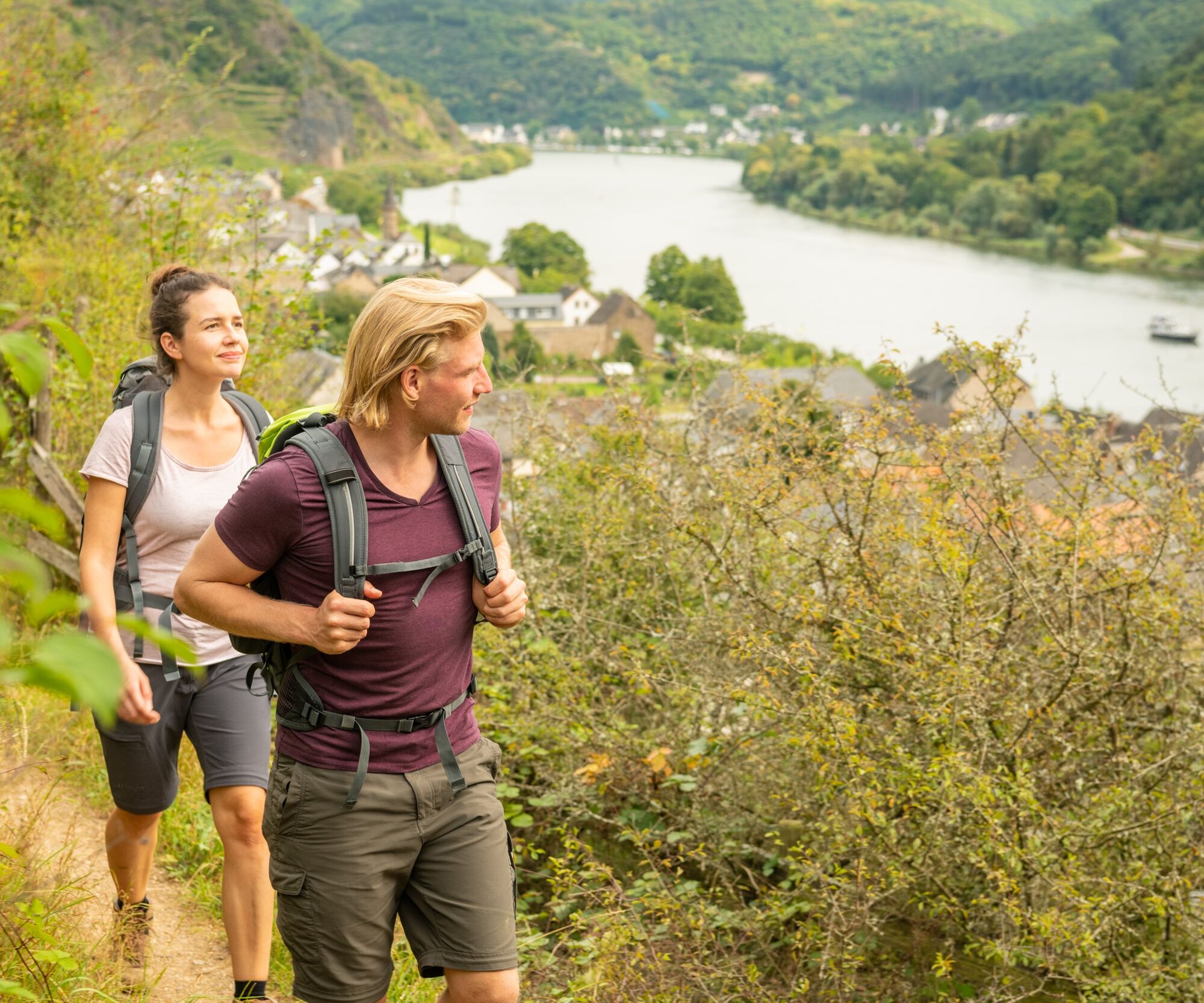
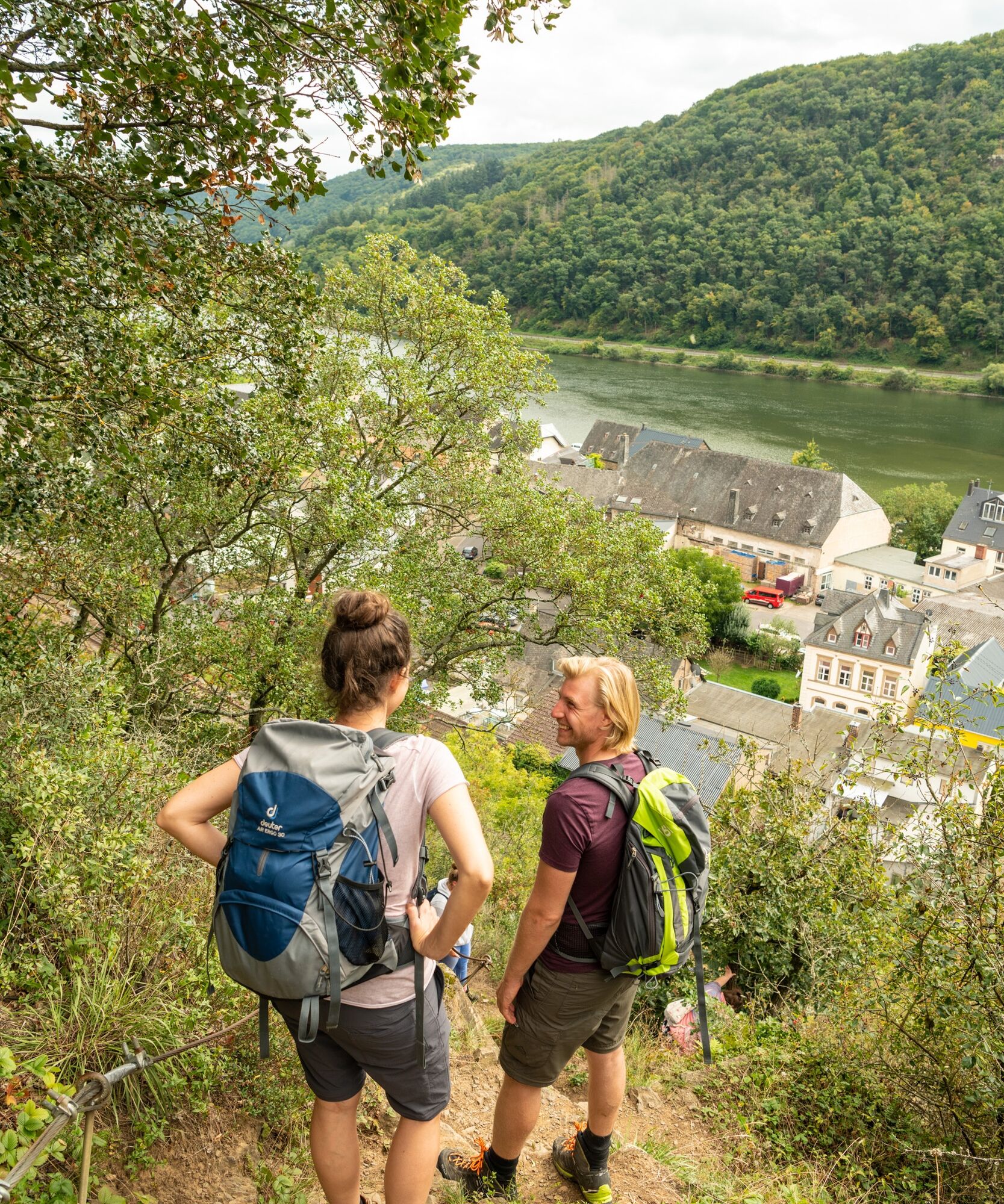
The stage between Moselkern and Löf starts off sportily: initially, the path leads on a steep path through the vineyards – then rewards the hiker on the following ridge path with magnificent views: The...
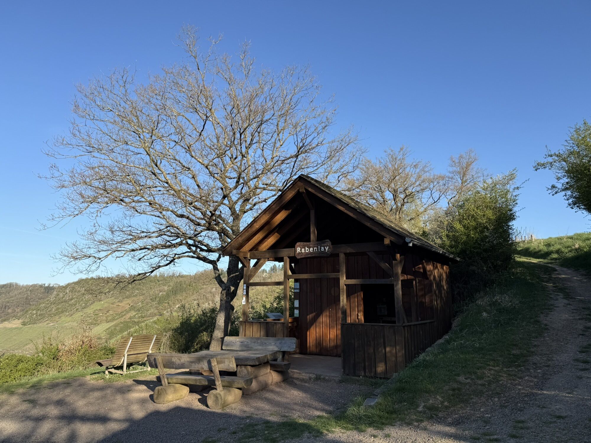
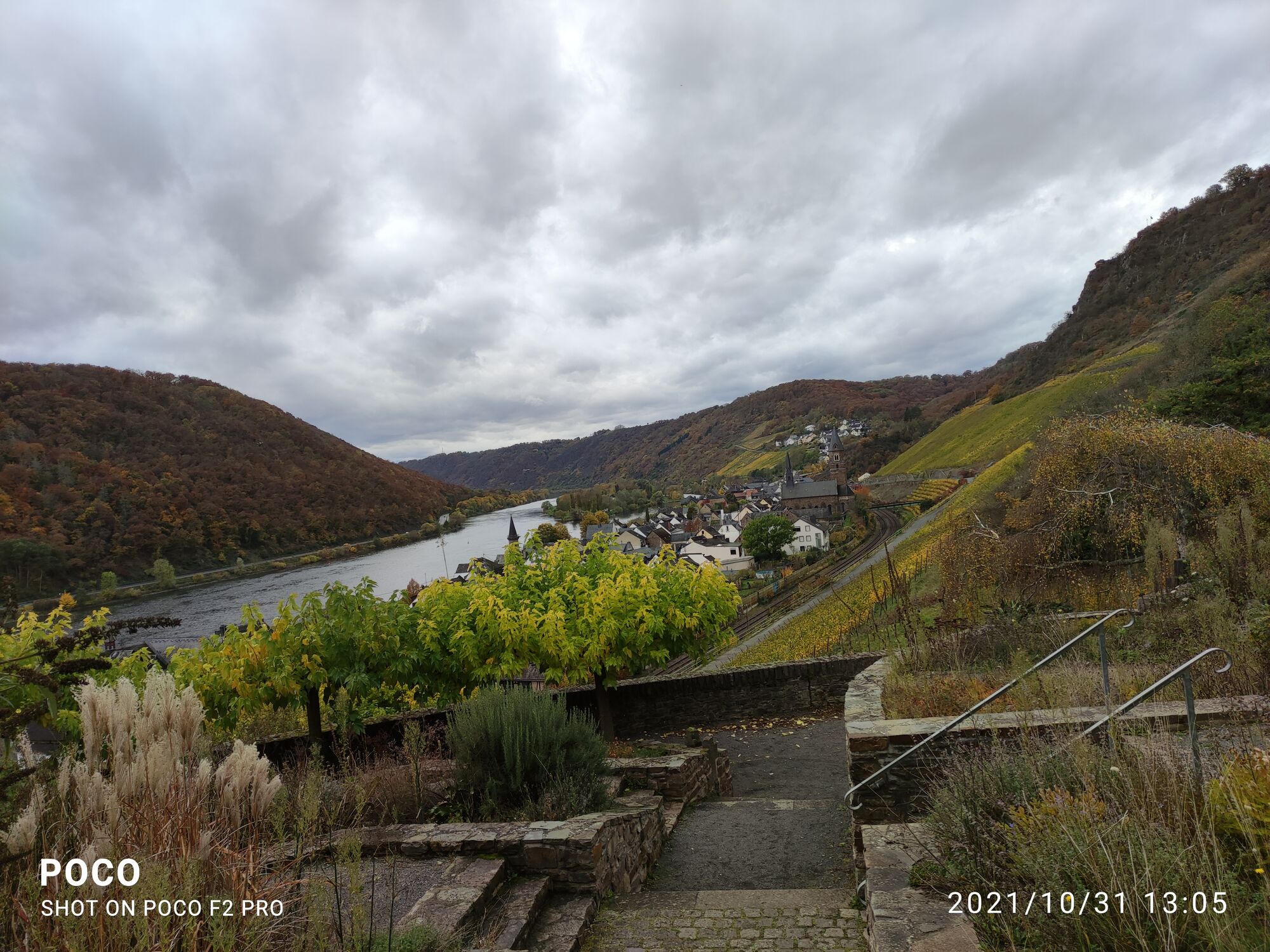
The stage between Moselkern and Löf starts off sportily: initially, the path leads on a steep path through the vineyards – then rewards the hiker on the following ridge path with magnificent views: The "Küppchen" viewpoint offers a fantastic view of the Moselle and Baybach valleys and nearby Bischofsstein Castle. Also impressive is the sight of paragliders and hang gliders taking off here. The route of the Hatzenporter Laysteig dream path runs parallel to the Moselsteig from now on – together they go downhill to Hatzenport and then ascend to the Rabenlay with a shelter and rest area. Shortly afterwards, the Moselsteig separates again from the dream path and leads downhill through dense boxwood stands and the Kehrbachtal to the stage town Löf.

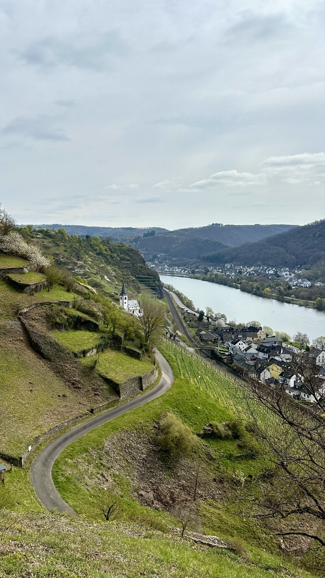
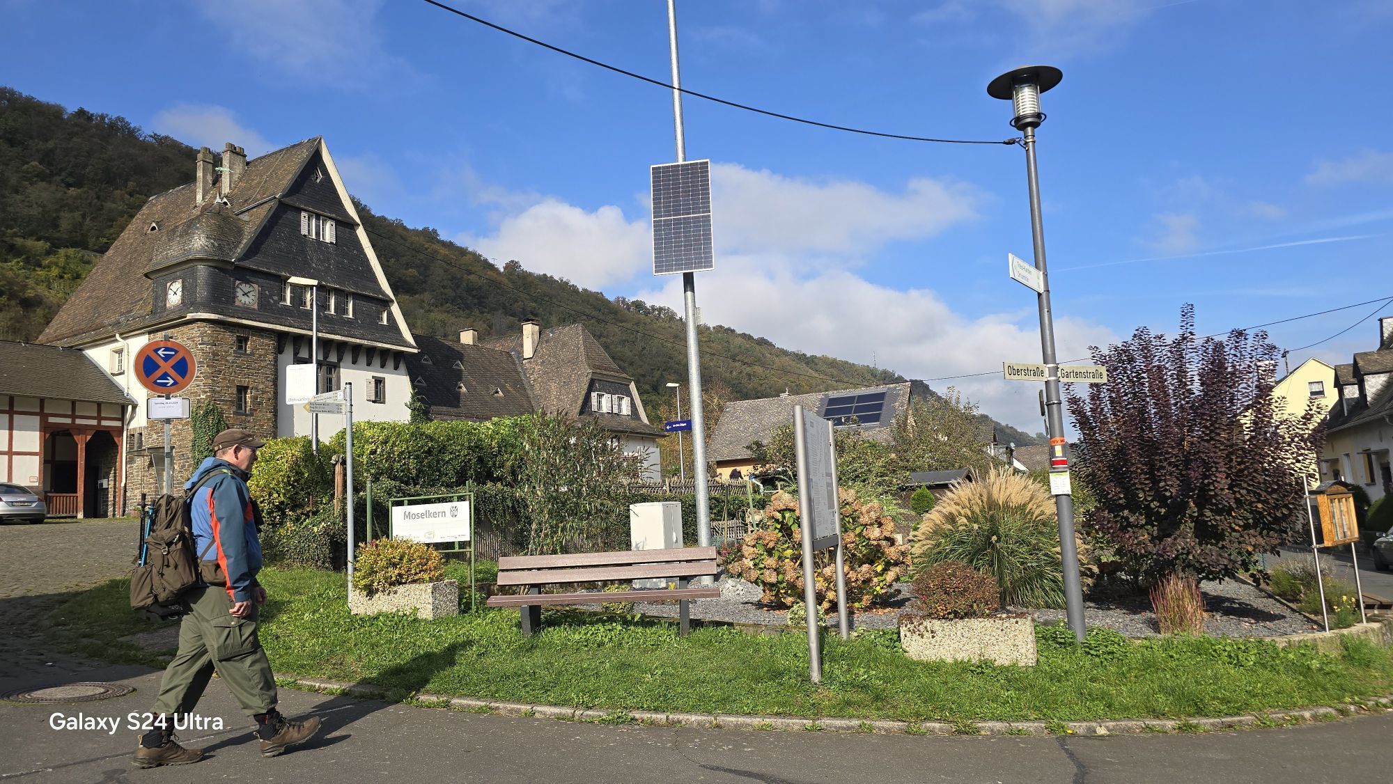
You start this Moselsteig stage from the train station in Moselkern by first following the access path marking. Along the paved path next to the railway tracks, you go to the overpass over the railway line and then into the new development area. After the last houses, you follow a flat path through the vineyards for a while. Then a steep path branches off, climbing the slope through the forest in several switchbacks. The path reaches the K 33, on which you have to hike uphill for a short distance. At a chapel on the edge of the slope, you soon leave the road. Now you have reached the main Moselsteig trail, which continues towards Löf.
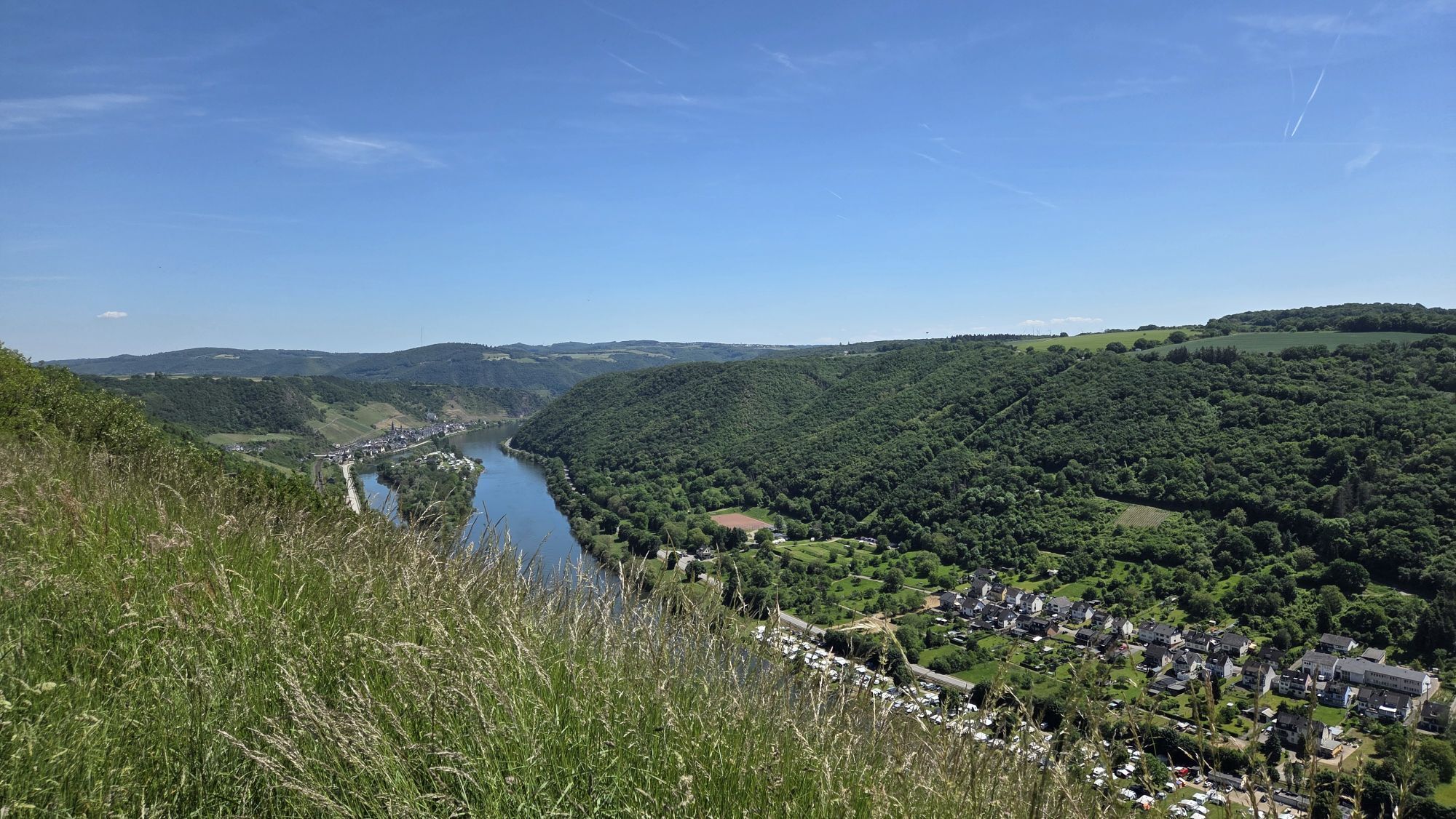
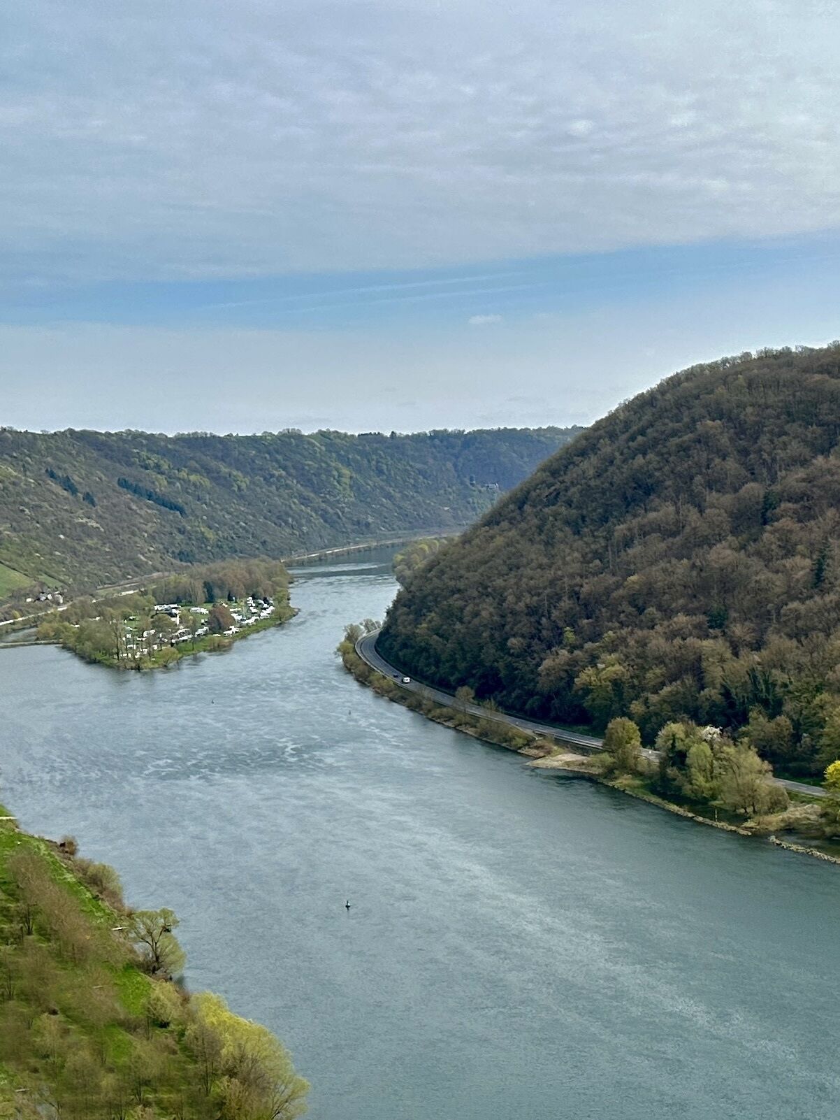
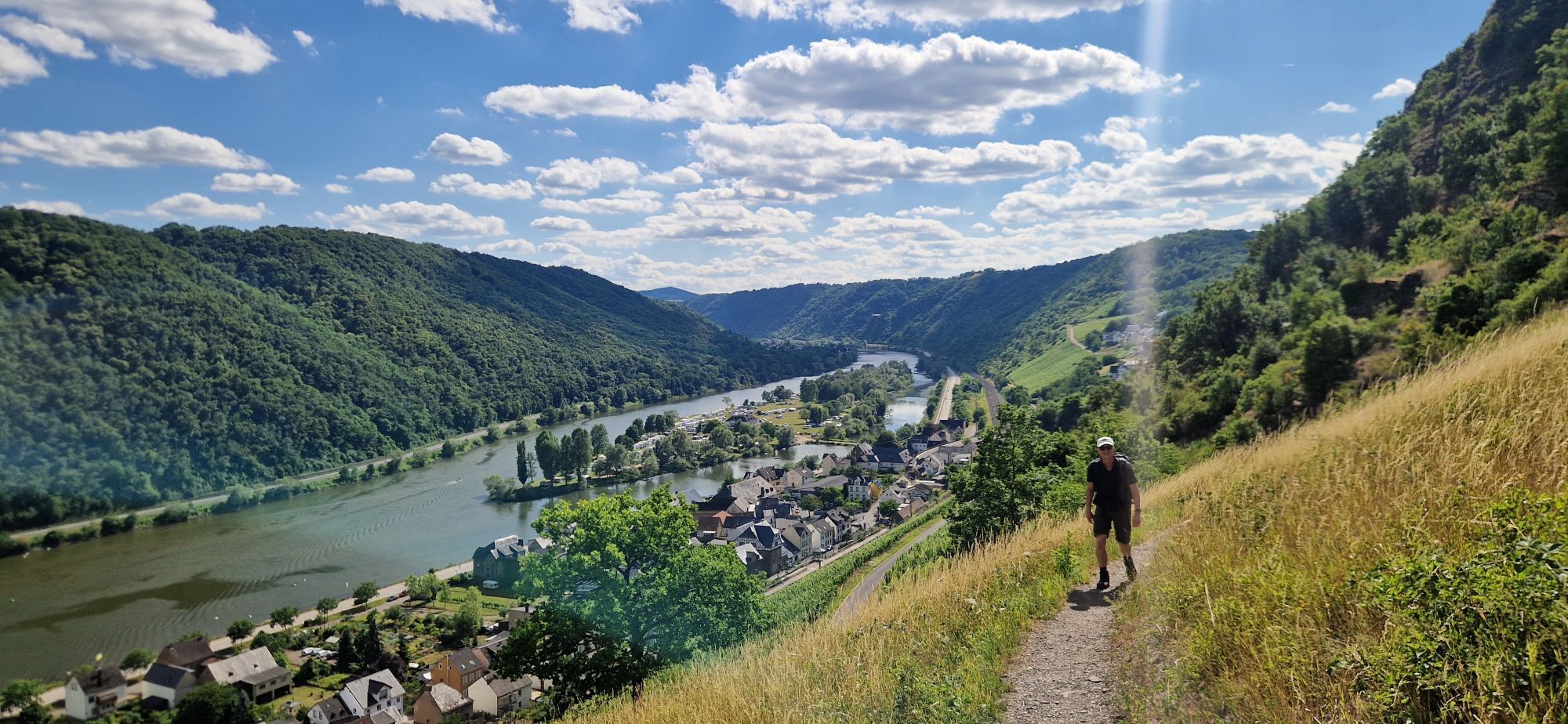
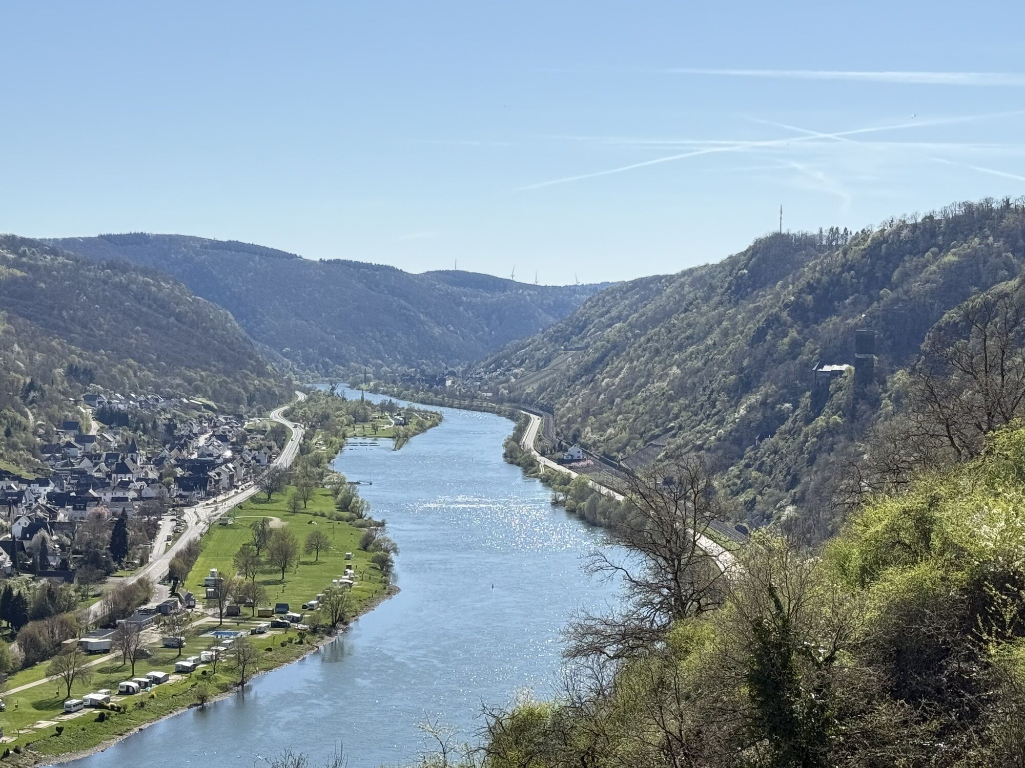
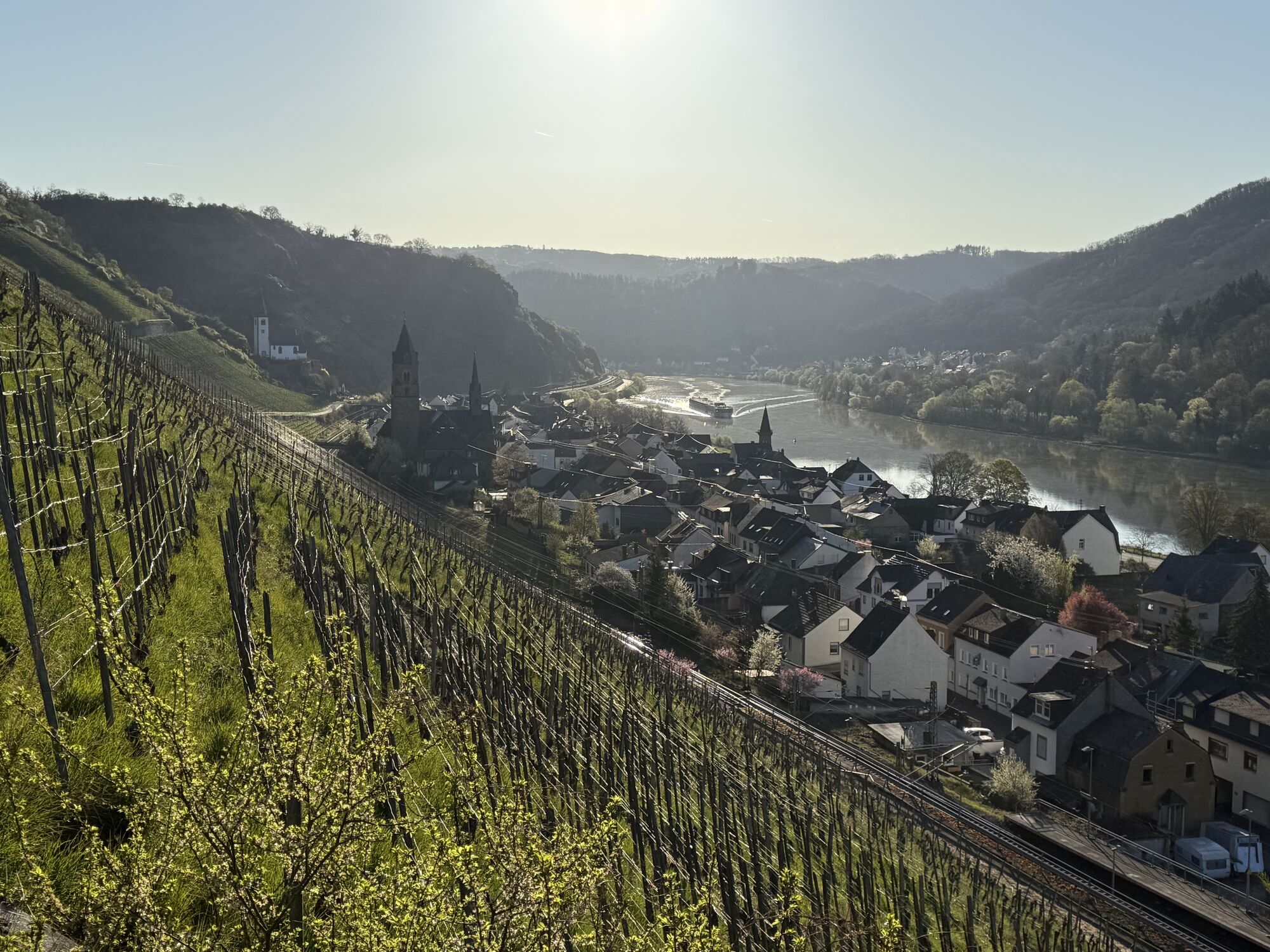
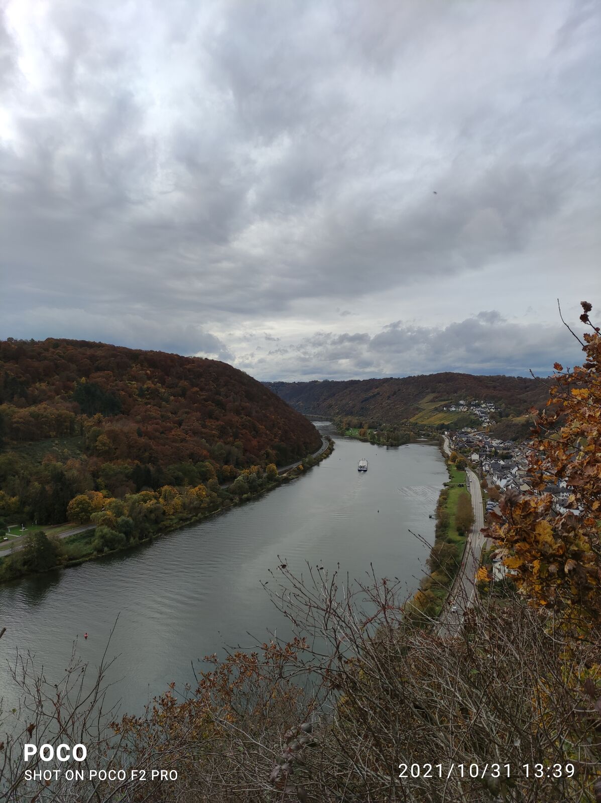
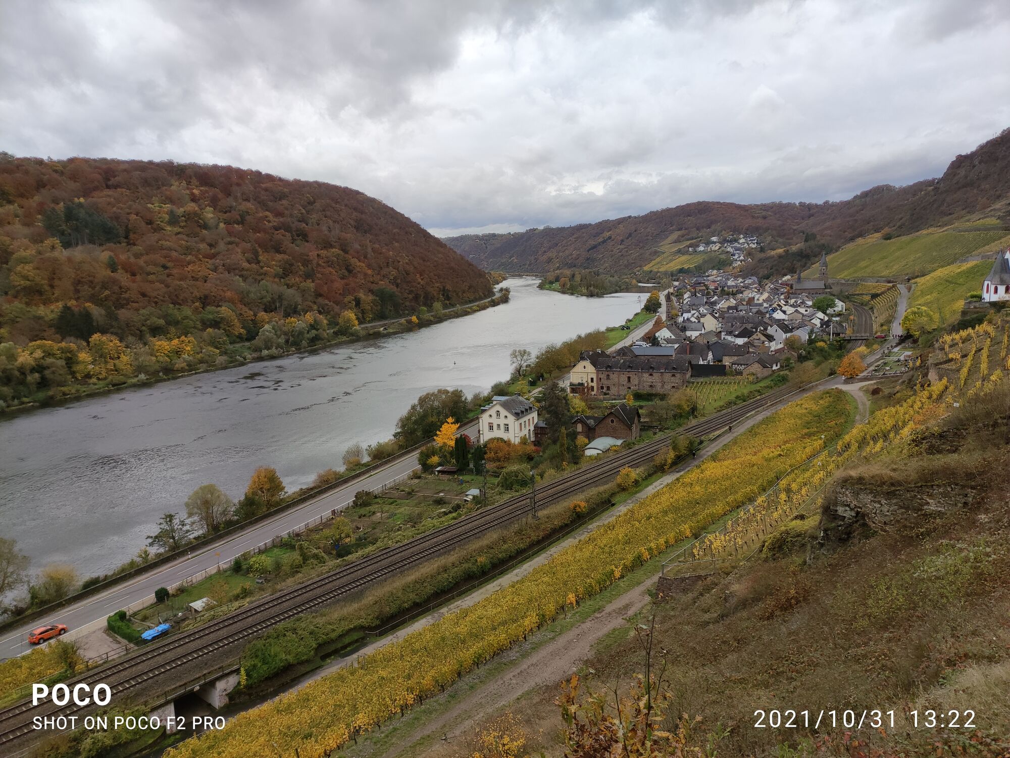
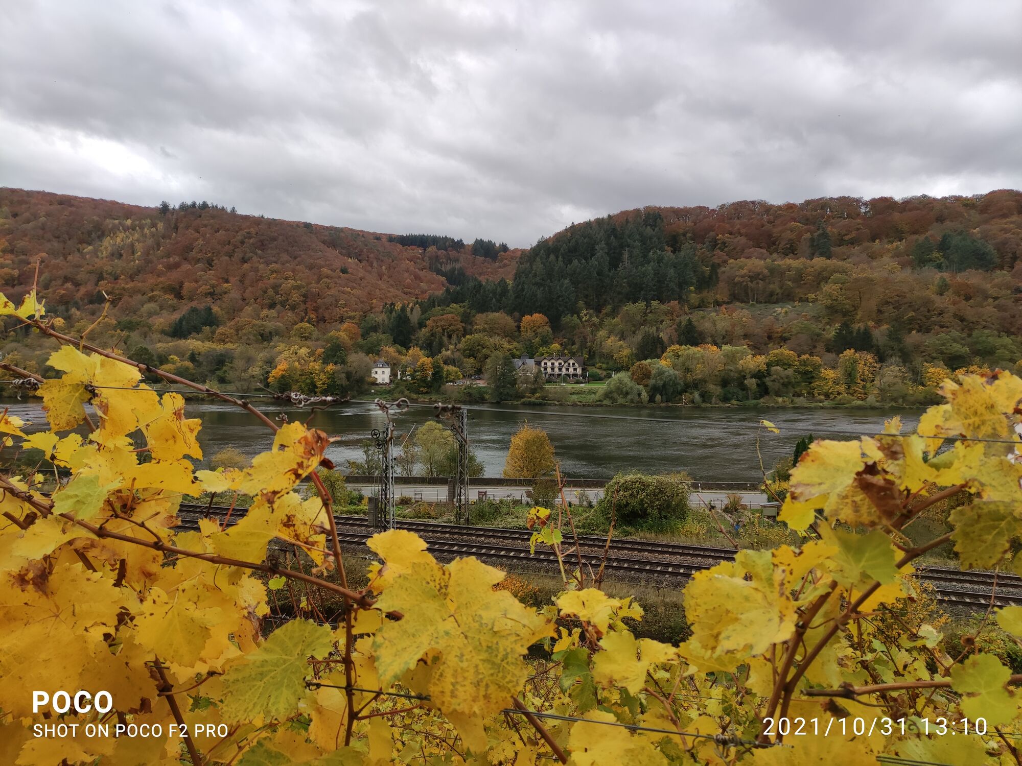
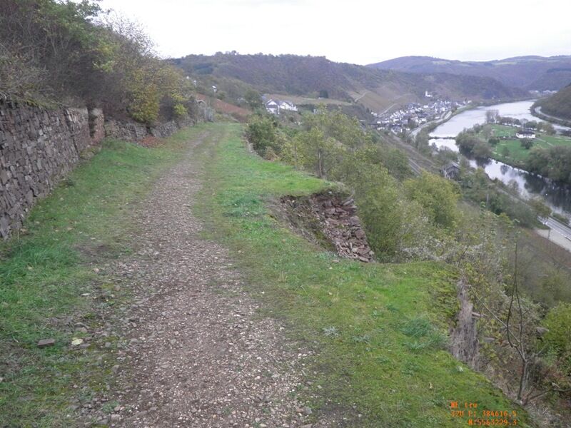
The path leads along the edge of the slope without major altitude changes. The dense forest still does not allow a view into the Moselle valley. At a radio mast, the moment has come: a viewpoint has been created a few meters off the path, from which you can enjoy a magnificent view over the Moselle valley from Burgen to Hatzenport! The route continues mostly along the ridge to Lasserg. The small village is quickly crossed, and at the sports field the last houses are already behind you. After a short distance, you reach a beautiful spot with a hut, rest area, and a view into the Moselle valley. Just a few meters further on a path, then you stand on the edge of the slope at the "Küppchen" viewpoint high above the Moselle. The view from up here is spectacular. Below you spot Bischofstein Castle with its massive round tower. Burgen lies on the opposite Moselle side at the mouth of the Baybach valley, deeply cut into the Hunsrück (see author's tip). The dreamy view extends far over the heights of the Hunsrück and, of course, downstream the Moselle, where Hatzenport, the next intermediate destination, is already visible. In suitable weather, you can watch the paragliders taking off from this starting point here.
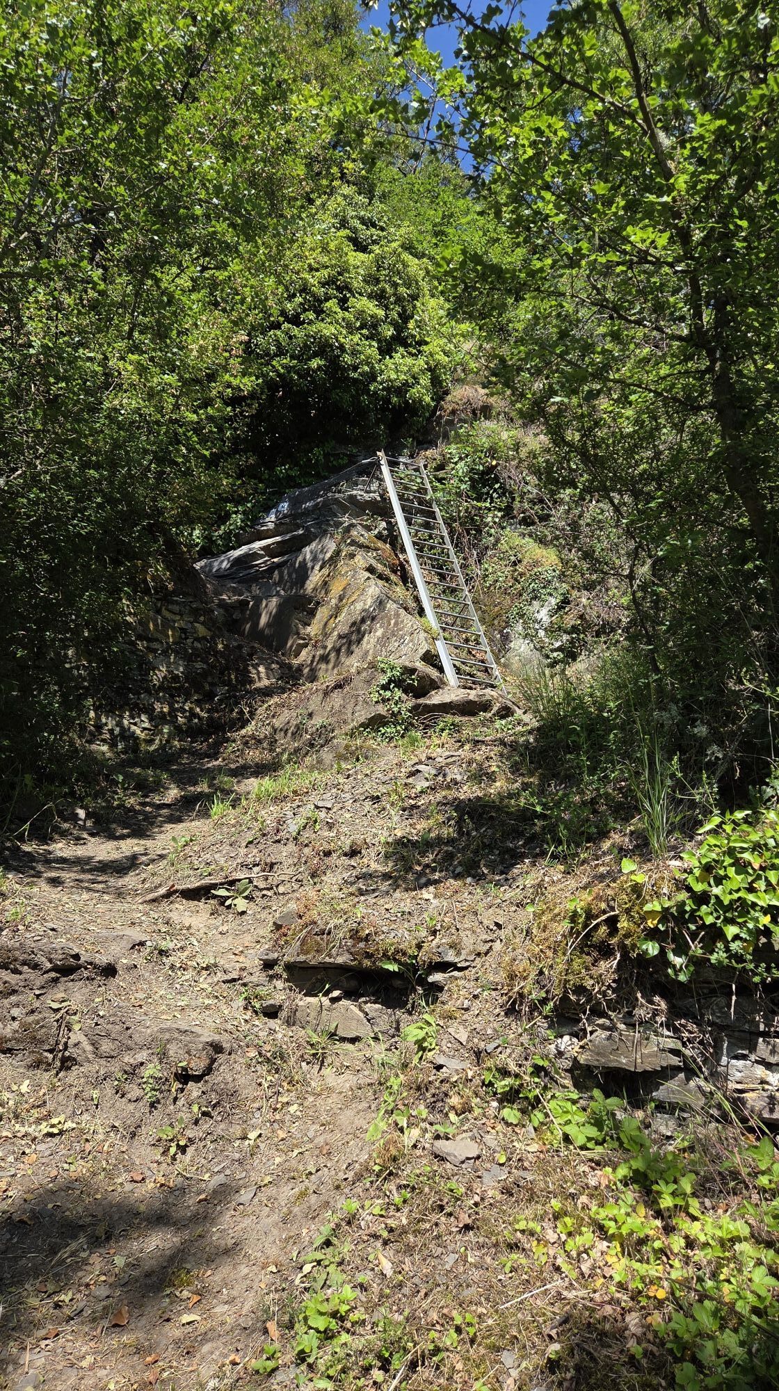
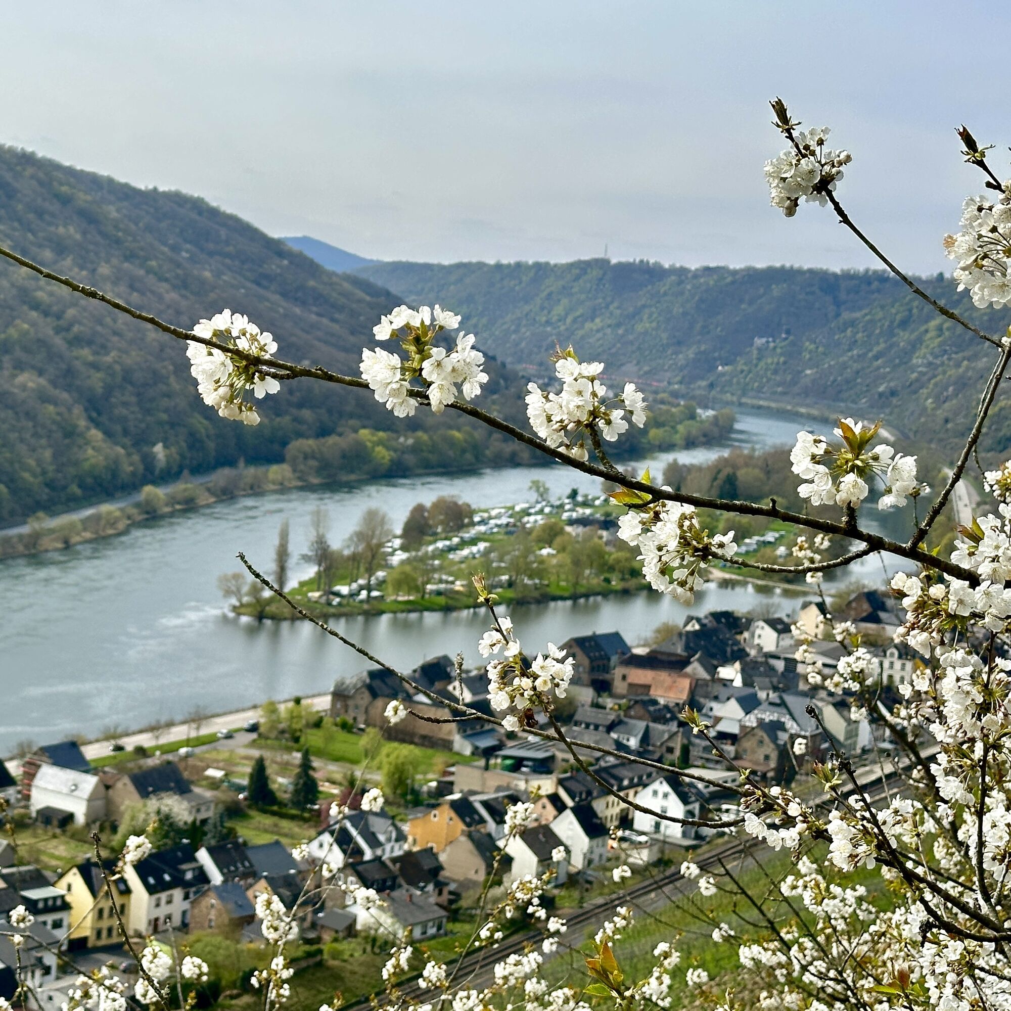
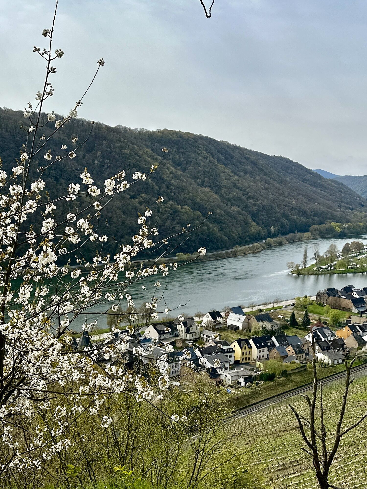
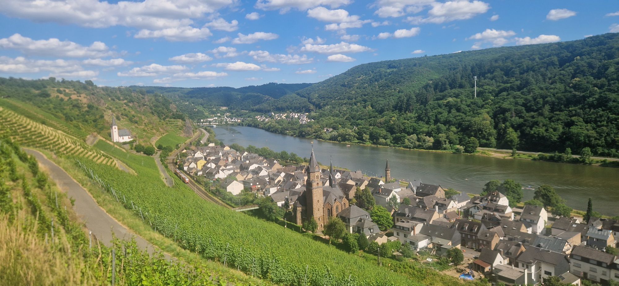
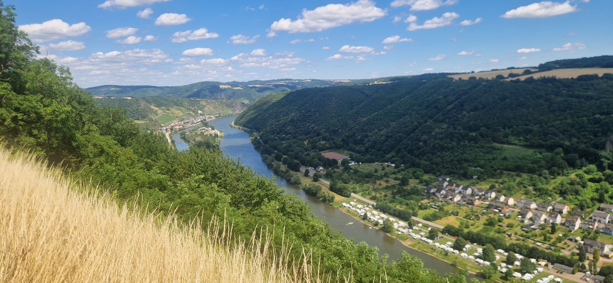
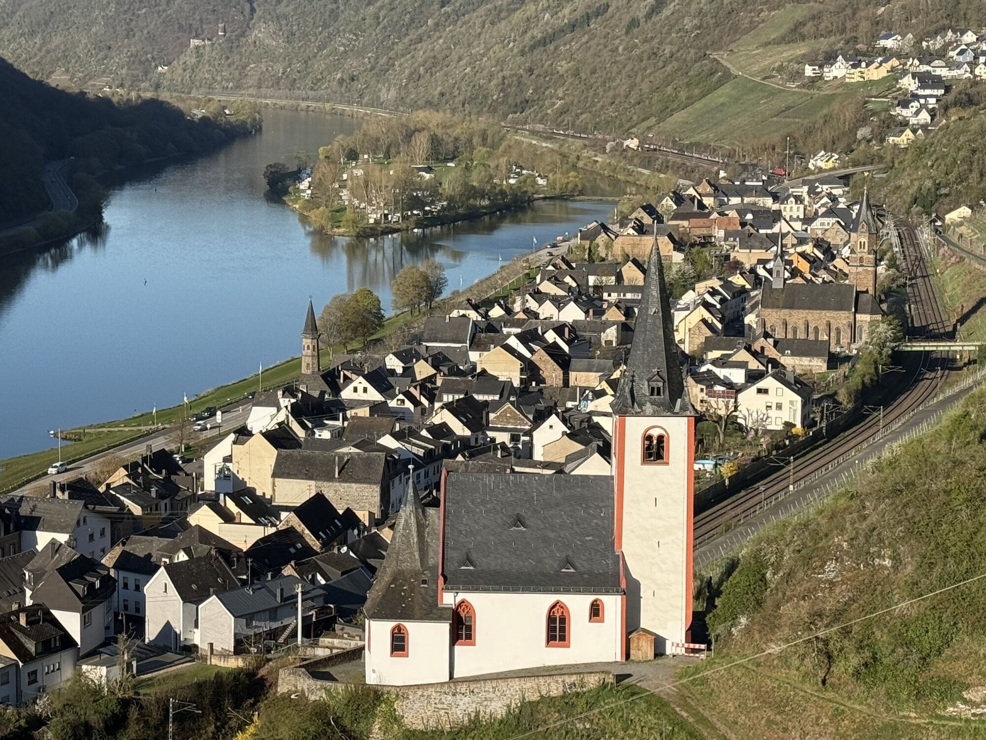
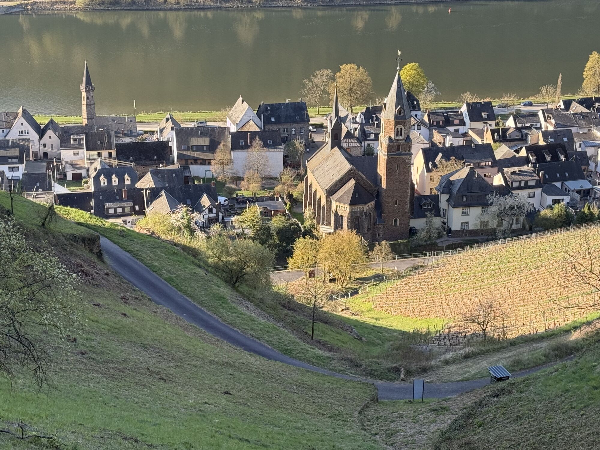
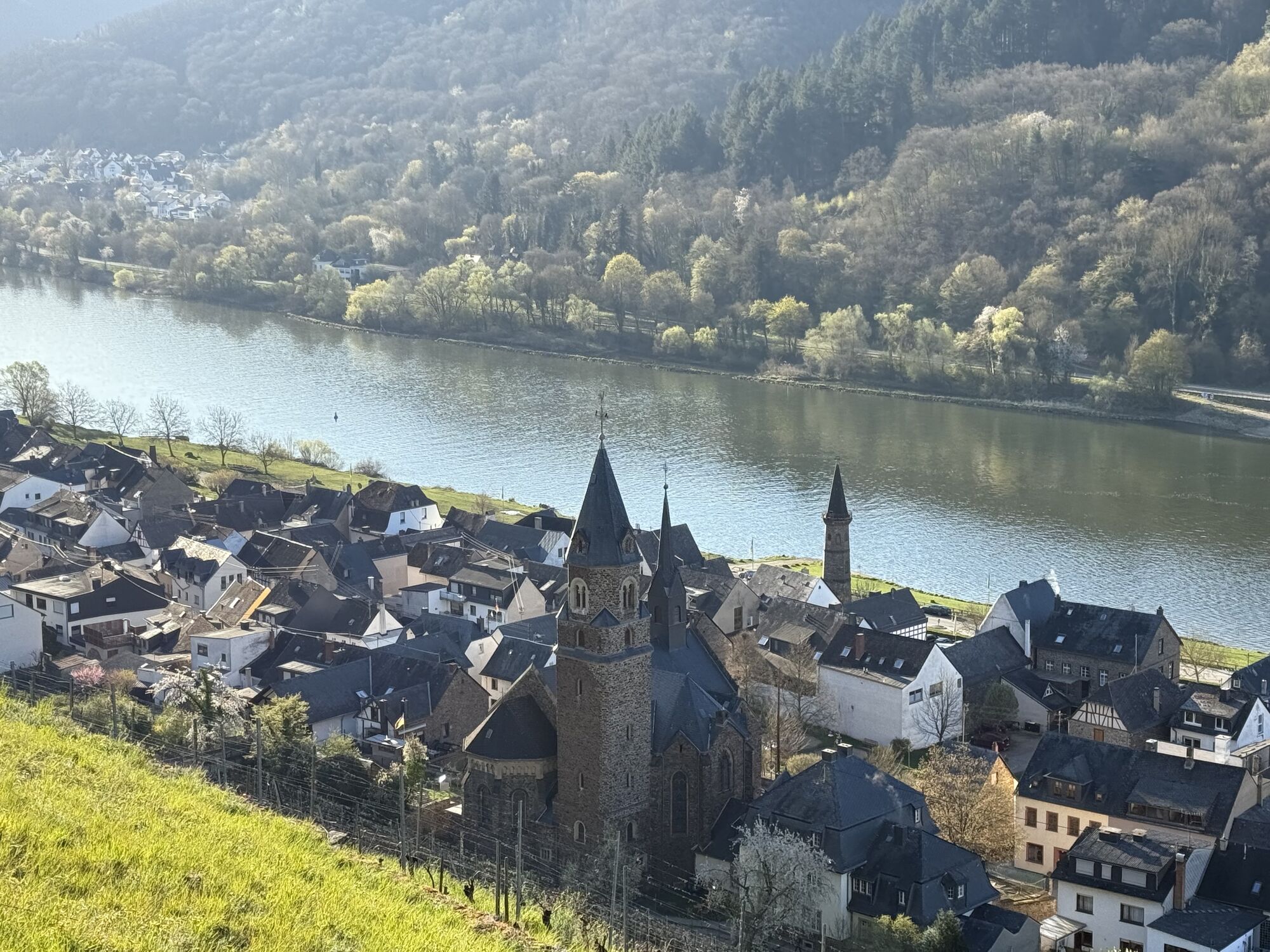
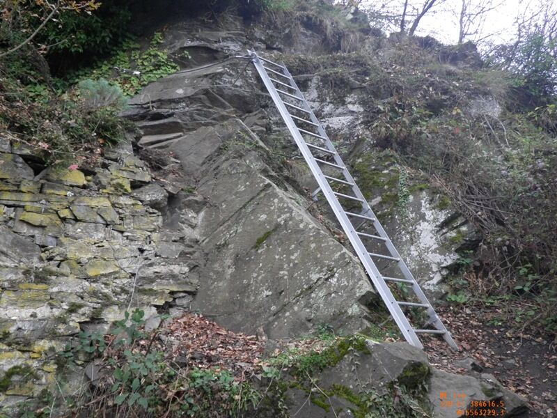
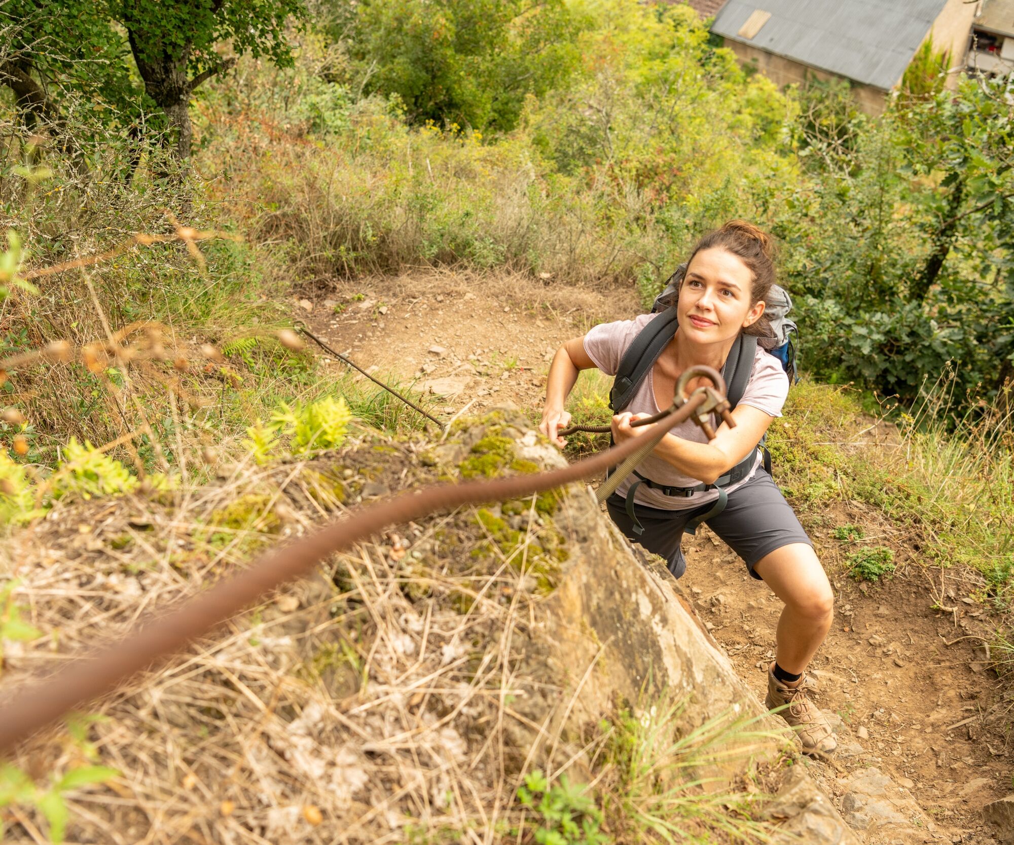
The Moselsteig continues along the ridge to the edge of the forest. From here, the Hatzenporter Laysteig dream path runs on the same route, and the path now leads downhill through the low forest. At a rest area with a wonderful view of the Moselle valley, the path section ends. A panorama path follows, which slowly descends with an open view of the Moselle valley through what used to be vineyards. The new development area of Hatzenport is quickly crossed. After crossing the L 113, you encounter the short Dolling via ferrata – you can bypass it along the road. Both options meet again at the railway underpass in the Schrumpftal in Hatzenport, very close to the train stop.
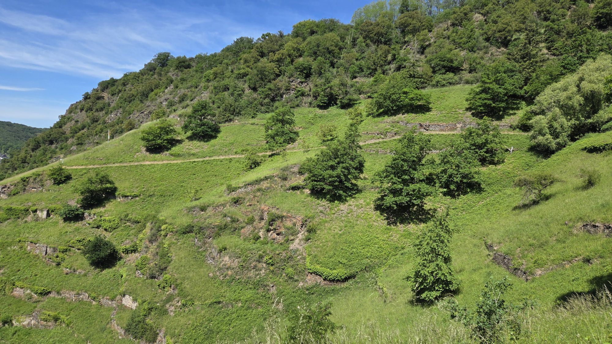
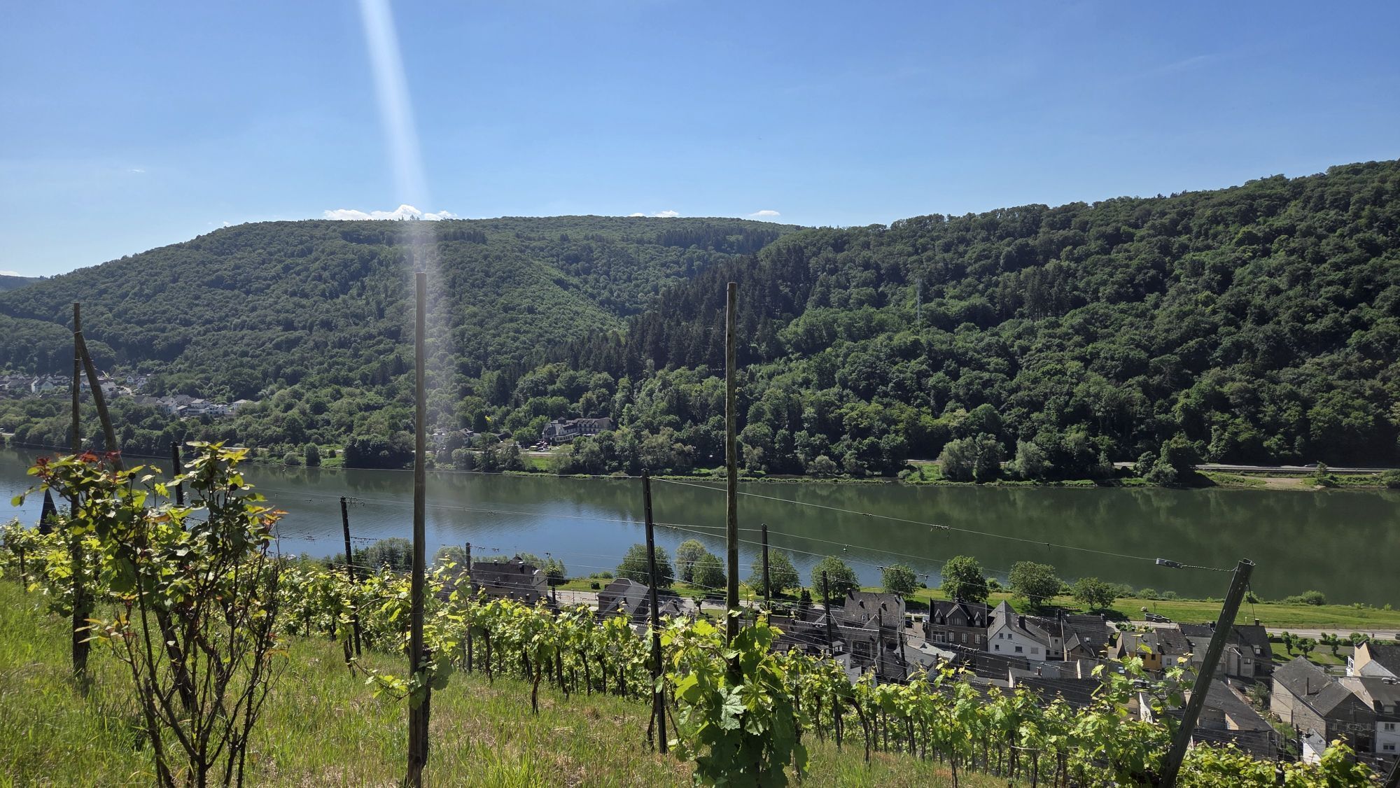
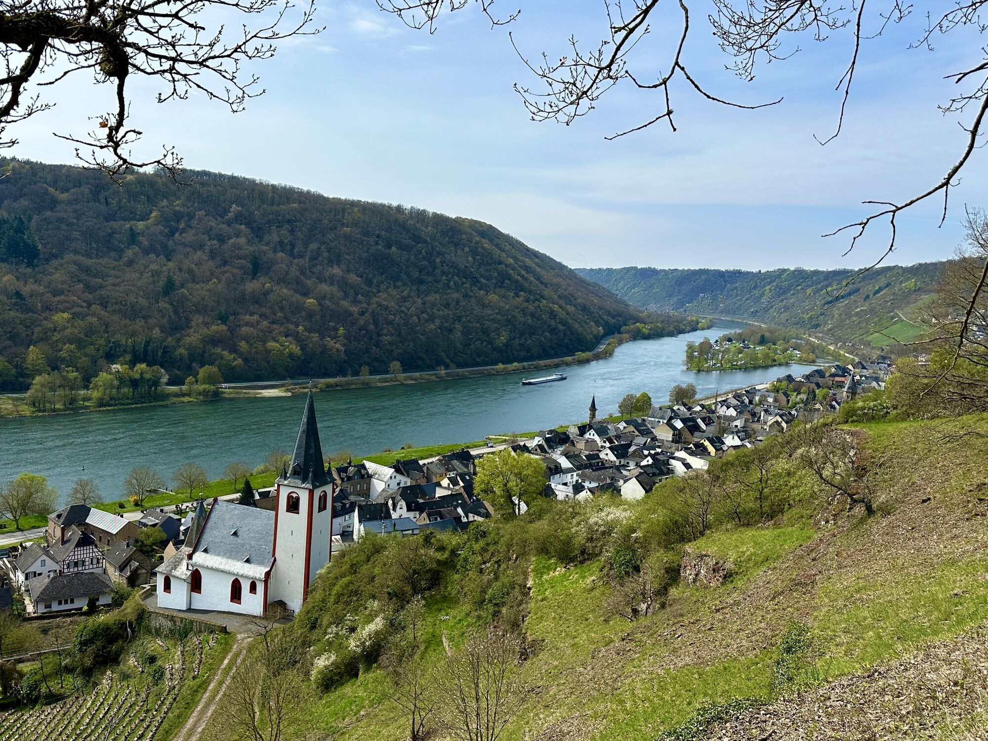
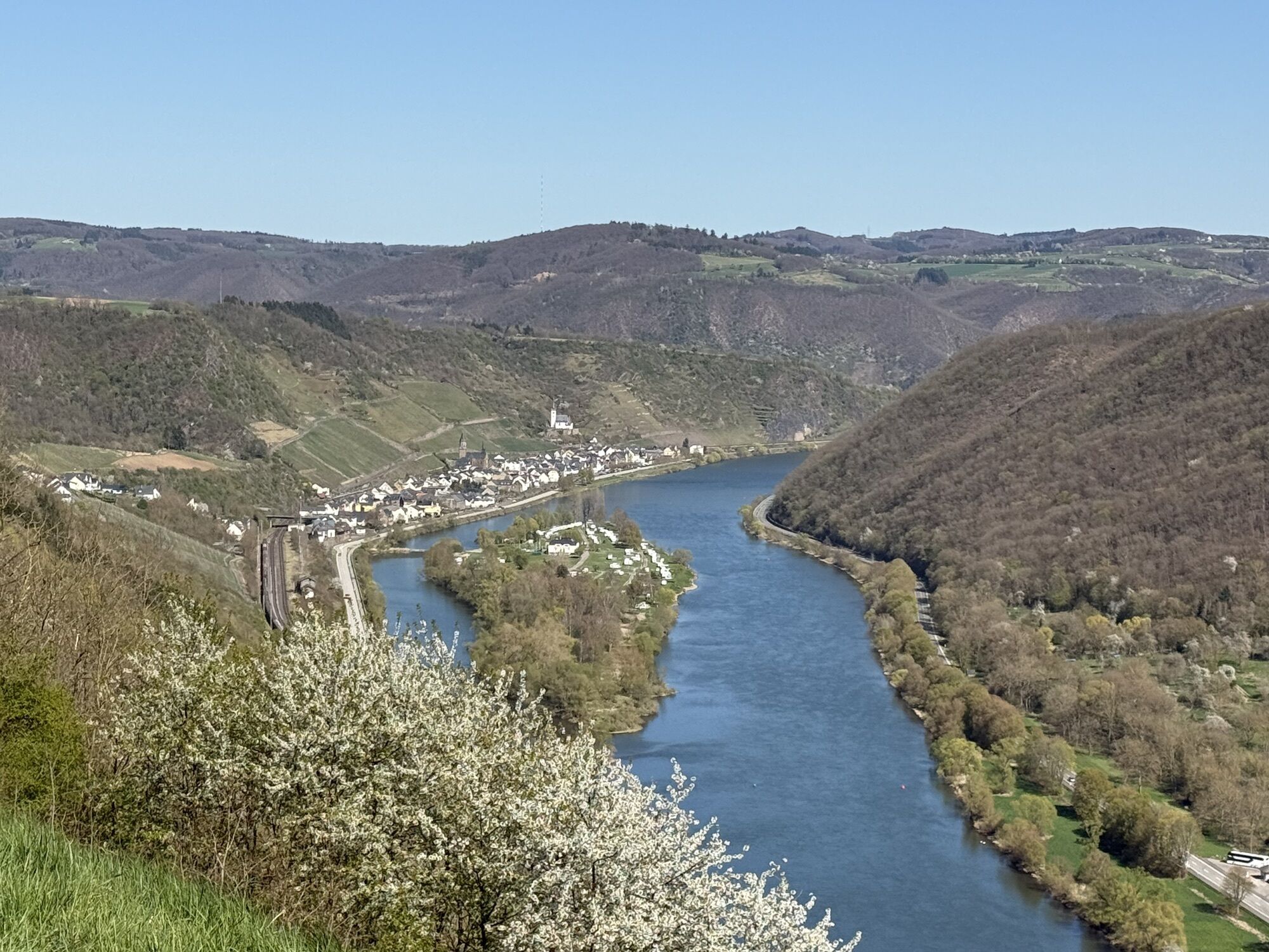
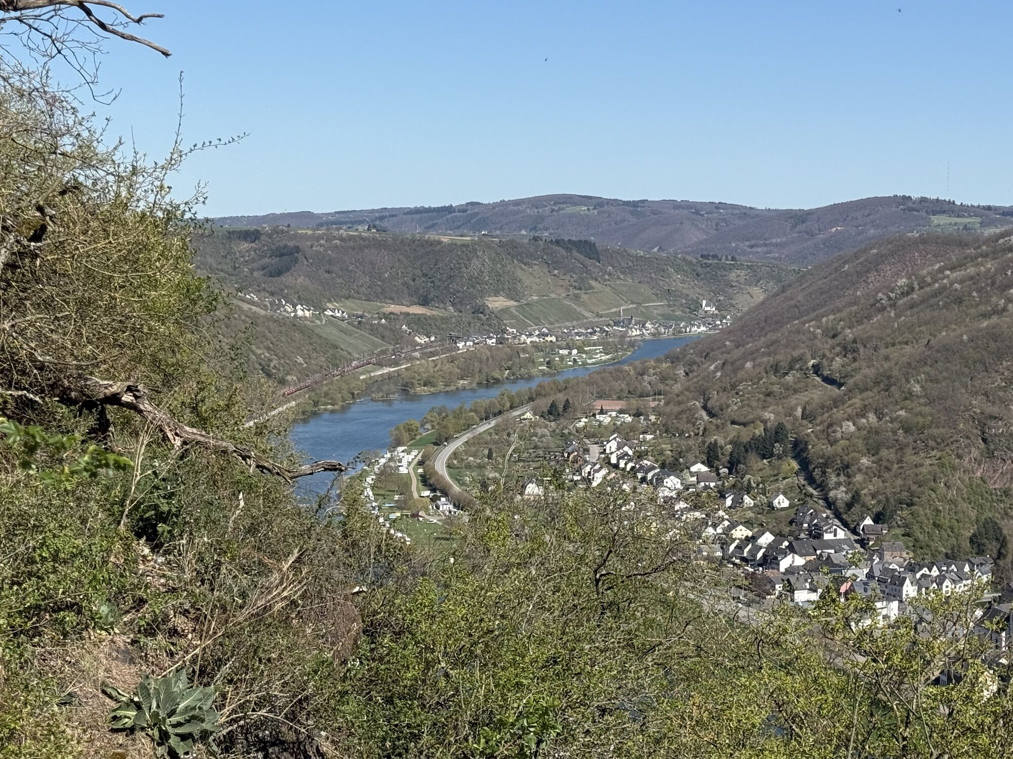
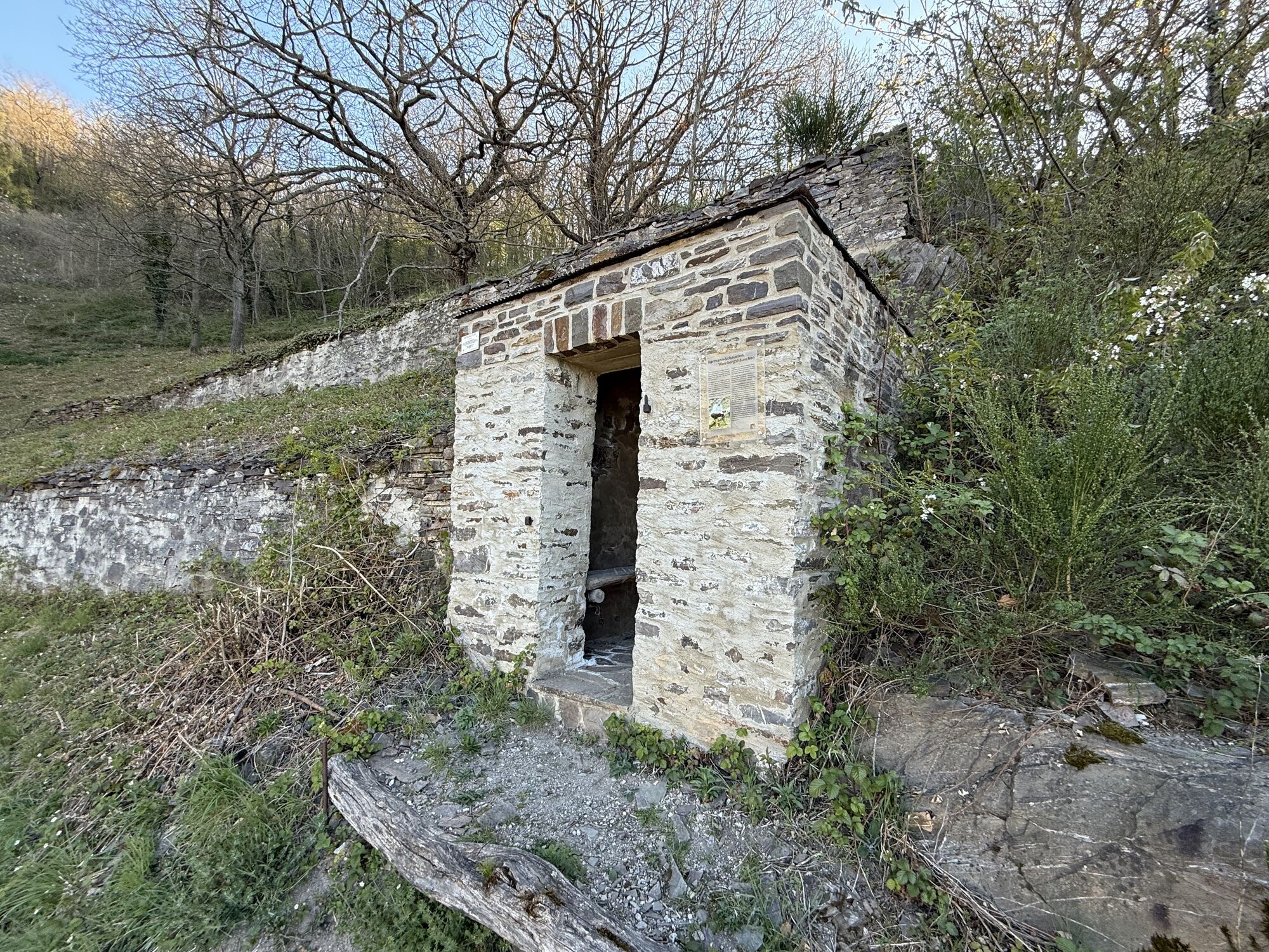
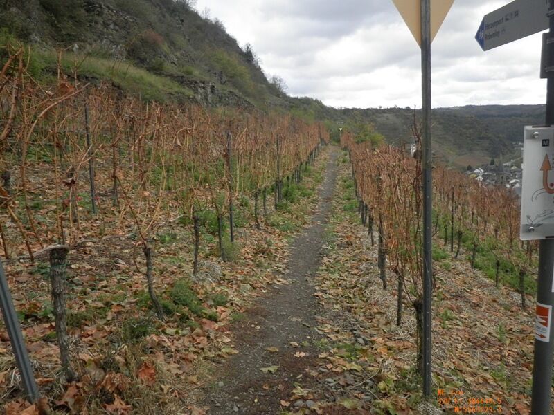
From here, you immediately go back into the steep terrain above the village. A path secured with ropes leads you into the vineyards and to the nearby weather station. The path through the slopes covered with vines leads past an old vineyard hut to a forecourt shelter. From here – but also already on the way here – you get a fascinating view of the Moselle valley at Hatzenport! Especially the Johanniskirche directly below the vineyards offers a memorable picture. After a section through the low forest, it becomes scenic again, and shortly after you reach the Rabenlay. Here you will find a shelter, a rest area, and a lounge with a dream view – an ideal place for an extensive picnic!
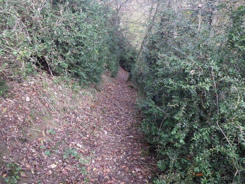
Now the Moselsteig still follows a strip of woodland alongside the dream path before it turns away over the open field. The path now crosses a street, and after entering the forest, it goes down briefly. Further through the forest, you reach the side valley of the Alsbach with a slight ascent. Here you meet the Würzlaysteig, which accompanies the Moselsteig until shortly before Löf. The next section again runs through the forest, briefly interrupted by a dense boxwood stand, which you cross on a path. Slightly downhill, you then enter the Kehrbachtal. Now, accompanied by a stream, it only goes downhill. Under a dark green canopy of leaves, you walk past stations of the Stations of the Cross to the outskirts of Löf. Now you have the choice: take the access path to the train station via Nachtigallenweg or walk directly into the village and end this beautiful stage near the Moselle bridge.
Tak
sturdy footwear
weather-appropriate, functional hiking clothing
backpack provisions
Starting point: Moselkern via the B 416 between Treis-Karden and Koblenz
Destination: Löf via the B 416 between Treis-Karden and Koblenz
You can reach the stage towns Moselkern (train station) and Löf (train station) by train (RB 81).
There are regular connections. Please note that during the school holidays of Rhineland-Palatinate / Saarland, on weekends, and on public holidays, frequency restrictions may occur! Please check the current timetable on the website of the Rhein-Mosel transport association (VRM): www.vrminfo.de
Moselkern: parking available at the train station, large parking lot at the Kirchstraße/Moselstraße junction
Löf: parking available along the B 416
Tak
Mosellandtouristik GmbH
Kordelweg 1, 54470 Bernkastel-Kues; phone: +49 (0)6531/97330
Tourist Information Ferienland Treis-Karden
St. Castor-Straße 87, 56253 Treis-Karden, OT Karden; phone: +49 (0)2672/9157700
Tourist Information Sonnige Untermosel
Moselstraße 7, 56332 Alken; phone: +49 (0)2605/8472736
Popularne wycieczki w okolicy
-
4,6
Traumschleife Ehrbachklamm
ciężkiWędrówka 11,0 km -
4,4
Marienkapellchen - Wierschem - Petersköpfchen - Unterschänke
ciężkiWędrówka 12,7 km -
4,4
Mosel - Burg Eltz - Mosel
średniWędrówka 12,8 km -
4,8
Murscher Eselsche Dream Loop
średniWędrówka 10,7 km -
5,0
Dream Loop Upper Baybach Valley
ciężkiWędrówka 15,6 km -
4,8
Dommershausen - Steffenshof - Schmausemühle - Beltheim
ciężkiWędrówka 10,4 km -
4,7
Schessels Beersche
średniWędrówka 5,44 km -
4,5
Boppard - Restaurant Cafe Vierseenblick - GedeonsEck
ciężkiWędrówka 4,99 km -
4,5
Mittelrheinsteig Boppard #LL2ROM V09
ciężkiWędrówka 5,01 km -
4,5
Moselsteig Stage 22: Löf – Kobern-Gondorf
ciężkidługodystansowy szlak pieszy 13,7 km
Wędrówki i tropienie


Nie przegap ofert i inspiracji na następne wakacje
Twój adres e-mail została dodana do listy mailingowej.