


Mount Tournairet from the Brasque barns
Poziom trudności: T2
Observation points and points of interest:
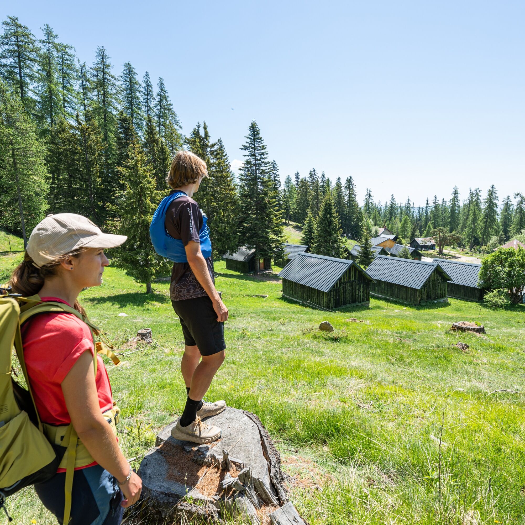
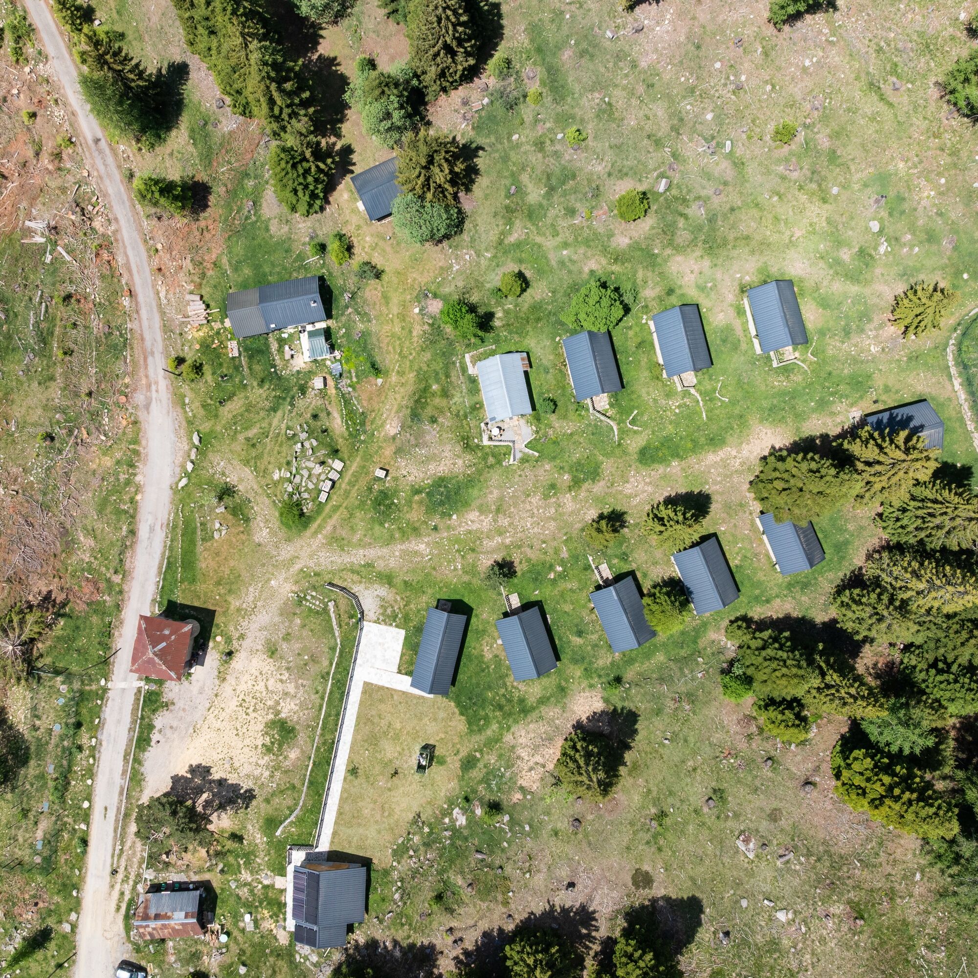
The Brasque barns
Developed from 1885 by the French army, the Brasque barns site is a fortified military camp completed in 1931 to face the Italian threat. Reinforced...
Observation points and points of interest:
The Brasque barns
Developed from 1885 by the French army, the Brasque barns site is a fortified military camp completed in 1931 to face the Italian threat. Reinforced in 1933 by the fortified work of the Col-du-Fort integrated into the Maginot Line, the site preserves commemorative steles and engravings as well as the chapel Notre-Dame des Victoires, bearing witness to the life of the troops on garrison.
Today converted into tourist accommodation, the Brasque barns offer an unusual experience combining an unknown military heritage and a preserved natural setting.
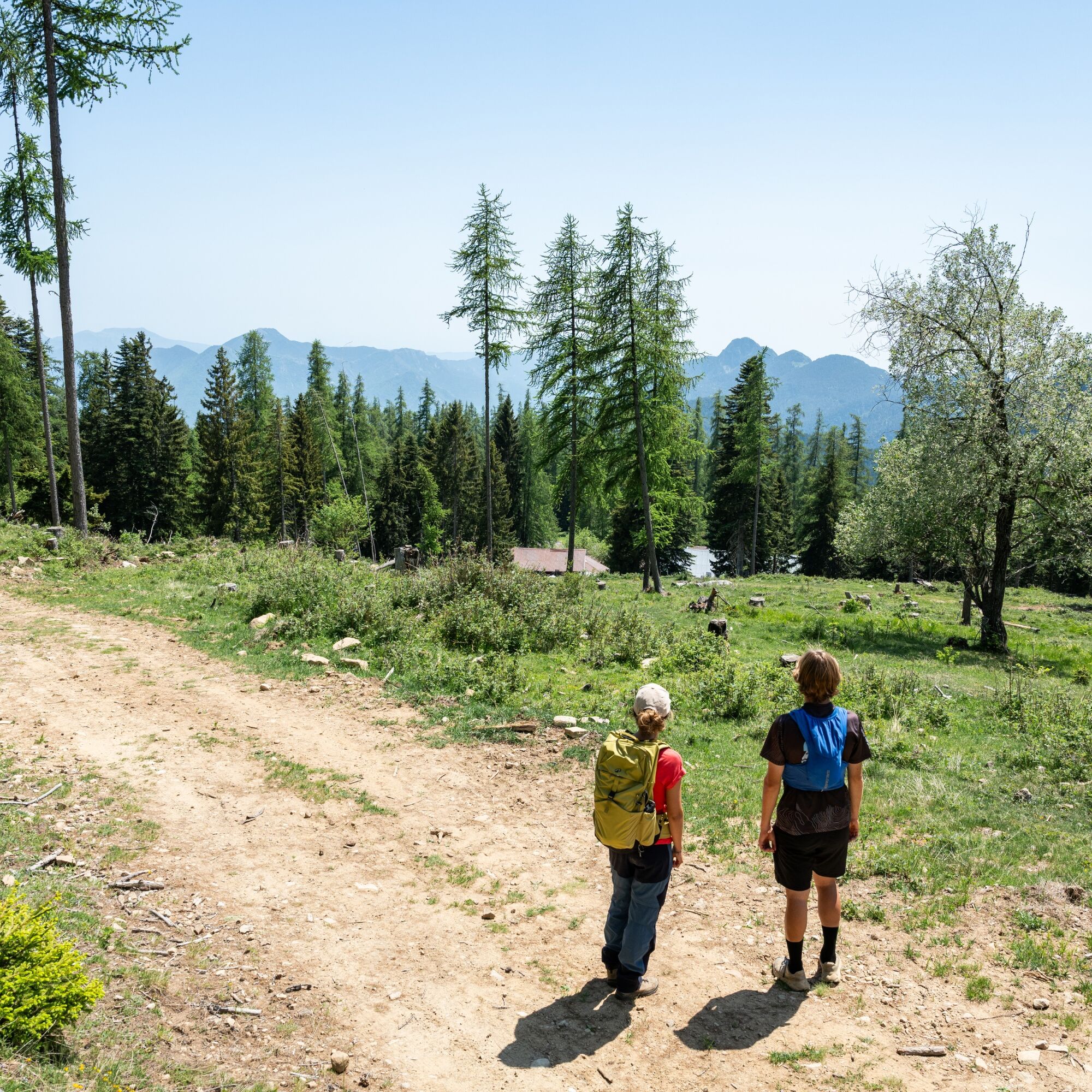
Mount Tournairet (2086 meters)
Although the massif bears its name, Mount Tournairet is not its highest point. It is surpassed by Mount Chalancha (2102 meters) located slightly to the north. Once at the summit, you can admire the "Greats" of the Mercantour, including the Gélas Peak (3143 meters) and Mount Argentera (3298 meters).
The forest mosaic
Mount Tournairet is located at the crossroads of several climatic influences, making the contrast between sunny and shaded slopes particularly marked. Numerous species blend along the route: larch dominates the sunny slopes of the communes of Utelle and Lantosque, while the more shaded slopes overlooking Clans and Venanson are mostly covered with spruces and firs.
1 - Km 0 : From the Brasque barns, take the GR5 trail uphill, cutting across the switchbacks of the old military track.
2 - Km 1.6 : Pass below the Col du Fort, then cross to join the collet des Trous.
3 - Km 2.7 : The trail steepens. Take the switchbacks to reach the summit of Mount Tournairet.
4 - Km 3 : Retrace your steps slightly then begin the descent on the north slope, following the trail around the peak of the Tournairet combe and the head of Cabanal.
5 - Km 5.8 : Then start the ascent to reach the Andrion pass.
6 - Km 7.5 : At the pass, take the gently descending road to return to the Brasque barns.
T2
Popularne wycieczki w okolicy
The Salt Roads: The Pagarine Route
średnidługodystansowy szlak pieszy 159,7 km- 5,0
FFC cycling circuit No. 32: The loop of the 2 valleys from St. Sauveur/Tinée
ciężkiDroga rowerowa 117,8 km FFC MTB Circuit No. 4b: Le Turini
średniMountainbike 32,0 kmRoquebillière - Saint-Martin-Vésubie / Pagarine route (stage 5)
ciężkiWędrówka 18,3 kmUtelle - Roquebillière / Pagarine route (stage 4)
średniWędrówka 20,0 kmMercantour to Nice Electric Mountain Bike Route "e-bike MNCA"
średniMountainbike 236,3 kmMountain bike circuit FFC no. 21a: Les granges de la Brasque
ciężkiMountainbike 41,2 kmRoute n°1 - 2 days - Stage 2 Isola Village - Nice
ciężkiDroga rowerowa 139,4 kmFFC mountain bike route no. 11: The pointe de la Penna
średniMountainbike 11,1 kmVTT FFC route no. 2: The Férisson dairy farm
ciężkiMountainbike 28,0 km
Wędrówki i tropienie


Nie przegap ofert i inspiracji na następne wakacje
Twój adres e-mail została dodana do listy mailingowej.