


A little walk in Beaulieu-sur-Mer: coastline, city trek and viewpoint
Beaulieu, a prime tourist spot from the Belle Époque era with sumptuous villas and magnificent buildings, a small city-trek to discover the main landmarks of the town and the sea views.
During this walk,...
Beaulieu, a prime tourist spot from the Belle Époque era with sumptuous villas and magnificent buildings, a small city-trek to discover the main landmarks of the town and the sea views.
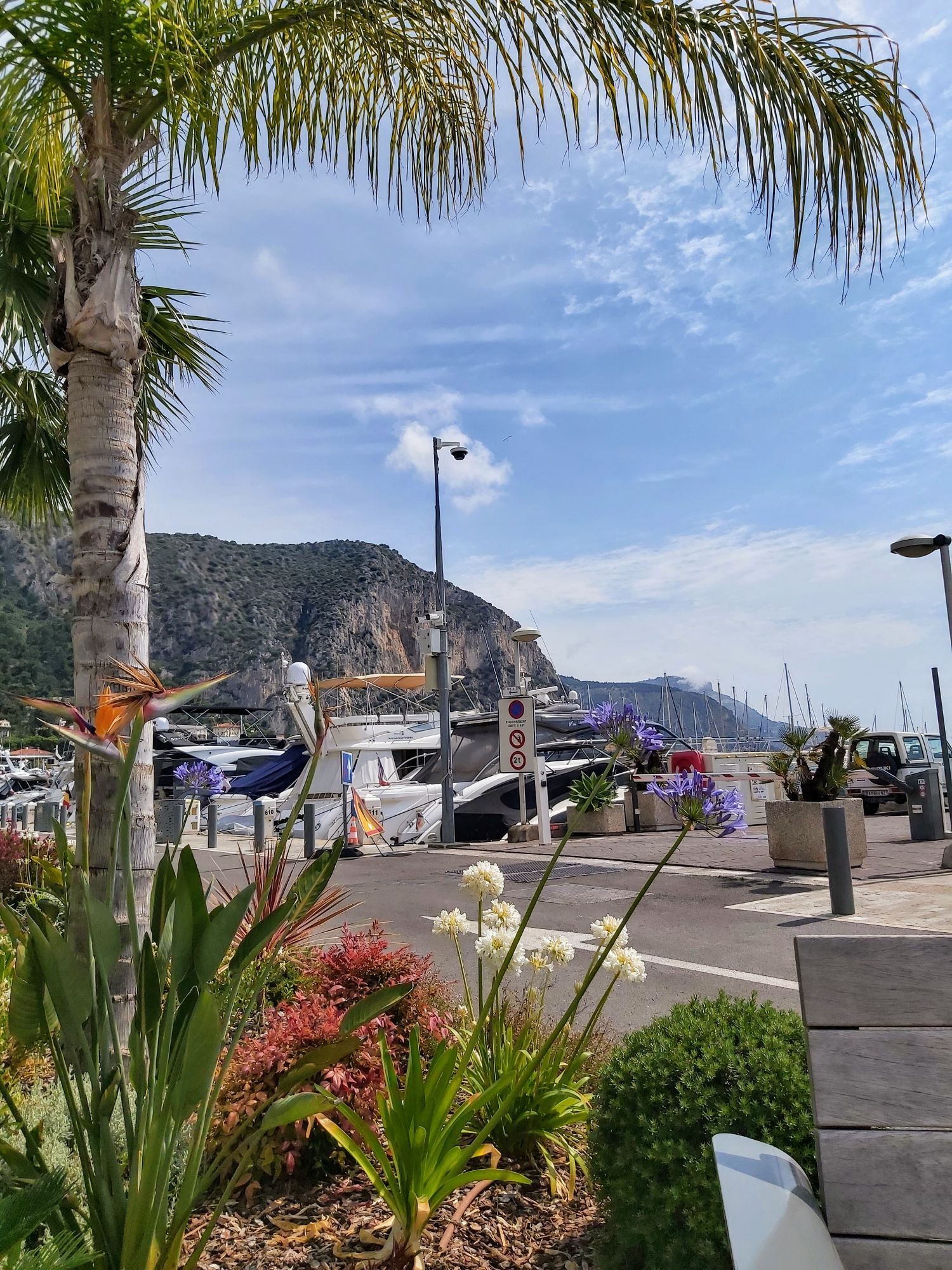
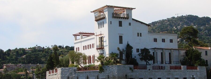
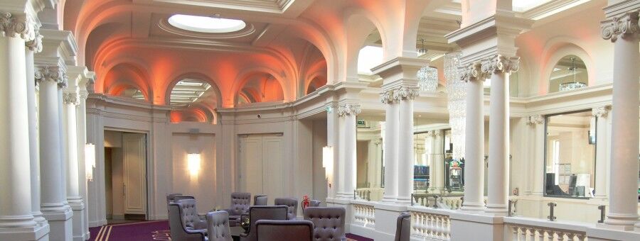
During this walk, you will admire the built heritage such as the port, the Chapelle Sancta-Maria de Olivo, villa Kerylos, the Rotonde, the Casino.
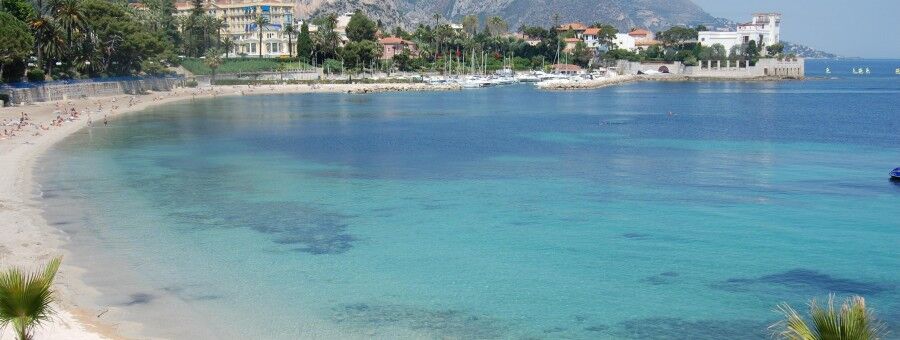
You can also take a swimming break on the magnificent plage des Fourmis, equipped with showers and toilets. Then dine in one of the bay's restaurants.
A very easy walk to do with family.
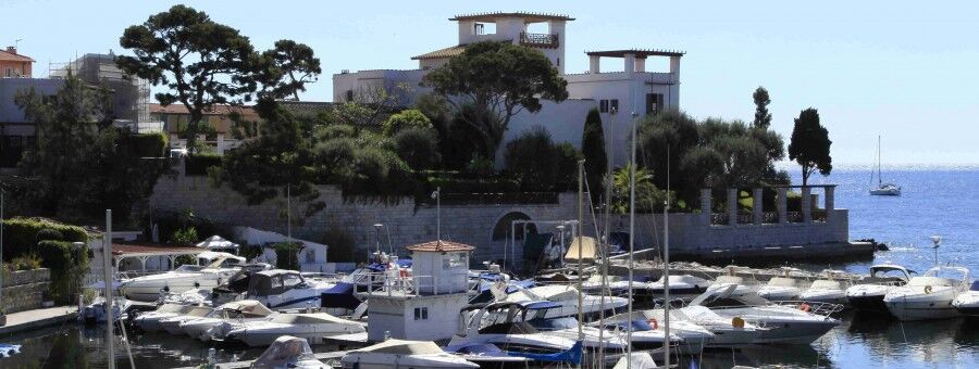
From the parking and the harbor master's office, follow the port south to its end and take the stairs on the right to arrive at a semicircular parking lot.
Continue 80 m along the sea and take a street to the right that quickly leads to boulevard d'Alsace Lorraine.
Turn left and follow this boulevard for about 150 m, then continue straight on avenue des Hellènes. (A short round trip to Rue Gustave Eiffel to visit villa Kérylos shortly after).
Continue on avenue des Hellènes along the port des Fourmis and opposite the Casino de Beaulieu, go down the stairs giving access to the promenade overlooking the beach.
Continue to the end and go up to the right to find yourself on avenue Fernand Dunan.
Then take a right and follow the avenue to the Casino. Cross the public garden to the left to reach Rue du Lt Colonelli.
At its end, turn left onto Marechal Leclerc, then after the SNCF bridge, turn right on G. Clémenceau, then left Maréchal Foch and right BD Marinon. You then reach boulevard Eugène Gauthier which allows a return to the harbor master's office and parking.
Possible round trip along the sea (return possible via the sidewalk) to reach the Beaulieu Cap Ferrat viewpoint, passing in front of some Belle Epoque houses.
Tak
Tak
Tak
Sport shoes welcome
In case of problem call 112
Coming by car: Autoroute A8
From the west: La Turbie exit (exit 57)
From the east: Monaco-La Turbie-Eze exit (exit 58)
Parks of the Marina ( next to the Petit Afrique beach), free from mid-September to May 1st except blue zone
To learn more about our destination, visit our website
https://outdoor.nicecotedazur.org/ , the dedicated outdoor activities platform for the Metropole Nice Côte d'Azur
Popularne wycieczki w okolicy
- 4,8
Tour du Cap-Ferrat
średniWędrówka 8,99 km - 4,0
Chemin de Nietzsche
światłoWędrówka 3,73 km - 5,0
Little hike at Eze: Fort de la Revère Circuit
światłoWędrówka 6,02 km Little hike in Nice: the Mont Boron route
światłoWędrówka 5,13 kmNice - Aspremont / Pagarine Route (stage 1)
średniWędrówka 15,8 km- 4,0
Little hike in Aspremont: Mont Chauve circuit
światłoWędrówka 6,49 km FFC bike circuit no. 5: on the Tour De France routes (big loop)
średniDroga rowerowa 74,2 km- 5,0
Goldtoni - Alpenbogen A082 Drap-Nizza
światłodługodystansowy szlak pieszy 26,4 km Grande Randonnée® de Pays: Lou Camin Nissart
ciężkidługodystansowy szlak pieszy 44,7 km- 5,0
Goldtoni - Alpenbogen A102 Monaco-Sospel
światłodługodystansowy szlak pieszy 29,7 km
Wędrówki i tropienie


Nie przegap ofert i inspiracji na następne wakacje
Twój adres e-mail została dodana do listy mailingowej.