







Via dei Briganti | Stage 1 Cisterna d'Asti - Ferrere
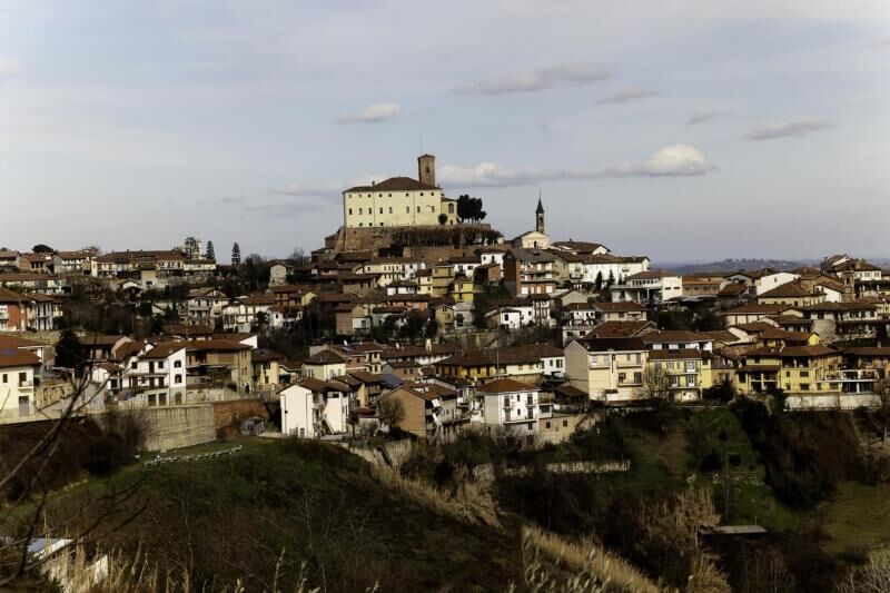
The itinerary of the Via dei Briganti starts from the center of Cisterna d'Asti, dominated by the castle dating back to the 11th century, now home to the Museum of Arts and Crafts of the past. The first...
The itinerary of the Via dei Briganti starts from the center of Cisterna d'Asti, dominated by the castle dating back to the 11th century, now home to the Museum of Arts and Crafts of the past. The first part of the route crosses the ordinary road network, then goes into the woods along Via Pranzovero to go down and up to the village Saretto. It continues north-east through woods little anthropized up to Cascina San Damiano and the hamlet Scaglie, once an important agricultural nucleus. Then, gradually, descends to the provincial road where the church of Vattigliera is located. It continues through a beautiful forest to the road of the hamlet of San Giuseppe, with a recently restored nineteenth-century church. The municipal road crosses the hamlet of San Giuseppe and descends until it intersects the Gherba road. Here the stage 1 ends, with the possibility to continue towards Villafranca d'Asti or take the ancient Via dei Morti, variant 1B, which leads to the historic center of Ferrere with its town hall at the Castelvecchio and the guesthouse of the Casa Carolina.


Popularne wycieczki w okolicy
- 5,0
Castagnito - Oratory of the Holy Spirit
średniWędrówka 14,7 km PRALORMO - Ring around the Lake of the Thorn
Jazda na rowerze 11,3 kmArch 3 | From Casale Monferrato to Racconigi
ciężkiKolarstwo długodystansowe 143,4 kmVILLASTELLONE - Ring from Borgo Cornalese toward the Roero.
średniDroga rowerowa 64,4 kmVia dei Santi | Stage 2 Celle Enomondo San Pancrazio - Tigliole Hamlet San Carlo
światłoWędrówka 7,32 kmVia dei Santi | Variant 3A Baldichieri d'Asti - Castellero
światłoWędrówka 3,24 kmVia dei Santi: Stage 1 San Martino Alfieri - Celle Enomondo Fraz. San Pancrazio
światłoWędrówka 6,93 kmVia dei Briganti | Stage 2 Ferrere - Villafranca d'Asti
światłoWędrówka 10,6 kmStreet of the Saints | Variant 1B Crossroads Rio Cravina - San Pancrazio Celle Enomondo Stage 1 at Rio Cravina - Celle Enomondo hamlet San Pancrazio
światłoWędrówka 11,4 kmWater Street | Stage 1 Tigliole Fraz. San Carlo - Valfenera
światłoWędrówka 14,4 km
Wędrówki i tropienie


Nie przegap ofert i inspiracji na następne wakacje
Twój adres e-mail została dodana do listy mailingowej.





