


Colle Bercia-Lago dei Sette Colori/Lac Gignoux

The trail connects Colle Bercia (in the municipality of Cesana T.se) with Lago Gignoux / Lago dei Sette Colori, in French territory. A very pleasant path that runs entirely on a dirt track; the mid-altitude...
The trail connects Colle Bercia (in the municipality of Cesana T.se) with Lago Gignoux / Lago dei Sette Colori, in French territory. A very pleasant path that runs entirely on a dirt track; the mid-altitude route between 2,200 and 2,400 meters offers an open and extremely panoramic environment, of geological, historic-military interest due to numerous relics present on site, as well as botanical for the presence of ancient trees in the first section.
Support and technical description by Barbara Demonte - Environmental hiking guide.

The path starts from Colle Bercia at an altitude of 2,250 m, accessible from Cesana Torinese and Sagnalonga via a rather long dirt road that leads to the Chaberton parking area (where you can park) at 2,220 m just below Colle Bercia; it can also be accessed from Claviere using the available routes (dirt roads and hiking trails).
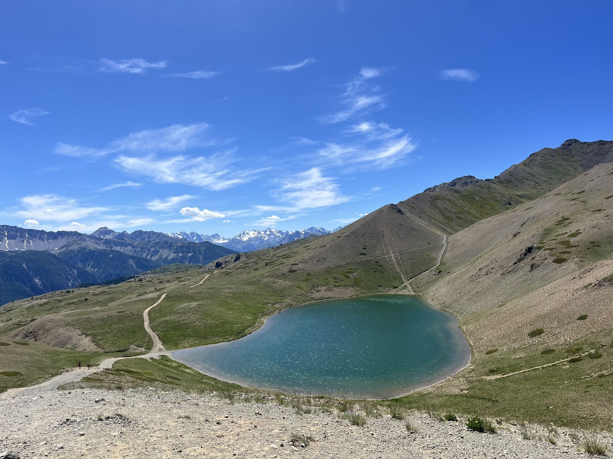
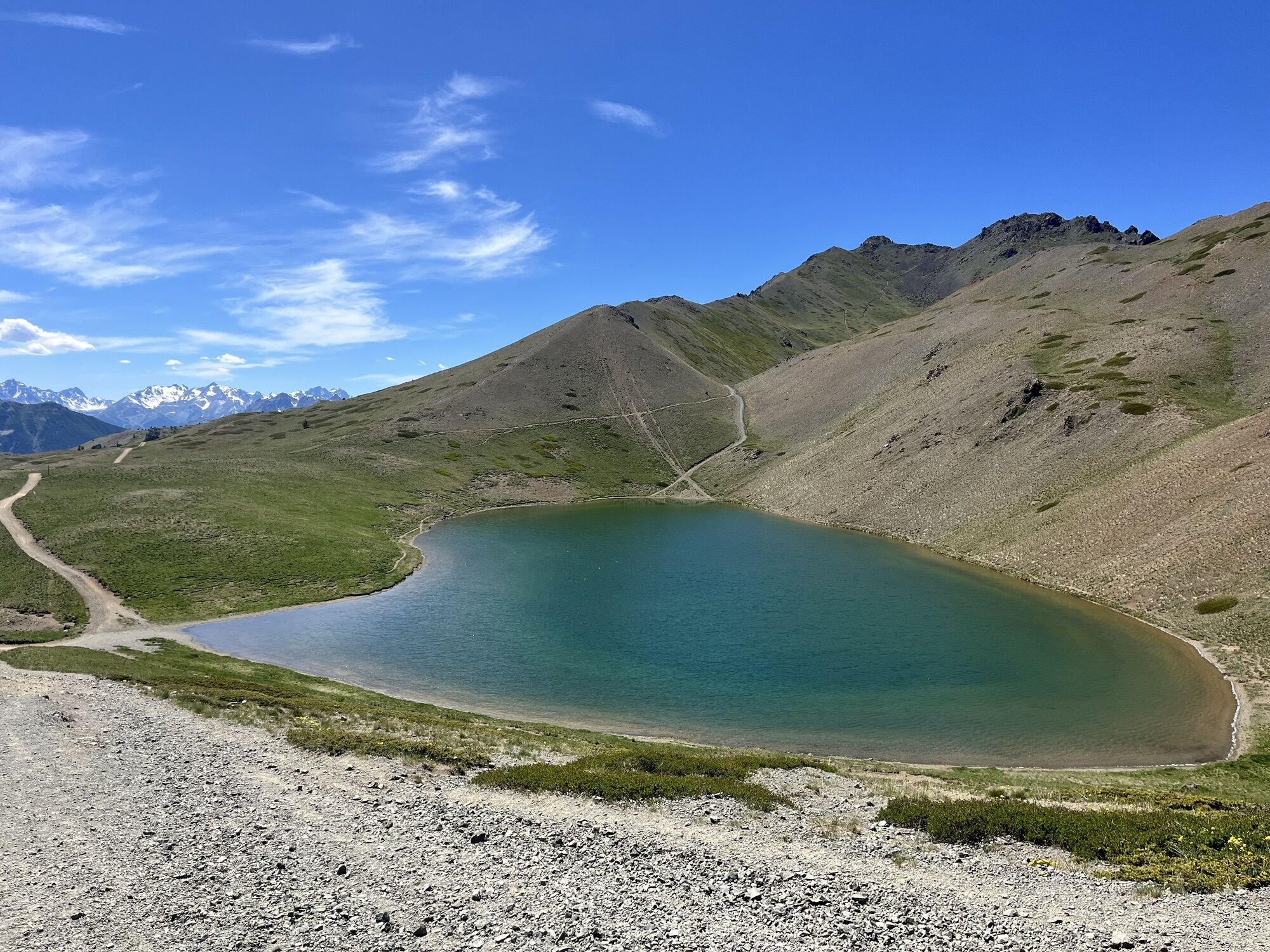
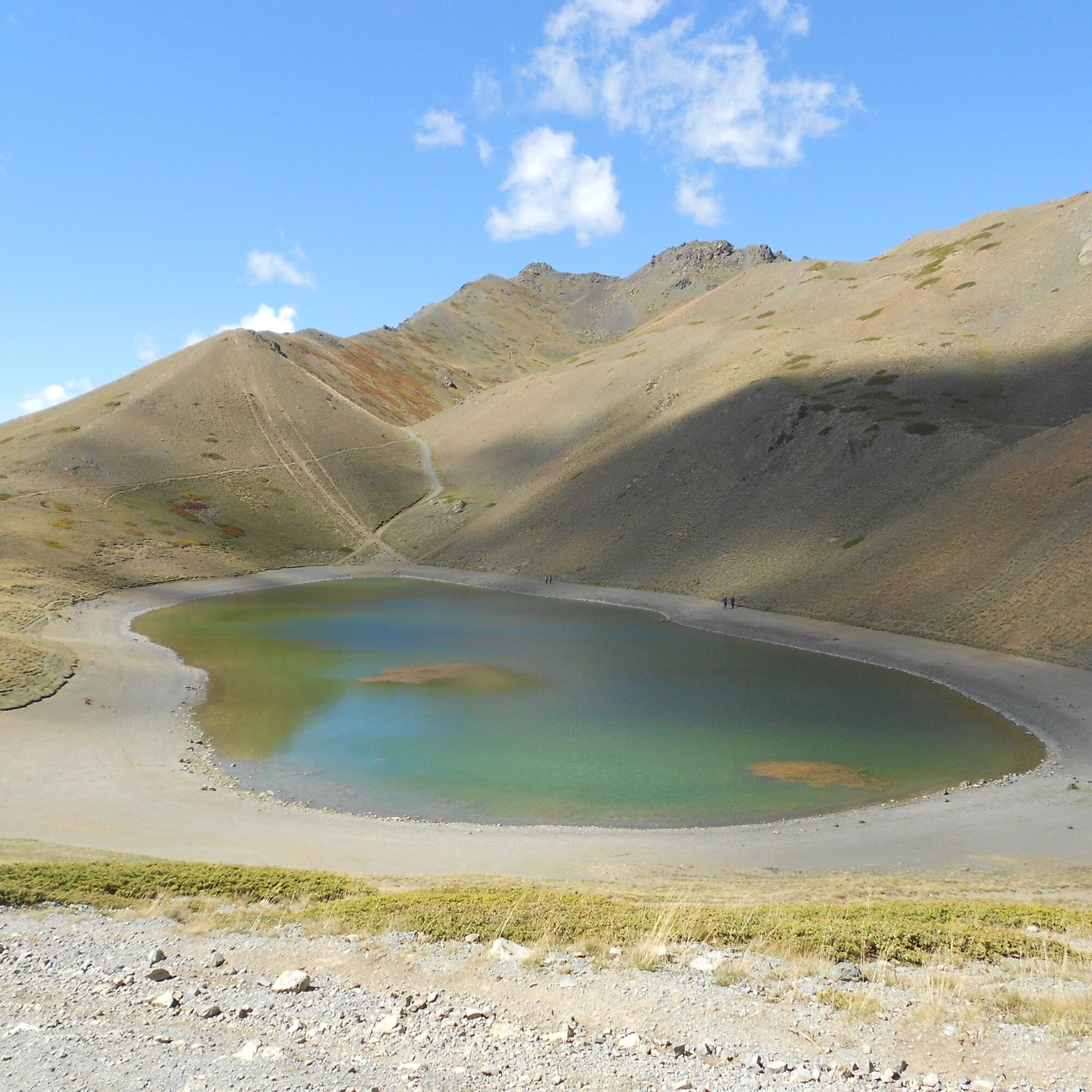
From the parking area, take the dirt track heading southwest, passing through some beautiful mountain huts and gently sloping up to a crossroads at about 2,660 m, where you ignore the path to the left towards Capanna Mautino and Lago Nero, and also the path to the right to the Ancient Trees, and proceed towards Lago dei Sette Colori; you encounter two more junctions on the left to Mautino and Lago Nero at about 2,300 m and 2,350 m, which you ignore; following the main path along the hillside beneath several destroyed military positions, you finally reach the Costa La Luna pass at 2,370 m; ignore both the path to the left leading to military positions and the one on the right leading to Val Gimont and Colletto Verde, and proceed on the main path which climbs briefly then gently levels off again; at the fork at about 2,380 m, maintain the altitude choosing the diagonal trail (alternatively you can continue on the dirt road which descends and then climbs back up) and finally reach Col Saurel at 2,390 m, overlooking the lake. From here you descend into the basin hosting Lago dei Sette Colori at 2,330 m.
Tak
Tak
Wear clothing and footwear suitable for the environment and season.
From Turin follow the signs for the North Ring Road towards Trafori - Frejus. Take the A32 motorway towards Bardonecchia and exit at Monginevro Sestriere. At the tunnel exit continue to the right towards Cesana, Claviere, Monginevro/France.
Parking at the Chaberton parking area just below Colle Bercia
Before undertaking any hike it is recommended to check the weather forecasts or ask for information at local Tourism Offices. It is good practice not to hike alone and always inform someone about your destination.
Do not litter but carry your waste with you, also picking up any left by others.
The indicated travel times are approximate and may vary depending on weather conditions and your abilities.
The refreshment point "La Baita" near Colle Bercia is open only during the winter season
There are no fountains along the route.
Kamery internetowe z trasy
Popularne wycieczki w okolicy
- 5,0
BARDONECCHIA Col des Acles - Passo della Mulattiera
średniWędrówka 6,23 km - 5,0
SESTRIERE Monte Rognosa
ciężkiWędrówka 6,42 km BARDONECCHIA - Loop Colle della Scala - Col de Montgenèvre - Colle del Sestriere
ciężkiDroga rowerowa 91,9 km- 5,0
CESANA T.SE Thures - Cima Bosco
ciężkiRakieta do chodzenia po śniegu 3,94 km - 5,0
CESANA T.SE Cesana - Fenils
światłoWędrówka 4,60 km CESANA T.SE Lago Nero - Seven Colors Lake
średniWędrówka 3,51 kmGR® 5 La grande traversée des Alpes
średniWędrówka 95,6 kmCESANA T.SE Val Thuras
średniWędrówka 7,58 kmCESANA T.SE The Lakes Route
średniWędrówka 10,2 kmCESANA T.SE Bousson - Lago Nero
średniRakieta do chodzenia po śniegu 4,68 km
Wędrówki i tropienie


Nie przegap ofert i inspiracji na następne wakacje
Twój adres e-mail została dodana do listy mailingowej.