


The Ascents of Champions
This is a route dedicated to expert cyclists who will enjoy testing their prowess on some of the hills; these steeps are voted to famous past cycling champions. The route begins in Bossolasco, one of the...
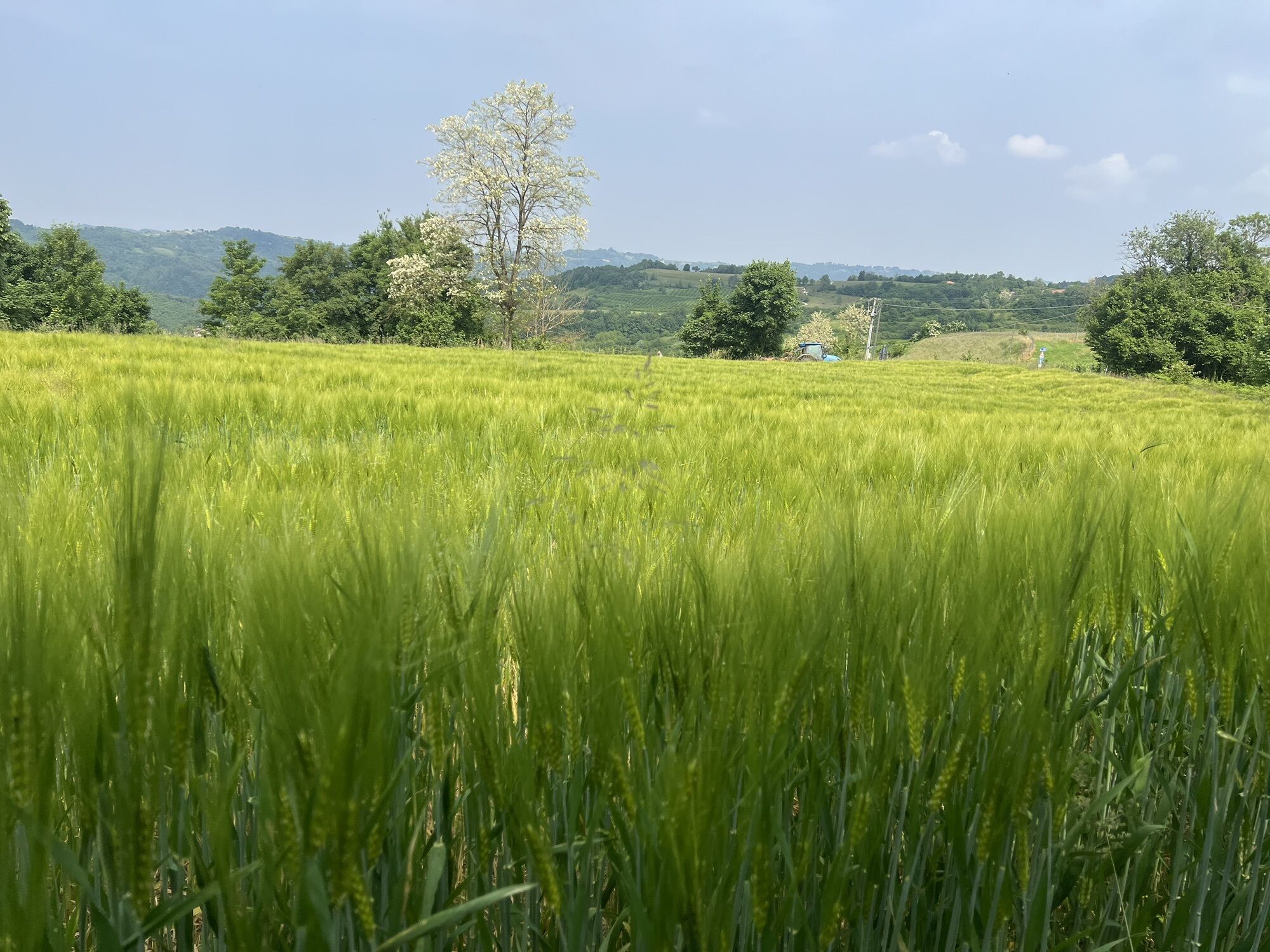
This is a route dedicated to expert cyclists who will enjoy testing their prowess on some of the hills; these steeps are voted to famous past cycling champions. The route begins in Bossolasco, one of the most famous villages in the Alta Langa (High Langa) area, renowned for its flowery balconies and borders and for its attractive historical centre. From here, you continue through some of the most sparsely populated and untouched countryside of the entire area until you reach the village of Murazzano, via the first of the 'Champion's Ascents', dedicated to Jacques Anquetil, with its 318 metres difference in altitude, and an average gradient of 5% for 6.3 km.
Once in Murazzano, the cyclist might well choose to take a short break to refresh him or herself with some of the delicious locally produced cheese (also known as 'Murazzano') in order to continue refreshed along the challenging route that awaits. The route now takes the visitor through peaceful pasture lands until the village of Mombarcaro, reached only after grappling with the ascent 'Fausto Coppi' with its 7.2% average gradient for 3 km and difference in altitude of 261 metres. Mombarcaro is known as 'the peak of the Langa' for its height above sea level and is also renowned for its 'Strada romantica' or 'romantic road' which forms part of an entire system of clearly indicated 'romantic roads' distributed throughout the Langa, all possessing a series of breath-taking views.>br /< Once through Mombarcaro, the cultivation of hazelnuts, here known as the 'tonda e gentile delle Langhe' ('round and sweet hazel of the Langa') predominates. The route offers a welcome relatively flat stretch to Niella Belbo, then on to Feisoglio,Cravanzana and Bosia. After Bosia, the road takes an upward turn once again and the section which will take you to the village of Lequio Berria is dedicated to Marco Pantani with a change in altitude of 361 metres and average gradient of 5,1% for around 7 km. Along the way, the road leads you through some of the places around the village of San Bovo di Castino mentioned in Beppe Fenoglio's novels, especially his most famous work 'La Malora' ('Hard Times'). It isn't difficult to imagine the kind of hardships that local 'contadini' or subsistence farmers faced only 50 or 60 years ago as they eked out a living on these hills.>br /< Going on towards Sinio, one of the steps of the itinerary 'Strada Romantica delle Langhe e del Roero’, the cyclist will climb another taxing stretch of road. This is part is dedicated to Gino Bartali and runs between Sinio and Albaretto della Torre, with 326 metres difference in altitude and a 10% gradient for 3 km. This is the most gruelling stretch of road of the whole trail where expert cyclists will really put their skill and endurance to the test: a gradient of 18% at the most crucial point will surely sort the sheep from the goats! After this heroic enterprise the extraordinary beauty of the landscape will reward all your efforts. But not before a final hill is overcome: the one dedicated to Louison Bobet with a difference in altitude of 310 metres and 2% gradient for 6 km. This last stretch of road runs between the villages of Cissone and Bossolasco and will take you back to where you started out, among the roses of Bossolasco.

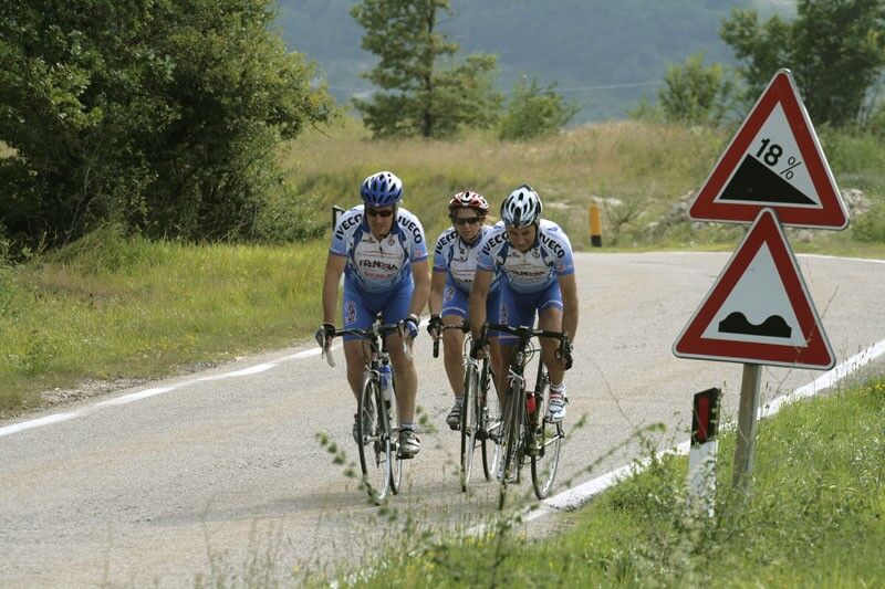
It starts from Bossolasco, one of the best-known towns in the Alta Langa thanks to the care of the floral arrangements and the beauty of its small and characteristic historic center, to then continue through the less inhabited and wilder Langa until you reach Murazzano, to discover of the tasty cheese of the same name, tackling the first major climb dedicated to Jacques Anquetil (318 m in altitude at 5% average gradient for 6.3 km). The route enters the thick green areas historically used for grazing until it reaches Mombarcaro, the "peak of the Langhe" after tackling the 'Fausto Coppi' climb (average gradient of 7.2%, difference in height of 261 m and about 3 km in length ). After Mombarcaro begins the undisputed reign of the cultivation of the 'round and gentle Langhe' hazelnut where the route offers respite to the climber with a downhill stretch that touches the villages of Niella Belbo, Feisoglio, Cravanzana and Bosia. Beyond Bosia the itinerary becomes decidedly demanding again. The stretch to reach Lequio Berria presents the challenge of the climb named after Marco Pantani (361 m in altitude, 5.1% average gradient and about 7 km in length) which will lead to Lequio Berria. Continuing the journey, it will cross San Bovo di Castino, where it will be possible to admire the literary places associated with Beppe Fenoglio's narrative and in particular with his story 'La Malora', reliving the strong-hued impressions transmitted by the writer. Continuing towards Sinio, another point chosen to become a stop on the 'romantic road', the competitive level of the cycling challenge starts to grow again and then reaches its peak on the climb between Sinio and Albaretto della Torre, named after Gino Bartali (326 m in altitude, 10% average gradient for 3 km length). This is the point where even the most trained will find bread for their teeth, the vertical drop of 18% (at its most arduous point) will take no prisoners, only the best will have the satisfaction of having successfully ventured on. Once this obstacle has been overcome, the profuse effort will be repaid by the extraordinary beauty of the area to be crossed to reach the chosen destination again. Before arriving, it will be necessary to face the Louison Bobet climb (310 m difference in altitude, 2% average gradient for 6 km in length), located between Cissone and Bossolasco and then take a well-deserved rest among the Bossolasco roses.
Punti di Interesse:
Bossolasco: Park of the Resistance.
Murazzano: Medieval Tower, ruins of the ancient windmill, defensive walls.
Mombarcaro: Chapel of San Rocco, Military Historical Museum, Defensive Gates.
Niella Belbo: French’s Arch, Parish church of San Giorgio,
Lequio Berria: International Pastel Draw Collection.
Castino (Frazione San Bovo): Cascina Pavaglione – Literary Places.
Albaretto della Torre: Medieval Tower.
Serravalle Langhe:Ex Oratorio di San Michele, Chiesa di San Michele.
Popularne wycieczki w okolicy
Barolo Classic
ciężkiDroga rowerowa 50,0 kmThe hills of Count Cavour
światłoDroga rowerowa 35,8 kmMombarcaro-San Benedetto Belbo Rundweg
światłoWędrówka 11,3 kmGran Traversata delle Langhe - GTL
średniWędrówka 129,2 kmConfraternity of San Michele - Serravalle Langhe
średniWędrówka 14,6 kmBar To Bar in mountain bike
ciężkiKolarstwo długodystansowe 68,6 kmBTB - Bar To Bar - Stage 5A: Serralunga d'Alba - Monforte d'Alba
średniWędrówka 10,8 kmSentiero Tanaro: Tappa 1 Dogliani (Centro Storico) - Clavesana (Loc. S. Giuseppe)
światłoMountainbike 12,1 kmBTB - Bar To Bar - Stage 6: Monforte d'Alba - Verduno
średniWędrówka 12,2 kmBTB - Bar To Bar
średniWędrówka 121,0 km
Wędrówki i tropienie


Nie przegap ofert i inspiracji na następne wakacje
Twój adres e-mail została dodana do listy mailingowej.