


Piemonte without cars | Paesana-Dronero Stage 3: Rifugio Alpetto - Pontechianale
Poziom trudności: T2
Starting from the Alpetto Refuge and Lake at the foot of Monviso, the route is characterised by scree slopes topped by pinnacles and peaks and some glacial lakes in the Vallone delle Giargiatte which converge...
Starting from the Alpetto Refuge and Lake at the foot of Monviso, the route is characterised by scree slopes topped by pinnacles and peaks and some glacial lakes in the Vallone delle Giargiatte which converge on its eastern wall in the Po Valley, before descending from the Vallanta in the Alta Val Varaita to the Borgata Maddalena di Pontechianale, touching the Bosco dell’Alevé.

This stretch of the route is not very popular, but it is well marked with reminders and cairns: you continue through grass and debris going up the bottom of the long detrital valley at the foot of Monviso; the path climbs quite straight towards the South until you discover a clear depression visible on the right (Passo Gallarino - 2,727 m.) with the Cima delle Lobbie massif on the horizon a little further south. Near the Pass, with several hairpin bends, you pass a rock jump beyond which the path enters the wider and more popular itinerary that connects the Pass to the Sella Refuge which you follow on the U10 signpost towards Fraz. Castello; the section is included in the Giro di Viso and from here onwards it is an integral part of the GTA stage (Pontechianale-Quintino Sella) and Sentiero Italia E21.
From here you continue to the right in a South West direction with an undulating path halfway up the hill; the mule track cuts almost flat across the southern slopes, still somewhat grassy, ââof Punta Trento and soon reaches the wide depression of the Passo di San Chiaffredo (2,764 m), on the watershed between the Valle Varaita and the Po, with an almost lunar landscape. Always following the track, you cross the Vallone delle Giargiatte, where you encounter three crystalline bodies of water in succession: in order, Lago Lungo (2,743 m), a small lake without a name, and then Lago Bertin (2,701 m.), at the foot of the jagged profile of Cima Costarossa and Punta Dante. The stretch between these last two lakes is characterized by an expanse of hundreds of stone slabs - called "giargiatte" - placed in vertical equilibrium, created by the glacial effect and enriched over time by passing hikers, almost a spontaneous modern art installation, which pays homage to wild nature, with the respectful passage of man.
On the right, after Lake Bertin, you pass a short distance from the Bertoglio Bivouac (2,760) already clearly visible when you pass next to the lake and reachable in about 10 minutes with a short climb. The small wooden and sheet metal construction, with the unmistakable yellow and red colors, of the CAI of Savigliano, is always open and has 9 beds and is located in an extremely panoramic position, overlooking Lake Bertin and on the opposite side Lake del Prete (2,706 m.).
Now you start to descend: you enter a wide stony gully, engaging a long series of narrow hairpin bends that make you lose altitude significantly, then the track follows a long traverse to the right in a still rocky section, until with a new series of narrow hairpin bends you reach a detrital false flat and then reaches the wide grassy basin at the edge of the coniferous forest of Gias Fons (2,365 m) that opens between Rocca Jarea and Rocce Meano. A little further on you enter the Swiss pine and larch forest, to start descending the slope again with several hairpin bends to the large meadow of Pian Meyer surrounded by Swiss pines and then towards the Vallone del Vallanta with tight bends inside the pine forest; at about 2010 meters above sea level the path bends north almost flat, then turns left towards the west and reaches the ruins of the Grange Gheit (1,912 m.).
You then cross the Vallanta stream on the right orographic side on a footbridge and join the path downhill, signposted U09 (Castello di Ponte Chianale - Rifugio Vallanta) that goes up the valley.You turn left and continue along the Vallanta on the right hydrographic side, on a wide mule track that runs alongside the watercourse and the westernmost part of the Bosco dell’Alevé.
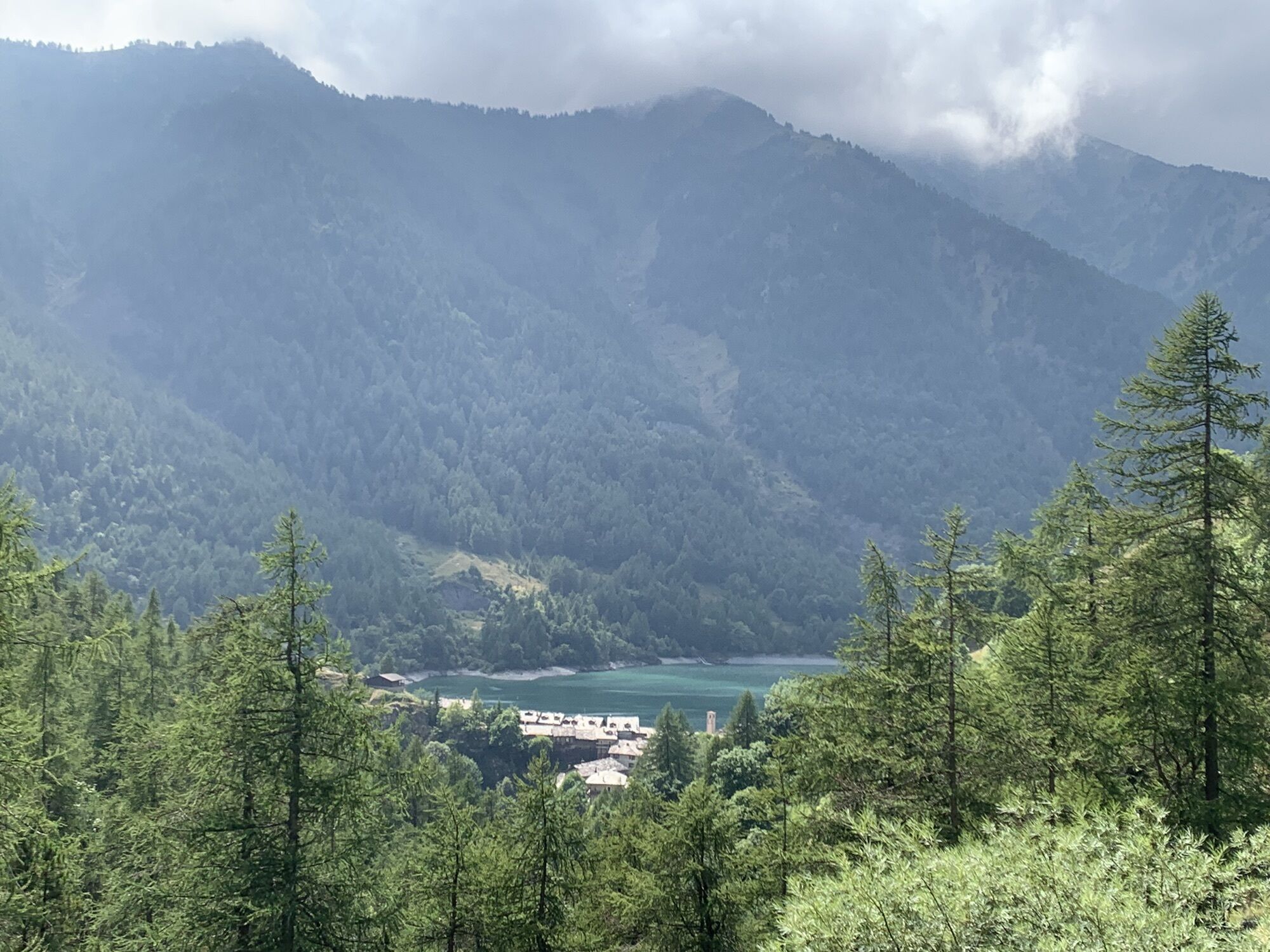
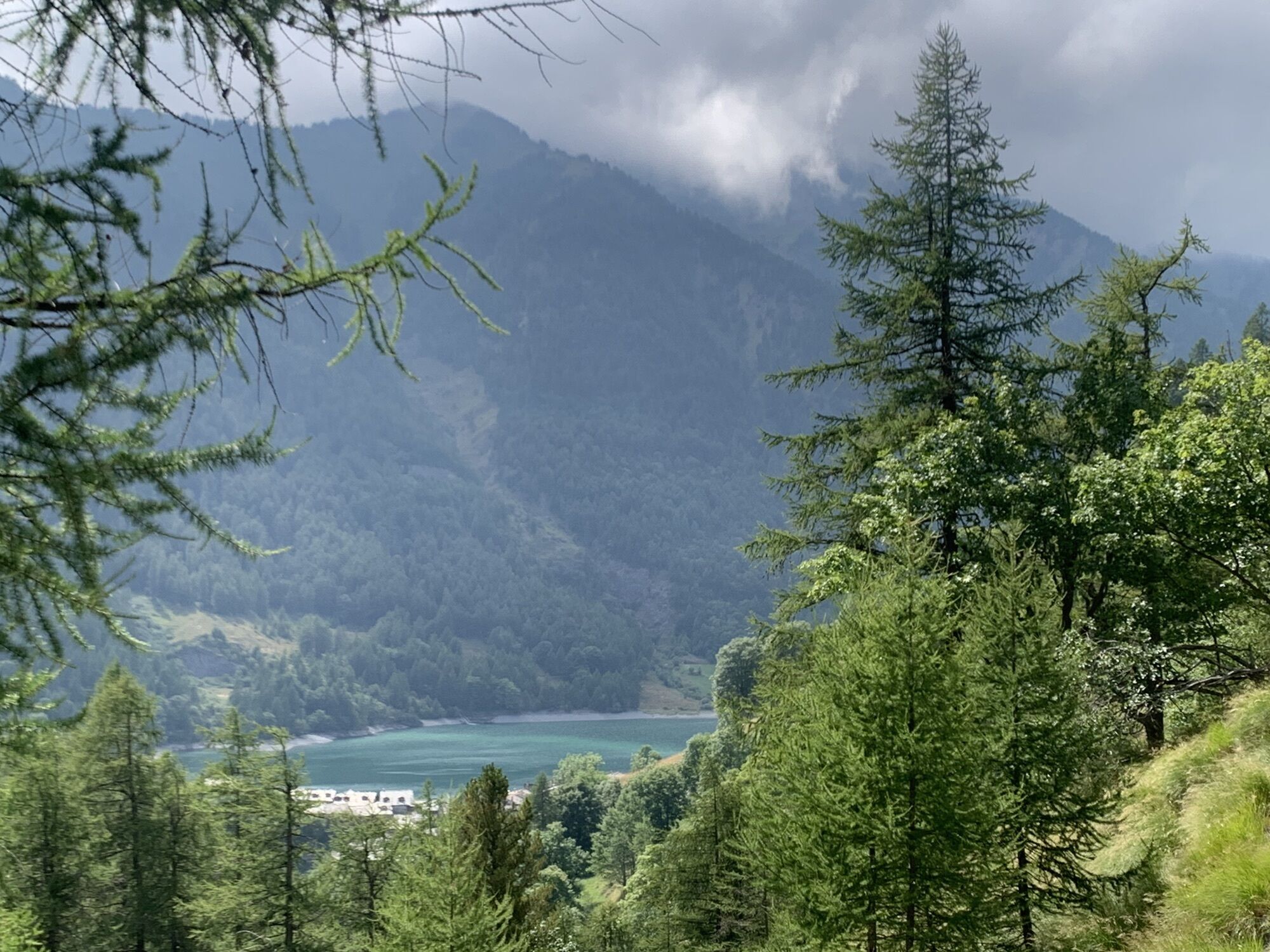
The descent ends at the Lago Castello dam: here you cross the dam and head along the right hydrographic bank, skirting the lake on the cycle/pedestrian path to end the stage in the town of Maddalena (1,615 m), the main hamlet of Pontechianale.
T2
The hamlet of Chianale (1,800 m.) “La Cianal” or in Occitan “the canal” - included among the most beautiful villages in Italy - is in fact divided by the Varaita into two nuclei connected to each other by a stone bridge, in the center of this village, a jewel of Alpine architecture made of stone houses and slate roofs. The bridge is located in correspondence with a small square with a fountain overlooking the church of Sant’Antonio, from the 14th century, which was the parish church of Chianale from 1459 until the end of the 17th century, with the typical bell gable with mullioned windows, an entrance portico, the Romanesque portal with triple architrave. On the façade the mullioned window with the coats of arms of France and Dauphiné.
On the Chemin Royal, the main street of the town, Casa Martinet, is what remains of the Calvinist temple and testifies how Chianale was, for a good part of the 17th century, the only place in the valley where freedom of worship was guaranteed; on the façade the mullioned window presents the coats of arms of France and Dauphiné. Beyond the Varaita stands, instead, the more recent parish church of San Lorenzo, built between the 17th and 18th centuries, which preserves a large baroque altar of Brianza tradition from 1726, supported by four massive twisted columns of Swiss pine and the result of splendid carving work.
At the museum of the ancient Capuchin church, Chianale also hosts the Costume Museum dedicated to representing a rich collection of traditional women's costumes of the valley and textile handicraft products of the Alta Val Varaita, including tomoli, decorative ribbons and precious accessories.Bosco dell’Alevé.
This protected area, with an extension of about 825 hectares, between 1,500 and 2,500 meters above sea level in the municipalities of Casteldelfino, Pontechianale and Sampeyre on the left bank of the Val Varaita and represents a unicum in the entire Alpine arc. It is a forest of almost pure Swiss pine - the southernmost in Europe - from which the toponym, which derives from the term "èlvou" in Occitan.
It hosts some centuries-old monumental specimens, including a tree over 20 meters tall, the Pino del Bagnour, estimated to be almost 600 years old. Already protected in different ways in the past, and already known to Pliny the Elder, its ecosystem has been declared a Site of Community Interest and a special protection area managed by the Monviso Park.
Other points of interest
Gallarino Pass San Chiaffredo Pass Vallone delle Giargiatte with its three lakes Bertoglio Bivouac The Bosco dell’Alevé Pontechianale with its hamlets Castello and Chianale and Lake Castello
Popularne wycieczki w okolicy
-
Gran Tour del Monviso
średniWędrówka 57,1 km -
5,0
04 Monviso Ring. Rifugio du Viso - Rifugio Alevè . Pontechianale, Piemont/Italien
światłoWędrówka 13,3 km -
5,0
Rifugio Quintino sella - monte Monviso
średniWspinaczka 9,13 km -
5,0
Occitan routes: Stage 6 Elva - San Michele di Prazzo
średniWędrówka 11,5 km -
5,0
01-Monviso Ring. Rifugio Alevè - Rifugio Quintino sella Pontechianale, Piemont/Italien
światłoWędrówka 11,8 km -
5,0
Percorsi Occitani: Tappa 4 Frazione Camoglieres - San Martino Inferiore
średniWędrówka 16,8 km -
3,5
Occitan Routes Stage 5
średniWędrówka 6,86 km -
Saint-Véran- Col de la Noire - Col Longet - Col Blanchet
średniWędrówka 19,4 km -
5,0
02 Monviso Ring. Rifugio Quindino Sella - Rifugio Giacoletti. Crissolo, Piemonte/Italia
światłoWędrówka 7,11 km -
Le Strade dei Forti - stage 13a Detour towards the Gran Tour del Monviso
średniTrasa pielgrzymki 6,01 km

Wędrówki i tropienie


Nie przegap ofert i inspiracji na następne wakacje
Twój adres e-mail została dodana do listy mailingowej.