


Cella Monte Loop in Trekking
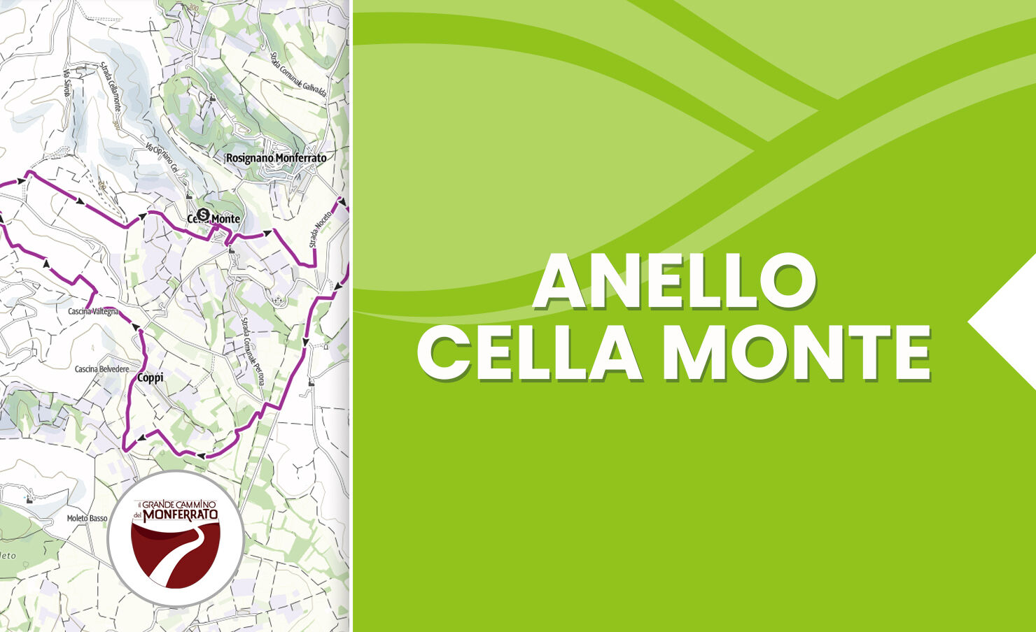
The trekking route on the hills of Monferrato casalese, along its 10 kilometers, offers spectacular views over an uncontaminated landscape. Starting from Cella Monte, with its cobbled streets and stone...
The trekking route on the hills of Monferrato casalese, along its 10 kilometers, offers spectacular views over an uncontaminated landscape. Starting from Cella Monte, with its cobbled streets and stone houses, the route passes through vineyards and centuries-old oak woods. Along the way, you can enjoy the colors of the surrounding countryside, from green meadows to the violet shades of lavender fields and the lively colors of the vineyards.
On the ancient roads, you pass through small villages and find 360-degree panoramic viewpoints. During the walk, you can also taste local products, such as Monferrato wines and typical cheeses.
The route ends at Cella Monte, where you can admire the village at sunset.
In conclusion, the trekking route in Monferrato casalese offers an engaging and rejuvenating experience, allowing you to discover the hidden beauty of this region.

Tak
Trekking shoes are recommended.
It is advisable to bring a water supply.
Getting to the village of Cella Monte is easy by taking the exit at Casale Monferrato Sud tollbooth.
In Cella Monte it is possible to park near via della Circonvallazione.
Tastings: cinque quinti, bonzano vini, la casaccia, botto marco, la ca' nova.
Eating: la ca' nova, bar il carpino, 365 (cella monte)
Sleeping: la ca' nova, benvenuti altrove
Popularne wycieczki w okolicy
-
Sentiero "Vigneti e Infernot" - Sentiero 726 in mountain bike
Mountainbike 14,1 km -
Sentiero le Vecchie Fonti - Sentiero 860 in camminata
Trasa pielgrzymki 14,4 km -
Sentiero le Vecchie Fonti - Sentiero 860 in mountain bike
Mountainbike 14,4 km -
Sentiero "Vigneti e Infernot" - Sentiero 726 in camminata
Trasa pielgrzymki 14,1 km -
Sentiero panorami e ciminiere di Ozzano - Sentiero 738 in camminata
Trasa pielgrzymki 7,20 km -
Sentiero 700 - SVC Tratto Murisengo - Crea in mountain bike
Mountainbike 18,6 km -
Panoramas and chimneys path of Ozzano - Path 738 by mountain bike
Mountainbike 7,20 km -
Cycling the lands of San Giovanni Bosco
średniMountainbike 61,7 km -
Sentiero Pieve di San Giovanni - Santuario di Crea - Sentiero 727 in mountain bike
Mountainbike 27,3 km -
Sentiero 700 - SVC Tratto Murisengo - Crea in camminata
Trasa pielgrzymki 18,6 km
Wędrówki i tropienie


Nie przegap ofert i inspiracji na następne wakacje
Twój adres e-mail została dodana do listy mailingowej.