







Giro delle 5 torri in Langa astigiana
The Giro delle Cinque Torri winds through this territory: from the historic circular path that takes place on the ridges of the Langa Astigiana, crossing the municipalities of Monastero Bormida, Bubbio,...
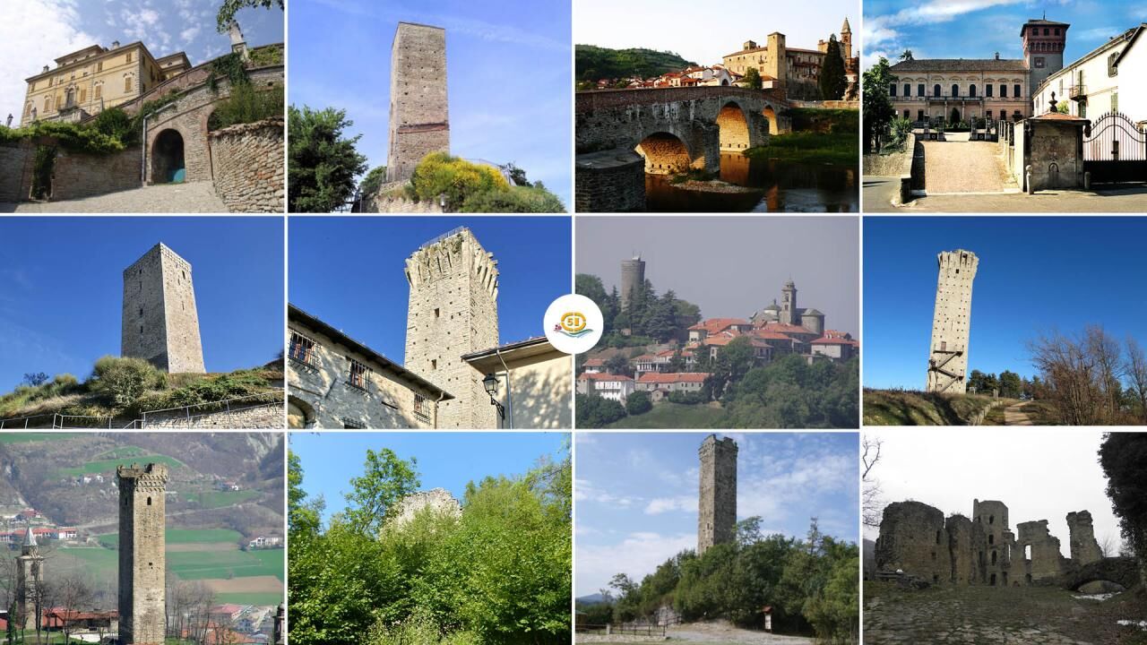
The Giro delle Cinque Torri winds through this territory: from the historic circular path that takes place on the ridges of the Langa Astigiana, crossing the municipalities of Monastero Bormida, Bubbio, Loazzolo, Cessole, Vesime, San Giorgio Scarampi, Olmo Gentile and Roccaverano, they can reach the UNESCO heritage territories to the north and the Ligurian Apennines to the south and from here the internationally renowned Alta Via dei Monti Liguri itinerary.This part of the Langa still has its original characteristics: simultaneously harsh and sweet, wild and cultivated, rich in history, monuments, flora and fauna. In particular, you will be able to admire and visit the medieval towers that stand out along the route, immobile witnesses of history.Towers, woods, vineyards and meadows characterize the hills, while down in the valley the river, sometimes slow and sometimes impetuous, tells its stories to the poplars that accompany it. The landscape is never identical to itself, not even on the same day: the lights, the shadows, the colors, the wind, the scents change. Set in a particularly evocative natural setting, fourteen villages form this territory between Piedmont and Liguria, between the plains and the Apennines, between the Langa and the sea. They are ancient villages, which have partly preserved medieval urban structures, with their castles and the cloister of towers dominating the high hills, the sandstone parish churches and the rich baroque parish churches, the cellars dug into the tuff and the ciabot scattered around the vineyards .Here is the Langa Astigiana, the land where stone, wind and forest reign supreme.The Robiola DOP from Roccaverano, the Loazzolo Passito and the other great wines of the Acquese and Asti areas, the hazelnuts, the Piedmontese cattle, the artistic and naturalistic heritage, the presence of sports facilities, the fairs and popular festivals, the opportunities to purchase products and the presence of national level restaurants are just some of the good reasons for a visit.A few lines are not enough to describe the countless riches of a territory, such as that of the Langa Astigiana, which needs to be "experienced" to be appreciated. And what better way to experience an area than to get to know it step by step along an itinerary that will take you to discover landscapes, villages, vineyards, gullies and especially testimonies of a past rich in history. This is the Giro delle Cinque Torri in Langa Astigiana. A Grand Tour that connects the historic circular path that unites the towers of Monastero Bormida, San Giorgio Scarampi, Olmo Gentile, Roccaverano and Vengore with the UNESCO heritage wine-growing territories to the north and the Ligurian Apennines to the south and the itinerary in Valenza international Alta Via dei Monti Liguri.You travel along partly asphalted and unpaved roads, cart tracks, paths in the woods and meadows and can also be traveled by mountain bike with the exception of short stretches in the woods where you need to carry the bike on your shoulder. Clothing must be appropriate for the season: trekking boots are recommended.


Tak
Cellular coverage4G coverage in all municipalities of the itinerary. Please note that some parts of the itinerary not close to inhabited centers do not have cell phone coverage for short stretches.
Auto: da Asti direzione Acqui Terme - Nizza Monferrato - Canelli. Da Milano casello Alessandria Sud direzione Acqui Terme - Nizza Monferrato - Canelli. Da Genova casello Ovada direzione Acqui Terme - Nizza Monferrato - Canelli.
Treno (www.trenitalia.com): linea Alessandria - Savona. Stazioni di accesso all'itinerario: Ponti, Montechiaro-Denice, Mombaldone-Roccaverano, Spigno e Merana.
Bus (www.gelosobus.it): linee Acqui T. – Asti Asti – Canelli – Cortemilia Cortemilia – Acqui Terme Cortemilia – Asti Loazzolo - Canelli.
Sito internet "5 Torri Sentieri del Monferrato": https://5torri.sentieridelmonferrato.it/
Sito internet "Sentieri del Monferrato": https://www.sentieridelmonferrato.it/
Canelli: Parish of San Tommaso and the Bosca, Contrato, Coppo and Gancia wineries Loazzolo: Parish of S. Antonio Abate and the DOC wineries Cassinasco: Parish of S. Ilario di Poitiers and Sanctuary of the Caffi Bubbio: Parish of the Assunta and Oratory of Disciplined Bormida Monastery: Parish of S. Giulia and country Church of S. Desiderio Cessole: Parish of NS Assunta and Sanctuary of Mad. della Neve Vesime: Town Hall, Church NS Assunta of S. Martino, Partisan Airport, Parish Church of S. Maria San Giorgio Scarampi: Parish of S. Giorgio, Oratory Immacolata Concezione Olmo Gentile: Parish of S. Martino Roccaverano: Cemetery Church of S. John the Baptist and Parish of S. Maria Annunziata Serole: Parish of S. Lorenzo and Chapel of S. Sebastiano Merana: Parish Church of San Nicolao and small rock church of S. Fermo Denice: Church of S. Lorenzo and Oratory of S. Sebastiano Bridges: Parish of the Assumption, Old Church of the Assumption.
Popularne wycieczki w okolicy
-
5,0
Sentiero anello di Bistagno - Sentiero 500 in camminata
Trasa pielgrzymki 14,7 km -
5,0
IL GRANDE CAMMINO DEL MONFERRATO - 7°TAPPA: CANELLI - PONTI
ciężkiTrasa pielgrzymki 20,3 km -
Sentiero "Giro delle 5 Torri" - Sentiero 5T in mountain bike
Mountainbike 29,4 km -
Rundweg Montechiaro - Weg 573 mit dem Mountainbike
Mountainbike 30,9 km -
Sentiero Cartosio - Ponzone - Sentiero 569 in camminata
Trasa pielgrzymki 6,83 km -
Sentiero anello di Merana - Sentiero 575 in camminata
Trasa pielgrzymki 10,5 km -
Rundwanderweg Montechiaro - Weg 573 zum Wandern
Trasa pielgrzymki 30,8 km -
Sentiero delle Chiese Campestri - Sentiero 571 in camminata
Trasa pielgrzymki 21,5 km -
Sentiero Acqui Terme - Cavatore - Sentiero 537 in camminata
Trasa pielgrzymki 5,78 km -
Sentiero anello di Bistagno - Sentiero 500 in mountain bike
Mountainbike 14,7 km
Wędrówki i tropienie


Nie przegap ofert i inspiracji na następne wakacje
Twój adres e-mail została dodana do listy mailingowej.





