


Chläggi route
Poziom trudności: 3


Cycle through rural Klettgau, through endless vineyards, past breathtaking viewpoints, through lush meadows and rustling forests. Let yourself be enchanted by the charm of the wine-growing villages and...
Cycle through rural Klettgau, through endless vineyards, past breathtaking viewpoints, through lush meadows and rustling forests. Let yourself be enchanted by the charm of the wine-growing villages and treat yourself to a good drop in one of the numerous, cozy wine cellars.
The Chläggi Route offers you a varied experience with culinary, cultural and scenic highlights. Discover part of the Schaffhausen Regional Nature Park on two wheels.

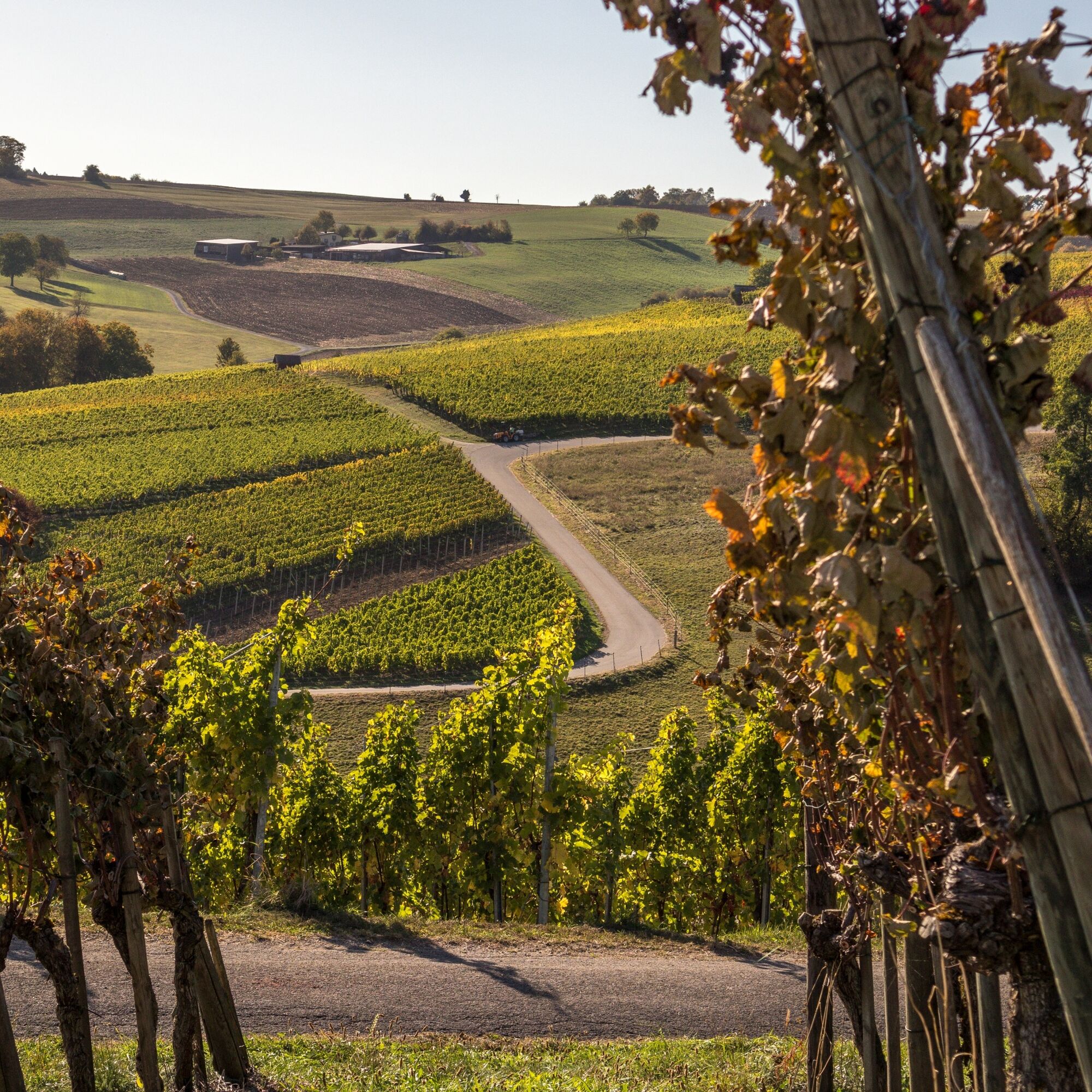


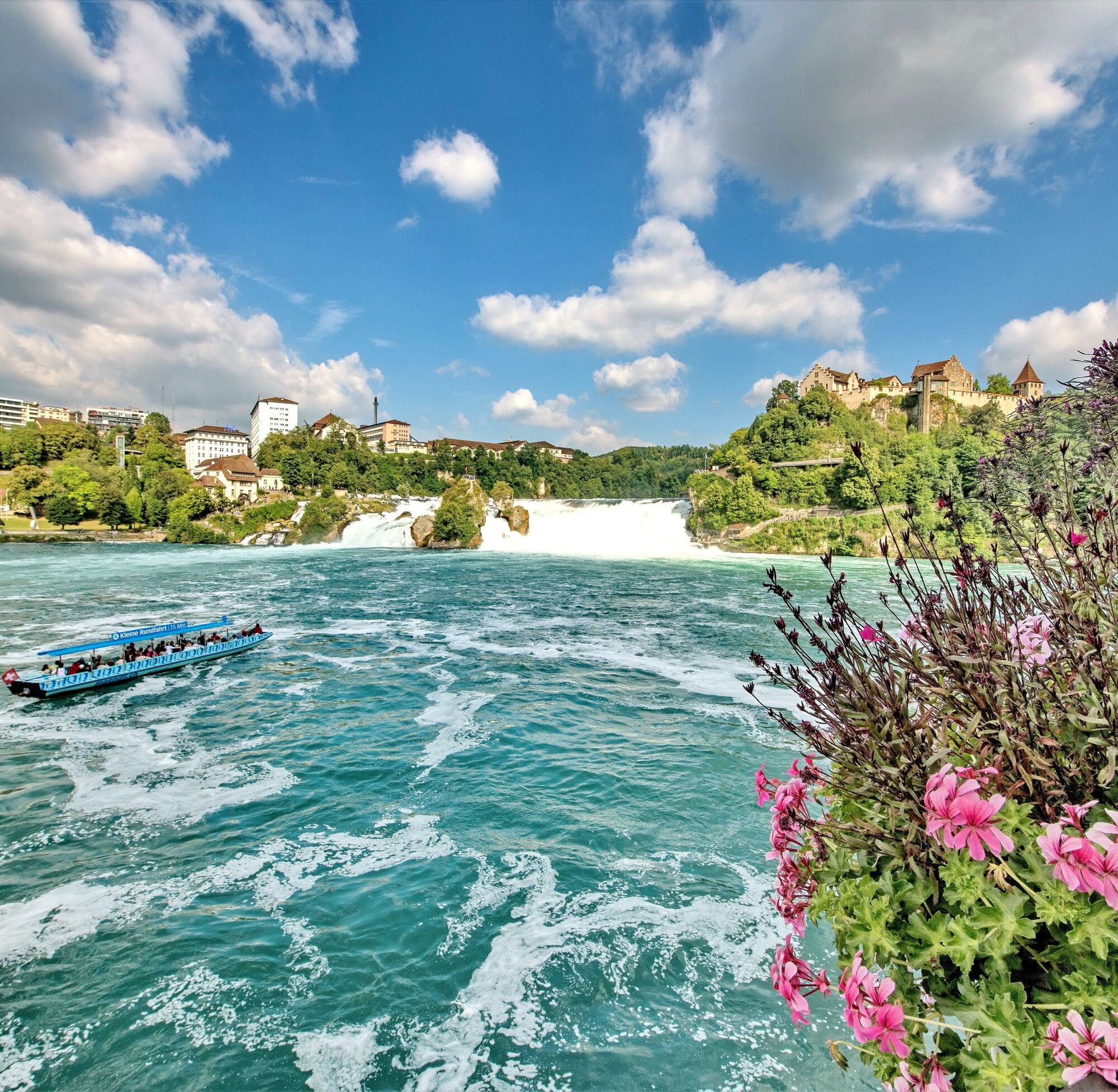


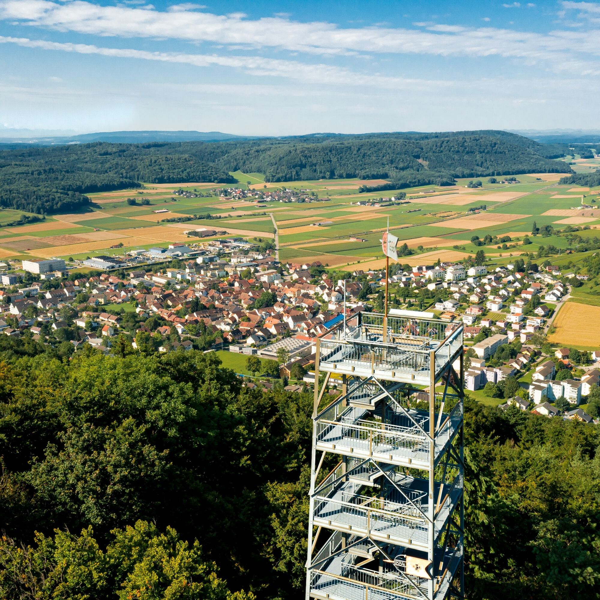

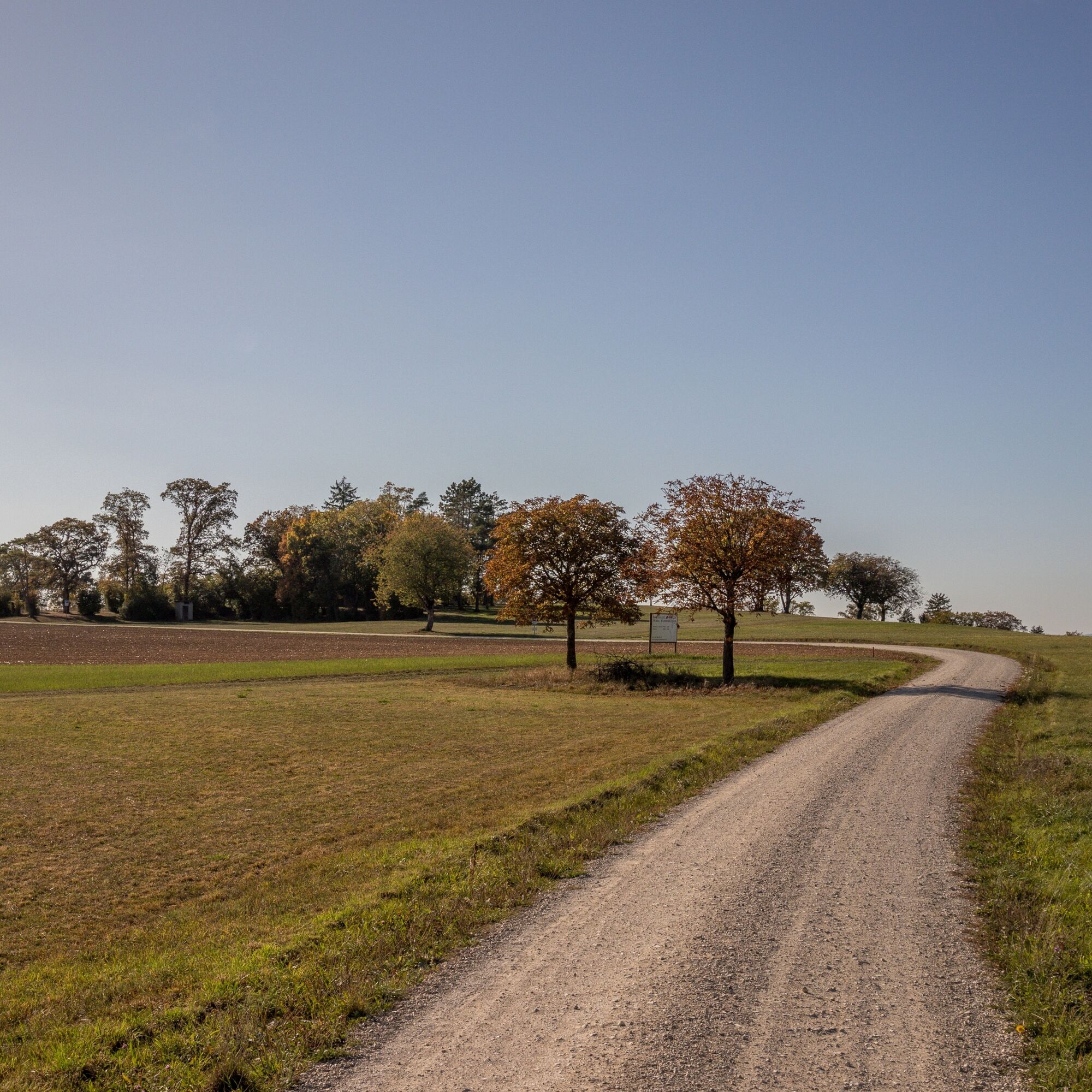
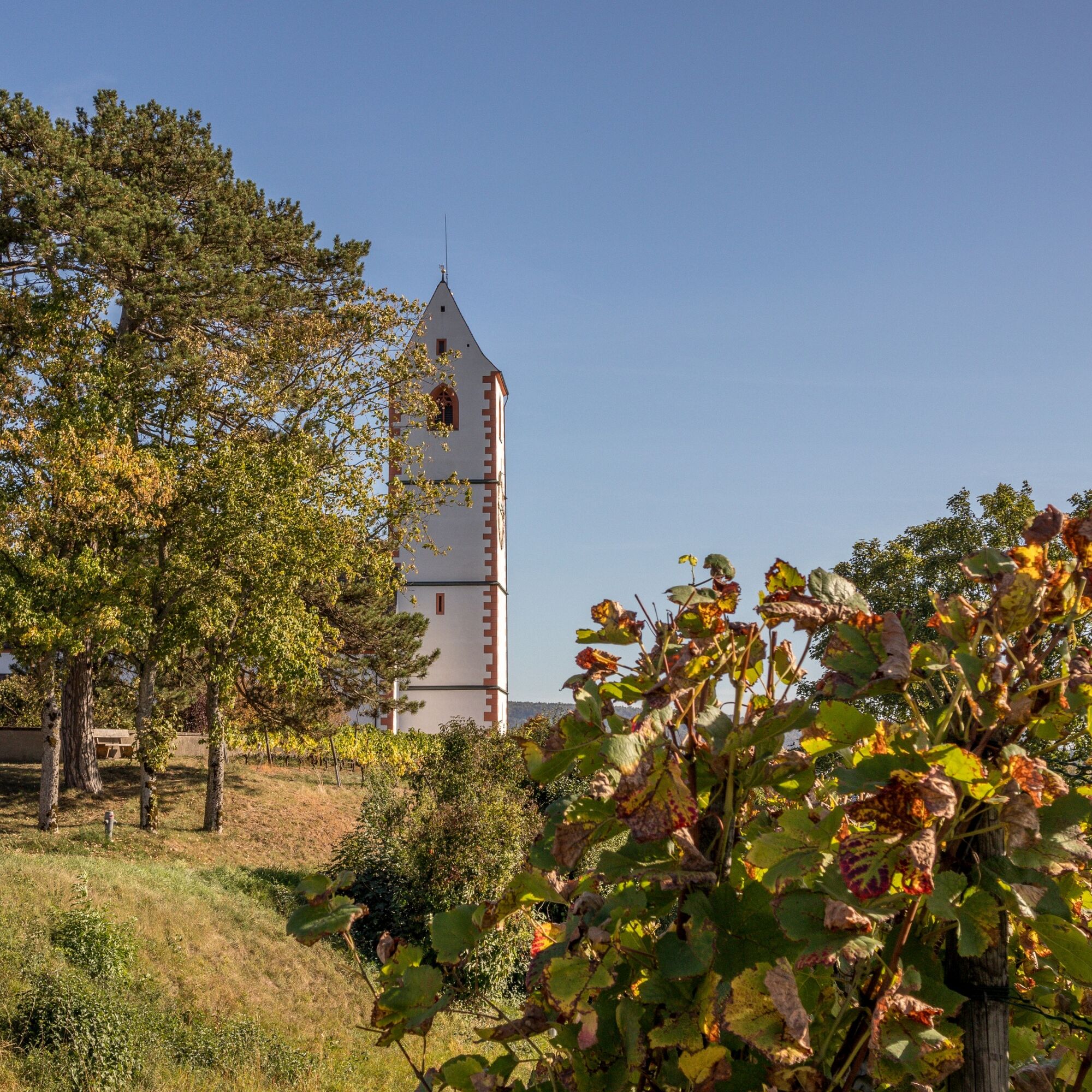
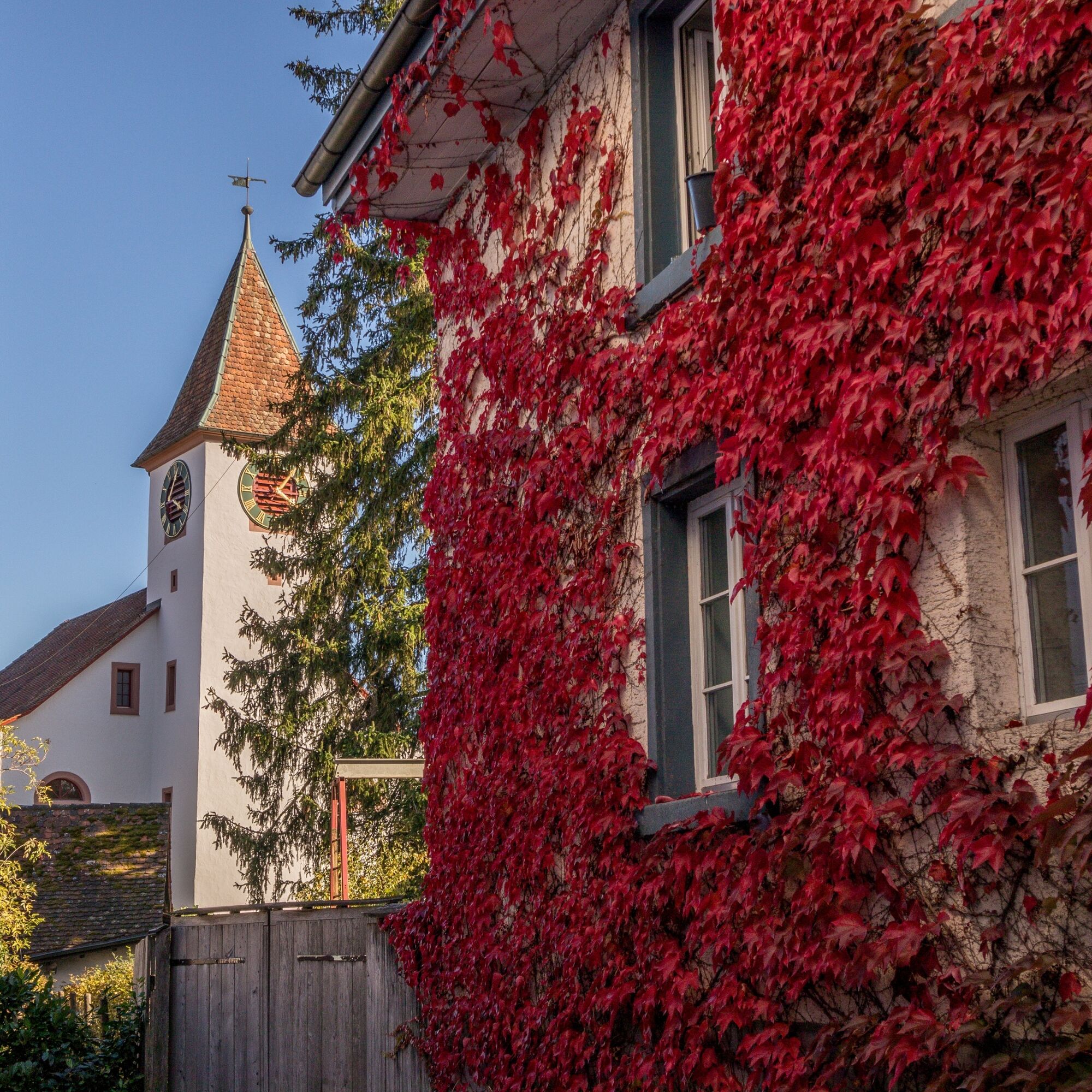
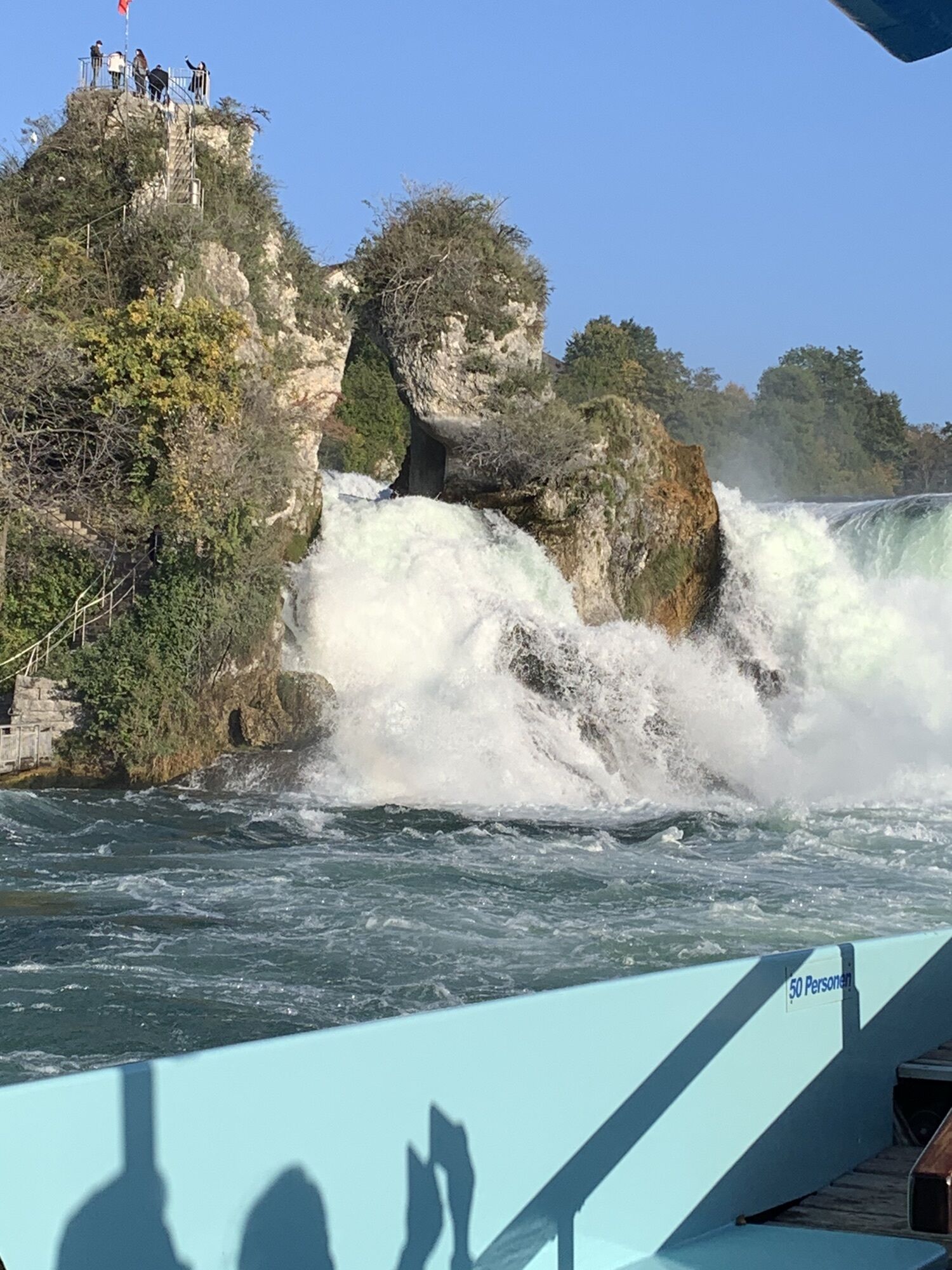
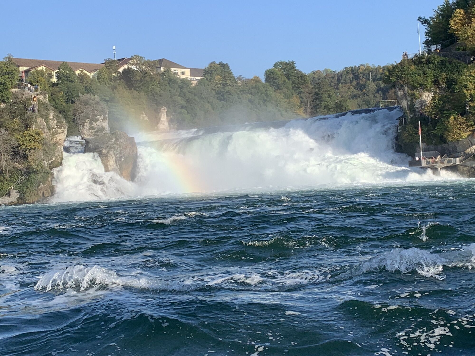
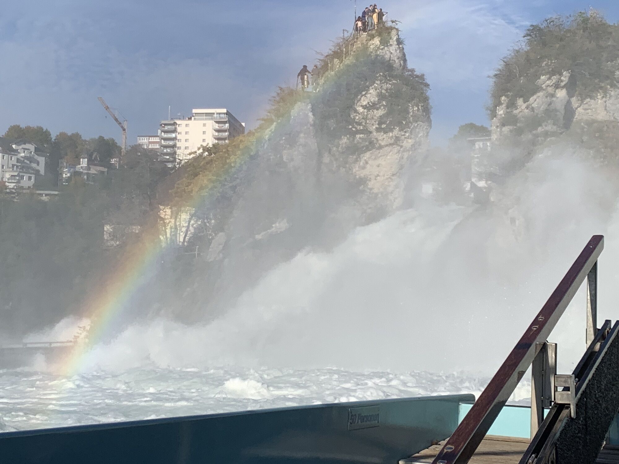
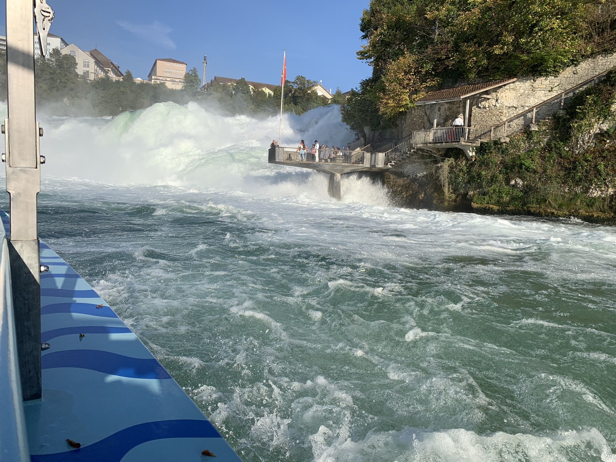
You start in Schaffhausen at the train station and follow the signposts on the cycle path towards Beringen. In the middle of the village of Beringen, take a right turn to the "Gwaagge Badi" natural swimming pool - perfect for a quick dip in summer. Continue to the next village, Löhningen. Before you enter the village, however, take the left fork to Schmerlat airfield. From there, the route takes you to the small town of Neunkirch, with its striking and well-preserved buildings, picturesque old town with picturesque alleyways and romantic courtyards giving the town an incomparable charm. The cycle path continues to Hallau, the largest wine-growing village in Klettgau. Now it's uphill, but the climb is worth it. On the way up the Hallauerberg, you pass the romantically situated mountain church of St. Moritz, the landmark of Hallau, and numerous vineyards. Once at the top, you can enjoy a wonderful view over the Klettgau and, on clear days, as far as the majestic Alps. Now follow the signs to Trasadingen and on to Wilchingen. Explore the picturesque little villages before continuing towards Osterfingen, a wine-growing village situated between the Wannenberg and the Rossberg. Its history is characterized by a long tradition of viticulture. Prominent evidence of this is the well-known Bergtrotte, which sits enthroned in the vineyard above the village. The restaurant invites you to celebrate and enjoy. Here you can discover regional delicacies and the wealth of Schaffhausen wines. You now ride over the Rossberg in the direction of Jestetten (DE). On the southern slope of the Rossberg, not directly on the route but well worth a detour, are the ruins of Radegg Castle on a rugged mountain spur. If you stand on top of the ruins, you can see as far as the Säntis and the Churfirsten. And with a bit of luck, you may come across the "Kätterli vo Radegg" or find his blue rose bush. In any case, the view is legendary. On the onward journey from Jestetten to Neuhausen am Rheinfall, you will pass the Celtic rampart in Altenburg dating from the 2nd century BC. It bears witness to the Celtic history of the area. In Neuhausen you pass the Rhine Falls - you may feel the spray on your skin. Continue along the Rhine back to Schaffhausen. Enjoy the northernmost town in Switzerland with its 171 oriels and, if you like, climb the imposing Munot.
Tak
Bicycle in good condition, bicycle helmet, drinks and snacks for in between.
You ride on cycle paths, gravel paths and roads - a bike helmet is therefore recommended.
Starting point: Schaffhausen railroad station
Route planner
There are various parking garages near Schaffhausen station.
3
Order the route map or download it directly at: https: //www.natourpark.ch/tour/chlaeggi-route/
Taste the wines from the Schaffhausen Blauburgunderland.
Download route map at: https://www.natourpark.ch/tour/chlaeggi-route/
Popularne wycieczki w okolicy
- 4,6
Small Rhine Falls circular route
światłoWędrówka3,48 km - 4,5
Rundwanderweg Rheinau
światłoWędrówka6,85 km Hike to the highest point in Schaffhausen
średniWędrówka10,1 kmKleie Rheinfallrunde
światłoWędrówka3,82 kmEglisau - Buchberg - Eglisau
światłoWędrówka5,99 km46 / 5.000 Übersetzungsergebnisse Übersetzung Stone Age Trail Route Kesslerloch-Schweizersbild
średniTrasa tematyczna11,2 kmSwitzerlandMobility 899: Blauburgunderland Panorama Trail
średniWędrówka14,2 kmSwitzerlandMobility 901: Randen Weg
średniWędrówka16,2 km- 5,0
Circular hike over the Hinterranden
średniWędrówka11,0 km Ostweg: Stühlingen - Schaffhausen
średniWędrówka19,3 km
Wędrówki i tropienie


Nie przegap ofert i inspiracji na następne wakacje
Twój adres e-mail została dodana do listy mailingowej.