


Mountain bike route "Clara" Pizol
Poziom trudności: S2
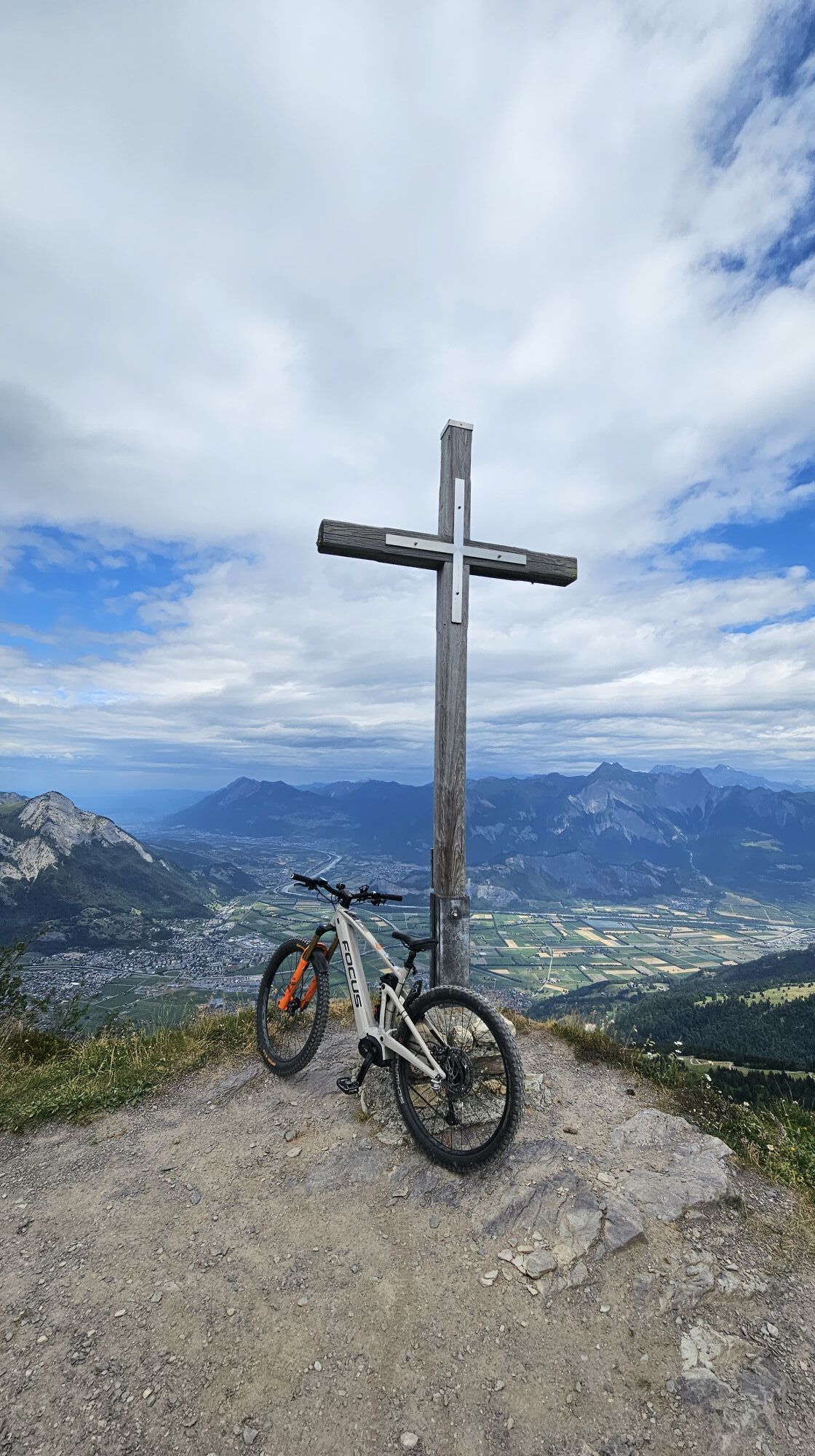
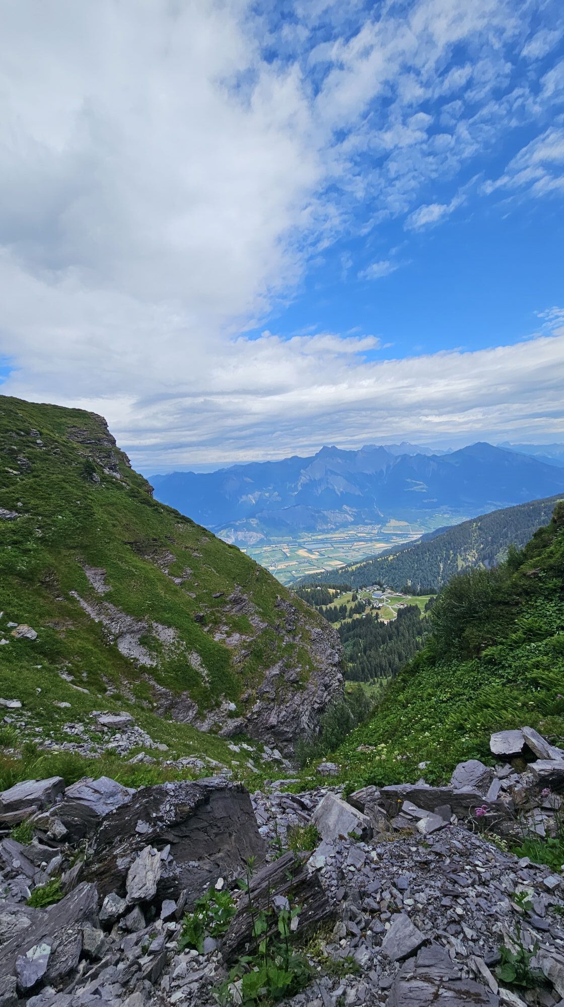
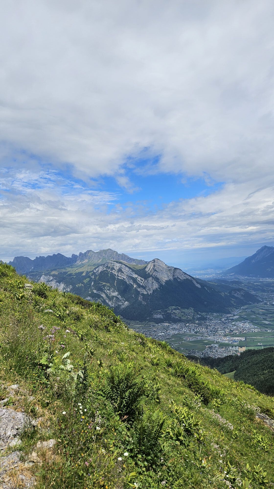
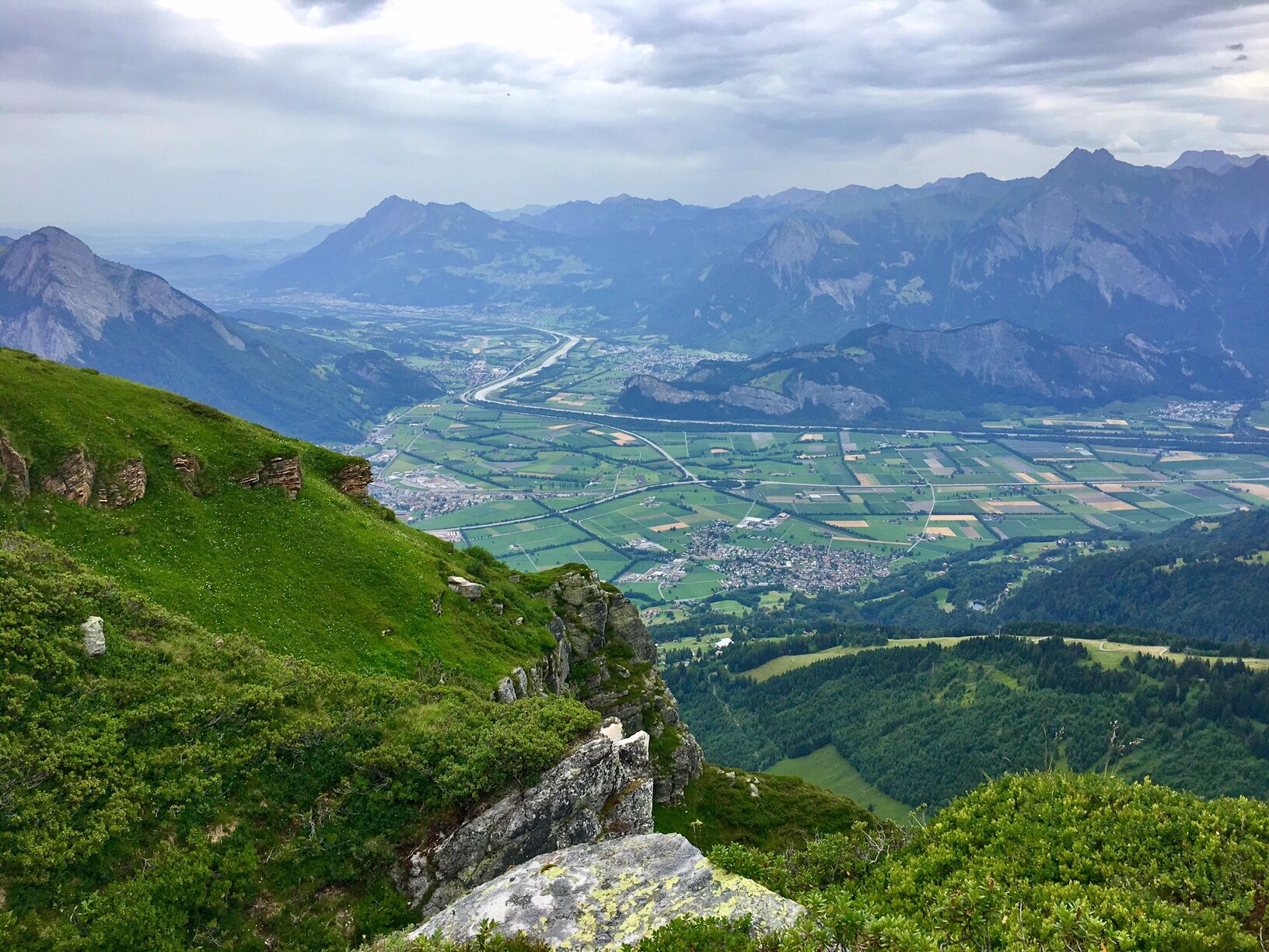
The route leads us to the summit of Garmil. At the Fürggli, we have the opportunity to cool down at the fountain or rest at the lovely barbecue area. Always before us: a picture-perfect panorama with views...
The route leads us to the summit of Garmil. At the Fürggli, we have the opportunity to cool down at the fountain or rest at the lovely barbecue area. Always before us: a picture-perfect panorama with views over the St. Gallen Rhine Valley and the Churfirsten.

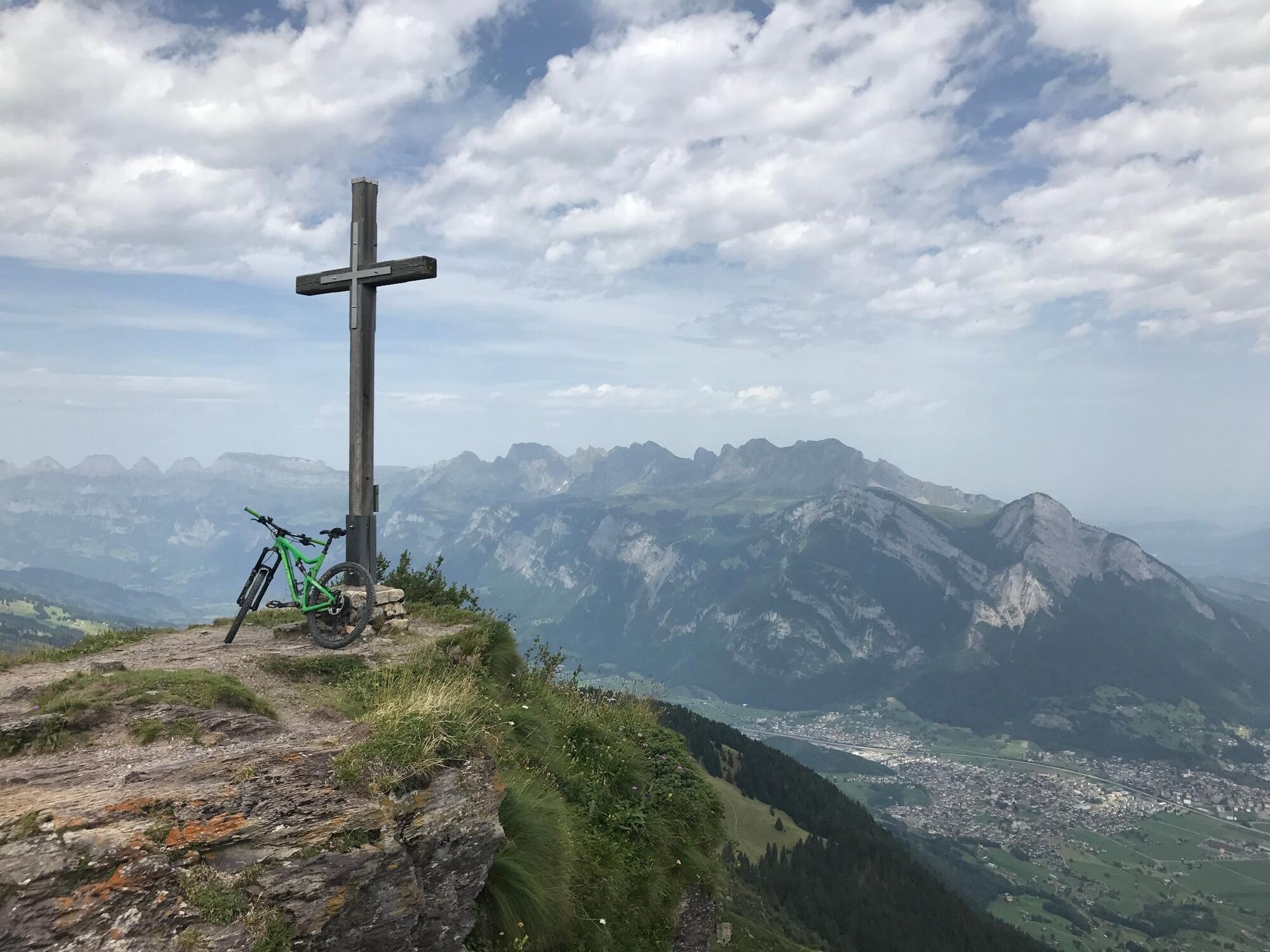
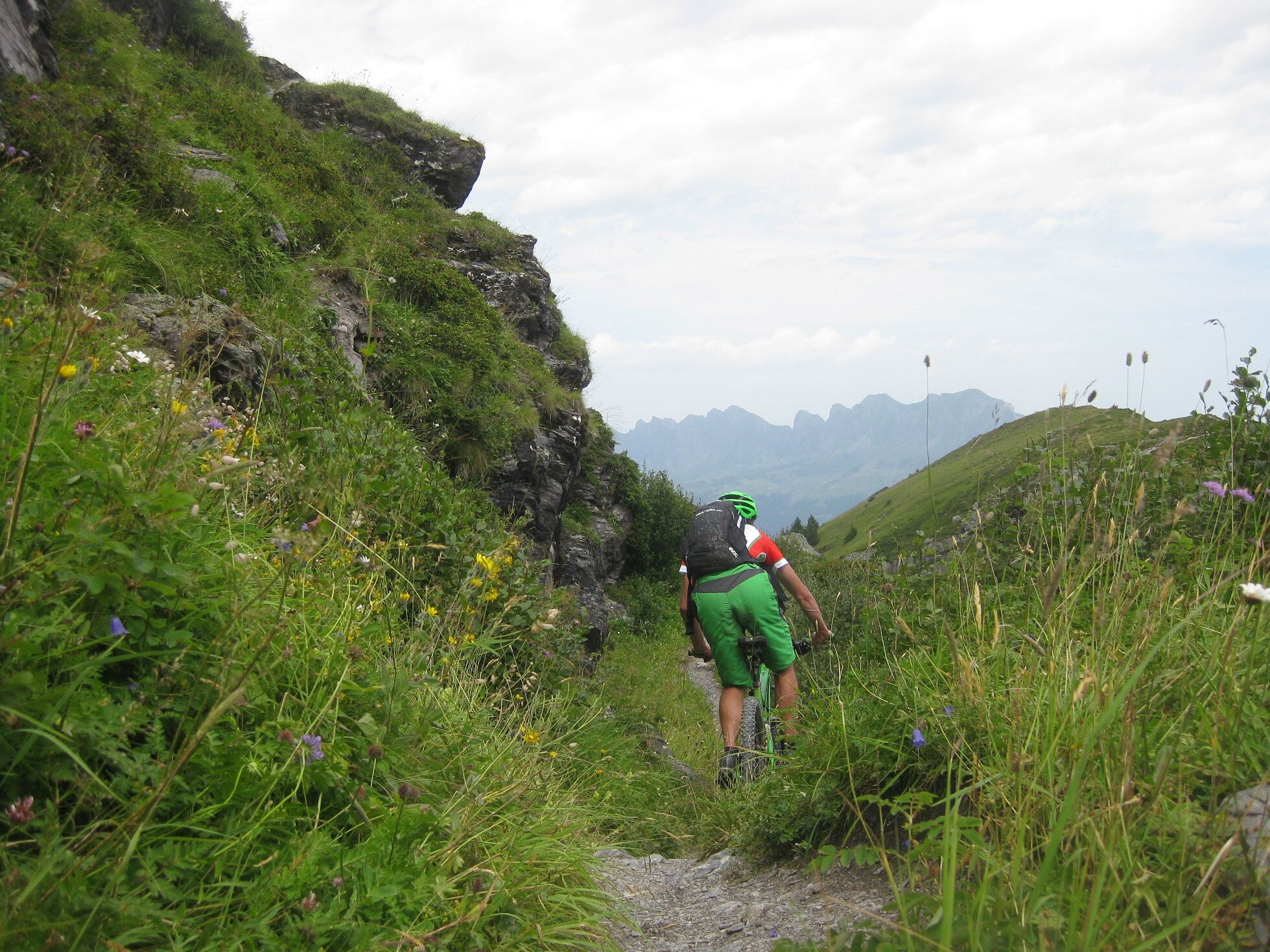
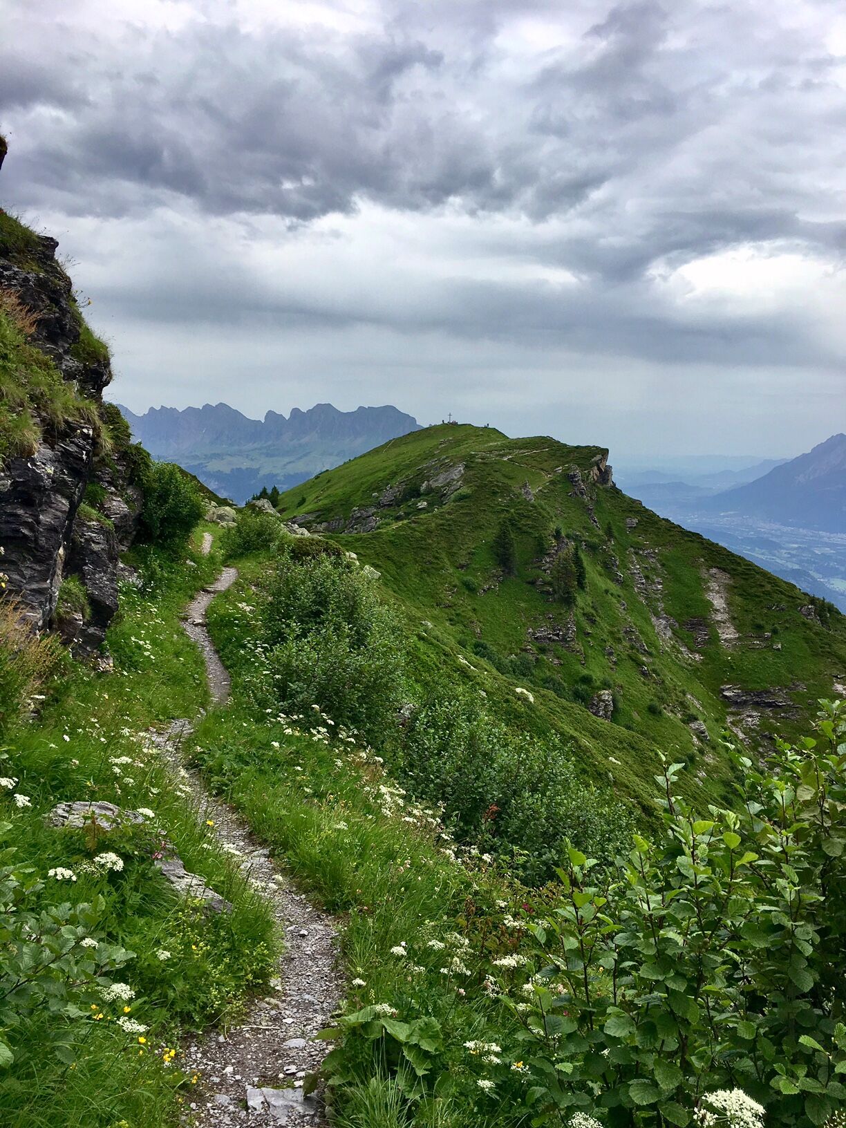
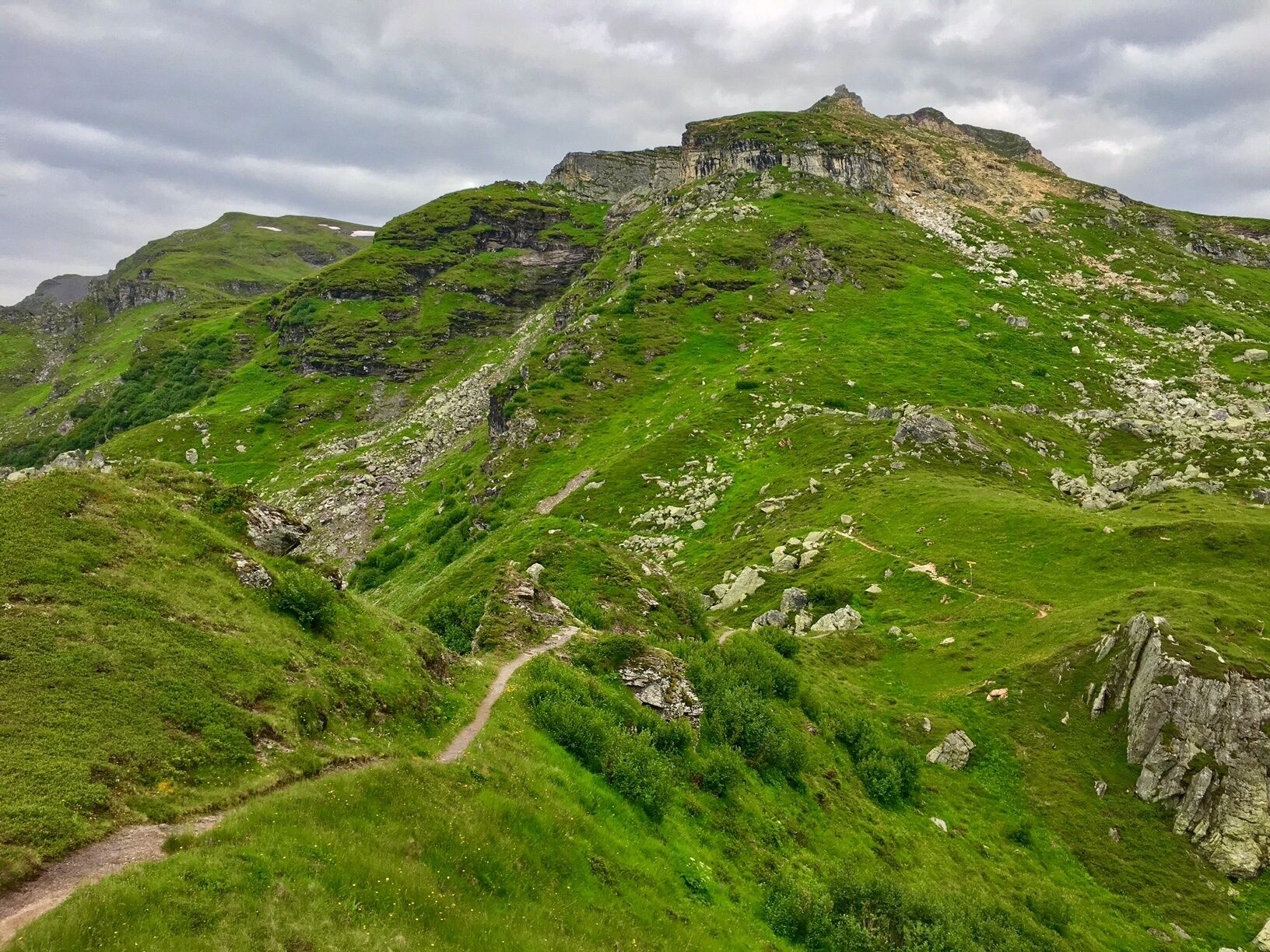
We start our route at the Gaffia mountain station of the Pizolbahnen. After an ascent via the Garmilweg, we reach the summit of the Garmil. About one third of this section is rideable, as the path has some larger steps and steep climbs. The descent goes down via the Fürggli to the Furt. Upon arrival at the Furt, you have the option to refresh yourself at one of the mountain restaurants. Afterwards, you can either return to Wangs by the Pizolbahnen gondola or continue biking via Maienberg and Valeis to Vilters.
Tak
Tak
Tak
Recommended equipment:
Bike:
- Roadworthy, full-suspension (e-)mountain bike
General safety equipment:
- Helmet, gloves, cycling shoes, etc.
- First aid kit
- Knee and elbow protectors for the descent
- Service materials for breakdowns, pump, bike tools, patch kit
Personal equipment:
- Biker backpack
- Drinking water, provisions
- Mobile phone
- Sun and rain protection
Usual equipment for a biking experience.
The route runs along hiking trails, please be considerate of other users.
High-altitude biking route:
- Pay attention to weather conditions, ride only in good weather
- The descent from Garmil to Fürggli can be slippery when wet
For the Wangs valley station, take the Sargans exit, and for the Bad Ragaz valley station, take the Bad Ragaz North exit. The valley stations are well signposted from the motorway exit. Both valley stations are only 5 minutes from the motorway exit and accessible in winter without snow chains or other aids. Ideal accessibility via the A3 (Zurich-Chur) and A13 (Lake Constance-Sargans-Chur).
Navigation entry:
Bad Ragaz valley station: Loisstrasse 50, 7310 Bad Ragaz
Wangs valley station: Pizolstrasse 3, 7323 Wangs
For the Clara mountain bike route, we recommend arriving via the Wangs valley station.
The Pizol area is quickly and conveniently accessible by public transport: one hour from Zurich and St. Gallen to Sargans or Bad Ragaz, 15 minutes from Chur. From the Sargans and Bad Ragaz train stations, buses run in a few minutes to the valley stations of the Pizolbahnen.
For the Clara mountain bike route, we recommend arriving via the Wangs valley station.
Parking options at the Pizolbahnen
Our guests benefit from easily accessible public parking spaces at both valley stations – Bad Ragaz and Wangs.
Parking fees:
Flat rate CHF 6.00 per day
First 45 minutes free
For overnight guests at Pizol: from the 3rd night CHF 4.00 per day
Wangs valley station
Payment: parking ticket online via Parkingpay, Twint or with common debit/credit cards.
Alternatively, during opening hours at the cable car ticket office.
Handicapped parking spaces: 2 reserved spaces
E-charging stations: 4 charging stations available
Bad Ragaz valley station
Payment: ticket at the entrance barrier. Payment before exit at the machine (card payment only) or at the ticket office.
Handicapped spaces: 8 reserved spaces
E-charging stations: 4 charging stations available
Bad Ragaz motorhome parking
During the summer season, we offer a quiet and natural motorhome parking area at the Bad Ragaz valley station.
More information: www.pizol.com
S2
Pizolbahnen AG
+41 300 48 30
www.pizol.com
Heidiland Tourism, Bad Ragaz Info Office
+41 81 300 40 20
www.heidiland.com
Various mountain restaurants invite you to stop both at the beginning and the end of the route (Alte Alp Gaffia, Furt, Graue Hörner, Alpina).
Kamery internetowe z trasy
Popularne wycieczki w okolicy
-
4,7
5-Seen Wanderung am Pizol
światłoWędrówka 10,1 km -
4,7
Tamina Gorge Circular Route
średniWędrówka 14,0 km -
4,7
Alvier
średniWędrówka 3,33 km -
4,6
Pizol - Batöni - Weisstannen
ciężkiWędrówka 11,7 km -
4,6
Pizalun circular route
światłoWędrówka 7,18 km -
4,7
4-Summit-Route Flumserberg
średniWędrówka 8,65 km -
4,4
7-Peak Tour Flumserberg
ciężkiWędrówka 15,0 km -
4,7
Off to the Falknis
ciężkiWędrówka 18,2 km -
4,8
Hike from Berschis to the Berschner Falls
średniWędrówka 3,64 km -
4,7
Mädems Trail
średniRakieta do chodzenia po śniegu 7,48 km
Wędrówki i tropienie


Nie przegap ofert i inspiracji na następne wakacje
Twój adres e-mail została dodana do listy mailingowej.