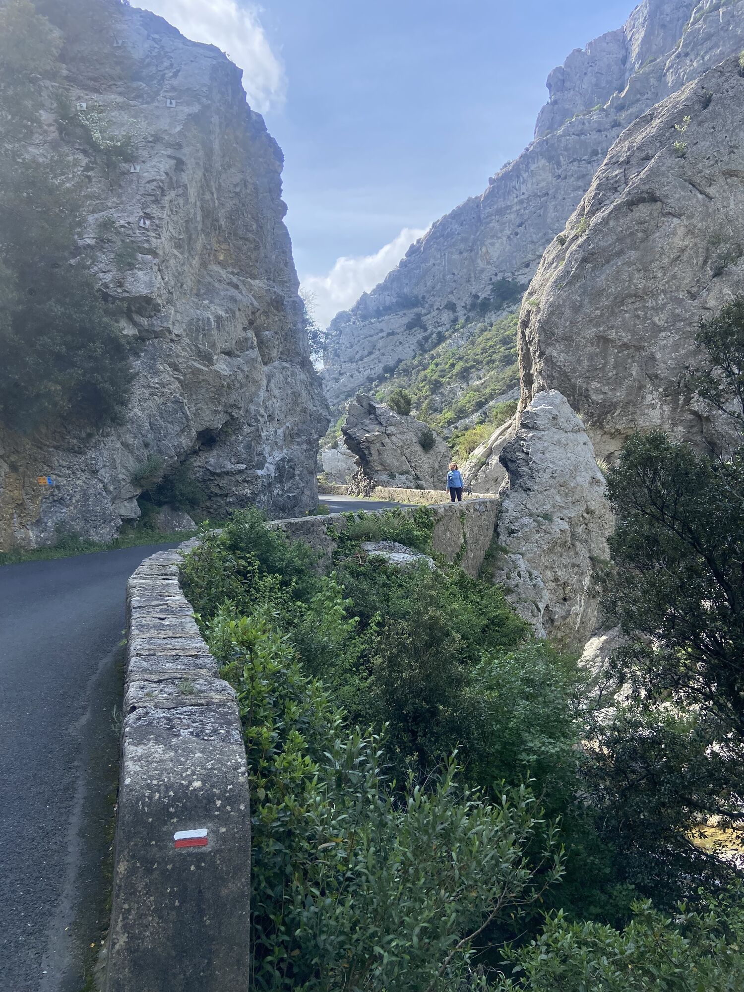
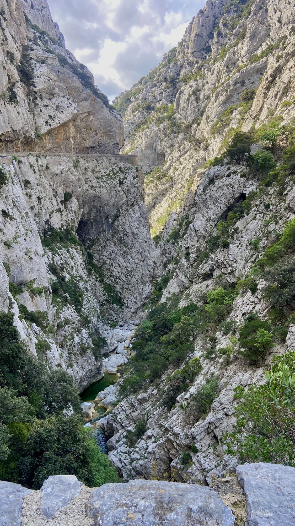
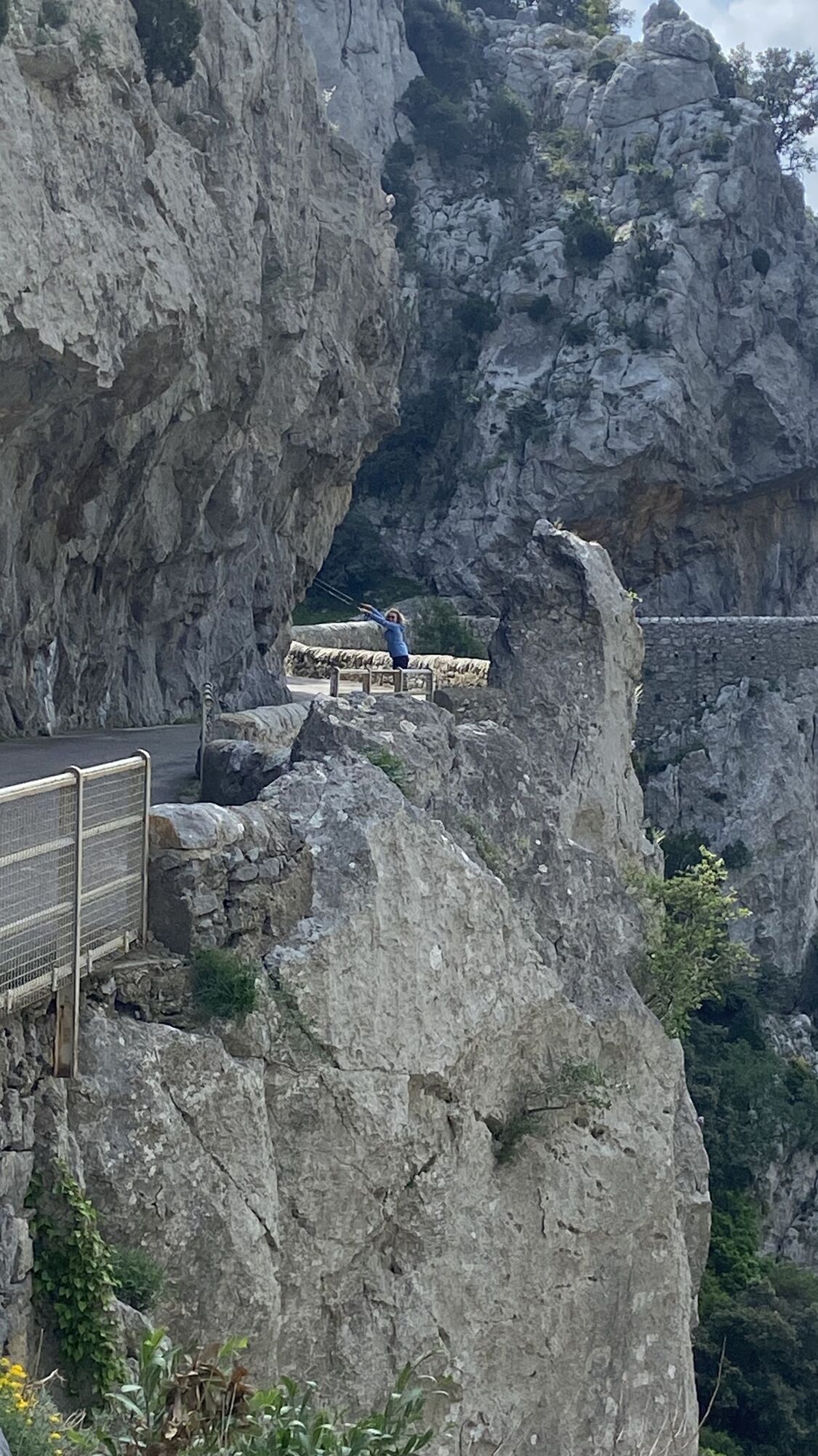
Cubières-Sur-Cinoble, Gorges les Galamus, Col das Souls
średni
Nawigacja
Nawigacja
Pobierz tę trasę na swój telefon komórkowy
Cubières-Sur-Cinoble, Gorges les Galamus, Col das Souls
średni
Wędrówka
10,19
km
Zeskanuj kod QR i rozpocznij nawigację w aplikacji bergfex.

Wędrówki i tropienie


Cubières-Sur-Cinoble, Gorges les Galamus, Col das Souls
średni
Odległość
10,19
km
Czas trwania
02:33
h
Ascent
399
hm
Poziom morza
367 -
688
m
Ścieżka do pobrania
Cubières-Sur-Cinoble, Gorges les Galamus, Col das Souls
średni
Wędrówka
10,19
km
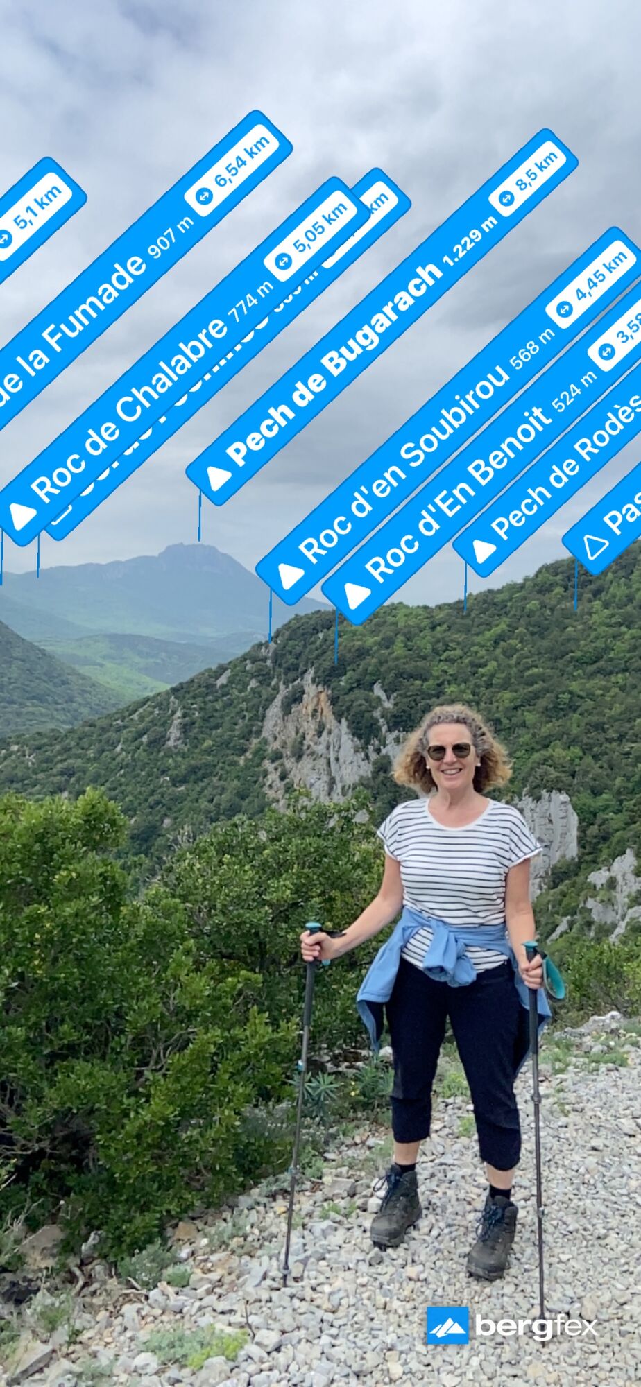
Moderate hike with great views of Gorges de Galamus and views from the mountains over the valley with Saint-Paul-de-Fenouillet.
Pathway with many stones so wear solid shoes.
Trasa
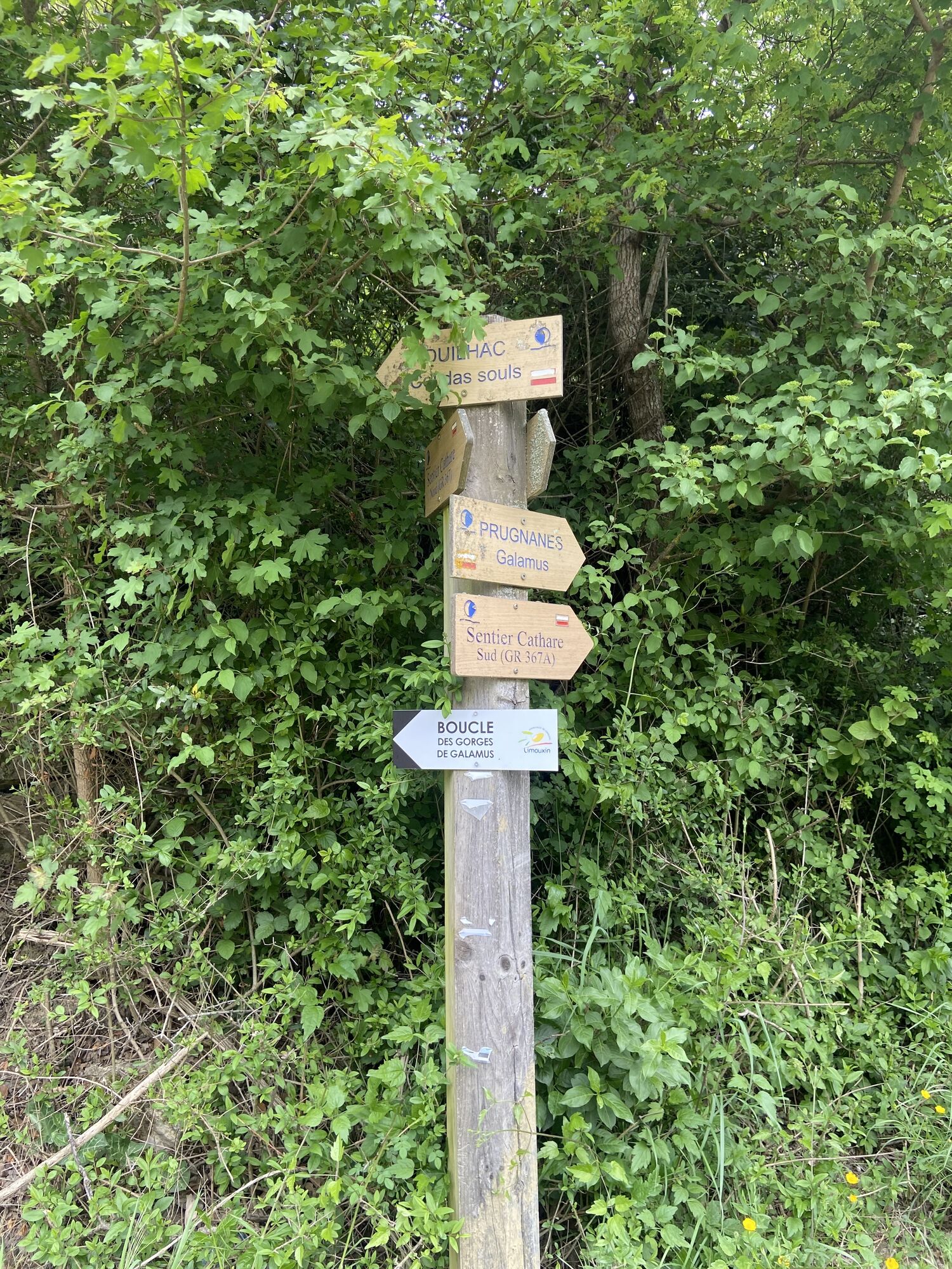
Ermitage Saint-Antoine de Galamus
(363 m)
Miejsce kultu
1,7 km
Trasa
Cubières-Sur-Cinoble, Gorges les Galamus, Col das Souls
średni
Wędrówka
10,19
km
Ermitage Saint-Antoine de Galamus
(363 m)
Miejsce kultu
1,7 km
Informacje o trasie
Trasa
Drive to Cubières-sur-Cinoble and follow D10 to Gorges de Galamus. Find a parking spot in the vincinity to the Gorges.
Sprzęt
Good shoes and hiking gear
Informacje o przyjeździe
Przybycie
By car or bike
Parking
Several parking lots in the vincinity
Wyceny
5
(0)
4
(1)
3
(0)
2
(0)
1
(0)
Popularne wycieczki w okolicy
-
5,0
Col du Linas - Pech de Bugarach
średniWędrówka 6,90 km -
Cassagnes - Peyro d'Arquo - Caramany - Église Notre-Dame-de-l'Assomption
ciężkiWędrówka 22,1 km -
4,0
Saint-Paul-de-Fenouillet - Ermitage Saint-Antoine de Galamus
średniWędrówka 8,88 km -
Bugarach - Pech de Bugarach - La Pique Grosse - Col du Linas
ciężkiWędrówka 13,4 km -
Bugarach - Cascade des Mathieux - Pech de Bugarach - Église Notre-Dame
ciężkiWędrówka 16,9 km -
Le Péchou - Bugarach - Cascade des Mathieux - Pech de Bugarach
ciężkiWędrówka 11,1 km -
Halte Train Rouge - Ermitage Saint-Antoine de Galamus - Église Notre-Dame - Saint-Paul-de-Fenouillet
ciężkiDroga rowerowa 42,2 km -
Bugarach - Pech de Bugarach - Église Saint-Nazaire et Saint-Celse - Rennes-les-Bains
ciężkiWędrówka 21,9 km -
Cucugnan - Église Saint-Julien et Sainte-Basilisse - Pla de l’Oum
średniWędrówka 9,38 km -
Lansac - Roch de Lansac
średniWędrówka 5,83 km

Wędrówki i tropienie

Ponad 550.000 propozycji wycieczek, szczegółowe mapy i intuicyjny planer tras sprawiają, że aplikacja jest niezbędna dla wszystkich entuzjastów przyrody.

Nie przegap ofert i inspiracji na następne wakacje
Zapisz się do newslettera
Błąd
Wystąpił błąd. Spróbuj ponownie.
Dziękujemy za rejestrację
Twój adres e-mail została dodana do listy mailingowej.
Wycieczki po całej Europie
Austria
Szwajcaria
Niemcy
Włochy
Słowenię
Francja
Holandia
Belgia
Polska
Liechtenstein
Czechy
Słowacja
Hiszpania
Chorwacja
Bośnia i Hercegowina
Luksemburg
Andorra
Portugalia
Islandia
Wielka Brytania
Irlandia
Grecja
Albania
Macedonia Północna
Malta
Norwegia
Czarnogóra
Mołdawia
Kosowo
Węgry
San Marino
Rumunia
Estonia
Łotwa
Białoruś
Cypr
Litwa
Serbia
Bułgaria
Monako
Dania
Szwecja
Finlandia