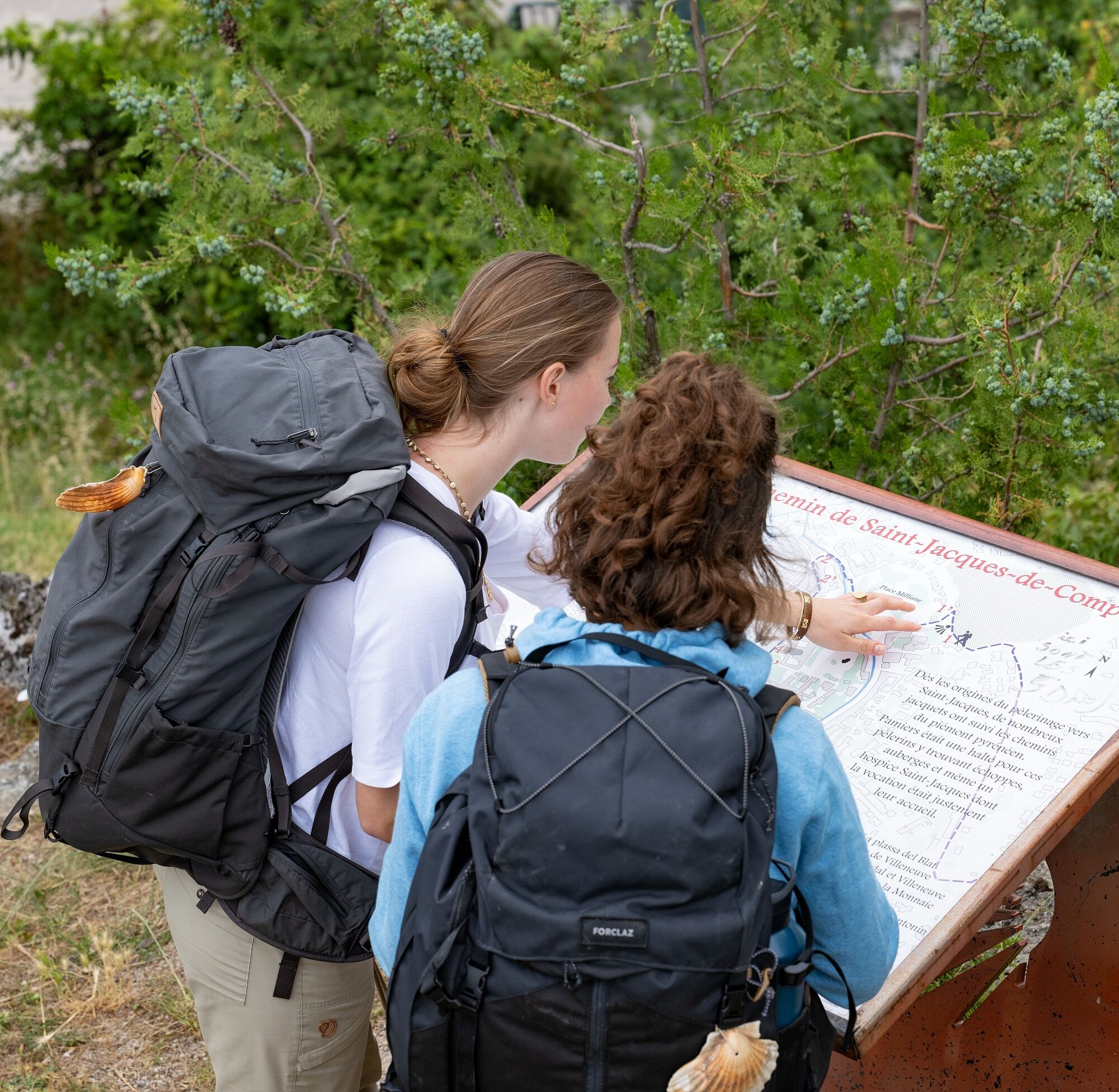
The Pyrenean Piedmont Route GR®78
ciężki
Nawigacja
Nawigacja
Pobierz tę trasę na swój telefon komórkowy
The Pyrenean Piedmont Route GR®78
ciężki
Wędrówka
152,81
km
Zeskanuj kod QR i rozpocznij nawigację w aplikacji bergfex.

Wędrówki i tropienie


The Pyrenean Piedmont Route GR®78
ciężki
Odległość
152,81
km
Czas trwania
42:24
h
Ascent
3 586
hm
Poziom morza
255 -
906
m
Ścieżka do pobrania
The Pyrenean Piedmont Route GR®78
ciężki
Wędrówka
152,81
km
Zdjęcia naszych użytkowników
This route links Montpellier to Saint-Jean-Pied-de-Port over 700 kilometers. At the foot of the Black Mountain, between Hérault and Aude, old land registers speak of the pilgrims who gave their name to...
Opis
This route links Montpellier to Saint-Jean-Pied-de-Port over 700 kilometers. At the foot of the Black Mountain, between Hérault and Aude, old land registers speak of the pilgrims who gave their name to the route: the Camin de Sanct Jaume or the Camin romieu, a unique feature in France. The Codex Calixtinus even refers to it by recommending honoring Tibère, Modeste, and Florence in Saint-Thibéry.
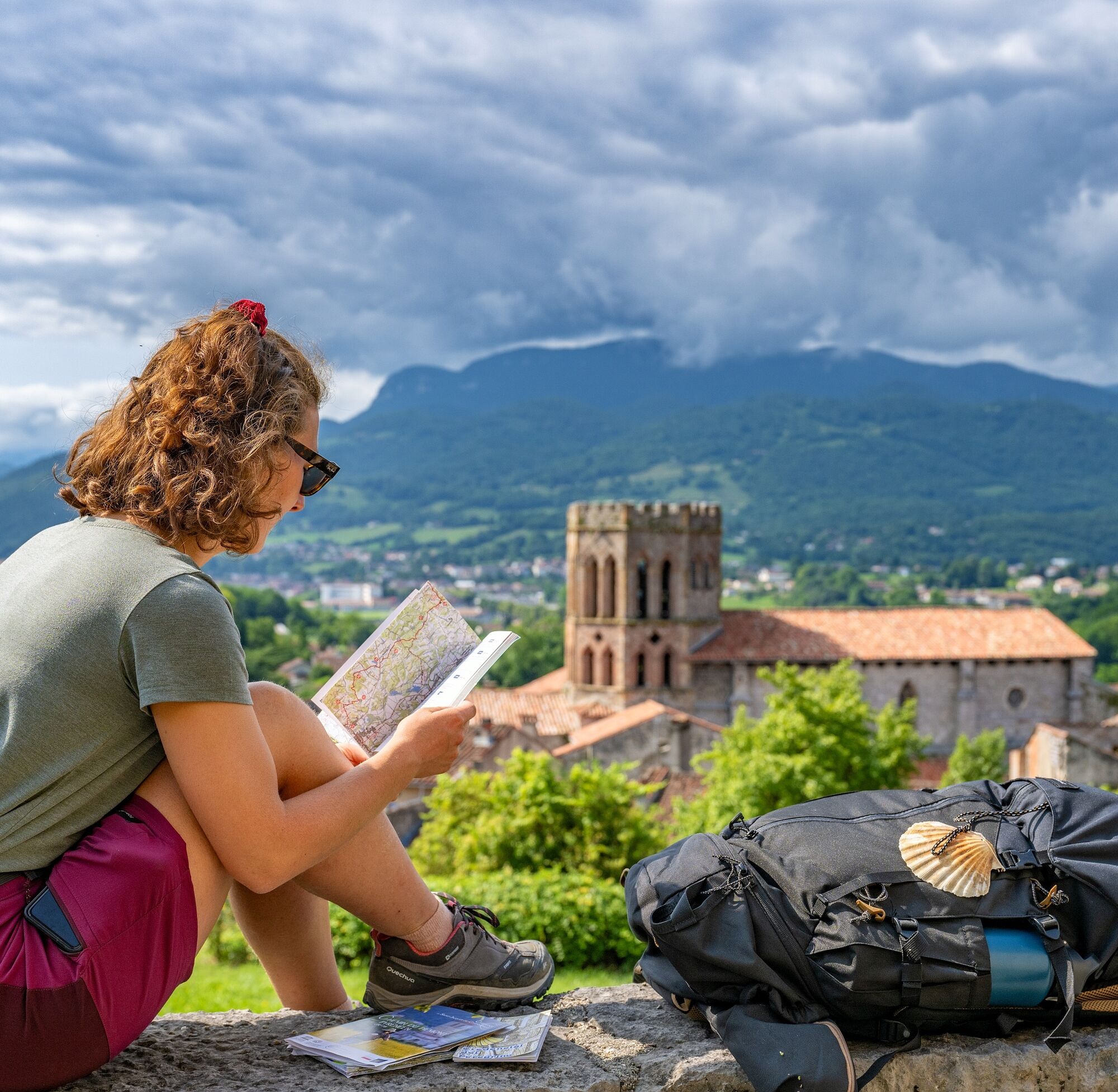
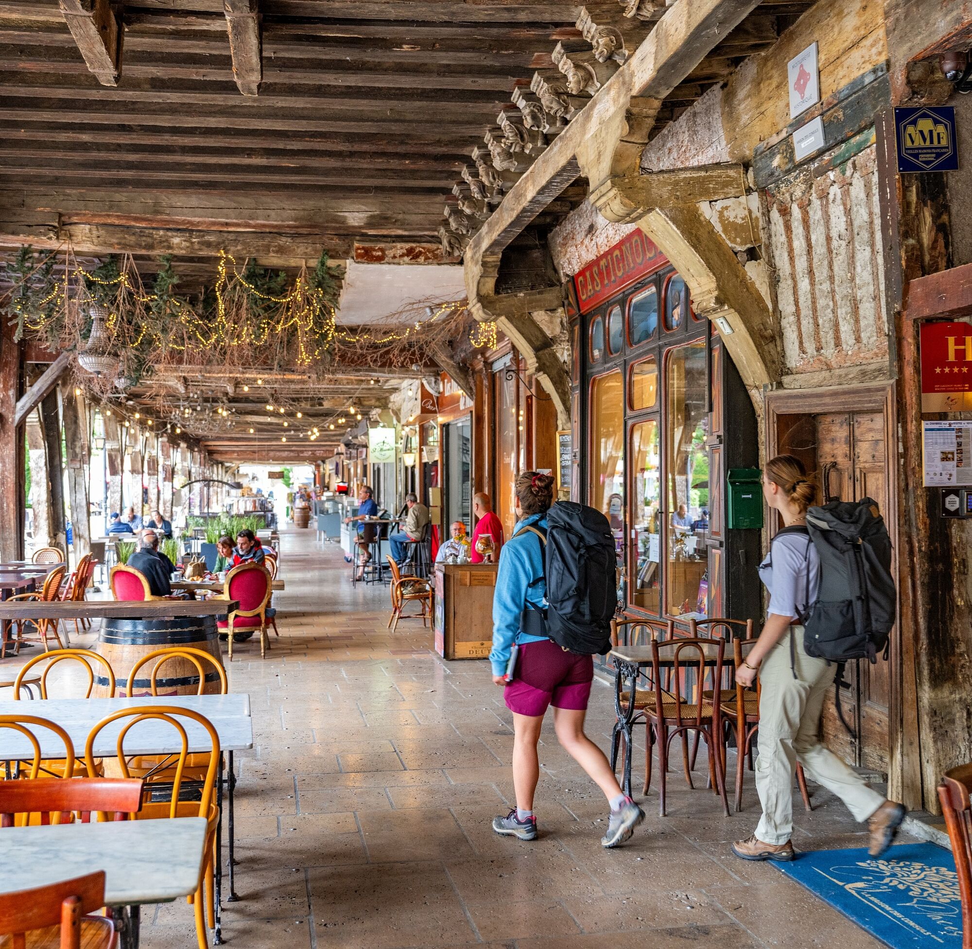
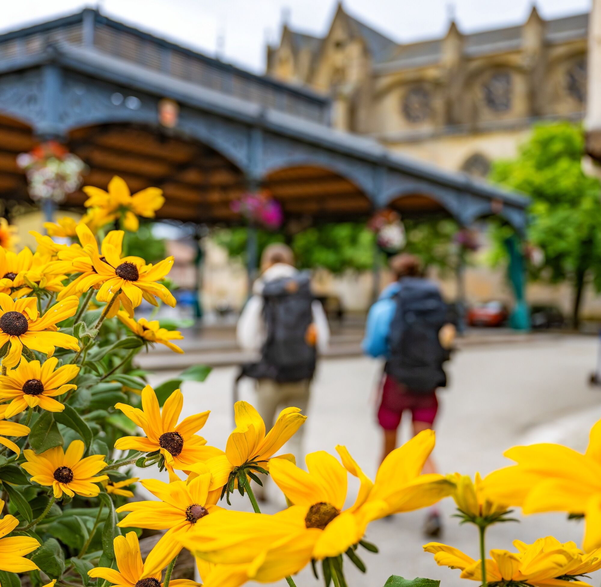
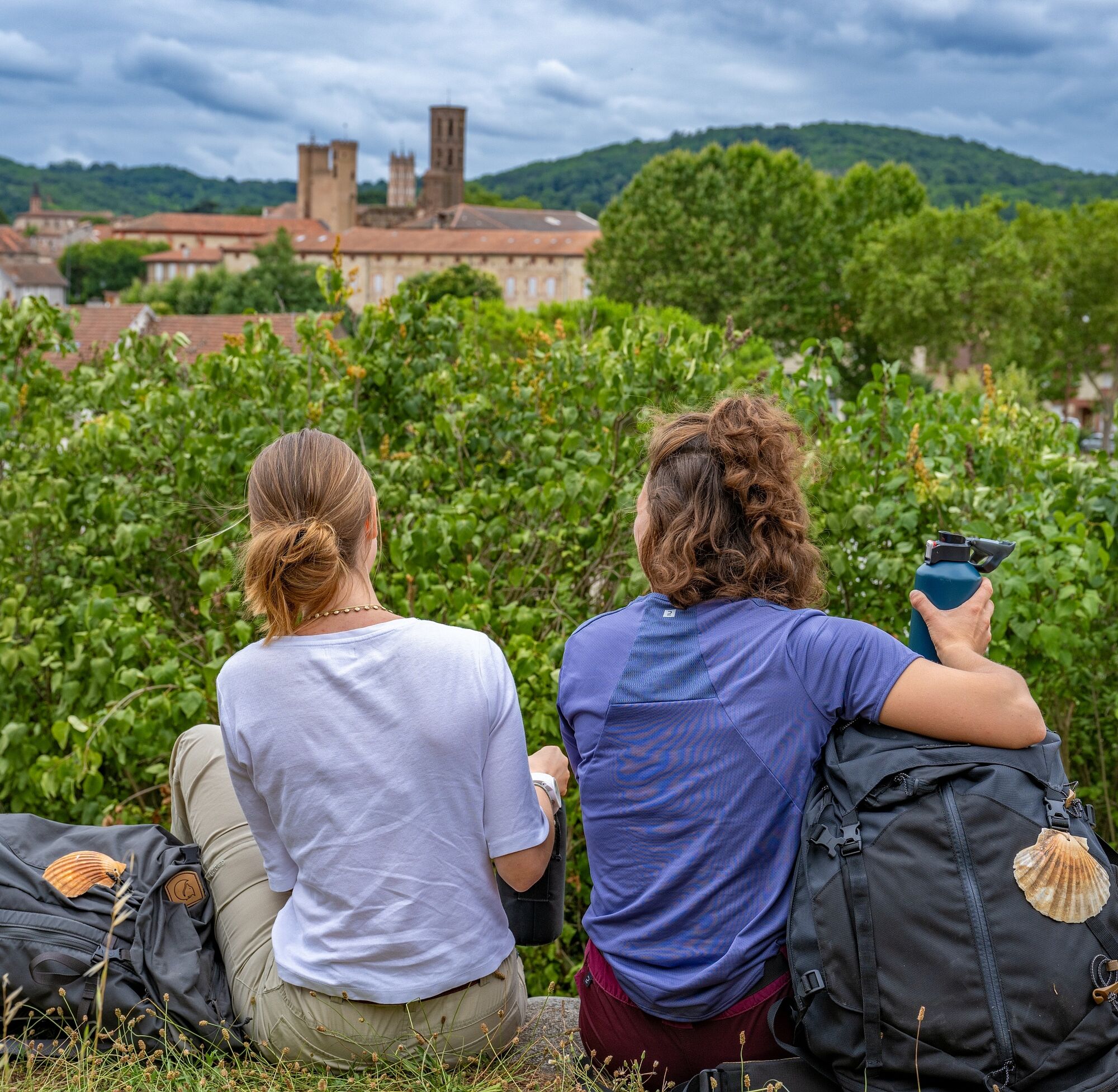
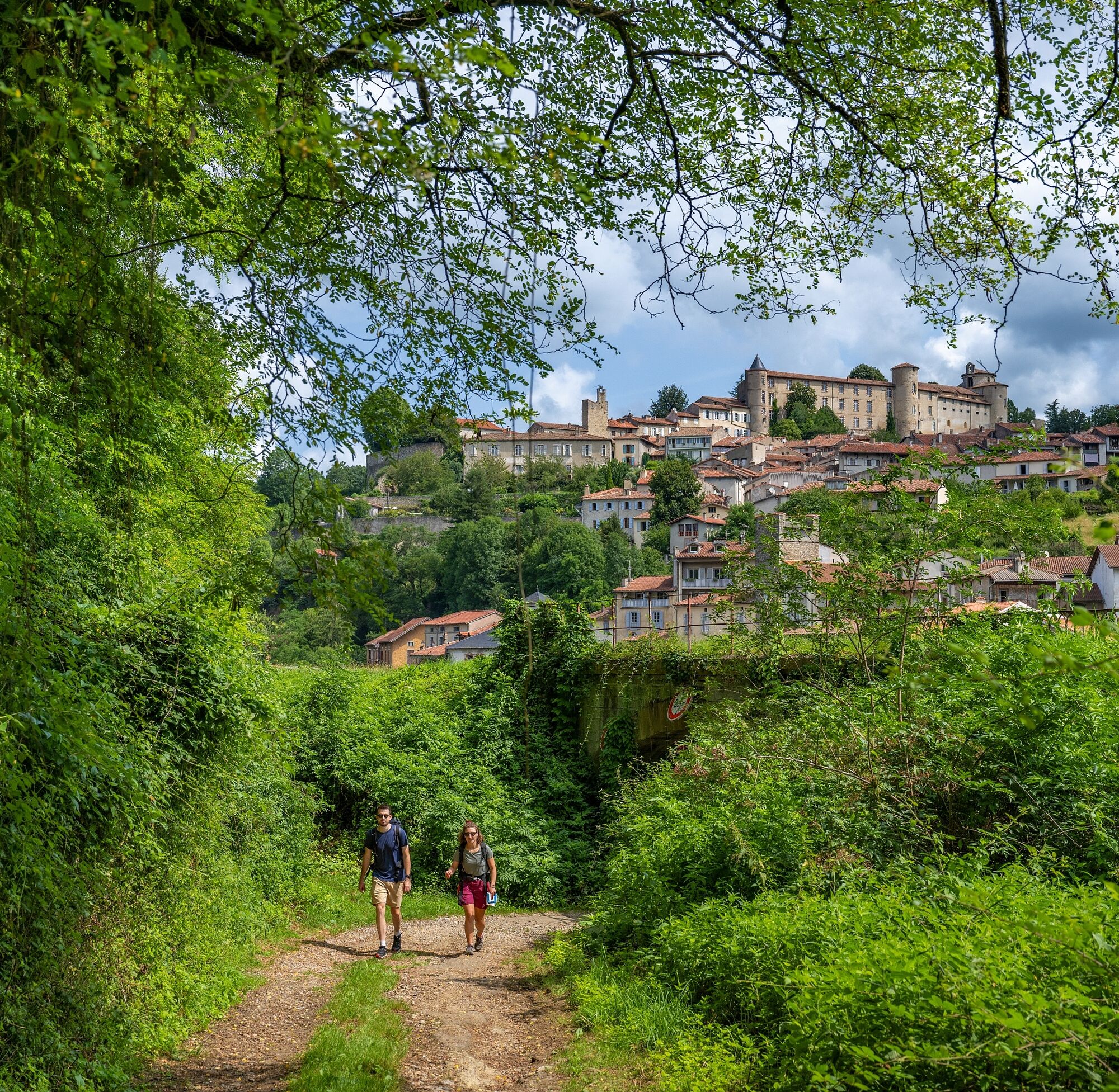
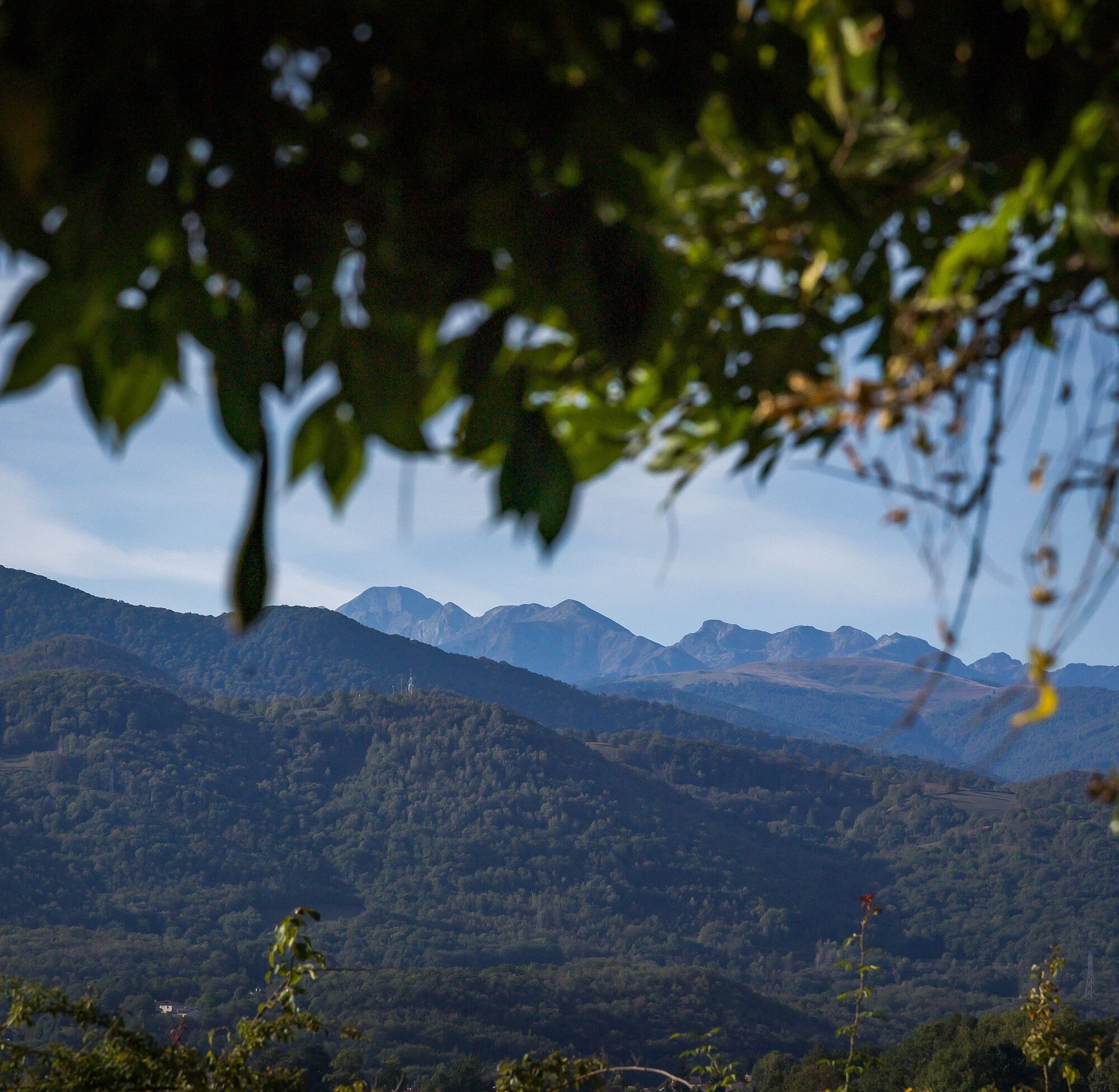
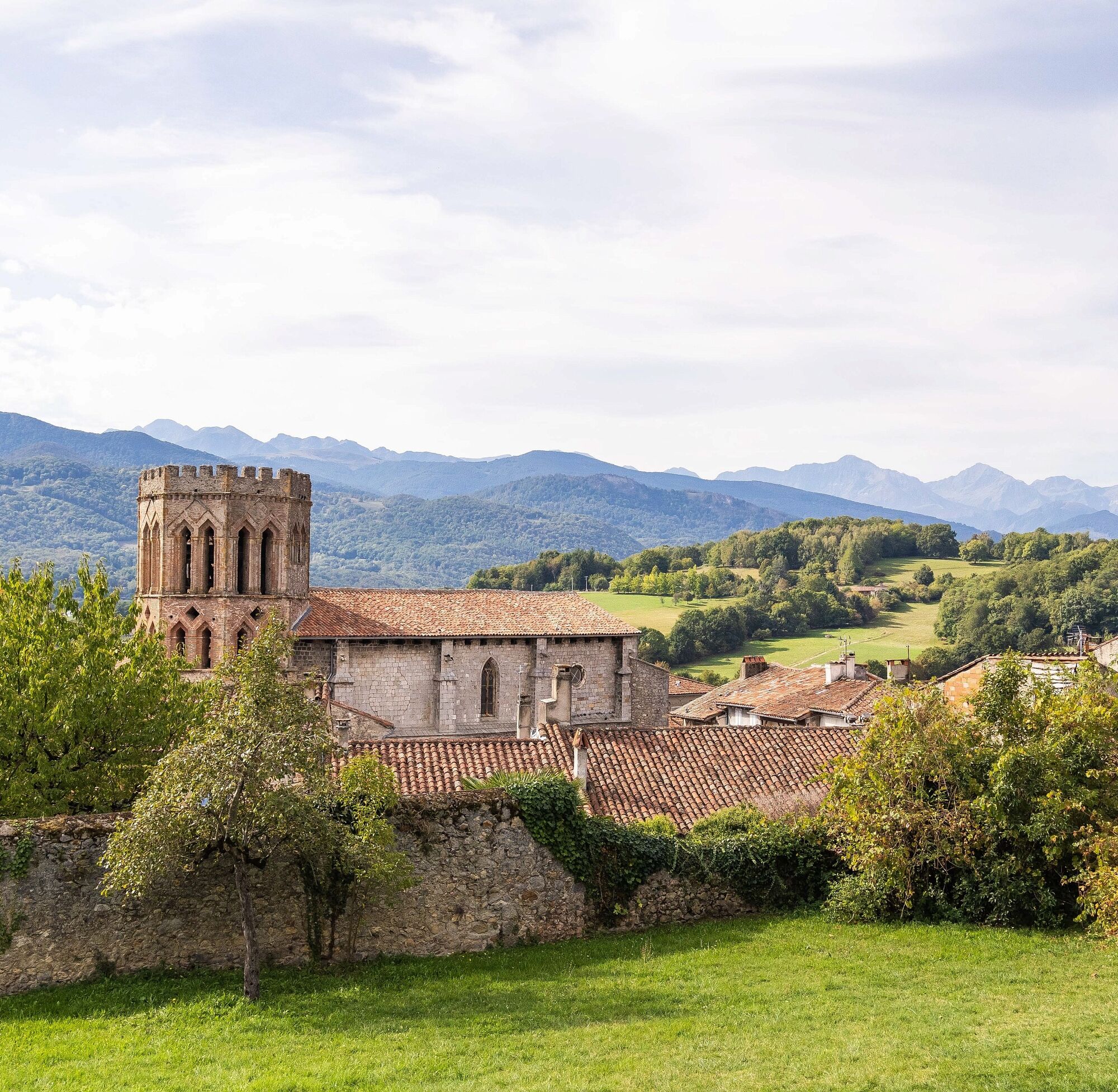
The Piedmont route, still little known, enchants with the serenity of its landscapes and the beauty of its churches, abbeys, small villages, and its tranquility far from the crowds of other routes.
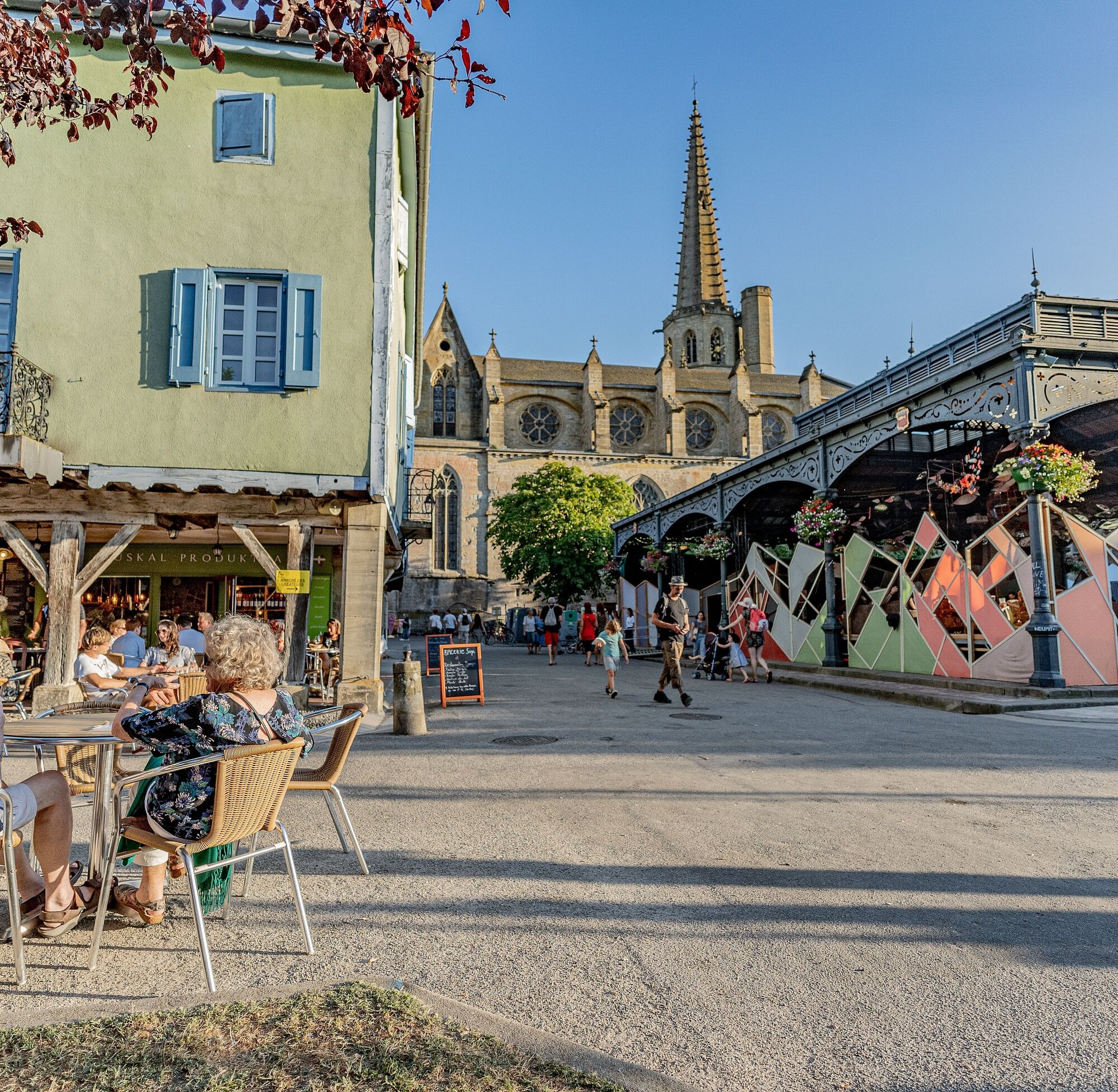
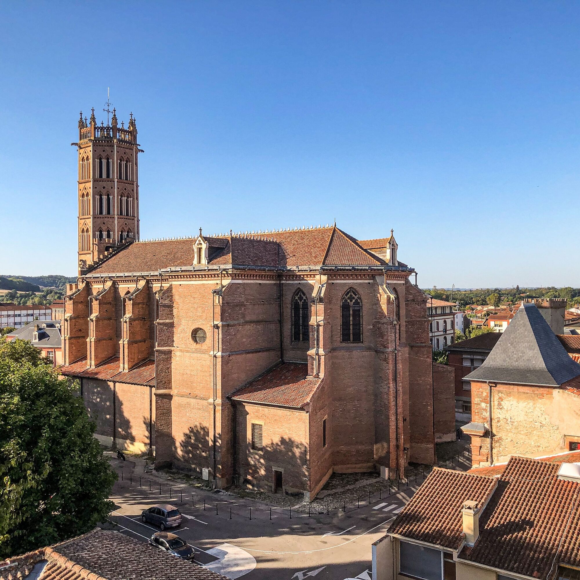
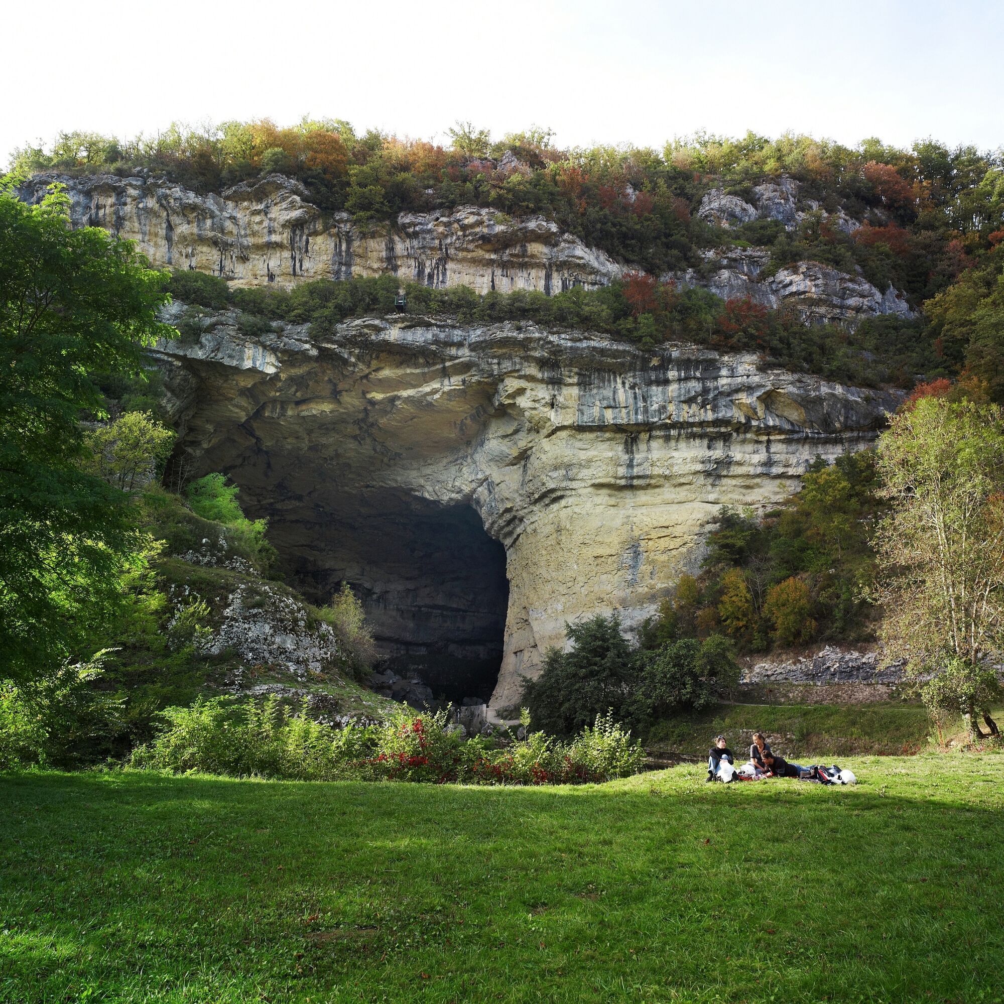
Starting from the city of Carcassonne, the route links the villages of Fanjeaux and Montréal in the Aude, the medieval bastide of Mirepoix, the three bell towers of Pamiers, the Mas d’Azil cave, the city of Saint-Lizier in Ariège, Saint-Bertrand-de-Comminges and the basilica of Valcabrère, the world-renowned sanctuary of Lourdes and leads to Oloron in Béarn and to Saint-Jean-Pied-de-Port serving the valleys and mountain passes of the Pyrenees.
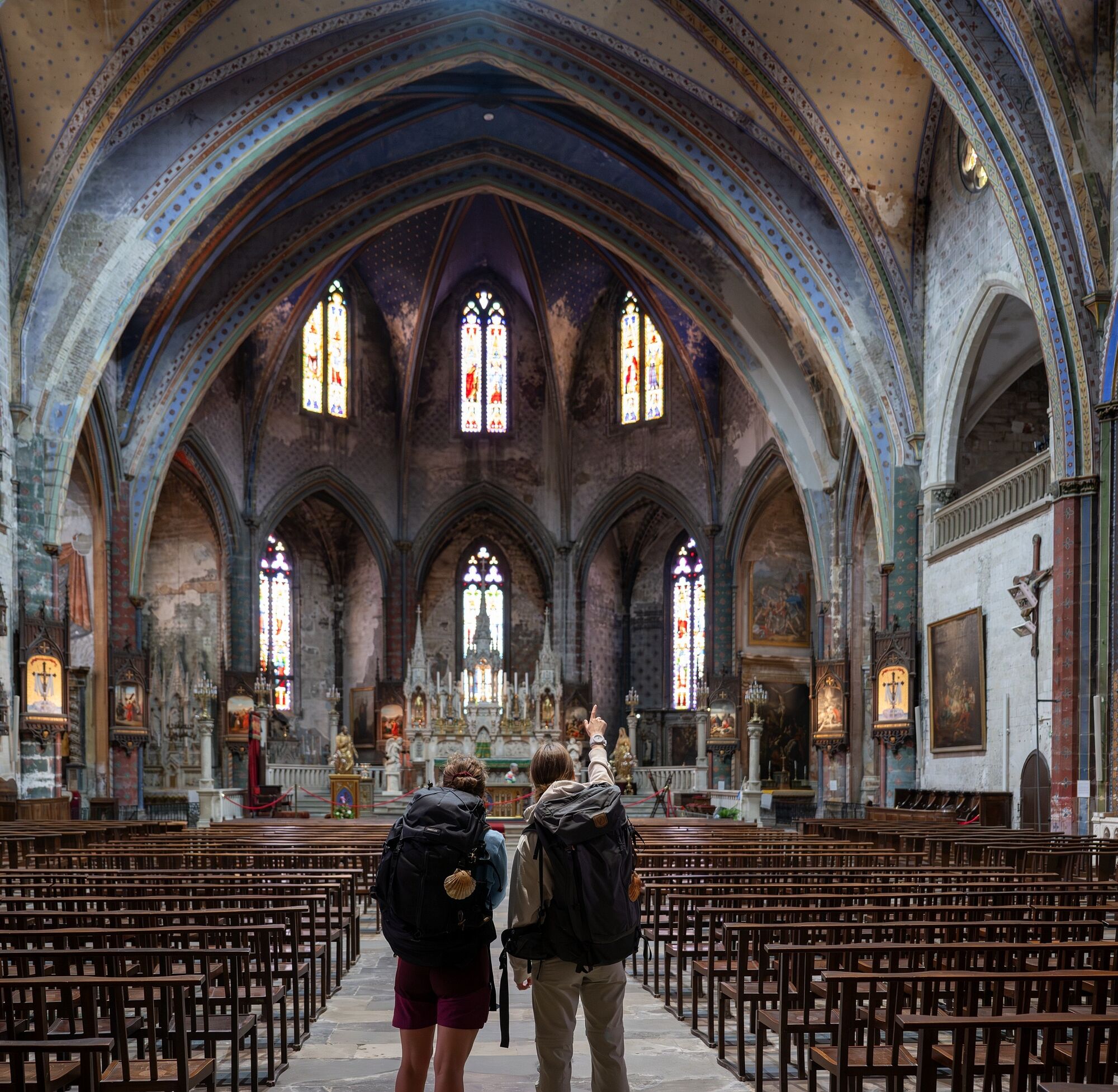
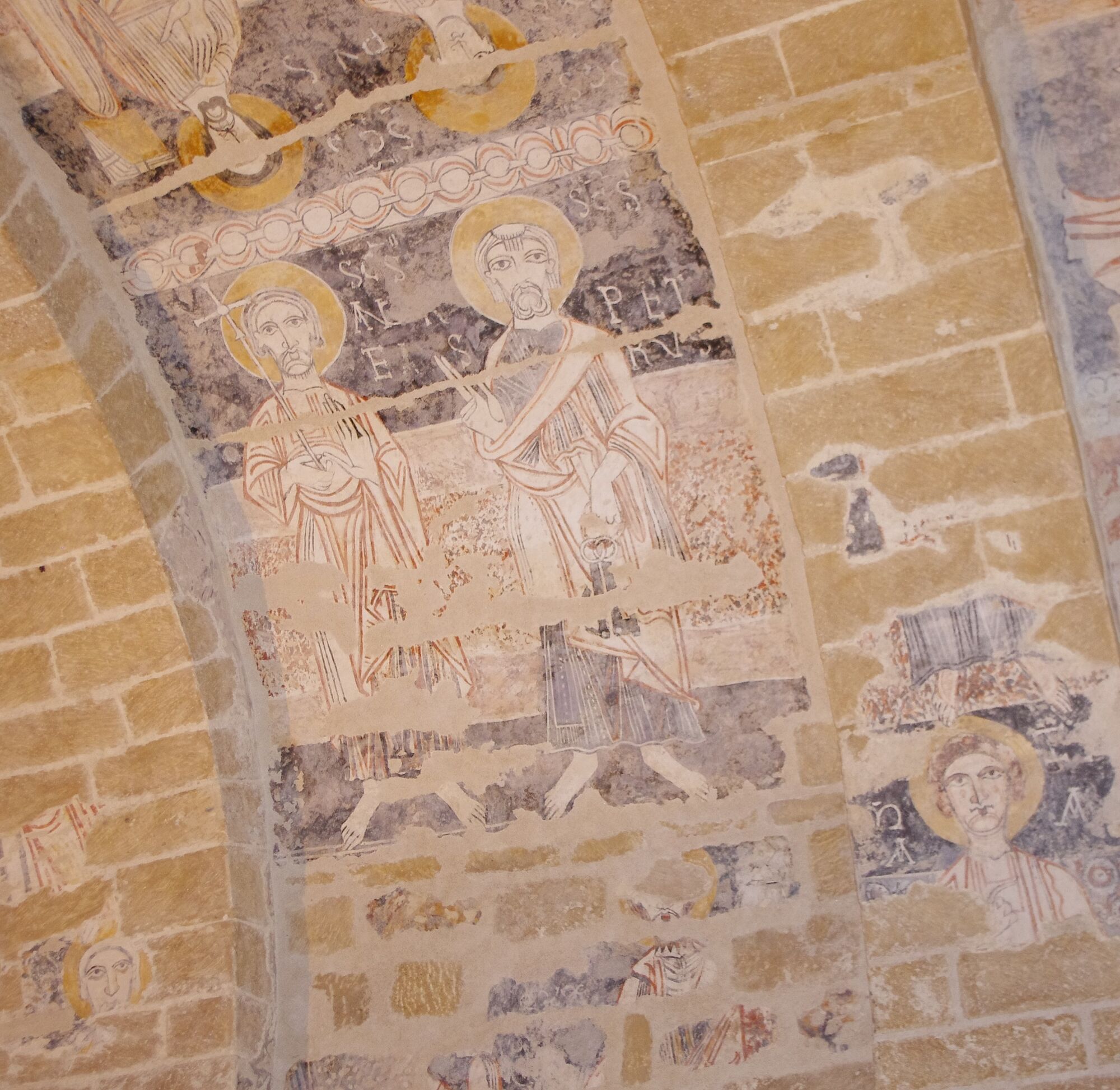
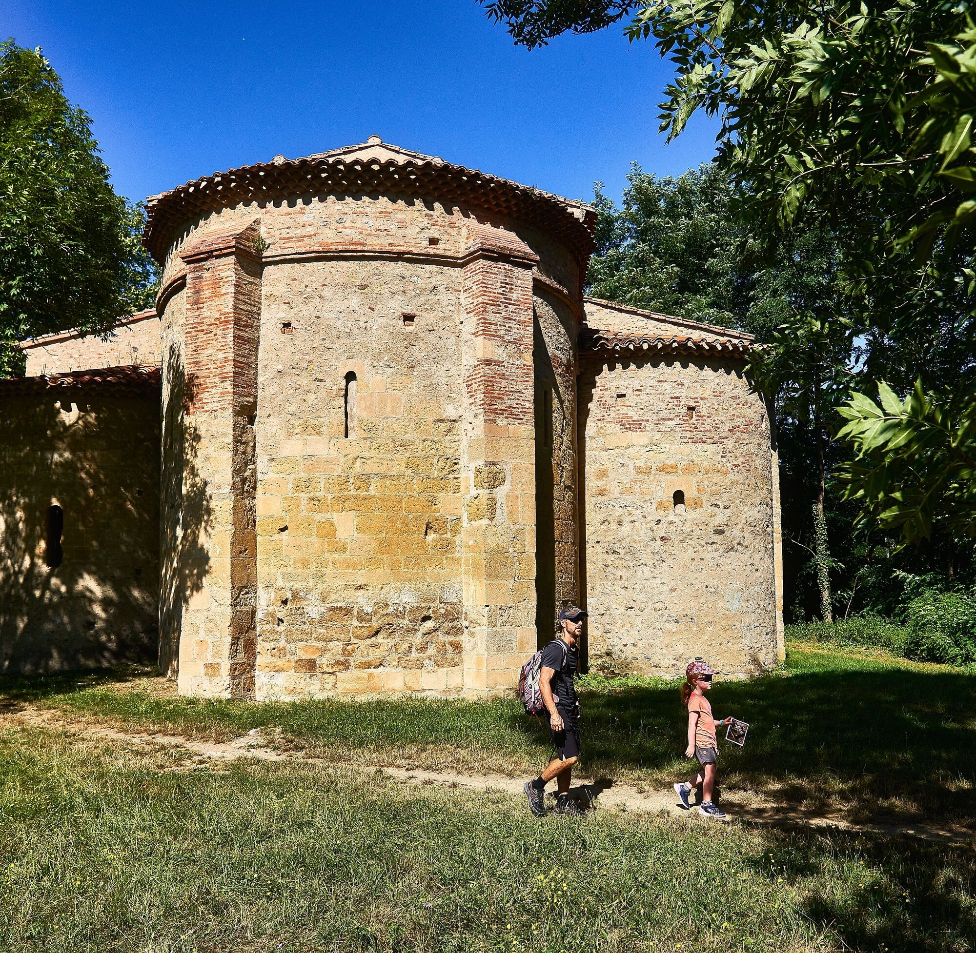
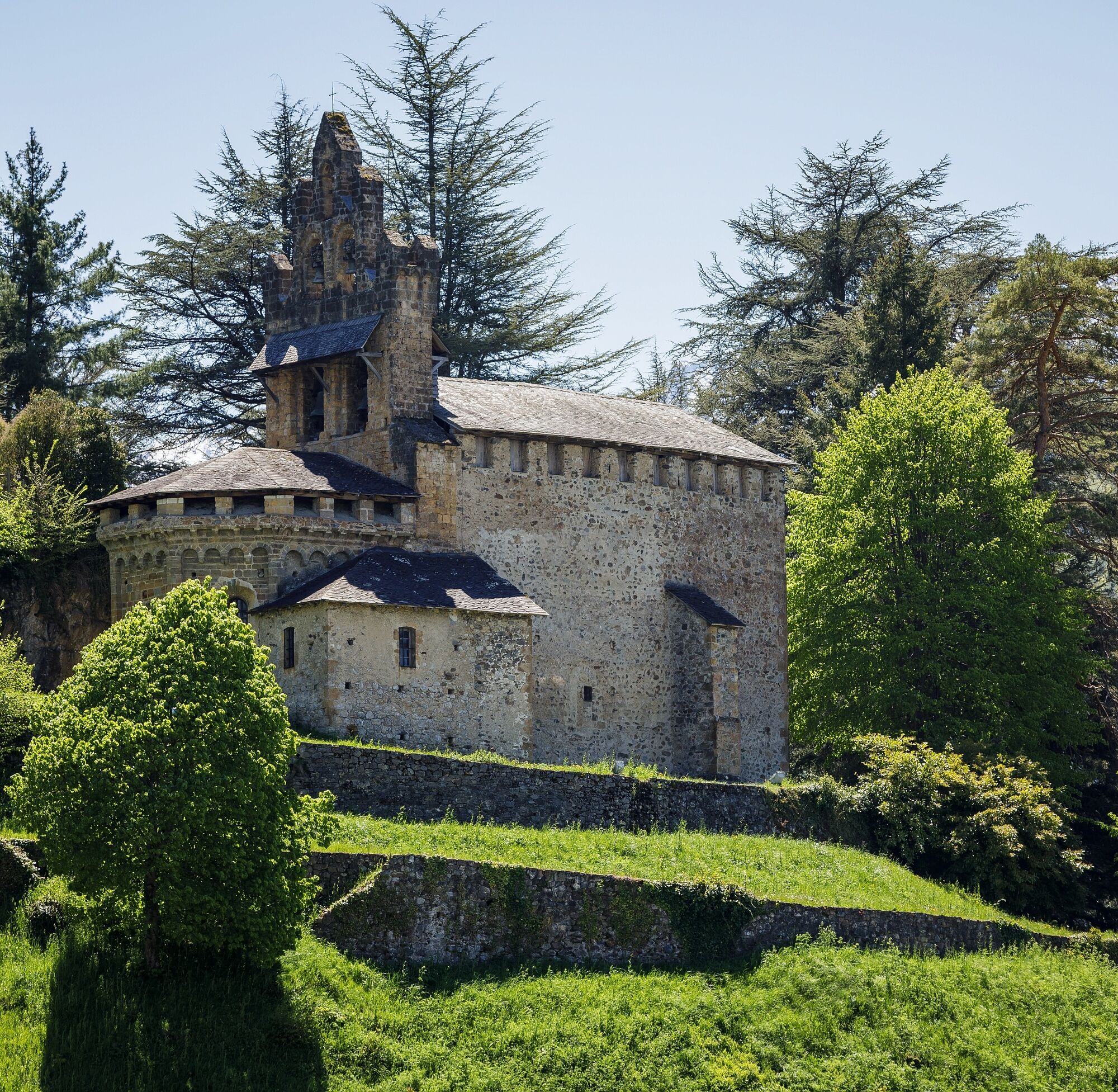
Marked by the presence of magnificent Romanesque buildings such as in Rieux-Minervois, Vals, or Hôpital-Saint-Blaise, the Piedmont route is a path of character that enchants by the serenity of its landscapes overlooking the mountain massif. Its moderate traffic makes it a path of intimacy that can promote reflection and introspection.
The Piedmont route, still little known, enchants with the serenity of its landscapes and the beauty of its churches, abbeys, small villages, and its tranquility far from the crowds of other routes.
Starting from the city of Carcassonne, the route links the villages of Fanjeaux and Montréal in the Aude, the medieval bastide of Mirepoix, the three bell towers of Pamiers, the Mas d’Azil cave, the city of Saint-Lizier in Ariège, Saint-Bertrand-de-Comminges and the basilica of Valcabrère, the world-renowned sanctuary of Lourdes and leads to Oloron in Béarn and to Saint-Jean-Pied-de-Port serving the valleys and mountain passes of the Pyrenees.
Marked by the presence of magnificent Romanesque buildings such as in Rieux-Minervois, Vals, or Hôpital-Saint-Blaise, the Piedmont route is a path of character that enchants by the serenity of its landscapes overlooking the mountain massif. Its moderate traffic makes it a path of intimacy that can promote reflection and introspection.
Trasa
Pech Naboune
(409 m)
Szczyt
5,0 km
Touron
(366 m)
Szczyt
22,7 km
Église de la Conversion-de-Saint-Paul
(401 m)
Miejsce kultu
98,0 km
Halte Jacquaire
(422 m)
Schronienie
116,2 km
Saint-Girons
(392 m)
Miasto
119,5 km
Église Notre-Dame-de-Tramesaygues
(503 m)
Miejsce kultu
133,1 km
Église Saint-Hilaire
(677 m)
Miejsce kultu
149,7 km
Trasa
The Pyrenean Piedmont Route GR®78
ciężki
Wędrówka
152,81
km
Malegoude
(338 m)
Wioska
0,8 km
Gagnoulet
(333 m)
Rozliczenie
1,1 km
Église de la Nativité-de-la-Vierge-Marie
(340 m)
Miejsce kultu
1,8 km
Pech Naboune
(409 m)
Szczyt
5,0 km
Barthas
(295 m)
Rozliczenie
9,6 km
Senesse
(303 m)
Rozliczenie
10,9 km
Église Saint-Genès
(305 m)
Miejsce kultu
12,3 km
Manses
(299 m)
Wioska
15,5 km
Église Saint-Jean-Baptiste
(308 m)
Miejsce kultu
15,6 km
Église Saint-Jean l’Évangéliste
(282 m)
Miejsce kultu
19,7 km
Teilhet
(274 m)
Wioska
19,7 km
Vals
(271 m)
Wioska
21,6 km
Touron
(366 m)
Szczyt
22,7 km
Segneuries
(257 m)
Rozliczenie
27,5 km
Saint-Amadou
(271 m)
Wioska
29,3 km
Ludiès
(324 m)
Wioska
30,8 km
Le Carlaret
(317 m)
Wioska
32,0 km
Église Saint-Saturnin
(317 m)
Miejsce kultu
32,1 km
Pamiers
(298 m)
Stacja kolejowa
41,6 km
Chapelle du Cimetière Saint-Jean
(295 m)
Miejsce kultu
42,0 km
Fontaine Sainte-Natalène.
(285 m)
Źródło
42,2 km
Église Notre-Dame-du-Camp
(284 m)
Miejsce kultu
43,1 km
Pamiers
(289 m)
Miasto
43,5 km
Saint-Victor-Rouzaud
(330 m)
Wioska
53,9 km
Montégut-Plantaurel
(348 m)
Wioska
62,3 km
Église Notre-Dame de l'Assomption
(333 m)
Miejsce kultu
62,7 km
Église Saint-Étienne
(419 m)
Miejsce kultu
67,6 km
Monesple
(342 m)
Wioska
68,2 km
Pailhès
(285 m)
Wioska
69,7 km
Le Barry
(303 m)
Sąsiedztwo
69,7 km
Temple
(285 m)
Miejsce kultu
85,5 km
Le Mas-d'Azil
(286 m)
Wioska
85,6 km
Église protestante du Mas d'Azil
(285 m)
Miejsce kultu
85,7 km
La terrasse du mas
(287 m)
Restauracja
85,7 km
Église Saint-Étienne
(287 m)
Miejsce kultu
85,8 km
Par hazard
(287 m)
Restauracja
85,9 km
kiwi
(287 m)
Restauracja
85,9 km
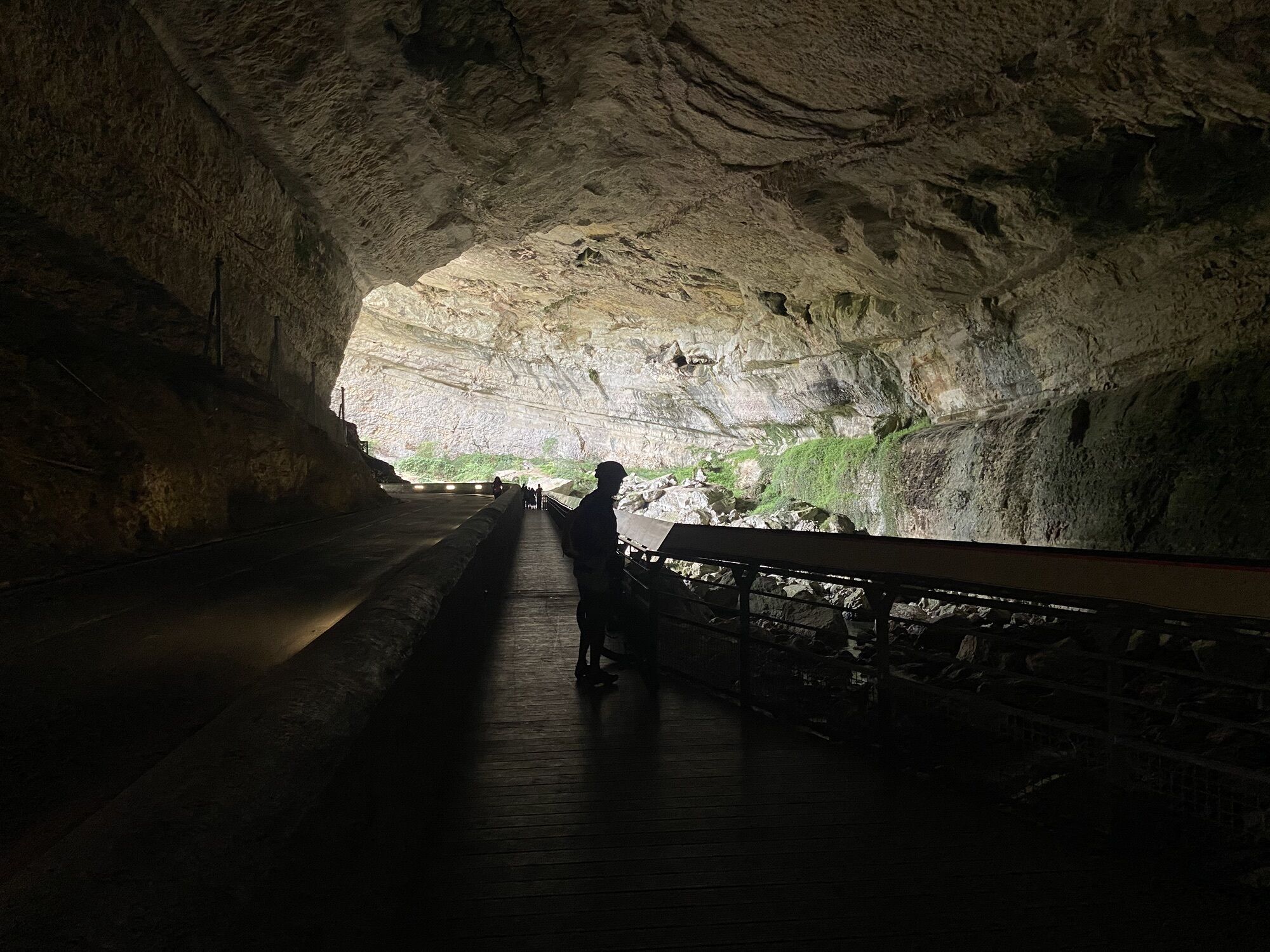
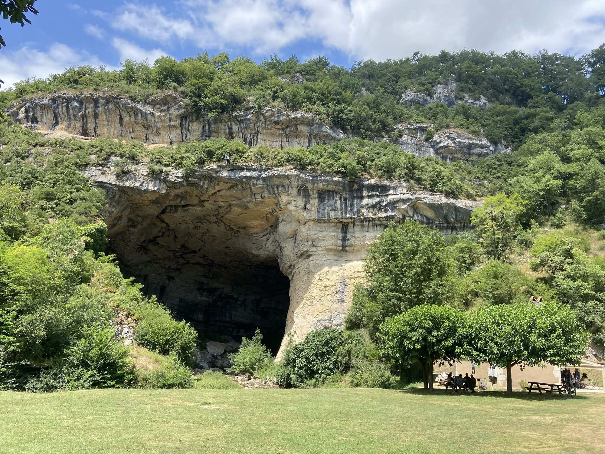
Grotte du Mas-d'Azil
(402 m)
Wejście do jaskini
87,2 km
Capès
(410 m)
Rozliczenie
94,2 km
Baluette
(521 m)
Rozliczenie
95,0 km
Cap del Pradou
(496 m)
Rozliczenie
96,5 km
Église de la Conversion-de-Saint-Paul
(401 m)
Miejsce kultu
98,0 km
Lagrausse
(402 m)
Rozliczenie
98,0 km
Soueix des Barthes
(477 m)
Rozliczenie
102,3 km
Capet
(505 m)
Rozliczenie
103,4 km
La Baure
(486 m)
Korytarz/teren
105,9 km
Église de la Nativité-de-Notre-Dame
(496 m)
Miejsce kultu
105,9 km
La Baure
(438 m)
Rozliczenie
106,8 km
Lescure
(438 m)
Wioska
106,8 km
Montjoie-en-Couserans
(437 m)
Wioska
113,8 km
Église Saint-Étienne
(454 m)
Miejsce kultu
114,2 km
monument aux morts
(456 m)
Stół piknikowy
114,3 km
Le Castech
(465 m)
Korytarz/teren
114,5 km
Halte Jacquaire
(422 m)
Schronienie
116,2 km
Saint-Lizier
(437 m)
Wioska
116,3 km
La Ville
(419 m)
Korytarz/teren
116,4 km
Friquet
(397 m)
Korytarz/teren
117,1 km
Peyre-Rouge
(405 m)
Rozliczenie
117,8 km
Lagarde
(410 m)
Rozliczenie
118,3 km
Vieux Lédar
(406 m)
Rozliczenie
119,1 km
Saint-Girons
(392 m)
Miasto
119,5 km
Sières
(399 m)
Sąsiedztwo
119,7 km
Clos de Bouycho
(479 m)
Rozliczenie
120,4 km
Grotte des Fadettes
(455 m)
Wejście do jaskini
121,9 km
Fontaine de Ribens
(420 m)
Źródło
122,3 km
Aubert
(423 m)
Rozliczenie
122,9 km
Loutrach
(429 m)
Korytarz/teren
123,7 km
Pizza Kiwi
(433 m)
Restauracja
123,9 km
Moulis
(430 m)
Wioska
124,0 km
Restaurant Pizzeria du Moulin
(428 m)
Restauracja
124,1 km
Église Saint-Jean-Baptiste
(479 m)
Miejsce kultu
125,5 km
Pouech
(480 m)
Rozliczenie
125,6 km
Engomer
(462 m)
Wioska
127,3 km
Vignau
(463 m)
Sąsiedztwo
127,3 km
Alas
(472 m)
Rozliczenie
129,0 km
Arrout
(599 m)
Wioska
130,9 km
Église Saint-Pierre
(564 m)
Miejsce kultu
131,1 km
Église Notre-Dame-de-Tramesaygues
(503 m)
Miejsce kultu
133,1 km
Audressein
(506 m)
Wioska
133,2 km
Argein
(534 m)
Wioska
136,2 km
Le Viellot
(549 m)
Sąsiedztwo
138,7 km
Aucazein
(552 m)
Wioska
138,8 km
Illartein
(567 m)
Wioska
139,3 km
Buzan
(722 m)
Wioska
140,1 km
Chapelle Saint-Jean
(814 m)
Miejsce kultu
141,2 km
Orgibet
(657 m)
Wioska
145,1 km
Église Saint-Jean-Baptiste
(702 m)
Miejsce kultu
145,5 km
Saint-Jean-du-Castillonnais
(706 m)
Wioska
145,5 km
Terreferte
(654 m)
Rozliczenie
147,0 km
Augirein
(630 m)
Wioska
147,2 km
Saint-Lary
(674 m)
Wioska
149,5 km
Église Saint-Hilaire
(677 m)
Miejsce kultu
149,7 km
Escarchein
(854 m)
Rozliczenie
152,0 km
Grotte d'Escarchein
(890 m)
Wejście do jaskini
152,4 km
Autor
Dostarczone przez Ariège Pyrénées Tourisme
Wycieczkę The Pyrenean Piedmont Route GR®78 zapewnia outdooractive.com.


Kathedrale St. Mauritius
©
JJ.Gelbbart/AFCC - Ariège Pyrénées Tourisme
Mahlzeit mit Aussicht von Arrout
©
JJ.Gelbbart/AFCC - Ariège Pyrénées Tourisme
Aussichtspunkt auf Pamiers
©
JJ.Gelbbart/AFCC - Ariège Pyrénées Tourisme
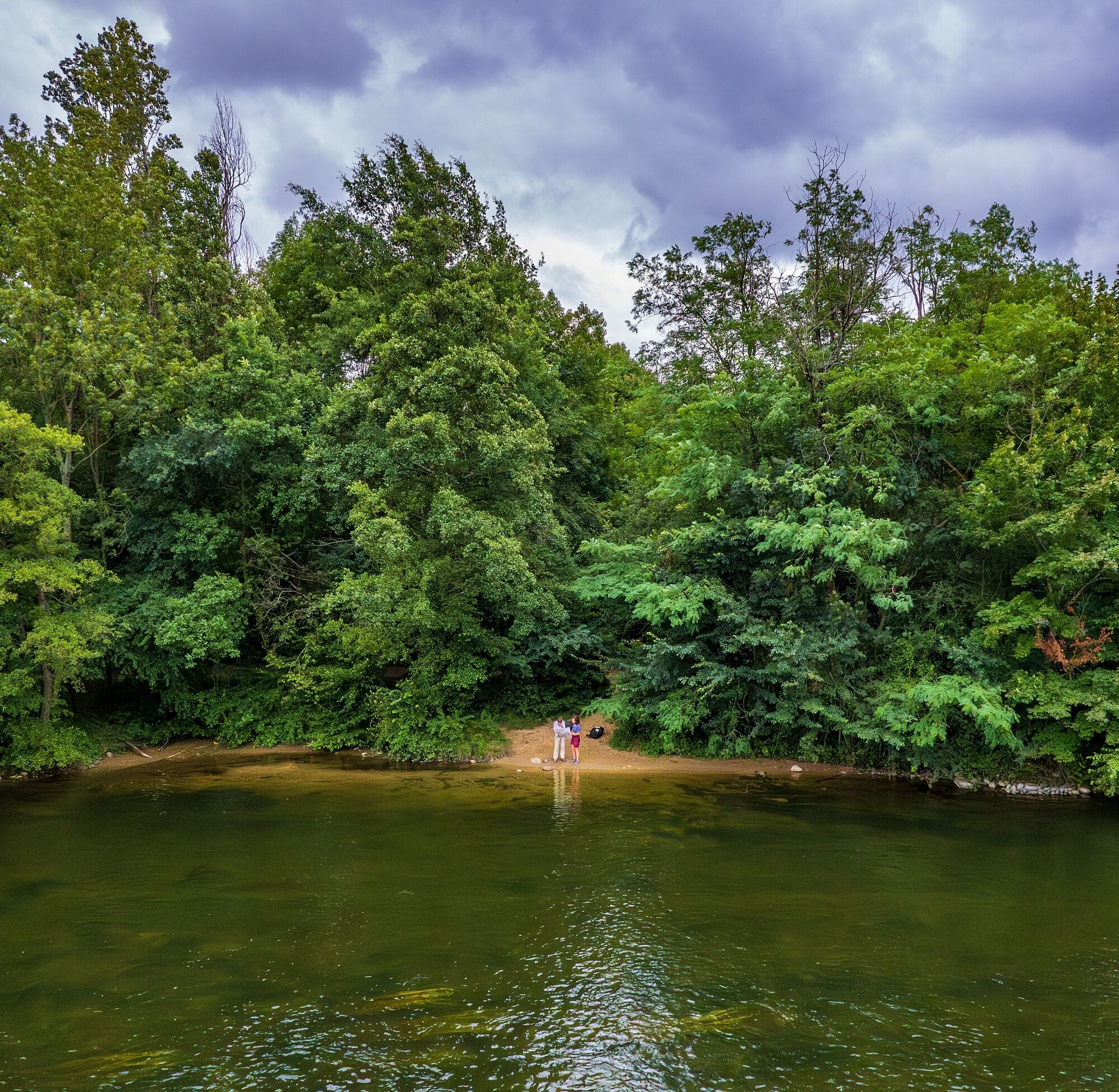
Die Ariège südlich von Pamiers
©
JJ.Gelbbart/AFCC - Ariège Pyrénées Tourisme
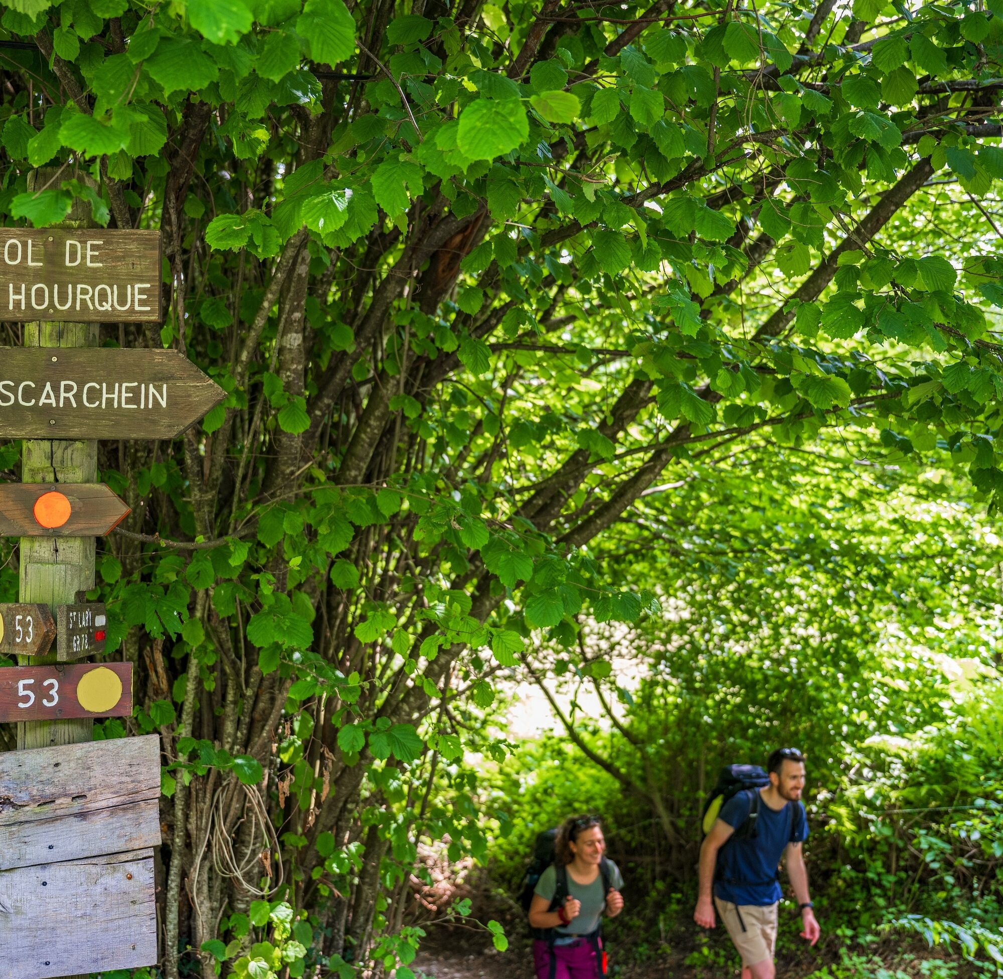
Col de la Hourque
©
JJ.Gelbbart/AFCC - Ariège Pyrénées Tourisme
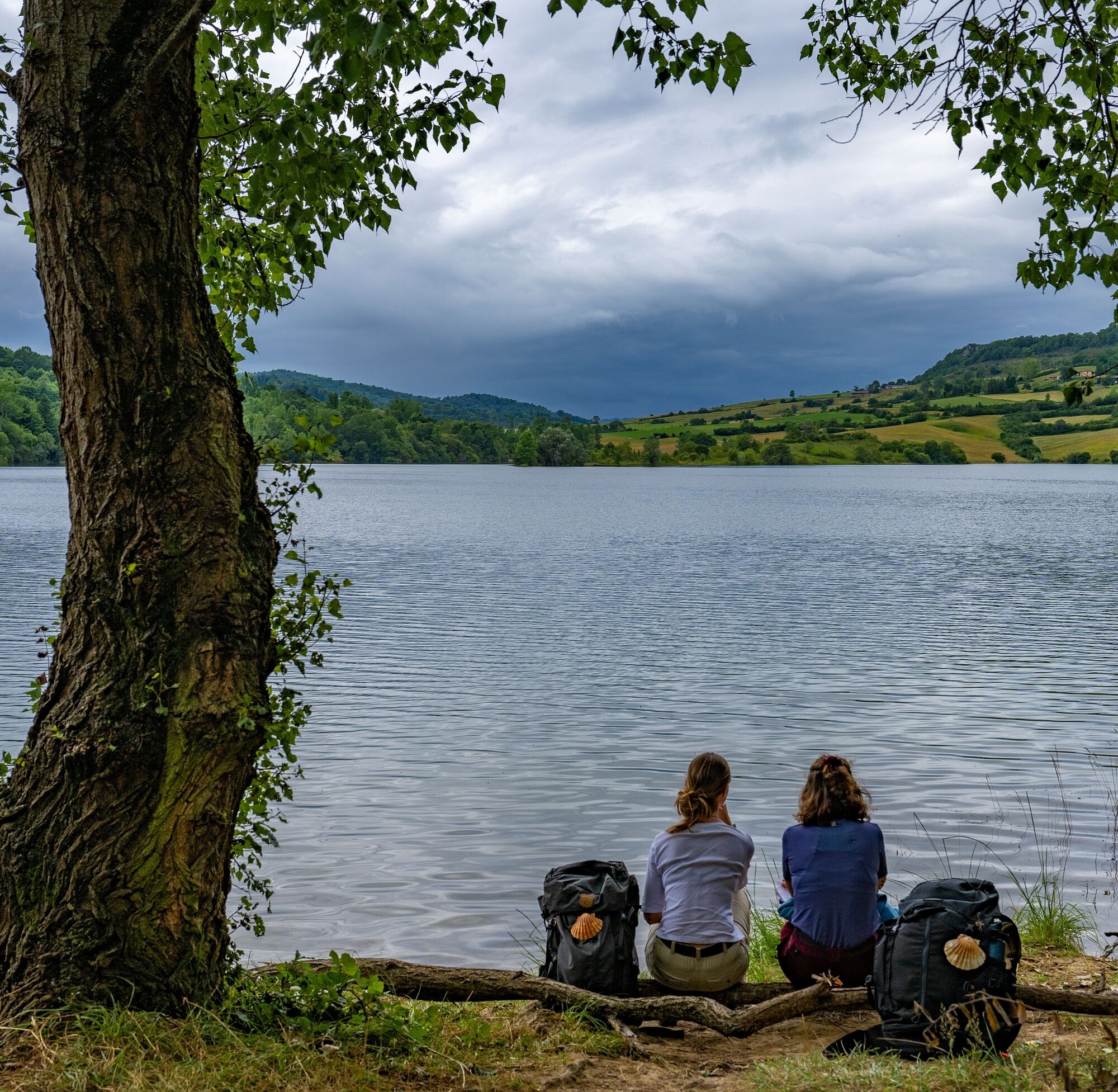
Lac de Filleit
©
JJ.Gelbbart/AFCC - Ariège Pyrénées Tourisme
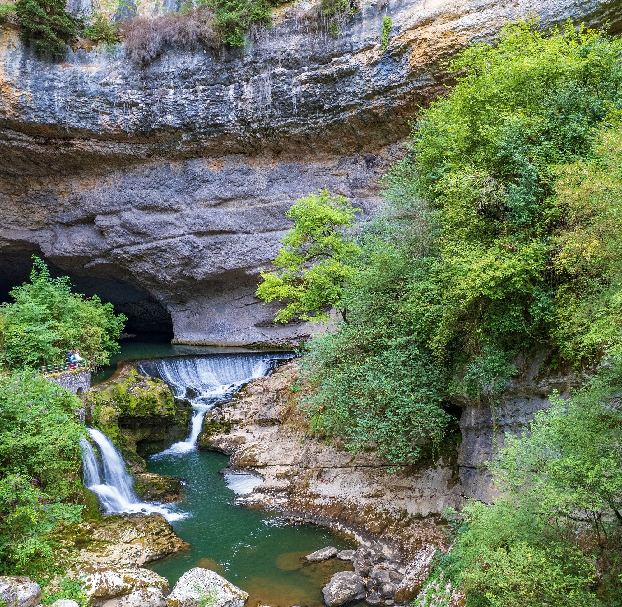
Grotte du Mas d'Azil
©
JJ.Gelbbart/AFCC - Ariège Pyrénées Tourisme
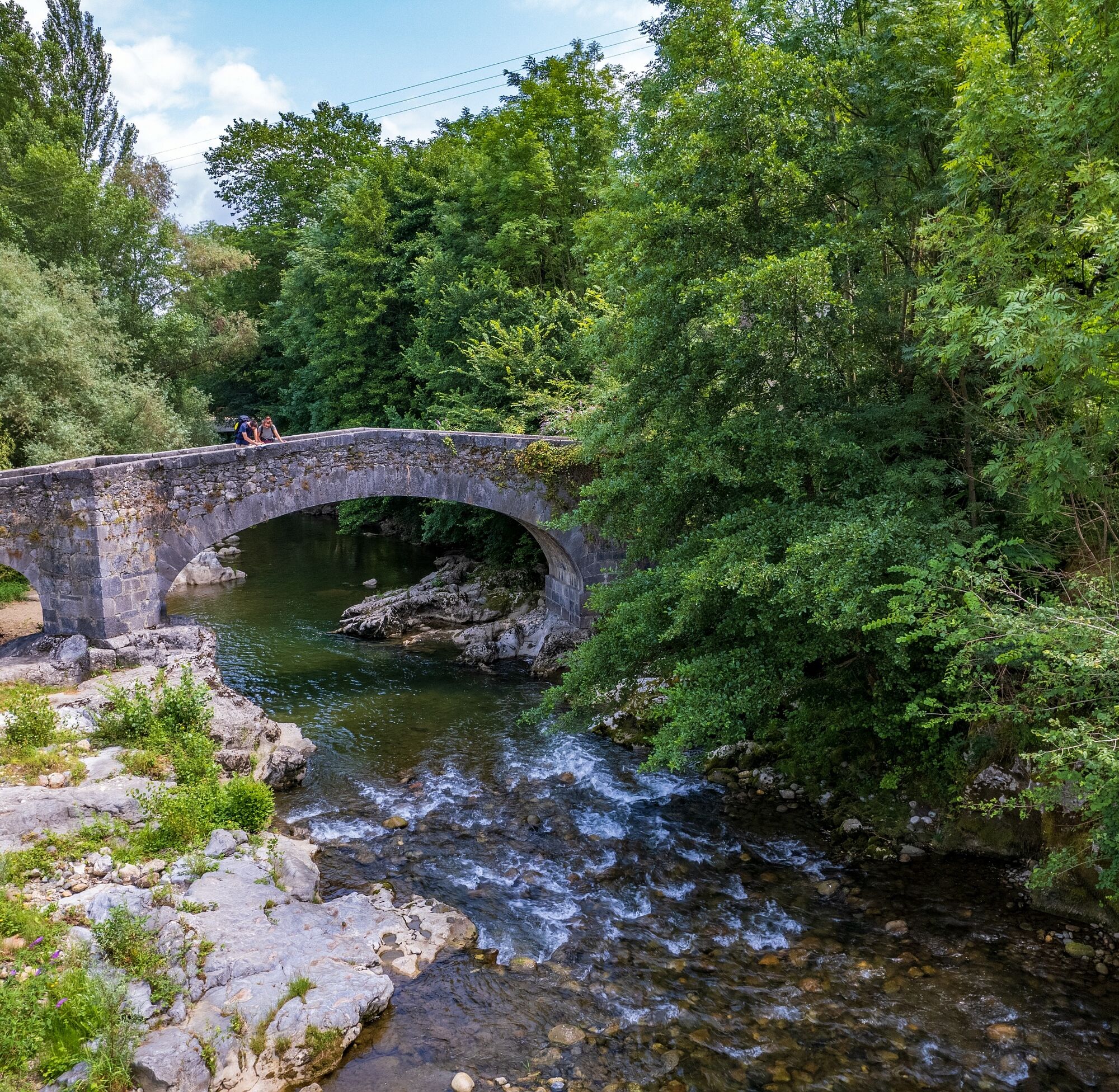
Pont d'Aubert in der Gemeinde Moulis
©
JJ.Gelbbart/AFCC - Ariège Pyrénées Tourisme
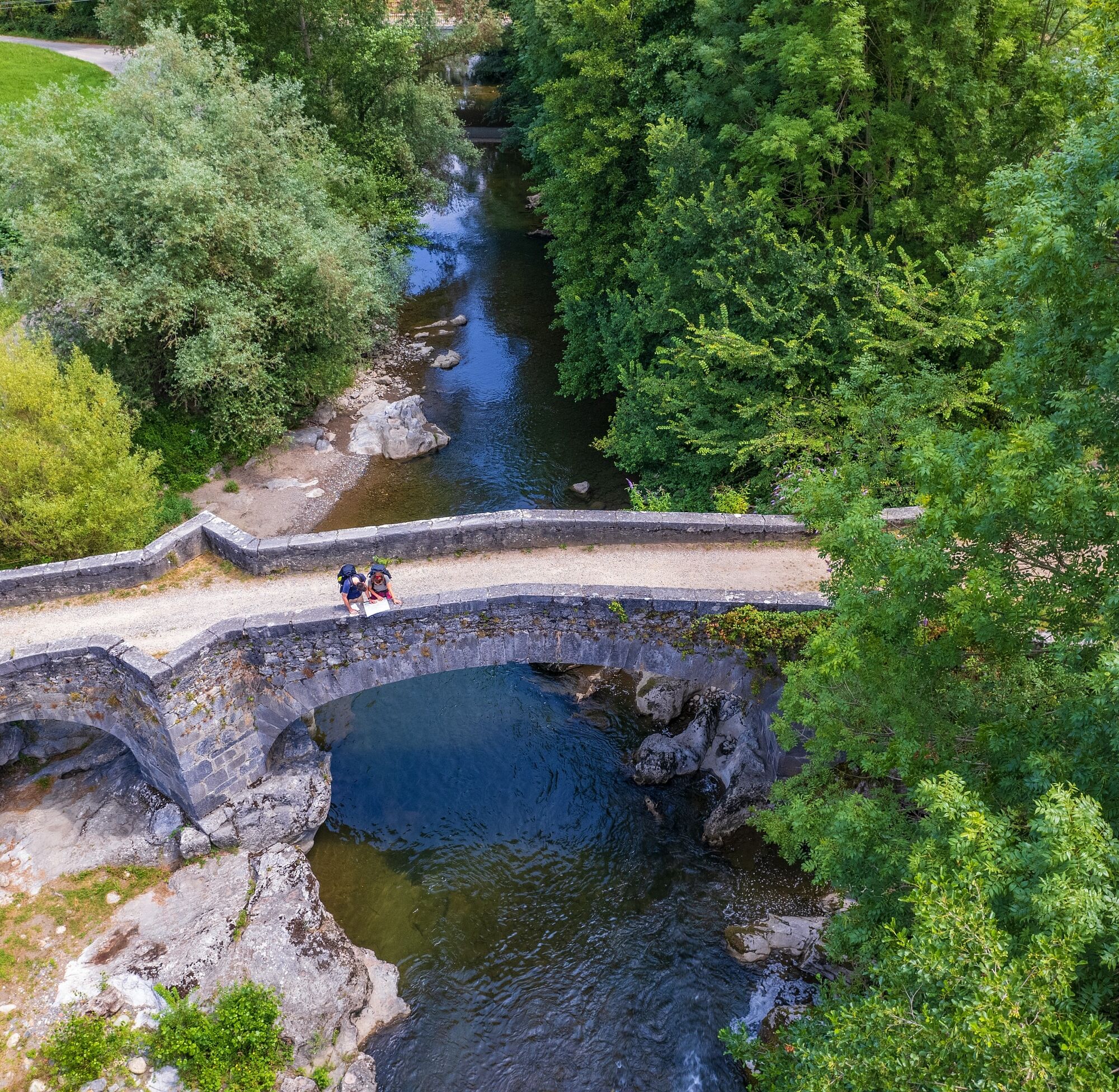
Aubert-Brücke in der Gemeinde Moulis
©
JJ.Gelbbart/AFCC - Ariège Pyrénées Tourisme
Chemin Lescure in Rimont
©
JJ.Gelbbart/AFCC - Ariège Pyrénées Tourisme
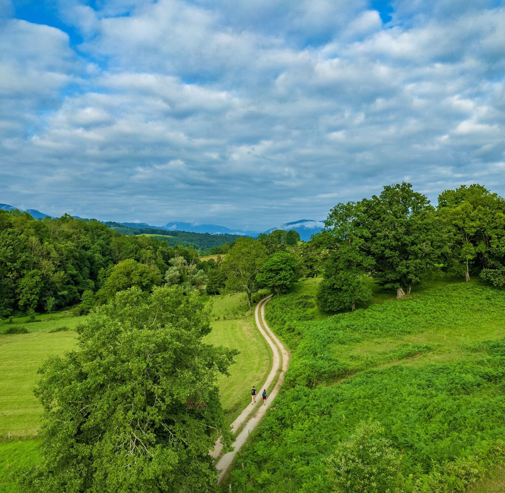
Weg von Saint Lizier nach Moulis
©
JJ.Gelbbart/AFCC - Ariège Pyrénées Tourisme
Weg von Saint Lizier nach Moulis
©
JJ.Gelbbart/AFCC - Ariège Pyrénées Tourisme

Kreuzgang Kathedrale Saint-Lizier
©
JJ.Gelbbart/AFCC - Ariège Pyrénées Tourisme
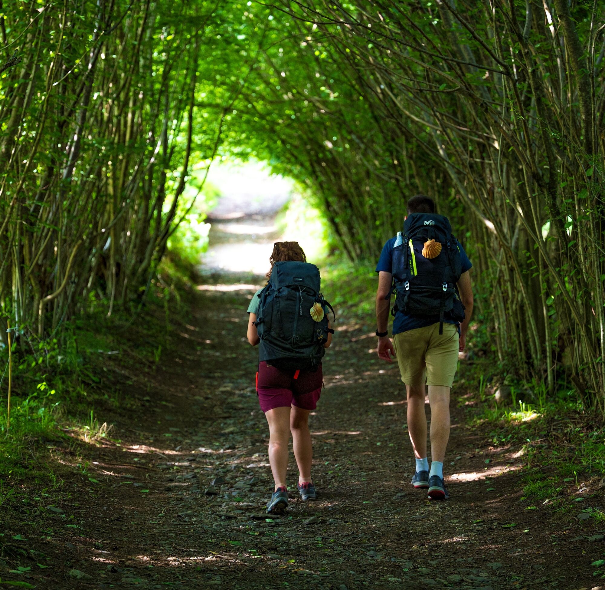
Jakobswege
©
JJ.Gelbbart/AFCC - Ariège Pyrénées Tourisme
Terrassen auf dem Place des Couverts - Mirepoix
©
Lieu Production - Ariège Pyrénées Tourisme

Ariège - Mirepoix
©
Stéphane Meurisse - Ariège Pyrénées Tourisme
Fresken in Vals
©
Mado Goncalves - Ariège Pyrénées Tourisme
Ehemalige Abtei Saint-Antonin, genannt Mas Cailloup
©
Ivan Olivier - Ariège Pyrénées Tourisme
Die Kathedrale Saint-Antonin, Pamiers
©
Roxane Banos - Ariège Pyrénées Tourisme

Grotte du Mas d'Azil
©
Sébastien Courbet - Ariège Pyrénées Tourisme
Grotte du Mas d'Azil, Ariège
©
Dominique VIET - CRT Midi-Pyrénées
Naturkulisse von Saint-Lizier aus gesehen
©
Charles Ripon - Ariège Pyrénées Tourisme
Blick auf den Kreuzgang von Saint-Lizier
©
Charles Ripon - Ariège Pyrénées Tourisme
Castillon en Couserans - Kirche Saint Pierre
©
Stéphane Meurisse - Ariège Pyrénées Tourisme
Castillon en Couserans
©
Stéphane Meurisse - Ariège Pyrénées Tourisme
Informacje o trasie
Trasa
STAGE 1: CARCASSONNE - LAVALETTE Walking time: 3:00 h - Distance: 11.9 km - Elevation gain +/-: 70 m / 140 m
STAGE 2: LAVALETTE - LA TUILERIE HAUTE Walking time: 2:40 h - Distance: 9.9 km - Elevation gain +/-: 170 m / 110 m
STAGE 3: LA TUILERIE HAUTE - FANJEAUX Walking time: 4:14 h - Distance: 15.3 km - Elevation gain +/-: 290 m / 210 m
STAGE 4: FANJEAUX - CHEMIN D'ESCUEILLENS Walking time: 4:00 h - Distance: 14.1 km - Elevation gain +/-: 270 m / 240 m
STAGE 5: CHEMIN D'ESCUEILLENS - BARTHAS Walking time: 4:10 h - Distance: 14.9 km - Elevation gain +/-: 260 m / 330 m
STAGE 6: BARTHAS - VALS Walking time: 3:30 h - Distance: 12.3 km - Elevation gain +/-: 260 m / 290 m
STAGE 7: VALS - CARLARET TRAIN STATION DISTRICT Walking time: 3:00 h - Distance: 10.7 km - Elevation gain +/-: 210 m / 190 m
STAGE 8: CARLARET - SABARTHES Walking time: 5:20 h - Distance: 19.9 km - Elevation gain +/-: 240 m / 210 m
STAGE 9: SABARTHES - PAILHES Walking time: 4:00 h - Distance: 14.0 km - Elevation gain +/-: 280 m / 320 m
STAGE 10: PAILHES - MAS D'AZIL Walking time: 3:00 h - Distance: 9.8 km - Elevation gain +/-: 320 m / 320 m
STAGE 11: MAS D'AZIL - LA GRAUSSE Walking time: 3:35 h - Distance: 12.3 km - Elevation gain +/-: 350 m / 240 m
STAGE 12: LA GRAUSSE - MONTJOIE-EN-COUSERANS Walking time: 4:22 h - Distance: 15.7 km - Elevation gain +/-: 310 m / 260 m
STAGE 13: MONTJOIE-EN-COUSERANS - MOULIS Walking time: 2:38 h - Distance: 9.7 km - Elevation gain +/-: 140 m / 150 m
STAGE 14: MOULIS - AUCAZEIN Walking time: 4:14 h - Distance: 15.2 km - Elevation gain +/-: 340 m / 220 m
STAGE 15: AUCAZEIN - PORTET-D'ASPET Walking time: 4:55 h - Distance: 15.5 km - Elevation gain +/-: 720 m / 420 m
STAGE 16: PORTET-D'ASPET - JUZET-D'IZAUT Walking time: 4:54 h - Distance: 16.0 km - Elevation gain +/-: 470 m / 750 m
STAGE 17: JUZET-D'IZAUT - GENOS Walking time: 3:19 h - Distance: 11.1 km - Elevation gain +/-: 340 m / 380 m
STAGE 18: GENOS - VALCABRERE Walking time: 4:14 h - Distance: 13.6 km - Elevation gain +/-: 460 m / 540 m
STAGE 19: VALCABRERE - NESTIER Walking time: 4:00 h - Distance: 14.2 km - Elevation gain +/-: 280 m / 240 m
STAGE 20: NESTIER - LORTET Walking time: 3:34 h - Distance: 12.3 km - Elevation gain +/-: 350 m / 290 m
STAGE 21: LORTET - ESPECHE Walking time: 4:42 h - Distance: 14.9 km - Elevation gain +/-: 530 m / 640 m
STAGE 22: ESPECHE - UZER Walking time: 5:20 h - Distance: 18.6 km - Elevation gain +/-: 490 m / 380 m
STAGE 23: UZER - BAGNERES-DE-BIGORRE Walking time: 2:45 h - Distance: 8.7 km - Elevation gain +/-: 350 m / 350 m
STAGE 24: BAGNERES-DE-BIGORRE - ESQUIOU Walking time: 3:15 h - Distance: 9.75 km - Elevation gain +/-: 590 m / 110 m
STAGE 25: ESQUIOU - COTDOUSSAN Walking time: 4:05 h - Distance: 13.1 km - Elevation gain +/-: 370 m / 740 m
STAGE 26: COTDOUSSAN - LOURDES Walking time: 3:40 h - Distance: 12.0 km - Elevation gain +/-: 280 m / 540 m
STAGE 27: LOURDES - BETHARRAM Walking time: 4:36 h - Distance: 16.9 km - Elevation gain +/-: 210 m / 300 m
STAGE 28: BETHARRAM - MIFAGET Walking time: 3:22 h - Distance: 12.4 km - Elevation gain +/-: 180 m / 170 m
STAGE 29: MIFAGET - BESCAT Walking time: 4:45 h - Distance: 16.4 km - Elevation gain +/-: 500 m / 370 m
STAGE 30: BESCAT - BUZY Walking time: 1:15 h - Distance: 2.94 miles - Elevation gain +/-: 40 m / 120 m
STAGE 31: BUZY - OLORON-SAINTE-MARIE Walking time: 5:00 h - Distance: 19.3 km - Elevation gain +/-: 130 m / 270 m
STAGE 32: OLORON-SAINTE-MARIE - AREN Walking time: 3:35 h - Distance: 13.6 km - Elevation gain +/-: 60 m / 110 m
STAGE 33: AREN - L'HOPITAL-SAINT-BLAISE Walking time: 2:35 h - Distance: 9.7 km - Elevation gain +/-: 150 m / 170 m
STAGE 34: L'HOPITAL-SAINT-BLAISE - MAULEON-LICHARRE Walking time: 5:10 h - Distance: 17.8 km - Elevation gain +/-: 500 m / 520 m
STAGE 35: MAULEON-LICHARRE - ORDIARP Walking time: 2:35 h - Distance: 9.0 km - Elevation gain +/-: 240 m / 200 m
STAGE 36: ORDIARP - SAINT-JUST-IBARRE Walking time: 4:55 h - Distance: 14.6 km - Elevation gain +/-: 870 m / 430 m
STAGE 37: SAINT-JUST-IBARRE - GAMIA Walking time: 3:30 h - Distance: 11.2 km - Elevation gain +/-: 390 m / 490 m
STAGE 38: GAMIA - SAINT-JEAN-PIED-DE-PORT Walking time: 3:15 h - Distance: 12.0 km - Elevation gain +/-: 900 m / 450 m
END OF GR®78; START OF GR®65
STAGE 39: SAINT-JEAN-PIED-DE-PORT - RONCESVALLES Walking time: 7:55 h - Distance: 24.4 km - Elevation gain +/-: 1370 m / 580 m
Dodatkowe informacje i wskazówki
Dodatkowe informacje
You are in good physical condition and prepared for multi-day hiking in the mountains, possibly in high mountain.
Find information and advice on mountain conduct: https://www.ariegepyrenees.com/preparer/randonner/montagne-mode-demploi/
Also information on the art of sleeping in the mountains: https://www.ariegepyrenees.com/preparer/randonner/lart-de-dormir-en-montagne/
Find information and advice on mountain conduct: https://www.ariegepyrenees.com/preparer/randonner/montagne-mode-demploi/
Also information on the art of sleeping in the mountains: https://www.ariegepyrenees.com/preparer/randonner/lart-de-dormir-en-montagne/
Nie ma jeszcze recenzji
Popularne wycieczki w okolicy
-
Randonnée d'Uscla
światłoWędrówka 5,95 km -
Le sentier du solitaire
ciężkiWędrówka 2,62 km -
Cycling & Cheese Route
średniJazda na rowerze 55,6 km -
The Ariège MTB Crossing - Stage 08: Pamiers to Montégut Plantaurel
ciężkiMountainbike 18,0 km -
The Laurède Mill
światłoWędrówka 1,77 km -
Le tour du lac de Filheit
światłoWędrówka 7,29 km -
Le Cap du Carmil
ciężkiWędrówka 13,5 km -
Cycle touring route - Le Mas-d'Azil
średniDroga rowerowa 77,3 km -
The Ariège MTB Crossing - Stage 10: From Mas d'Azil to Lescure
ciężkiMountainbike 16,5 km -
Cyclotourism circuit - Welcome to the land of Foix
ciężkiDroga rowerowa 70,0 km
Wędrówki i tropienie

Ponad 550.000 propozycji wycieczek, szczegółowe mapy i intuicyjny planer tras sprawiają, że aplikacja jest niezbędna dla wszystkich entuzjastów przyrody.

Nie przegap ofert i inspiracji na następne wakacje
Zapisz się do newslettera
Błąd
Wystąpił błąd. Spróbuj ponownie.
Dziękujemy za rejestrację
Twój adres e-mail została dodana do listy mailingowej.
Wycieczki po całej Europie
Austria
Szwajcaria
Niemcy
Włochy
Słowenię
Francja
Holandia
Belgia
Polska
Liechtenstein
Czechy
Słowacja
Hiszpania
Chorwacja
Bośnia i Hercegowina
Luksemburg
Andorra
Portugalia
Islandia
Wielka Brytania
Irlandia
Grecja
Albania
Macedonia Północna
Malta
Norwegia
Czarnogóra
Mołdawia
Kosowo
Węgry
San Marino
Rumunia
Estonia
Łotwa
Białoruś
Cypr
Litwa
Serbia
Bułgaria
Monako
Dania
Szwecja
Finlandia