
Étang d'Izourt
światło
Pobierz tę trasę na swój telefon komórkowy
Étang d'Izourt
światło
Wędrówka
6,05
km
Zeskanuj kod QR i rozpocznij nawigację w aplikacji bergfex.


Wędrówki i tropienie





Étang d'Izourt
światło
Odległość
6,05
km
Czas trwania
02:45
h
Ascent
491
hm
Poziom morza
1 153 -
1 661
m

Nawiguj po trasie w aplikacji
Zainstaluj aplikację za darmo i śledź trasę dzięki nawigacji GPS i funkcji śledzenia.
Skorzystaj już teraz z funkcji „ bergfex ” w aplikacji
Zeskanuj kod QR za pomocą aparatu
Po zainstalowaniu aplikacji treść otworzy się od razu. Jeśli jeszcze nie masz tej aplikacji, zostaniesz przekierowany do strony, z której możesz ją bezpłatnie pobrać.
Ścieżka do pobrania
Étang d'Izourt
światło
Wędrówka
6,05
km
August 19, 2026: Municipal ordinance issued by the town of Auzat prohibiting swimming in mountain lakes for everyone and requiring that dogs be kept on a leash.
Directions: From Vicdessos, on the D8, drive...
Opis
August 19, 2026: Municipal ordinance issued by the town of Auzat prohibiting swimming in mountain lakes for everyone and requiring that dogs be kept on a leash.
Directions: From Vicdessos, on the D8, drive past Auzat. Shortly after the Capunta Bridge, turn left onto the Artiès Road, which you’ll need to drive past (there’s a fountain and restrooms on the right side of the road...). Be sure to park in the Pradières-d’en-haut parking lot on the right.
Directions: From Vicdessos, on the D8, drive past Auzat. Shortly after the Capunta Bridge, turn left onto the Artiès Road, which you’ll need to drive past (there’s a fountain and restrooms on the right side of the road...). Be sure to park in the Pradières-d’en-haut parking lot on the right.
Trasa
Trasa
Étang d'Izourt
światło
Wędrówka
6,05
km
Autor
Dostarczone przez Ariège Pyrénées Tourismus
Wycieczkę Étang d'Izourt zapewnia outdooractive.com.


Informacje o trasie
Trasa
Caution! Temporary detour via the "Artiès" option at the "Coumasses Grandes" intersection and at the "Etang d'Izourt" intersection.
(D/A) From Pradières-d'en-haut to Garguéran (1177m) at the parking lot, follow the signs for Etangs du Fourcat (white and red markings), Refuge du Fourcat. Continue through a birch wood, leaving the stream and the power station on the left bank. Cross the stream by the footbridge. You return to the road and shortly afterwards the path starts off to the right through the ferns.
0h55 - ORRIS DE LA COUME (1522m). Pass the small Coume lock on a hairpin bend, and the path leads down into the valley.
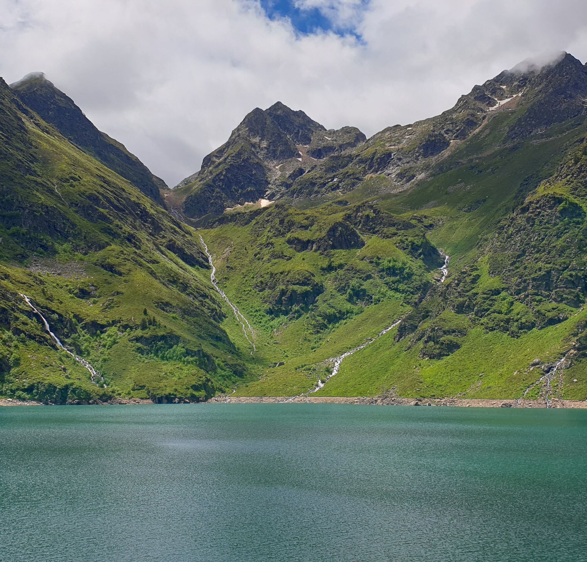
1h40 - ETANG D'IZOURT (1647m). Keep your distance from the buildings. Go past the hut, straight through the low walls, the opening is on the right. Return to the path.
2h45 - A - Return to the Pradières-d'en-haut parking lot.
(D/A) From Pradières-d'en-haut to Garguéran (1177m) at the parking lot, follow the signs for Etangs du Fourcat (white and red markings), Refuge du Fourcat. Continue through a birch wood, leaving the stream and the power station on the left bank. Cross the stream by the footbridge. You return to the road and shortly afterwards the path starts off to the right through the ferns.
0h55 - ORRIS DE LA COUME (1522m). Pass the small Coume lock on a hairpin bend, and the path leads down into the valley.
1h40 - ETANG D'IZOURT (1647m). Keep your distance from the buildings. Go past the hut, straight through the low walls, the opening is on the right. Return to the path.
2h45 - A - Return to the Pradières-d'en-haut parking lot.
Wycieczka w jedną stronę
Tak
Dodatkowe informacje i wskazówki
Dodatkowe informacje
The tourist office, the communities of communes and the communes crossed by these trails cannot be held responsible for accidents of any kind that may occur to hikers, nor for any changes that may occur in the terrain (routes and markings).
Nie ma jeszcze recenzji

Wszystkie kamery internetowe na mapie
Zainstaluj aplikację za darmo i porównaj obrazy na żywo z kilku miejsc, zanim wyruszysz w drogę.
Skorzystaj już teraz z funkcji „ bergfex ” w aplikacji
Zeskanuj kod QR za pomocą aparatu
Po zainstalowaniu aplikacji treść otworzy się od razu. Jeśli jeszcze nie masz tej aplikacji, zostaniesz przekierowany do strony, z której możesz ją bezpłatnie pobrać.
Popularne wycieczki w okolicy
-
5,0
Étang de Guzet by the Ars waterfall
ciężkiWędrówka 13,0 km -
Montcalm and the Pique d'Estats
ciężkiWędrówka 17,4 km -
Pic de Comapedrosa
średniWędrówka 14,2 km -
GR®10 - The great crossing of the Pyrenees
ciężkiWędrówka 278,3 km -
5,0
Route E - Ars Waterfall
średniTrailrunning 13,4 km -
Ars waterfall
światłoWędrówka 8,64 km -
4,0
The Bassiès ponds and their refuge
ciężkiWędrówka 14,9 km -
GR10 Pyrenäenweg Etappe 38
średnidługodystansowy szlak pieszy 21,5 km -
La Pique Rouge de Bassiès by Massada
ciężkiWędrówka 26,8 km -
Étangs du Fourcat and the refuge
ciężkiWędrówka 17,6 km
Wędrówki i tropienie

Ponad 550.000 propozycji wycieczek, szczegółowe mapy i intuicyjny planer tras sprawiają, że aplikacja jest niezbędna dla wszystkich entuzjastów przyrody.

Nie przegap ofert i inspiracji na następne wakacje
Zapisz się do newslettera
Błąd
Wystąpił błąd. Spróbuj ponownie.
Dziękujemy za rejestrację
Twój adres e-mail została dodana do listy mailingowej.
Wycieczki po całej Europie
Austria
Szwajcaria
Niemcy
Włochy
Słowenię
Francja
Holandia
Belgia
Polska
Liechtenstein
Czechy
Słowacja
Hiszpania
Chorwacja
Bośnia i Hercegowina
Luksemburg
Andorra
Portugalia
Islandia
Wielka Brytania
Irlandia
Grecja
Albania
Macedonia Północna
Malta
Norwegia
Czarnogóra
Mołdawia
Kosowo
Węgry
San Marino
Rumunia
Estonia
Łotwa
Białoruś
Cypr
Litwa
Serbia
Bułgaria
Monako
Dania
Szwecja
Finlandia





