


COASTAL LOOP HIKING
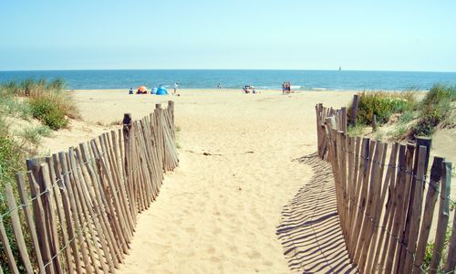
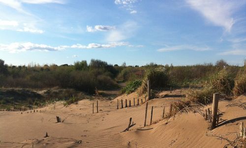
Leaving from the harbormaster's office at the Port du Chichoulet in Vendres plage, set off to discover a protected environment.The coastal loop will take you over the dunes along the coast, through the...
Leaving from the harbormaster's office at the Port du Chichoulet in Vendres plage, set off to discover a protected environment.
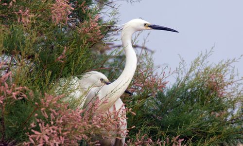
The coastal loop will take you over the dunes along the coast, through the sansouïres (salt marshes), the brackish lakes and their meadows. You'll be able to observe numerous birds such as the heron and the little egret, and above all, enjoy the peace and quiet of an unspoilt natural environment.

1
From the harbor master's office parking lot, take the path along the harbor to the Aude River. Follow the left-hand track along the grau to the dike.
2
Turn left onto the path which begins at a wooden pontoon. Cross two junctions and continue straight ahead. Leave another platform on the left and continue along the path behind the dunes. Cross another crossroads, then turn left.
3
Follow the path between two bodies of water, pass a crossroads and turn left onto the track.
4
Follow this track, crossing two crossroads, then a planking, and continue straight ahead. Ignore all lateral departures, then cross a wide track. Go slightly to the right. Continue until you reach the cycle path, then turn right and return to the starting point.
beemob E line
beemob E line
Avoid the hottest hours of the day in summer, preferring the evening when the sun sets and the birds wake up.
Depending on the season, don't forget your water bottle and cap.
Jaune PR
+33 4 67 32 88 77
Maison du Malpas
PR - FFR
Popularne wycieczki w okolicy
-
OENORANDO® LES COTEAUX D'ENSÉRUNE
światłoWędrówka 8,08 km -
LA GRANDE MAÏRE HIKE
światłoWędrówka 11,2 km -
OENORANDO® BETWEEN CANAL DU MIDI AND VINEYARD
średniWędrówka 10,2 km -
MOUNTAIN BIKE CIRCUIT 21: LE GRAND SALAN - ESPACE VTT/GRAVEL CAP D'AGDE MÉDITERRANÉE
światłoMountainbike 19,5 km -
HIKING OF THE PASEJADE DEL CRES
średniWędrówka 14,2 km -
CYCLING LOOP NO.23 BIS SUMMER - FROM VALRAS COAST TO THE CANAL DU MIDI
światłoJazda na rowerze 39,9 km -
HIKING BETWEEN CANAL DU MIDI AND BEZIERS
światłoWędrówka 7,81 km -
CYCLE LOOP No. 22 - RIDE SOUTH OF THE CANAL DU MIDI
światłoJazda na rowerze 27,2 km -
CIRCUIT BETWEEN ORB, SEA AND POND - ESPACE VTT-FFC BEZIERS MEDITERRANEE
światłoMountainbike 17,0 km -
CYCLING ROUTE FROM BÉZIERS TO THE SEA BY BIKE
średniMountainbike 8,64 km

Wędrówki i tropienie


Nie przegap ofert i inspiracji na następne wakacje
Twój adres e-mail została dodana do listy mailingowej.