


PIC SAINT LOUP HIKE
Located 20 km north of Montpellier, between the Cévennes mountains and the Mediterranean, the 658-metre-high Pic Saint-Loup offers a breathtaking view of the region. Perceived as the highest point in the...
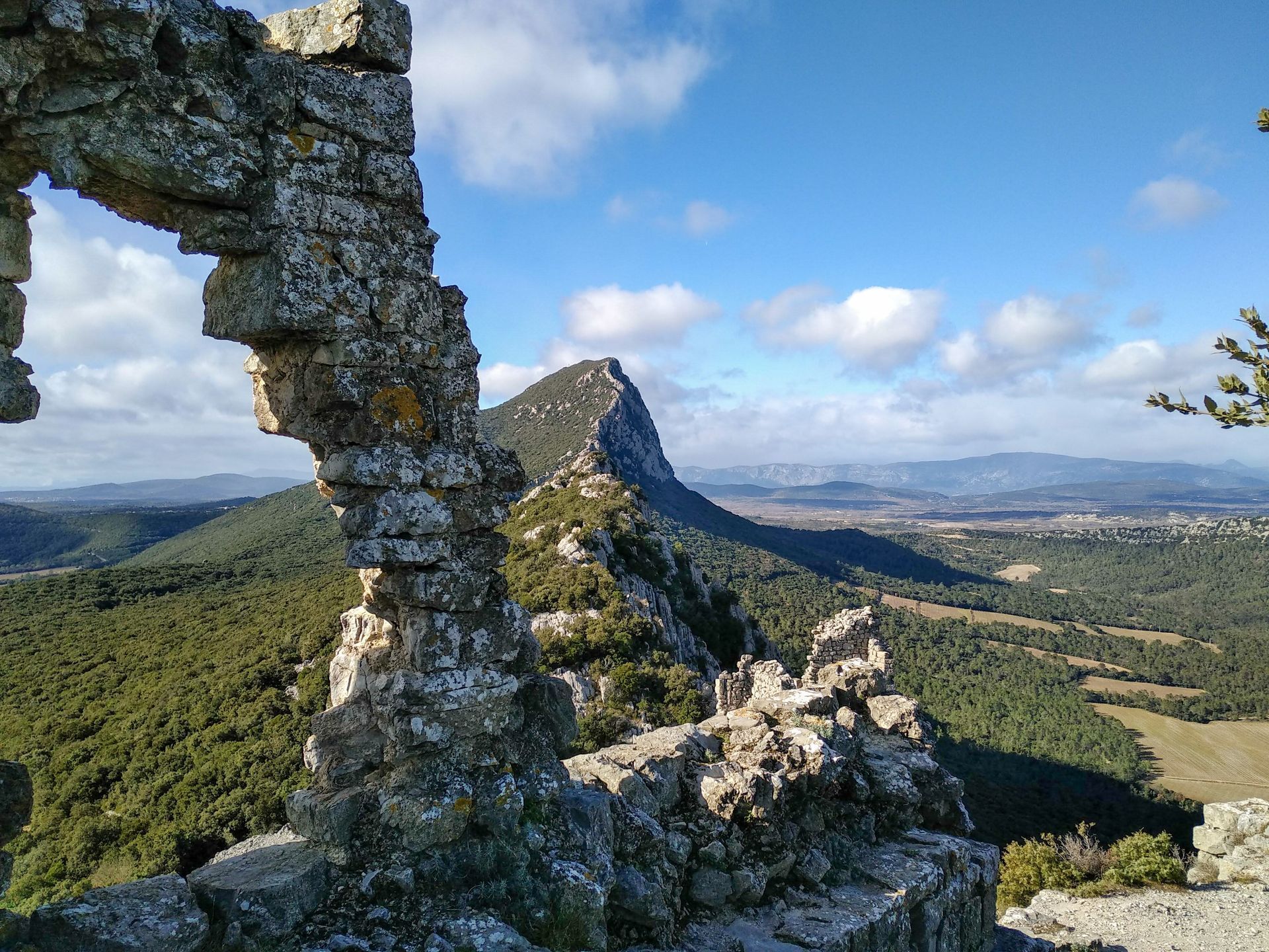
Located 20 km north of Montpellier, between the Cévennes mountains and the Mediterranean, the 658-metre-high Pic Saint-Loup offers a breathtaking view of the region. Perceived as the highest point in the Languedoc region, the so-called "Sainte-Victoire" has become a veritable symbol for the Montpellier region, and a benchmark for outdoor leisure activities.

1
From the parking lot, head for the dry-stone shelter and take the stony path. It leads to a track coming from the village.
2
Take the right-hand path, which rises steeply, through vegetation of cades, holm oaks, boxwoods and junipers (view opposite to the summit cross, on the right to the coastline and wine-growing plain). After 1.5 km, ignore the path that descends to the right and continue through a small tunnel of holm oaks before passing a scree on the left. Reach the Croisette crossroads.
3
Climb opposite on the access path to the summit. It narrows and twists upwards before reaching the rocky platform (chapel) below the summit. A few metres higher, you reach the highest point of Pic Saint-Loup at 658 m (panorama: to the north, Mont Aigoual, the Séranne massif, the Saint-Martin-de-Londres basin, Mont Lozère and, on a clear day to the east, Mont Ventoux).
4
Take the same route down to the parking lot.
In case of emergency, call 112.
PR Yellow
https://www.grandpicsaintloup-tourisme.fr/
Office de Tourisme du Grand Pic Saint-Loup
PDESI

Popularne wycieczki w okolicy
-
MEDIEVAL ROUTE AROUND PIC SAINT-LOUP
Motorrad 25,1 km -
RAVIN DES ARCS HIKE
średniWędrówka 3,83 km -
5,0
DRAILLES HIKE
światłoWędrówka 7,16 km -
HIKING THE OASIS OF THE GARRIGUES
średniWędrówka 10,9 km -
HIKE OF THE CHÂTEAU DE RESTINCLIERES
światłoWędrówka 7,86 km -
OENORANDO® BETWEEN GRÉS DE MONTPELLIER AND PIC SAINT-LOUP
średniWędrówka 15,0 km -
5,0
CHARBONNIERES HIKE
światłoWędrówka 5,24 km -
LOOP CYCLO N°18 - LA SOURCE DU LEZ
światłoJazda na rowerze 13,9 km -
WINE ROUTE IN THE SHADOW OF THE CHATEAU DE MONTFERRAND
Motorrad 49,8 km -
WINE ROUTE AROUND THE GORGES DE L'HERAULT
Motorrad 57,9 km

Wędrówki i tropienie


Nie przegap ofert i inspiracji na następne wakacje
Twój adres e-mail została dodana do listy mailingowej.