
Chaos of la Rouquette and Saint Dominic’s Cave Trail
światło
Pobierz tę trasę na swój telefon komórkowy
Chaos of la Rouquette and Saint Dominic’s Cave Trail
światło
Wędrówka
3,65
km
Zeskanuj kod QR i rozpocznij nawigację w aplikacji bergfex.


Wędrówki i tropienie





Chaos of la Rouquette and Saint Dominic’s Cave Trail
światło
Odległość
3,65
km
Czas trwania
01:00
h
Ascent
81
hm
Poziom morza
320 -
419
m
Ścieżka do pobrania
Chaos of la Rouquette and Saint Dominic’s Cave Trail
światło
Wędrówka
3,65
km
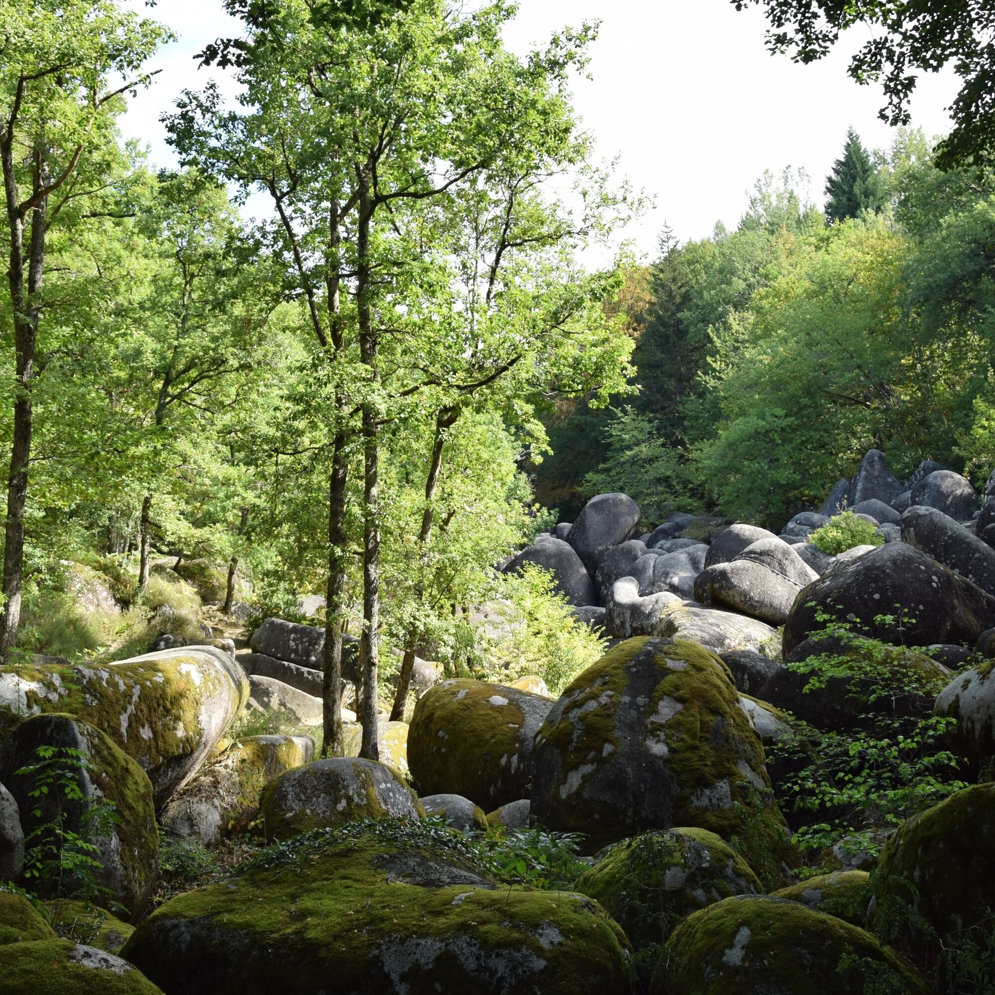
From the parking area, pass by the Egg Rock and walk along the chaos (river of rocks). At the end of it, take the small road to get back to the parking area. On this road you may discover some granite...
Opis
From the parking area, pass by the Egg Rock and walk along the chaos (river of rocks). At the end of it, take the small road to get back to the parking area. On this road you may discover some granite quarry blocks, which, as wild animals, remain hidden in the undergrowth.
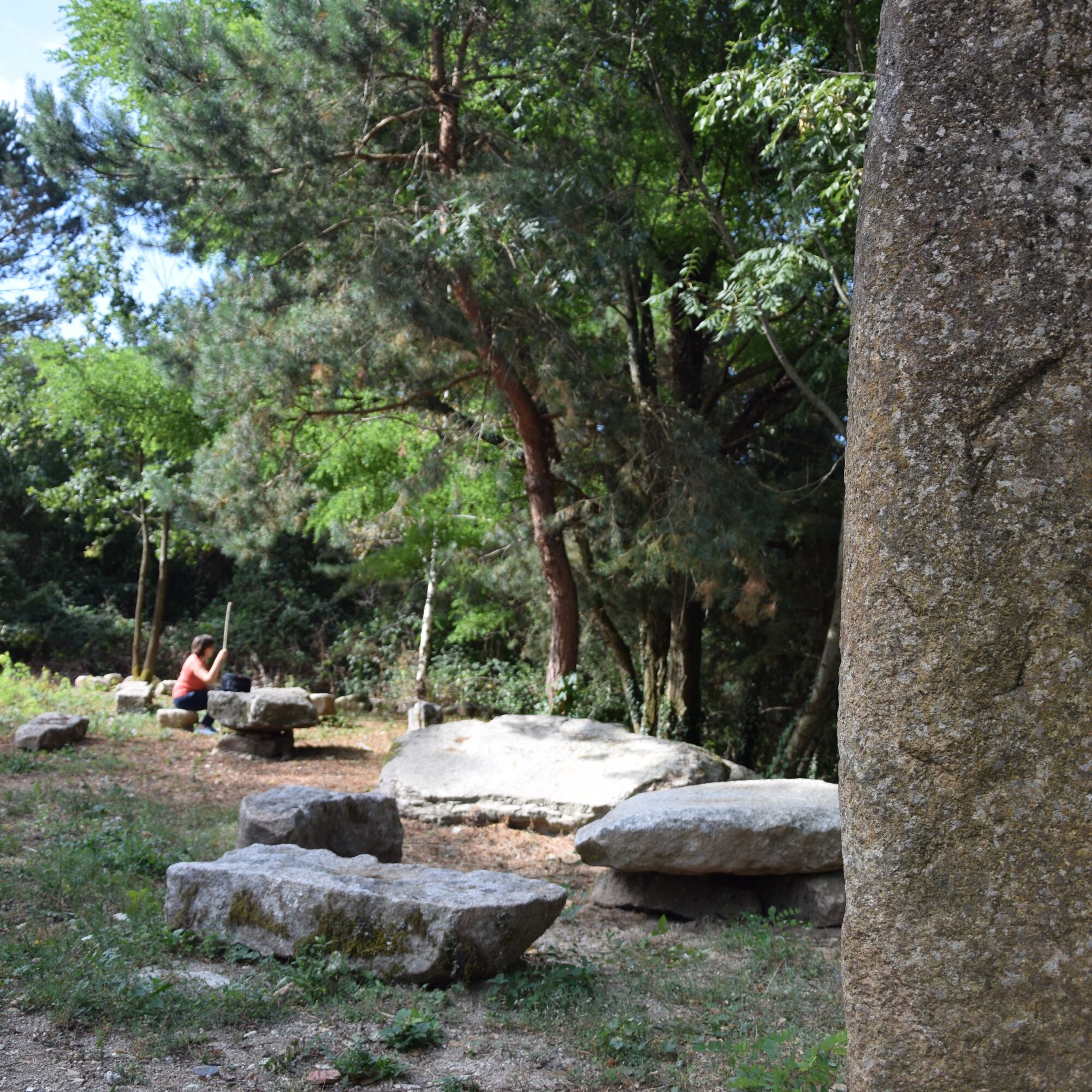
You will also see some typical Sidobre meadows bordered by planted stones who follow, but do not resemble, one another.
It’s not recommended to enter the cave for children under 8 years old and during bad weather. Be sure you wear good walking shoes. (20 min)
On the road, before or after this walk, you should not miss the incredible Baptistou Rock.(out and back 20 min)
You will also see some typical Sidobre meadows bordered by planted stones who follow, but do not resemble, one another.
It’s not recommended to enter the cave for children under 8 years old and during bad weather. Be sure you wear good walking shoes. (20 min)
On the road, before or after this walk, you should not miss the incredible Baptistou Rock.(out and back 20 min)
Trasa
Trasa
Chaos of la Rouquette and Saint Dominic’s Cave Trail
światło
Wędrówka
3,65
km
Autor
Dostarczone przez Tarn Tourisme
Wycieczkę Chaos of la Rouquette and Saint Dominic’s Cave Trail zapewnia outdooractive.com.


Informacje o trasie
Trasa
1- From the departure sign, follow the path that goes into the forest. After 15 m, turn left and descend the small path toward the chaos. Follow the wooden steps to the crossroads.
2- In front of the chaos, turn right. Follow the direction "Saint-Dominique cave", cross the road and follow the signs on granite steles. The descent takes place between rock blocks and wooden steps. Access inside the cave is difficult and narrow. Climb back by the same route to continue exploring the chaos. Back at point 2, in front of the chaos, turn left and take the direction "Sentier de la Rouquette". Follow the main trail between granite blocks upstream. The route follows the chaos; follow wooden steps and footbridges to the crossroads.
3- At the crossroads, descend toward the chaos, follow the direction "Sentier de la Rouquette", cross the wooden footbridge and continue the route. Cross the iron footbridge spanning the chaos. On the left bank, head upstream and cross the tributary using the wooden footbridge. The path moves away from the chaos. After 30 m, turn left on the main trail to arrive in front of the Lézert stream finally visible.
4- Attention: A ford allows crossing the stream only during low water periods (granite block and rope). If crossing is possible: return by the same route. If crossing is not possible: continue on the right bank of the Lézert stream to the road. Return by the same route.
2- In front of the chaos, turn right. Follow the direction "Saint-Dominique cave", cross the road and follow the signs on granite steles. The descent takes place between rock blocks and wooden steps. Access inside the cave is difficult and narrow. Climb back by the same route to continue exploring the chaos. Back at point 2, in front of the chaos, turn left and take the direction "Sentier de la Rouquette". Follow the main trail between granite blocks upstream. The route follows the chaos; follow wooden steps and footbridges to the crossroads.
3- At the crossroads, descend toward the chaos, follow the direction "Sentier de la Rouquette", cross the wooden footbridge and continue the route. Cross the iron footbridge spanning the chaos. On the left bank, head upstream and cross the tributary using the wooden footbridge. The path moves away from the chaos. After 30 m, turn left on the main trail to arrive in front of the Lézert stream finally visible.
4- Attention: A ford allows crossing the stream only during low water periods (granite block and rope). If crossing is possible: return by the same route. If crossing is not possible: continue on the right bank of the Lézert stream to the road. Return by the same route.
Najważniejsze informacje geologiczne
Tak
Odpowiedni dla rodzin
Tak
Wycieczka w jedną stronę
Tak
Dodatkowe informacje i wskazówki
Dodatkowe informacje
Hiking also means being properly equipped (shoes, clothing, water...) and respecting the trail environment.
Nie ma jeszcze recenzji
Popularne wycieczki w okolicy
Randonnée pédestre : Les Hauts de la Môle 13km / 3h30
ciężkiWędrówka 11,3 kmDiscovery trail of the Travet Meadows
światłoWędrówka 0,31 kmSentier Randonnée du Patrimoine 13km / 3h30
światłoWędrówka 13,0 kmLa Ronda del Peiraire walk
światłoWędrówka 15,0 kmCircuit n°3 VTT - Secteur Lacrouzette
ciężkiMountainbike 28,1 kmCircuit No. 2 MTB - Lacrouzette Area
ciężkiMountainbike 21,8 kmTour du Tarn on horseback: Montredon-Labessonnié / Cambounès
ciężkiJazda konna 26,8 kmPath of the crests of Bau del Poun
światłoWędrówka 9,25 kmLa boucle de l'Agout à Fréjeville
światłoWędrówka 14,6 kmHike through the Chaos de la Balme
światłoWędrówka 6,16 km

Wędrówki i tropienie

Ponad 550.000 propozycji wycieczek, szczegółowe mapy i intuicyjny planer tras sprawiają, że aplikacja jest niezbędna dla wszystkich entuzjastów przyrody.

Nie przegap ofert i inspiracji na następne wakacje
Zapisz się do newslettera
Błąd
Wystąpił błąd. Spróbuj ponownie.Dziękujemy za rejestrację
Twój adres e-mail została dodana do listy mailingowej.
Wycieczki po całej Europie
Austria Szwajcaria Niemcy Włochy Słowenię Francja Holandia Belgia Polska Liechtenstein Czechy Słowacja Hiszpania Chorwacja Bośnia i Hercegowina Luksemburg Andorra Portugalia Islandia Wielka Brytania Irlandia Grecja Albania Macedonia Północna Malta Norwegia Czarnogóra Mołdawia Kosowo Węgry San Marino Rumunia Estonia Łotwa Białoruś Cypr Litwa Serbia Bułgaria Monako Dania Szwecja Finlandia





