







Cyclotourism route - At the heart of the Douctouyre

Poziom trudności: 3
From Laroque, the walk becomes intimate and takes you to the heart of the Mirepoix hills. By twists and turns, discover small villages and hamlets along roads resembling paths.
To see :
Laroque d'Olmes
Situated...
From Laroque, the walk becomes intimate and takes you to the heart of the Mirepoix hills. By twists and turns, discover small villages and hamlets along roads resembling paths.
To see :
Laroque d'Olmes
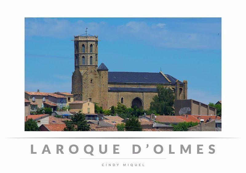
Situated on a hill, the old town of Laroque d'Olmes overlooks the Touyre stream, bearing the marks of the region's history. The fortified Castella church (14th century) in flamboyant Gothic style, with its octagonal bell tower and porch, is remarkable. It was fully re-registered on the historical monuments inventory in 2001.


Tak
Before setting off:
Make sure the bike is in perfect mechanical condition, including tires and brakes Ensure the bike is properly adjusted to your body shape Wearing a helmet is strongly recommended Bring repair supplies Remember that the Highway Code applies to cyclists at all times Never ride more than two abreast and move into a single file when traffic conditions require it Respect other users as you would like them to respect you Choose a route suited to your physical abilities Inform those around you of your itinerary Check the weather conditions A first aid kit is not essential but can be very useful Inform yourself and keep emergency phone numbers handy Respect the environment by not throwing food wrappers on the roadside If you need to return at nightfall, make sure to see and be seenEmergency number: 112
Start of the route: village of Dun, head towards Lieurac via the Taychel.
Parking near the starting point
3
To learn more about the destination, visit our site
Main difficulties :
Lieurac - Laroque d'Olmes : 6 km at 2% Short but difficult climbs before Esclagne and Pradettes Climb before Senesse-de-Senabugue: 3 km at 3%Popularne wycieczki w okolicy
- 4,5
Tour of Lake Montbel
światłoWędrówka 14,8 km Cycling race route 1 - The Cathar Castles
ciężkiDroga rowerowa 88,2 kmCyclotour de l'Ariège in 5 days
ciężkiDroga rowerowa 441,0 kmThe Grande Traversée VTT de l'Ariège
ciężkiMountainbike 208,5 kmCyclosportive route 11 - The Ariège cycle route - Stage 3: from Auzat to Prades
ciężkiDroga rowerowa 107,4 kmGrande Traversée VTT Ariège Pyrénées
ciężkiMountainbike 207,3 kmBalade du Pech de Montgailhard
średniWędrówka 6,94 kmCycling route - The Mirapicien around Camon and the lake of Montbel
światłoJazda na rowerze 20,7 kmCyclosport route 2 - The textile country
średniDroga rowerowa 86,5 kmThe Ariège MTB Crossing - Stage 06: Mirepoix to Saint-Amadou
ciężkiMountainbike 21,5 km
Wędrówki i tropienie


Nie przegap ofert i inspiracji na następne wakacje
Twój adres e-mail została dodana do listy mailingowej.





