







Naves, following the Solane

The departure from the village of Naves allows you to admire the church altarpiece, a Baroque masterpiece from the late 17th century.
It occupies the chevet of the 14th-century church and measures 14 m...
The departure from the village of Naves allows you to admire the church altarpiece, a Baroque masterpiece from the late 17th century.
It occupies the chevet of the 14th-century church and measures 14 m high by 12 m long.
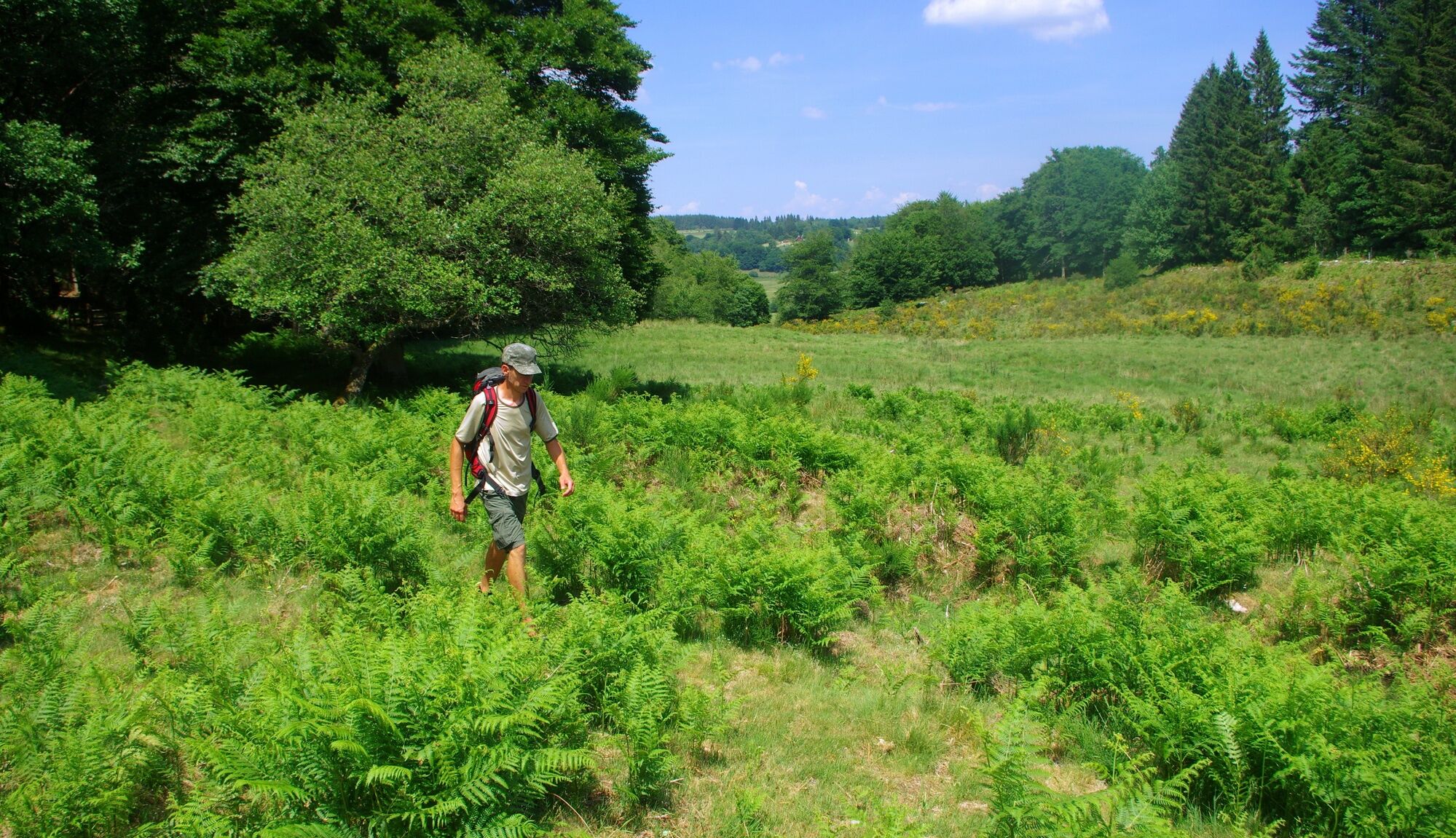
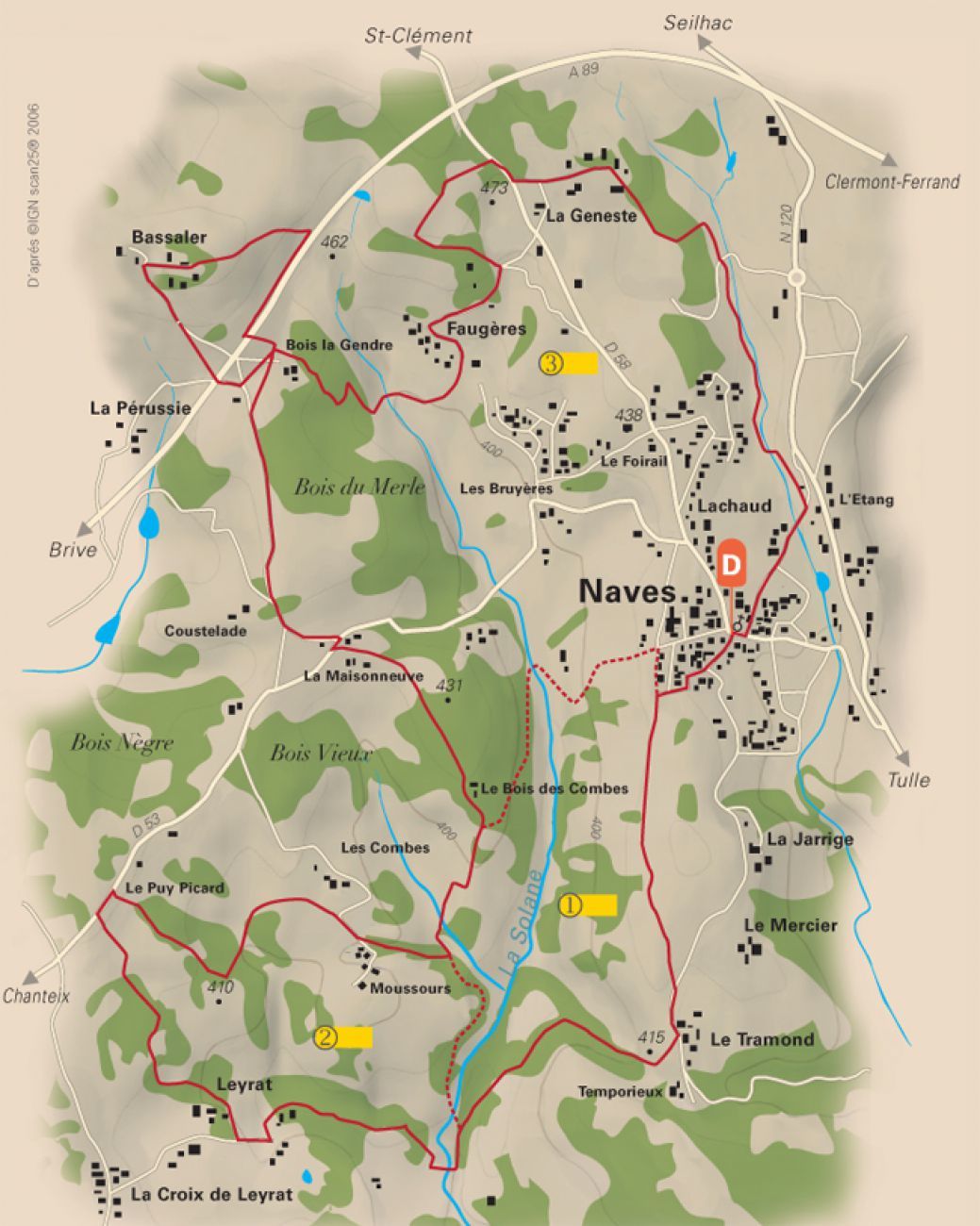
Along the route, you discover several viewpoints over the Monédières massif and the village of Naves (from Bassaler).
On the route, pass near the Leyrat manor and Bach castle. Possible visit of a oven in the hamlet of La Pérussie.
Light blue waymarking. Variants of 5km (dark blue waymarking) and 8km (red waymarking).


Tak
Clothing suitable for the season and conditions (cold, hot, humid...)
Hiking boots appropriate for the terrain (even for children!)
Hiking poles (useful for stability and to relieve joints)
Mobile phone and spare battery
Before setting off:
Check the general and local weather, ensuring no precipitation Get information about the approach walk, route elevation, duration, possible escape routes (IGN map, GPS, guidebook, etc.) Assess possible risks by consulting mountain professionals, refuges, lodgings Inform a close person of your plan and contact them in case of changes: departure and return times, number of participants with each phone number, vehicle(s), parking Avoid going alone, use proper equipment suited to the activity, adjusted and in good condition, headlamp, complete first aid kit, survival blanket, etc.In case of emergency
Alert: call 112 (European emergency number)
5 key points to relay your alert:
Where? town, place, route, altitude Who? identity, phone number What? type of accident, number of victims, severity, fall dynamics When? time of the accident Weather? wind, visibilityParking available near the starting point.
Please respect traffic rules.
Popularne wycieczki w okolicy
Lovers of the Blanchefort Forest
średniWędrówka 9,69 kmThe path of paradise
ciężkiWędrówka 13,4 kmLe Grand Saut - Chapelle Notre-Dame-du-Rosaire - chalet de paul - Gimel-les-Cascades
średniWędrówka 5,61 kmÉglise Saint-Sernin - Brive-la-Gaillarde - Église Saint-Martial - La Seniorie
ciężkiDroga rowerowa 50,7 kmÉglise Saint-Mexant-de-Poitiers - Saint-Mexant - Les Épicuriens - Chapelle Saint-Loup
średniDroga rowerowa 33,6 kmLa Table des Monédières - Ferme de l'Étang - La Vialle Neuve - Église Sainte-Anne
średniWędrówka 11,2 kmBar - Chapelle Notre-Dame-du-Rosaire - Église Saint-Augustin - Orliac-de-Bar
ciężkiDroga rowerowa 49,7 kmBar - Église Saint-Côme et Saint-Damien - Église Saint-Augustin - Chapelle Saint-Jean-Baptiste
ciężkiDroga rowerowa 54,6 kmEspagnac - Chapelle Notre-Dame-du-Rosaire - Église Saint-Martial - Église Notre-Dame du Pont-du-Salut
średniDroga rowerowa 59,5 kmSaint-Clément - Soleilhavoup - Boussaguet - Chez Charrière
ciężkiJazda na rowerze 34,8 km
Wędrówki i tropienie


Nie przegap ofert i inspiracji na następne wakacje
Twój adres e-mail została dodana do listy mailingowej.





