







Chemin d'Amadour : étape 6 de Le Pian-Médoc à Bordeaux
Poziom trudności: T1
The final stage on the left bank of the Garonne, crossing the towns of Blanquefort and Bruges, arrives in Bordeaux. Thanks to its remarkable architectural style, Bordeaux holds the record for the largest...
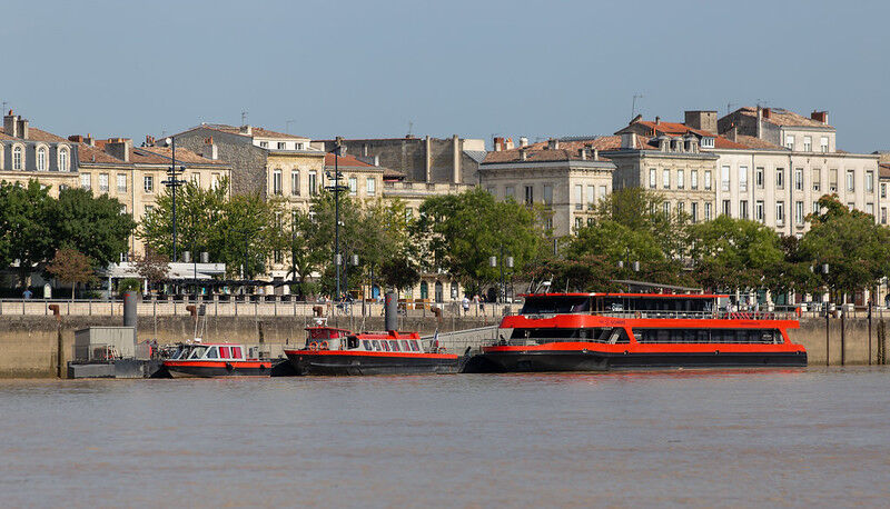
The final stage on the left bank of the Garonne, crossing the towns of Blanquefort and Bruges, arrives in Bordeaux. Thanks to its remarkable architectural style, Bordeaux holds the record for the largest urban area listed as a UNESCO World Heritage Site. The wine capital offers a wide range of visits, including the Cité du Vin, the Place de la Bourse and its water mirror, the Saint-Michel spire and basilica, as well as the Saint-André Cathedral and its Pey-Berland tower. The path crosses to the right bank via the iconic Pont de Pierre, Bordeaux’s first bridge, built more than 200 years ago (in May 1822).

Tak
Study the route: Familiarize yourself with the stages, it is important to know the distance, the level of difficulty, and the supply points. In the plain, paths can be varied, passing through forests, fields, or urban areas. Check the maps and the website www.chemin-amadour.fr to understand the difficulty of the route.
Weather: Check the weather forecast before leaving and prepare for weather changes. The risks of thunderstorms or heavy rain are frequent in the plain, and some trails can become muddy or impassable after rain. Adapt your route according to the weather.
Know the emergency numbers: 112 is the European emergency number.
Fauna and flora: In the plain, watch out for animals (shepherd dogs, sometimes cows) and some irritating plants like nettles. It is also common to encounter insects, especially in summer: bring repellents against mosquitoes and ticks.
Sun protection: The plain is often sparsely shaded; apply sunscreen, wear a hat and sunglasses to protect yourself from UV rays.
Leave no trace: Take your waste with you, do not pick protected flowers, and respect agricultural land. During harvest time, avoid crossing fields so as not to damage crops.
T1
Gironde Tourisme (ADT)
Uzyskaj wgląd Zawsze na żywo z ponad 9 500 kamer internetowych. bergfex Jako użytkownik Pro, możesz teraz zobaczyć odpowiednie kamery internetowe dla wielu wycieczek w aplikacji wycieczki od. Pozwala to na bezpośredni podgląd aktualnych warunków. Popularne wycieczki w okolicy
La boucle des pins
światłoWędrówka 12,6 kmBalade à roulettes : La forêt du Bourgailh - Impraticable
Wędrówka 2,85 kmAventure entre vignes et architecture
światłoJazda na rowerze 17,8 kmSuper balade : Sur l'eau et dans les nuages
światłoWędrówka 20,6 kmBalade à roulettes : La forêt du Taillan 2 - Impraticable
Wędrówka 3,15 kmBalade à roulettes : La forêt du Taillan 1 - Impraticable
Wędrówka 2,52 kmBalade à roulettes : Le parc Cazalet - Impraticable
Wędrówka 1,20 kmSuper balade : La vigne et l'architecte
światłoWędrówka 30,7 kmBalade à roulettes : Parc Sourreil à Villenave d'Ornon - Impraticable
Wędrówka 1,27 kmBalade à roulettes : Parc de Fontaudin - Impraticable
Wędrówka 1,35 km
Wędrówki i tropienie


Nie przegap ofert i inspiracji na następne wakacje
Twój adres e-mail została dodana do listy mailingowej.





