Randonnée en écomobilité entre Saint-André-de-Cubzac et Blaye sur le GR® 655
średni
Pobierz tę trasę na swój telefon komórkowy
Randonnée en écomobilité entre Saint-André-de-Cubzac et Blaye sur le GR® 655
średni
Wędrówka
34,35
km
Zeskanuj kod QR i rozpocznij nawigację w aplikacji bergfex.

Wędrówki i tropienie


Randonnée en écomobilité entre Saint-André-de-Cubzac et Blaye sur le GR® 655
średni
Odległość
34,35
km
Czas trwania
08:31
h
Ascent
276
hm
Poziom morza
3 -
72
m
Ścieżka do pobrania
Randonnée en écomobilité entre Saint-André-de-Cubzac et Blaye sur le GR® 655
średni
Wędrówka
34,35
km
This 35 km itinerary, which can be completed over two days, takes you from Saint-André-de-Cubzac to Blaye, with an overnight stop in Bourg-sur-Girondebourg-sur-Gironde for the night.On the GR®655, you...
Opis
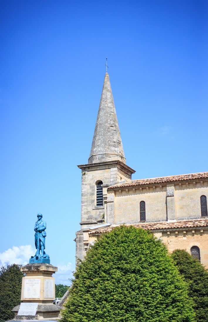
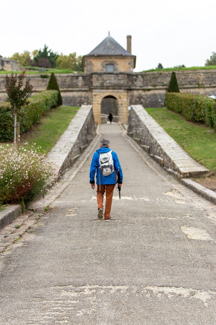
This 35 km itinerary, which can be completed over two days, takes you from Saint-André-de-Cubzac to Blaye, with an overnight stop in Bourg-sur-Gironde bourg-sur-Gironde for the night. On the GR®655, you can contemplate the banks of the Dordogne, the Gironde Estuary and its numerous harbours and atypical carrelets, as well as the Moorish-style houses of Bourg, its château, church and washhouse, before rising above the vineyards to reach the splendid and famous citadel of Blaye.
This route is proposed by the Comité Régional de Randonnée Pédestre. Departing from a train station or TER bus stop, it allows you to join a walking or hiking itinerary, and take a stroll in ecomobility!
This route is proposed by the Comité Régional de Randonnée Pédestre. Departing from a train station or TER bus stop, it allows you to join a walking or hiking itinerary, and take a stroll in ecomobility!
Trasa
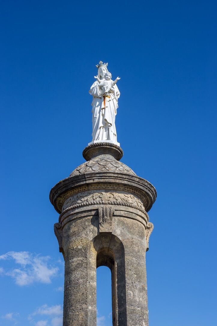
Église Sainte-Luce
(29 m)
Miejsce kultu
0,9 km
Église Saint-Pierre
(13 m)
Miejsce kultu
4,0 km
Église Saint-Vincent
(25 m)
Miejsce kultu
7,6 km
La Ridoise
(57 m)
Rozliczenie
12,0 km
Église Saint-Géronce
(24 m)
Miejsce kultu
18,1 km
Bourg
(25 m)
Wioska
18,2 km
Église Saint-André
(33 m)
Miejsce kultu
34,2 km
Trasa
Randonnée en écomobilité entre Saint-André-de-Cubzac et Blaye sur le GR® 655
średni
Wędrówka
34,35
km
Blaye
(5 m)
Miasto
0,1 km
La Terrière
(28 m)
Korytarz/teren
0,5 km
La Merlette
(29 m)
Korytarz/teren
0,6 km
Église Sainte-Luce
(29 m)
Miejsce kultu
0,9 km
Lers
(26 m)
Korytarz/teren
2,4 km
La Lande-Ouest
(12 m)
Korytarz/teren
2,8 km
Chopine
(19 m)
Korytarz/teren
3,1 km
Plassac
(4 m)
Wioska
3,5 km
Bar Restaurant du Port
(4 m)
Restauracja
3,6 km
Le Port-Nord
(9 m)
Korytarz/teren
3,6 km
Roubiscle
(5 m)
Korytarz/teren
3,8 km
Le Bourg
(11 m)
Korytarz/teren
4,0 km
Église Saint-Pierre
(13 m)
Miejsce kultu
4,0 km
La Mothe
(32 m)
Korytarz/teren
4,3 km
Paradis-Nord
(23 m)
Korytarz/teren
4,3 km
Jongay
(29 m)
Rozliczenie
7,4 km
Église Saint-Vincent
(25 m)
Miejsce kultu
7,6 km
Villeneuve
(26 m)
Wioska
7,8 km
Au Castaing
(6 m)
Rozliczenie
8,4 km
Roque de Thau
(4 m)
Rozliczenie
8,6 km
Marmisson
(6 m)
Rozliczenie
9,8 km
Furt
(5 m)
Rozliczenie
10,6 km
La Mayanne
(5 m)
Rozliczenie
10,8 km
Francicot
(61 m)
Wioska
11,5 km
La Ridoise
(57 m)
Rozliczenie
12,0 km
Le Carré
(53 m)
Rozliczenie
12,2 km
Plissau
(56 m)
Rozliczenie
12,4 km
Moulin Dechamps
(56 m)
Rozliczenie
12,6 km
Rousset
(53 m)
Rozliczenie
12,8 km
Luc
(48 m)
Rozliczenie
13,1 km
Bayon-sur-Gironde
(47 m)
Wioska
13,4 km
Panorama du Bec d'Ambes
(50 m)
Punkt widzenia
14,4 km
Pain de Sucre
(7 m)
Rozliczenie
15,5 km
Brangette
(11 m)
Rozliczenie
15,9 km
Clote Blanche
(31 m)
Rozliczenie
16,4 km
Les Cabanes
(22 m)
Rozliczenie
16,6 km
Gogues
(43 m)
Rozliczenie
16,9 km
Cambes
(5 m)
Rozliczenie
17,0 km
La Croix
(33 m)
Rozliczenie
17,9 km
Église Saint-Géronce
(24 m)
Miejsce kultu
18,1 km
Bourg
(25 m)
Wioska
18,2 km
Reynaud
(5 m)
Rozliczenie
21,1 km
Sous la Pierrière
(5 m)
Rozliczenie
21,8 km
La Pierrière
(30 m)
Sąsiedztwo
22,1 km
Le Lustre
(13 m)
Sąsiedztwo
22,2 km
Au Pont du Roi
(5 m)
Rozliczenie
22,6 km
Prignac-et-Marcamps
(30 m)
Wioska
24,4 km
Les Hugons
(37 m)
Rozliczenie
25,6 km
La Piguille
(27 m)
Rozliczenie
25,7 km
Les Lurzines
(33 m)
Rozliczenie
26,6 km
Saint-Gervais
(38 m)
Wioska
28,7 km
Église Saint-Gervais
(38 m)
Miejsce kultu
28,8 km
Tizac
(46 m)
Rozliczenie
30,4 km
Saint-André-de-Cubzac
(43 m)
Wioska
33,8 km
Église Saint-André
(33 m)
Miejsce kultu
34,2 km
la table d'Inomoto
(34 m)
Restauracja
34,2 km
Autor
Dostarczone przez Gironde tourisme


Informacje o trasie
Odpowiedni dla wózków inwalidzkich
Tak
Dodatkowe informacje i wskazówki
Dodatkowe informacje
Comité Régional de Randonnée Pédestre de Nouvelle-Aquitaine https://www.ffrandonnee-nouvelle-aquitaine.com/
Wskazówki
White and red (GR®)
cdt64.media.tourinsoft.eu/upload/Fich...
Nie ma jeszcze recenzji
Popularne wycieczki w okolicy
-
5,0
La boucle des châteaux de Margaux
światłoWędrówka 10,3 km -
Randonnée pédestre à Plassac
średniWędrówka 14,5 km -
Boucle de la Lagune d'enfer à pied ou à vélo
Wędrówka 15,3 km -
Boucle pédestre du Lac de Saint-Christoly-de-Blaye
Wędrówka 9,66 km -
La boucle des pins
światłoWędrówka 12,6 km -
Les vignobles à vélo - la boucle des Châteaux de Margaux
światłoJazda na rowerze 7,47 km -
Les boucles des marais d'Arcins-Soussans
światłoWędrówka 11,4 km -
Boucle des Trias
światłoJazda na rowerze 21,4 km -
Boucle St Ciers de Canesse et Villeneuve
średniWędrówka 12,4 km -
Balade à roulettes : Les lacs de Saint-Christoly-de-Blaye - Impraticable
Wędrówka 2,09 km
Wędrówki i tropienie

Ponad 550.000 propozycji wycieczek, szczegółowe mapy i intuicyjny planer tras sprawiają, że aplikacja jest niezbędna dla wszystkich entuzjastów przyrody.

Nie przegap ofert i inspiracji na następne wakacje
Zapisz się do newslettera
Błąd
Wystąpił błąd. Spróbuj ponownie.
Dziękujemy za rejestrację
Twój adres e-mail została dodana do listy mailingowej.
Wycieczki po całej Europie
Austria
Szwajcaria
Niemcy
Włochy
Słowenię
Francja
Holandia
Belgia
Polska
Liechtenstein
Czechy
Słowacja
Hiszpania
Chorwacja
Bośnia i Hercegowina
Luksemburg
Andorra
Portugalia
Islandia
Wielka Brytania
Irlandia
Grecja
Albania
Macedonia Północna
Malta
Norwegia
Czarnogóra
Mołdawia
Kosowo
Węgry
San Marino
Rumunia
Estonia
Łotwa
Białoruś
Cypr
Litwa
Serbia
Bułgaria
Monako
Dania
Szwecja
Finlandia