Boucle pédestre : Entre combes et coteaux - paysages UNESCO
średni
Pobierz tę trasę na swój telefon komórkowy
Boucle pédestre : Entre combes et coteaux - paysages UNESCO
średni
Wędrówka
11,46
km
Zeskanuj kod QR i rozpocznij nawigację w aplikacji bergfex.

Wędrówki i tropienie


Boucle pédestre : Entre combes et coteaux - paysages UNESCO
średni
Odległość
11,46
km
Czas trwania
02:55
h
Ascent
135
hm
Poziom morza
28 -
99
m
Ścieżka do pobrania
Boucle pédestre : Entre combes et coteaux - paysages UNESCO
średni
Wędrówka
11,46
km
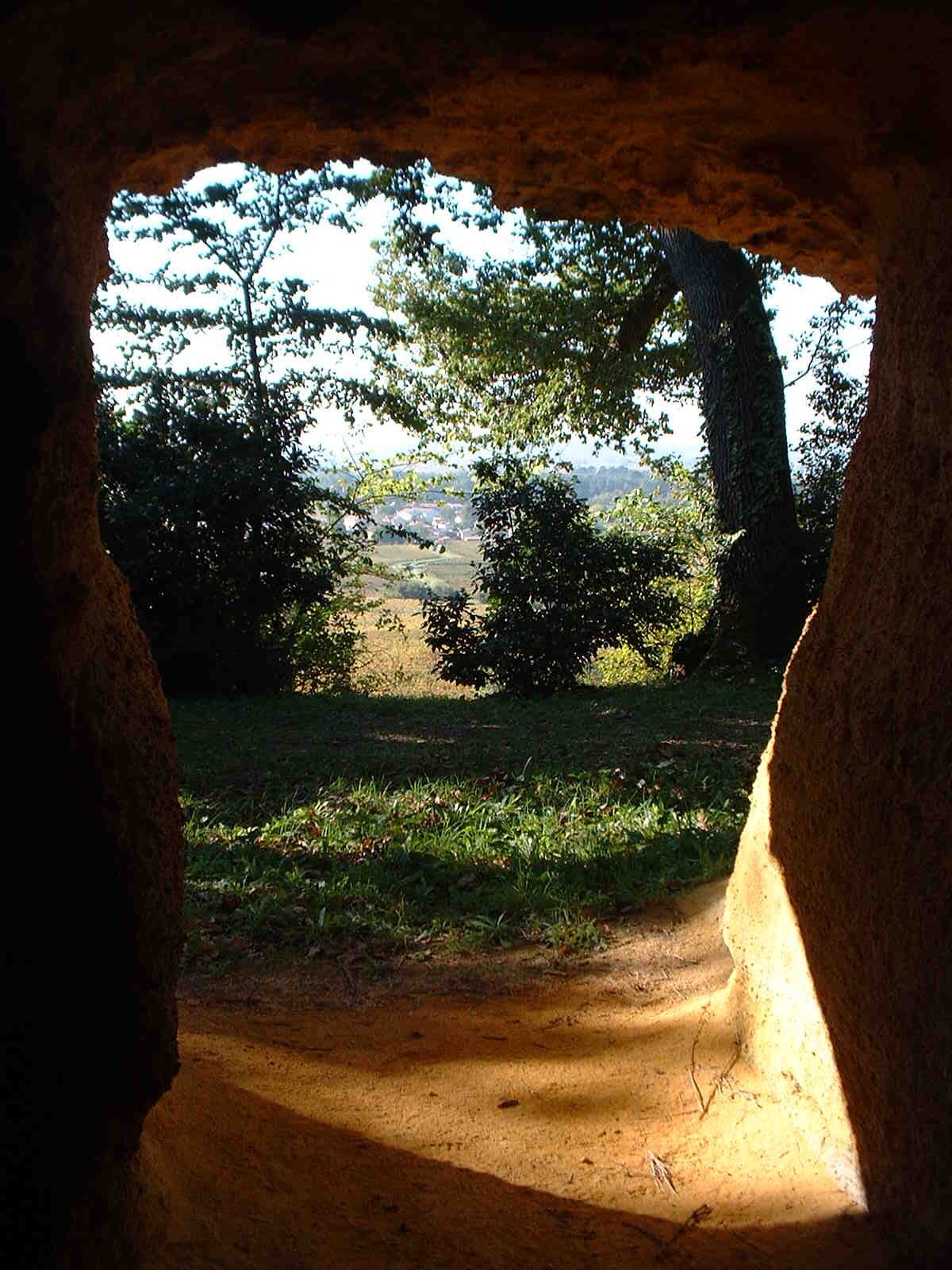
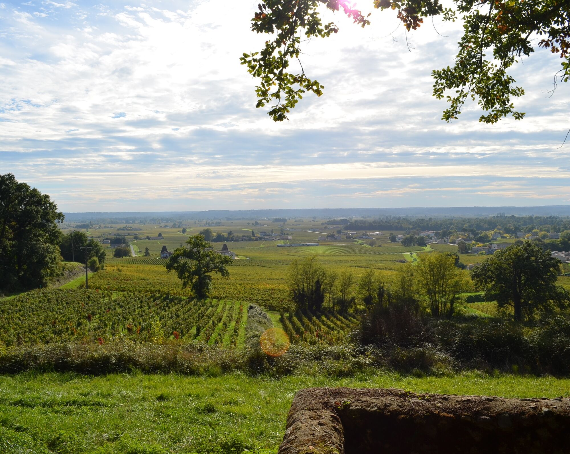
Discover the many facets of the Saint-Émilion vineyards and our colourful landscapes between hillsides and valleys, listed as a World Heritage Site by UNESCO as a cultural landscape.From the Tourist Office,...
Opis
Discover the many facets of the Saint-Émilion vineyards and our colourful landscapes between hillsides and valleys, listed as a World Heritage Site by UNESCO as a cultural landscape.From the Tourist Office, take the Rue du Clocher on your left.
Trasa
Cloître
(82 m)
Miejsce kultu
0,0 km
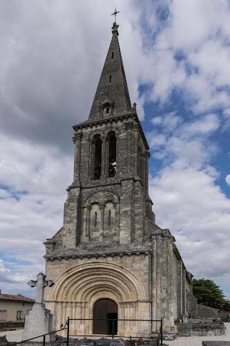
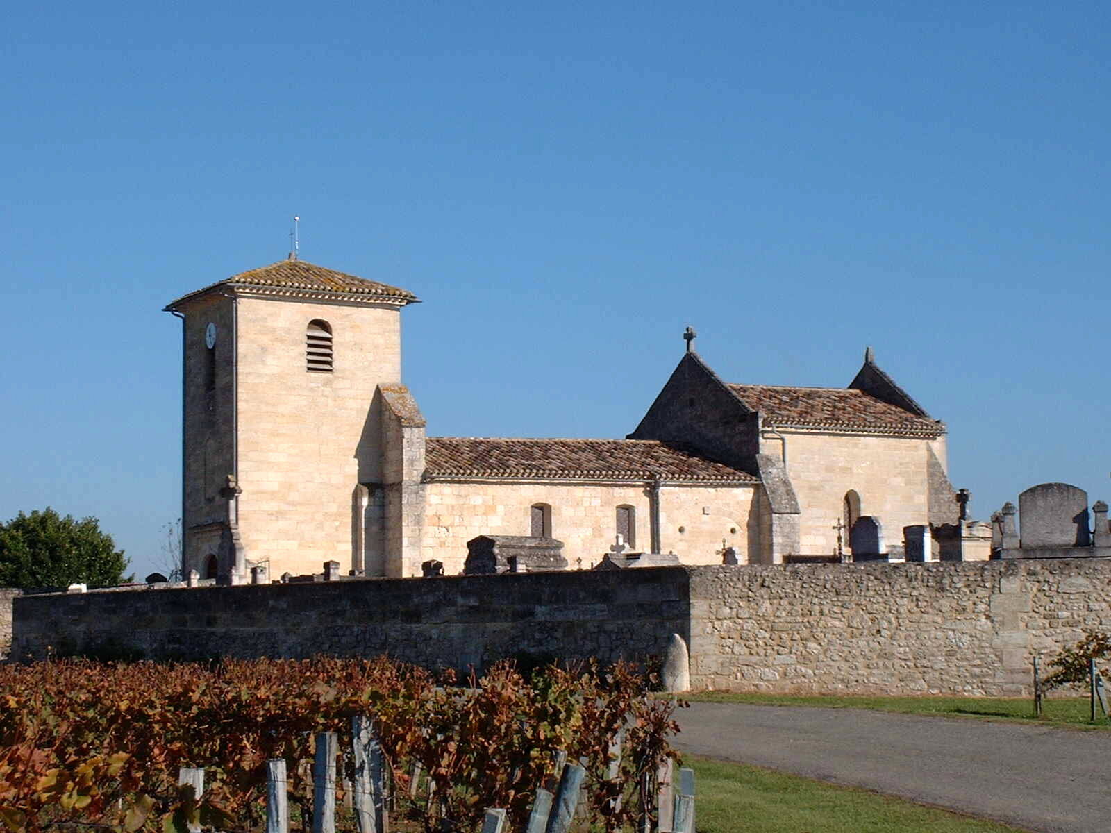
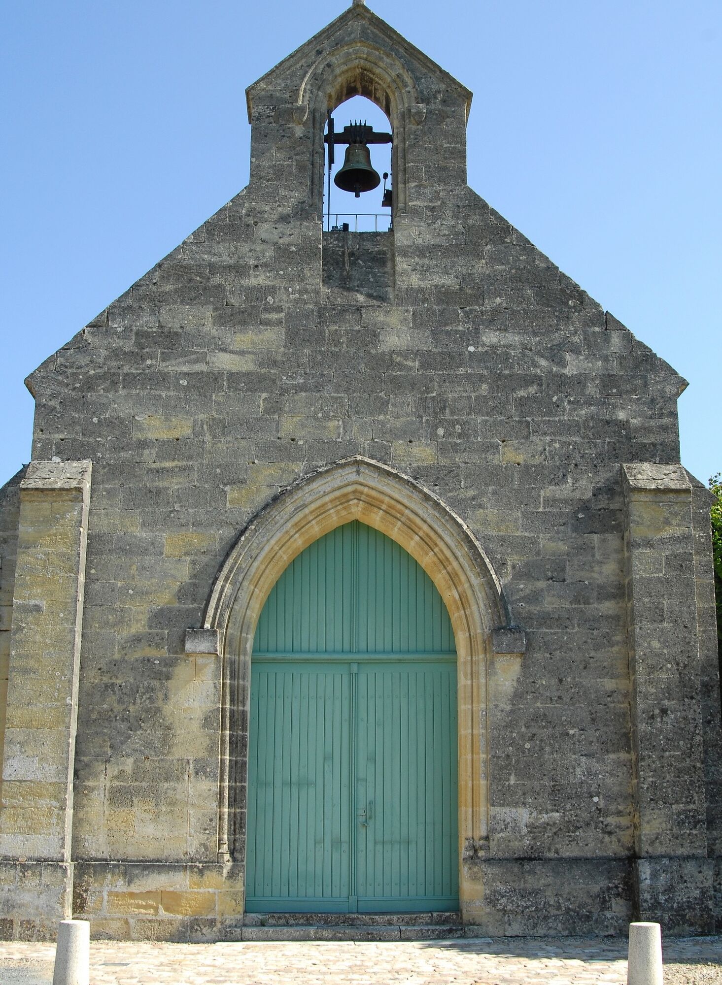
Église collégiale Saint-Emilion
(82 m)
Miejsce kultu
0,0 km
Église Saint-Laurent
(75 m)
Miejsce kultu
3,7 km
Église Saint-Hippolyte
(92 m)
Miejsce kultu
5,6 km
Saint-Poly
(90 m)
Rozliczenie
5,7 km
Saint-Christophe-des-Bardes
(81 m)
Wioska
8,6 km
Trasa
Boucle pédestre : Entre combes et coteaux - paysages UNESCO
średni
Wędrówka
11,46
km
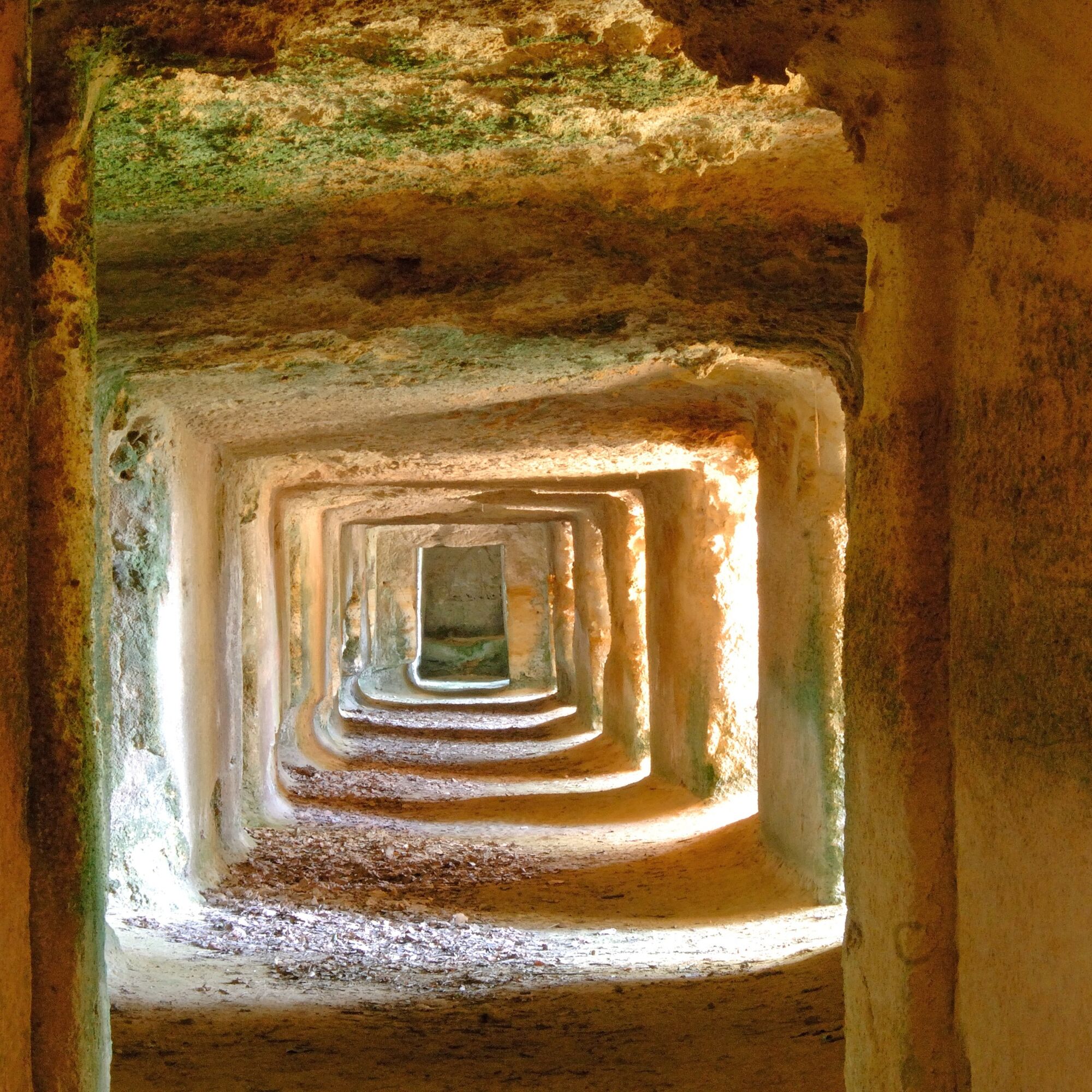
Église souterraine monolithe
(68 m)
Miejsce kultu
0,0 km
Cloître
(82 m)
Miejsce kultu
0,0 km
Saint-Émilion
(65 m)
Wioska
0,0 km
Église collégiale Saint-Emilion
(82 m)
Miejsce kultu
0,0 km
Lasserre
(83 m)
Rozliczenie
0,9 km
Pavie
(100 m)
Korytarz/teren
2,1 km
La Clusière
(86 m)
Korytarz/teren
2,4 km
Église Saint-Laurent
(75 m)
Miejsce kultu
3,7 km
L'Atelier de Candale
(39 m)
Restauracja
4,1 km
Saint-Laurent-des-Combes
(21 m)
Wioska
4,3 km
Plante de Jacques
(88 m)
Rozliczenie
5,5 km
Église Saint-Hippolyte
(92 m)
Miejsce kultu
5,6 km
Saint-Poly
(90 m)
Rozliczenie
5,7 km
Pirote
(82 m)
Rozliczenie
6,7 km
Rocheyron
(92 m)
Rozliczenie
7,7 km
Saint-Christophe-des-Bardes
(81 m)
Wioska
8,6 km
Lasserre
(83 m)
Rozliczenie
11,2 km
Saint-Émilion
(65 m)
Wioska
11,4 km
Autor
Dostarczone przez Gironde tourisme
Wycieczkę Boucle pédestre : Entre combes et coteaux - paysages UNESCO zapewnia outdooractive.com.
Informacje o trasie
Odpowiedni dla wózków inwalidzkich
Tak
Dodatkowe informacje i wskazówki
Dodatkowe informacje
OT Saint-Emilion https://www.saint-emilion-tourisme.com/fr/
Nie ma jeszcze recenzji
Popularne wycieczki w okolicy
Boucle vélo: Néac et Lalande de Pomerol
średniMountainbike 12,7 kmBoucle vélo : Tour du Grand Saint-Emilionnais
ciężkiJazda na rowerze 60 kmBoucle vélo: Les premiers Grands Crus Classés
światłoJazda na rowerze 15,5 km- 5,0
Boucle pédestre : sur les chemins de Néac
światłoWędrówka 4,06 km Boucle vélo: Entre vignes et Dordogne
światłoJazda na rowerze 30,4 kmBoucle de l'Escouach
średniWędrówka 18,6 kmBoucle pédestre : Autour de Parsac
światłoWędrówka 6,49 kmBoucle pédestre : La Route des vins biologiques
światłoWędrówka 6,51 kmBoucle vélo: De Sainte-Terre à Castillon par la Dordogne
światłoJazda na rowerze 18,2 kmBoucle vélo: Le long de la Dordogne en famille
światłoJazda na rowerze 5,73 km
Wędrówki i tropienie

Ponad 550.000 propozycji wycieczek, szczegółowe mapy i intuicyjny planer tras sprawiają, że aplikacja jest niezbędna dla wszystkich entuzjastów przyrody.

Nie przegap ofert i inspiracji na następne wakacje
Zapisz się do newslettera
Błąd
Wystąpił błąd. Spróbuj ponownie.Dziękujemy za rejestrację
Twój adres e-mail została dodana do listy mailingowej.
Wycieczki po całej Europie
Austria Szwajcaria Niemcy Włochy Słowenię Francja Holandia Belgia Polska Liechtenstein Czechy Słowacja Hiszpania Chorwacja Bośnia i Hercegowina Luksemburg Andorra Portugalia Islandia Wielka Brytania Irlandia Grecja Albania Macedonia Północna Malta Norwegia Czarnogóra Mołdawia Kosowo Węgry San Marino Rumunia Estonia Łotwa Białoruś Cypr Litwa Serbia Bułgaria Monako Dania Szwecja Finlandia