






Espagnac - Chastang Dam
Poziom trudności: 5
The route starts from the small village of Espagnac, then follows the Doustre gorges, with superb views of La Roche-Basse.
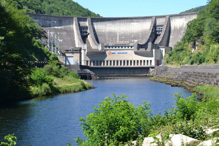
It then crosses the Dordogne at the Chastang Dam before climbing up to the village...
The route starts from the small village of Espagnac, then follows the Doustre gorges, with superb views of La Roche-Basse.
It then crosses the Dordogne at the Chastang Dam before climbing up to the village of Servières-le-Château (Servières Hill).
After a flatter section to Auriac, a fairly steep descent leads to the Chambon Bridge, a cast iron suspension bridge.*
A 5km climb (Charbonniers Hill) takes you back to the plateau before finishing more gently over the last 20 kilometres...


A well-maintained and well-equipped bike helps ensure your safety as well as that of other road users.
Before setting off:
Make sure the bike is in perfect mechanical condition, including tires and brakes Ensure the bike fits your body properly Wearing a helmet is strongly recommended Bring a repair kit Remember that the Highway Code applies to cyclists at all times Never ride more than two abreast and move into a single file when traffic conditions require it Respect other road users as you would like to be respected Choose a route suitable for your physical abilities Inform those around you of your itinerary Check the weather conditions A first aid kit is not essential, but can be very useful Stay informed and keep emergency numbers handy Respect the environment by not littering food packaging on the roadside If you must return at dusk, make sure you can see and be seenEmergency number: 112
Parking available in Espagnac.
Please respect traffic regulations.
5
Corrèze Tourism
Corrèze Tourism Development and Booking Agency
45 quai Aristide Briand
19000 TULLE
Tel: + 33 (0)5 55 29 98 78
Popularne wycieczki w okolicy
-
Bike and cheese circuit in Xaintrie blanche
średniJazda na rowerze 57,6 km -
Leisure cycling route: Château de Sédières
światłoJazda na rowerze 14,8 km -
L'école buissonnière
ciężkiWędrówka 10,3 km -
From the Soursacois plateau to the Luzège gorges
średniWędrówka 14,8 km -
Bardot's Garden
średniWędrówka 3,79 km -
Die Dordogne von Dörfern zu Staudämmen - vom Vent Haut zum Peuch
ciężkiMountainbike 45,8 km -
La Dordogne de villages en barrages - du Peuch à Argentat
ciężkiMountainbike 44,0 km -
La Chapeloune
światłoWędrówka 9,38 km -
5,0
Église Saint-Pierre - Longour - Chapelle Jeanne d'Arc - Argentat
średniWędrówka 13,5 km -
Église Saint-Pierre - Longour - Argentat
światłoWędrówka 7,06 km

Wędrówki i tropienie


Nie przegap ofert i inspiracji na następne wakacje
Twój adres e-mail została dodana do listy mailingowej.





