
Circuit VTT n°18 - Le tour de Versillat
średni
Pobierz tę trasę na swój telefon komórkowy
Circuit VTT n°18 - Le tour de Versillat
średni
Mountainbike
27,80
km
Zeskanuj kod QR i rozpocznij nawigację w aplikacji bergfex.


Wędrówki i tropienie





Circuit VTT n°18 - Le tour de Versillat
średni
Odległość
27,8
km
Czas trwania
02:36
h
Ascent
351
hm
Poziom morza
292 -
434
m
Ścieżka do pobrania
Circuit VTT n°18 - Le tour de Versillat
średni
Mountainbike
27,80
km
We leave the outskirts of La Souterraine fairly quickly to access the Sédelle valley via the GR654 and the Chemin de Compostelle, which we intersect several times.There's a nice downhill path (watch out...
Opis
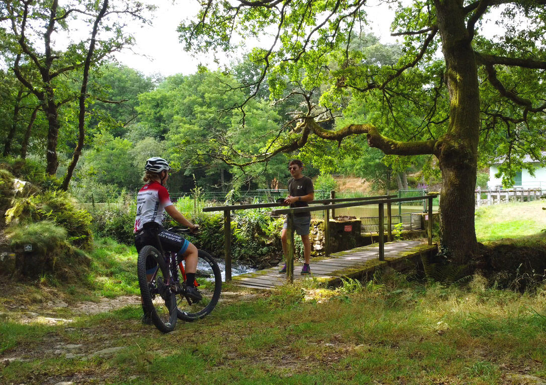
We leave the outskirts of La Souterraine fairly quickly to access the Sédelle valley via the GR654 and the Chemin de Compostelle, which we intersect several times.
There's a nice downhill path (watch out for Compostelle pilgrims going the wrong way!) at around km 7; a pleasant, albeit technical, passage through a stream at km 21... And a beautiful hill to climb at km 22.
Trasa
Bousseresse
(377 m)
Rozliczenie
1,7 km
Peu de Châtelus
(350 m)
Szczyt
5,4 km
Église Saint-Agnan
(308 m)
Miejsce kultu
8,2 km
Mazégout
(313 m)
Rozliczenie
8,5 km
La Peyre
(312 m)
Rozliczenie
18,5 km
La Grande Vergnolle
(410 m)
Rozliczenie
23,1 km
Bridiers
(409 m)
Rozliczenie
26,3 km
Trasa
Circuit VTT n°18 - Le tour de Versillat
średni
Mountainbike
27,80
km
Bousseresse
(377 m)
Rozliczenie
1,7 km
Le Moulin Porcher
(354 m)
Rozliczenie
3,2 km
La Coustière
(375 m)
Rozliczenie
4,2 km
La Rebeyrolle
(354 m)
Rozliczenie
5,0 km
Peu de Châtelus
(350 m)
Szczyt
5,4 km
Lascoux
(362 m)
Rozliczenie
6,1 km
Saint-Agnant-de-Versillat
(310 m)
Wioska
7,9 km
Mel Lou
(312 m)
Restauracja
8,1 km
Église Saint-Agnan
(308 m)
Miejsce kultu
8,2 km
Mazégout
(313 m)
Rozliczenie
8,5 km
Le Breuil
(355 m)
Rozliczenie
11,2 km
Le Boucheron
(329 m)
Rozliczenie
15,5 km
La Peyre
(312 m)
Rozliczenie
18,5 km
Le Grand Couret
(341 m)
Rozliczenie
20,4 km
La Caffarderie
(339 m)
Rozliczenie
21,2 km
La Grande Vergnolle
(410 m)
Rozliczenie
23,1 km
La Petite Vergnolle
(415 m)
Rozliczenie
23,3 km
Le Cluzeau
(403 m)
Rozliczenie
23,7 km
Bridiers
(409 m)
Rozliczenie
26,3 km
L'Aquarelle du Limousin
(394 m)
Restauracja
27,6 km
Autor
Dostarczone przez Tourisme Creuse
Wycieczkę Circuit VTT n°18 - Le tour de Versillat zapewnia outdooractive.com.


Dodatkowe informacje i wskazówki
Dodatkowe informacje
OT Pays Sostranien https://www.tourisme-creuse.com/pays-sostranien/
Wskazówki
Nie ma jeszcze recenzji
Popularne wycieczki w okolicy
-
The painters' trail
światłoTrasa tematyczna 3,68 km -
Circuit pédestre Dans les pas de Monet F1
światłoWędrówka 3,22 km -
Circuit Uni'Vert Trail n°6 : Racin'es Trail
średniWędrówka 8,23 km -
Mountain bike route no. 39 - Crozant
ciężkiMountainbike 32,7 km -
MTB route no. 41 - Saint Sébastien
światłoMountainbike 11,0 km -
Creuse Loop / Western Section: Crozant > Châtelus le Marcheix
średniKolarstwo długodystansowe 64,9 km -
Circuit Uni'Vert Trail n°7 : Urbain'POLT
średniWędrówka 19,6 km -
Circuit Uni'Vert Trail n°5 : Cazitrail
średniWędrówka 15,8 km -
Circuit VTT n°20 - Autour de l'étang de la Cazine
światłoMountainbike 12,7 km -
De Pierre et de Bois SD1
średniWędrówka 11,1 km

Wędrówki i tropienie

Ponad 550.000 propozycji wycieczek, szczegółowe mapy i intuicyjny planer tras sprawiają, że aplikacja jest niezbędna dla wszystkich entuzjastów przyrody.

Nie przegap ofert i inspiracji na następne wakacje
Zapisz się do newslettera
Błąd
Wystąpił błąd. Spróbuj ponownie.
Dziękujemy za rejestrację
Twój adres e-mail została dodana do listy mailingowej.
Wycieczki po całej Europie
Austria
Szwajcaria
Niemcy
Włochy
Słowenię
Francja
Holandia
Belgia
Polska
Liechtenstein
Czechy
Słowacja
Hiszpania
Chorwacja
Bośnia i Hercegowina
Luksemburg
Andorra
Portugalia
Islandia
Wielka Brytania
Irlandia
Grecja
Albania
Macedonia Północna
Malta
Norwegia
Czarnogóra
Mołdawia
Kosowo
Węgry
San Marino
Rumunia
Estonia
Łotwa
Białoruś
Cypr
Litwa
Serbia
Bułgaria
Monako
Dania
Szwecja
Finlandia





