


AhrSteig Stage 2: Freilinger See to Aremberg (11.7 km)
Freilinger See - Freilingen - Hühnerberg - Lommersdorf Forest - Aremberg
Coming from Freilingen, we cross the L115 with the necessary caution. Behind it, left, then right and uphill in a leisurely ascent...
Freilinger See - Freilingen - Hühnerberg - Lommersdorf Forest - Aremberg
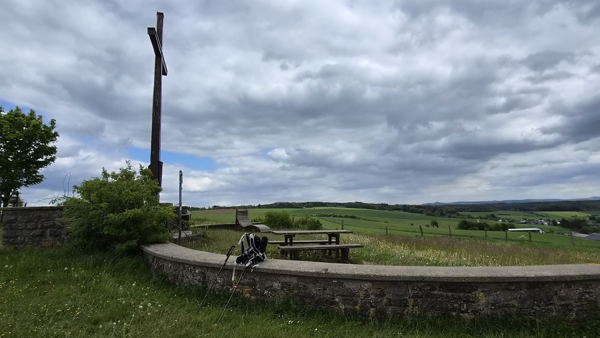
Coming from Freilingen, we cross the L115 with the necessary caution. Behind it, left, then right and uphill in a leisurely ascent to the Hühnerberg, which is already recognizable from afar by the large cross. From above, the view sweeps across a magnificent all-around panorama. After a relaxing rest, we hike across the wide high plain through the field area Am Gericht.
Soon, however, the path dips into the forest and now leads for a long stretch along the route of an old Roman road through a restorative forest landscape between Lommersdorf and Aremberg. After we have crossed the connecting road between the two places, it goes a bit downhill, then left uphill, finally on a quiet path through the woods. On a well-maintained forest path, we reach the Aremberg area. At the very beginning, old stations of the cross and the Guardian Angel Chapel welcome us. The view opens to the south; before our eyes unfolds a panorama with Nürburg and Hohe Acht.
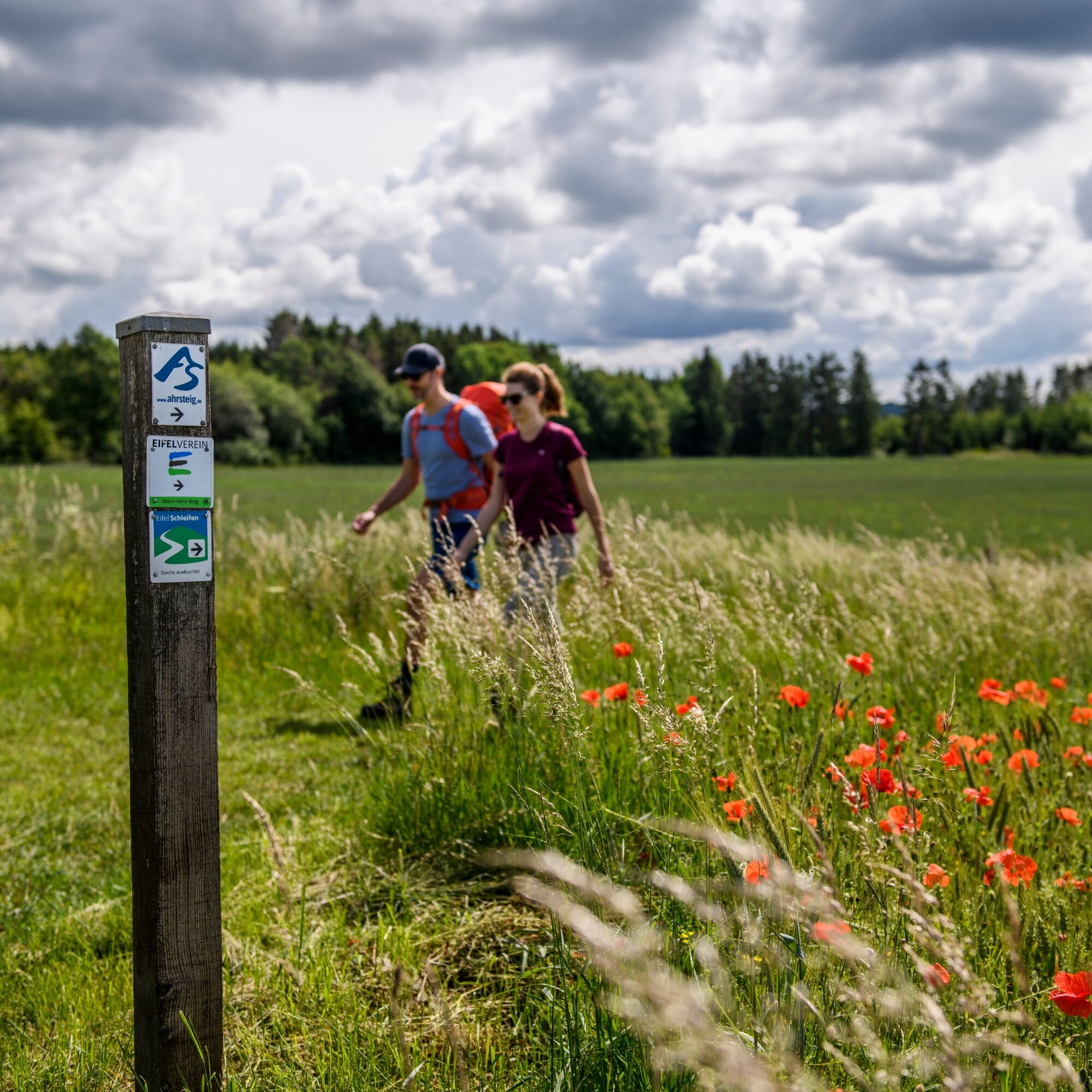
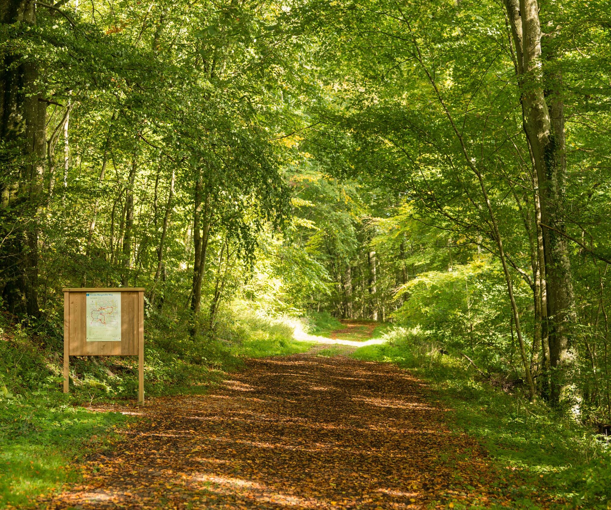
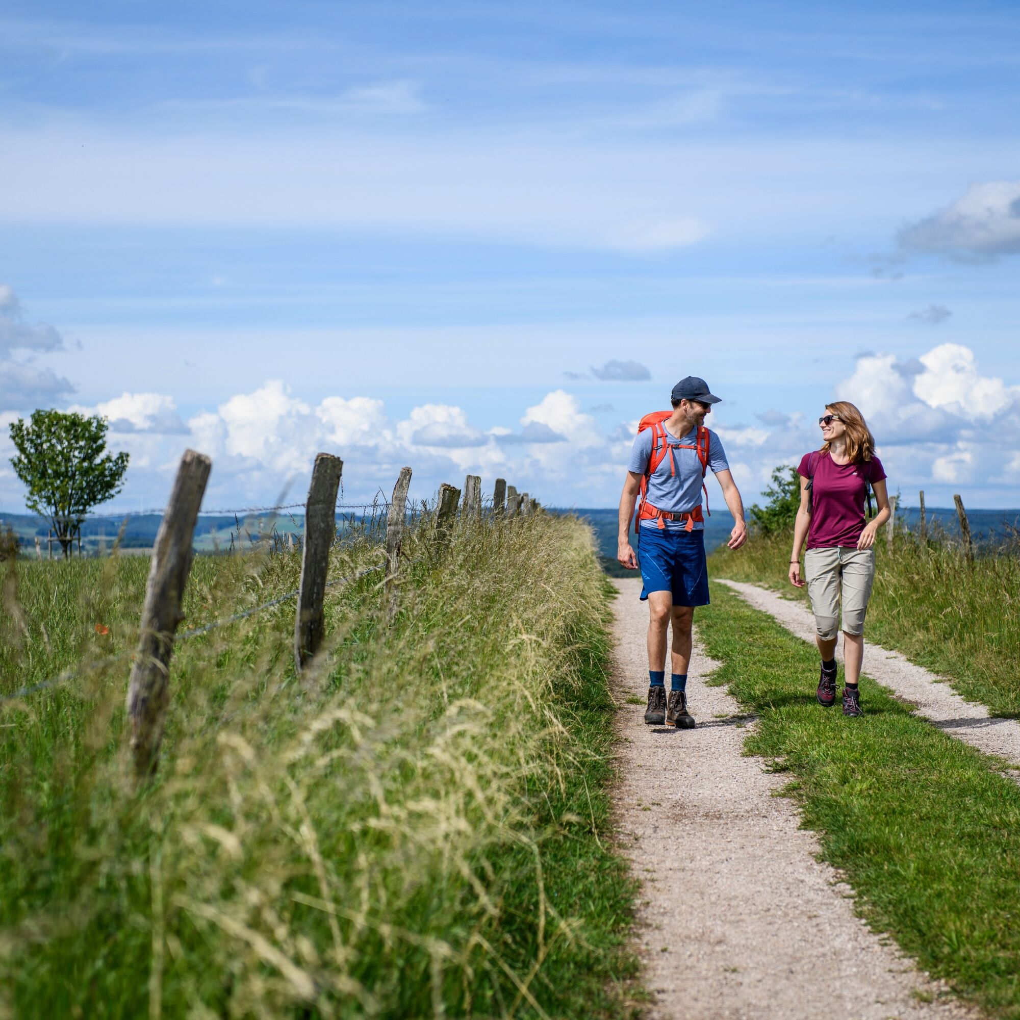
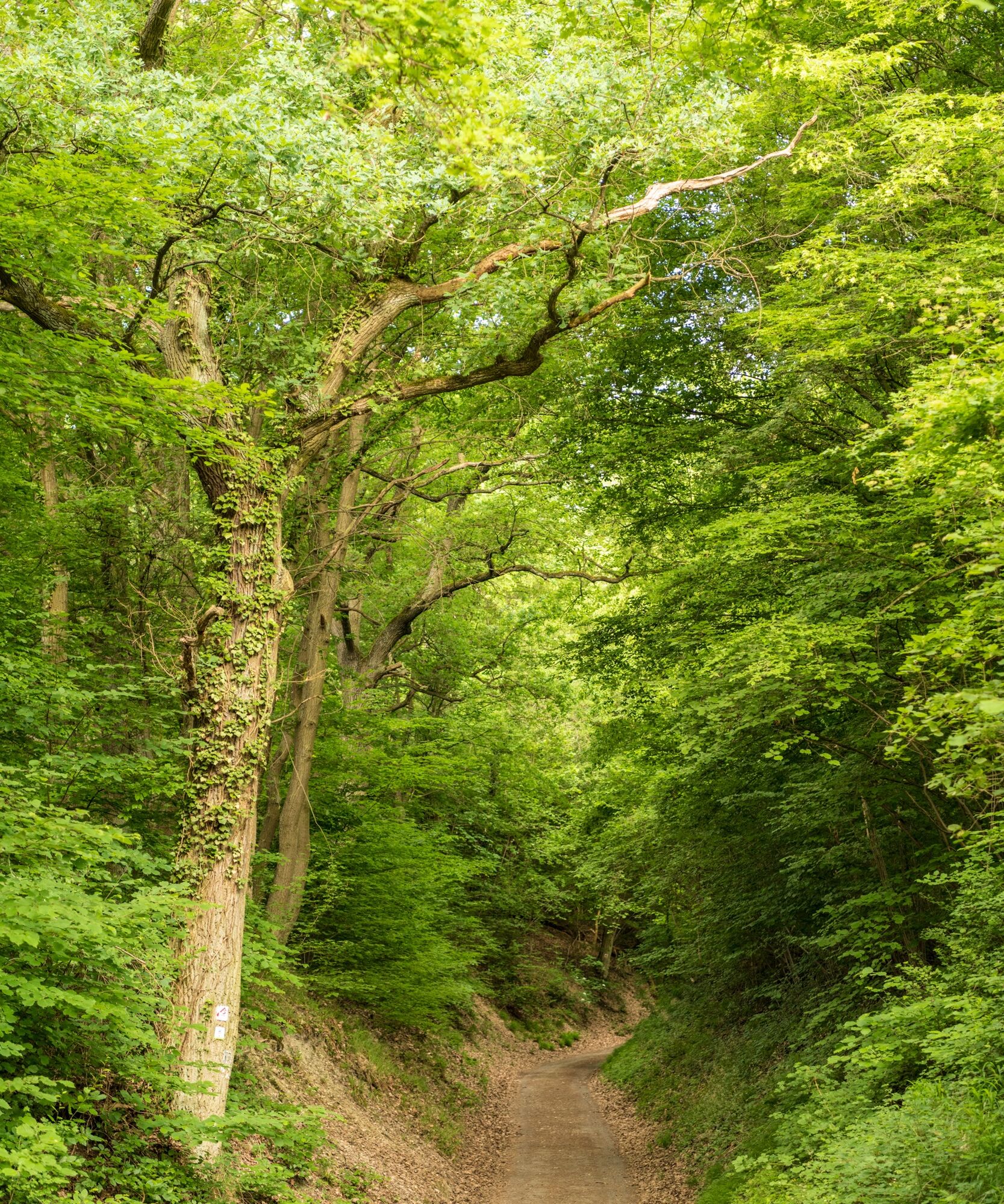
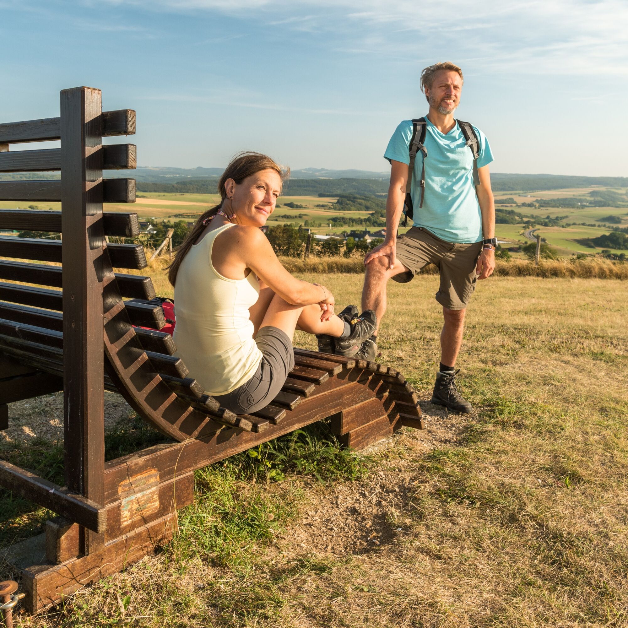
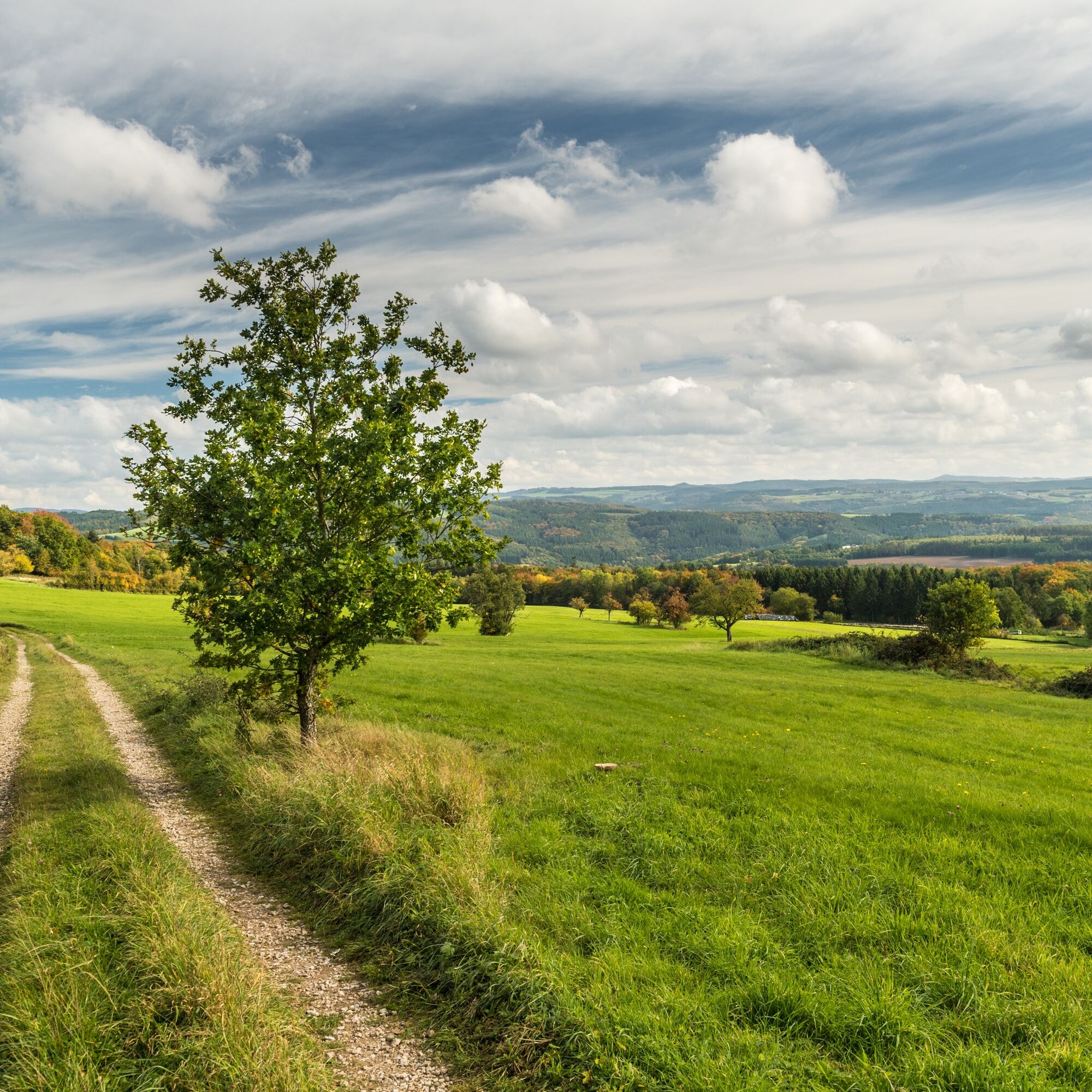
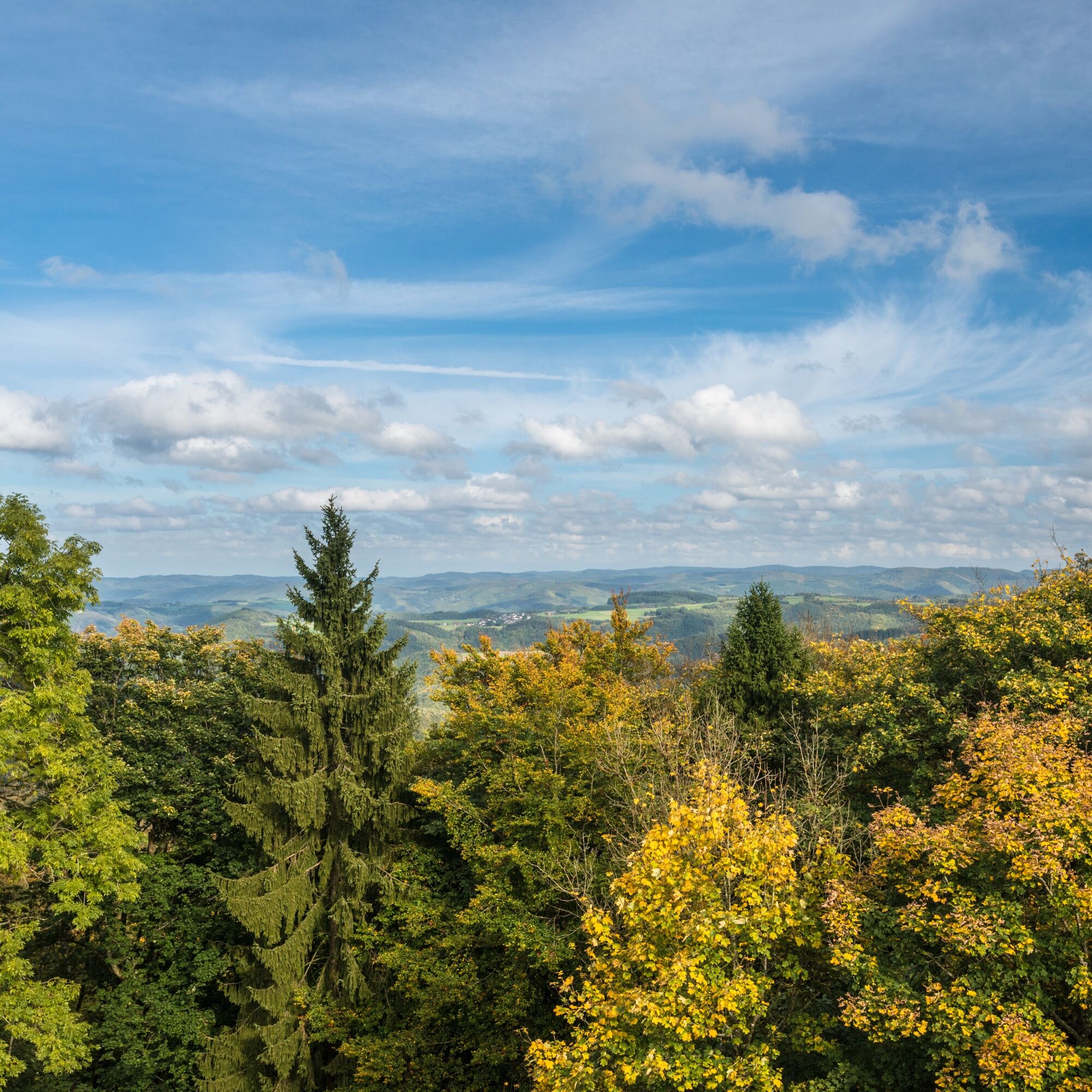
The route starts at the shore of the Freilinger See and passes the edge of the village of Freilingen towards Lommersdorf. After crossing the L115, the path leads over hidden meadow trails up to the 534 m high Hühnerberg. From the summit plateau, we enjoy an excellent panoramic view of the Ahr Mountains, the North Eifel, and the heights of the High Eifel with the 747 m high, distinctive peak of the Hohe Acht. Along fragrant dry meadows, the path takes us through the field area "Am Gericht" into the Lommersdorf Forest. The extensive forest is a place of peace and relaxation. Rest areas and a shelter of the Eifelverein invite you to linger. Following the old Roman road, the AhrSteig leads us after crossing the K41 initially downhill through the natural Aulbach valley. After a few hundred meters, a steep ascent branches off and, after passing a forest clearing with rare plants, we reach a small chapel at the roadside on enchanting forest paths. The Guardian Angel Chapel is dedicated to the patron saint of hikers, Archangel Raphael. Over charming meadow paths and field edges, the place Aremberg, located southeast of the mountain of the same name, is reached. This picturesque gem offers quaint alleys and the splendidly furnished parish church of Saint Nicholas, built at the end of the 18th century. You can completely forget everyday life from the sun terrace of the inn Burgschänke. From here, one of the most beautiful distant views of the entire AhrSteig opens up, extending to the majestic Nürburg.
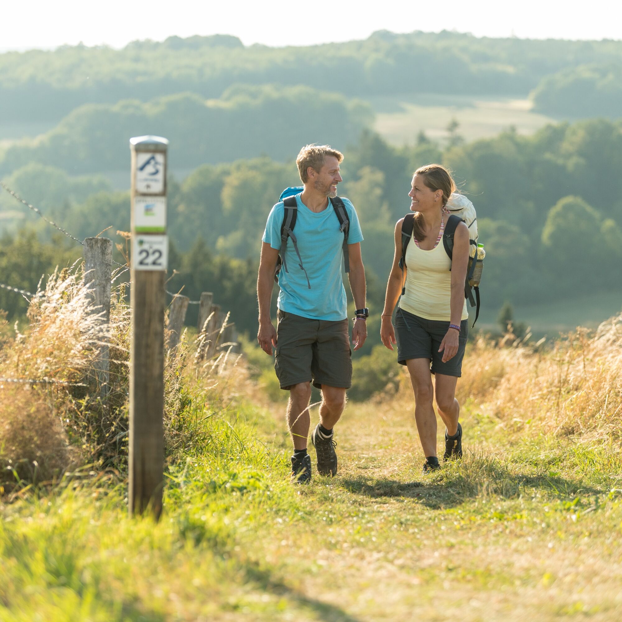
Sturdy footwear
Pay attention to sturdy and hiking-friendly footwear!
A1 to the Blankenheim exit, continue on B258 towards Nürburgring until past Ahrhütte, then left onto L115 and K41 to Freilingen.
From Bonn take the S23 to Rheinbach, then continue with the SEV bus to Rheinbach and from there to Blankenheim (Wald)
From Blankenheim (Wald) with the taxi bus to Freilingen. Tel.: 0 18 06 / 15 15 15, please order at least half an hour before the desired departure.
Please note: The taxi bus runs exclusively to Freilingen and does not continue to Aremberg.
Timetable information at https://www.bahn.de and https:// www.vrminfo.de
Line 899 RadWanderBus Upper Ahr Valley (RVK) valid from 01.08.2024 – 31.10.2024 Blankenheim – Aremberg – Altenahr – Ahrweiler
From August 1, 2024, Line 899 will be partially extended to Ahrweiler and operates here as RadWanderBus.
Between Altenahr, Ahrbrück, Schuld, Müsch and Blankenheim, in the future from April to October a RadWanderBus (Line 899) runs along the Ahr Valley cycle path, where – preferably after online reservation – up to 20 bicycles can be transported on a separate trailer.
Transitionally, some RadBus rides - until the Ahr Valley Railway is reactivated on this section - also serve the places between Ahrbrück and Ahrweiler along the Middle Ahr.
Line 899 can thus be used as a feeder or return service for the Ahr cycle path towards Upper and Lower Ahr Valley. Additionally, other long-distance cycle routes such as the Vulkanradroute Eifel from Dümpelfeld towards Adenau/Nürburgring, the Kalkeifel cycle path from Ahrdorf towards Hillesheim, the Erfcycle path from Schuld towards Bad Münstereifel, or the Rhine cycle path from Sinzig from the Upper Ahr Valley are connected. Of course, the line can also be used by hikers to explore the AhrSteig or the Rotweinwanderweg.
Parking lot at the Freilinger See recreation area
Ahrtal-Tourismus Bad Neuenahr-Ahrweiler e.V.
Oberstr. 8
53474 Bad Neuenahr-Ahrweiler
Tel: 0049 2641 9171-0
Fax: 0049 2641 9171-51
E-Mail: info@ahrtal.de
Internet: www.ahrtal.de
Another natural highlight is offered by the Hohes Venn Nature Park between Lommersdorf and Aremberg with fantastic distant views extending to Nürburg.
Conveniently reach the starting point with the RadWanderBus Upper Ahr Valley (RVK Line 899) Blankenheim – Altenahr – Ahrweiler between stages 1 - 4.
Popularne wycieczki w okolicy
-
4,2
Eifelspuren: Toscana der Eifel
światłoWędrówka 15,7 km -
5,0
Wasserfall - Runde
średniWędrówka 10,2 km -
Dörferblick-Schleife (Kirmutscheid - Pomster - Barweiler - Kirmutscheid)
średniWędrówka 14,0 km -
5,0
Müllenwirft-Schleife
Wędrówka 14,9 km -
4,5
Über Heidentempel durchs Hornbachtal
światłoWędrówka 6,78 km -
4,0
AhrSchleife "Köhlerweg"
Wędrówka 10,9 km -
5,0
Effelsberg
światłoWędrówka 8,48 km -
Eifelsteig-Etappe 06
długodystansowy szlak pieszy 23,4 km -
AhrSteig Gesamtstrecke
Wędrówka 107,4 km -
Rundwanderweg Nr. 7 Schuld-Insul-Schuld
Wędrówka 5,70 km
Wędrówki i tropienie


Nie przegap ofert i inspiracji na następne wakacje
Twój adres e-mail została dodana do listy mailingowej.