


Language Panorama and Hydropower on the Rhine

Before the hike begins, students explore the winding old town of Laufenburg and can gain insights into various areas of language and communication at the Language Panorama. The hike from the picturesque...
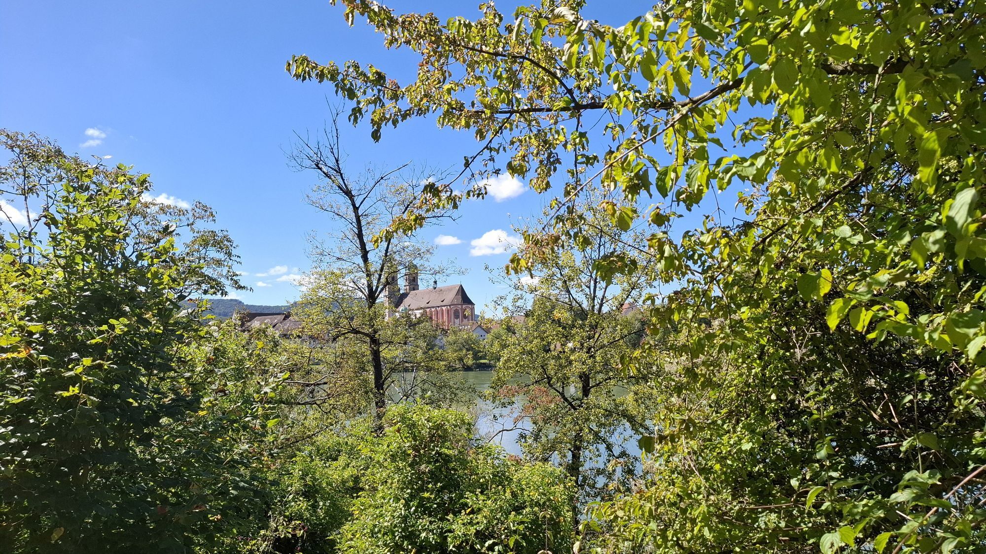
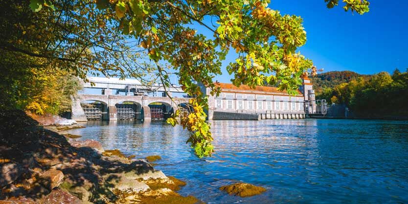
Before the hike begins, students explore the winding old town of Laufenburg and can gain insights into various areas of language and communication at the Language Panorama. The hike from the picturesque town of Laufenburg to Stein AG is like a symbiosis of nature and technology. Two hydropower plants – a rather modern one at Stein and a venerable one at Laufenburg – are located on the hiking route. In between are mostly natural sections of the Upper Rhine riverbanks.

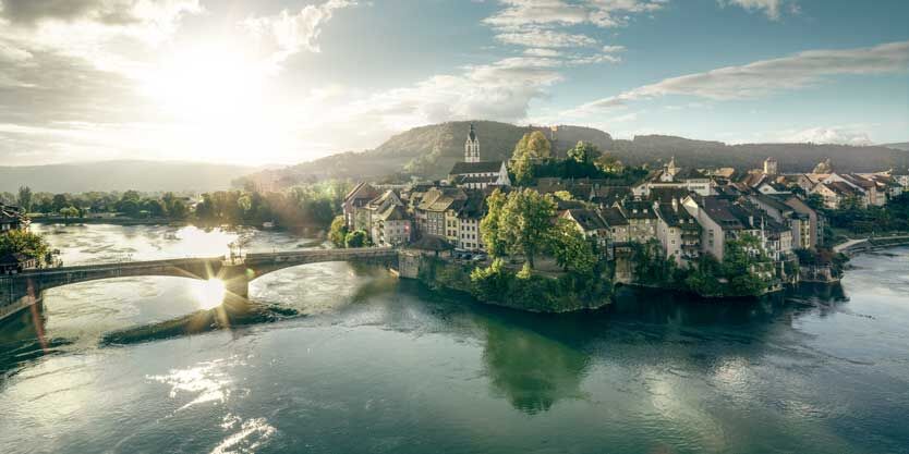
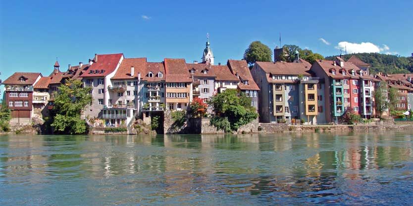
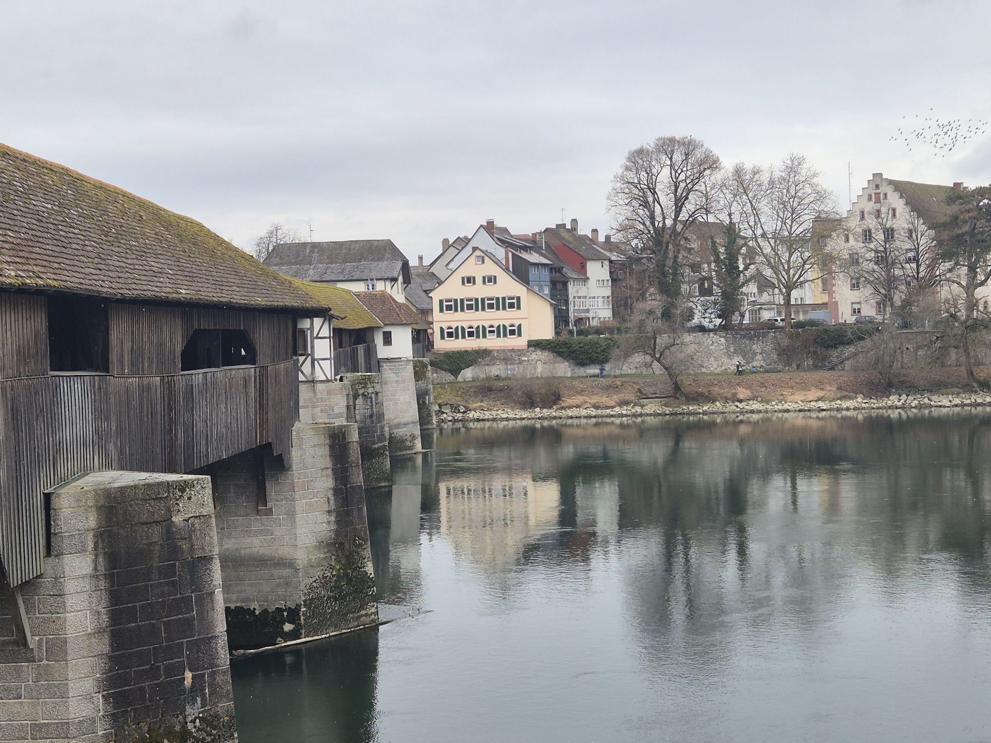
Arrival by train to Laufenburg. From the station, it goes through the winding old town of Laufenburg to the Language Panorama. There, school classes go on a trail of the various dialects or explore the special exhibitions. Afterwards, the hiking route always follows the left bank of the Rhine downstream. First, the listed hydropower plant of Laufenburg is passed. Then a pleasant path leads down to Sisseln.
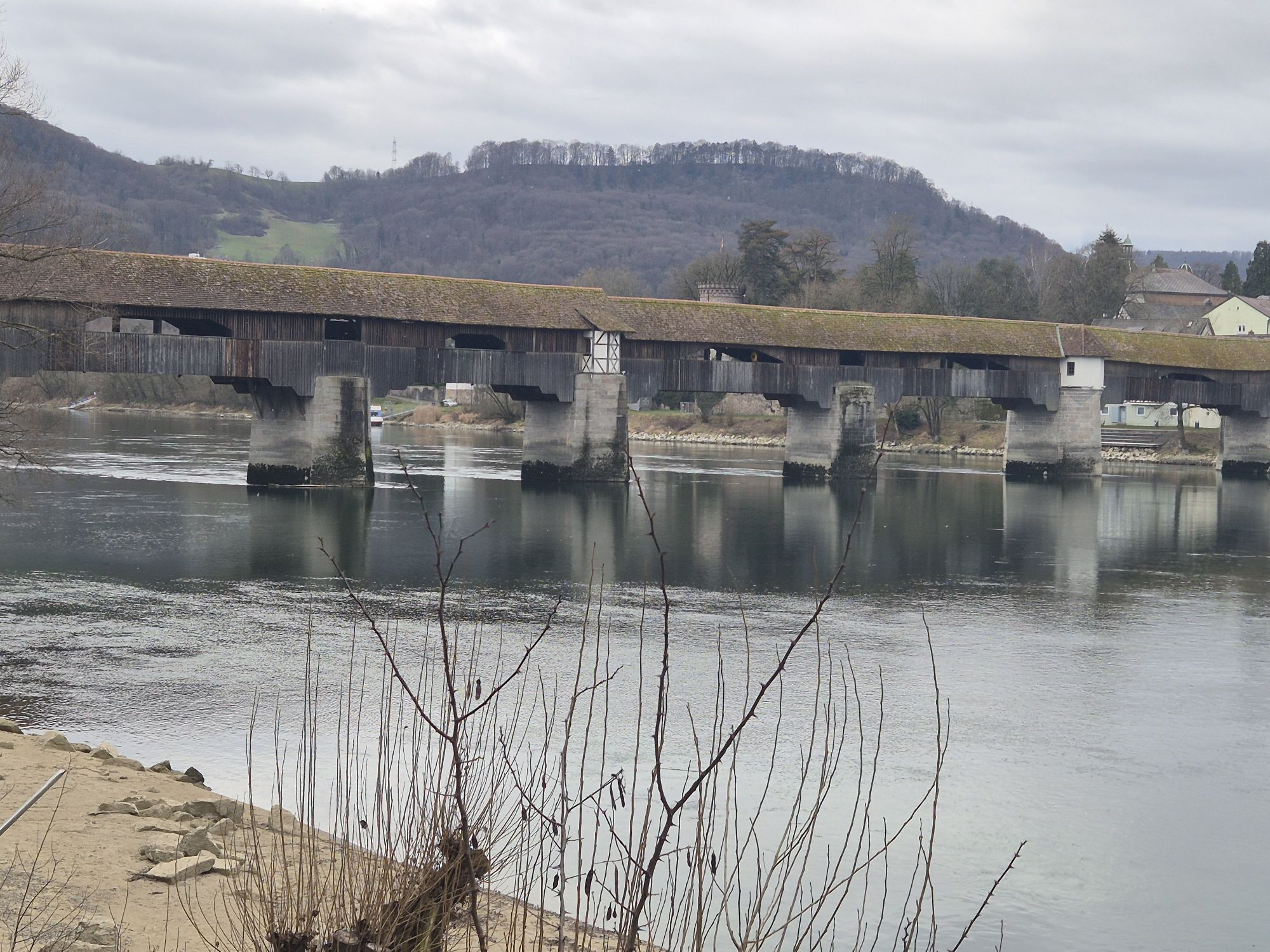
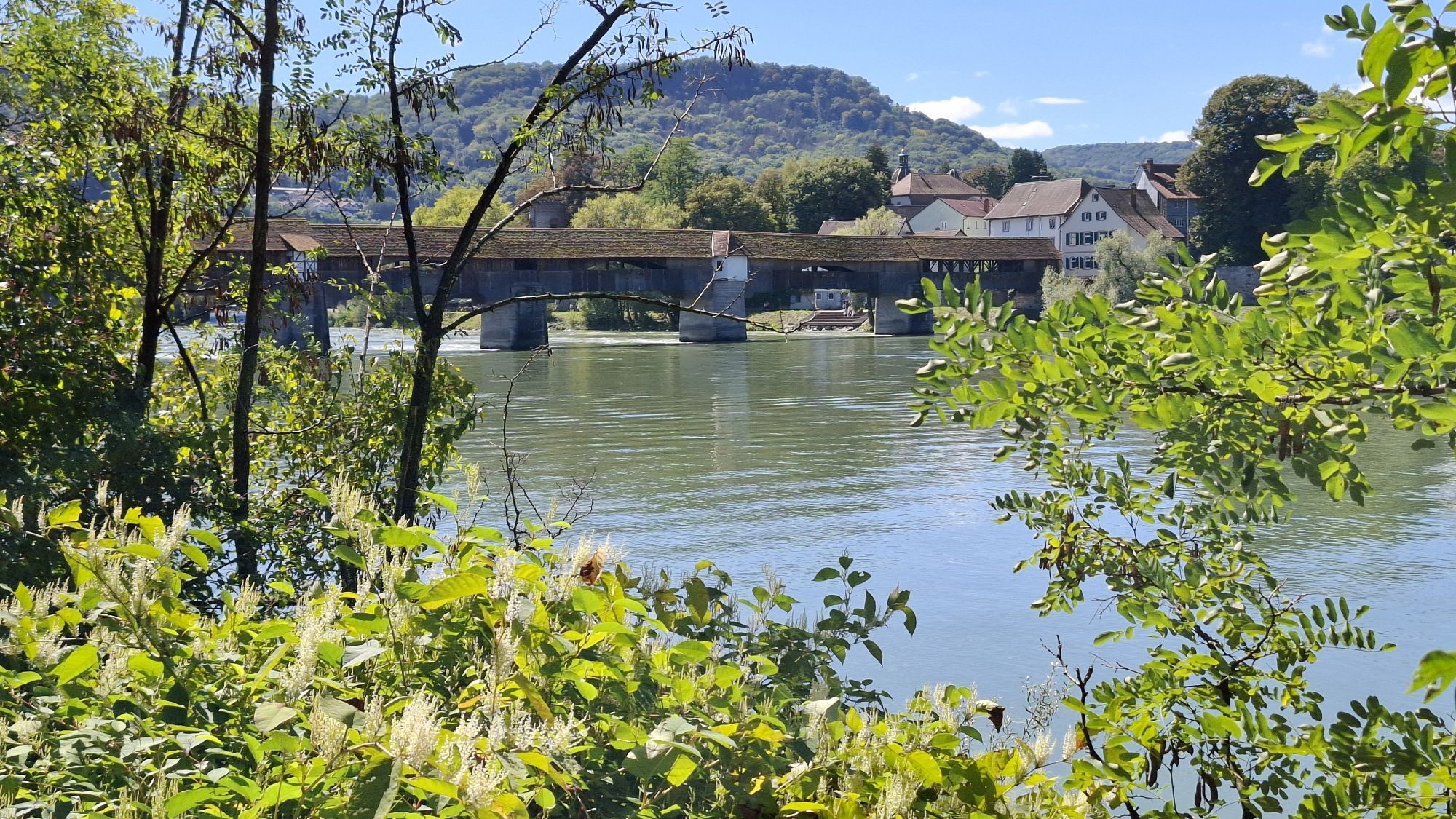
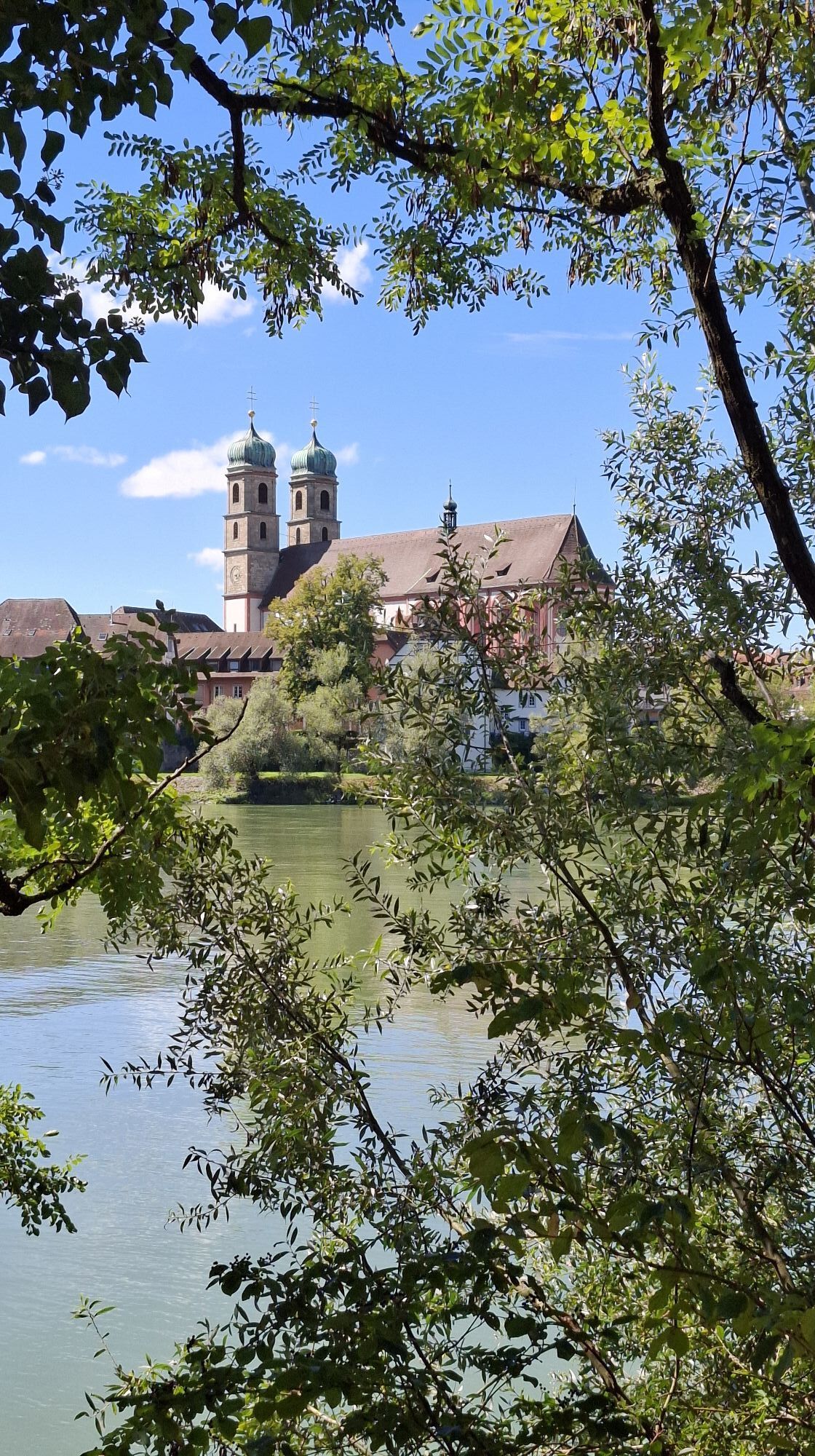
A little further downstream, the power plant of Stein-Säckingen comes into view. Immediately behind it opens a beautiful view over to Bad Säckingen with the twin-towered cathedral. Past the historic wooden bridge, the Stein-Säckingen station is finally reached. Return journey from Stein-Säckingen station by train.
Tak
By train to Laufenburg. Return journey from Stein-Säckingen station by train.
Lunch break
Picnicking is pleasant on the Rhine bank in the shade of the trees.
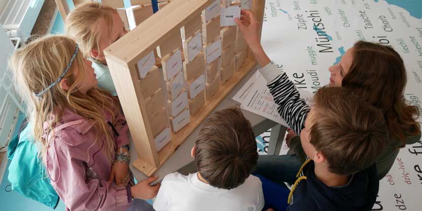
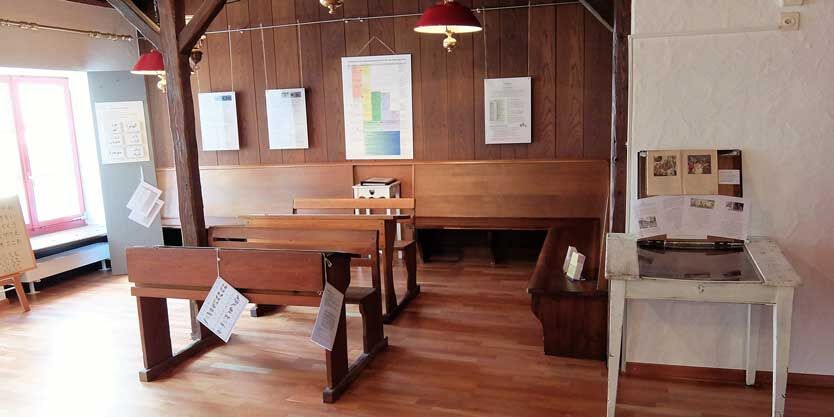
Language Panorama Laufenburg
At the Language Panorama, students gain deep insights into various areas of language and communication from research and practice.
Variant: Rehmann Museum Laufenburg
School classes discover the sculpture museum and the border town with a guided tour, workshop and/or sculpture tour in Laufenburg.
Recommended for grades 4 to 9
At the Language Panorama, students gain deep insights into various areas of language and communication from research and practice.

Popularne wycieczki w okolicy
-
5,0
Hotzenwald Höhenweg
średniWędrówka 8,32 km -
Herrischried - Wanderung zum Gugelturm
średniWędrówka 6,88 km -
4,8
Hüslischnegg am Asperstrihen
średniWędrówka 5,05 km -
Linner Wasserfall
światłoWędrówka 4,67 km -
4,8
Rickenbach: Ins Reich des Hans mit de Giige
średniWędrówka 8,34 km -
5,0
Rickenbach: Hotzenpfad Premiumwanderweg
średniWędrówka 12,7 km -
Aussichtsreiche Mountainbike Tour rund um Herrischried
średniMountainbike 15,8 km -
5,0
Murgtalpfad - Streckentour
ciężkiWędrówka 28,1 km -
2,0
Staffelegg - Ruine Schenkenberg - Thalheim
światłoWędrówka 6,96 km -
5,0
Zum Höllbachfall im Hotzenwald
średniWędrówka 5,16 km

Wędrówki i tropienie


Nie przegap ofert i inspiracji na następne wakacje
Twój adres e-mail została dodana do listy mailingowej.